Filters: Tags: Minnesota (X) > Date Range: {"choice":"year"} (X)
511 results (87ms)|
Filters
Date Types (for Date Range)
Types (Less)
Contacts (Less)
Categories (Less)
Tag Types
|
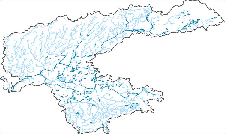
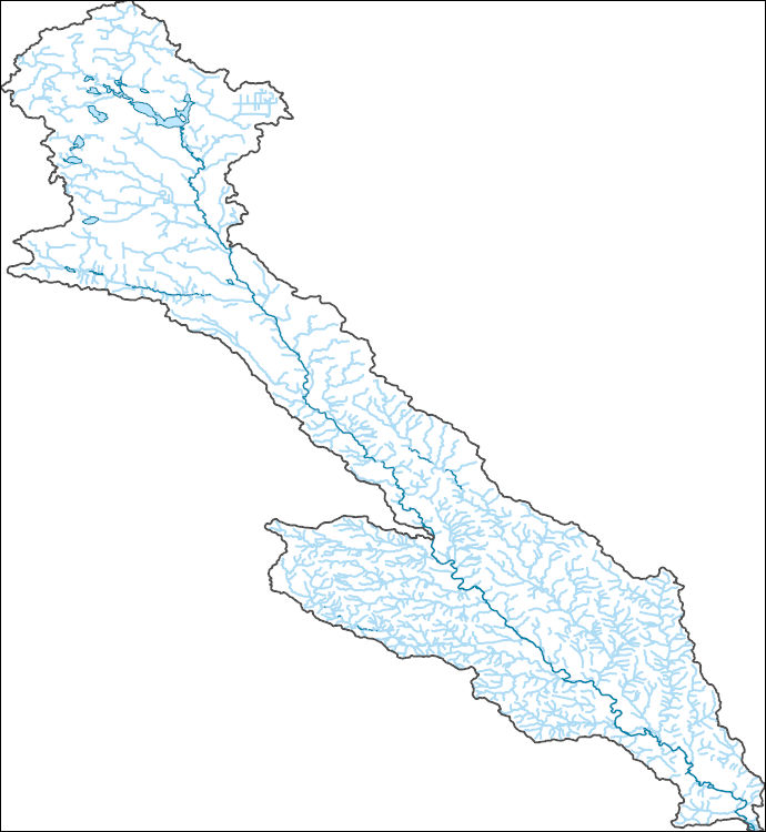
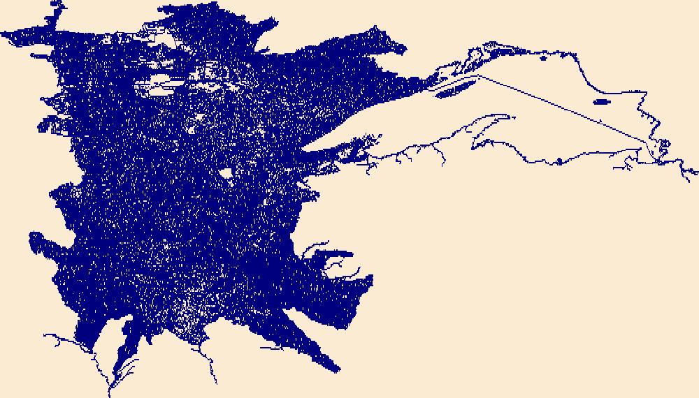
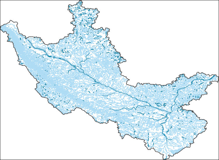
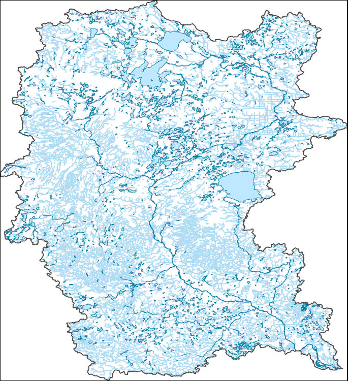
The National Hydrography Dataset (NHD) is a feature-based database that interconnects and uniquely identifies the stream segments or reaches that make up the nation's surface water drainage system. NHD data was originally developed at 1:100,000-scale and exists at that scale for the whole country. This high-resolution NHD, generally developed at 1:24,000/1:12,000 scale, adds detail to the original 1:100,000-scale NHD. (Data for Alaska, Puerto Rico and the Virgin Islands was developed at high-resolution, not 1:100,000 scale.) Local resolution NHD is being developed where partners and data exist. The NHD contains reach codes for networked features, flow direction, names, and centerline representations for areal water...
The National Hydrography Dataset (NHD) is a feature-based database that interconnects and uniquely identifies the stream segments or reaches that make up the nation's surface water drainage system. NHD data was originally developed at 1:100,000-scale and exists at that scale for the whole country. This high-resolution NHD, generally developed at 1:24,000/1:12,000 scale, adds detail to the original 1:100,000-scale NHD. (Data for Alaska, Puerto Rico and the Virgin Islands was developed at high-resolution, not 1:100,000 scale.) Local resolution NHD is being developed where partners and data exist. The NHD contains reach codes for networked features, flow direction, names, and centerline representations for areal water...
The National Hydrography Dataset (NHD) is a feature-based database that interconnects and uniquely identifies the stream segments or reaches that make up the nation's surface water drainage system. NHD data was originally developed at 1:100,000-scale and exists at that scale for the whole country. This high-resolution NHD, generally developed at 1:24,000/1:12,000 scale, adds detail to the original 1:100,000-scale NHD. (Data for Alaska, Puerto Rico and the Virgin Islands was developed at high-resolution, not 1:100,000 scale.) Local resolution NHD is being developed where partners and data exist. The NHD contains reach codes for networked features, flow direction, names, and centerline representations for areal water...
Pollinator decline and conservation is a complex and challenging issue with the potential to tax the capacity of individual state agencies; a collaborative approach among states and federal agencies has a higher likelihood success in meeting this emerging conservation challenge. Bumble bees have been identified as a particularly imperiled group of important pollinators. To aid the collaborative pollinator conservation effort, this report compiles the most up-to-date information related to bumble bees: threats, best practices for land management, and monitoring protocols into one location.The goal is to provide the basis for discussions on how to move bumble bee conservation forward more collaboratively in the Midwest.
Categories: Data;
Types: Map Service,
OGC WFS Layer,
OGC WMS Layer,
OGC WMS Service;
Tags: 2017,
Conservation Plan/Design/Framework,
Conservation Planning,
EARTH SCIENCE > LAND SURFACE > LANDSCAPE,
IA-01,
The National Hydrography Dataset (NHD) is a feature-based database that interconnects and uniquely identifies the stream segments or reaches that make up the nation's surface water drainage system. NHD data was originally developed at 1:100,000-scale and exists at that scale for the whole country. This high-resolution NHD, generally developed at 1:24,000/1:12,000 scale, adds detail to the original 1:100,000-scale NHD. (Data for Alaska, Puerto Rico and the Virgin Islands was developed at high-resolution, not 1:100,000 scale.) Local resolution NHD is being developed where partners and data exist. The NHD contains reach codes for networked features, flow direction, names, and centerline representations for areal water...
Location data for exploratory, sciencific, or engineering borings conducted statwide since the early 1900s. Drill Core and/or other samples from a large number of these borings are stored in the DNR's Drill Core Library in Hibbing, Minnesota. For more information on the drill core library please vist the DNR's webpage: http://www.dnr.state.mn.us/lands_minerals/dc_library.html
Categories: Collection;
Types: Map Service,
OGC WFS Layer,
OGC WMS Layer,
OGC WMS Service;
Tags: Geospatial,
Minnesota,
Web map application,
ndc_collection
We analyzed the single nucleotide polymorphisms (SNPs) present in the genomes of moose representing 3 subspecies in the contiguous United States. Blood samples were collected opportunistically from collaborators during field efforts or were supplied to our lab from collaborators' archives, and represented moose sampling occurring between 2009-2017. DNA was extracted, sequenced using next generation sequencing, and SNPs analyzed using the genetics programs Structure and Tess3, and by performing basic population statistics. These analyses were used to determine the population structure of moose at the subspecies level.
Compilation of rotary sonic drill cores with magnetic susceptibility measurements collected by Minnesota Geological Survey Quaternary geologists. The full dataset is available upon request and includes 1) magnetic susceptibility profiles for each rotary sonic core, 2) named unit averages and standard deviations for each county, and 3) named unit averages and standard deviations for all data.
Categories: Data;
Types: Map Service,
OGC WFS Layer,
OGC WMS Layer,
OGC WMS Service;
Tags: Geological Collection,
Minnesota,
core,
geophysics,
magnetic,

The National Hydrography Dataset (NHD) is a feature-based database that interconnects and uniquely identifies the stream segments or reaches that make up the nation's surface water drainage system. NHD data was originally developed at 1:100,000-scale and exists at that scale for the whole country. This high-resolution NHD, generally developed at 1:24,000/1:12,000 scale, adds detail to the original 1:100,000-scale NHD. (Data for Alaska, Puerto Rico and the Virgin Islands was developed at high-resolution, not 1:100,000 scale.) Local resolution NHD is being developed where partners and data exist. The NHD contains reach codes for networked features, flow direction, names, and centerline representations for areal water...
The U.S. Army Corps of Engineers' Upper Mississippi River Restoration (UMRR) program, through its Long Term Resource Monitoring (LTRM) element, collected aerial imagery of the systemic Upper Mississippi River System (UMRS) during the summer of 2020. A Land Cover/Land Use (LCU) spatial database was developed based on the 2020 aerial imagery, which adds a fourth systemic-wide database to the existing 1989, 2000, and 2010/11 LCU databases. While a crosswalk was used to update the 1989 LCU database (originally developed using a different classification system), the 2000, 2010/11, and 2020 LCU databases share the same classification, making them directly comparable from a classification standpoint. Furthermore, protocols...
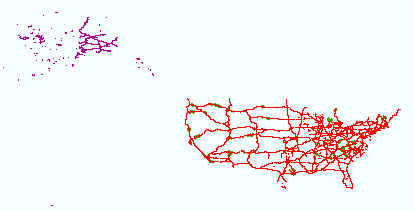
Layers of geospatial data include roads, airports, trails, and railroads.
The National Hydrography Dataset (NHD) is a feature-based database that interconnects and uniquely identifies the stream segments or reaches that make up the nation's surface water drainage system. NHD data was originally developed at 1:100,000-scale and exists at that scale for the whole country. This high-resolution NHD, generally developed at 1:24,000/1:12,000 scale, adds detail to the original 1:100,000-scale NHD. (Data for Alaska, Puerto Rico and the Virgin Islands was developed at high-resolution, not 1:100,000 scale.) Local resolution NHD is being developed where partners and data exist. The NHD contains reach codes for networked features, flow direction, names, and centerline representations for areal water...
The National Hydrography Dataset (NHD) is a feature-based database that interconnects and uniquely identifies the stream segments or reaches that make up the nation's surface water drainage system. NHD data was originally developed at 1:100,000-scale and exists at that scale for the whole country. This high-resolution NHD, generally developed at 1:24,000/1:12,000 scale, adds detail to the original 1:100,000-scale NHD. (Data for Alaska, Puerto Rico and the Virgin Islands was developed at high-resolution, not 1:100,000 scale.) Local resolution NHD is being developed where partners and data exist. The NHD contains reach codes for networked features, flow direction, names, and centerline representations for areal water...

The National Hydrography Dataset (NHD) is a feature-based database that interconnects and uniquely identifies the stream segments or reaches that make up the nation's surface water drainage system. NHD data was originally developed at 1:100,000-scale and exists at that scale for the whole country. This high-resolution NHD, generally developed at 1:24,000/1:12,000 scale, adds detail to the original 1:100,000-scale NHD. (Data for Alaska, Puerto Rico and the Virgin Islands was developed at high-resolution, not 1:100,000 scale.) Local resolution NHD is being developed where partners and data exist. The NHD contains reach codes for networked features, flow direction, names, and centerline representations for areal water...

The National Hydrography Dataset (NHD) is a feature-based database that interconnects and uniquely identifies the stream segments or reaches that make up the nation's surface water drainage system. NHD data was originally developed at 1:100,000-scale and exists at that scale for the whole country. This high-resolution NHD, generally developed at 1:24,000/1:12,000 scale, adds detail to the original 1:100,000-scale NHD. (Data for Alaska, Puerto Rico and the Virgin Islands was developed at high-resolution, not 1:100,000 scale.) Local resolution NHD is being developed where partners and data exist. The NHD contains reach codes for networked features, flow direction, names, and centerline representations for areal water...
Water quality and fish tissue samples were collected and measured for mercury concentrations in a total of 23 small to medium size lakes in Minnesota to assess the impact that zebra mussel (Dreissena polymorpha) invasion had on mercury bioaccumulation. Water samples were collected in October and November of 2021 from 22 lakes and analyzed for total mercury, methylmercury, dissolved organic carbon, and suspended particulate matter at the U.S. Geological Survey (USGS) Mercury Research Laboratory (MRL). Tissue samples of walleye (Sander vitreus) and yellow perch (Perca flavescens) were collected by researchers at the University of Minnesota, Twin Cities from July to October in 2019 and 2021 and June to October in 2020...
Categories: Data;
Tags: Aquatic Biology,
Environmental Health,
Minnesota,
USGS Science Data Catalog (SDC),
Water Quality,
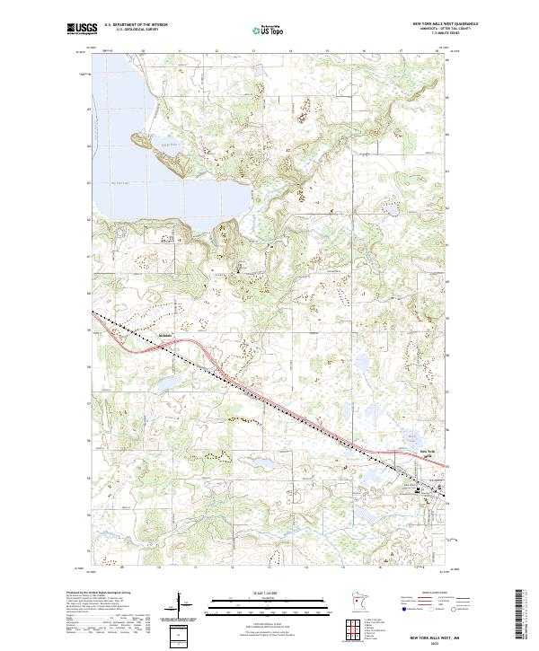
Layered geospatial PDF 7.5 Minute Quadrangle Map. Layers of geospatial data include orthoimagery, roads, grids, geographic names, elevation contours, hydrography, and other selected map features. This map is derived from GIS (geospatial information system) data. It represents a repackaging of GIS data in traditional map form, not creation of new information. The geospatial data in this map are from selected National Map data holdings and other government sources.

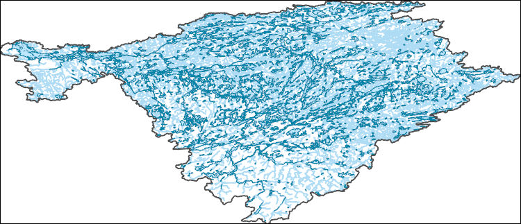
The High Resolution National Hydrography Dataset Plus (NHDPlus HR) is an integrated set of geospatial data layers, including the best available National Hydrography Dataset (NHD), the 10-meter 3D Elevation Program Digital Elevation Model (3DEP DEM), and the National Watershed Boundary Dataset (WBD). The NHDPlus HR combines the NHD, 3DEP DEMs, and WBD to create a stream network with linear referencing, feature naming, "value added attributes" (VAAs), elevation-derived catchments, and other features for hydrologic data analysis. The stream network with linear referencing is a system of data relationships applied to hydrographic systems so that one stream reach "flows" into another and "events" can be tied to and traced...
The U.S. Geological Survey is developing national water-use models to support water resources management in the United States. Model benefits include a nationally consistent estimation approach, greater temporal and spatial resolution of estimates, efficient and automated updates of results, and capabilities to forecast water use into the future and assess model uncertainty. This data release contains data used in a machine learning model to estimate monthly water use for communities that are supplied by public-supply water systems in the conterminous United States for 2000-2020. This data release also contains associated scripts used to produce input features as well as model output values by 12-digit hydrologic...
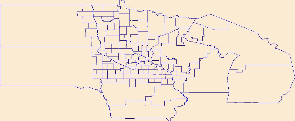
Geospatial data is comprised of government boundaries.
|

|
