Filters
Date Types (for Date Range)
Extensions
Types
Contacts
Categories
Tag Types
Tag Schemes
|

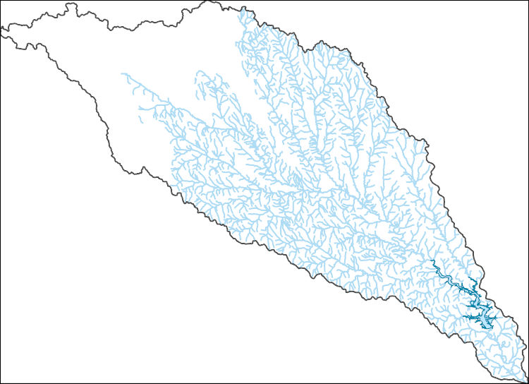
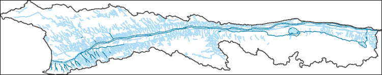
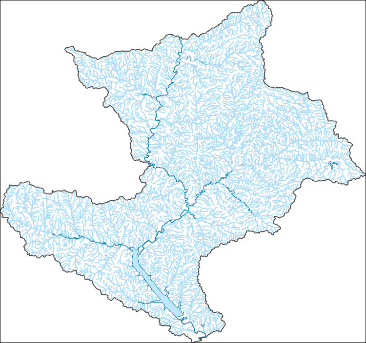
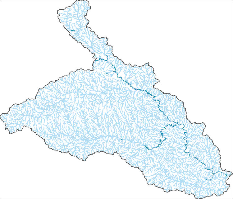
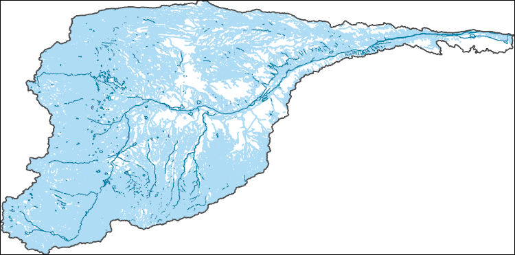
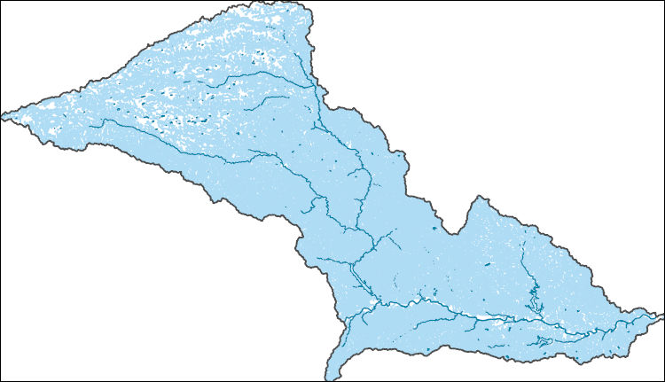
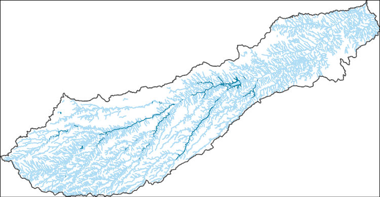
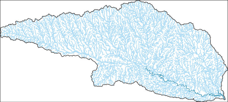
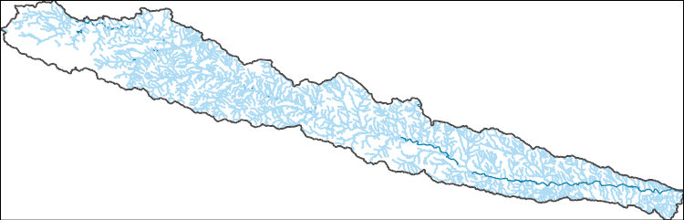
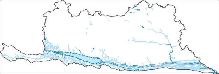
The National Hydrography Dataset (NHD) is a feature-based database that interconnects and uniquely identifies the stream segments or reaches that make up the nation's surface water drainage system. NHD data was originally developed at 1:100,000-scale and exists at that scale for the whole country. This high-resolution NHD, generally developed at 1:24,000/1:12,000 scale, adds detail to the original 1:100,000-scale NHD. (Data for Alaska, Puerto Rico and the Virgin Islands was developed at high-resolution, not 1:100,000 scale.) Local resolution NHD is being developed where partners and data exist. The NHD contains reach codes for networked features, flow direction, names, and centerline representations for areal water...
Tags: Administrative watershed units,
Administrative watershed units,
Area of Complex Channels,
Area to be submerged,
Basin, All tags...
Basin,
Bay/Inlet,
Boundaries,
Boundary,
Bridge,
Canal/Ditch,
Coastline,
Connector,
Dam/Weir,
Downloadable Data,
Drainage areas for surface water,
Drainageway,
Esri Shapefile nan,
Estuary,
Flow direction network,
Flume,
ForeShore,
Frontier,
Furnas,
Gaging Station,
Gate,
HU-8,
HU-8 Subbasin,
HU10,
HU12,
HU14,
HU16,
HU2,
HU4,
HU6,
HU8,
HU8_10250008,
HUC,
Hayes,
Hazard Zone,
Hydrographic,
Hydrography,
Hydrography,
Hydrography,
Hydrologic Unit Code,
Hydrologic Units,
Ice mass,
Inundation Area,
Levee,
Lincoln,
Line,
Lock Chamber,
Marsh,
NE,
National Hydrography Dataset (NHD),
National Hydrography Dataset (NHD) Best Resolution,
National Hydrography Dataset (NHD) Best Resolution,
Nebraska,
Nonearthen Shore,
Orthoimage,
Playa,
Point,
PointEvent,
Pond,
Rapids,
Rapids,
Reach,
Reach code,
Red Willow,
Reef,
Region,
Reservoir,
Rock,
Sea/Ocean,
Shapefile,
Sink/Rise,
Sounding Datum Line,
Special Use Zone,
Special Use Zone Limit,
Spillway,
Stream,
Stream/River,
Sub-basin,
Sub-region,
Subbasin,
Submerged Stream,
Subregion,
Subwatershed,
Surface water systems,
Swamp,
Topographic,
Tunnel,
US,
Underground Conduit,
United States,
WBD,
WBD,
Wall,
Wash,
Water Intake Outflow,
Waterfall,
Watershed,
Watershed Boundaries,
Watershed Boundary Dataset,
Watershed Boundary Dataset,
Well,
artificial path,
boundaries,
dams,
drainage systems and characteristics,
inlandWaters,
lakes,
ngda,
rivers, Fewer tags
The National Hydrography Dataset (NHD) is a feature-based database that interconnects and uniquely identifies the stream segments or reaches that make up the nation's surface water drainage system. NHD data was originally developed at 1:100,000-scale and exists at that scale for the whole country. This high-resolution NHD, generally developed at 1:24,000/1:12,000 scale, adds detail to the original 1:100,000-scale NHD. (Data for Alaska, Puerto Rico and the Virgin Islands was developed at high-resolution, not 1:100,000 scale.) Local resolution NHD is being developed where partners and data exist. The NHD contains reach codes for networked features, flow direction, names, and centerline representations for areal water...
Tags: Administrative watershed units,
Administrative watershed units,
Area of Complex Channels,
Area to be submerged,
Basin, All tags...
Basin,
Bay/Inlet,
Boundaries,
Boundary,
Bridge,
Canal/Ditch,
Coastline,
Connector,
Dam/Weir,
Downloadable Data,
Drainage areas for surface water,
Drainageway,
Esri File GeoDatabase 10,
Estuary,
FileGDB,
Flow direction network,
Flume,
ForeShore,
Frontier,
Furnas,
Gaging Station,
Gate,
HU-8,
HU-8 Subbasin,
HU10,
HU12,
HU14,
HU16,
HU2,
HU4,
HU6,
HU8,
HU8_10250008,
HUC,
Hayes,
Hazard Zone,
Hydrographic,
Hydrography,
Hydrography,
Hydrography,
Hydrologic Unit Code,
Hydrologic Units,
Ice mass,
Inundation Area,
Levee,
Lincoln,
Line,
Lock Chamber,
Marsh,
NE,
National Hydrography Dataset (NHD),
National Hydrography Dataset (NHD) Best Resolution,
National Hydrography Dataset (NHD) Best Resolution,
Nebraska,
Nonearthen Shore,
Orthoimage,
Playa,
Point,
PointEvent,
Pond,
Rapids,
Rapids,
Reach,
Reach code,
Red Willow,
Reef,
Region,
Reservoir,
Rock,
Sea/Ocean,
Sink/Rise,
Sounding Datum Line,
Special Use Zone,
Special Use Zone Limit,
Spillway,
Stream,
Stream/River,
Sub-basin,
Sub-region,
Subbasin,
Submerged Stream,
Subregion,
Subwatershed,
Surface water systems,
Swamp,
Topographic,
Tunnel,
US,
Underground Conduit,
United States,
WBD,
WBD,
Wall,
Wash,
Water Intake Outflow,
Waterfall,
Watershed,
Watershed Boundaries,
Watershed Boundary Dataset,
Watershed Boundary Dataset,
Well,
artificial path,
boundaries,
dams,
drainage systems and characteristics,
inlandWaters,
lakes,
ngda,
rivers, Fewer tags
The National Hydrography Dataset (NHD) is a feature-based database that interconnects and uniquely identifies the stream segments or reaches that make up the nation's surface water drainage system. NHD data was originally developed at 1:100,000-scale and exists at that scale for the whole country. This high-resolution NHD, generally developed at 1:24,000/1:12,000 scale, adds detail to the original 1:100,000-scale NHD. (Data for Alaska, Puerto Rico and the Virgin Islands was developed at high-resolution, not 1:100,000 scale.) Local resolution NHD is being developed where partners and data exist. The NHD contains reach codes for networked features, flow direction, names, and centerline representations for areal water...
Tags: Administrative watershed units,
Administrative watershed units,
Area of Complex Channels,
Area to be submerged,
Basin, All tags...
Basin,
Bay/Inlet,
Boundaries,
Boundary,
Bridge,
CO,
Canal/Ditch,
Cheyenne,
Coastline,
Colorado,
Connector,
Dam/Weir,
Deuel,
Downloadable Data,
Drainage areas for surface water,
Drainageway,
Esri File GeoDatabase 10,
Estuary,
FileGDB,
Flow direction network,
Flume,
ForeShore,
Gaging Station,
Garden,
Gate,
HU-8,
HU-8 Subbasin,
HU10,
HU12,
HU14,
HU16,
HU2,
HU4,
HU6,
HU8,
HU8_10190018,
HUC,
Hazard Zone,
Hydrographic,
Hydrography,
Hydrography,
Hydrography,
Hydrologic Unit Code,
Hydrologic Units,
Ice mass,
Inundation Area,
Keith,
Levee,
Lincoln,
Line,
Lock Chamber,
Marsh,
NE,
National Hydrography Dataset (NHD),
National Hydrography Dataset (NHD) Best Resolution,
National Hydrography Dataset (NHD) Best Resolution,
Nebraska,
Nonearthen Shore,
Orthoimage,
Perkins,
Playa,
Point,
PointEvent,
Pond,
Rapids,
Rapids,
Reach,
Reach code,
Reef,
Region,
Reservoir,
Rock,
Sea/Ocean,
Sedgwick,
Sink/Rise,
Sounding Datum Line,
Special Use Zone,
Special Use Zone Limit,
Spillway,
Stream,
Stream/River,
Sub-basin,
Sub-region,
Subbasin,
Submerged Stream,
Subregion,
Subwatershed,
Surface water systems,
Swamp,
Topographic,
Tunnel,
US,
Underground Conduit,
United States,
WBD,
WBD,
Wall,
Wash,
Water Intake Outflow,
Waterfall,
Watershed,
Watershed Boundaries,
Watershed Boundary Dataset,
Watershed Boundary Dataset,
Well,
artificial path,
boundaries,
dams,
drainage systems and characteristics,
inlandWaters,
lakes,
ngda,
rivers, Fewer tags
The National Hydrography Dataset (NHD) is a feature-based database that interconnects and uniquely identifies the stream segments or reaches that make up the nation's surface water drainage system. NHD data was originally developed at 1:100,000-scale and exists at that scale for the whole country. This high-resolution NHD, generally developed at 1:24,000/1:12,000 scale, adds detail to the original 1:100,000-scale NHD. (Data for Alaska, Puerto Rico and the Virgin Islands was developed at high-resolution, not 1:100,000 scale.) Local resolution NHD is being developed where partners and data exist. The NHD contains reach codes for networked features, flow direction, names, and centerline representations for areal water...
Tags: Administrative watershed units,
Administrative watershed units,
Area of Complex Channels,
Area to be submerged,
Basin, All tags...
Basin,
Bay/Inlet,
Boundaries,
Boundary,
Bridge,
Canal/Ditch,
Clay,
Coastline,
Connector,
Dam/Weir,
Downloadable Data,
Drainage areas for surface water,
Drainageway,
Estuary,
Flow direction network,
Flume,
ForeShore,
Gage,
Gaging Station,
Gate,
GeoPackage,
HU-8,
HU-8 Subbasin,
HU10,
HU12,
HU14,
HU16,
HU2,
HU4,
HU6,
HU8,
HU8_10270205,
HUC,
Hazard Zone,
Hydrographic,
Hydrography,
Hydrography,
Hydrography,
Hydrologic Unit Code,
Hydrologic Units,
Ice mass,
Inundation Area,
Jefferson,
KS,
Kansas,
Levee,
Line,
Lock Chamber,
Marsh,
Marshall,
NE,
National Hydrography Dataset (NHD),
National Hydrography Dataset (NHD) Best Resolution,
National Hydrography Dataset (NHD) Best Resolution,
Nebraska,
Nemaha,
Nonearthen Shore,
Open Geospatial Consortium GeoPackage 1.2,
Orthoimage,
Pawnee,
Playa,
Point,
PointEvent,
Pond,
Pottawatomie,
Rapids,
Rapids,
Reach,
Reach code,
Reef,
Region,
Reservoir,
Riley,
Rock,
Sea/Ocean,
Sink/Rise,
Sounding Datum Line,
Special Use Zone,
Special Use Zone Limit,
Spillway,
Stream,
Stream/River,
Sub-basin,
Sub-region,
Subbasin,
Submerged Stream,
Subregion,
Subwatershed,
Surface water systems,
Swamp,
Topographic,
Tunnel,
US,
Underground Conduit,
United States,
WBD,
WBD,
Wall,
Wash,
Washington,
Water Intake Outflow,
Waterfall,
Watershed,
Watershed Boundaries,
Watershed Boundary Dataset,
Watershed Boundary Dataset,
Well,
artificial path,
boundaries,
dams,
drainage systems and characteristics,
inlandWaters,
lakes,
ngda,
rivers, Fewer tags
The National Hydrography Dataset (NHD) is a feature-based database that interconnects and uniquely identifies the stream segments or reaches that make up the nation's surface water drainage system. NHD data was originally developed at 1:100,000-scale and exists at that scale for the whole country. This high-resolution NHD, generally developed at 1:24,000/1:12,000 scale, adds detail to the original 1:100,000-scale NHD. (Data for Alaska, Puerto Rico and the Virgin Islands was developed at high-resolution, not 1:100,000 scale.) Local resolution NHD is being developed where partners and data exist. The NHD contains reach codes for networked features, flow direction, names, and centerline representations for areal water...
Tags: Administrative watershed units,
Administrative watershed units,
Area of Complex Channels,
Area to be submerged,
Basin, All tags...
Basin,
Bay/Inlet,
Boundaries,
Boundary,
Bridge,
Canal/Ditch,
Coastline,
Connector,
Dam/Weir,
Downloadable Data,
Drainage areas for surface water,
Drainageway,
Estuary,
Fillmore,
Flow direction network,
Flume,
ForeShore,
Gage,
Gaging Station,
Gate,
GeoPackage,
HU-8,
HU-8 Subbasin,
HU10,
HU12,
HU14,
HU16,
HU2,
HU4,
HU6,
HU8,
HU8_10270207,
HUC,
Hazard Zone,
Hydrographic,
Hydrography,
Hydrography,
Hydrography,
Hydrologic Unit Code,
Hydrologic Units,
Ice mass,
Inundation Area,
Jefferson,
KS,
Kansas,
Levee,
Line,
Lock Chamber,
Marsh,
Marshall,
NE,
National Hydrography Dataset (NHD),
National Hydrography Dataset (NHD) Best Resolution,
National Hydrography Dataset (NHD) Best Resolution,
Nebraska,
Nonearthen Shore,
Open Geospatial Consortium GeoPackage 1.2,
Orthoimage,
Playa,
Point,
PointEvent,
Pond,
Rapids,
Rapids,
Reach,
Reach code,
Reef,
Region,
Republic,
Reservoir,
Rock,
Saline,
Sea/Ocean,
Sink/Rise,
Sounding Datum Line,
Special Use Zone,
Special Use Zone Limit,
Spillway,
Stream,
Stream/River,
Sub-basin,
Sub-region,
Subbasin,
Submerged Stream,
Subregion,
Subwatershed,
Surface water systems,
Swamp,
Thayer,
Topographic,
Tunnel,
US,
Underground Conduit,
United States,
WBD,
WBD,
Wall,
Wash,
Washington,
Water Intake Outflow,
Waterfall,
Watershed,
Watershed Boundaries,
Watershed Boundary Dataset,
Watershed Boundary Dataset,
Well,
artificial path,
boundaries,
dams,
drainage systems and characteristics,
inlandWaters,
lakes,
ngda,
rivers, Fewer tags
The National Hydrography Dataset (NHD) is a feature-based database that interconnects and uniquely identifies the stream segments or reaches that make up the nation's surface water drainage system. NHD data was originally developed at 1:100,000-scale and exists at that scale for the whole country. This high-resolution NHD, generally developed at 1:24,000/1:12,000 scale, adds detail to the original 1:100,000-scale NHD. (Data for Alaska, Puerto Rico and the Virgin Islands was developed at high-resolution, not 1:100,000 scale.) Local resolution NHD is being developed where partners and data exist. The NHD contains reach codes for networked features, flow direction, names, and centerline representations for areal water...
Tags: Adams,
Administrative watershed units,
Administrative watershed units,
Albany,
Arapahoe, All tags...
Area of Complex Channels,
Area to be submerged,
Banner,
Basin,
Basin,
Bay/Inlet,
Boulder,
Boundaries,
Boundary,
Bridge,
Broomfield,
CO,
Canal/Ditch,
Chaffee,
Cheyenne,
Clear Creek,
Coastline,
Colorado,
Connector,
Dam/Weir,
Denver,
Deuel,
Douglas,
Downloadable Data,
Drainage areas for surface water,
Drainageway,
El Paso,
Elbert,
Estuary,
Flow direction network,
Flume,
ForeShore,
Gaging Station,
Garden,
Gate,
GeoPackage,
Gilpin,
Grand,
HU-4,
HU-4 Subregion,
HU10,
HU12,
HU14,
HU16,
HU2,
HU4,
HU4_1019,
HU6,
HU8,
HUC,
Hazard Zone,
Hydrographic,
Hydrography,
Hydrography,
Hydrography,
Hydrologic Unit Code,
Hydrologic Units,
Ice mass,
Inundation Area,
Jackson,
Jefferson,
Keith,
Kimball,
Lake,
Laramie,
Larimer,
Levee,
Lincoln,
Line,
Lock Chamber,
Logan,
Marsh,
Morgan,
NE,
National Hydrography Dataset (NHD),
National Hydrography Dataset (NHD) Best Resolution,
National Hydrography Dataset (NHD) Best Resolution,
Nebraska,
Nonearthen Shore,
Open Geospatial Consortium GeoPackage 1.2,
Orthoimage,
Park,
Perkins,
Playa,
Point,
PointEvent,
Pond,
Rapids,
Rapids,
Reach,
Reach code,
Reef,
Region,
Reservoir,
Rock,
Sea/Ocean,
Sedgwick,
Sink/Rise,
Sounding Datum Line,
Special Use Zone,
Special Use Zone Limit,
Spillway,
Stream,
Stream/River,
Sub-basin,
Sub-region,
Subbasin,
Submerged Stream,
Subregion,
Subwatershed,
Summit,
Surface water systems,
Swamp,
Teller,
Topographic,
Tunnel,
US,
Underground Conduit,
United States,
WBD,
WBD,
WY,
Wall,
Wash,
Washington,
Water Intake Outflow,
Waterfall,
Watershed,
Watershed Boundaries,
Watershed Boundary Dataset,
Watershed Boundary Dataset,
Weld,
Well,
Wyoming,
artificial path,
boundaries,
dams,
drainage systems and characteristics,
inlandWaters,
lakes,
ngda,
rivers, Fewer tags
The National Hydrography Dataset (NHD) is a feature-based database that interconnects and uniquely identifies the stream segments or reaches that make up the nation's surface water drainage system. NHD data was originally developed at 1:100,000-scale and exists at that scale for the whole country. This high-resolution NHD, generally developed at 1:24,000/1:12,000 scale, adds detail to the original 1:100,000-scale NHD. (Data for Alaska, Puerto Rico and the Virgin Islands was developed at high-resolution, not 1:100,000 scale.) Local resolution NHD is being developed where partners and data exist. The NHD contains reach codes for networked features, flow direction, names, and centerline representations for areal water...
Tags: Adams,
Administrative watershed units,
Administrative watershed units,
Area of Complex Channels,
Area to be submerged, All tags...
Atchison,
Basin,
Basin,
Bay/Inlet,
Boundaries,
Boundary,
Bridge,
Brown,
Butler,
Canal/Ditch,
Clay,
Coastline,
Connector,
Dam/Weir,
Douglas,
Downloadable Data,
Drainage areas for surface water,
Drainageway,
Esri File GeoDatabase 10,
Estuary,
FileGDB,
Fillmore,
Flow direction network,
Flume,
ForeShore,
Franklin,
Gage,
Gaging Station,
Gate,
Geary,
HU-4,
HU-4 Subregion,
HU10,
HU12,
HU14,
HU16,
HU2,
HU4,
HU4_1027,
HU6,
HU8,
HUC,
Hall,
Hamilton,
Hazard Zone,
Hydrographic,
Hydrography,
Hydrography,
Hydrography,
Hydrologic Unit Code,
Hydrologic Units,
Ice mass,
Inundation Area,
Jackson,
Jefferson,
Johnson,
KS,
Kansas,
Kearney,
Lancaster,
Leavenworth,
Levee,
Line,
Lock Chamber,
MO,
Marsh,
Marshall,
Missouri,
Morris,
NE,
National Hydrography Dataset (NHD),
National Hydrography Dataset (NHD) Best Resolution,
National Hydrography Dataset (NHD) Best Resolution,
Nebraska,
Nemaha,
Nonearthen Shore,
Nuckolls,
Orthoimage,
Osage,
Pawnee,
Playa,
Point,
PointEvent,
Polk,
Pond,
Pottawatomie,
Rapids,
Rapids,
Reach,
Reach code,
Reef,
Region,
Republic,
Reservoir,
Riley,
Rock,
Saline,
Sea/Ocean,
Seward,
Shawnee,
Sink/Rise,
Sounding Datum Line,
Special Use Zone,
Special Use Zone Limit,
Spillway,
Stream,
Stream/River,
Sub-basin,
Sub-region,
Subbasin,
Submerged Stream,
Subregion,
Subwatershed,
Surface water systems,
Swamp,
Thayer,
Topographic,
Tunnel,
US,
Underground Conduit,
United States,
WBD,
WBD,
Wabaunsee,
Wall,
Wash,
Washington,
Water Intake Outflow,
Waterfall,
Watershed,
Watershed Boundaries,
Watershed Boundary Dataset,
Watershed Boundary Dataset,
Webster,
Well,
Wyandotte,
York,
artificial path,
boundaries,
dams,
drainage systems and characteristics,
inlandWaters,
lakes,
ngda,
rivers, Fewer tags
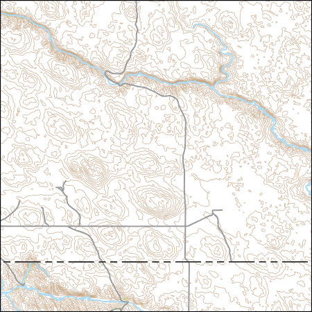
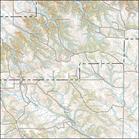
Layers of geospatial data include contours, boundaries, land cover, hydrography, roads, transportation, geographic names, structures, and other selected map features.
Tags: 7.5 x 7.5 minute,
7_5_Min,
Combined Vector,
Combined Vector,
Combined Vector, All tags...
Downloadable Data,
GeoPackage,
Lincoln,
McPherson,
NE,
Nebraska,
Open Geospatial Consortium GeoPackage 1.2,
Public Land Survey System,
Topo Map Vector Data,
US,
United States,
boundary,
contours,
geographic names,
hydrography,
structures,
transportation,
woodland, Fewer tags
Layers of geospatial data include contours, boundaries, land cover, hydrography, roads, transportation, geographic names, structures, and other selected map features.
Tags: 7.5 x 7.5 minute,
7_5_Min,
Combined Vector,
Combined Vector,
Combined Vector, All tags...
Dawes,
Downloadable Data,
GeoPackage,
NE,
Nebraska,
Open Geospatial Consortium GeoPackage 1.2,
Public Land Survey System,
Topo Map Vector Data,
US,
United States,
boundary,
contours,
geographic names,
hydrography,
structures,
transportation,
woodland, Fewer tags

The RCMAP (Rangeland Condition Monitoring Assessment and Projection) dataset quantifies the percent cover of rangeland components across western North America using Landsat imagery from 1985-2023. The RCMAP product suite consists of ten fractional components: annual herbaceous, bare ground, herbaceous, litter, non-sagebrush shrub, perennial herbaceous, sagebrush, shrub, tree, and shrub height in addition to the temporal trends of each component. Several enhancements were made to the RCMAP process relative to prior generations. First, high-resolution training was revised using an improved neural-net classifier and modelling approach. These data serve as foundation to the RCMAP approach. The training database was...
Tags: AB,
AZ,
Alberta,
Arizona,
Arizona Plateau, All tags...
Black Hills,
Blue Mountains,
CA,
CO,
California,
Canada,
Chihuahuan,
Chihuahuan Desert,
Colorado,
Colorado Plateau,
Columbia Plateau,
Desert,
Grand Canyon,
Great Basin,
Gunnison,
ID,
Idaho,
MT,
Mediterranean California,
Middle Rockies,
Mojave,
Montana,
ND,
NE,
NM,
NV,
Nebraska,
Nevada,
New Mexico,
North Dakota,
North Plains,
Northern Great Plains,
Northern Great Salt Lake Desert,
Northern Mountainous,
Northern Rocky Mountains,
OR,
Oregon,
Plains,
Plateau,
Prairie Provinces,
Rocky Mountains,
SD,
SK,
Saskatchewan,
Sierra Nevada,
Sonoran,
Sonoran Desert,
South Dakota,
Southern Great Salt Lake Desert,
Southern Rocky Mountains,
Southwest Tablelands,
TX,
Texas,
The Rockies,
Three Forks,
UT,
United States,
Utah,
WA,
WY,
Wasatch,
Washington,
Western US,
Wyoming,
Wyoming Basin,
Yellowstone,
annual herbaceous,
back-in-time,
bare ground,
big sagebrush,
biota,
climate change,
environment,
geoscientificInformation,
grass,
grassland change,
herbaceous,
imageryBaseMapsEarthCover,
litter,
mts,
rangeland,
rangeland management,
sagebrush,
shrub,
shrub height,
shrubland,
shrubland change,
shrubland ecosystems,
shrublands,
terrestrial ecosystems,
time series,
trends,
vegetation,
vegetation change,
vegetation height, Fewer tags

The need to monitor change in sagebrush steppe is urgent due to the increasing impacts of climate change, shifting fire regimes, and management practices on ecosystem health. Remote sensing provides a cost-effective and reliable method for monitoring change through time and attributing changes to drivers. We report an automated method of mapping rangeland fractional component cover over a large portion of the Northern Great Basin, USA, from 1986 to 2016 using a dense Landsat imagery time series. 2012 was excluded from the time-series due to a lack of quality imagery. Our method improved upon the traditional change vector method by considering the legacy of change at each pixel. We evaluate cover trends stratified...
Tags: AZ,
Arizona,
Arizona Plateau,
Black Hills,
Blue Mountains, All tags...
CA,
CO,
California,
Chihuahuan Desert,
Colorado,
Colorado Plateau,
Columbia Plateau,
Grand Canyon,
Great Basin,
Gunnison,
ID,
Idaho,
Land Use Change,
MT,
Middle Rockies,
Montana,
ND,
NE,
NM,
NV,
Nebraska,
Nevada,
New Mexico,
North Dakota,
Northern Mountainous,
OR,
Oregon,
Rocky Mountains,
SD,
Sonoran Desert,
South Dakota,
Southwest Tablelands,
TX,
Texas,
Three Forks,
USGS Science Data Catalog (SDC),
UT,
United States,
Utah,
WA,
WY,
Wasatch,
Washington,
Western US,
Wyoming,
Yellowstone,
annual herbaceous,
back-in-time,
bare ground,
big sagebrush,
biota,
climate change,
environment,
geoscientificInformation,
grass,
grassland change,
herbaceous,
imageryBaseMapsEarthCover,
litter,
rangeland,
rangeland management,
sagebrush,
shrub,
shrubland,
shrubland change,
shrubland ecosystems,
shrublands,
terrestrial ecosystems,
time series,
trends,
vegetation,
vegetation change, Fewer tags
The National Hydrography Dataset (NHD) is a feature-based database that interconnects and uniquely identifies the stream segments or reaches that make up the nation's surface water drainage system. NHD data was originally developed at 1:100,000-scale and exists at that scale for the whole country. This high-resolution NHD, generally developed at 1:24,000/1:12,000 scale, adds detail to the original 1:100,000-scale NHD. (Data for Alaska, Puerto Rico and the Virgin Islands was developed at high-resolution, not 1:100,000 scale.) Local resolution NHD is being developed where partners and data exist. The NHD contains reach codes for networked features, flow direction, names, and centerline representations for areal water...
Tags: AK,
AL,
AR,
AS,
AZ, All tags...
Administrative watershed units,
Administrative watershed units,
Alabama,
Alaska,
American Samoa,
Area of Complex Channels,
Area to be submerged,
Arizona,
Arkansas,
Basin,
Basin,
Bay/Inlet,
Boundaries,
Boundary,
Bridge,
CA,
CO,
CT,
California,
Canal/Ditch,
Coastline,
Colorado,
Connecticut,
Connector,
DC,
DE,
Dam/Weir,
Delaware,
District of Columbia,
Downloadable Data,
Drainage areas for surface water,
Drainageway,
Estuary,
FL,
Florida,
Flow direction network,
Flume,
ForeShore,
GA,
GU,
Gaging Station,
Gate,
GeoPackage,
Georgia,
Guam,
HI,
HU10,
HU12,
HU14,
HU16,
HU2,
HU4,
HU6,
HU8,
HUC,
Hawaii,
Hazard Zone,
Hydrographic,
Hydrography,
Hydrography,
Hydrography,
Hydrologic Unit Code,
Hydrologic Units,
IA,
ID,
IL,
IN,
Ice mass,
Idaho,
Illinois,
Indiana,
Inundation Area,
Iowa,
KS,
KY,
Kansas,
Kentucky,
LA,
Levee,
Line,
Lock Chamber,
Louisiana,
MA,
MD,
ME,
MI,
MN,
MO,
MP,
MS,
MT,
Maine,
Marsh,
Maryland,
Massachusetts,
Michigan,
Minnesota,
Mississippi,
Missouri,
Montana,
NC,
ND,
NE,
NH,
NJ,
NM,
NV,
NY,
National,
National,
National Hydrography Dataset (NHD),
National Hydrography Dataset (NHD) Best Resolution,
National Hydrography Dataset (NHD) Best Resolution,
Nebraska,
Nevada,
New Hampshire,
New Jersey,
New Mexico,
New York,
Nonearthen Shore,
North Carolina,
North Dakota,
Northern Mariana Islands,
OH,
OK,
OR,
Ohio,
Oklahoma,
Open Geospatial Consortium GeoPackage 1.2,
Oregon,
Orthoimage,
PA,
PR,
Pennsylvania,
Playa,
Point,
PointEvent,
Pond,
Puerto Rico,
RI,
Rapids,
Rapids,
Reach,
Reach code,
Reef,
Region,
Reservoir,
Rhode Island,
Rock,
SC,
SD,
Sea/Ocean,
Sink/Rise,
Sounding Datum Line,
South Carolina,
South Dakota,
Special Use Zone,
Special Use Zone Limit,
Spillway,
Stream,
Stream/River,
Sub-basin,
Sub-region,
Subbasin,
Submerged Stream,
Subregion,
Subwatershed,
Surface water systems,
Swamp,
TN,
TX,
Tennessee,
Texas,
Topographic,
Tunnel,
US,
UT,
Underground Conduit,
United States,
Utah,
VA,
VI,
VT,
Vermont,
Virgin Islands,
Virginia,
WA,
WBD,
WBD,
WI,
WV,
WY,
Wall,
Wash,
Washington,
Water Intake Outflow,
Waterfall,
Watershed,
Watershed Boundaries,
Watershed Boundary Dataset,
Watershed Boundary Dataset,
Well,
West Virginia,
Wisconsin,
Wyoming,
artificial path,
boundaries,
dams,
drainage systems and characteristics,
inlandWaters,
lakes,
ngda,
rivers, Fewer tags
The Geographic Names Information System (GNIS) is the Federal standard for geographic nomenclature. The U.S. Geological Survey developed the GNIS for the U.S. Board on Geographic Names, a Federal inter-agency body chartered by public law to maintain uniform feature name usage throughout the Government and to promulgate standard names to the public. The GNIS is the official repository of domestic geographic names data; the official vehicle for geographic names use by all departments of the Federal Government; and the source for applying geographic names to Federal electronic and printed products of all types.
Tags: Adams,
Antarctica,
Antarctica,
Antelope,
Arthur, All tags...
BGN,
Banner,
Blaine,
Board on Geographic Names,
Boone,
Borough,
Box Butte,
Boyd,
Brown,
Buffalo,
Burt,
Butler,
Cass,
Cedar,
Census Area,
Chase,
Cherry,
Cheyenne,
Clay,
Colfax,
Commonwealth,
County,
Cuming,
Custer,
Dakota,
Dawes,
Dawson,
Deuel,
District,
Dixon,
Dodge,
Douglas,
Downloadable Data,
Dundy,
Esri File GeoDatabase 10,
Feature class,
Feature coordinates,
Feature county,
Feature description,
Feature designation,
Feature history,
Feature indentification,
Feature name,
Feature state,
FileGDB,
Fillmore,
Franklin,
Frontier,
Furnas,
GNIS,
Gage,
Garden,
Garfield,
Geographic Names,
Geographic Names Full Model,
Geographic Names Information System,
Geographic feature,
Geographic name,
Geographical feature,
Geographical name,
Gosper,
Grant,
Greeley,
Hall,
Hamilton,
Harlan,
Hayes,
Hitchcock,
Holt,
Hooker,
Howard,
Jefferson,
Johnson,
Kearney,
Keith,
Keya Paha,
Kimball,
Knox,
Lancaster,
Lincoln,
Logan,
Loup,
Madison,
McPherson,
Merrick,
Morrill,
Municipio,
NE,
Nance,
National Geographic Names Information System (GNIS),
National Geographic Names Information System (GNIS),
Nebraska,
Nemaha,
Nuckolls,
Official feature name,
Otoe,
Outlying Area,
Parish,
Pawnee,
Perkins,
Phelps,
Pierce,
Place name,
Platte,
Polk,
Populated Place,
Red Willow,
Richardson,
Rock,
Saline,
Sarpy,
Saunders,
Scotts Bluff,
Seward,
Sheridan,
Sherman,
Sioux,
Stanton,
State,
Territories,
Territory,
Thayer,
Thomas,
Thurston,
Topographic Map,
U.S. Board on Geographic Names,
U.S. Geological Survey,
US,
USA,
USBGN,
USGS,
United States,
United States,
United States,
Valley,
Variant name,
Washington,
Wayne,
Webster,
Wheeler,
York,
antarctic,
database,
economy,
environment,
feature,
gazetteer,
geographic,
geographic names,
geographical,
geography,
geospatial,
imageryBaseMapsEarthCover,
inlandWaters,
location,
map,
name,
place,
placename,
society,
structure,
topographic map,
toponymy, Fewer tags
The National Hydrography Dataset (NHD) is a feature-based database that interconnects and uniquely identifies the stream segments or reaches that make up the nation's surface water drainage system. NHD data was originally developed at 1:100,000-scale and exists at that scale for the whole country. This high-resolution NHD, generally developed at 1:24,000/1:12,000 scale, adds detail to the original 1:100,000-scale NHD. (Data for Alaska, Puerto Rico and the Virgin Islands was developed at high-resolution, not 1:100,000 scale.) Local resolution NHD is being developed where partners and data exist. The NHD contains reach codes for networked features, flow direction, names, and centerline representations for areal water...
Tags: Administrative watershed units,
Administrative watershed units,
Antelope,
Area of Complex Channels,
Area to be submerged, All tags...
Basin,
Basin,
Bay/Inlet,
Boone,
Boundaries,
Boundary,
Bridge,
Brown,
Canal/Ditch,
Coastline,
Connector,
Dam/Weir,
Downloadable Data,
Drainage areas for surface water,
Drainageway,
Esri Shapefile nan,
Estuary,
Flow direction network,
Flume,
ForeShore,
Gaging Station,
Garfield,
Gate,
HU-8,
HU-8 Subbasin,
HU10,
HU12,
HU14,
HU16,
HU2,
HU4,
HU6,
HU8,
HU8_10220001,
HUC,
Hazard Zone,
Holt,
Hydrographic,
Hydrography,
Hydrography,
Hydrography,
Hydrologic Unit Code,
Hydrologic Units,
Ice mass,
Inundation Area,
Levee,
Line,
Lock Chamber,
Madison,
Marsh,
NE,
National Hydrography Dataset (NHD),
National Hydrography Dataset (NHD) Best Resolution,
National Hydrography Dataset (NHD) Best Resolution,
Nebraska,
Nonearthen Shore,
Orthoimage,
Pierce,
Playa,
Point,
PointEvent,
Pond,
Rapids,
Rapids,
Reach,
Reach code,
Reef,
Region,
Reservoir,
Rock,
Rock,
Sea/Ocean,
Shapefile,
Sink/Rise,
Sounding Datum Line,
Special Use Zone,
Special Use Zone Limit,
Spillway,
Stanton,
Stream,
Stream/River,
Sub-basin,
Sub-region,
Subbasin,
Submerged Stream,
Subregion,
Subwatershed,
Surface water systems,
Swamp,
Topographic,
Tunnel,
US,
Underground Conduit,
United States,
WBD,
WBD,
Wall,
Wash,
Water Intake Outflow,
Waterfall,
Watershed,
Watershed Boundaries,
Watershed Boundary Dataset,
Watershed Boundary Dataset,
Well,
Wheeler,
artificial path,
boundaries,
dams,
drainage systems and characteristics,
inlandWaters,
lakes,
ngda,
rivers, Fewer tags
The National Hydrography Dataset (NHD) is a feature-based database that interconnects and uniquely identifies the stream segments or reaches that make up the nation's surface water drainage system. NHD data was originally developed at 1:100,000-scale and exists at that scale for the whole country. This high-resolution NHD, generally developed at 1:24,000/1:12,000 scale, adds detail to the original 1:100,000-scale NHD. (Data for Alaska, Puerto Rico and the Virgin Islands was developed at high-resolution, not 1:100,000 scale.) Local resolution NHD is being developed where partners and data exist. The NHD contains reach codes for networked features, flow direction, names, and centerline representations for areal water...
Tags: Administrative watershed units,
Administrative watershed units,
Area of Complex Channels,
Area to be submerged,
Basin, All tags...
Basin,
Bay/Inlet,
Boone,
Boundaries,
Boundary,
Bridge,
Canal/Ditch,
Coastline,
Connector,
Dam/Weir,
Downloadable Data,
Drainage areas for surface water,
Drainageway,
Esri Shapefile nan,
Estuary,
Flow direction network,
Flume,
ForeShore,
Gaging Station,
Garfield,
Gate,
Greeley,
HU-8,
HU-8 Subbasin,
HU10,
HU12,
HU14,
HU16,
HU2,
HU4,
HU6,
HU8,
HU8_10210010,
HUC,
Hazard Zone,
Holt,
Hydrographic,
Hydrography,
Hydrography,
Hydrography,
Hydrologic Unit Code,
Hydrologic Units,
Ice mass,
Inundation Area,
Levee,
Line,
Lock Chamber,
Loup,
Marsh,
NE,
Nance,
National Hydrography Dataset (NHD),
National Hydrography Dataset (NHD) Best Resolution,
National Hydrography Dataset (NHD) Best Resolution,
Nebraska,
Nonearthen Shore,
Orthoimage,
Playa,
Point,
PointEvent,
Pond,
Rapids,
Rapids,
Reach,
Reach code,
Reef,
Region,
Reservoir,
Rock,
Rock,
Sea/Ocean,
Shapefile,
Sink/Rise,
Sounding Datum Line,
Special Use Zone,
Special Use Zone Limit,
Spillway,
Stream,
Stream/River,
Sub-basin,
Sub-region,
Subbasin,
Submerged Stream,
Subregion,
Subwatershed,
Surface water systems,
Swamp,
Topographic,
Tunnel,
US,
Underground Conduit,
United States,
Valley,
WBD,
WBD,
Wall,
Wash,
Water Intake Outflow,
Waterfall,
Watershed,
Watershed Boundaries,
Watershed Boundary Dataset,
Watershed Boundary Dataset,
Well,
Wheeler,
artificial path,
boundaries,
dams,
drainage systems and characteristics,
inlandWaters,
lakes,
ngda,
rivers, Fewer tags
The National Hydrography Dataset (NHD) is a feature-based database that interconnects and uniquely identifies the stream segments or reaches that make up the nation's surface water drainage system. NHD data was originally developed at 1:100,000-scale and exists at that scale for the whole country. This high-resolution NHD, generally developed at 1:24,000/1:12,000 scale, adds detail to the original 1:100,000-scale NHD. (Data for Alaska, Puerto Rico and the Virgin Islands was developed at high-resolution, not 1:100,000 scale.) Local resolution NHD is being developed where partners and data exist. The NHD contains reach codes for networked features, flow direction, names, and centerline representations for areal water...
Tags: Administrative watershed units,
Administrative watershed units,
Area of Complex Channels,
Area to be submerged,
Basin, All tags...
Basin,
Bay/Inlet,
Boundaries,
Boundary,
Bridge,
CO,
Canal/Ditch,
Cheyenne,
Coastline,
Colorado,
Connector,
Dam/Weir,
Downloadable Data,
Drainage areas for surface water,
Drainageway,
Dundy,
Esri Shapefile nan,
Estuary,
Flow direction network,
Flume,
ForeShore,
Gaging Station,
Gate,
HU-8,
HU-8 Subbasin,
HU10,
HU12,
HU14,
HU16,
HU2,
HU4,
HU6,
HU8,
HU8_10250003,
HUC,
Hazard Zone,
Hydrographic,
Hydrography,
Hydrography,
Hydrography,
Hydrologic Unit Code,
Hydrologic Units,
Ice mass,
Inundation Area,
KS,
Kansas,
Kit Carson,
Levee,
Lincoln,
Line,
Lock Chamber,
Marsh,
NE,
National Hydrography Dataset (NHD),
National Hydrography Dataset (NHD) Best Resolution,
National Hydrography Dataset (NHD) Best Resolution,
Nebraska,
Nonearthen Shore,
Orthoimage,
Playa,
Point,
PointEvent,
Pond,
Rapids,
Rapids,
Reach,
Reach code,
Reef,
Region,
Reservoir,
Rock,
Sea/Ocean,
Shapefile,
Sherman,
Sink/Rise,
Sounding Datum Line,
Special Use Zone,
Special Use Zone Limit,
Spillway,
Stream,
Stream/River,
Sub-basin,
Sub-region,
Subbasin,
Submerged Stream,
Subregion,
Subwatershed,
Surface water systems,
Swamp,
Topographic,
Tunnel,
US,
Underground Conduit,
United States,
WBD,
WBD,
Wall,
Wash,
Washington,
Water Intake Outflow,
Waterfall,
Watershed,
Watershed Boundaries,
Watershed Boundary Dataset,
Watershed Boundary Dataset,
Well,
Yuma,
artificial path,
boundaries,
dams,
drainage systems and characteristics,
inlandWaters,
lakes,
ngda,
rivers, Fewer tags
The National Hydrography Dataset (NHD) is a feature-based database that interconnects and uniquely identifies the stream segments or reaches that make up the nation's surface water drainage system. NHD data was originally developed at 1:100,000-scale and exists at that scale for the whole country. This high-resolution NHD, generally developed at 1:24,000/1:12,000 scale, adds detail to the original 1:100,000-scale NHD. (Data for Alaska, Puerto Rico and the Virgin Islands was developed at high-resolution, not 1:100,000 scale.) Local resolution NHD is being developed where partners and data exist. The NHD contains reach codes for networked features, flow direction, names, and centerline representations for areal water...
Tags: Administrative watershed units,
Administrative watershed units,
Area of Complex Channels,
Area to be submerged,
Basin, All tags...
Basin,
Bay/Inlet,
Boundaries,
Boundary,
Bridge,
Canal/Ditch,
Coastline,
Connector,
Dam/Weir,
Downloadable Data,
Drainage areas for surface water,
Drainageway,
Esri File GeoDatabase 10,
Estuary,
FileGDB,
Flow direction network,
Flume,
ForeShore,
Franklin,
Gaging Station,
Gate,
HU-8,
HU-8 Subbasin,
HU10,
HU12,
HU14,
HU16,
HU2,
HU4,
HU6,
HU8,
HU8_10260012,
HUC,
Hazard Zone,
Hydrographic,
Hydrography,
Hydrography,
Hydrography,
Hydrologic Unit Code,
Hydrologic Units,
Ice mass,
Inundation Area,
Jewell,
KS,
Kansas,
Levee,
Line,
Lock Chamber,
Marsh,
Mitchell,
NE,
National Hydrography Dataset (NHD),
National Hydrography Dataset (NHD) Best Resolution,
National Hydrography Dataset (NHD) Best Resolution,
Nebraska,
Nonearthen Shore,
Norton,
Orthoimage,
Osborne,
Phillips,
Playa,
Point,
PointEvent,
Pond,
Rapids,
Rapids,
Reach,
Reach code,
Reef,
Region,
Reservoir,
Rock,
Rooks,
Sea/Ocean,
Sink/Rise,
Smith,
Sounding Datum Line,
Special Use Zone,
Special Use Zone Limit,
Spillway,
Stream,
Stream/River,
Sub-basin,
Sub-region,
Subbasin,
Submerged Stream,
Subregion,
Subwatershed,
Surface water systems,
Swamp,
Topographic,
Tunnel,
US,
Underground Conduit,
United States,
WBD,
WBD,
Wall,
Wash,
Water Intake Outflow,
Waterfall,
Watershed,
Watershed Boundaries,
Watershed Boundary Dataset,
Watershed Boundary Dataset,
Well,
artificial path,
boundaries,
dams,
drainage systems and characteristics,
inlandWaters,
lakes,
ngda,
rivers, Fewer tags
The National Hydrography Dataset (NHD) is a feature-based database that interconnects and uniquely identifies the stream segments or reaches that make up the nation's surface water drainage system. NHD data was originally developed at 1:100,000-scale and exists at that scale for the whole country. This high-resolution NHD, generally developed at 1:24,000/1:12,000 scale, adds detail to the original 1:100,000-scale NHD. (Data for Alaska, Puerto Rico and the Virgin Islands was developed at high-resolution, not 1:100,000 scale.) Local resolution NHD is being developed where partners and data exist. The NHD contains reach codes for networked features, flow direction, names, and centerline representations for areal water...
Tags: Administrative watershed units,
Administrative watershed units,
Area of Complex Channels,
Area to be submerged,
Basin, All tags...
Basin,
Bay/Inlet,
Boundaries,
Boundary,
Boyd,
Bridge,
Canal/Ditch,
Coastline,
Connector,
Dam/Weir,
Downloadable Data,
Drainage areas for surface water,
Drainageway,
Esri Shapefile nan,
Estuary,
Flow direction network,
Flume,
ForeShore,
Gaging Station,
Gate,
Gregory,
HU-8,
HU-8 Subbasin,
HU10,
HU12,
HU14,
HU16,
HU2,
HU4,
HU6,
HU8,
HU8_10170104,
HUC,
Hazard Zone,
Hydrographic,
Hydrography,
Hydrography,
Hydrography,
Hydrologic Unit Code,
Hydrologic Units,
Ice mass,
Inundation Area,
Keya Paha,
Knox,
Levee,
Line,
Lock Chamber,
Marsh,
NE,
National Hydrography Dataset (NHD),
National Hydrography Dataset (NHD) Best Resolution,
National Hydrography Dataset (NHD) Best Resolution,
Nebraska,
Nonearthen Shore,
Orthoimage,
Playa,
Point,
PointEvent,
Pond,
Rapids,
Rapids,
Reach,
Reach code,
Reef,
Region,
Reservoir,
Rock,
SD,
Sea/Ocean,
Shapefile,
Sink/Rise,
Sounding Datum Line,
South Dakota,
Special Use Zone,
Special Use Zone Limit,
Spillway,
Stream,
Stream/River,
Sub-basin,
Sub-region,
Subbasin,
Submerged Stream,
Subregion,
Subwatershed,
Surface water systems,
Swamp,
Topographic,
Tripp,
Tunnel,
US,
Underground Conduit,
United States,
WBD,
WBD,
Wall,
Wash,
Water Intake Outflow,
Waterfall,
Watershed,
Watershed Boundaries,
Watershed Boundary Dataset,
Watershed Boundary Dataset,
Well,
artificial path,
boundaries,
dams,
drainage systems and characteristics,
inlandWaters,
lakes,
ngda,
rivers, Fewer tags
The National Hydrography Dataset (NHD) is a feature-based database that interconnects and uniquely identifies the stream segments or reaches that make up the nation's surface water drainage system. NHD data was originally developed at 1:100,000-scale and exists at that scale for the whole country. This high-resolution NHD, generally developed at 1:24,000/1:12,000 scale, adds detail to the original 1:100,000-scale NHD. (Data for Alaska, Puerto Rico and the Virgin Islands was developed at high-resolution, not 1:100,000 scale.) Local resolution NHD is being developed where partners and data exist. The NHD contains reach codes for networked features, flow direction, names, and centerline representations for areal water...
Tags: Administrative watershed units,
Administrative watershed units,
Area of Complex Channels,
Area to be submerged,
Arthur, All tags...
Basin,
Basin,
Bay/Inlet,
Boundaries,
Boundary,
Bridge,
Canal/Ditch,
Coastline,
Connector,
Dam/Weir,
Deuel,
Downloadable Data,
Drainage areas for surface water,
Drainageway,
Esri File GeoDatabase 10,
Estuary,
FileGDB,
Flow direction network,
Flume,
ForeShore,
Gaging Station,
Garden,
Gate,
HU-8,
HU-8 Subbasin,
HU10,
HU12,
HU14,
HU16,
HU2,
HU4,
HU6,
HU8,
HU8_10180014,
HUC,
Hazard Zone,
Hydrographic,
Hydrography,
Hydrography,
Hydrography,
Hydrologic Unit Code,
Hydrologic Units,
Ice mass,
Inundation Area,
Keith,
Levee,
Lincoln,
Line,
Lock Chamber,
Marsh,
McPherson,
NE,
National Hydrography Dataset (NHD),
National Hydrography Dataset (NHD) Best Resolution,
National Hydrography Dataset (NHD) Best Resolution,
Nebraska,
Nonearthen Shore,
Orthoimage,
Playa,
Point,
PointEvent,
Pond,
Rapids,
Rapids,
Reach,
Reach code,
Reef,
Region,
Reservoir,
Rock,
Sea/Ocean,
Sink/Rise,
Sounding Datum Line,
Special Use Zone,
Special Use Zone Limit,
Spillway,
Stream,
Stream/River,
Sub-basin,
Sub-region,
Subbasin,
Submerged Stream,
Subregion,
Subwatershed,
Surface water systems,
Swamp,
Topographic,
Tunnel,
US,
Underground Conduit,
United States,
WBD,
WBD,
Wall,
Wash,
Water Intake Outflow,
Waterfall,
Watershed,
Watershed Boundaries,
Watershed Boundary Dataset,
Watershed Boundary Dataset,
Well,
artificial path,
boundaries,
dams,
drainage systems and characteristics,
inlandWaters,
lakes,
ngda,
rivers, Fewer tags
|
|

