Filters: Tags: Virginia (X) > Date Range: {"choice":"year"} (X)
847 results (20ms)|
Filters
Date Types (for Date Range)
Types
Contacts
Categories Tag Types
|
This service definition contains landscape factors representing human disturbances summarized to local and network catchments of river reaches for the Ohio River Basin Fish Habitat Partnership. This dataset is the result of clipping the feature class 'NFHAP 2010 HCI Scores and Human Disturbance Data for the Conterminous United States linked to NHDPLUSV1.gdb' to the boundary of the Ohio River Basin Fish Habitat Partnership. Landscape factors include land uses, population density, roads, dams, mines, and point-source pollution sites. The source datasets that were compiled and attributed to catchments were identified as being: (1) meaningful for assessing fish habitat; (2) consistent across the entire study area in...
Categories: Data;
Types: ArcGIS REST Map Service,
ArcGIS Service Definition,
Downloadable,
Map Service;
Tags: Anthropogenic factors,
Aquatic habitats,
Atlantic Coast FHP,
Catchment areas,
Connecticut,

This dataset, termed "GAGES II", an acronym for Geospatial Attributes of Gages for Evaluating Streamflow, version II, provides geospatial data and classifications for 9,322 stream gages maintained by the U.S. Geological Survey (USGS). It is an update to the original GAGES, which was published as a Data Paper on the journal Ecology's website (Falcone and others, 2010b) in 2010. The GAGES II dataset consists of gages which have had either 20+ complete years (not necessarily continuous) of discharge record since 1950, or are currently active, as of water year 2009, and whose watersheds lie within the United States, including Alaska, Hawaii, and Puerto Rico. Reference gages were identified based on indicators that they...
Types: Map Service,
OGC WFS Layer,
OGC WMS Layer,
OGC WMS Service;
Tags: Alabama,
Alaska,
All 50 states,
Arizona,
Arkansas,
The National Hydrography Dataset (NHD) is a feature-based database that interconnects and uniquely identifies the stream segments or reaches that make up the nation's surface water drainage system. NHD data was originally developed at 1:100,000-scale and exists at that scale for the whole country. This high-resolution NHD, generally developed at 1:24,000/1:12,000 scale, adds detail to the original 1:100,000-scale NHD. (Data for Alaska, Puerto Rico and the Virgin Islands was developed at high-resolution, not 1:100,000 scale.) Local resolution NHD is being developed where partners and data exist. The NHD contains reach codes for networked features, flow direction, names, and centerline representations for areal water...
This dataset details individual species and natural habitat vulnerability rankings, including contextual study-specific information. This data was collected from original publications found through a literature search. Information is cumulative to include climate change vulnerability assessment (CCVA) results summarized in Staudinger et al. (2015) and published as of December 2023.
Categories: Data;
Tags: CCVA,
Climate Change Vulnerability Assessment,
Climatology,
Connecticut,
Delaware,
The geology of an area of 660 square miles mostly in the northeastern corner of Tennessee and small adjacent areas in Virginia and North Carolina is the subject of this report. The region lies principally in the Unaka province, with extensions northwestward into the Appalachian Valley and southwestward into the Blue Ridge province. The report combines results of surveys made between 1941 and 1953 by the U. S. Geological Survey, the Tennessee Division of Geology, and the Tennessee Valley Authority, and is published in cooperation with the Tennessee Division of Geology. Northeasternmost Tennessee is a region of widespread mineralization and was formerly important for mineral production. Iron, manganese, and bauxite...
The U.S. Geological Survey (USGS) has compiled national shoreline data for more than 20 years to document coastal change and serve the needs of research, management, and the public. Maintaining a record of historical shoreline positions is an effective method to monitor national shoreline evolution over time, enabling scientists to identify areas most susceptible to erosion or accretion. These data can help coastal managers and planners understand which areas of the coast are vulnerable to change. This data release includes a compilation of previously published historical shoreline positions for Virginia spanning 148 years (1849-1997), and two new mean high water (MHW) shorelines extracted from lidar data collected...
Categories: Data;
Types: Downloadable,
Map Service,
OGC WFS Layer,
OGC WMS Layer,
Shapefile;
Tags: Atlantic Coast,
Atlantic Coast,
Baseline,
DSAS,
Digital Shoreline Analysis System,
The U.S. Geological Survey (USGS) has compiled national shoreline data for more than 20 years to document coastal change and serve the needs of research, management, and the public. Maintaining a record of historical shoreline positions is an effective method to monitor national shoreline evolution over time, enabling scientists to identify areas most susceptible to erosion or accretion. These data can help coastal managers and planners understand which areas of the coast are vulnerable to change. This data release includes a compilation of previously published historical shoreline positions for Virginia spanning 148 years (1849-1997), and two new mean high water (MHW) shorelines extracted from lidar data collected...
Categories: Data;
Types: Downloadable,
Map Service,
OGC WFS Layer,
OGC WMS Layer,
Shapefile;
Tags: Atlantic Coast,
Baseline,
DSAS,
Digital Shoreline Analysis System,
HWL,
The U.S. Geological Survey (USGS) has compiled national shoreline data for more than 20 years to document coastal change and serve the needs of research, management, and the public. Maintaining a record of historical shoreline positions is an effective method to monitor national shoreline evolution over time, enabling scientists to identify areas most susceptible to erosion or accretion. These data can help coastal managers and planners understand which areas of the coast are vulnerable to change. This data release includes a compilation of previously published historical shoreline positions for Virginia spanning 148 years (1849-1997), and two new mean high water (MHW) shorelines extracted from lidar data collected...
Categories: Data;
Types: Downloadable,
Map Service,
OGC WFS Layer,
OGC WMS Layer,
Shapefile;
Tags: Atlantic Coast,
Baseline,
DSAS,
Digital Shoreline Analysis System,
Mid-Atlantic,
Burnsville Cove in Bath and Highland Counties (Virginia, USA) is a karst region in the Valley and Ridge Province of the Appalachian Mountains. The region contains many caves in Silurian to Devonian limestone, and is well suited for examining geologic controls on cave location and cave passage morphology. In Burnsville Cove, many caves are located preferentially near the axes of synclines and anticlines. For example, Butler Cave is an elongate cave where the trunk channel follows the axis of Sinking Creek syncline and most of the side passages follow joints at right angles to the syncline axis. In contrast, the Water Sinks Subway Cave, Owl Cave, and Helictite Cave have abundant maze patterns, and are located near...
Categories: Data,
Data Release - In Progress;
Tags: Bath County,
Burnsville Cove,
Butler Cave,
Geomorphology,
Highland County,
Twenty-four piston cores (and associated trigger cores) were collected from the source zone of the Currituck Landslide Complex and upper slope adjacent to Baltimore Canyon by the U.S. Geological Survey and the University of Rhode Island Department of Ocean Engineering during an eight-day cruise aboard the R/V Hugh R. Sharp in September/October of 2012. These cores were analyzed for evidence of seafloor mass transport processes, with an emphasis on constraining the age and shallow stratigraphy of the landslide complex. Sedimentological and geotechnical characterization of the cores was carried out through whole core imaging and description, followed by analysis of discrete samples at the USGS Woods Hole Coastal and...
Categories: Data;
Tags: Atlantic,
Baltimore Canyon,
Cruise ID HRS1209,
Currituck Landslide,
Holocene,
Background The North Atlantic Coastal Plain (NACP) covers a land area of approximately 34,000 mi 2 along the eastern seaboard of the United States from Long Island, N.Y., southward to the northern portion of North Carolina. This area is underlain by a thick wedge of sedimentary deposits that form a complex groundwater system in which the sands and gravels function as confined aquifers, and the silts and clays function as confining units. These confined aquifers of the NACP constitute a major source of water for public and domestic supply for the nearly 27 million people living in the region, as well as being important source of water for industrial and agricultural purposes. Increases in population and changes...
Categories: Data,
Project;
Types: Downloadable,
Map Service,
OGC WFS Layer,
OGC WMS Layer,
Shapefile;
Tags: Cooperative Water Program,
Delaware,
Focused Assessments,
Focused Assessments,
Focused Assessments,

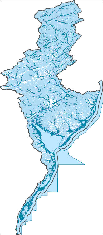
The Watershed Boundary Dataset (WBD) is a comprehensive aggregated collection of hydrologic unit data consistent with the national criteria for delineation and resolution. It defines the areal extent of surface water drainage to a point except in coastal or lake front areas where there could be multiple outlets as stated by the "Federal Standards and Procedures for the National Watershed Boundary Dataset (WBD)" "Standard" (https://pubs.usgs.gov/tm/11/a3/). Watershed boundaries are determined solely upon science-based hydrologic principles, not favoring any administrative boundaries or special projects, nor particular program or agency. This dataset represents the hydrologic unit boundaries to the 12-digit (6th level)...

The Watershed Boundary Dataset (WBD) is a comprehensive aggregated collection of hydrologic unit data consistent with the national criteria for delineation and resolution. It defines the areal extent of surface water drainage to a point except in coastal or lake front areas where there could be multiple outlets as stated by the "Federal Standards and Procedures for the National Watershed Boundary Dataset (WBD)" "Standard" (https://pubs.usgs.gov/tm/11/a3/). Watershed boundaries are determined solely upon science-based hydrologic principles, not favoring any administrative boundaries or special projects, nor particular program or agency. This dataset represents the hydrologic unit boundaries to the 12-digit (6th level)...
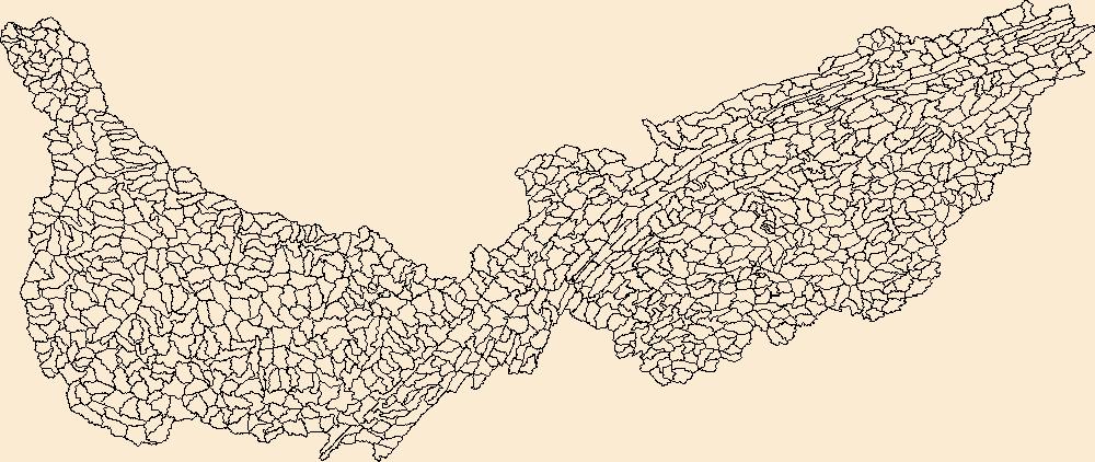
The Watershed Boundary Dataset (WBD) is a comprehensive aggregated collection of hydrologic unit data consistent with the national criteria for delineation and resolution. It defines the areal extent of surface water drainage to a point except in coastal or lake front areas where there could be multiple outlets as stated by the "Federal Standards and Procedures for the National Watershed Boundary Dataset (WBD)" "Standard" (https://pubs.usgs.gov/tm/11/a3/). Watershed boundaries are determined solely upon science-based hydrologic principles, not favoring any administrative boundaries or special projects, nor particular program or agency. This dataset represents the hydrologic unit boundaries to the 12-digit (6th level)...
Mouth of Swan Creek near Fort Washington. Altitude 1000 feet. The light colored band is a deep channel with muddy water, on each side of it clear shallow water with muds. Virginia. September 2, 1920. Photos taken between 2:30 and 4:30 p.m.
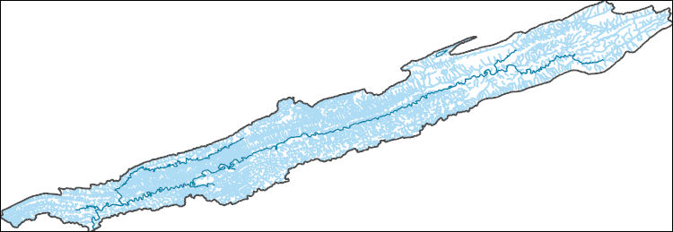
The National Hydrography Dataset (NHD) is a feature-based database that interconnects and uniquely identifies the stream segments or reaches that make up the nation's surface water drainage system. NHD data was originally developed at 1:100,000-scale and exists at that scale for the whole country. This high-resolution NHD, generally developed at 1:24,000/1:12,000 scale, adds detail to the original 1:100,000-scale NHD. (Data for Alaska, Puerto Rico and the Virgin Islands was developed at high-resolution, not 1:100,000 scale.) Local resolution NHD is being developed where partners and data exist. The NHD contains reach codes for networked features, flow direction, names, and centerline representations for areal water...
Bed of Pleistocene gravel one-half mile north of Wares Wharf. In south bank of Rappahannock River. Tappahannock quadrangle. Virginia. No date.
Fault breccia in railroad cut at Plasterco. Chiefly Cambrian dolomite fragments in Carboniferous shale matrix. Abingdon quadrangle. Virginia. No date.

The National Hydrography Dataset (NHD) is a feature-based database that interconnects and uniquely identifies the stream segments or reaches that make up the nation's surface water drainage system. NHD data was originally developed at 1:100,000-scale and exists at that scale for the whole country. This high-resolution NHD, generally developed at 1:24,000/1:12,000 scale, adds detail to the original 1:100,000-scale NHD. (Data for Alaska, Puerto Rico and the Virgin Islands was developed at high-resolution, not 1:100,000 scale.) Local resolution NHD is being developed where partners and data exist. The NHD contains reach codes for networked features, flow direction, names, and centerline representations for areal water...
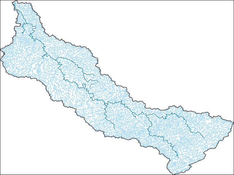
The National Hydrography Dataset (NHD) is a feature-based database that interconnects and uniquely identifies the stream segments or reaches that make up the nation's surface water drainage system. NHD data was originally developed at 1:100,000-scale and exists at that scale for the whole country. This high-resolution NHD, generally developed at 1:24,000/1:12,000 scale, adds detail to the original 1:100,000-scale NHD. (Data for Alaska, Puerto Rico and the Virgin Islands was developed at high-resolution, not 1:100,000 scale.) Local resolution NHD is being developed where partners and data exist. The NHD contains reach codes for networked features, flow direction, names, and centerline representations for areal water...
|

|
