Filters: Tags: coal (X) > Date Range: {"choice":"year"} (X)
66 results (115ms)|
Filters
Date Types (for Date Range)
Types Contacts
Categories Tag Types
|
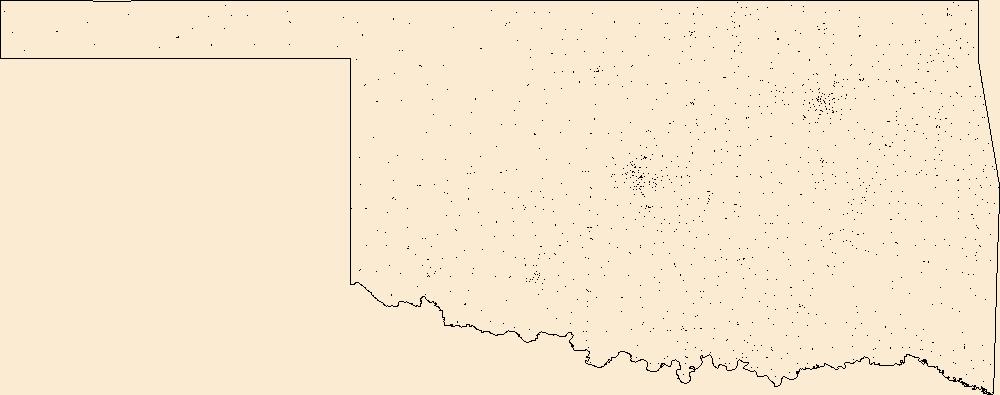
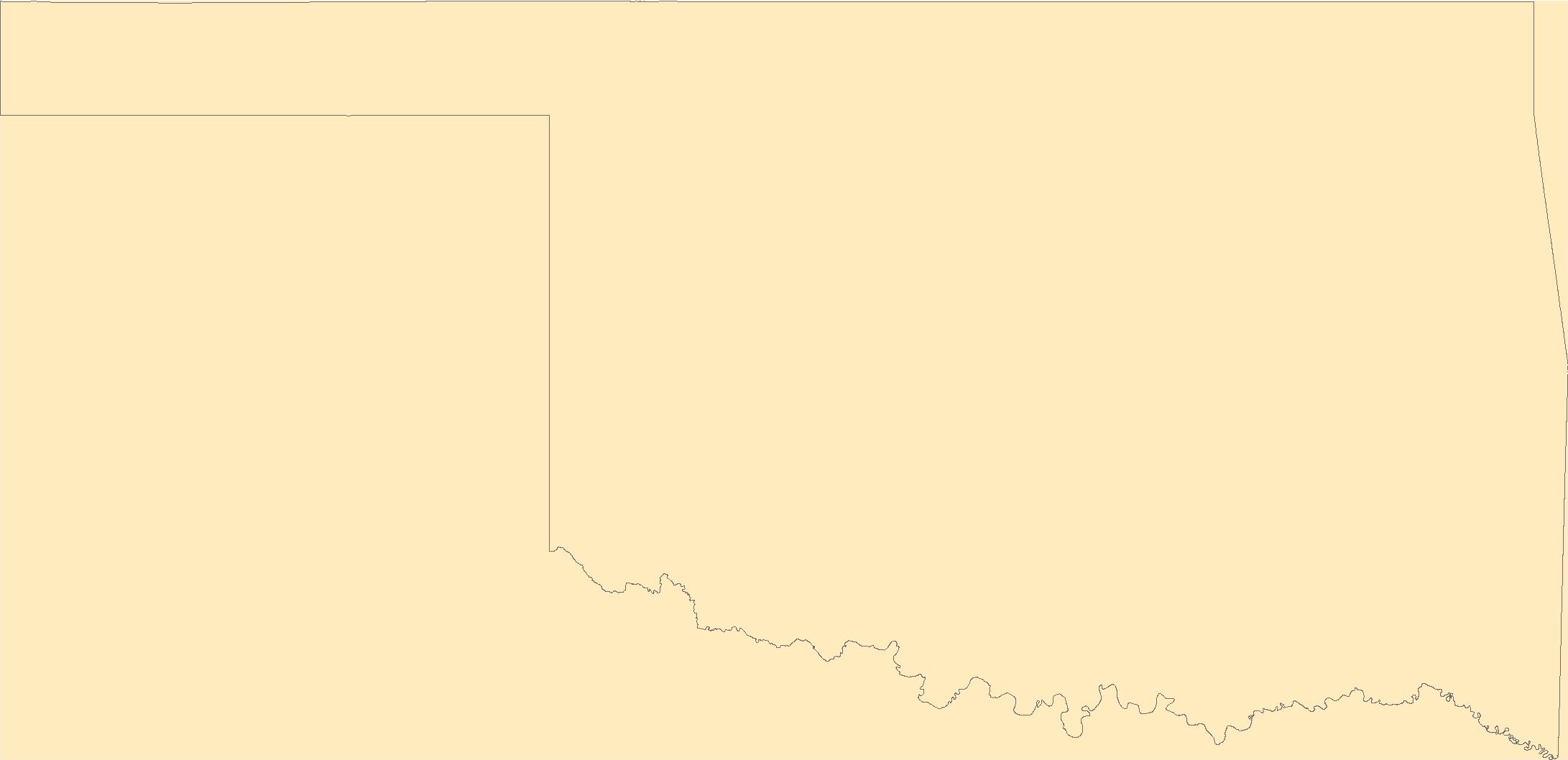
Geospatial data includes structures and other selected map features.

Geospatial data is comprised of government boundaries.
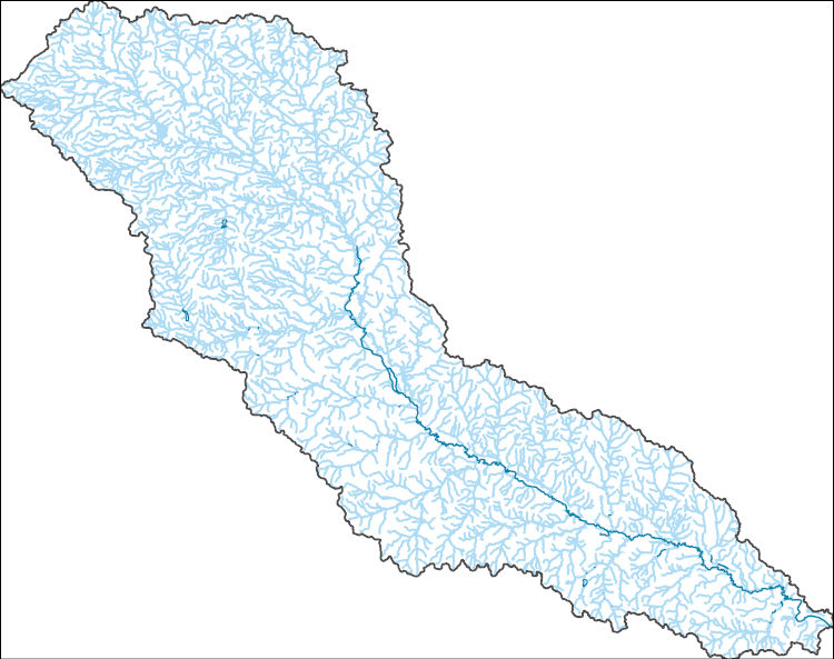
The National Hydrography Dataset (NHD) is a feature-based database that interconnects and uniquely identifies the stream segments or reaches that make up the nation's surface water drainage system. NHD data was originally developed at 1:100,000-scale and exists at that scale for the whole country. This high-resolution NHD, generally developed at 1:24,000/1:12,000 scale, adds detail to the original 1:100,000-scale NHD. (Data for Alaska, Puerto Rico and the Virgin Islands was developed at high-resolution, not 1:100,000 scale.) Local resolution NHD is being developed where partners and data exist. The NHD contains reach codes for networked features, flow direction, names, and centerline representations for areal water...
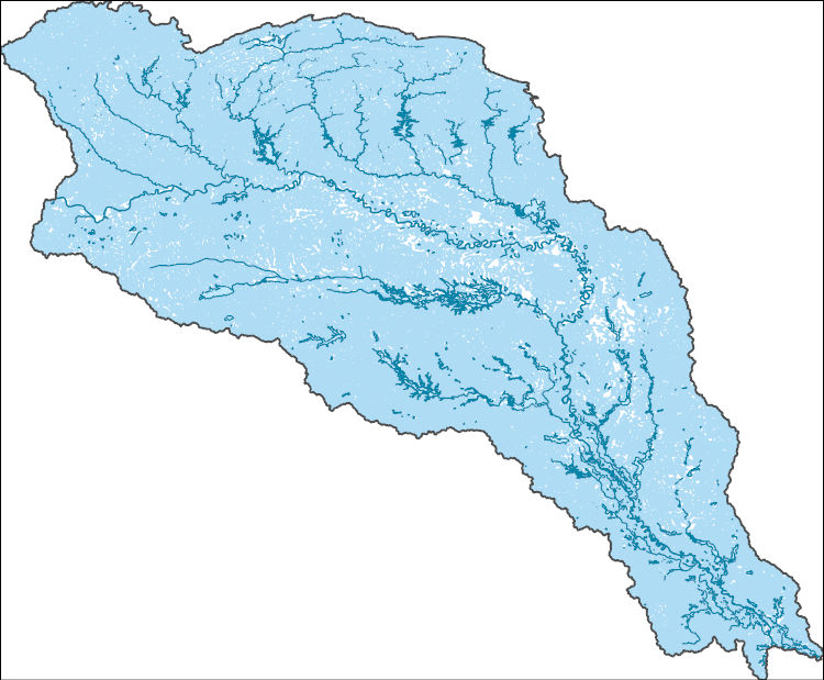
The National Hydrography Dataset (NHD) is a feature-based database that interconnects and uniquely identifies the stream segments or reaches that make up the nation's surface water drainage system. NHD data was originally developed at 1:100,000-scale and exists at that scale for the whole country. This high-resolution NHD, generally developed at 1:24,000/1:12,000 scale, adds detail to the original 1:100,000-scale NHD. (Data for Alaska, Puerto Rico and the Virgin Islands was developed at high-resolution, not 1:100,000 scale.) Local resolution NHD is being developed where partners and data exist. The NHD contains reach codes for networked features, flow direction, names, and centerline representations for areal water...

The Geographic Names Information System (GNIS) is the Federal standard for geographic nomenclature. The U.S. Geological Survey developed the GNIS for the U.S. Board on Geographic Names, a Federal inter-agency body chartered by public law to maintain uniform feature name usage throughout the Government and to promulgate standard names to the public. The GNIS is the official repository of domestic geographic names data; the official vehicle for geographic names use by all departments of the Federal Government; and the source for applying geographic names to Federal electronic and printed products of all types.
The Geographic Names Information System (GNIS) is the Federal standard for geographic nomenclature. The U.S. Geological Survey developed the GNIS for the U.S. Board on Geographic Names, a Federal inter-agency body chartered by public law to maintain uniform feature name usage throughout the Government and to promulgate standard names to the public. The GNIS is the official repository of domestic geographic names data; the official vehicle for geographic names use by all departments of the Federal Government; and the source for applying geographic names to Federal electronic and printed products of all types.
This dataset of anticlines is intended primarily for reference; it includes major structures such as those shown on Plate 2, Principal structural features, Gulf of Mexico Basin (compiled by T.E. Ewing and R.F. Lopez), in Volume J, The Geology of North America (1991). This dataset contains basic data and interpretations developed and compiled by the U.S. Geological Survey's Framework Studies and Assessment of the Gulf Coast Project. Other major sources of data include publicly available information from state agencies as well as publications of the U.S. Geological Survey and other scientific organizations. In cases where company proprietary data were used to produce various derivatives such as contour surfaces, the...
Categories: Data,
pre-SM502.8;
Types: Downloadable,
Map Service,
OGC WFS Layer,
OGC WMS Layer,
Shapefile;
Tags: AL,
AR,
Anticlines,
Coal,
Coalbed Methane,
The maximum extent of Cretaceous onlap is generalized from Plate 3, Structure at the base and subcrop below Mesozoic marine section, Gulf of Mexico Basin (compiled by A. Salvador) in Volume J, The Geology of North America (1991). This dataset contains basic data and interpretations developed and compiled by the U.S. Geological Survey's Framework Studies and Assessment of the Gulf Coast Project. Other major sources of data include publicly available information from state agencies as well as publications of the U.S. Geological Survey and other scientific organizations. In cases where company proprietary data were used to produce various derivatives such as contour surfaces, the source is cited but the data are not...
Categories: Data,
pre-SM502.8;
Types: Downloadable,
Map Service,
OGC WFS Layer,
OGC WMS Layer,
Shapefile;
Tags: 47 = Western Gulf,
48 = East Texas Basin,
49 = Louisiana-Mississippi Salt Basins,
50 = Florida Peninsula,
AL,
The Appalachians are a landscape filled with globally-significant biological diversity and cultural resources that provides essential benefits to large cities and surrounding human communities. The region is also rich in energy resources that meet national and regional demands for energy. As wind, natural gas, and oil energy development expand along with traditional coal, there is an increasing need for research to inform discussions on how to meet immediate and future energy needs while sustaining the health of natural systems. To help address this need, the Appalachian LCC awarded a grant to The Nature Conservancy to assess current and future energy development across the entire region. Assessing Future Energy...
Categories: Data;
Tags: Academics & scientific researchers,
AppLCC,
Appalachian,
Conservation NGOs,
Data,

The National Geologic Map Database (NGMDB) is a Congressionally mandated national archive of geoscience maps, reports, and stratigraphic information. The Geologic Mapping Act of 1992 and its Reauthorizations calls for the U.S. Geological Survey and the Association of American State Geologists (AASG) to cooperatively build this national archive, according to technical and scientific standards whose development is coordinated by the NGMDB. The NGMDB consists of a comprehensive set of publication citations, stratigraphic nomenclature, downloadable content in raster and vector formats, unpublished source information, and guidance on standards development. The NGMDB contains information on more than 110,000 maps and...
The U.S. Geological Survey (USGS) has compiled a geodatabase containing mineral-related geospatial data for 19 countries of interest in the Indo-Pacific region (area of study): Bangladesh, Bhutan, Brunei, Burma, Fiji, Malaysia, Mongolia, Nauru, New Caledonia, New Zealand, Papua New Guinea, Philippines, Singapore, Solomon Islands, South Korea (Republic of Korea), Sri Lanka, Taiwan, Timor-Leste, and Vietnam. The data can be used in analyses of the extractive fuel and nonfuel mineral industries integral for the successful operation of the mineral industries within the area of study. This geodatabase reflects the USGS ongoing commitment to its mission of understanding the nature and distribution of global mineral commodity...
Types: Map Service,
OGC WFS Layer,
OGC WMS Layer,
OGC WMS Service;
Tags: Asia,
Bangladesh,
Bhutan,
Brunei,
Burma,
This data represents the map extent for current and historical USGS topographic maps for the United States and Territories, including 1 X 2 Degree, 1 X 1 Degree, 30 X 60 Minute, 15 X 15 Minute, 7.5 X 7.5 Minute, and 3.75 X 3.75 Minute. The grid was generated using ESRI ArcInfo GIS software.
The volcanic provinces are modified after Plate 2, Principal structural features, Gulf of Mexico Basin (compiled by T.E. Ewing and R.F. Lopez) in Volume J, The Geology of North America (1991). This dataset contains basic data and interpretations developed and compiled by the U.S. Geological Survey's Framework Studies and Assessment of the Gulf Coast Project. Other major sources of data include publicly available information from state agencies as well as publications of the U.S. Geological Survey and other scientific organizations. In cases where company proprietary data were used to produce various derivatives such as contour surfaces, the source is cited but the data are not displayed.
Categories: Data,
pre-SM502.8;
Types: Downloadable,
Map Service,
OGC WFS Layer,
OGC WMS Layer,
Shapefile;
Tags: AL,
AR,
Anticlines,
Coal,
Coalbed Methane,
Locations and shapes of salt diapirs were modified after the New Orleans Geological Society map, Salt tectonism of the U.S. Gulf Coast Basin (compiled by J.A. Lopez, 1995); Plate 2, Principal structural features, Gulf of Mexico Basin (compiled by T.E. Ewing and R.F. Lopez) in Volume J, The Geology of North America (1991); and U.S. Geological Survey Miscellaneous Field Studies Map MF-1213, Distribution of salt structures, Gulf of Mexico, by R.G. Martin (1980). This dataset contains basic data and interpretations developed and compiled by the U.S. Geological Survey's Framework Studies and Assessment of the Gulf Coast Project. Other major sources of data include publicly available information from state agencies as...
Categories: Data,
pre-SM502.8;
Types: Downloadable,
Map Service,
OGC WFS Layer,
OGC WMS Layer,
Shapefile;
Tags: AL,
AR,
Anticlines,
Coal,
Coalbed Methane,

Geospatial data includes structures and other selected map features.
The U.S. Geological Survey (USGS) has compiled a geodatabase containing mineral-related geospatial data for the People's Republic of China. The data can be used in analyses of the extractive fuel and nonfuel mineral industries and related economic and physical infrastructure integral for the successful operation of the mineral industries within the area of study as well as the movement of mineral products across domestic and global markets. This geodatabase reflects the USGS ongoing commitment to its mission of understanding the nature and distribution of global mineral commodity supply chains by updating and publishing the georeferenced locations of mineral commodity production and processing facilities, mineral...
The structure contours were created using biostratigraphic data in the Paleo-Data, Inc., Tenroc Regional Geologic Database. The depths of the microfossil locations were associated with the wells data provided by the Louisiana Department of Natural Resources. Because of the proprietary nature of the Tenroc database, no actual data can be shown and only those data points contained in the Louisiana State wells database are included in the control points layer. Contouring was accomplished in Dynamic Graphics, Inc., EarthVision modeling software (v.5) using minimum tension gridding. Three custom programs were used to convert contour lines generated from grids in EarthVision to Arc/Info coverages and then to shapefiles....
Categories: Data,
pre-SM502.8;
Types: Downloadable,
Map Service,
OGC WFS Layer,
OGC WMS Layer,
Shapefile;
Tags: Coal,
Coalbed Methane,
Coalbed methane resources,
Contours,
Earth Science,
These mapped faults are modified from Plate 2, Principal structural features, Gulf of Mexico Basin (compiled by T.E. Ewing and R.F. Lopez) in Volume J, The Geology of North America (1991); Plate 2, Geologic map of the U.S. Appalachians showing the Laurentian margin and the Taconic orogen (compiled by D.R. Rankin, A.A. Drake, and N.M. Ratcliffe) in Volume F-2, The Geology of North America (1989); and Plate 9, Tectonic map of the Ouachita orogen (compiled by W.A. Thomas) in Volume F-2, The Geology of North America (1989). This dataset contains basic data and interpretations developed and compiled by the U.S. Geological Survey's Framework Studies and Assessment of the Gulf Coast Project. Other major sources of data...
Categories: Data,
pre-SM502.8;
Types: Downloadable,
Map Service,
OGC WFS Layer,
OGC WMS Layer,
Shapefile;
Tags: AL,
AR,
Anticlines,
Coal,
Coalbed Methane,
These data provide generalized outlines of major basins and uplifts in the Gulf Coast region modified after Plate 2, Principal structural features, Gulf of Mexico Basin (compiled by T.E. Ewing and R.F. Lopez) in Volume J, The Geology of North America (1991). This dataset contains basic data and interpretations developed and compiled by the U.S. Geological Survey's Framework Studies and Assessment of the Gulf Coast Project. Other major sources of data include publicly available information from state agencies as well as publications of the U.S. Geological Survey and other scientific organizations. In cases where company proprietary data were used to produce various derivatives such as contour surfaces, the source...
Categories: Data,
pre-SM502.8;
Types: Downloadable,
Map Service,
OGC WFS Layer,
OGC WMS Layer,
Shapefile;
Tags: AL,
AR,
Basins,
Coal,
Coalbed Methane,

The National Hydrography Dataset (NHD) is a feature-based database that interconnects and uniquely identifies the stream segments or reaches that make up the nation's surface water drainage system. NHD data was originally developed at 1:100,000-scale and exists at that scale for the whole country. This high-resolution NHD, generally developed at 1:24,000/1:12,000 scale, adds detail to the original 1:100,000-scale NHD. (Data for Alaska, Puerto Rico and the Virgin Islands was developed at high-resolution, not 1:100,000 scale.) Local resolution NHD is being developed where partners and data exist. The NHD contains reach codes for networked features, flow direction, names, and centerline representations for areal water...
|

|
