Filters: Tags: grazing (X) > partyWithName: U.S. Geological Survey (X)
5 results (28ms)|
Filters
Date Range
Types Contacts
Categories Tag Types Tag Schemes |
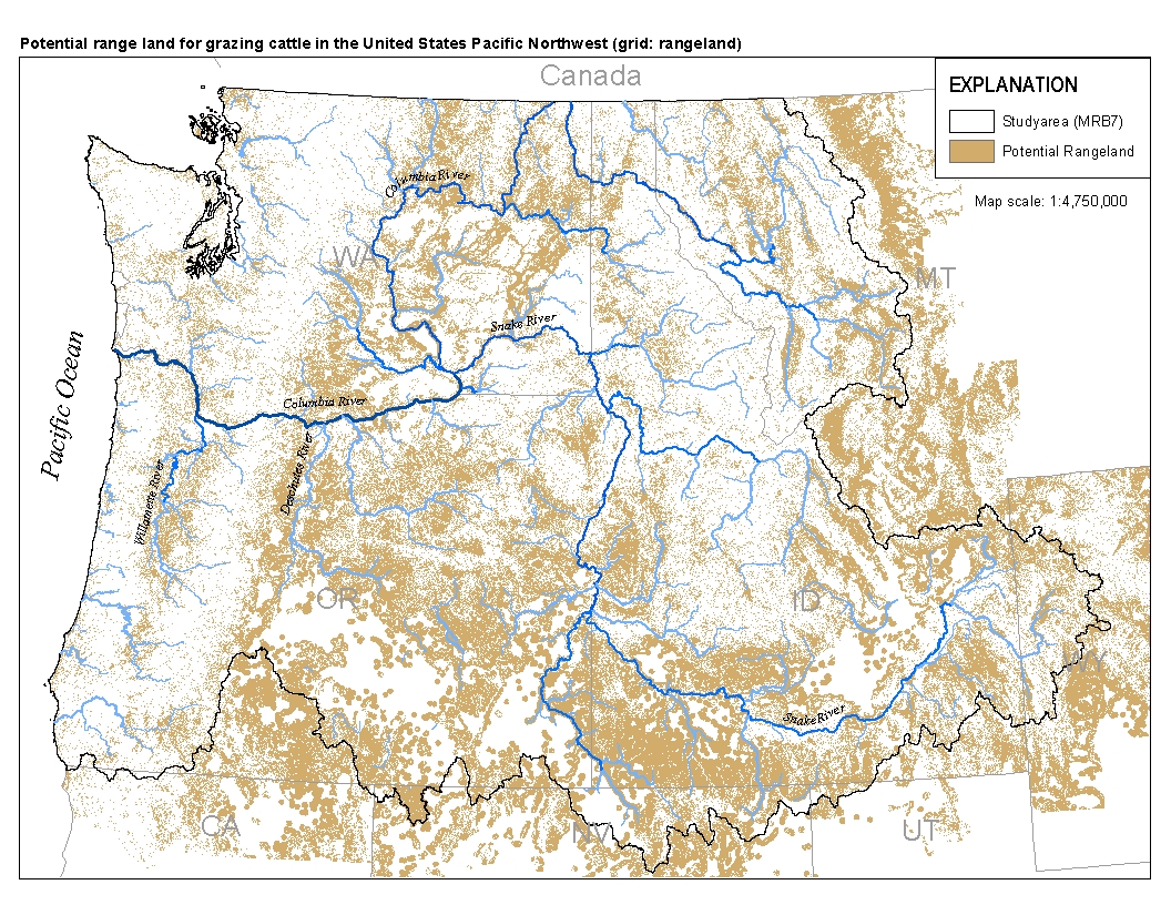
This spatial data set was created by the U.S. Geological Survey (USGS) to represent the extent of land in the Pacific Northwest region of the United States (Hydro Region 17; Major River Basin 7 (MRB7)) that potentially received waste from grazing cattle in 2002.

These data were released prior to the October 1, 2016 effective date for the USGS’s policy dictating the review, approval, and release of scientific data as referenced in USGS Survey Manual Chapter 502.8 Fundamental Science Practices: Review and Approval of Scientific Data for Release. This spatial data set was created by the U.S. Geological Survey (USGS) to represent the extent of land in the Pacific Northwest region of the United States (Hydro Region 17; Major River Basin 7 (MRB7)) that potentially received waste from grazing cattle in 2002.

These data were released prior to the October 1, 2016 effective date for the USGS’s policy dictating the review, approval, and release of scientific data as referenced in USGS Survey Manual Chapter 502.8 Fundamental Science Practices: Review and Approval of Scientific Data for Release. This spatial data set was created by the U.S. Geological Survey (USGS) to represent the area of land within each incremental watershed delineated in the NHDPlus v2 dataset in the Pacific Northwest region of the United States (Hydro Region 17; Major River Basin 7 (MRB7)) that potentially received waste from grazing cattle in 2002.
These data were compiled to support and inform the Bureau of Land Management’s Colorado Plateau Native Plant Program and to guide future management action when selecting regions to collect and increase seed for native plant materials development. The objective of our study was to develop geospatial datasets to aid land managers and restoration practitioners in identifying areas that will need to be restored in the future (currently disturbed) as well as areas to source new native plant materials for propagation with increased climate similarity to these areas across the Colorado Plateau, Arizona/New Mexico Mountains, and Arizona/New Mexico Plateaus. These data represent species distribution models for 12 high priority...
This dataset provides an additional "Grazing Potential" land use class to the previously published U.S. Geological Survey (USGS) National Water-Quality Program (NAWQA) Wall-to-Wall Anthropogenic Land-use Trends (NWALT) product (Falcone, 2015, USGS Data Series 948). As with the NWALT, the dataset consists of five national 60-m land use grids, for the years 1974, 1982, 1992, 2002, 2012. The only change to the dataset is, for every year, some pixels which are class 50 "Low-use" in the NWALT, are reclassified to a new class 46 "Grazing Potential Expanded". The purpose of the re-classification is to identify areas which are likely to have had at least some grazing activity based on agreement of historical land cover/use...
|

|
