Filters: Tags: hydrographic datasets (X)
328 results (161ms)|
Filters
Contacts
(Less)
|
These data are bathymetry (lake bottom elevation) in XYZ format (Easting, Northing, Elevation), generated from the May 30–June 1, 2023, bathymetric survey of Buckhorn Lake, Kentucky, from the dam to CR-1475 (19.5 miles total reach length). Hydrographic data were collected using a RESON 210 kHz NaviSound single-beam echosounder (SBES) with a Hemisphere A222 integrated global navigation satellite system (GNSS) smart antenna. The SBES and GNSS antenna were mounted on a marine survey vessel, and data were collected as the survey vessel traversed the lake along planned survey lines. A total of 380 survey lines were oriented approximately perpendicular to the primary flow direction at generally 250-foot or 500-foot spacing....

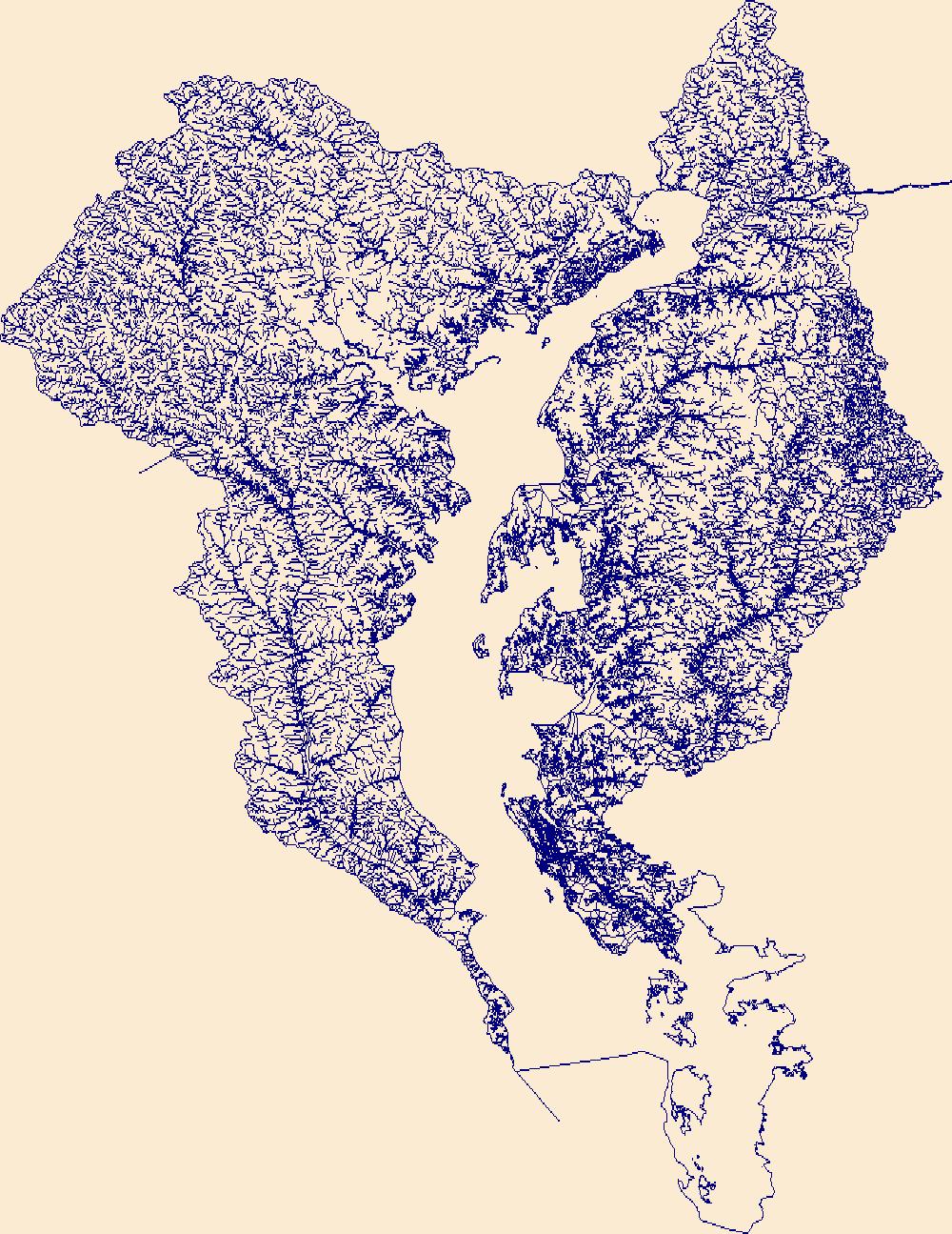
The High Resolution National Hydrography Dataset Plus (NHDPlus HR) is an integrated set of geospatial data layers, including the National Hydrography Dataset (NHD), National Watershed Boundary Dataset (WBD), and 3D Elevation Program Digital Elevation Model (3DEP DEM). The NHDPlus HR combines the NHD, 3DEP DEMs, and WBD to a data suite that includes the NHD stream network with linear referencing functionality, the WBD hydrologic units, elevation-derived catchment areas for each stream segment, "value added attributes" (VAAs), and other features that enhance hydrologic data analysis and routing.
The High Resolution National Hydrography Dataset Plus (NHDPlus HR) is an integrated set of geospatial data layers, including the National Hydrography Dataset (NHD), National Watershed Boundary Dataset (WBD), and 3D Elevation Program Digital Elevation Model (3DEP DEM). The NHDPlus HR combines the NHD, 3DEP DEMs, and WBD to a data suite that includes the NHD stream network with linear referencing functionality, the WBD hydrologic units, elevation-derived catchment areas for each stream segment, "value added attributes" (VAAs), and other features that enhance hydrologic data analysis and routing.
This data release contains a comma-delimited ascii file of five same-day, discrete discharge measurements made at sites along selected reaches of South Hālawa Stream, North Hālawa Stream, and Hālawa Stream, Oʻahu, Hawaiʻi on January 19, 2022. These discrete discharge measurements form what is commonly referred to as a “seepage run.” The intent of the seepage run is to quantify the spatial distribution of streamflow along the reach during fair-weather, low-flow conditions, generally characterized by negligible direct runoff within the reach. The measurements can be used to characterize the net seepage of water into (water gain) or out of (water loss) the stream channel between measurement sites provided that the...
Categories: Data;
Tags: Hālawa Stream,
North Hālawa Stream,
Oʻahu,
South Hālawa Stream,
State of Hawaii,
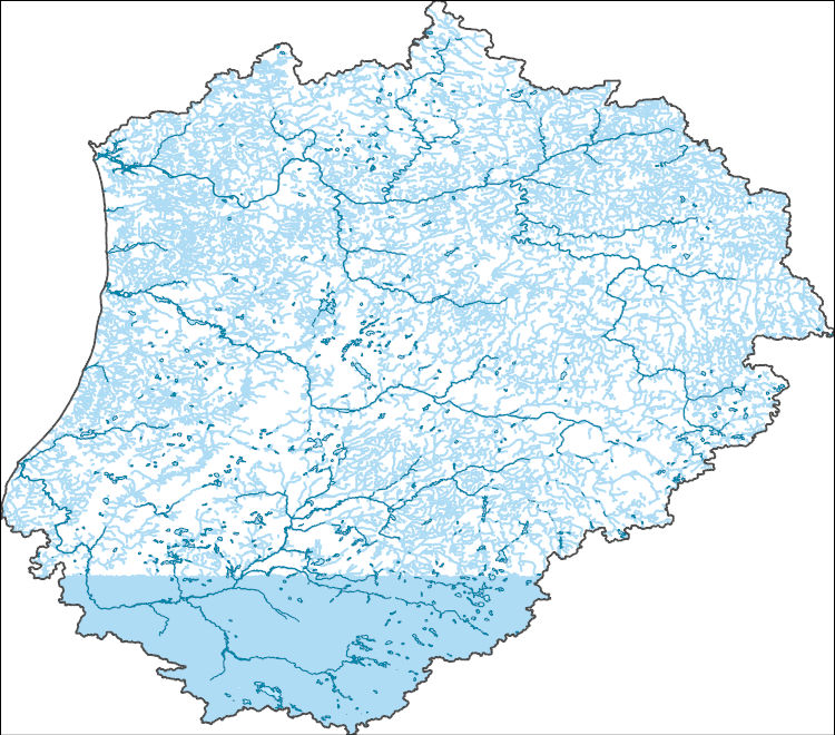
The High Resolution National Hydrography Dataset Plus (NHDPlus HR) is an integrated set of geospatial data layers, including the best available National Hydrography Dataset (NHD), the 10-meter 3D Elevation Program Digital Elevation Model (3DEP DEM), and the National Watershed Boundary Dataset (WBD). The NHDPlus HR combines the NHD, 3DEP DEMs, and WBD to create a stream network with linear referencing, feature naming, "value added attributes" (VAAs), elevation-derived catchments, and other features for hydrologic data analysis. The stream network with linear referencing is a system of data relationships applied to hydrographic systems so that one stream reach "flows" into another and "events" can be tied to and traced...

The High Resolution National Hydrography Dataset Plus (NHDPlus HR) is an integrated set of geospatial data layers, including the best available National Hydrography Dataset (NHD), the 10-meter 3D Elevation Program Digital Elevation Model (3DEP DEM), and the National Watershed Boundary Dataset (WBD). The NHDPlus HR combines the NHD, 3DEP DEMs, and WBD to create a stream network with linear referencing, feature naming, "value added attributes" (VAAs), elevation-derived catchments, and other features for hydrologic data analysis. The stream network with linear referencing is a system of data relationships applied to hydrographic systems so that one stream reach "flows" into another and "events" can be tied to and traced...
The High Resolution National Hydrography Dataset Plus (NHDPlus HR) is an integrated set of geospatial data layers, including the best available National Hydrography Dataset (NHD), the 10-meter 3D Elevation Program Digital Elevation Model (3DEP DEM), and the National Watershed Boundary Dataset (WBD). The NHDPlus HR combines the NHD, 3DEP DEMs, and WBD to create a stream network with linear referencing, feature naming, "value added attributes" (VAAs), elevation-derived catchments, and other features for hydrologic data analysis. The stream network with linear referencing is a system of data relationships applied to hydrographic systems so that one stream reach "flows" into another and "events" can be tied to and traced...
Videos and imagery collected of the Arkansas River at Parkdale, CO on March 20–21, 2018 as part of the US Geological Survey (USGS) "2018 Airshow". These videos capture ground conditions of river flow at three locations in the vicinity of the USGS 07094500 Arkansas River at Parkdale, CO streamgage. The videos were captured by either a tripod-mounted digital camera, smartphone, or unmanned aerial system. All videos are named according to the date, time, and location of acquisition. Included with each video is an image with annotation indicating ground control points. The absolute distances between each ground control points are described in the included "Sensor_Cameras.csv" table on which this metadata is based. ...
|

|
