Filters: Tags: streamflow (X)
1,076 results (730ms)|
Filters
Date Range
Extensions Types
Contacts
Categories
Tag Types
|
Summary There is convincing evidence that land use/land cover (LULC) change has contributed to increasing discharge in the Upper Mississippi River Basin (UMRB) but key details remain unresolved. In this study, we extend our previous work (Zhang and Schilling, 2006) to quantify how much of the increasing discharge was due to LULC change. We examined daily streamflow for the 1890–2003 period from the US Geological Survey stream gage at Keokuk, Iowa and compiled county agricultural statistics for soybean production in the watershed above the gage to quantify how much of the change in the relation of discharge to precipitation was due to increased soybean cultivation. By allowing the slope of the discharge–precipitation...
Categories: Publication;
Types: Citation;
Tags: Agricultural hydrology,
Land cover land use change,
Mississippi River,
Northeast CASC,
Other Landscapes,
The U.S. Geological Survey (USGS), prepared geographic information systems (GIS) layers for use in the West Virginia StreamStats application. The Digital Elevation Model and associated data were hydrologically conditioned, which is the process of burning in single line streams at the 1:24,000 scale into a digital elevation model to produce flow direction and flow accumulation grids. This data includes geotif images for a 10 meter digital elevation model, a flow direction, and a flow accumulation raster/grid image for the WV Streamstats area. The 34 HUCs represented by this dataset are 02070001, 02070002, 02070003, 02070004, 02070005, 02070006, 02070007, 05020001, 05020002,05020003, 05020004, 05020005, 05020006,...
Categories: Data;
Types: Downloadable,
GeoTIFF,
Map Service,
OGC WFS Layer,
OGC WMS Layer,
OGC WMS Service,
Raster;
Tags: USGS Science Data Catalog (SDC),
USGS:5e8f8e7282cee42d134ae181,
United States,
Water Resources,
West Virginia,
The North Dakota State Water Commission and International Joint Commission partnered with USGS to characterize the climate and streamflow in the Souris River Basin and develop a set of daily streamflow traces from 10-day stochastic streamflow traces discussed in Kolars and others (2016).The Kolars and others (2016) dataset is provided and was used to determine the statistical characteristics of historical and stochastically generated climate variables and streamflow in the Souris River Basin from the headwaters of the Souris River Basin in Saskatchewan through Minot, N. Dak. Stochastic streamflow presented in this dataset can be characterized as either regulated or natural (unregulated) streamflow. The natural streamflow...
A machine learning streamflow (MLFLOW) model was developed in R (model is in the Rscripts folder) for modeling monthly streamflow from 2012 to 2017 in three watersheds on the Wyoming Range in the upper Green River basin. Geospatial information for 125 site features (vector data are in the Sites.shp file) and discrete streamflow observation data and environmental predictor data were used in fitting the MLFLOW model and predicting with the fitted model. Tabular calibration and validation data are in the Model_Fitting_Site_Data.csv file, totaling 971 discrete observations and predictions of monthly streamflow. Geospatial information for 17,518 stream grid cells (raster data are in the Streams.tif file) and environmental...
Types: Map Service,
OGC WFS Layer,
OGC WMS Layer,
OGC WMS Service;
Tags: Ecology,
Geography,
Hydrology,
USGS Science Data Catalog (SDC),
Upper Green,
Salinity regimes in coastal ecosystems are highly dynamic and driven by complex geomorphic and hydrological processes. Estuarine biota are generally adapted to salinity fluctuation, but are vulnerable to salinity extremes. Characterizing coastal salinity regime for ecological studies therefore requires representing extremes of salinity ranges at various time scales relevant to ecology (e.g., daily, monthly, seasonally). This data release provides supporting data for the journal article titled, "Quantifying uncertainty in coastal salinity regime for biological application using quantile regression," by Yurek et al. (2022). A spatially-resolved model was developed that derives quantile distributions of salinity related...
The National Water Quality Network (NWQN) for Rivers and Streams includes 110 surface-water river and stream sites monitored by the U.S. Geological Survey (USGS) National Water Quality Program, National Water-Quality Assessment (NAWQA) Project. The NWQN includes 20 large river coastal sites, 41 large river inland sites, 30 wadeable stream reference sites, 10 wadeable stream urban sites, and 9 wadeable stream agricultural sites. In addition to the 110 NWQN sites, 35 sites from the USGS Cooperative Water Program are also included in this data release. This data release provides streamflow, nutrient, pesticide and sediment data collected and analyzed by NWQN and other historical water-quality networks from 1950-2020....
Categories: Data;
Tags: United States,
nutrient content,
pesticide and herbicide contamination,
river systems,
sediment transport,
This child item contains the raw videos captured by small Unoccupied Aircraft Systems (sUAS) at each field site. Each Field Site is abbreviated in various files in this data release. File and folder names are used to quickly identify which site a particular file or dataset represents. The following abbreviations are used: ACR: Androscoggin River, Auburn, Maine, USA AFR: Agua Fria River, near Rock Springs, Arizona, USA CCC: Coachella Canal above All-American Canal Diversion, California, USA CMC: Cochiti East Side Main Channel, near Cochiti, New Mexico, USA GLR: Gila River near Dome, Arizona, USA RMC: Reservation Main Canal near Yuma, Arizona, USA SMC: Sile Main Canal (at head) at Cochiti, New Mexico, USA WMD: Wellton-Mohawk...
This child item contains images associated with each field site annotated with labeled calibration marks and associated pixel locations for each dataset. The images can be used to calibrate image velocimetry results into real world units (meters, for example). Each Field Site is abbreviated in various files in this data release. File and folder names are used to quickly identify which site a particular file or dataset represents. The following abbreviations are used: ACR: Androscoggin River, Auburn, Maine, USA AFR: Agua Fria River, near Rock Springs, Arizona, USA CCC: Coachella Canal above All-American Canal Diversion, California, USA CMC: Cochiti East Side Main Channel, near Cochiti, New Mexico, USA GLR: Gila...
These data were released prior to the October 1, 2016 effective date for the USGS’s policy dictating the review, approval, and release of scientific data as referenced in USGS Survey Manual Chapter 502.8 Fundamental Science Practices: Review and Approval of Scientific Data for Release. This arc and point data set contains streamflow-measurement sites and reaches indicating streamflow gain or loss under base-flow conditions along the Republican River and tributaries in Nebraska during October 19 to 20, 1981 (Engel and others, 1984). The streamflow measurements were made to obtain data on ground-water/surface-water interaction. Flow was observed visually to be zero, was measured, or was estimated at 105 sites. The...
Categories: pre-SM502.8;
Tags: Furnas County,
NSDI,
Nebraska,
Republican River,
Republican River Basin,
Our objective was to model intermittency (perennial, weakly intermittent, or strongly intermittent) on small, ungaged streams in the Upper Colorado River Basin. Modeling streamflows is an important tool for understanding landscape-scale drivers of flow and estimating flows where there are no gaged records. We focused our study in the Upper Colorado River Basin, a region that is not only critical for water resources but also projected to experience large future climate shifts toward a drier climate.We used a random forest modeling approach to model the relation between intermittency on gaged streams (115 gages) and environmental variables. We then projected intermittency status to ungaged reaches in the Upper Colorado...
Our objective was to model minimum flow coefficient of variation (CV) on small, ungaged streams in the Upper Colorado River Basin. Modeling streamflows is an important tool for understanding landscape-scale drivers of flow and estimating flows where there are no gaged records. We focused our study in the Upper Colorado River Basin, a region that is not only critical for water resources but also projected to experience large future climate shifts toward a drier climate. We used a random forest modeling approach to model the relation between minimum flow CV (the standard deviation of annual minimum flows times 100 divided by the mean of annual minimum flows) on gaged streams (115 gages) and environmental variables....
This USGS data release represents the 1:500,000-scale geospatial data for the following publication: Eakin, T.E., and Lamke, R.D., 1966, Hydrologic reconnaissance of the Humboldt River basin, Nevada: Nevada Department of Conservation and Natural Resources, Water Resources Bulletin 32, 107 p. The data set consists of 3 separate items: 1. Depth-to-water area polygons 2. Isopleths showing mean annual runoff, 1912-1963 3. Water-level altitude contours
This file (wymt_ffa_2022B.psf) contains specifications to run PeakFQ version 7.4 for peak-flow frequency analyses for selected streamgages based on data through water year 2022.
Types: Map Service,
OGC WFS Layer,
OGC WMS Layer,
OGC WMS Service;
Tags: Boxelder,
Carter County,
Custer County,
Fallon County,
Little Powder,

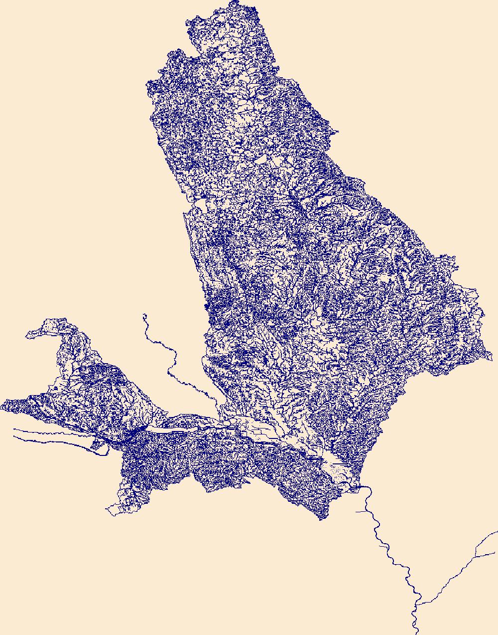
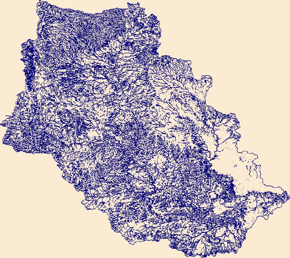
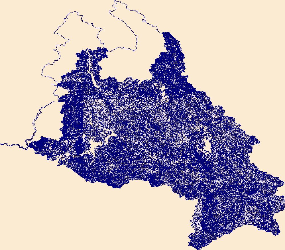
The High Resolution National Hydrography Dataset Plus (NHDPlus HR) is an integrated set of geospatial data layers, including the National Hydrography Dataset (NHD), National Watershed Boundary Dataset (WBD), and 3D Elevation Program Digital Elevation Model (3DEP DEM). The NHDPlus HR combines the NHD, 3DEP DEMs, and WBD to a data suite that includes the NHD stream network with linear referencing functionality, the WBD hydrologic units, elevation-derived catchment areas for each stream segment, "value added attributes" (VAAs), and other features that enhance hydrologic data analysis and routing.
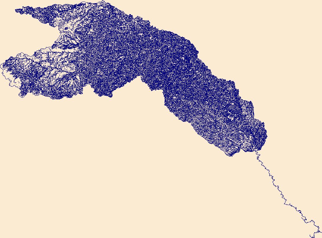
The High Resolution National Hydrography Dataset Plus (NHDPlus HR) is an integrated set of geospatial data layers, including the best available National Hydrography Dataset (NHD), the 10-meter 3D Elevation Program Digital Elevation Model (3DEP DEM), and the National Watershed Boundary Dataset (WBD). The NHDPlus HR combines the NHD, 3DEP DEMs, and WBD to create a stream network with linear referencing, feature naming, "value added attributes" (VAAs), elevation-derived catchments, and other features for hydrologic data analysis. The stream network with linear referencing is a system of data relationships applied to hydrographic systems so that one stream reach "flows" into another and "events" can be tied to and traced...

The High Resolution National Hydrography Dataset Plus (NHDPlus HR) is an integrated set of geospatial data layers, including the National Hydrography Dataset (NHD), National Watershed Boundary Dataset (WBD), and 3D Elevation Program Digital Elevation Model (3DEP DEM). The NHDPlus HR combines the NHD, 3DEP DEMs, and WBD to a data suite that includes the NHD stream network with linear referencing functionality, the WBD hydrologic units, elevation-derived catchment areas for each stream segment, "value added attributes" (VAAs), and other features that enhance hydrologic data analysis and routing.
The High Resolution National Hydrography Dataset Plus (NHDPlus HR) is an integrated set of geospatial data layers, including the best available National Hydrography Dataset (NHD), the 10-meter 3D Elevation Program Digital Elevation Model (3DEP DEM), and the National Watershed Boundary Dataset (WBD). The NHDPlus HR combines the NHD, 3DEP DEMs, and WBD to create a stream network with linear referencing, feature naming, "value added attributes" (VAAs), elevation-derived catchments, and other features for hydrologic data analysis. The stream network with linear referencing is a system of data relationships applied to hydrographic systems so that one stream reach "flows" into another and "events" can be tied to and traced...
The High Resolution National Hydrography Dataset Plus (NHDPlus HR) is an integrated set of geospatial data layers, including the best available National Hydrography Dataset (NHD), the 10-meter 3D Elevation Program Digital Elevation Model (3DEP DEM), and the National Watershed Boundary Dataset (WBD). The NHDPlus HR combines the NHD, 3DEP DEMs, and WBD to create a stream network with linear referencing, feature naming, "value added attributes" (VAAs), elevation-derived catchments, and other features for hydrologic data analysis. The stream network with linear referencing is a system of data relationships applied to hydrographic systems so that one stream reach "flows" into another and "events" can be tied to and traced...

The High Resolution National Hydrography Dataset Plus (NHDPlus HR) is an integrated set of geospatial data layers, including the National Hydrography Dataset (NHD), National Watershed Boundary Dataset (WBD), and 3D Elevation Program Digital Elevation Model (3DEP DEM). The NHDPlus HR combines the NHD, 3DEP DEMs, and WBD to a data suite that includes the NHD stream network with linear referencing functionality, the WBD hydrologic units, elevation-derived catchment areas for each stream segment, "value added attributes" (VAAs), and other features that enhance hydrologic data analysis and routing.
The High Resolution National Hydrography Dataset Plus (NHDPlus HR) is an integrated set of geospatial data layers, including the best available National Hydrography Dataset (NHD), the 10-meter 3D Elevation Program Digital Elevation Model (3DEP DEM), and the National Watershed Boundary Dataset (WBD). The NHDPlus HR combines the NHD, 3DEP DEMs, and WBD to create a stream network with linear referencing, feature naming, "value added attributes" (VAAs), elevation-derived catchments, and other features for hydrologic data analysis. The stream network with linear referencing is a system of data relationships applied to hydrographic systems so that one stream reach "flows" into another and "events" can be tied to and traced...
|

|
