Filters: Tags: wyoming (X)
15,042 results (693ms)|
Filters
Date Range
Extensions (Less)
Types (Less) Contacts (Less)
Categories (Less)
Tag Types
|

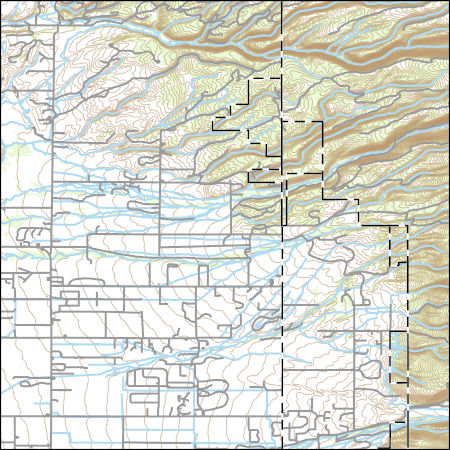
Vector file of 305b listed streams
This dataset represents soils of Wyoming at 1:100,000- scale. The layer contains 350 separate soils descriptions across 23 Wyoming counties. The layer was compiled based on the five-factor soil forming model using digital surficial geology, bedrock geology, and elevation. This dataset will be more fully documented in 23 AES publications scheduled for completion in winter of 99/00. These publications will use the designation AES Bulletin B-1071 followed by a two letter abreviation for each county.
Categories: Data;
Types: Downloadable;
Tags: Wyoming,
aquifer sensitivity,
biota,
farming,
geoscientificInformation,
PRISM climate data for Wyoming. Data can be accessed through the Geospatial Data Gateway http://datagateway.nrcs.usda.gov/.
Categories: Data;
Types: Downloadable;
Tags: PRISM,
Precipitation,
Wyoming,
climate,
climatologyMeteorologyAtmosphere,
This theme is polygon data that depicts two types of development for the state of Wyoming. The first is existing development and the second are habitats where there is a high likelihood that development will occur in the near future. We considered development of oil, gas and coal bed methane, mining of minerals (trona, uranimum, coal, and bentonite), urban expansion. Other infrastructure activities such as roads, highways, fiberoptic lines, processing plants, pipelines, other facilities, and various combinations of development that were believed to impact sage-grouse were recorded. Information sources and assessment processes varied depending on data available and resource specialist participation for areas within...
Categories: Data;
Types: Downloadable;
Tags: BLM,
Federal Government,
Wyoming,
biota,
developed habitat,
Tax district mapping is an important function of the Property Tax Division - Technical Services Group. The identification of tax districts aids in the mill levy process and helps counties redistribute tax funds more effectively.
Categories: Data;
Types: Downloadable;
Tags: Campbell County,
Counties,
Tax Districts,
Tax Entities,
United States,
Hydrographic features for Wyoming at 1:100,000-scale, including perennial and intermittent designations and Strahler stream order attributes for streams. Does not include man-made ditches, canals and aqueducts. The data was originally produced by USGS, a Digital Line Graph (DLG) product, though this product was enhanced (edgematched, some linework and attributes corrected, stream order attribute added). A subset of this dataset is also available for distribution, including only major streams (order 4 to 7) and major lakes and reservoirs. In order to reduce the size of this subset, the line segments were dissolved to remove unncessary segments.
Categories: Data;
Types: Downloadable;
Tags: Wyoming,
digital line graphs,
hydrography,
inlandWaters,
lakes,
A new species of poplar is recognized based on abundant specimens from the early Middle Eocene Parachute Creek Member of the Green River Formation in eastern Utah and western Colorado and compared with two other contemporary species. A rare twig bearing both leaves and fruits serves as a Rosetta stone, linking the vegetative and reproductive structures that formerly were only known from dispersed organs. Fruit and foliage characters distinguish Populus tidwellii sp. n. from Populus cinnamomoides (Lesquereux) MacGinitie (typified on specimens from Green River Station, WY), to which the isolated leaves had formerly been attributed. In addition, new data from fruits and foliage confirm that there were two distinct...
Categories: Publication;
Types: Citation,
Journal Citation;
Tags: Colorado,
International Journal of Plant Sciences,
Montana,
Populus,
Pseudosalix,
Statewide migration barriers for Moose. The severity of the threat to the migration route and the severity of problem noted.
Tax district mapping is an important function of the Property Tax Division - Technical Services Group. The identification of tax districts aids in the mill levy process and helps counties redistribute tax funds more effectively.
Categories: Data;
Types: Downloadable;
Tags: Counties,
Crook County,
Tax Districts,
Tax Entities,
United States,

The USDA, NASS Cropland Data Layer (CDL) is a raster, geo-referenced, crop-specific land cover data layer with a ground resolution of 56 meters. The CDL is produced using satellite imagery from the Indian Remote Sensing RESOURCESAT-1 (IRS-P6) Advanced Wide Field Sensor (AWiFS) collected during the current growing season. Some Cropland Data Layer states used Landsat 5 TM and/or Landsat 7 ETM+ satellite imagery to supplement the classification. Ancillary classification inputs include: the United States Geological Survey (USGS) National Elevation Dataset (NED), the USGS National Land Cover Dataset 2001 (NLCD 2001), and the National Aeronautics and Space Administration (NASA) Moderate Resolution Imaging Spectroradiometer...
Layers of geospatial data include contours, boundaries, land cover, hydrography, roads, transportation, geographic names, structures, and other selected map features.
Types: Citation;
Tags: 7.5 x 7.5 minute,
7.5 x 7.5 minute,
Combined Vector,
Combined Vector,
Combined Vector,
This dataset was compiled and published as a service definition for the purpose of display in an interactive web map of the Wyoming Landscape Conservation Initiative (WLCI). The data layers selected for the dataset are a subset of the data layers in USGS Data Series 683, the Energy Map of Southwestern Wyoming, Part A - Coal and Wind (2012). Data Series 683 includes a geodatabase of all the shapefiles used as data sources. These shapefiles and their metadata can be downloaded from http://pubs.usgs.gov/ds/683/contents/Datafiles/. In order to show the most recent information about mine activity in Wyoming, an additional data layer was added to the service definition: Active Coal Mines (data set credit: Chris Carrol,...
Categories: Data;
Types: ArcGIS REST Map Service,
ArcGIS Service Definition,
Downloadable,
Map Service;
Tags: Wyoming
Proportion of juniper land cover within a 18-km radius developed using a circular focal moving window analysis.
Categories: Data;
Types: Downloadable,
GeoTIFF,
Map Service,
Raster,
Shapefile;
Tags: Colorado,
Idaho,
Juniperus,
Montana,
United States,
Habitat selection studies can make important contributions to habitat prioritization efforts for species of conservation concern. We present a large-scale collaborative effort to develop habitat selection models for Greater Sage-grouse (Centrocercus urophasianus) across large landscapes (Wyoming, USA) and multiple seasons. Greater Sage-grouse are limited to western semi-arid landscapes in North America, range-wide population declines have been documented, and the species is currently listed a “warranted but precluded” from listing under the U.S. Endangered Species Act. Wyoming is predicted to remain a stronghold for Sage-grouse populations and contains approximately 37% of the remaining birds. We developed Resource...
Categories: Data;
Types: Downloadable,
GeoTIFF,
Map Service,
Raster;
Tags: Centrocercus urophasianus,
Greater sage-grouse,
United States,
WY,
Wyoming,
|

|
