Filters
Date Range
Extensions
(Less)
Types
(Less)
Contacts
(Less)
Categories
(Less)
Tag Types
Tag Schemes
- None (418052)
- Geographic Names Information System (418312)
- ISO 19115 Topic Category (266789)
- The National Map Collection Thesaurus (418288)
- The National Map Product Format Thesaurus (418288)
- The National Map Theme Thesaurus (418307)
- The National Map Type Thesaurus (418300)
- The National Map Product Extent Thesaurus (418288)
- Geospatial Platform (8163)
- USGS Thesaurus (288)
- ISO Topic Categories from ISO 19115:2003 (216)
- none (16)
- ISO Topic Categories from ISO 19115:2003 elevation (50)
- URL of thesaurus? (3)
- FGDC (8)
- Geographic Names Information System (GNIS) (8)
- U.S. Department of Commerce; 2013; American National Standards Institute (ANSI) Codes for States, the District of Columbia, Puerto Rico, and the Insular Areas of the United States; Washington, DC; U.S. Census Bureau; http://www.census.gov/geo/reference/ansi_statetables.html. (5)
- NGDA Portfolio Themes (22)
- U.S. Department of the Interior, U.S. Geological Survey, 1999, Standards for National Hydrography Dataset (http://mapping.usgs.gov/standards/) (6)
- https://www.sciencebase.gov/vocab/vocabulary/54760ef9e4b0f62cb5dc41a0 (15)
- ISO 19115 Topic Categories (11)
- https://earthdata.nasa.gov/gcmd-forum (14)
- Common geographic areas (6)
- GCMD Location Keywords (2)
- https://www.sciencebase.gov/vocab/category/WRET/CMS_Topics/CASC_CMS_Topics (2)
- Organization for International Standards, 2008, ISO 3166 Country Codes, https://www.iso.org/obp/ui/#search. (3)
- USGS Metadata Identifier (6)
- https://www.sciencebase.gov/vocab/category/WRET/CMS_Themes/CASC_CMS_Themes (2)
- ISO Topic Categories from ISO 19115 (1)
- https://www.sciencebase.gov/vocab/category/NCCWSC/Keyword (2)
- https://www.sciencebase.gov/vocab/category/bis/NFHP%20Data%20Catalog%20 (1)
- ISO 19115 (1)
- Organization for International Standards, 2008, ISO 3166 Country Codes, https://www.iso.org/obp/ui/#search (2)
- The National Map Place Thesaurus (2)
- https://www.sciencebase.gov/vocab/category/NCCWSC/Project/FiscalYear (2)
- https://www.sciencebase.gov/vocab/category/NCCWSC/ScienceThemes (2)
- https://www.sciencebase.gov/vocab/category/NCCWSC/WaterCoastsandIce (2)
- 19115 Topic Category (3)
- U.S. Department of Commerce, 1977, Countries, dependencies, areas of special sovereignty, and their principal administrative divisions (Federal Information Processing Standards 10-3): Washington, D.C., National Institute of Standards and Technology. (3)
- URL of ISO Codelist? (3)
-
More...
|
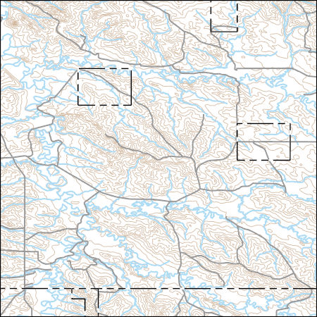
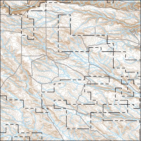
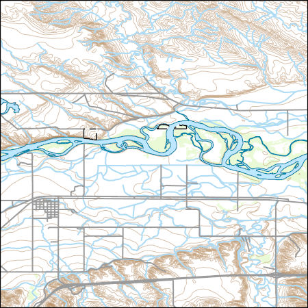
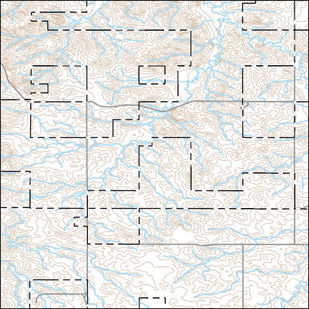
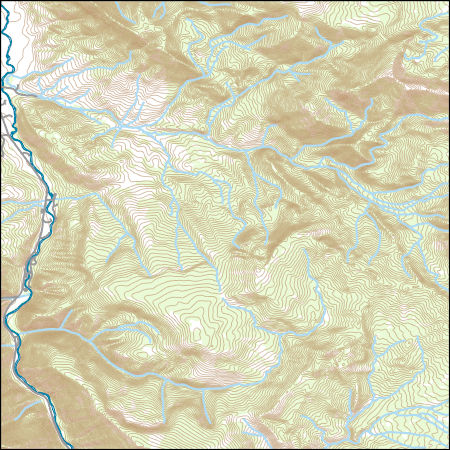
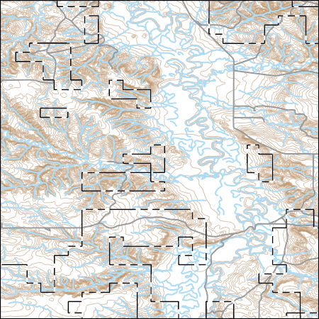
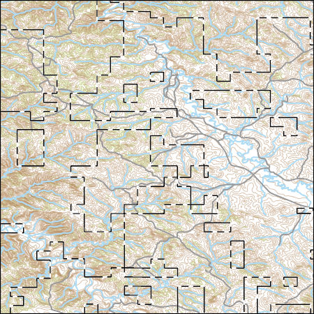
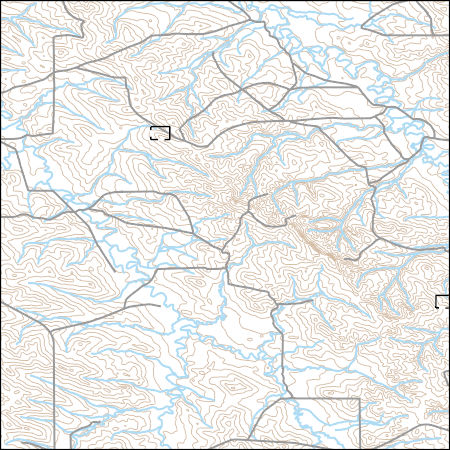
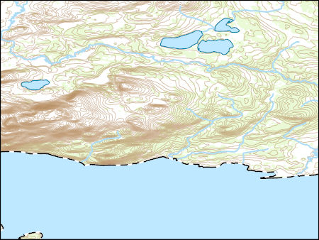
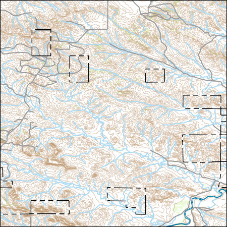
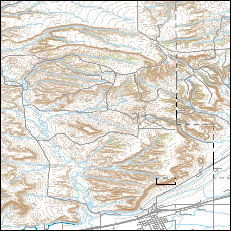
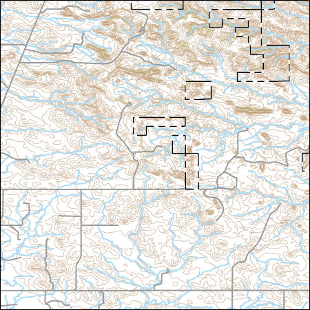
Layers of geospatial data include contours, boundaries, land cover, hydrography, roads, transportation, geographic names, structures, and other selected map features.
Types: Citation;
Tags: 7.5 x 7.5 minute,
7.5 x 7.5 minute,
Carter County,
Combined Vector,
Combined Vector, All tags...
Combined Vector,
Downloadable Data,
Fallon County,
FileGDB 10.1,
FileGDB 10.1,
MT,
Montana,
Public Land Survey System,
US,
United States,
boundary,
contours,
geographic names,
hydrography,
structures,
transportation,
woodland, Fewer tags
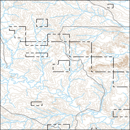
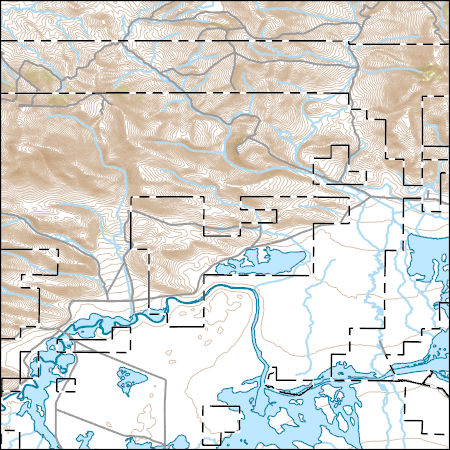
Layers of geospatial data include contours, boundaries, land cover, hydrography, roads, transportation, geographic names, structures, and other selected map features.
Types: Citation;
Tags: 7.5 x 7.5 minute,
7.5 x 7.5 minute,
Combined Vector,
Combined Vector,
Combined Vector, All tags...
Downloadable Data,
FileGDB 10.1,
FileGDB 10.1,
MT,
Montana,
Public Land Survey System,
Rosebud County,
US,
United States,
boundary,
contours,
geographic names,
hydrography,
structures,
transportation,
woodland, Fewer tags
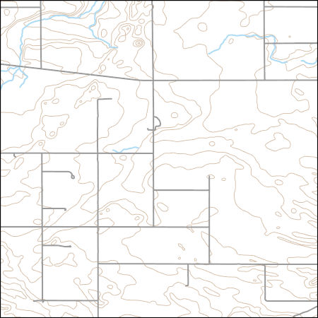
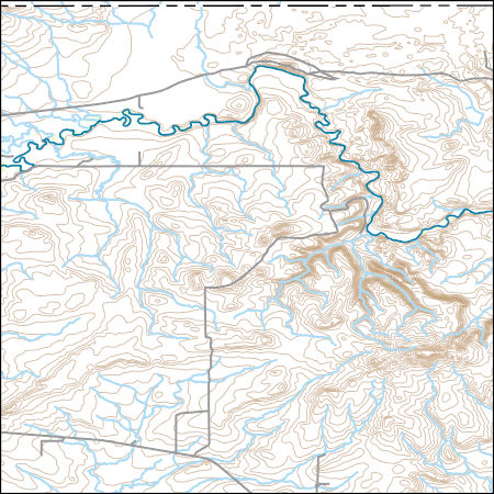
Layers of geospatial data include contours, boundaries, land cover, hydrography, roads, transportation, geographic names, structures, and other selected map features.
Types: Citation;
Tags: 7.5 x 7.5 minute,
7.5 x 7.5 minute,
Blaine County,
Combined Vector,
Combined Vector, All tags...
Combined Vector,
Downloadable Data,
FileGDB 10.1,
FileGDB 10.1,
MT,
Montana,
Public Land Survey System,
US,
United States,
boundary,
contours,
geographic names,
hydrography,
structures,
transportation,
woodland, Fewer tags
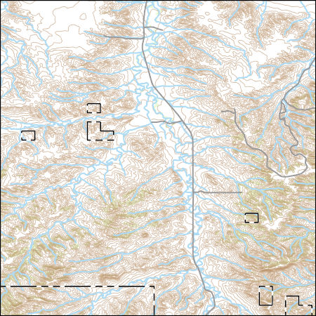
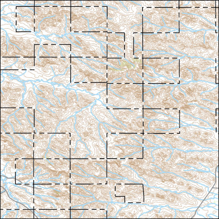
Layers of geospatial data include contours, boundaries, land cover, hydrography, roads, transportation, geographic names, structures, and other selected map features.
Types: Citation;
Tags: 7.5 x 7.5 minute,
7.5 x 7.5 minute,
Combined Vector,
Combined Vector,
Combined Vector, All tags...
Downloadable Data,
MT,
Montana,
Public Land Survey System,
Rosebud County,
Shapefile,
Shapefile,
Treasure County,
US,
United States,
boundary,
contours,
geographic names,
hydrography,
structures,
transportation,
woodland, Fewer tags
Layers of geospatial data include contours, boundaries, land cover, hydrography, roads, transportation, geographic names, structures, and other selected map features.
Types: Citation;
Tags: 7.5 x 7.5 minute,
7.5 x 7.5 minute,
Combined Vector,
Combined Vector,
Combined Vector, All tags...
Downloadable Data,
MT,
Montana,
Public Land Survey System,
Shapefile,
Shapefile,
US,
United States,
Valley County,
boundary,
contours,
geographic names,
hydrography,
structures,
transportation,
woodland, Fewer tags
Layers of geospatial data include contours, boundaries, land cover, hydrography, roads, transportation, geographic names, structures, and other selected map features.
Types: Citation;
Tags: 7.5 x 7.5 minute,
7.5 x 7.5 minute,
Combined Vector,
Combined Vector,
Combined Vector, All tags...
Downloadable Data,
MT,
Montana,
Public Land Survey System,
Shapefile,
Shapefile,
Treasure County,
US,
United States,
boundary,
contours,
geographic names,
hydrography,
structures,
transportation,
woodland, Fewer tags
Layers of geospatial data include contours, boundaries, land cover, hydrography, roads, transportation, geographic names, structures, and other selected map features.
Types: Citation;
Tags: 7.5 x 7.5 minute,
7.5 x 7.5 minute,
Combined Vector,
Combined Vector,
Combined Vector, All tags...
Custer County,
Downloadable Data,
FileGDB 10.1,
FileGDB 10.1,
MT,
Montana,
Prairie County,
Public Land Survey System,
US,
United States,
boundary,
contours,
geographic names,
hydrography,
structures,
transportation,
woodland, Fewer tags
Layers of geospatial data include contours, boundaries, land cover, hydrography, roads, transportation, geographic names, structures, and other selected map features.
Types: Citation;
Tags: 7.5 x 7.5 minute,
7.5 x 7.5 minute,
Combined Vector,
Combined Vector,
Combined Vector, All tags...
Downloadable Data,
FileGDB 10.1,
FileGDB 10.1,
Gallatin County,
MT,
Montana,
Public Land Survey System,
US,
United States,
boundary,
contours,
geographic names,
hydrography,
structures,
transportation,
woodland, Fewer tags
Layers of geospatial data include contours, boundaries, land cover, hydrography, roads, transportation, geographic names, structures, and other selected map features.
Types: Citation;
Tags: 7.5 x 7.5 minute,
7.5 x 7.5 minute,
Combined Vector,
Combined Vector,
Combined Vector, All tags...
Downloadable Data,
MT,
Montana,
Phillips County,
Public Land Survey System,
Shapefile,
Shapefile,
US,
United States,
boundary,
contours,
geographic names,
hydrography,
structures,
transportation,
woodland, Fewer tags
Layers of geospatial data include contours, boundaries, land cover, hydrography, roads, transportation, geographic names, structures, and other selected map features.
Types: Citation;
Tags: 7.5 x 7.5 minute,
7.5 x 7.5 minute,
Beaverhead County,
Combined Vector,
Combined Vector, All tags...
Combined Vector,
Downloadable Data,
FileGDB 10.1,
FileGDB 10.1,
MT,
Montana,
Public Land Survey System,
US,
United States,
boundary,
contours,
geographic names,
hydrography,
structures,
transportation,
woodland, Fewer tags
Layers of geospatial data include contours, boundaries, land cover, hydrography, roads, transportation, geographic names, structures, and other selected map features.
Types: Citation;
Tags: 7.5 x 7.5 minute,
7.5 x 7.5 minute,
Combined Vector,
Combined Vector,
Combined Vector, All tags...
Downloadable Data,
Glacier County,
MT,
Montana,
Public Land Survey System,
Shapefile,
Shapefile,
US,
United States,
boundary,
contours,
geographic names,
hydrography,
structures,
transportation,
woodland, Fewer tags
Layers of geospatial data include contours, boundaries, land cover, hydrography, roads, transportation, geographic names, structures, and other selected map features.
Types: Citation;
Tags: 7.5 x 7.5 minute,
7.5 x 7.5 minute,
Combined Vector,
Combined Vector,
Combined Vector, All tags...
Custer County,
Downloadable Data,
FileGDB 10.1,
FileGDB 10.1,
MT,
Montana,
Public Land Survey System,
US,
United States,
boundary,
contours,
geographic names,
hydrography,
structures,
transportation,
woodland, Fewer tags
Layers of geospatial data include contours, boundaries, land cover, hydrography, roads, transportation, geographic names, structures, and other selected map features.
Types: Citation;
Tags: 7.5 x 7.5 minute,
7.5 x 7.5 minute,
Combined Vector,
Combined Vector,
Combined Vector, All tags...
Downloadable Data,
Garfield County,
MT,
Montana,
Public Land Survey System,
Shapefile,
Shapefile,
US,
United States,
boundary,
contours,
geographic names,
hydrography,
structures,
transportation,
woodland, Fewer tags
Layers of geospatial data include contours, boundaries, land cover, hydrography, roads, transportation, geographic names, structures, and other selected map features.
Types: Citation;
Tags: 7.5 x 7.5 minute,
7.5 x 7.5 minute,
AK,
Alaska,
Combined Vector, All tags...
Combined Vector,
Combined Vector,
Downloadable Data,
FileGDB 10.1,
FileGDB 10.1,
Lake and Peninsula County,
Public Land Survey System,
US,
United States,
boundary,
contours,
geographic names,
hydrography,
structures,
transportation,
woodland, Fewer tags
Layers of geospatial data include contours, boundaries, land cover, hydrography, roads, transportation, geographic names, structures, and other selected map features.
Types: Citation;
Tags: 7.5 x 7.5 minute,
7.5 x 7.5 minute,
AK,
Alaska,
Combined Vector, All tags...
Combined Vector,
Combined Vector,
Downloadable Data,
FileGDB 10.1,
FileGDB 10.1,
Public Land Survey System,
US,
United States,
Yukon-KoyukukCounty,
boundary,
contours,
geographic names,
hydrography,
structures,
transportation,
woodland, Fewer tags
Layers of geospatial data include contours, boundaries, land cover, hydrography, roads, transportation, geographic names, structures, and other selected map features.
Types: Citation;
Tags: 7.5 x 7.5 minute,
7.5 x 7.5 minute,
Combined Vector,
Combined Vector,
Combined Vector, All tags...
Custer County,
Downloadable Data,
MT,
Montana,
Public Land Survey System,
Shapefile,
Shapefile,
US,
United States,
boundary,
contours,
geographic names,
hydrography,
structures,
transportation,
woodland, Fewer tags
Layers of geospatial data include contours, boundaries, land cover, hydrography, roads, transportation, geographic names, structures, and other selected map features.
Types: Citation;
Tags: 7.5 x 7.5 minute,
7.5 x 7.5 minute,
Combined Vector,
Combined Vector,
Combined Vector, All tags...
Downloadable Data,
FileGDB 10.1,
FileGDB 10.1,
MT,
Montana,
Public Land Survey System,
Stillwater County,
US,
United States,
Yellowstone County,
boundary,
contours,
geographic names,
hydrography,
structures,
transportation,
woodland, Fewer tags
Layers of geospatial data include contours, boundaries, land cover, hydrography, roads, transportation, geographic names, structures, and other selected map features.
Types: Citation;
Tags: 7.5 x 7.5 minute,
7.5 x 7.5 minute,
Combined Vector,
Combined Vector,
Combined Vector, All tags...
Downloadable Data,
Fallon County,
MT,
Montana,
Public Land Survey System,
Shapefile,
Shapefile,
US,
United States,
boundary,
contours,
geographic names,
hydrography,
structures,
transportation,
woodland, Fewer tags
Layers of geospatial data include contours, boundaries, land cover, hydrography, roads, transportation, geographic names, structures, and other selected map features.
Types: Citation;
Tags: 7.5 x 7.5 minute,
7.5 x 7.5 minute,
AK,
Alaska,
Combined Vector, All tags...
Combined Vector,
Combined Vector,
Downloadable Data,
Public Land Survey System,
Shapefile,
Shapefile,
Southeast FairbanksCounty,
US,
United States,
boundary,
contours,
geographic names,
hydrography,
structures,
transportation,
woodland, Fewer tags
|
|

