Filters: Date Range: {"choice":"year"} (X) > Tags: {"type":"Place","name":"ak"} (X) > Tags: {"type":"Place","name":"hawaii"} (X)
109 results (102ms)|
Filters
Date Types (for Date Range)
Contacts (Less)
Categories (Less) Tag Schemes Tags (with Type=Place ) |

The Geographic Names Information System (GNIS) is the Federal standard for geographic nomenclature. The U.S. Geological Survey developed the GNIS for the U.S. Board on Geographic Names, a Federal inter-agency body chartered by public law to maintain uniform feature name usage throughout the Government and to promulgate standard names to the public. The GNIS is the official repository of domestic geographic names data; the official vehicle for geographic names use by all departments of the Federal Government; and the source for applying geographic names to Federal electronic and printed products of all types.
The National Park Service (NPS) requests burn severity assessments through an agreement with the U.S. Geological Survey (USGS) to be completed by analysts with the Monitoring Trends in Burn Severity (MTBS) Program. The MTBS Program assesses the frequency, extent, and magnitude (size and severity) of all large wildland fires (wildfires and prescribed fires) in the conterminous United States (CONUS), Alaska, Hawaii, and Puerto Rico for the period 1984 and beyond. All fires reported as greater than 1,000 acres in the western U.S. and greater than 500 acres in the eastern U.S. are mapped across all ownerships. MTBS produces a series of geospatial and tabular data for analysis at a range of spatial, temporal, and thematic...
Types: Map Service,
OGC WFS Layer,
OGC WMS Layer,
OGC WMS Service;
Tags: AK,
Alaska,
Burn severity,
Burned area,
CONUS,
This map layer is a vector polygon shapefile of the perimeters of all currently inventoried fires occurring between calendar year 2021 and 2021 that do not meet standard MTBS size criteria. These data are published to augment the data that are available from the MTBS program. This product was produced using the methods of the Monitoring Trends in Burn Severity Program (MTBS); however, these fires do not meet the size criteria for a standard MTBS assessment. The MTBS Program assesses the frequency, extent, and magnitude (size and severity) of all large wildland fires (wildfires and prescribed fires) in the conterminous United States (CONUS), Alaska, Hawaii, and Puerto Rico for the period 1984 and beyond. MTBS typically...
The National Park Service (NPS) requests burn severity assessments through an agreement with the U.S. Geological Survey (USGS) to be completed by analysts with the Monitoring Trends in Burn Severity (MTBS) Program. The MTBS Program assesses the frequency, extent, and magnitude (size and severity) of all large wildland fires (wildfires and prescribed fires) in the conterminous United States (CONUS), Alaska, Hawaii, and Puerto Rico for the period 1984 and beyond. All fires reported as greater than 1,000 acres in the western U.S. and greater than 500 acres in the eastern U.S. are mapped across all ownerships. MTBS produces a series of geospatial and tabular data for analysis at a range of spatial, temporal, and thematic...
Types: Map Service,
OGC WFS Layer,
OGC WMS Layer,
OGC WMS Service;
Tags: AK,
Alaska,
Burn severity,
Burned area,
CONUS,
The Monitoring Trends in Burn Severity (MTBS) Program assesses the frequency, extent, and magnitude (size and severity) of all large wildland fires (wildfires and prescribed fires) in the conterminous United States (CONUS), Alaska, Hawaii, and Puerto Rico for the period 1984 and beyond. All fires reported as greater than 1,000 acres in the western U.S. and greater than 500 acres in the eastern U.S. are mapped across all ownerships. MTBS produces a series of geospatial and tabular data for analysis at a range of spatial, temporal, and thematic scales and are intended to meet a variety of information needs that require consistent data about fire effects through space and time. This map layer is a thematic raster image...
The Monitoring Trends in Burn Severity (MTBS) Program assesses the frequency, extent, and magnitude (size and severity) of all large wildland fires (wildfires and prescribed fires) in the conterminous United States (CONUS), Alaska, Hawaii, and Puerto Rico for the period 1984 and beyond. All fires reported as greater than 1,000 acres in the western U.S. and greater than 500 acres in the eastern U.S. are mapped across all ownerships. MTBS produces a series of geospatial and tabular data for analysis at a range of spatial, temporal, and thematic scales and are intended to meet a variety of information needs that require consistent data about fire effects through space and time. This map layer is a thematic raster image...
The Monitoring Trends in Burn Severity (MTBS) Program assesses the frequency, extent, and magnitude (size and severity) of all large wildland fires (wildfires and prescribed fires) in the conterminous United States (CONUS), Alaska, Hawaii, and Puerto Rico for the period 1984 and beyond. All fires reported as greater than 1,000 acres in the western U.S. and greater than 500 acres in the eastern U.S. are mapped across all ownerships. MTBS produces a series of geospatial and tabular data for analysis at a range of spatial, temporal, and thematic scales and are intended to meet a variety of information needs that require consistent data about fire effects through space and time. This map layer is a thematic raster image...
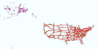
Layers of geospatial data include roads, airports, trails, and railroads.
The National Park Service (NPS) requests burn severity assessments through an agreement with the U.S. Geological Survey (USGS) to be completed by analysts with the Monitoring Trends in Burn Severity (MTBS) Program. The MTBS Program assesses the frequency, extent, and magnitude (size and severity) of all large wildland fires (wildfires and prescribed fires) in the conterminous United States (CONUS), Alaska, Hawaii, and Puerto Rico for the period 1984 and beyond. All fires reported as greater than 1,000 acres in the western U.S. and greater than 500 acres in the eastern U.S. are mapped across all ownerships. MTBS produces a series of geospatial and tabular data for analysis at a range of spatial, temporal, and thematic...
Types: Map Service,
OGC WFS Layer,
OGC WMS Layer,
OGC WMS Service;
Tags: AK,
Alaska,
Burn severity,
Burned area,
CONUS,
|

|
