Filters
Date Range
Types
Contacts
Tag Types
Tags (with Scheme=The National Map Collection Thesaurus)
|

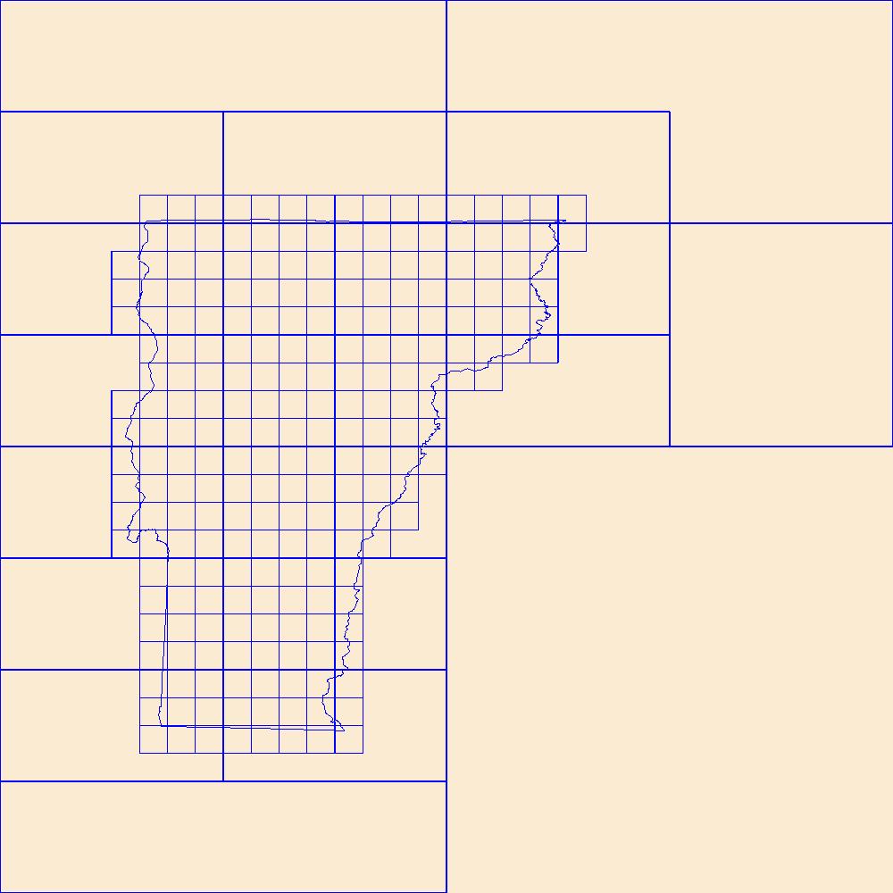
This data represents the map extent for current and historical USGS topographic maps for the United States and Territories, including 1 X 2 Degree, 1 X 1 Degree, 30 X 60 Minute, 15 X 15 Minute, 7.5 X 7.5 Minute, and 3.75 X 3.75 Minute. The grid was generated using ESRI ArcInfo GIS software.
Types: Citation;
Tags: Albany,
Big Horn,
Boundaries,
Campbell,
Carbon, All tags...
Converse,
Crook,
Downloadable Data,
Esri Shapefile nan,
Fremont,
Goshen,
Hot Springs,
Johnson,
Laramie,
Lincoln,
Map Indices,
Map Indices,
Map Indices,
Natrona,
Niobrara,
Park,
Platte,
Shapefile,
Sheridan,
State,
State,
Sublette,
Sweetwater,
Teton,
US,
Uinta,
United States,
United States of America,
WY,
Washakie,
Weston,
Wyoming,
cells,
map indices,
polygon grid, Fewer tags
This data represents the map extent for current and historical USGS topographic maps for the United States and Territories, including 1 X 2 Degree, 1 X 1 Degree, 30 X 60 Minute, 15 X 15 Minute, 7.5 X 7.5 Minute, and 3.75 X 3.75 Minute. The grid was generated using ESRI ArcInfo GIS software.
Types: Citation;
Tags: Addison,
Bennington,
Boundaries,
Caledonia,
Chittenden, All tags...
Downloadable Data,
Esri Shapefile nan,
Essex,
Franklin,
Grand Isle,
Lamoille,
Map Indices,
Map Indices,
Map Indices,
Orange,
Orleans,
Rutland,
Shapefile,
State,
State,
US,
United States,
United States of America,
VT,
Vermont,
Washington,
Windham,
Windsor,
cells,
map indices,
polygon grid, Fewer tags
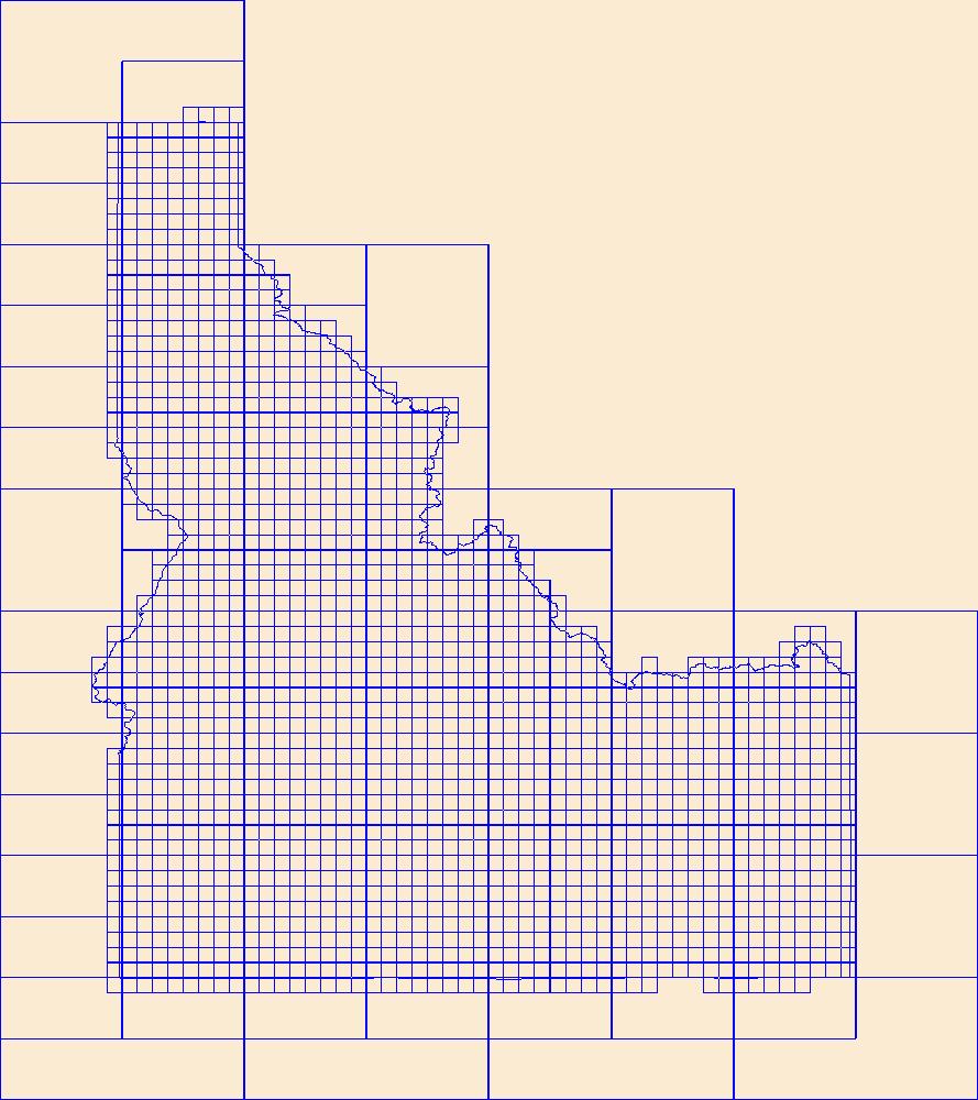
This data represents the map extent for current and historical USGS topographic maps for the United States and Territories, including 1 X 2 Degree, 1 X 1 Degree, 30 X 60 Minute, 15 X 15 Minute, 7.5 X 7.5 Minute, and 3.75 X 3.75 Minute. The grid was generated using ESRI ArcInfo GIS software.
Tags: Ada,
Adams,
Bannock,
Bear Lake,
Benewah, All tags...
Bingham,
Blaine,
Boise,
Bonner,
Bonneville,
Boundaries,
Boundary,
Butte,
Camas,
Canyon,
Caribou,
Cassia,
Clark,
Clearwater,
Custer,
Downloadable Data,
Elmore,
Esri Shapefile nan,
Franklin,
Fremont,
Gem,
Gooding,
ID,
Idaho,
Idaho,
Jefferson,
Jerome,
Kootenai,
Latah,
Lemhi,
Lewis,
Lincoln,
Madison,
Map Indices,
Map Indices,
Map Indices,
Minidoka,
Nez Perce,
Oneida,
Owyhee,
Payette,
Power,
Shapefile,
Shoshone,
State,
State,
Teton,
Twin Falls,
US,
United States,
United States of America,
Valley,
Washington,
cells,
map indices,
polygon grid, Fewer tags
This data represents the map extent for current and historical USGS topographic maps for the United States and Territories, including 1 X 2 Degree, 1 X 1 Degree, 30 X 60 Minute, 15 X 15 Minute, 7.5 X 7.5 Minute, and 3.75 X 3.75 Minute. The grid was generated using ESRI ArcInfo GIS software.
Tags: Boundaries,
Downloadable Data,
Esri Shapefile nan,
MP,
Map Indices, All tags...
Map Indices,
Map Indices,
Northern Islands,
Northern Mariana Islands,
Rota,
Saipan,
Shapefile,
State,
State,
Tinian,
US,
United States,
United States of America,
cells,
map indices,
polygon grid, Fewer tags
This data represents the map extent for current and historical USGS topographic maps for the United States and Territories, including 1 X 2 Degree, 1 X 1 Degree, 30 X 60 Minute, 15 X 15 Minute, 7.5 X 7.5 Minute, and 3.75 X 3.75 Minute. The grid was generated using ESRI ArcInfo GIS software.
Types: Citation;
Tags: Allegany,
Anne Arundel,
Baltimore,
Boundaries,
Calvert, All tags...
Caroline,
Carroll,
Cecil,
Charles,
Dorchester,
Downloadable Data,
Esri Shapefile nan,
Frederick,
Garrett,
Harford,
Howard,
Kent,
MD,
Map Indices,
Map Indices,
Map Indices,
Maryland,
Montgomery,
Prince George's,
Queen Anne's,
Shapefile,
Somerset,
St. Mary's,
State,
State,
Talbot,
US,
United States,
United States of America,
Washington,
Wicomico,
Worcester,
cells,
map indices,
polygon grid, Fewer tags

This data represents the map extent for current and historical USGS topographic maps for the United States and Territories, including 1 X 2 Degree, 1 X 1 Degree, 30 X 60 Minute, 15 X 15 Minute, 7.5 X 7.5 Minute, and 3.75 X 3.75 Minute. The grid was generated using ESRI ArcInfo GIS software.
Tags: Adair,
Adams,
Allamakee,
Appanoose,
Audubon, All tags...
Benton,
Black Hawk,
Boone,
Boundaries,
Bremer,
Buchanan,
Buena Vista,
Butler,
Calhoun,
Carroll,
Cass,
Cedar,
Cerro Gordo,
Cherokee,
Chickasaw,
Clarke,
Clay,
Clayton,
Clinton,
Crawford,
Dallas,
Davis,
Decatur,
Delaware,
Des Moines,
Dickinson,
Downloadable Data,
Dubuque,
Emmet,
Esri File GeoDatabase 10,
Fayette,
FileGDB,
Floyd,
Franklin,
Fremont,
Greene,
Grundy,
Guthrie,
Hamilton,
Hancock,
Hardin,
Harrison,
Henry,
Howard,
Humboldt,
IA,
Ida,
Iowa,
Iowa,
Jackson,
Jasper,
Jefferson,
Johnson,
Jones,
Keokuk,
Kossuth,
Lee,
Linn,
Louisa,
Lucas,
Lyon,
Madison,
Mahaska,
Map Indices,
Map Indices,
Map Indices,
Marion,
Marshall,
Mills,
Mitchell,
Monona,
Monroe,
Montgomery,
Muscatine,
O'Brien,
Osceola,
Page,
Palo Alto,
Plymouth,
Pocahontas,
Polk,
Pottawattamie,
Poweshiek,
Ringgold,
Sac,
Scott,
Shelby,
Sioux,
State,
State,
Story,
Tama,
Taylor,
US,
Union,
United States,
United States of America,
Van Buren,
Wapello,
Warren,
Washington,
Wayne,
Webster,
Winnebago,
Winneshiek,
Woodbury,
Worth,
Wright,
cells,
map indices,
polygon grid, Fewer tags
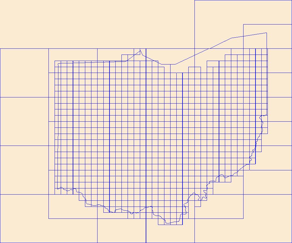
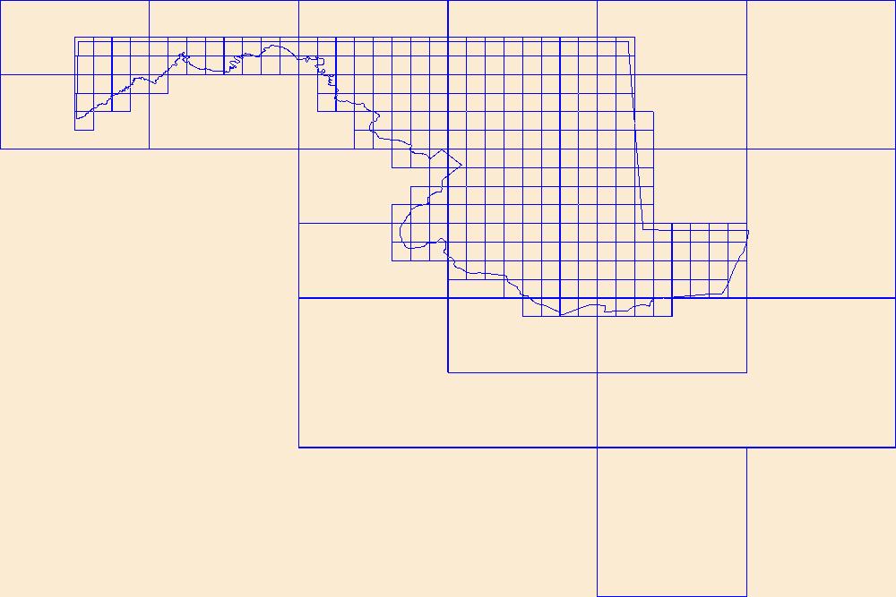
This data represents the map extent for current and historical USGS topographic maps for the United States and Territories, including 1 X 2 Degree, 1 X 1 Degree, 30 X 60 Minute, 15 X 15 Minute, 7.5 X 7.5 Minute, and 3.75 X 3.75 Minute. The grid was generated using ESRI ArcInfo GIS software.
Tags: Adams,
Allen,
Ashland,
Ashtabula,
Athens, All tags...
Auglaize,
Belmont,
Boundaries,
Brown,
Butler,
Carroll,
Champaign,
Clark,
Clermont,
Clinton,
Columbiana,
Coshocton,
Crawford,
Cuyahoga,
Darke,
Defiance,
Delaware,
Downloadable Data,
Erie,
Esri File GeoDatabase 10,
Fairfield,
Fayette,
FileGDB,
Franklin,
Fulton,
Gallia,
Geauga,
Greene,
Guernsey,
Hamilton,
Hancock,
Hardin,
Harrison,
Henry,
Highland,
Hocking,
Holmes,
Huron,
Jackson,
Jefferson,
Knox,
Lake,
Lawrence,
Licking,
Logan,
Lorain,
Lucas,
Madison,
Mahoning,
Map Indices,
Map Indices,
Map Indices,
Marion,
Medina,
Meigs,
Mercer,
Miami,
Monroe,
Montgomery,
Morgan,
Morrow,
Muskingum,
Noble,
OH,
Ohio,
Ottawa,
Paulding,
Perry,
Pickaway,
Pike,
Portage,
Preble,
Putnam,
Richland,
Ross,
Sandusky,
Scioto,
Seneca,
Shelby,
Stark,
State,
State,
Summit,
Trumbull,
Tuscarawas,
US,
Union,
United States,
United States of America,
Van Wert,
Vinton,
Warren,
Washington,
Wayne,
Williams,
Wood,
Wyandot,
cells,
map indices,
polygon grid, Fewer tags
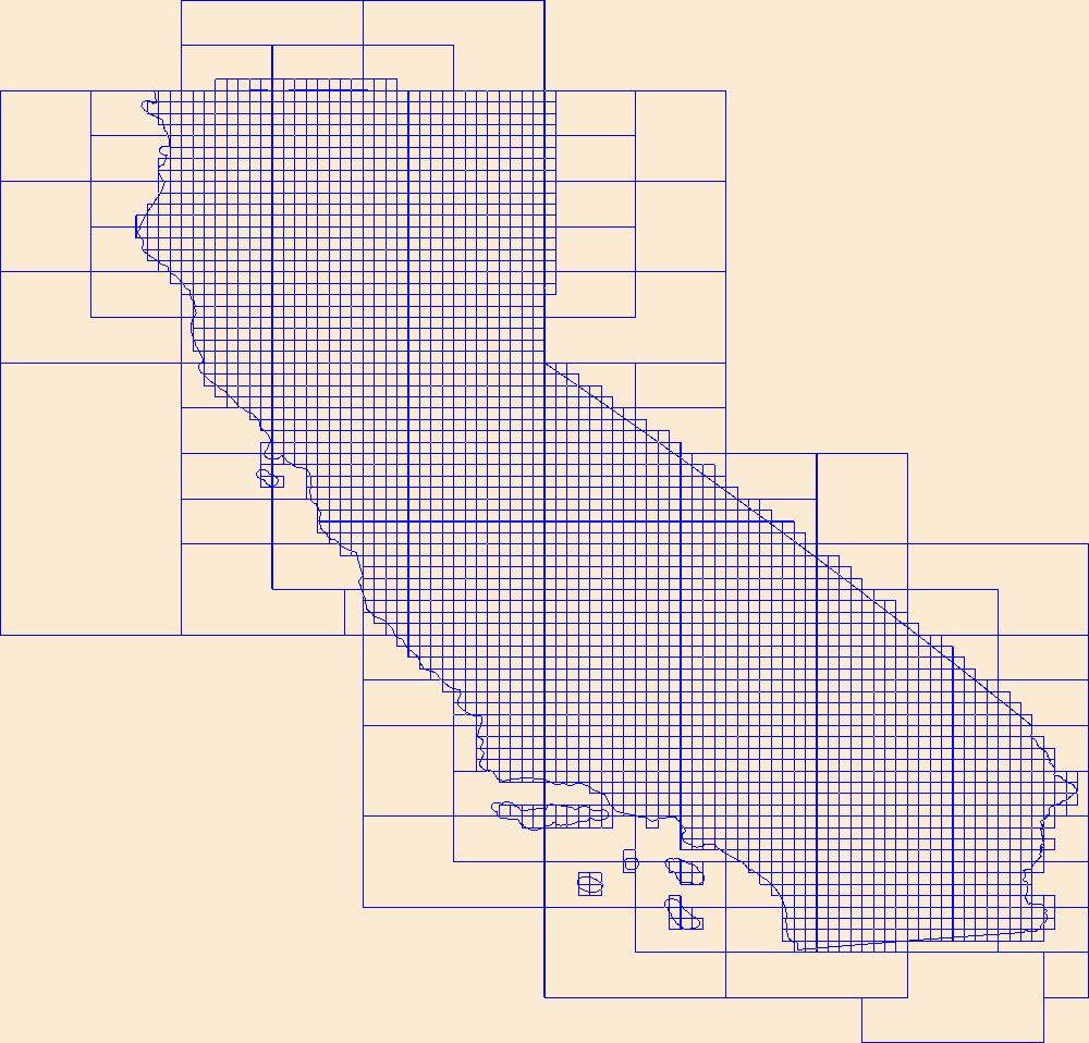
This data represents the map extent for current and historical USGS topographic maps for the United States and Territories, including 1 X 2 Degree, 1 X 1 Degree, 30 X 60 Minute, 15 X 15 Minute, 7.5 X 7.5 Minute, and 3.75 X 3.75 Minute. The grid was generated using ESRI ArcInfo GIS software.
Tags: Alameda,
Alpine,
Amador,
Boundaries,
Butte, All tags...
CA,
Calaveras,
California,
Colusa,
Contra Costa,
Del Norte,
Downloadable Data,
El Dorado,
Esri File GeoDatabase 10,
FileGDB,
Fresno,
Glenn,
Humboldt,
Imperial,
Inyo,
Kern,
Kings,
Lake,
Lassen,
Los Angeles,
Madera,
Map Indices,
Map Indices,
Map Indices,
Marin,
Mariposa,
Mendocino,
Merced,
Modoc,
Mono,
Monterey,
Napa,
Nevada,
Orange,
Placer,
Plumas,
Riverside,
Sacramento,
San Benito,
San Bernardino,
San Diego,
San Francisco,
San Joaquin,
San Luis Obispo,
San Mateo,
Santa Barbara,
Santa Clara,
Santa Cruz,
Shasta,
Sierra,
Siskiyou,
Solano,
Sonoma,
Stanislaus,
State,
State,
Sutter,
Tehama,
Trinity,
Tulare,
Tuolumne,
US,
United States,
United States of America,
Ventura,
Yolo,
Yuba,
cells,
map indices,
polygon grid, Fewer tags
This data represents the map extent for current and historical USGS topographic maps for the United States and Territories, including 1 X 2 Degree, 1 X 1 Degree, 30 X 60 Minute, 15 X 15 Minute, 7.5 X 7.5 Minute, and 3.75 X 3.75 Minute. The grid was generated using ESRI ArcInfo GIS software.
Tags: Beaver,
Boundaries,
Box Elder,
Cache,
Carbon, All tags...
Daggett,
Davis,
Downloadable Data,
Duchesne,
Emery,
Esri File GeoDatabase 10,
FileGDB,
Garfield,
Grand,
Iron,
Juab,
Kane,
Map Indices,
Map Indices,
Map Indices,
Millard,
Morgan,
Piute,
Rich,
Salt Lake,
San Juan,
Sanpete,
Sevier,
State,
State,
Summit,
Tooele,
US,
UT,
Uintah,
United States,
United States of America,
Utah,
Utah,
Wasatch,
Washington,
Wayne,
Weber,
cells,
map indices,
polygon grid, Fewer tags
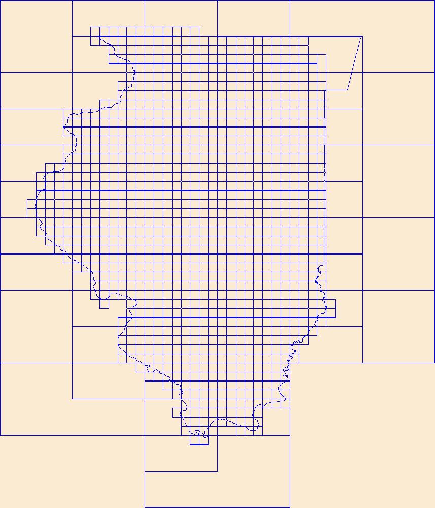
This data represents the map extent for current and historical USGS topographic maps for the United States and Territories, including 1 X 2 Degree, 1 X 1 Degree, 30 X 60 Minute, 15 X 15 Minute, 7.5 X 7.5 Minute, and 3.75 X 3.75 Minute. The grid was generated using ESRI ArcInfo GIS software.
Types: Citation;
Tags: Adams,
Alexander,
Bond,
Boone,
Boundaries, All tags...
Brown,
Bureau,
Calhoun,
Carroll,
Cass,
Champaign,
Christian,
Clark,
Clay,
Clinton,
Coles,
Cook,
Crawford,
Cumberland,
De Witt,
DeKalb,
Douglas,
Downloadable Data,
DuPage,
Edgar,
Edwards,
Effingham,
Esri Shapefile nan,
Fayette,
Ford,
Franklin,
Fulton,
Gallatin,
Greene,
Grundy,
Hamilton,
Hancock,
Hardin,
Henderson,
Henry,
IL,
Illinois,
Iroquois,
Jackson,
Jasper,
Jefferson,
Jersey,
Jo Daviess,
Johnson,
Kane,
Kankakee,
Kendall,
Knox,
LaSalle,
Lake,
Lawrence,
Lee,
Livingston,
Logan,
Macon,
Macoupin,
Madison,
Map Indices,
Map Indices,
Map Indices,
Marion,
Marshall,
Mason,
Massac,
McDonough,
McHenry,
McLean,
Menard,
Mercer,
Monroe,
Montgomery,
Morgan,
Moultrie,
Ogle,
Peoria,
Perry,
Piatt,
Pike,
Pope,
Pulaski,
Putnam,
Randolph,
Richland,
Rock Island,
Saline,
Sangamon,
Schuyler,
Scott,
Shapefile,
Shelby,
St. Clair,
Stark,
State,
State,
Stephenson,
Tazewell,
US,
Union,
United States,
United States of America,
Vermilion,
Wabash,
Warren,
Washington,
Wayne,
White,
Whiteside,
Will,
Williamson,
Winnebago,
Woodford,
cells,
map indices,
polygon grid, Fewer tags
This data represents the map extent for current and historical USGS topographic maps for the United States and Territories, including 1 X 2 Degree, 1 X 1 Degree, 30 X 60 Minute, 15 X 15 Minute, 7.5 X 7.5 Minute, and 3.75 X 3.75 Minute. The grid was generated using ESRI ArcInfo GIS software.
Types: Citation;
Tags: Allen,
Anderson,
Atchison,
Barber,
Barton, All tags...
Boundaries,
Bourbon,
Brown,
Butler,
Chase,
Chautauqua,
Cherokee,
Cheyenne,
Clark,
Clay,
Cloud,
Coffey,
Comanche,
Cowley,
Crawford,
Decatur,
Dickinson,
Doniphan,
Douglas,
Downloadable Data,
Edwards,
Elk,
Ellis,
Ellsworth,
Esri Shapefile nan,
Finney,
Ford,
Franklin,
Geary,
Gove,
Graham,
Grant,
Gray,
Greeley,
Greenwood,
Hamilton,
Harper,
Harvey,
Haskell,
Hodgeman,
Jackson,
Jefferson,
Jewell,
Johnson,
KS,
Kansas,
Kearny,
Kingman,
Kiowa,
Labette,
Lane,
Leavenworth,
Lincoln,
Linn,
Logan,
Lyon,
Map Indices,
Map Indices,
Map Indices,
Marion,
Marshall,
McPherson,
Meade,
Miami,
Mitchell,
Montgomery,
Morris,
Morton,
Nemaha,
Neosho,
Ness,
Norton,
Osage,
Osborne,
Ottawa,
Pawnee,
Phillips,
Pottawatomie,
Pratt,
Rawlins,
Reno,
Republic,
Rice,
Riley,
Rooks,
Rush,
Russell,
Saline,
Scott,
Sedgwick,
Seward,
Shapefile,
Shawnee,
Sheridan,
Sherman,
Smith,
Stafford,
Stanton,
State,
State,
Stevens,
Sumner,
Thomas,
Trego,
US,
United States,
United States of America,
Wabaunsee,
Wallace,
Washington,
Wichita,
Wilson,
Woodson,
Wyandotte,
cells,
map indices,
polygon grid, Fewer tags

This data represents the map extent for current and historical USGS topographic maps for the United States and Territories, including 1 X 2 Degree, 1 X 1 Degree, 30 X 60 Minute, 15 X 15 Minute, 7.5 X 7.5 Minute, and 3.75 X 3.75 Minute. The grid was generated using ESRI ArcInfo GIS software.
Tags: Adams,
Alexander,
Bond,
Boone,
Boundaries, All tags...
Brown,
Bureau,
Calhoun,
Carroll,
Cass,
Champaign,
Christian,
Clark,
Clay,
Clinton,
Coles,
Cook,
Crawford,
Cumberland,
De Witt,
DeKalb,
Douglas,
Downloadable Data,
DuPage,
Edgar,
Edwards,
Effingham,
Esri File GeoDatabase 10,
Fayette,
FileGDB,
Ford,
Franklin,
Fulton,
Gallatin,
Greene,
Grundy,
Hamilton,
Hancock,
Hardin,
Henderson,
Henry,
IL,
Illinois,
Iroquois,
Jackson,
Jasper,
Jefferson,
Jersey,
Jo Daviess,
Johnson,
Kane,
Kankakee,
Kendall,
Knox,
LaSalle,
Lake,
Lawrence,
Lee,
Livingston,
Logan,
Macon,
Macoupin,
Madison,
Map Indices,
Map Indices,
Map Indices,
Marion,
Marshall,
Mason,
Massac,
McDonough,
McHenry,
McLean,
Menard,
Mercer,
Monroe,
Montgomery,
Morgan,
Moultrie,
Ogle,
Peoria,
Perry,
Piatt,
Pike,
Pope,
Pulaski,
Putnam,
Randolph,
Richland,
Rock Island,
Saline,
Sangamon,
Schuyler,
Scott,
Shelby,
St. Clair,
Stark,
State,
State,
Stephenson,
Tazewell,
US,
Union,
United States,
United States of America,
Vermilion,
Wabash,
Warren,
Washington,
Wayne,
White,
Whiteside,
Will,
Williamson,
Winnebago,
Woodford,
cells,
map indices,
polygon grid, Fewer tags

This data represents the map extent for current and historical USGS topographic maps for the United States and Territories, including 1 X 2 Degree, 1 X 1 Degree, 30 X 60 Minute, 15 X 15 Minute, 7.5 X 7.5 Minute, and 3.75 X 3.75 Minute. The grid was generated using ESRI ArcInfo GIS software.
Types: Citation;
Tags: Adair,
Adams,
Allamakee,
Appanoose,
Audubon, All tags...
Benton,
Black Hawk,
Boone,
Boundaries,
Bremer,
Buchanan,
Buena Vista,
Butler,
Calhoun,
Carroll,
Cass,
Cedar,
Cerro Gordo,
Cherokee,
Chickasaw,
Clarke,
Clay,
Clayton,
Clinton,
Crawford,
Dallas,
Davis,
Decatur,
Delaware,
Des Moines,
Dickinson,
Downloadable Data,
Dubuque,
Emmet,
Esri Shapefile nan,
Fayette,
Floyd,
Franklin,
Fremont,
Greene,
Grundy,
Guthrie,
Hamilton,
Hancock,
Hardin,
Harrison,
Henry,
Howard,
Humboldt,
IA,
Ida,
Iowa,
Iowa,
Jackson,
Jasper,
Jefferson,
Johnson,
Jones,
Keokuk,
Kossuth,
Lee,
Linn,
Louisa,
Lucas,
Lyon,
Madison,
Mahaska,
Map Indices,
Map Indices,
Map Indices,
Marion,
Marshall,
Mills,
Mitchell,
Monona,
Monroe,
Montgomery,
Muscatine,
O'Brien,
Osceola,
Page,
Palo Alto,
Plymouth,
Pocahontas,
Polk,
Pottawattamie,
Poweshiek,
Ringgold,
Sac,
Scott,
Shapefile,
Shelby,
Sioux,
State,
State,
Story,
Tama,
Taylor,
US,
Union,
United States,
United States of America,
Van Buren,
Wapello,
Warren,
Washington,
Wayne,
Webster,
Winnebago,
Winneshiek,
Woodbury,
Worth,
Wright,
cells,
map indices,
polygon grid, Fewer tags
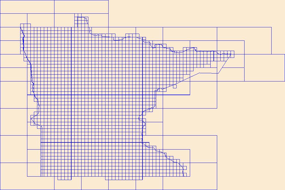
This data represents the map extent for current and historical USGS topographic maps for the United States and Territories, including 1 X 2 Degree, 1 X 1 Degree, 30 X 60 Minute, 15 X 15 Minute, 7.5 X 7.5 Minute, and 3.75 X 3.75 Minute. The grid was generated using ESRI ArcInfo GIS software.
Types: Citation;
Tags: Aitkin,
Anoka,
Becker,
Beltrami,
Benton, All tags...
Big Stone,
Blue Earth,
Boundaries,
Brown,
Carlton,
Carver,
Cass,
Chippewa,
Chisago,
Clay,
Clearwater,
Cook,
Cottonwood,
Crow Wing,
Dakota,
Dodge,
Douglas,
Downloadable Data,
Esri Shapefile nan,
Faribault,
Fillmore,
Freeborn,
Goodhue,
Grant,
Hennepin,
Houston,
Hubbard,
Isanti,
Itasca,
Jackson,
Kanabec,
Kandiyohi,
Kittson,
Koochiching,
Lac qui Parle,
Lake,
Lake of the Woods,
Le Sueur,
Lincoln,
Lyon,
MN,
Mahnomen,
Map Indices,
Map Indices,
Map Indices,
Marshall,
Martin,
McLeod,
Meeker,
Mille Lacs,
Minnesota,
Morrison,
Mower,
Murray,
Nicollet,
Nobles,
Norman,
Olmsted,
Otter Tail,
Pennington,
Pine,
Pipestone,
Polk,
Pope,
Ramsey,
Red Lake,
Redwood,
Renville,
Rice,
Rock,
Roseau,
Scott,
Shapefile,
Sherburne,
Sibley,
St. Louis,
State,
State,
Stearns,
Steele,
Stevens,
Swift,
Todd,
Traverse,
US,
United States,
United States of America,
Wabasha,
Wadena,
Waseca,
Washington,
Watonwan,
Wilkin,
Winona,
Wright,
Yellow Medicine,
cells,
map indices,
polygon grid, Fewer tags
This data represents the map extent for current and historical USGS topographic maps for the United States and Territories, including 1 X 2 Degree, 1 X 1 Degree, 30 X 60 Minute, 15 X 15 Minute, 7.5 X 7.5 Minute, and 3.75 X 3.75 Minute. The grid was generated using ESRI ArcInfo GIS software.
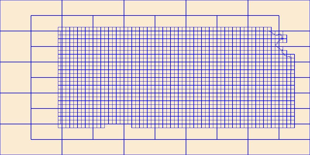
Types: Citation;
Tags: Adams,
Barnes,
Benson,
Billings,
Bottineau, All tags...
Boundaries,
Bowman,
Burke,
Burleigh,
Cass,
Cavalier,
Dickey,
Divide,
Downloadable Data,
Dunn,
Eddy,
Emmons,
Esri Shapefile nan,
Foster,
Golden Valley,
Grand Forks,
Grant,
Griggs,
Hettinger,
Kidder,
LaMoure,
Logan,
Map Indices,
Map Indices,
Map Indices,
McHenry,
McIntosh,
McKenzie,
McLean,
Mercer,
Morton,
Mountrail,
ND,
Nelson,
North Dakota,
Oliver,
Pembina,
Pierce,
Ramsey,
Ransom,
Renville,
Richland,
Rolette,
Sargent,
Shapefile,
Sheridan,
Sioux,
Slope,
Stark,
State,
State,
Steele,
Stutsman,
Towner,
Traill,
US,
United States,
United States of America,
Walsh,
Ward,
Wells,
Williams,
cells,
map indices,
polygon grid, Fewer tags
This data represents the map extent for current and historical USGS topographic maps for the United States and Territories, including 1 X 2 Degree, 1 X 1 Degree, 30 X 60 Minute, 15 X 15 Minute, 7.5 X 7.5 Minute, and 3.75 X 3.75 Minute. The grid was generated using ESRI ArcInfo GIS software.
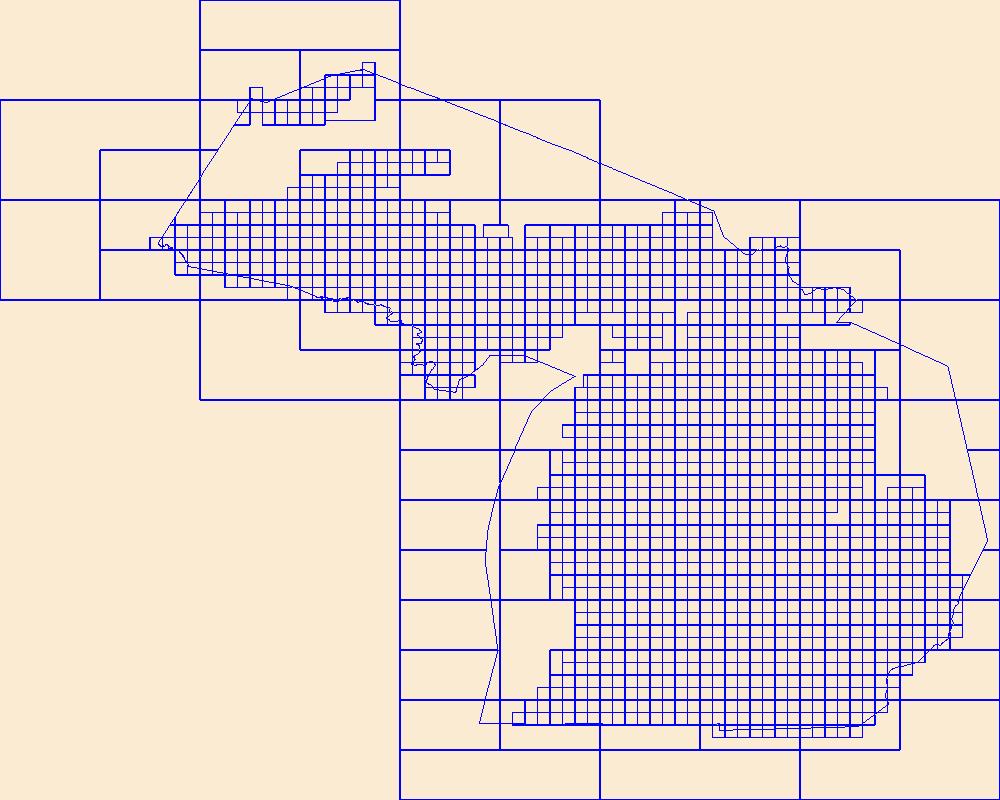
Types: Citation;
Tags: Alcona,
Alger,
Allegan,
Alpena,
Antrim, All tags...
Arenac,
Baraga,
Barry,
Bay,
Benzie,
Berrien,
Boundaries,
Branch,
Calhoun,
Cass,
Charlevoix,
Cheboygan,
Chippewa,
Clare,
Clinton,
Crawford,
Delta,
Dickinson,
Downloadable Data,
Eaton,
Emmet,
Esri Shapefile nan,
Genesee,
Gladwin,
Gogebic,
Grand Traverse,
Gratiot,
Hillsdale,
Houghton,
Huron,
Ingham,
Ionia,
Iosco,
Iron,
Isabella,
Jackson,
Kalamazoo,
Kalkaska,
Kent,
Keweenaw,
Lake,
Lapeer,
Leelanau,
Lenawee,
Livingston,
Luce,
MI,
Mackinac,
Macomb,
Manistee,
Map Indices,
Map Indices,
Map Indices,
Marquette,
Mason,
Mecosta,
Menominee,
Michigan,
Midland,
Missaukee,
Monroe,
Montcalm,
Montmorency,
Muskegon,
Newaygo,
Oakland,
Oceana,
Ogemaw,
Ontonagon,
Osceola,
Oscoda,
Otsego,
Ottawa,
Presque Isle,
Roscommon,
Saginaw,
Sanilac,
Schoolcraft,
Shapefile,
Shiawassee,
St. Clair,
St. Joseph,
State,
State,
Tuscola,
US,
United States,
United States of America,
Van Buren,
Washtenaw,
Wayne,
Wexford,
cells,
map indices,
polygon grid, Fewer tags
This data represents the map extent for current and historical USGS topographic maps for the United States and Territories, including 1 X 2 Degree, 1 X 1 Degree, 30 X 60 Minute, 15 X 15 Minute, 7.5 X 7.5 Minute, and 3.75 X 3.75 Minute. The grid was generated using ESRI ArcInfo GIS software.
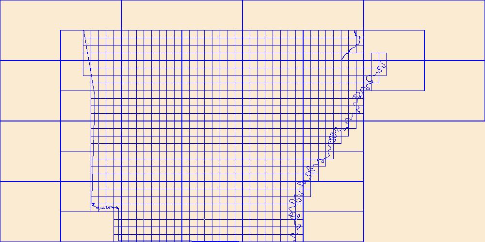
Types: Citation;
Tags: Adams,
Asotin,
Benton,
Boundaries,
Chelan, All tags...
Clallam,
Clark,
Columbia,
Cowlitz,
Douglas,
Downloadable Data,
Esri Shapefile nan,
Ferry,
Franklin,
Garfield,
Grant,
Grays Harbor,
Island,
Jefferson,
King,
Kitsap,
Kittitas,
Klickitat,
Lewis,
Lincoln,
Map Indices,
Map Indices,
Map Indices,
Mason,
Okanogan,
Pacific,
Pend Oreille,
Pierce,
San Juan,
Shapefile,
Skagit,
Skamania,
Snohomish,
Spokane,
State,
State,
Stevens,
Thurston,
US,
United States,
United States of America,
WA,
Wahkiakum,
Walla Walla,
Washington,
Whatcom,
Whitman,
Yakima,
cells,
map indices,
polygon grid, Fewer tags
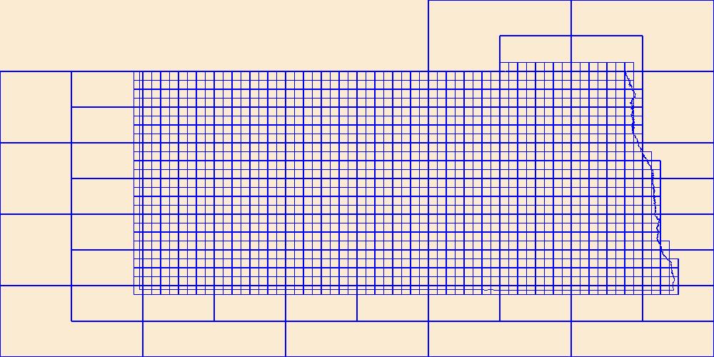
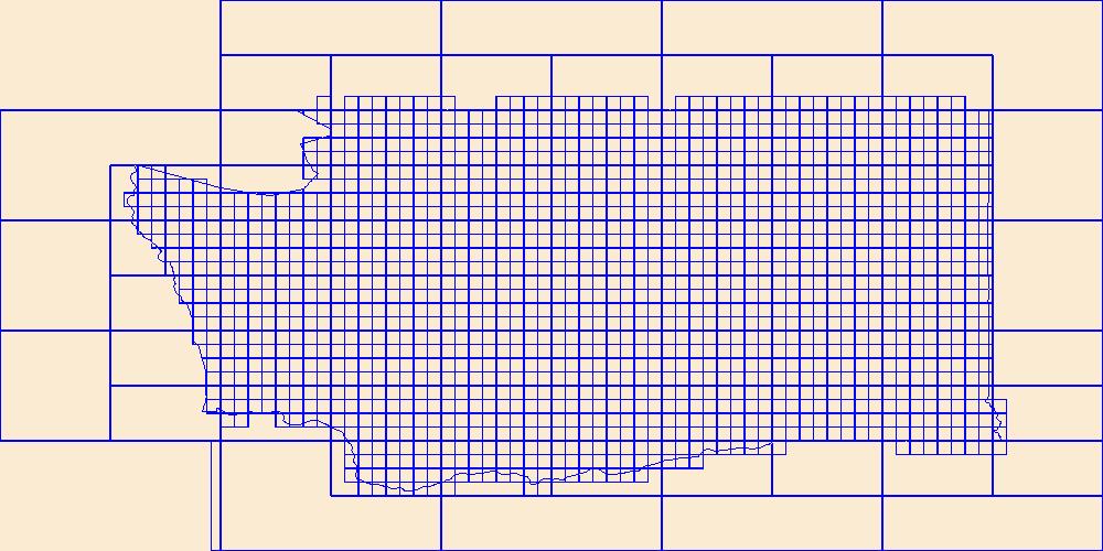
This data represents the map extent for current and historical USGS topographic maps for the United States and Territories, including 1 X 2 Degree, 1 X 1 Degree, 30 X 60 Minute, 15 X 15 Minute, 7.5 X 7.5 Minute, and 3.75 X 3.75 Minute. The grid was generated using ESRI ArcInfo GIS software.
Tags: AR,
Arkansas,
Arkansas,
Ashley,
Baxter, All tags...
Benton,
Boone,
Boundaries,
Bradley,
Calhoun,
Carroll,
Chicot,
Clark,
Clay,
Cleburne,
Cleveland,
Columbia,
Conway,
Craighead,
Crawford,
Crittenden,
Cross,
Dallas,
Desha,
Downloadable Data,
Drew,
Esri File GeoDatabase 10,
Faulkner,
FileGDB,
Franklin,
Fulton,
Garland,
Grant,
Greene,
Hempstead,
Hot Spring,
Howard,
Independence,
Izard,
Jackson,
Jefferson,
Johnson,
Lafayette,
Lawrence,
Lee,
Lincoln,
Little River,
Logan,
Lonoke,
Madison,
Map Indices,
Map Indices,
Map Indices,
Marion,
Miller,
Mississippi,
Monroe,
Montgomery,
Nevada,
Newton,
Ouachita,
Perry,
Phillips,
Pike,
Poinsett,
Polk,
Pope,
Prairie,
Pulaski,
Randolph,
Saline,
Scott,
Searcy,
Sebastian,
Sevier,
Sharp,
St. Francis,
State,
State,
Stone,
US,
Union,
United States,
United States of America,
Van Buren,
Washington,
White,
Woodruff,
Yell,
cells,
map indices,
polygon grid, Fewer tags
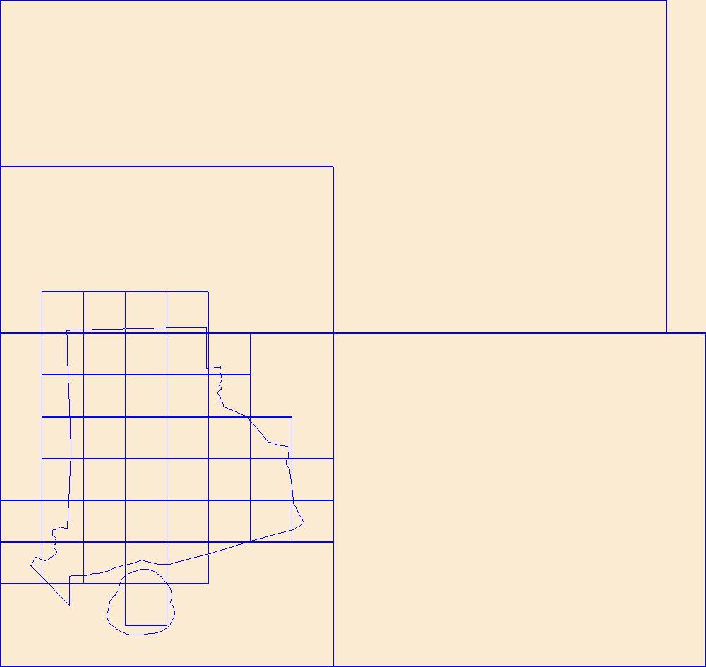
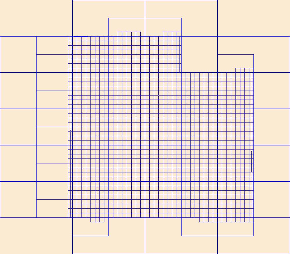
This data represents the map extent for current and historical USGS topographic maps for the United States and Territories, including 1 X 2 Degree, 1 X 1 Degree, 30 X 60 Minute, 15 X 15 Minute, 7.5 X 7.5 Minute, and 3.75 X 3.75 Minute. The grid was generated using ESRI ArcInfo GIS software.
Tags: Boundaries,
Bristol,
Downloadable Data,
Esri File GeoDatabase 10,
FileGDB, All tags...
Kent,
Map Indices,
Map Indices,
Map Indices,
Newport,
Providence,
RI,
Rhode Island,
State,
State,
US,
United States,
United States of America,
Washington,
cells,
map indices,
polygon grid, Fewer tags
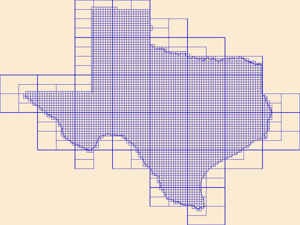
This data represents the map extent for current and historical USGS topographic maps for the United States and Territories, including 1 X 2 Degree, 1 X 1 Degree, 30 X 60 Minute, 15 X 15 Minute, 7.5 X 7.5 Minute, and 3.75 X 3.75 Minute. The grid was generated using ESRI ArcInfo GIS software.
Tags: Anderson,
Andrews,
Angelina,
Aransas,
Archer, All tags...
Armstrong,
Atascosa,
Austin,
Bailey,
Bandera,
Bastrop,
Baylor,
Bee,
Bell,
Bexar,
Blanco,
Borden,
Bosque,
Boundaries,
Bowie,
Brazoria,
Brazos,
Brewster,
Briscoe,
Brooks,
Brown,
Burleson,
Burnet,
Caldwell,
Calhoun,
Callahan,
Cameron,
Camp,
Carson,
Cass,
Castro,
Chambers,
Cherokee,
Childress,
Clay,
Cochran,
Coke,
Coleman,
Collin,
Collingsworth,
Colorado,
Comal,
Comanche,
Concho,
Cooke,
Coryell,
Cottle,
Crane,
Crockett,
Crosby,
Culberson,
Dallam,
Dallas,
Dawson,
DeWitt,
Deaf Smith,
Delta,
Denton,
Dickens,
Dimmit,
Donley,
Downloadable Data,
Duval,
Eastland,
Ector,
Edwards,
El Paso,
Ellis,
Erath,
Esri File GeoDatabase 10,
Falls,
Fannin,
Fayette,
FileGDB,
Fisher,
Floyd,
Foard,
Fort Bend,
Franklin,
Freestone,
Frio,
Gaines,
Galveston,
Garza,
Gillespie,
Glasscock,
Goliad,
Gonzales,
Gray,
Grayson,
Gregg,
Grimes,
Guadalupe,
Hale,
Hall,
Hamilton,
Hansford,
Hardeman,
Hardin,
Harris,
Harrison,
Hartley,
Haskell,
Hays,
Hemphill,
Henderson,
Hidalgo,
Hill,
Hockley,
Hood,
Hopkins,
Houston,
Howard,
Hudspeth,
Hunt,
Hutchinson,
Irion,
Jack,
Jackson,
Jasper,
Jeff Davis,
Jefferson,
Jim Hogg,
Jim Wells,
Johnson,
Jones,
Karnes,
Kaufman,
Kendall,
Kenedy,
Kent,
Kerr,
Kimble,
King,
Kinney,
Kleberg,
Knox,
La Salle,
Lamar,
Lamb,
Lampasas,
Lavaca,
Lee,
Leon,
Liberty,
Limestone,
Lipscomb,
Live Oak,
Llano,
Loving,
Lubbock,
Lynn,
Madison,
Map Indices,
Map Indices,
Map Indices,
Marion,
Martin,
Mason,
Matagorda,
Maverick,
McCulloch,
McLennan,
McMullen,
Medina,
Menard,
Midland,
Milam,
Mills,
Mitchell,
Montague,
Montgomery,
Moore,
Morris,
Motley,
Nacogdoches,
Navarro,
Newton,
Nolan,
Nueces,
Ochiltree,
Oldham,
Orange,
Palo Pinto,
Panola,
Parker,
Parmer,
Pecos,
Polk,
Potter,
Presidio,
Rains,
Randall,
Reagan,
Real,
Red River,
Reeves,
Refugio,
Roberts,
Robertson,
Rockwall,
Runnels,
Rusk,
Sabine,
San Augustine,
San Jacinto,
San Patricio,
San Saba,
Schleicher,
Scurry,
Shackelford,
Shelby,
Sherman,
Smith,
Somervell,
Starr,
State,
State,
Stephens,
Sterling,
Stonewall,
Sutton,
Swisher,
TX,
Tarrant,
Taylor,
Terrell,
Terry,
Texas,
Throckmorton,
Titus,
Tom Green,
Travis,
Trinity,
Tyler,
US,
United States,
United States of America,
Upshur,
Upton,
Uvalde,
Val Verde,
Van Zandt,
Victoria,
Walker,
Waller,
Ward,
Washington,
Webb,
Wharton,
Wheeler,
Wichita,
Wilbarger,
Willacy,
Williamson,
Wilson,
Winkler,
Wise,
Wood,
Yoakum,
Young,
Zapata,
Zavala,
cells,
map indices,
polygon grid, Fewer tags
|
|

