Filters: Tags: {"type":"Theme","scheme":"none"} (X) > Extensions: Shapefile (X)
151 results (49ms)|
Filters
Date Range
Extensions Types
Contacts
Categories Tags (with Type=Theme and Scheme=none) |
This data set contains the Sedge Island Marine Conservation Zone delineated by NJDEP Green Acres Program. The Sedge Island Marine Conservation Zone contains approximately 1,600 acres of highly productive tidal marshes, creeks, ponds, and open water.
Categories: Data;
Types: Downloadable,
Map Service,
OGC WFS Layer,
OGC WMS Layer,
Shapefile;
Tags: New Jersey,
Sedge Island,
environment,
green acres,
marine conservation zone,
Temperate lakes may contain both coolwater fish species such as walleye (Sander vitreus) and warmwater species such as largemouth bass (Micropterus salmoides). Recent declines in walleye and increases in largemouth bass populations have raised questions regarding the future trajectories and appropriate management actions for these important species. We developed a thermodynamic model of water temperatures driven by downscaled climate data and lake specific characteristics to estimate daily water temperature profiles for 2148 lakes in Wisconsin, USA under contemporary (1989-2014) and future (2040-2064 and 2065-2089) conditions. We correlated contemporary walleye recruitment success and largemouth bass relative abundance...
Categories: Data;
Types: Citation,
Downloadable,
Map Service,
OGC WFS Layer,
OGC WMS Layer,
Shapefile;
Tags: 007,
012,
Fish,
Northeast CASC,
Rivers, Streams and Lakes,
This dataset shows depth ranges to the top of the Cloverly Formation within the Big Horn Basin Province, Montana and Wyoming.
Categories: Data,
pre-SM502.8;
Types: Downloadable,
Map Service,
OGC WFS Layer,
OGC WMS Layer,
Shapefile;
Tags: 503401 = Phosphoria,
50340101 = Paleozoic-Mesozoic Conventional Oil and Gas,
503402 = Cretaceous-Tertiary Composite,
50340201 = Cretaceous-Tertiary Conventional Oil and Gas,
50340261 = Muddy-Frontier Sandstone and Mowry Fractured Shale Continuous Gas,
The Assessment Unit is the fundamental unit used in the National Assessment Project for the assessment of undiscovered oil and gas resources. The Assessment Unit is defined within the context of the higher-level Total Petroleum System. The Assessment Unit is shown here as a geographic boundary interpreted, defined, and mapped by the geologist responsible for the province and incorporates a set of known or postulated oil and (or) gas accumulations sharing similar geologic, geographic, and temporal properties within the Total Petroleum System, such as source rock, timing, migration pathways, trapping mechanism, and hydrocarbon type. The Assessment Unit boundary is defined geologically as the limits of the geologic...
Categories: Data,
pre-SM502.8;
Types: Downloadable,
Map Service,
OGC WFS Layer,
OGC WMS Layer,
Shapefile;
Tags: 502001 = Ferron Coal/Wasatch Plateau,
50200101 = Conventional Ferron Sandstone Gas,
50200161 = Deep (6,000 feet plus) Coal and Sandstone Gas,
50200181 = Northern Coal Fairway/Drunkards Wash,
50200182 = Central Coal Fairway/Buzzards Bench,
Whole-rock and calcite geochemical data are reported for twelve carbonatite samples collected from the Bear Lodge alkaline complex, Wyoming and from the Mountain Pass mine, California. Calcite geochemical data was collected using electron microprobe and laser ablation inductively coupled plasma-mass spectrometry (LA-ICP-MS) analyses. Reported whole-rock data was measured by inductively coupled plasma-optical emission spectrometry (ICP-OES), inductively coupled plasma-mass spectrometry (ICP-MS), ion selective electrode-fluoride (ISE-F), and wavelength dispersive X-ray fluorescence (WDXRF). Geochemical data are presented in downloadable .csv files. Spatial data of sample collection sites are provided as polygons in...
Categories: Data;
Types: Downloadable,
Map Service,
OGC WFS Layer,
OGC WMS Layer,
Shapefile;
Tags: Bear Lodge Mountains,
Black Hills,
California,
California,
Carbonatite,
This data set represents the results of calculations of hazard curves for a grid of points with a spacing of 0.05 degrees in latitude and longitude. This particular data set is for horizontal spectral response acceleration for 0.2-second period with a 1 percent probability of exceedance in 1 year. The data are for the Western United States and are based on the long-term 2014 National Seismic Hazard Model.
Categories: Data;
Types: Citation,
Downloadable,
Map Service,
OGC WFS Layer,
OGC WMS Layer,
Shapefile;
Tags: Arizona,
California,
Colorado,
Earthquake,
Hazard,
A one-year seismic hazard forecast for the Central and Eastern United States, based on induced and natural earthquakes, has been produced by the U.S. Geological Survey. The model assumes that earthquake rates calculated from several different time windows will remain relatively stationary and can be used to forecast earthquake hazard and damage intensity for the year 2016. This assessment is the first step in developing an operational earthquake forecast for the CEUS, and the analysis could be revised with updated seismicity and model parameters. Consensus input models consider alternative earthquake catalog durations, smoothing parameters, maximum magnitudes, and ground motion estimates, and represent uncertainties...
Categories: Data;
Types: Downloadable,
Map Service,
OGC WFS Layer,
OGC WMS Layer,
Shapefile;
Tags: Alabama,
Arizona,
Arkansas,
Colorado,
Connecticut,
A seismic hazard model for South America, based on a smoothed (gridded) seismicity model, a subduction model, a crustal fault model, and a ground motion model, has been produced by the U.S. Geological Survey. These models are combined to account for ground shaking from earthquakes on known faults as well as earthquakes on un-modeled faults. This data set represents the results of calculations of hazard curves for a grid of points with a spacing of 0.1 degrees in latitude and longitude. This particular data set is for horizontal spectral response acceleration for 0.2-second period with a 10 percent probability of exceedance in 50 years.
Categories: Data;
Types: Citation,
Downloadable,
Map Service,
OGC WFS Layer,
OGC WMS Layer,
Shapefile;
Tags: Argentina,
Bolivia,
Brazil,
Chile,
Colombia,
Water samples were collected by the USGS National Water Quality Program (NWQP) Southeastern Stream Quality Assessment (SESQA) from 76 perennial, wadeable (less than 10 m width and 1 m depth at base-flow) headwater stream sites in watersheds with varying degrees of urban land use in four states. Dataset includes sample site locations and information, water sample nutrient concentrations and statistics analyses, and corresponding watershed land-use-land-cover data and data dictionary.
Categories: Data;
Types: Downloadable,
Map Service,
OGC WFS Layer,
OGC WMS Layer,
OGC WMS Service,
Shapefile;
Tags: Georgia,
North America,
North Carolina,
South Carolina,
USGS Science Data Catalog (SDC),
Cassiterite (SnO2) samples were collected throughout Devon and Cornwall Counties in southwest England, United Kingdom. Samples were prepared and analyzed for direct age dating on a laser ablation inductively coupled plasma mass spectrometer (LA-ICPMS) system at the U.S. Geological Survey in Denver, Colorado in February and April 2018. This data release accompanies the publication, 'U-Pb geochronology of tin deposits associated with the Cornubian Batholith of southwest England: Direct dating of cassiterite by in situ LA-ICPMS' (Moscati and Neymark, in press). The publication describes a greater chronologic control and refinement of Cornubian tin ore deposition and allows comparison of its timing with previously published...
Categories: Data;
Types: Downloadable,
Map Service,
OGC WFS Layer,
OGC WMS Layer,
Shapefile;
Tags: Cornwall,
Devon,
Geochemistry,
Geology, Geophysics, and Geochemistry Science Center,
LA-ICPMS,
This U.S. Geological Survey data release provides surface-water quality, streamflow, and groundwater-elevation data collected within the Central Pine Barrens (CPB) Region of Suffolk County, New York. The data were collected in cooperation with the Central Pine Barrens Commission and the Town of Brookhaven as part of a five-year comprehensive water-resources monitoring program. Water quality and quality-assurance data from seven sites on two rivers (Carmans River- 5 sites and Peconic River - 2 sites) in the CPB are included. Carmans River sites were sampled four times throughout the year (fall, winter, spring, and summer) and Peconic River sites were sampled twice throughout the year (fall and spring). Water-quality...
Categories: Data,
Data Release - Revised;
Types: Downloadable,
Map Service,
OGC WFS Layer,
OGC WMS Layer,
Shapefile;
Tags: Ambient Monitoring,
Carmans River,
Central Pine Barrens,
Contaminants, Emerging,
Contaminants, Natural,
This data release contains the forcings and outputs of 7-day ahead maximum water temperature forecasting models that made real-time predictions in the Delaware River Basin during 2021. The model is driven by weather forecasts and observed reservoir releases and produces maximum water temperature forecasts for the issue day (day 0) and 7 days into the future (days 1-7) at five sites. This data release captures the entire forecasting period that is reported in Zwart et al. 2022, and is an extension of a previous data release that contains all data needed to build these models but only extends to July 16, 2021 (Oliver et al. 2021). Additionally, this release contains a tidy version of the model predictions with paired...
Categories: Data;
Types: Downloadable,
Map Service,
OGC WFS Layer,
OGC WMS Layer,
Shapefile;
Tags: Hydrology,
NY,
New York,
US,
USGS Science Data Catalog (SDC),
This data release provides quantitative whole rock geochemical results from The Geysers vapor-dominated geothermal field in California. The concentrations of major elements are reported in oxide weight percent by wavelength dispersive x-ray fluorescence (WDXRF), the concentrations for sixty elements are reported in elemental weight percent (pct) or parts per million (ppm) from inductively coupled plasma-optical emission spectrometry-mass spectrometry ICP-OES-MS analysis, mercury is reported in ppm by cold vapor atomic absorption spectrometry (CVAAS), and ammonium in ppm from automated colorimetry analysis. The analyses show significant enrichment of volatile elements and elements such as sulfur, boron, arsenic,...
Categories: Data;
Types: Downloadable,
Map Service,
OGC WFS Layer,
OGC WMS Layer,
Shapefile;
Tags: California,
GGGSC,
Geochemistry,
Geology, Geophysics, and Geochemistry Science Center,
Lake County,
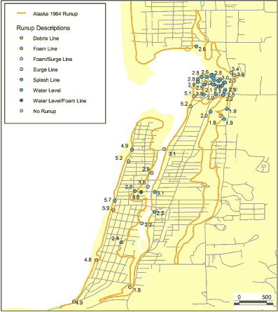
This data set is a point shapefile representing observations of inundation and water levels from the Alaska 1964 event obtained by Tom Horning (1997). The geospatial dataset were derived from a spreadsheet provided by Bruce Jaffe.
Categories: Data;
Types: Citation,
Downloadable,
Map Service,
OGC WFS Layer,
OGC WMS Layer,
Shapefile;
Tags: Oregon,
Seaside, Oregon,
USA,
observations,
tsunami inundation,
This data release provides digital flight line data for a high-resolution airborne magnetic and radiometric survey over Virginia and North Carolina along and near the eastern U.S. 'Fall Zone', which represents the transitional area between Atlantic Coastal Plain sediments and Piedmont metamorphic and igneous rocks. The airborne data collection was funded by the U.S. Geological Survey (USGS) Earth Mapping Resources Initiative (Earth MRI) and National Cooperative Geological Mapping Program (NCGMP). Goals include a gaining a better understanding of placer deposits containing critical mineral resources titanium, zirconium, and rare earth elements, assisting geologic mapping of the crystalline basement either exposed...
Categories: Data;
Types: Downloadable,
Map Service,
OGC WFS Layer,
OGC WMS Layer,
Shapefile;
Tags: "Geophysics",
"Mineral Resources",
"Sedimentology"],
"Structural Geology",
AASG,
Derived from data provided by USDA Forest Service, Alberta Sustainable Resource Development, and GeoBC on Bruce spanworm, Large aspen tortrix, and Forest tent caterpillar . See Data Mining Report, uploaded with this file, for more information
Categories: Data;
Types: Downloadable,
Map Service,
OGC WFS Layer,
OGC WMS Layer,
Shapefile;
Tags: Biology,
Biology,
Biology, Ecology& Biophysical,
Biology, Ecology& Biophysical,
Data,
Most of these data were collected in order to create a database of tree locations for use in calibrating remote sensing tools and products, particularly dead tree detection tools and canopy species maps. Data include tree locations, species identification, and status (live, dead, and, if dead, sometimes includes information on foliage and twig retention). They are a collection of different sampling efforts performed over several years, starting in a period of severe drought mortality. One csv table is included that shows data and validation results for an additional dataset that was used to test the NAIP derived dead tree detection model that is associated with this data release. Locations are not included for that...
Categories: Data;
Types: Downloadable,
Map Service,
OGC WFS Layer,
OGC WMS Layer,
Shapefile;
Tags: California,
Forestry,
Kings Canyon National Park,
Sequoia National Park,
Sierra Nevada,
The Assessment Unit is the fundamental unit used in the National Assessment Project for the assessment of undiscovered oil and gas resources. The Assessment Unit is defined within the context of the higher-level Total Petroleum System. The Assessment Unit is shown here as a geographic boundary interpreted, defined, and mapped by the geologist responsible for the province and incorporates a set of known or postulated oil and (or) gas accumulations sharing similar geologic, geographic, and temporal properties within the Total Petroleum System, such as source rock, timing, migration pathways, trapping mechanism, and hydrocarbon type. The Assessment Unit boundary is defined geologically as the limits of the geologic...
This data release provides the predictions from stream temperature models described in Chen et al. 2021. Briefly, various deep learning and process-guided deep learning models were built to test improved performance of stream temperature predictions below reservoirs in the Delaware River Basin. The spatial extent of predictions was restricted to streams above the Delaware River at Lordville, NY, and includes the West Branch of the Delaware River below Cannonsville Reservoir and the East Branch of the Delaware River below Pepacton Reservoir. Various model architectures, training schemes, and data assimilation methods were used to generate the table and figures in Chen et a.l (2021) and predictions of each model are...
Categories: Data;
Types: Downloadable,
Map Service,
OGC WFS Layer,
OGC WMS Layer,
Shapefile;
Tags: Hydrology,
NY,
New York,
PA,
Pennsylvania,
|

|
