Filters: Tags: ANACACHO (X)
40 results (94ms)|
Filters
Date Range
Contacts
Categories Tag Types Tag Schemes |
Core Research Center, cutting HH01897, from well operated by PIONEER NATURAL RESOURCESRaw Properties from download, web scrape, MapServer, and Macrostrat API{"Lib Num": "HH01897", "API Num": "4228333911", "Operator": "PIONEER NATURAL RESOURCES", "Well Name": "WASHBURN RANCH 04 03H", "Field": "EAGLEVILLE", "State": "TX", "County": "LA SALLE", "Thin Sec": "F", "Analysis": "F", "Latitude": "28.378772", "Longitude": "-98.918317", "coordinates_geohash": "9v19mn1yk4sb", "Source": "PROVIDED BY DONOR", "Min": "200", "Max": "16710", "Security Flag": "NO SPECIAL RESTRICTIONS", "crc_collection_name": "cutting", "sb_parent_id": "4f4e49d8e4b07f02db5df2d2", "intervals": [{"Formation": "EAGLE FORD", "Age": "CRETACEOUS", "Min Depth":...
Core Research Center, cutting HH01905, from well operated by PIONEER NATURAL RESOURCESRaw Properties from download, web scrape, MapServer, and Macrostrat API{"Lib Num": "HH01905", "API Num": "4229735358", "Operator": "PIONEER NATURAL RESOURCES", "Well Name": "GEORGIA BUCK 01 05H", "Field": "EAGLEVILLE", "State": "TX", "County": "LIVE OAK", "Thin Sec": "F", "Analysis": "F", "Latitude": "28.67482", "Longitude": "-98.24856", "coordinates_geohash": "9v45hk1dftgu", "Source": "PROVIDED BY DONOR", "Min": "2100", "Max": "15370", "Security Flag": "NO SPECIAL RESTRICTIONS", "crc_collection_name": "cutting", "sb_parent_id": "4f4e49d8e4b07f02db5df2d2", "intervals": [{"Formation": "EAGLE FORD", "Age": "CRETACEOUS", "Min Depth":...
Core Research Center, cutting HH01881, from well operated by PIONEER NATURAL RESOURCESRaw Properties from download, web scrape, MapServer, and Macrostrat API{"Lib Num": "HH01881", "API Num": "4201334323", "Operator": "PIONEER NATURAL RESOURCES", "Well Name": "EDMUND TOM 02 01 PILOT", "Field": "EAGLEVILLE", "State": "TX", "County": "ATASCOSA", "Thin Sec": "F", "Analysis": "F", "Latitude": "28.72015", "Longitude": "-98.2812", "coordinates_geohash": "9v457s3g4018", "Source": "PROVIDED BY DONOR", "Min": "900", "Max": "10690", "Security Flag": "NO SPECIAL RESTRICTIONS", "crc_collection_name": "cutting", "sb_parent_id": "4f4e49d8e4b07f02db5df2d2", "intervals": [{"Formation": "NAVARRO", "Age": "CRETACEOUS", "Min Depth":...
Core Research Center, cutting HH01883, from well operated by PIONEER NATURAL RESOURCESRaw Properties from download, web scrape, MapServer, and Macrostrat API{"Lib Num": "HH01883", "API Num": "4201334322", "Operator": "PIONEER NATURAL RESOURCES", "Well Name": "EDMUND TOM 01 01 P/H", "Field": "EAGLEVILLE", "State": "TX", "County": "ATASCOSA", "Thin Sec": "F", "Analysis": "F", "Latitude": "28.696978", "Longitude": "-98.295219", "coordinates_geohash": "9v4570ps52km", "Source": "PROVIDED BY DONOR", "Min": "10000", "Max": "15620", "Security Flag": "NO SPECIAL RESTRICTIONS", "crc_collection_name": "cutting", "sb_parent_id": "4f4e49d8e4b07f02db5df2d2", "intervals": [{"Formation": "GEORGETOWN", "Age": "CRETACEOUS", "Min...
Core Research Center, cutting HH01933, from well operated by PIONEER NATURAL RESOURCESRaw Properties from download, web scrape, MapServer, and Macrostrat API{"Lib Num": "HH01933", "API Num": "4229735079", "Operator": "PIONEER NATURAL RESOURCES", "Well Name": "JAMES KEITH ESSE 01 02H", "Field": "EAGLEVILLE", "State": "TX", "County": "LIVE OAK", "Thin Sec": "F", "Analysis": "F", "Latitude": "28.654181", "Longitude": "-98.231322", "coordinates_geohash": "9v45h8q4sq3r", "Source": "PROVIDED BY DONOR", "Min": "1000", "Max": "17369", "Security Flag": "NO SPECIAL RESTRICTIONS", "crc_collection_name": "cutting", "sb_parent_id": "4f4e49d8e4b07f02db5df2d2", "intervals": [{"Formation": "EAGLE FORD", "Age": "CRETACEOUS", "Min...
Core Research Center, cutting HH01949, from well operated by SUNDANCE ENERGYRaw Properties from download, web scrape, MapServer, and Macrostrat API{"Lib Num": "HH01949", "API Num": "4201334347", "Operator": "SUNDANCE ENERGY", "Well Name": "EDMUND TOM 02 02H", "Field": "EAGLEVILLE", "State": "TX", "County": "ATASCOSA", "Thin Sec": "F", "Analysis": "F", "Latitude": "28.69624", "Longitude": "-98.29095", "coordinates_geohash": "9v455rfxwyge", "Source": "PROVIDED BY DONOR", "Min": "2500", "Max": "16492", "Security Flag": "NO SPECIAL RESTRICTIONS", "crc_collection_name": "cutting", "sb_parent_id": "4f4e49d8e4b07f02db5df2d2", "intervals": [{"Formation": "EAGLE FORD", "Age": "CRETACEOUS", "Min Depth": "10908", "Max Depth":...
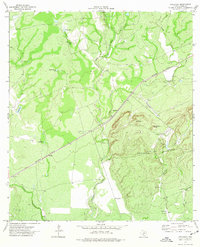
USGS Historical Quadrangle in GeoPDF.
Core Research Center, cutting HH01923, from well operated by PIONEER NATURAL RESOURCESRaw Properties from download, web scrape, MapServer, and Macrostrat API{"Lib Num": "HH01923", "API Num": "4229734922", "Operator": "PIONEER NATURAL RESOURCES", "Well Name": "JAMES KEITH ESSE 01 01H", "Field": "SUGARKANE", "State": "TX", "County": "LIVE OAK", "Thin Sec": "F", "Analysis": "F", "Latitude": "28.65423", "Longitude": "-98.23383", "coordinates_geohash": "9v45h8k6cze7", "Source": "PROVIDED BY DONOR", "Min": "1030", "Max": "16931", "Security Flag": "NO SPECIAL RESTRICTIONS", "crc_collection_name": "cutting", "sb_parent_id": "4f4e49d8e4b07f02db5df2d2", "intervals": [{"Formation": "EAGLE FORD", "Age": "CRETACEOUS", "Min Depth":...
Core Research Center, cutting HH01927, from well operated by PIONEER NATURAL RESOURCESRaw Properties from download, web scrape, MapServer, and Macrostrat API{"Lib Num": "HH01927", "API Num": "4229735015", "Operator": "PIONEER NATURAL RESOURCES", "Well Name": "HT CHAPMAN 4-1H", "Field": "EAGLEVILLE", "State": "TX", "County": "LIVE OAK", "Thin Sec": "F", "Analysis": "F", "Latitude": "28.6568", "Longitude": "-98.22041", "coordinates_geohash": "9v45hby1fwdn", "Source": "PROVIDED BY DONOR", "Min": "4750", "Max": "16103", "Security Flag": "NO SPECIAL RESTRICTIONS", "crc_collection_name": "cutting", "sb_parent_id": "4f4e49d8e4b07f02db5df2d2", "intervals": [{"Formation": "EAGLE FORD", "Age": "CRETACEOUS", "Min Depth": "11876",...
Core Research Center, cutting HH01910, from well operated by PIONEER NATURAL RESOURCESRaw Properties from download, web scrape, MapServer, and Macrostrat API{"Lib Num": "HH01910", "API Num": "4229735014", "Operator": "PIONEER NATURAL RESOURCES", "Well Name": "IDYLWOOD 01 01H", "Field": "EAGLEVILLE", "State": "TX", "County": "LIVE OAK", "Thin Sec": "F", "Analysis": "F", "Latitude": "28.61755", "Longitude": "-98.29557", "coordinates_geohash": "9v44g1xm71yx", "Source": "PROVIDED BY DONOR", "Min": "3000", "Max": "17542", "Security Flag": "NO SPECIAL RESTRICTIONS", "crc_collection_name": "cutting", "sb_parent_id": "4f4e49d8e4b07f02db5df2d2", "intervals": [{"Formation": "EAGLE FORD", "Age": "CRETACEOUS", "Min Depth":...
Core Research Center, cutting HH01895, from well operated by PIONEER NATURAL RESOURCESRaw Properties from download, web scrape, MapServer, and Macrostrat API{"Lib Num": "HH01895", "API Num": "4228333910", "Operator": "PIONEER NATURAL RESOURCES", "Well Name": "WASHBURN RANCH 02 02H", "Field": "EAGLEVILLE", "State": "TX", "County": "LA SALLE", "Thin Sec": "F", "Analysis": "F", "Latitude": "28.378772", "Longitude": "-98.918411", "coordinates_geohash": "9v19mn1y3fwb", "Source": "PROVIDED BY DONOR", "Min": "200", "Max": "16000", "Security Flag": "NO SPECIAL RESTRICTIONS", "crc_collection_name": "cutting", "sb_parent_id": "4f4e49d8e4b07f02db5df2d2", "intervals": [{"Formation": "EAGLE FORD", "Age": "CRETACEOUS", "Min Depth":...
Core Research Center, cutting HH01906, from well operated by PIONEER NATURAL RESOURCESRaw Properties from download, web scrape, MapServer, and Macrostrat API{"Lib Num": "HH01906", "API Num": "4229735359", "Operator": "PIONEER NATURAL RESOURCES", "Well Name": "GEORGIA BUCK 01 06H", "Field": "EAGLEVILLE", "State": "TX", "County": "LIVE OAK", "Thin Sec": "F", "Analysis": "F", "Latitude": "28.67488", "Longitude": "-98.2485", "coordinates_geohash": "9v45hk1ek109", "Source": "PROVIDED BY DONOR", "Min": "1000", "Max": "15300", "Security Flag": "NO SPECIAL RESTRICTIONS", "crc_collection_name": "cutting", "sb_parent_id": "4f4e49d8e4b07f02db5df2d2", "intervals": [{"Formation": "EAGLE FORD", "Age": "CRETACEOUS", "Min Depth":...
Core Research Center, cutting HH01921, from well operated by PIONEER NATURAL RESOURCESRaw Properties from download, web scrape, MapServer, and Macrostrat API{"Lib Num": "HH01921", "API Num": "4229734997", "Operator": "PIONEER NATURAL RESOURCES", "Well Name": "KOERTH 01 01H", "Field": "EAGLEVILLE", "State": "TX", "County": "LIVE OAK", "Thin Sec": "F", "Analysis": "F", "Latitude": "28.65472", "Longitude": "-98.22251", "coordinates_geohash": "9v45hbktcdun", "Source": "PROVIDED BY DONOR", "Min": "4000", "Max": "17013", "Security Flag": "NO SPECIAL RESTRICTIONS", "crc_collection_name": "cutting", "sb_parent_id": "4f4e49d8e4b07f02db5df2d2", "intervals": [{"Formation": "EAGLE FORD", "Age": "CRETACEOUS", "Min Depth": "11664",...
Core Research Center, cutting HH01904, from well operated by PIONEER NATURAL RESOURCESRaw Properties from download, web scrape, MapServer, and Macrostrat API{"Lib Num": "HH01904", "API Num": "4229735356", "Operator": "PIONEER NATURAL RESOURCES", "Well Name": "GEORGIA BUCK 01 04H", "Field": "EAGLEVILLE", "State": "TX", "County": "LIVE OAK", "Thin Sec": "F", "Analysis": "F", "Latitude": "28.67476", "Longitude": "-98.24863", "coordinates_geohash": "9v45hk1d8fxw", "Source": "PROVIDED BY DONOR", "Min": "1000", "Max": "15400", "Security Flag": "NO SPECIAL RESTRICTIONS", "crc_collection_name": "cutting", "sb_parent_id": "4f4e49d8e4b07f02db5df2d2", "intervals": [{"Formation": "EAGLE FORD", "Age": "CRETACEOUS", "Min Depth":...
Core Research Center, cutting HH01918, from well operated by SUNDANCE ENERGYRaw Properties from download, web scrape, MapServer, and Macrostrat API{"Lib Num": "HH01918", "API Num": "4231136653", "Operator": "SUNDANCE ENERGY", "Well Name": "WOODWARD EFS 4HB", "Field": "EAGLEVILLE", "State": "TX", "County": "LIVE OAK", "Thin Sec": "F", "Analysis": "F", "Latitude": "28.45576", "Longitude": "-98.37957", "coordinates_geohash": "9v41ck4nvf5s", "Source": "PROVIDED BY DONOR", "Min": "5870", "Max": "20402", "Security Flag": "NO SPECIAL RESTRICTIONS", "crc_collection_name": "cutting", "sb_parent_id": "4f4e49d8e4b07f02db5df2d2", "intervals": [{"Formation": "EAGLE FORD", "Age": "CRETACEOUS", "Min Depth": "16670", "Max Depth":...
Core Research Center, cutting HH01940, from well operated by PIONEER NATURAL RESOURCESRaw Properties from download, web scrape, MapServer, and Macrostrat API{"Lib Num": "HH01940", "API Num": "4229735103", "Operator": "PIONEER NATURAL RESOURCES", "Well Name": "JAMES KEITH ESSE 01 03", "Field": "EAGLEVILLE", "State": "TX", "County": "LIVE OAK", "Thin Sec": "F", "Analysis": "F", "Latitude": "28.654164", "Longitude": "-98.233839", "coordinates_geohash": "9v45h8k69ekd", "Source": "PROVIDED BY DONOR", "Min": "2060", "Max": "17482", "Security Flag": "NO SPECIAL RESTRICTIONS", "crc_collection_name": "cutting", "sb_parent_id": "4f4e49d8e4b07f02db5df2d2", "intervals": [{"Formation": "EAGLE FORD", "Age": "CRETACEOUS", "Min...
Core Research Center, cutting HH01945, from well operated by PIONEER NATURAL RESOURCESRaw Properties from download, web scrape, MapServer, and Macrostrat API{"Lib Num": "HH01945", "API Num": "4229735119", "Operator": "PIONEER NATURAL RESOURCES", "Well Name": "SHARON FORDYCE 01 01H", "Field": "EAGLEVILLE", "State": "TX", "County": "LIVE OAK", "Thin Sec": "F", "Analysis": "F", "Latitude": "28.677678", "Longitude": "-98.224531", "coordinates_geohash": "9v45hue5dd9h", "Source": "PROVIDED BY DONOR", "Min": "800", "Max": "15200", "Security Flag": "NO SPECIAL RESTRICTIONS", "crc_collection_name": "cutting", "sb_parent_id": "4f4e49d8e4b07f02db5df2d2", "intervals": [{"Formation": "EAGLE FORD", "Age": "CRETACEOUS", "Min Depth":...
Core Research Center, cutting HH01882, from well operated by SUNDANCE ENERGYRaw Properties from download, web scrape, MapServer, and Macrostrat API{"Lib Num": "HH01882", "API Num": "4231136683", "Operator": "SUNDANCE ENERGY", "Well Name": "SHANNON EFS 6UH", "Field": "EAGLEVILLE", "State": "TX", "County": "MCMULLEN", "Thin Sec": "F", "Analysis": "F", "Latitude": "28.59041", "Longitude": "-98.43624", "coordinates_geohash": "9v448h8zjqew", "Source": "PROVIDED BY DONOR", "Min": "9200", "Max": "17775", "Security Flag": "NO SPECIAL RESTRICTIONS", "crc_collection_name": "cutting", "sb_parent_id": "4f4e49d8e4b07f02db5df2d2", "intervals": [{"Formation": "EAGLE FORD", "Age": "CRETACEOUS", "Min Depth": "10600", "Max Depth":...
Core Research Center, cutting HH01941, from well operated by PIONEER NATURAL RESOURCESRaw Properties from download, web scrape, MapServer, and Macrostrat API{"Lib Num": "HH01941", "API Num": "4229734958", "Operator": "PIONEER NATURAL RESOURCES", "Well Name": "H HARLAN BETHUNE 01 01 PILOT", "Field": "EAGLEVILLE", "State": "TX", "County": "LIVE OAK", "Thin Sec": "F", "Analysis": "F", "Latitude": "28.6056", "Longitude": "-98.26323", "coordinates_geohash": "9v44ezqzsy34", "Source": "PROVIDED BY DONOR", "Min": "1200", "Max": "12070", "Security Flag": "NO SPECIAL RESTRICTIONS", "crc_collection_name": "cutting", "sb_parent_id": "4f4e49d8e4b07f02db5df2d2", "intervals": [{"Formation": "GEORGETOWN", "Age": "CRETACEOUS", "Min...
Core Research Center, cutting HH01943, from well operated by PIONEER NATURAL RESOURCESRaw Properties from download, web scrape, MapServer, and Macrostrat API{"Lib Num": "HH01943", "API Num": "4229735040", "Operator": "PIONEER NATURAL RESOURCES", "Well Name": "H HARLAN BETHUNE 01 03H", "Field": "EAGLEVILLE", "State": "TX", "County": "LIVE OAK", "Thin Sec": "F", "Analysis": "F", "Latitude": "28.614011", "Longitude": "-98.244353", "coordinates_geohash": "9v44u3h8swkb", "Source": "PROVIDED BY DONOR", "Min": "630", "Max": "17720", "Security Flag": "NO SPECIAL RESTRICTIONS", "crc_collection_name": "cutting", "sb_parent_id": "4f4e49d8e4b07f02db5df2d2", "intervals": [{"Formation": "OLMOS", "Age": "CRETACEOUS", "Min Depth":...
|

|
