Filters: Tags: Alcove (X)
10 results (53ms)|
Filters
Date Range
Contacts
Categories Tag Types Tag Schemes |
Continuous water temperature data were collected at multiple sites along the Middle Fork and mainstem Willamette Rivers between Jasper and Newberg, Oregon, to support effectiveness monitoring for a large-scale channel and floodplain restoration program (Willamette Focused Investment Partnership, WFIP). Continuous water temperature loggers were deployed at a subset of WFIP restoration sites where river restoration activities were implemented to improve habitat conditions for native fish species. Data from water temperature monitoring will be used to evaluate the effectiveness of restoration activities at improving habitat conditions for Endangered Species Act (ESA)-listed salmonids and other native fish in the Willamette...
Categories: Data;
Tags: Albany,
Bowers Rock State Park,
Browns Island,
Collins Bay,
Middle Fork Willamette River,
Continuous water-temperature data were collected at multiple sites along the Middle Fork and mainstem Willamette Rivers between Jasper and Newberg, Oregon, to support effectiveness monitoring for a large-scale channel and floodplain restoration program (Willamette Focused Investment Partnership, WFIP). Continuous water temperature loggers were deployed at a subset of WFIP restoration sites where river restoration activities were implemented to improve habitat conditions for native fish species. Data from water-temperature monitoring will be used to evaluate the effectiveness of restoration activities at improving habitat conditions for ESA-listed salmonids and other native fish in the Willamette River. Additionally,...
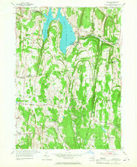
USGS Historical Quadrangle in GeoPDF.
Continuous water temperature data were collected at multiple sites along the Middle Fork and mainstem Willamette Rivers between Jasper and Newberg, Oregon, to support effectiveness monitoring for a large-scale channel and floodplain restoration program (Willamette Focused Investment Partnership, WFIP). Continuous water temperature loggers were deployed at a subset of WFIP restoration sites where river restoration activities were implemented to improve habitat conditions for native fish species. Data from water temperature monitoring will be used to evaluate the effectiveness of restoration activities at improving habitat conditions for Endangered Species Act (ESA)-listed salmonids and other native fish in the Willamette...
Categories: Data;
Tags: Albany,
Bowers Rock State Park,
Browns Island,
Collins Bay,
Middle Fork Willamette River,
Continuous water-temperature data were collected at multiple restoration sites along the Middle Fork and mainstem Willamette Rivers between Jasper and Newberg, Oregon, to support effectiveness monitoring for a large-scale channel and floodplain restoration initiative (Willamette Focused Investment Partnership, WFIP). Continuous water-temperature loggers were deployed at a subset of WFIP sites where river restoration activities were planned or implemented to improve habitat conditions for native fish species. Data from water-temperature monitoring will be used to evaluate the effectiveness of restoration activities at improving habitat conditions for native fish in the Willamette River. Additionally, water-temperature...
Continuous water-temperature data were collected at multiple sites along the Middle Fork and mainstem Willamette Rivers between Jasper and Newberg, Oregon, to support effectiveness monitoring for a large-scale channel and floodplain restoration program (Willamette Focused Investment Partnership, WFIP). Continuous water temperature loggers were deployed at a subset of WFIP restoration sites where river restoration activities were implemented to improve habitat conditions for native fish species. Data from water-temperature monitoring will be used to evaluate the effectiveness of restoration activities at improving habitat conditions for ESA-listed salmonids and other native fish in the Willamette River. Additionally,...
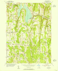
USGS Historical Quadrangle in GeoPDF.
Temperature loggers were placed on the ground (n=4) and hung in the air (n=2) near the upstream connection point of four Willamette River off-channel features (side channels and alcoves) to assess timing and discharge conditions when these four off-channel features were inundated at the upstream end with flow from the main channel. Temperature readings indicate that the upstream end of an off-channel feature is inundated when the ground temperature sensor does not match nearby air temperature readings, indicating the ground sensor is submerged by river water. Temperature loggers were installed from late May through mid-November, 2016, when discharge of the Willamette River was between approximately 5,500 and 45,000...
Categories: Data;
Tags: Ecology,
Geomorphology,
Oregon,
USGS Science Data Catalog (SDC),
Water Quality,
Continuous water temperature data were collected at multiple sites along the Middle Fork and mainstem Willamette Rivers between Jasper and Newberg, Oregon, to support effectiveness monitoring for a large-scale channel and floodplain restoration program (Willamette Focused Investment Partnership, WFIP). Continuous water temperature loggers were deployed at a subset of WFIP restoration sites where river restoration activities were implemented to improve habitat conditions for native fish species. Data from water temperature monitoring will be used to evaluate the effectiveness of restoration activities at improving habitat conditions for Endangered Species Act (ESA)-listed salmonids and other native fish in the Willamette...
Categories: Data;
Tags: Albany,
Bowers Rock State Park,
Browns Island,
Collins Bay,
Middle Fork Willamette River,
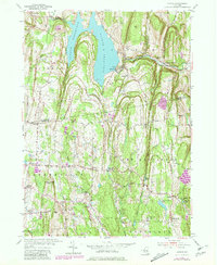
USGS Historical Quadrangle in GeoPDF.
|

|
