|
|
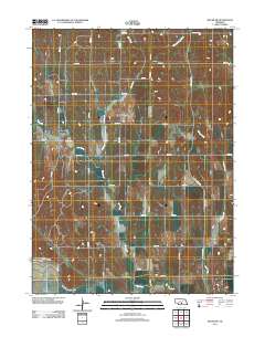
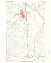
Layered GeoPDF 7.5 Minute Quadrangle Map. Layers of geospatial data include orthoimagery, roads, grids, geographic names, elevation contours, hydrography, and other selected map features.
Tags: 7.5 x 7.5 minute,
Buffalo,
Dawson,
Downloadable Data,
EarthCover, All tags...
GeoPDF,
Imagery and Base Maps,
Map,
Miller SW, NE,
Nebraska,
U.S. National Grid,
US,
US Topo,
US Topo Historical,
United States,
contour,
geographic names,
hydrography,
imageryBaseMapsEarthCover,
orthoimage,
structures,
topographic,
transportation, Fewer tags
The Geographic Names Information System (GNIS) is the Federal standard for geographic nomenclature. The U.S. Geological Survey developed the GNIS for the U.S. Board on Geographic Names, a Federal inter-agency body chartered by public law to maintain uniform feature name usage throughout the Government and to promulgate standard names to the public. The GNIS is the official repository of domestic geographic names data; the official vehicle for geographic names use by all departments of the Federal Government; and the source for applying geographic names to Federal electronic and printed products of all types.
Tags: Antarctica,
Antarctica,
Aurora,
BGN,
Beadle, All tags...
Bennett,
Board on Geographic Names,
Bon Homme,
Borough,
Brookings,
Brown,
Brule,
Buffalo,
Butte,
Campbell,
Census Area,
Charles Mix,
Clark,
Clay,
Codington,
Commonwealth,
Corson,
County,
Custer,
Davison,
Day,
Deuel,
Dewey,
District,
Douglas,
Downloadable Data,
Edmunds,
Fall River,
Faulk,
Feature class,
Feature coordinates,
Feature county,
Feature description,
Feature designation,
Feature history,
Feature indentification,
Feature name,
Feature state,
GNIS,
Geographic Names,
Geographic Names Domestic Names,
Geographic Names Information System,
Geographic feature,
Geographic name,
Geographical feature,
Geographical name,
Grant,
Gregory,
Haakon,
Hamlin,
Hand,
Hanson,
Harding,
Hughes,
Hutchinson,
Hyde,
Jackson,
Jerauld,
Jones,
Kingsbury,
Lake,
Lawrence,
Lincoln,
Lyman,
Marshall,
McCook,
McPherson,
Meade,
Mellette,
Miner,
Minnehaha,
Moody,
Municipio,
National Geographic Names Information System (GNIS),
National Geographic Names Information System (GNIS),
Official feature name,
Oglala Lakota,
Outlying Area,
Parish,
Pennington,
Perkins,
Place name,
Populated Place,
Potter,
Roberts,
SD,
Sanborn,
South Dakota,
Spink,
Stanley,
State,
Sully,
TXT (pipes),
Territories,
Territory,
Todd,
Topographic Map,
Tripp,
Turner,
U.S. Board on Geographic Names,
U.S. Geological Survey,
US,
USA,
USBGN,
USGS,
UTF-8 Pipe Delimited Text File nan,
Union,
United States,
United States,
United States,
Variant name,
Walworth,
Yankton,
Ziebach,
antarctic,
database,
economy,
environment,
feature,
gazetteer,
geographic,
geographic names,
geographical,
geography,
geospatial,
imageryBaseMapsEarthCover,
inlandWaters,
location,
map,
name,
place,
placename,
society,
structure,
topographic map,
toponymy, Fewer tags

This Sediment Analysis dataset, a conceptual subgroup of the Lake Erie Ecological Investigations (LEEI) dataset, focuses on the sediments sampled at Areas of Concern (AOCs) on Lake Erie. Per the Quality Assurance Project Plan (QAPP), sediment collections were a composite of at least five randomly selected samples collected from each site. Per an internal summary report, sediment samples were collected using a stainless steel Eckman dredge. Analytical methods and QA/QC were directed by the Patuxent Analytical Control Facility (PACF) of the US Fish and Wildlife Service. Per Dora Passino-Reader, the Geochemical & Environmental Research Group at Texas A&M University, College Station performed the analytical chemistry...
Categories: Data;
Tags: AOCs,
Ameiurus nebulosus,
Ashtabula,
Ashtabula River,
Black River, All tags...
Black River,
Buffalo,
Buffalo River,
Cleveland Harbor,
Cleveland Harbor,
Cuyahoga River,
Cuyahoga River,
Detroit,
Detroit River,
Detroit River,
Great Lakes,
Great Lakes,
Great Lakes,
Great Lakes Areas of Concern,
Huron River,
Lake Erie,
Lake Erie,
Lake Erie,
Lake or marine sediment,
Love Canal (historical),
Maumee River,
Michigan,
Michigan,
Mud Brook,
Mud Brook,
New York,
New York,
Niagara River,
Niagara River,
Ohio,
Ohio,
Old River,
Old Woman Creek,
Old Woman Creek,
Ottawa River,
PAHs,
PCBs,
Pennsylvania,
Pennsylvania,
Presque Isle Bay,
Presque Isle Bay,
aquatic ecosystems,
benthos,
benthos,
biomarkers,
biota,
brown bullhead,
contamination and pollution,
datasets,
ecotoxicology,
environment,
field sampling,
fish,
fish,
freshwater ecosystems,
heavy metal pollution,
histology,
industrial pollution,
inlandWaters,
invertebrates,
invertebrates,
liver tumors,
metal elements,
pathology,
pesticide and herbicide contamination,
plant and animal testing,
polyaromatic hydrocarbons,
polychlorinated biphenyls,
population and community ecology,
remediation,
sediment,
sediment analysis,
species diversity,
specimen collecting,
toxic trace element contamination,
water resources, Fewer tags
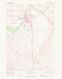
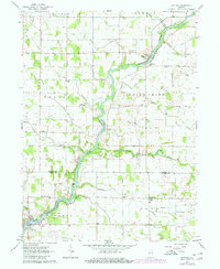
USGS Historical Quadrangle in GeoPDF.
Tags: 30 x 60 minute,
Buffalo,
Downloadable Data,
GeoPDF,
GeoTIFF, All tags...
Historical Topographic Maps,
Historical Topographic Maps 30 x 60 Minute Map Series,
Map,
OK,
Planimetric,
imageryBaseMapsEarthCover, Fewer tags

USGS Historical Quadrangle in GeoPDF.
Tags: 30 x 30 minute,
Buffalo,
Downloadable Data,
GeoPDF,
GeoTIFF, All tags...
Historical Topographic Maps,
Historical Topographic Maps 30 x 30 Minute Map Series,
Map,
SD,
imageryBaseMapsEarthCover, Fewer tags
USGS Historical Quadrangle in GeoPDF.
Tags: 7.5 x 7.5 minute,
Buffalo,
Downloadable Data,
GeoPDF,
GeoTIFF, All tags...
Historical Topographic Maps,
Historical Topographic Maps 7.5 x 7.5 Minute Map Series,
Map,
WY,
imageryBaseMapsEarthCover, Fewer tags
USGS Historical Quadrangle in GeoPDF.
Tags: 7.5 x 7.5 minute,
Buffalo,
Downloadable Data,
GeoPDF,
GeoTIFF, All tags...
Historical Topographic Maps,
Historical Topographic Maps 7.5 x 7.5 Minute Map Series,
Map,
WY,
imageryBaseMapsEarthCover, Fewer tags
USGS Historical Quadrangle in GeoPDF.
Tags: 7.5 x 7.5 minute,
Buffalo,
Downloadable Data,
GeoPDF,
GeoTIFF, All tags...
Historical Topographic Maps,
Historical Topographic Maps 7.5 x 7.5 Minute Map Series,
IN,
Map,
imageryBaseMapsEarthCover, Fewer tags
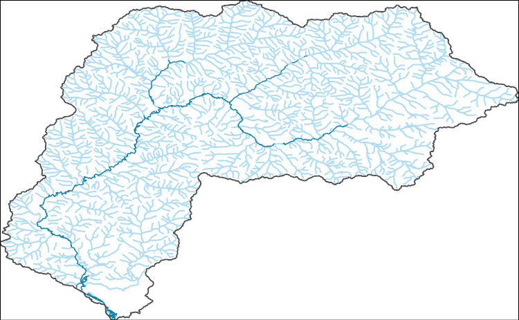
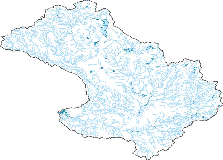
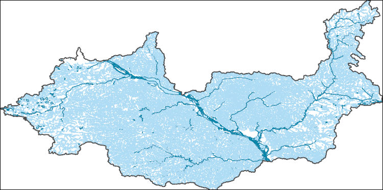
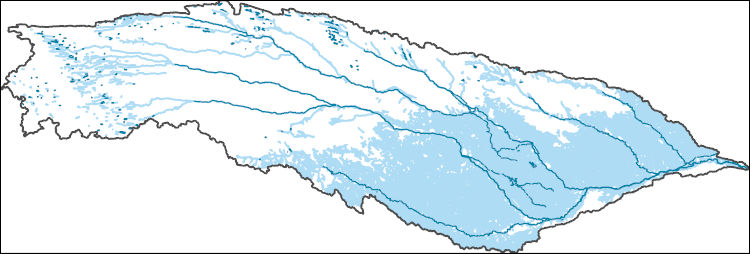
The National Hydrography Dataset (NHD) is a feature-based database that interconnects and uniquely identifies the stream segments or reaches that make up the nation's surface water drainage system. NHD data was originally developed at 1:100,000-scale and exists at that scale for the whole country. This high-resolution NHD, generally developed at 1:24,000/1:12,000 scale, adds detail to the original 1:100,000-scale NHD. (Data for Alaska, Puerto Rico and the Virgin Islands was developed at high-resolution, not 1:100,000 scale.) Local resolution NHD is being developed where partners and data exist. The NHD contains reach codes for networked features, flow direction, names, and centerline representations for areal water...
Tags: Administrative watershed units,
Administrative watershed units,
Area of Complex Channels,
Area to be submerged,
Basin, All tags...
Basin,
Bay/Inlet,
Boundaries,
Boundary,
Bridge,
Buffalo,
Canal/Ditch,
Coastline,
Connector,
Dam/Weir,
Downloadable Data,
Drainage areas for surface water,
Drainageway,
Estuary,
Flow direction network,
Flume,
ForeShore,
Gaging Station,
Gate,
GeoPackage,
HU-8,
HU-8 Subbasin,
HU10,
HU12,
HU14,
HU16,
HU2,
HU4,
HU6,
HU8,
HU8_07040005,
HUC,
Hazard Zone,
Hydrographic,
Hydrography,
Hydrography,
Hydrography,
Hydrologic Unit Code,
Hydrologic Units,
Ice mass,
Inundation Area,
Jackson,
Levee,
Line,
Lock Chamber,
Marsh,
National Hydrography Dataset (NHD),
National Hydrography Dataset (NHD) Best Resolution,
National Hydrography Dataset (NHD) Best Resolution,
Nonearthen Shore,
Open Geospatial Consortium GeoPackage 1.2,
Orthoimage,
Playa,
Point,
PointEvent,
Pond,
Rapids,
Rapids,
Reach,
Reach code,
Reef,
Region,
Reservoir,
Rock,
Sea/Ocean,
Sink/Rise,
Sounding Datum Line,
Special Use Zone,
Special Use Zone Limit,
Spillway,
Stream,
Stream/River,
Sub-basin,
Sub-region,
Subbasin,
Submerged Stream,
Subregion,
Subwatershed,
Surface water systems,
Swamp,
Topographic,
Trempealeau,
Tunnel,
US,
Underground Conduit,
United States,
WBD,
WBD,
WI,
Wall,
Wash,
Water Intake Outflow,
Waterfall,
Watershed,
Watershed Boundaries,
Watershed Boundary Dataset,
Watershed Boundary Dataset,
Well,
Wisconsin,
artificial path,
boundaries,
dams,
drainage systems and characteristics,
inlandWaters,
lakes,
ngda,
rivers, Fewer tags
The National Hydrography Dataset (NHD) is a feature-based database that interconnects and uniquely identifies the stream segments or reaches that make up the nation's surface water drainage system. NHD data was originally developed at 1:100,000-scale and exists at that scale for the whole country. This high-resolution NHD, generally developed at 1:24,000/1:12,000 scale, adds detail to the original 1:100,000-scale NHD. (Data for Alaska, Puerto Rico and the Virgin Islands was developed at high-resolution, not 1:100,000 scale.) Local resolution NHD is being developed where partners and data exist. The NHD contains reach codes for networked features, flow direction, names, and centerline representations for areal water...
Tags: Administrative watershed units,
Administrative watershed units,
Area of Complex Channels,
Area to be submerged,
Aurora, All tags...
Basin,
Basin,
Bay/Inlet,
Beadle,
Boundaries,
Boundary,
Bridge,
Brule,
Buffalo,
Canal/Ditch,
Coastline,
Connector,
Dam/Weir,
Downloadable Data,
Drainage areas for surface water,
Drainageway,
Esri Shapefile nan,
Estuary,
Flow direction network,
Flume,
ForeShore,
Gaging Station,
Gate,
HU-8,
HU-8 Subbasin,
HU10,
HU12,
HU14,
HU16,
HU2,
HU4,
HU6,
HU8,
HU8_10140105,
HUC,
Hand,
Hazard Zone,
Hyde,
Hydrographic,
Hydrography,
Hydrography,
Hydrography,
Hydrologic Unit Code,
Hydrologic Units,
Ice mass,
Inundation Area,
Jerauld,
Levee,
Line,
Lock Chamber,
Marsh,
National Hydrography Dataset (NHD),
National Hydrography Dataset (NHD) Best Resolution,
National Hydrography Dataset (NHD) Best Resolution,
Nonearthen Shore,
Orthoimage,
Playa,
Point,
PointEvent,
Pond,
Rapids,
Rapids,
Reach,
Reach code,
Reef,
Region,
Reservoir,
Rock,
SD,
Sea/Ocean,
Shapefile,
Sink/Rise,
Sounding Datum Line,
South Dakota,
Special Use Zone,
Special Use Zone Limit,
Spillway,
Stream,
Stream/River,
Sub-basin,
Sub-region,
Subbasin,
Submerged Stream,
Subregion,
Subwatershed,
Surface water systems,
Swamp,
Topographic,
Tunnel,
US,
Underground Conduit,
United States,
WBD,
WBD,
Wall,
Wash,
Water Intake Outflow,
Waterfall,
Watershed,
Watershed Boundaries,
Watershed Boundary Dataset,
Watershed Boundary Dataset,
Well,
artificial path,
boundaries,
dams,
drainage systems and characteristics,
inlandWaters,
lakes,
ngda,
rivers, Fewer tags

The National Hydrography Dataset (NHD) is a feature-based database that interconnects and uniquely identifies the stream segments or reaches that make up the nation's surface water drainage system. NHD data was originally developed at 1:100,000-scale and exists at that scale for the whole country. This high-resolution NHD, generally developed at 1:24,000/1:12,000 scale, adds detail to the original 1:100,000-scale NHD. (Data for Alaska, Puerto Rico and the Virgin Islands was developed at high-resolution, not 1:100,000 scale.) Local resolution NHD is being developed where partners and data exist. The NHD contains reach codes for networked features, flow direction, names, and centerline representations for areal water...
Tags: Administrative watershed units,
Administrative watershed units,
Area of Complex Channels,
Area to be submerged,
Basin, All tags...
Basin,
Bay/Inlet,
Boundaries,
Boundary,
Bridge,
Buffalo,
Canal/Ditch,
Coastline,
Connector,
Custer,
Dam/Weir,
Downloadable Data,
Drainage areas for surface water,
Drainageway,
Esri File GeoDatabase 10,
Estuary,
FileGDB,
Flow direction network,
Flume,
ForeShore,
Gaging Station,
Gate,
HU-8,
HU-8 Subbasin,
HU10,
HU12,
HU14,
HU16,
HU2,
HU4,
HU6,
HU8,
HU8_10210005,
HUC,
Hazard Zone,
Hydrographic,
Hydrography,
Hydrography,
Hydrography,
Hydrologic Unit Code,
Hydrologic Units,
Ice mass,
Inundation Area,
Levee,
Line,
Lock Chamber,
Marsh,
NE,
National Hydrography Dataset (NHD),
National Hydrography Dataset (NHD) Best Resolution,
National Hydrography Dataset (NHD) Best Resolution,
Nebraska,
Nonearthen Shore,
Orthoimage,
Playa,
Point,
PointEvent,
Pond,
Rapids,
Rapids,
Reach,
Reach code,
Reef,
Region,
Reservoir,
Rock,
Sea/Ocean,
Sherman,
Sink/Rise,
Sounding Datum Line,
Special Use Zone,
Special Use Zone Limit,
Spillway,
Stream,
Stream/River,
Sub-basin,
Sub-region,
Subbasin,
Submerged Stream,
Subregion,
Subwatershed,
Surface water systems,
Swamp,
Topographic,
Tunnel,
US,
Underground Conduit,
United States,
WBD,
WBD,
Wall,
Wash,
Water Intake Outflow,
Waterfall,
Watershed,
Watershed Boundaries,
Watershed Boundary Dataset,
Watershed Boundary Dataset,
Well,
artificial path,
boundaries,
dams,
drainage systems and characteristics,
inlandWaters,
lakes,
ngda,
rivers, Fewer tags
The National Hydrography Dataset (NHD) is a feature-based database that interconnects and uniquely identifies the stream segments or reaches that make up the nation's surface water drainage system. NHD data was originally developed at 1:100,000-scale and exists at that scale for the whole country. This high-resolution NHD, generally developed at 1:24,000/1:12,000 scale, adds detail to the original 1:100,000-scale NHD. (Data for Alaska, Puerto Rico and the Virgin Islands was developed at high-resolution, not 1:100,000 scale.) Local resolution NHD is being developed where partners and data exist. The NHD contains reach codes for networked features, flow direction, names, and centerline representations for areal water...
Tags: Administrative watershed units,
Administrative watershed units,
Area of Complex Channels,
Area to be submerged,
Basin, All tags...
Basin,
Bay/Inlet,
Blue Earth,
Boundaries,
Boundary,
Bridge,
Buffalo,
Canal/Ditch,
Clark,
Coastline,
Connector,
Dakota,
Dam/Weir,
Dodge,
Downloadable Data,
Drainage areas for surface water,
Drainageway,
Eau Claire,
Esri File GeoDatabase 10,
Estuary,
FileGDB,
Fillmore,
Flow direction network,
Flume,
ForeShore,
Freeborn,
Gaging Station,
Gate,
Goodhue,
HU-4,
HU-4 Subregion,
HU10,
HU12,
HU14,
HU16,
HU2,
HU4,
HU4_0704,
HU6,
HU8,
HUC,
Hazard Zone,
Houston,
Hydrographic,
Hydrography,
Hydrography,
Hydrography,
Hydrologic Unit Code,
Hydrologic Units,
IA,
Ice mass,
Inundation Area,
Iowa,
Jackson,
La Crosse,
Le Sueur,
Levee,
Line,
Lock Chamber,
MN,
Marathon,
Marsh,
Minnesota,
Monroe,
Mower,
National Hydrography Dataset (NHD),
National Hydrography Dataset (NHD) Best Resolution,
National Hydrography Dataset (NHD) Best Resolution,
Nonearthen Shore,
Olmsted,
Orthoimage,
Pepin,
Pierce,
Playa,
Point,
PointEvent,
Pond,
Rapids,
Rapids,
Reach,
Reach code,
Reef,
Region,
Reservoir,
Rice,
Rock,
Scott,
Sea/Ocean,
Sink/Rise,
Sounding Datum Line,
Special Use Zone,
Special Use Zone Limit,
Spillway,
St. Croix,
Steele,
Stream,
Stream/River,
Sub-basin,
Sub-region,
Subbasin,
Submerged Stream,
Subregion,
Subwatershed,
Surface water systems,
Swamp,
Taylor,
Topographic,
Trempealeau,
Tunnel,
US,
Underground Conduit,
United States,
WBD,
WBD,
WI,
Wabasha,
Wall,
Waseca,
Wash,
Washington,
Water Intake Outflow,
Waterfall,
Watershed,
Watershed Boundaries,
Watershed Boundary Dataset,
Watershed Boundary Dataset,
Well,
Winneshiek,
Winona,
Wisconsin,
Wood,
artificial path,
boundaries,
dams,
drainage systems and characteristics,
inlandWaters,
lakes,
ngda,
rivers, Fewer tags
The National Hydrography Dataset (NHD) is a feature-based database that interconnects and uniquely identifies the stream segments or reaches that make up the nation's surface water drainage system. NHD data was originally developed at 1:100,000-scale and exists at that scale for the whole country. This high-resolution NHD, generally developed at 1:24,000/1:12,000 scale, adds detail to the original 1:100,000-scale NHD. (Data for Alaska, Puerto Rico and the Virgin Islands was developed at high-resolution, not 1:100,000 scale.) Local resolution NHD is being developed where partners and data exist. The NHD contains reach codes for networked features, flow direction, names, and centerline representations for areal water...
Tags: Administrative watershed units,
Administrative watershed units,
Antelope,
Area of Complex Channels,
Area to be submerged, All tags...
Arthur,
Basin,
Basin,
Bay/Inlet,
Blaine,
Boone,
Boundaries,
Boundary,
Bridge,
Brown,
Buffalo,
Canal/Ditch,
Cherry,
Coastline,
Connector,
Custer,
Dam/Weir,
Dawson,
Downloadable Data,
Drainage areas for surface water,
Drainageway,
Esri File GeoDatabase 10,
Estuary,
FileGDB,
Flow direction network,
Flume,
ForeShore,
Gaging Station,
Garden,
Garfield,
Gate,
Grant,
Greeley,
HU-4,
HU-4 Subregion,
HU10,
HU12,
HU14,
HU16,
HU2,
HU4,
HU4_1021,
HU6,
HU8,
HUC,
Hall,
Hazard Zone,
Holt,
Hooker,
Howard,
Hydrographic,
Hydrography,
Hydrography,
Hydrography,
Hydrologic Unit Code,
Hydrologic Units,
Ice mass,
Inundation Area,
Levee,
Lincoln,
Line,
Lock Chamber,
Logan,
Loup,
Marsh,
McPherson,
Merrick,
NE,
Nance,
National Hydrography Dataset (NHD),
National Hydrography Dataset (NHD) Best Resolution,
National Hydrography Dataset (NHD) Best Resolution,
Nebraska,
Nonearthen Shore,
Orthoimage,
Platte,
Playa,
Point,
PointEvent,
Pond,
Rapids,
Rapids,
Reach,
Reach code,
Reef,
Region,
Reservoir,
Rock,
Rock,
Sea/Ocean,
Sheridan,
Sherman,
Sink/Rise,
Sounding Datum Line,
Special Use Zone,
Special Use Zone Limit,
Spillway,
Stream,
Stream/River,
Sub-basin,
Sub-region,
Subbasin,
Submerged Stream,
Subregion,
Subwatershed,
Surface water systems,
Swamp,
Thomas,
Topographic,
Tunnel,
US,
Underground Conduit,
United States,
Valley,
WBD,
WBD,
Wall,
Wash,
Water Intake Outflow,
Waterfall,
Watershed,
Watershed Boundaries,
Watershed Boundary Dataset,
Watershed Boundary Dataset,
Well,
Wheeler,
artificial path,
boundaries,
dams,
drainage systems and characteristics,
inlandWaters,
lakes,
ngda,
rivers, Fewer tags
The Watershed Boundary Dataset (WBD) is a comprehensive aggregated collection of hydrologic unit data consistent with the national criteria for delineation and resolution. It defines the areal extent of surface water drainage to a point except in coastal or lake front areas where there could be multiple outlets as stated by the "Federal Standards and Procedures for the National Watershed Boundary Dataset (WBD)" "Standard" (https://pubs.usgs.gov/tm/11/a3/). Watershed boundaries are determined solely upon science-based hydrologic principles, not favoring any administrative boundaries or special projects, nor particular program or agency. This dataset represents the hydrologic unit boundaries to the 12-digit (6th level)...
Tags: 10-digit,
12-digit,
14-digit,
16-digit,
2-digit, All tags...
4-digit,
6-digit,
8-digit,
Adair,
Adams,
Albany,
Allen,
Anderson,
Andrew,
Antelope,
Appanoose,
Arapahoe,
Arthur,
Atchison,
Audrain,
Audubon,
Aurora,
Banner,
Barnes,
Barton,
Basin,
Bates,
Beadle,
Beaverhead,
Bennett,
Benton,
Big Horn,
Billings,
Blaine,
Bon Homme,
Boone,
Boulder,
Bourbon,
Bowman,
Box Butte,
Boyd,
Broadwater,
Brookings,
Broomfield,
Brown,
Brule,
Buchanan,
Buena Vista,
Buffalo,
Burke,
Burleigh,
Burt,
Butler,
Butte,
CO,
Caldwell,
Callaway,
Camden,
Campbell,
Carbon,
Carroll,
Carter,
Cascade,
Cass,
Cedar,
Chaffee,
Chariton,
Charles Mix,
Chase,
Cherokee,
Cherry,
Cheyenne,
Chouteau,
Christian,
Clark,
Clarke,
Clay,
Clear Creek,
Clinton,
Cloud,
Codington,
Coffey,
Cole,
Colfax,
Colorado,
Converse,
Cooper,
Corson,
Crawford,
Crook,
Cuming,
Custer,
Dade,
Dakota,
Dallas,
Daniels,
Daviess,
Davis,
Davison,
Dawes,
Dawson,
Day,
DeKalb,
Decatur,
Deer Lodge,
Dent,
Denver,
Deuel,
Dewey,
Dickey,
Dickinson,
Divide,
Dixon,
Dodge,
Doniphan,
Douglas,
Downloadable Data,
Dundy,
Dunn,
Eddy,
Edmunds,
El Paso,
Elbert,
Ellis,
Ellsworth,
Emmet,
Emmons,
Esri File GeoDatabase 10,
Fall River,
Fallon,
Faulk,
Fergus,
FileGDB,
Fillmore,
Flathead,
Foster,
Franklin,
Fremont,
Frontier,
Furnas,
Gage,
Gallatin,
Garden,
Garfield,
Gasconade,
Geary,
Gentry,
Gilpin,
Glacier,
Golden Valley,
Goshen,
Gosper,
Gove,
Graham,
Grand,
Granite,
Grant,
Greeley,
Greene,
Gregory,
Grundy,
Guthrie,
HU-2,
HU-2 Region,
HU2_10,
HUC,
Haakon,
Hall,
Hamilton,
Hamlin,
Hand,
Hanson,
Harding,
Harlan,
Harrison,
Hayes,
Henry,
Hettinger,
Hickory,
Hill,
Hitchcock,
Holt,
Hooker,
Hot Springs,
Howard,
Howell,
Hughes,
Hutchinson,
Hyde,
Hydrography,
Hydrologic Unit Code,
Hydrologic Units,
IA,
ID,
Ida,
Idaho,
Iowa,
Jackson,
Jefferson,
Jerauld,
Jewell,
Johnson,
Jones,
Judith Basin,
KS,
Kansas,
Kearney,
Keith,
Keya Paha,
Kidder,
Kimball,
Kingsbury,
Kit Carson,
Knox,
LaMoure,
Laclede,
Lafayette,
Lake,
Lancaster,
Lane,
Laramie,
Larimer,
Lawrence,
Leavenworth,
Lemhi,
Lewis and Clark,
Liberty,
Lincoln,
Linn,
Livingston,
Logan,
Loup,
Lucas,
Lyman,
Lyon,
MN,
MO,
MT,
Macon,
Madison,
Maries,
Marion,
Marshall,
McCone,
McCook,
McHenry,
McIntosh,
McKenzie,
McLean,
McPherson,
Meade,
Meagher,
Mellette,
Mercer,
Merrick,
Miami,
Miller,
Mills,
Miner,
Minnehaha,
Minnesota,
Missouri,
Mitchell,
Moniteau,
Monona,
Monroe,
Montana,
Montgomery,
Moody,
Morgan,
Morrill,
Morris,
Morton,
Mountrail,
Murray,
Musselshell,
ND,
NE,
Nance,
National Watershed Boundary Dataset (WBD),
National Watershed Boundary Dataset (WBD),
Natrona,
Nebraska,
Nemaha,
Ness,
Niobrara,
Nobles,
Nodaway,
North Dakota,
Norton,
Nuckolls,
O'Brien,
Oglala Lakota,
Oliver,
Osage,
Osborne,
Osceola,
Otoe,
Ottawa,
Page,
Palo Alto,
Park,
Pawnee,
Pennington,
Perkins,
Petroleum,
Pettis,
Phelps,
Phillips,
Pierce,
Pipestone,
Platte,
Plymouth,
Polk,
Pondera,
Pottawatomie,
Pottawattamie,
Potter,
Powder River,
Powell,
Prairie,
Pulaski,
Putnam,
Randolph,
Ransom,
Ravalli,
Rawlins,
Ray,
Red Willow,
Region,
Republic,
Rice,
Richardson,
Richland,
Riley,
Ringgold,
Roberts,
Rock,
Rooks,
Roosevelt,
Rosebud,
Routt,
Rush,
Russell,
SD,
Sac,
Saline,
Sanborn,
Sargent,
Sarpy,
Saunders,
Schuyler,
Scott,
Scotts Bluff,
Sedgwick,
Seward,
Shawnee,
Shelby,
Sheridan,
Sherman,
Silver Bow,
Sioux,
Slope,
Smith,
South Dakota,
Spink,
St. Charles,
St. Clair,
St. Louis,
Stanley,
Stanton,
Stark,
Stillwater,
Stutsman,
Sub-basin,
Sub-region,
Sublette,
Subwatershed,
Sullivan,
Sully,
Summit,
Sweet Grass,
Sweetwater,
Taylor,
Teller,
Teton,
Texas,
Thayer,
Thomas,
Thurston,
Todd,
Toole,
Treasure,
Trego,
Tripp,
Turner,
US,
Union,
United States,
Valley,
Vernon,
WBD,
WY,
Wabaunsee,
Wallace,
Walworth,
Ward,
Warren,
Washakie,
Washington,
Watershed,
Watershed Boundary Dataset,
Wayne,
Webster,
Weld,
Wells,
Weston,
Wheatland,
Wheeler,
Wibaux,
Wichita,
Williams,
Woodbury,
Worth,
Wright,
Wyandotte,
Wyoming,
Yankton,
Yellowstone,
York,
Yuma,
Ziebach,
inlandWaters, Fewer tags
Geospatial data includes structures and other selected map features.
Tags: Aurora,
Beadle,
Bennett,
Bon Homme,
Brookings, All tags...
Brown,
Brule,
Buffalo,
Butte,
Campbell,
Campground,
Charles Mix,
Clark,
Clay,
Codington,
College / University,
Corson,
Courthouse,
Custer,
Davison,
Day,
Deuel,
Dewey,
Douglas,
Downloadable Data,
Edmunds,
Esri Shapefile nan,
Fall River,
Faulk,
Fire Station/ EMS Station,
Grant,
Gregory,
Haakon,
Hamlin,
Hand,
Hanson,
Harding,
Hospital/Medical Center,
Hughes,
Hutchinson,
Hyde,
Information Center,
Jackson,
Jerauld,
Jones,
Kingsbury,
Lake,
Law Enforcement,
Lawrence,
Lincoln,
Lyman,
Marshall,
McCook,
McPherson,
Meade,
Mellette,
Miner,
Minnehaha,
Moody,
National Structures Dataset (NSD),
National Structures Dataset (NSD),
Oglala Lakota,
Pennington,
Perkins,
Post Office,
Potter,
Prison/ Correctional Facility,
Roberts,
SD,
Sanborn,
School,
School:Elementary,
School:High School,
School:Middle School,
Shapefile,
South Dakota,
Spink,
Stanley,
State,
State,
State Capitol,
Structures,
Sully,
Technical School,
Todd,
Town Hall,
Trade School,
Trailhead,
Tripp,
Turner,
US,
Union,
United States,
Visitor Center,
Walworth,
Yankton,
Ziebach,
structure, Fewer tags
Geospatial data includes structures and other selected map features.
Tags: Adams,
Ashland,
Barron,
Bayfield,
Brown, All tags...
Buffalo,
Burnett,
Calumet,
Campground,
Chippewa,
Clark,
College / University,
Columbia,
Courthouse,
Crawford,
Dane,
Dodge,
Door,
Douglas,
Downloadable Data,
Dunn,
Eau Claire,
Esri File GeoDatabase 10,
FileGDB,
Fire Station/ EMS Station,
Florence,
Fond du Lac,
Forest,
Grant,
Green,
Green Lake,
Hospital/Medical Center,
Information Center,
Iowa,
Iron,
Jackson,
Jefferson,
Juneau,
Kenosha,
Kewaunee,
La Crosse,
Lafayette,
Langlade,
Law Enforcement,
Lincoln,
Manitowoc,
Marathon,
Marinette,
Marquette,
Menominee,
Milwaukee,
Monroe,
National Structures Dataset (NSD),
National Structures Dataset (NSD),
Oconto,
Oneida,
Outagamie,
Ozaukee,
Pepin,
Pierce,
Polk,
Portage,
Post Office,
Price,
Prison/ Correctional Facility,
Racine,
Richland,
Rock,
Rusk,
Sauk,
Sawyer,
School,
School:Elementary,
School:High School,
School:Middle School,
Shawano,
Sheboygan,
St. Croix,
State,
State,
State Capitol,
Structures,
Taylor,
Technical School,
Town Hall,
Trade School,
Trailhead,
Trempealeau,
US,
United States,
Vernon,
Vilas,
Visitor Center,
WI,
Walworth,
Washburn,
Washington,
Waukesha,
Waupaca,
Waushara,
Winnebago,
Wisconsin,
Wood,
structure, Fewer tags
Geospatial data includes structures and other selected map features.
Tags: Adams,
Antelope,
Arthur,
Banner,
Blaine, All tags...
Boone,
Box Butte,
Boyd,
Brown,
Buffalo,
Burt,
Butler,
Campground,
Cass,
Cedar,
Chase,
Cherry,
Cheyenne,
Clay,
Colfax,
College / University,
Courthouse,
Cuming,
Custer,
Dakota,
Dawes,
Dawson,
Deuel,
Dixon,
Dodge,
Douglas,
Downloadable Data,
Dundy,
Fillmore,
Fire Station/ EMS Station,
Franklin,
Frontier,
Furnas,
Gage,
Garden,
Garfield,
GeoPackage,
Gosper,
Grant,
Greeley,
Hall,
Hamilton,
Harlan,
Hayes,
Hitchcock,
Holt,
Hooker,
Hospital/Medical Center,
Howard,
Information Center,
Jefferson,
Johnson,
Kearney,
Keith,
Keya Paha,
Kimball,
Knox,
Lancaster,
Law Enforcement,
Lincoln,
Logan,
Loup,
Madison,
McPherson,
Merrick,
Morrill,
NE,
Nance,
National Structures Dataset (NSD),
National Structures Dataset (NSD),
Nebraska,
Nemaha,
Nuckolls,
Open Geospatial Consortium GeoPackage 1.2,
Otoe,
Pawnee,
Perkins,
Phelps,
Pierce,
Platte,
Polk,
Post Office,
Prison/ Correctional Facility,
Red Willow,
Richardson,
Rock,
Saline,
Sarpy,
Saunders,
School,
School:Elementary,
School:High School,
School:Middle School,
Scotts Bluff,
Seward,
Sheridan,
Sherman,
Sioux,
Stanton,
State,
State,
State Capitol,
Structures,
Technical School,
Thayer,
Thomas,
Thurston,
Town Hall,
Trade School,
Trailhead,
US,
United States,
Valley,
Visitor Center,
Washington,
Wayne,
Webster,
Wheeler,
York,
structure, Fewer tags
Geospatial data is comprised of government boundaries.
Tags: Aurora,
Beadle,
Bennett,
Bon Homme,
Boundaries, All tags...
Brookings,
Brown,
Brule,
Buffalo,
Butte,
Campbell,
Charles Mix,
Clark,
Clay,
Codington,
Corson,
County or Equivalent,
Custer,
Davison,
Day,
Deuel,
Dewey,
Douglas,
Downloadable Data,
Edmunds,
Fall River,
Faulk,
GeoPackage,
Grant,
Gregory,
Haakon,
Hamlin,
Hand,
Hanson,
Harding,
Hughes,
Hutchinson,
Hyde,
Incorporated Place,
Jackson,
Jerauld,
Jones,
Jurisdictional,
Kingsbury,
Lake,
Lawrence,
Lincoln,
Lyman,
Marshall,
McCook,
McPherson,
Meade,
Mellette,
Miner,
Minnehaha,
Minor Civil Division,
Moody,
National Boundary Dataset (NBD),
National Boundary Dataset (NBD),
Native American Area,
Oglala Lakota,
Open Geospatial Consortium GeoPackage 1.2,
PLSS First Division,
PLSS Special Survey,
PLSS Township,
Pennington,
Perkins,
Potter,
Public Land Survey System,
Reserve,
Roberts,
SD,
Sanborn,
South Dakota,
Spink,
Stanley,
State,
State,
State or Territory,
Sully,
Todd,
Tripp,
Turner,
U.S. National Grid,
US,
Unincorporated Place,
Union,
United States,
Walworth,
Yankton,
Ziebach,
boundaries,
boundary,
cadastral surveys,
geographic names,
land ownership,
land use maps,
legal land descriptions,
political and administrative boundaries,
zoning maps, Fewer tags
Geospatial data is comprised of government boundaries.
Tags: Adams,
Ashland,
Barron,
Bayfield,
Boundaries, All tags...
Brown,
Buffalo,
Burnett,
Calumet,
Chippewa,
Clark,
Columbia,
County or Equivalent,
Crawford,
Dane,
Dodge,
Door,
Douglas,
Downloadable Data,
Dunn,
Eau Claire,
Esri Shapefile nan,
Florence,
Fond du Lac,
Forest,
Grant,
Green,
Green Lake,
Incorporated Place,
Iowa,
Iron,
Jackson,
Jefferson,
Juneau,
Jurisdictional,
Kenosha,
Kewaunee,
La Crosse,
Lafayette,
Langlade,
Lincoln,
Manitowoc,
Marathon,
Marinette,
Marquette,
Menominee,
Milwaukee,
Minor Civil Division,
Monroe,
National Boundary Dataset (NBD),
National Boundary Dataset (NBD),
Native American Area,
Oconto,
Oneida,
Outagamie,
Ozaukee,
PLSS First Division,
PLSS Special Survey,
PLSS Township,
Pepin,
Pierce,
Polk,
Portage,
Price,
Public Land Survey System,
Racine,
Reserve,
Richland,
Rock,
Rusk,
Sauk,
Sawyer,
Shapefile,
Shawano,
Sheboygan,
St. Croix,
State,
State,
State or Territory,
Taylor,
Trempealeau,
U.S. National Grid,
US,
Unincorporated Place,
United States,
Vernon,
Vilas,
WI,
Walworth,
Washburn,
Washington,
Waukesha,
Waupaca,
Waushara,
Winnebago,
Wisconsin,
Wood,
boundaries,
boundary,
cadastral surveys,
geographic names,
land ownership,
land use maps,
legal land descriptions,
political and administrative boundaries,
zoning maps, Fewer tags
The Geographic Names Information System (GNIS) is the Federal standard for geographic nomenclature. The U.S. Geological Survey developed the GNIS for the U.S. Board on Geographic Names, a Federal inter-agency body chartered by public law to maintain uniform feature name usage throughout the Government and to promulgate standard names to the public. The GNIS is the official repository of domestic geographic names data; the official vehicle for geographic names use by all departments of the Federal Government; and the source for applying geographic names to Federal electronic and printed products of all types.
Tags: Adams,
Antarctica,
Antarctica,
Antelope,
Arthur, All tags...
BGN,
Banner,
Blaine,
Board on Geographic Names,
Boone,
Borough,
Box Butte,
Boyd,
Brown,
Buffalo,
Burt,
Butler,
Cass,
Cedar,
Census Area,
Chase,
Cherry,
Cheyenne,
Clay,
Colfax,
Commonwealth,
County,
Cuming,
Custer,
Dakota,
Dawes,
Dawson,
Deuel,
District,
Dixon,
Dodge,
Douglas,
Downloadable Data,
Dundy,
Esri File GeoDatabase 10,
Feature class,
Feature coordinates,
Feature county,
Feature description,
Feature designation,
Feature history,
Feature indentification,
Feature name,
Feature state,
FileGDB,
Fillmore,
Franklin,
Frontier,
Furnas,
GNIS,
Gage,
Garden,
Garfield,
Geographic Names,
Geographic Names Full Model,
Geographic Names Information System,
Geographic feature,
Geographic name,
Geographical feature,
Geographical name,
Gosper,
Grant,
Greeley,
Hall,
Hamilton,
Harlan,
Hayes,
Hitchcock,
Holt,
Hooker,
Howard,
Jefferson,
Johnson,
Kearney,
Keith,
Keya Paha,
Kimball,
Knox,
Lancaster,
Lincoln,
Logan,
Loup,
Madison,
McPherson,
Merrick,
Morrill,
Municipio,
NE,
Nance,
National Geographic Names Information System (GNIS),
National Geographic Names Information System (GNIS),
Nebraska,
Nemaha,
Nuckolls,
Official feature name,
Otoe,
Outlying Area,
Parish,
Pawnee,
Perkins,
Phelps,
Pierce,
Place name,
Platte,
Polk,
Populated Place,
Red Willow,
Richardson,
Rock,
Saline,
Sarpy,
Saunders,
Scotts Bluff,
Seward,
Sheridan,
Sherman,
Sioux,
Stanton,
State,
Territories,
Territory,
Thayer,
Thomas,
Thurston,
Topographic Map,
U.S. Board on Geographic Names,
U.S. Geological Survey,
US,
USA,
USBGN,
USGS,
United States,
United States,
United States,
Valley,
Variant name,
Washington,
Wayne,
Webster,
Wheeler,
York,
antarctic,
database,
economy,
environment,
feature,
gazetteer,
geographic,
geographic names,
geographical,
geography,
geospatial,
imageryBaseMapsEarthCover,
inlandWaters,
location,
map,
name,
place,
placename,
society,
structure,
topographic map,
toponymy, Fewer tags
|
|

