Filters: Tags: Basin (X) > Types: Citation (X)
30 results (134ms)|
Filters
Date Range
Extensions Types
Contacts
Categories Tag Types
|
ABSTRACT Nebraska is well endowed with water, particularly groundwater, but has few fossil fuel reserves. However, it is located adjacent to states which have almost no water but have enormous quantities of coal and oil shale. Recent court cases facilitate the movement of water from water-rich states such as Nebraska to water-short states, such as Colorado and Wyoming. The possibility of an energy-water partnership exists and raise numerous policy questions. Within Nebraska, energy consumption patterns are similar to those of the nation's, with consumption of electricity in the agricultural sector growing fastest. Water consumption in the state is dominated by agriculture, and future development of groundwater for...
This layer represents the number of Tier 1 fish species known to occur in each HUC10 watershed in the state, according to data available in CPW’s fish database as of December 2014. There are 25 fish species on the Tier 1 SGCN list; a maximum of eight different species occur in the same watershed. This map is an indicator of species richness only; it does not consider relative habitat quality, or population metrics such as density or abundance, across watersheds.
Categories: Data;
Types: Citation,
Downloadable,
Map Service,
OGC WFS Layer,
OGC WMS Layer,
Shapefile;
Tags: Basin,
HUC,
HUC12,
Hydrologic Unit Code,
Hydrologic Units,

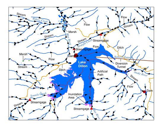
The USGS National Hydrography Dataset (NHD) service from The National Map (TNM) is a comprehensive set of digital spatial data that encodes information about naturally occurring and constructed bodies of surface water (lakes, ponds, and reservoirs), paths through which water flows (canals, ditches, streams, and rivers), and related entities such as point features (springs, wells, stream gages, and dams). The information encoded about these features includes classification and other characteristics, delineation, geographic name, position and related measures, a "reach code" through which other information can be related to the NHD, and the direction of water flow. The network of reach codes delineating water and...
Federal policymakers must not neglect to rationalize the allocation of jurisdiction between federal and state regulators, remove impediments to the expansion of the interstate transmission grid, and support the development of demand-side responsiveness to market pricing.
The purpose of this study was to develop land use projections for the middle of the next century. To separate the influence of climate change from other factors on land use, projections (a Central Projection and two variants) were made under both unchanged and changed climate. They cover the plausible range of alternative land claims of agriculture and urbanization. Impacts of climate change on land suitability as well as overall changes in the acreages of several land use categories are presented.

The National Hydrography Dataset (NHD) is a feature-based database that interconnects and uniquely identifies the stream segments or reaches that make up the nation's surface water drainage system. NHD data was originally developed at 1:100,000-scale and exists at that scale for the whole country. This high-resolution NHD, generally developed at 1:24,000/1:12,000 scale, adds detail to the original 1:100,000-scale NHD. (Data for Alaska, Puerto Rico and the Virgin Islands was developed at high-resolution, not 1:100,000 scale.) Local resolution NHD is being developed where partners and data exist. The NHD contains reach codes for networked features, flow direction, names, and centerline representations for areal water...
Categories: Data;
Types: Citation;
Tags: Administrative watershed units,
Area of Complex Channels,
Area to be submerged,
Basin,
Bay/Inlet,
Desert tortoises, Gopherus agassizii, generally were active in the spring and fall. They often became active during and after infrequent showers and thunderstorms, and drank from temporary pools of standing water even when air temperatures were suboptimal (9-15 C). In several instances tortoises constructed shallow catchment basins which held water for as long as six h. Thus tortoises can obtain drinking water by modifying their environment. Following small amounts of rainfall (5.6 mm) in July 1976, six tortoises increased an average of 9.2% in body weight; this increase was due to ingestion of water. Drinking may be an important source of water for this species. Published in Herpetologica, volume 36, issue 4, on...
Categories: Publication;
Types: Citation,
Journal Citation;
Tags: Gopherus,
Herpetologica,
Mojave Desert,
Reptilia,
Testudines,
The purpose of this study was to develop land use projections for the middle of the next century. To separate the influence of climate change from other factors on land use, projections (a Central Projection and two variants) were made under both unchanged and changed climate. They cover the plausible range of alternative land claims of agriculture and urbanization. Impacts of climate change on land suitability as well as overall changes in the acreages of several land use categories are presented.

The High Resolution National Hydrography Dataset Plus (NHDPlus HR) is an integrated datset of geospatial data layers, including the most current National Hydrography Dataset (NHD), the 10-meter 3D Elevation Program Digital Elevation Model (3DEP DEM), and the National Watershed Boundary Dataset (WBD). The NHDPlus HR combines the NHD, 3DEP DEMs, and WBD to create a stream network with linear referencing, feature naming, "value added attributes" (VAAs), elevation-derived catchments, and other features for hydrologic data analysis. The stream network with linear referencing is a system of data relationships applied to hydrographic systems so that one stream reach "flows" into another and "events" can be tied to and...
Types: Citation;
Tags: Administrative watershed units,
Area of Complex Channels,
Area to be submerged,
Basin,
Bay/Inlet,

The Watershed Boundary Dataset (WBD) is a comprehensive aggregated collection of hydrologic unit data consistent with the national criteria for delineation and resolution. It defines the areal extent of surface water drainage to a point except in coastal or lake front areas where there could be multiple outlets as stated by the "Federal Standards and Procedures for the National Watershed Boundary Dataset (WBD)" "Standard" (https://pubs.usgs.gov/tm/11/a3/). Watershed boundaries are determined solely upon science-based hydrologic principles, not favoring any administrative boundaries or special projects, nor particular program or agency. This dataset represents the hydrologic unit boundaries to the 12-digit (6th level)...
This article explores the institutional architecture in place to govern energy in the US and its underlying principles. More specifically, it identifies the key institutions involved with energy decision-making, with an emphasis on the national level and key legislative acts of the past four decades. The second section explores six historic guiding principles connected with national energy production and use, and the third section identifies how each of these conditions is eroding. The fourth section highlights the general implications of this shift for energy governance, namely that energy decision-making is now complex, inconsistent, vertically and horizontally fragmented and politicized.
Categories: Publication;
Types: Citation;
Tags: Case studies,
Natural,
Rio de la Plata,
basin,
change,
In petroleum industry, the difference between pore pressure (Pp) and minimum horizontal stress Sh (termed the seal or retention capacity) is of major consideration because it is often assumed to represent how close a system is to hydraulic failure and thus the maximum hydrocarbon column height that can be maintained. While Sh and Pp are often considered to be independent parameters, several studies in the last decade have demonstrated that Sh and Pp are in fact coupled. However, the nature of this coupling relationship remains poorly understood. In this paper, we explore the influences of the spatial pore pressure distribution on Sh/Pp coupling and then on failure pressure predictions and trap integrity evaluation....
Categories: Publication;
Types: Citation;
Tags: Analogue modelling,
Basin,
Cover integrity,
Fluid overpressure,
Hydraulic fracturing,

The Watershed Boundary Dataset (WBD) is a comprehensive aggregated collection of hydrologic unit data consistent with the national criteria for delineation and resolution. It defines the areal extent of surface water drainage to a point except in coastal or lake front areas where there could be multiple outlets as stated by the "Federal Standards and Procedures for the National Watershed Boundary Dataset (WBD)" "Standard" (https://pubs.usgs.gov/tm/11/a3/). Watershed boundaries are determined solely upon science-based hydrologic principles, not favoring any administrative boundaries or special projects, nor particular program or agency. This dataset represents the hydrologic unit boundaries to the 12-digit (6th level)...
In this article, the Lovins'[2] explain what is meant by Natural Capitalism, four principles that enable business to behave responsibly towards both nature and people while increasing profits, inspiring their workforce and gaining competitive advantage. It combines radically increased resource productivity; closed-loop, zero-waste, nontoxic production; a business model that rewards both; and reinvestment in natural capital. The article describes how, even today, when nature and people are typically valued at zero, protecting and restoring nature, culture and community can be far more profitable than liquidating them.
Categories: Publication;
Types: Citation;
Tags: Case studies,
Natural,
Rio de la Plata,
basin,
change,
The manufacturing sector in developing countries accounts for a steadily increasing share of world energy consumption and global greenhouse gas emissions. This paper is based on a study on policies to stimulate improvement of energy efficiency in the industrial sector in developing countries. The paper highlights developments in respect of the efficiency of industrial energy use in Africa, Asia and Latin America. The paper begins to outline some salient features of energy and technology use in four energy-intensive industries. Subsequently, recent policy initiatives and institutional development in support of rational use of energy (RUE) in industry are considered. The paper concludes with national policy priorities...
ABSTRACT Nebraska is well endowed with water, particularly groundwater, but has few fossil fuel reserves. However, it is located adjacent to states which have almost no water but have enormous quantities of coal and oil shale. Recent court cases facilitate the movement of water from water-rich states such as Nebraska to water-short states, such as Colorado and Wyoming. The possibility of an energy-water partnership exists and raise numerous policy questions. Within Nebraska, energy consumption patterns are similar to those of the nation's, with consumption of electricity in the agricultural sector growing fastest. Water consumption in the state is dominated by agriculture, and future development of groundwater for...
The dataset accompanies Figures 2–4 of Matchett and Fleskes (2018) and therein the subject data are referenced as "Table A1". Data summarize peak abundance (km2) of Central Valley waterbird habitats (i.e., wetland and flooded cropland types) that are available between August and April (of the following year) for each of 17 projected scenarios by planning basin, scenario, and habitat. Area of each habitat for each scenario-basin combination is provided for the month when the most area of the respective habitat is typically flooded and available for waterbird use (i.e., January for all wetlands and winter-flooded rice and corn, and September for other winter-flooded crops in Tulare Basin). The dataset also includes...
Categories: Data;
Types: Citation;
Tags: Central Valley of California,
basin,
birds,
climate change,
cropland,

The Watershed Boundary Dataset (WBD) from The National Map (TNM) defines the perimeter of drainage areas formed by the terrain and other landscape characteristics. The drainage areas are nested within each other so that a large drainage area, such as the Upper Mississippi River, will be composed of multiple smaller drainage areas, such as the Wisconsin River. Each of these smaller areas can further be subdivided into smaller and smaller drainage areas. The WBD uses six different levels in this hierarchy, with the smallest averaging about 30,000 acres. The WBD is made up of polygons nested into six levels of data respectively defined by Regions, Subregions, Basins, Subbasins, Watersheds, and Subwatersheds. For additional...
Types: Citation;
Tags: Administrative watershed units,
Administrative watershed units,
Basin,
Basin,
Boundaries,
In petroleum industry, the difference between pore pressure (Pp) and minimum horizontal stress Sh (termed the seal or retention capacity) is of major consideration because it is often assumed to represent how close a system is to hydraulic failure and thus the maximum hydrocarbon column height that can be maintained. While Sh and Pp are often considered to be independent parameters, several studies in the last decade have demonstrated that Sh and Pp are in fact coupled. However, the nature of this coupling relationship remains poorly understood. In this paper, we explore the influences of the spatial pore pressure distribution on Sh/Pp coupling and then on failure pressure predictions and trap integrity evaluation....
Categories: Publication;
Types: Citation;
Tags: Analogue modelling,
Basin,
Cover integrity,
Fluid overpressure,
Hydraulic fracturing,
ABSTRACT Nebraska is well endowed with water, particularly groundwater, but has few fossil fuel reserves. However, it is located adjacent to states which have almost no water but have enormous quantities of coal and oil shale. Recent court cases facilitate the movement of water from water-rich states such as Nebraska to water-short states, such as Colorado and Wyoming. The possibility of an energy-water partnership exists and raise numerous policy questions. Within Nebraska, energy consumption patterns are similar to those of the nation's, with consumption of electricity in the agricultural sector growing fastest. Water consumption in the state is dominated by agriculture, and future development of groundwater for...
|

|