Filters: Tags: Black Buttes (X)
9 results (47ms)|
Filters
Date Range
Contacts Categories Tag Types Tag Schemes
|
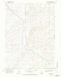
USGS Historical Quadrangle in GeoPDF.
First antelope of the season, taken at Black buttes camp. T. 18 N., R. 101 W. Almond quadrangle, Wyoming. No date.
Old stage house near Black Buttes, north of road, T. 18 N., R. 100 W. Almond quadrangle, Wyoming. No date.
Black Butte station. Sandstone ledges east of station capping Lewis shale in part represent the Black Buttes' fossil horizon. T. 18 N., R. 100 W. Almond quadrangle. Sweetwater County, Wyoming. 1907.
Unconformity near base of Laramie, Black Buttes, Wyoming. View taken at a distance of 100 double paces.
Fort Union contact showing underlying Black Buttes beds. T. 17 N., R. 101 W. South Bitter Creek quadrangle, Wyoming. No date.
Black Buttes quartzite, T. 18 N., R. 101 W. Almond quadrangle, Wyoming. No date.
Unconformity near base of Laramie near Black Buttes, Wyoming. Sec. 20, T. 18 N., R. 100 W. Almond quadrangle. Sweetwater County, Wyoming. 1907.
Fort Union and Black Buttes beds showing the nature of the unconformity between them. T. 17 N., R. 101 W. South Bitter Creek quadrangle, Wyoming. No date.
|

|
