Filters: Tags: Blackhawk (X)
88 results (208ms)|
Filters
Date Range
Contacts Categories Tag Types Tag Schemes |
Core Research Center, core U329, from well operated by UTAH POWER & LIGHTRaw Properties from download, web scrape, MapServer, and Macrostrat API{"Lib Num": "U329", "API Num": null, "Operator": "UTAH POWER & LIGHT", "Well Name": "A742 DEER CREEK", "Field": "DEER CREEK MINE", "State": "UT", "County": "EMERY", "Type": "FULL", "Photos": "F", "Thin Sec": "F", "Analysis": "F", "Latitude": "39.34924", "Longitude": "-111.14528", "coordinates_geohash": "9wbzyg63zmbr", "Source": "CENTER OF QUARTER SECTION", "Security Flag": "NO SPECIAL RESTRICTIONS", "crc_collection_name": "core", "sb_parent_id": "4f4e49dae4b07f02db5e0486", "intervals": [{"Formation": "BLACKHAWK", "Age": "CRET", "Min Depth": "0", "Max Depth": "0"}], "crcwc_url":...
Categories: Physical Item;
Tags: BLACKHAWK,
CRET,
North Horn Formation,
North Horn Formation,
Paleocene and Upper Cretaceous,
Core Research Center, core U352, from well operated by UTAH POWER & LIGHTRaw Properties from download, web scrape, MapServer, and Macrostrat API{"Lib Num": "U352", "API Num": null, "Operator": "UTAH POWER & LIGHT", "Well Name": "A-645 DEER CREEK", "Field": "DEER CREEK MINE", "State": "UT", "County": "EMERY", "Type": "FULL", "Photos": "F", "Thin Sec": "F", "Analysis": "F", "Latitude": "39.34199", "Longitude": "-111.14049", "coordinates_geohash": "9wbzycvzwykp", "Source": "CENTER OF QUARTER SECTION", "Security Flag": "NO SPECIAL RESTRICTIONS", "crc_collection_name": "core", "sb_parent_id": "4f4e49dae4b07f02db5e0486", "intervals": [{"Formation": "BLACKHAWK", "Age": "CRET", "Min Depth": "0", "Max Depth": "0"}], "crcwc_url":...
Categories: Physical Item;
Tags: BLACKHAWK,
CRET,
North Horn Formation,
North Horn Formation,
Paleocene and Upper Cretaceous,
Core Research Center, core U369, from well operated by UTAH POWER & LIGHTRaw Properties from download, web scrape, MapServer, and Macrostrat API{"Lib Num": "U369", "API Num": null, "Operator": "UTAH POWER & LIGHT", "Well Name": "A-738 DEER CREEK", "Field": "DEER CREEK MINE", "State": "UT", "County": "EMERY", "Type": "FULL", "Photos": "F", "Thin Sec": "F", "Analysis": "F", "Latitude": "39.34559", "Longitude": "-111.15002", "coordinates_geohash": "9wbzydxh8vd4", "Source": "CENTER OF QUARTER SECTION", "Security Flag": "NO SPECIAL RESTRICTIONS", "crc_collection_name": "core", "sb_parent_id": "4f4e49dae4b07f02db5e0486", "intervals": [{"Formation": "BLACKHAWK", "Age": "CRET", "Min Depth": "0", "Max Depth": "0"}], "crcwc_url":...
Categories: Physical Item;
Tags: BLACKHAWK,
CRET,
North Horn Formation,
North Horn Formation,
Paleocene and Upper Cretaceous,
Core Research Center, core U349, from well operated by UTAH POWER & LIGHTRaw Properties from download, web scrape, MapServer, and Macrostrat API{"Lib Num": "U349", "API Num": null, "Operator": "UTAH POWER & LIGHT", "Well Name": "A-661 DEER CREEK", "Field": "DEER CREEK MINE", "State": "UT", "County": "EMERY", "Type": "FULL", "Photos": "F", "Thin Sec": "F", "Analysis": "F", "Latitude": "39.33832", "Longitude": "-111.15462", "coordinates_geohash": "9wbzy97dmdk5", "Source": "CENTER OF QUARTER SECTION", "Security Flag": "NO SPECIAL RESTRICTIONS", "crc_collection_name": "core", "sb_parent_id": "4f4e49dae4b07f02db5e0486", "intervals": [{"Formation": "BLACKHAWK", "Age": "CRET", "Min Depth": "0", "Max Depth": "0"}], "crcwc_url":...
Categories: Physical Item;
Tags: BLACKHAWK,
CRET,
Eocene and Paleocene,
Flagstaff Limestone,
Flagstaff Limestone,
Core Research Center, core U364, from well operated by UTAH POWER & LIGHTRaw Properties from download, web scrape, MapServer, and Macrostrat API{"Lib Num": "U364", "API Num": null, "Operator": "UTAH POWER & LIGHT", "Well Name": "A-751 DEER CREEK", "Field": "DEER CREEK MINE", "State": "UT", "County": "EMERY", "Type": "FULL", "Photos": "F", "Thin Sec": "F", "Analysis": "F", "Latitude": "39.34919", "Longitude": "-111.15946", "coordinates_geohash": "9wbzye21suej", "Source": "CENTER OF QUARTER SECTION", "Security Flag": "NO SPECIAL RESTRICTIONS", "crc_collection_name": "core", "sb_parent_id": "4f4e49dae4b07f02db5e0486", "intervals": [{"Formation": "BLACKHAWK", "Age": "CRET", "Min Depth": "0", "Max Depth": "0"}], "crcwc_url":...
Categories: Physical Item;
Tags: BLACKHAWK,
CRET,
North Horn Formation,
North Horn Formation,
Paleocene and Upper Cretaceous,
Core Research Center, core S168, from well operated by USGSRaw Properties from download, web scrape, MapServer, and Macrostrat API{"Lib Num": "S168", "API Num": null, "Operator": "USGS", "Well Name": "BC-3-W", "Field": null, "State": "UT", "County": "EMERY", "Type": "FULL", "Photos": "T", "Thin Sec": "F", "Analysis": "T", "Latitude": "39.3461", "Longitude": "-110.2718", "coordinates_geohash": "9wcxfdwx8udk", "Source": "CENTER OF SECTION", "Security Flag": "NO SPECIAL RESTRICTIONS", "crc_collection_name": "core", "sb_parent_id": "4f4e49dae4b07f02db5e0486", "intervals": [{"Formation": "CASTLEGATE", "Age": null, "Min Depth": "955", "Max Depth": "1024"}, {"Formation": "BLACKHAWK", "Age": null, "Min Depth": "1024", "Max...
Categories: Physical Item;
Tags: BLACKHAWK,
CASTLEGATE,
Price River Formation,
Upper Cretaceous,
Upper part of Price River Formation,
Core Research Center, core U347, from well operated by UTAH POWER & LIGHTRaw Properties from download, web scrape, MapServer, and Macrostrat API{"Lib Num": "U347", "API Num": null, "Operator": "UTAH POWER & LIGHT", "Well Name": "A-657 DEER CREEK", "Field": "DEER CREEK MINE", "State": "UT", "County": "EMERY", "Type": "FULL", "Photos": "F", "Thin Sec": "F", "Analysis": "F", "Latitude": "39.33834", "Longitude": "-111.14991", "coordinates_geohash": "9wbzy9r47qh4", "Source": "CENTER OF QUARTER SECTION", "Security Flag": "NO SPECIAL RESTRICTIONS", "crc_collection_name": "core", "sb_parent_id": "4f4e49dae4b07f02db5e0486", "intervals": [{"Formation": "BLACKHAWK", "Age": "CRET", "Min Depth": "0", "Max Depth": "0"}], "crcwc_url":...
Categories: Physical Item;
Tags: BLACKHAWK,
CRET,
Eocene and Paleocene,
Flagstaff Limestone,
Flagstaff Limestone,
Core Research Center, core U400, from well operated by UTAH POWER & LIGHTRaw Properties from download, web scrape, MapServer, and Macrostrat API{"Lib Num": "U400", "API Num": null, "Operator": "UTAH POWER & LIGHT", "Well Name": "A-605 DEER CREEK", "Field": "DEER CREEK MINE", "State": "UT", "County": "EMERY", "Type": "FULL", "Photos": "F", "Thin Sec": "F", "Analysis": "F", "Latitude": "39.33477", "Longitude": "-111.14045", "coordinates_geohash": "9wbzybtvxu9f", "Source": "CENTER OF QUARTER SECTION", "Security Flag": "NO SPECIAL RESTRICTIONS", "crc_collection_name": "core", "sb_parent_id": "4f4e49dae4b07f02db5e0486", "intervals": [{"Formation": "BLACKHAWK", "Age": "CRET", "Min Depth": "0", "Max Depth": "0"}], "crcwc_url":...
Categories: Physical Item;
Tags: BLACKHAWK,
CRET,
North Horn Formation,
North Horn Formation,
Paleocene and Upper Cretaceous,
Core Research Center, core U406, from well operated by UTAH POWER & LIGHTRaw Properties from download, web scrape, MapServer, and Macrostrat API{"Lib Num": "U406", "API Num": null, "Operator": "UTAH POWER & LIGHT", "Well Name": "A-660 DEER CREEK", "Field": "DEER CREEK MINE", "State": "UT", "County": "EMERY", "Type": "FULL", "Photos": "F", "Thin Sec": "F", "Analysis": "F", "Latitude": "39.33837", "Longitude": "-111.14519", "coordinates_geohash": "9wbzyc6d97et", "Source": "CENTER OF QUARTER SECTION", "Security Flag": "NO SPECIAL RESTRICTIONS", "crc_collection_name": "core", "sb_parent_id": "4f4e49dae4b07f02db5e0486", "intervals": [{"Formation": "BLACKHAWK", "Age": "CRET", "Min Depth": "0", "Max Depth": "0"}], "crcwc_url":...
Categories: Physical Item;
Tags: BLACKHAWK,
CRET,
North Horn Formation,
North Horn Formation,
Paleocene and Upper Cretaceous,
Core Research Center, core U337, from well operated by UTAH POWER & LIGHTRaw Properties from download, web scrape, MapServer, and Macrostrat API{"Lib Num": "U337", "API Num": null, "Operator": "UTAH POWER & LIGHT", "Well Name": "B221 COTTONWOOD", "Field": "COTTONWOOD MINE", "State": "UT", "County": "EMERY", "Type": "FULL", "Photos": "F", "Thin Sec": "F", "Analysis": "F", "Latitude": "39.30933", "Longitude": "-111.15461", "coordinates_geohash": "9wbzws59my5r", "Source": "CENTER OF QUARTER SECTION", "Security Flag": "NO SPECIAL RESTRICTIONS", "crc_collection_name": "core", "sb_parent_id": "4f4e49dae4b07f02db5e0486", "intervals": [{"Formation": "BLACKHAWK", "Age": "CRET", "Min Depth": "0", "Max Depth": "0"}], "crcwc_url":...
Categories: Physical Item;
Tags: BLACKHAWK,
CRET,
Eocene and Paleocene,
Flagstaff Limestone,
Flagstaff Limestone,
Core Research Center, core U348, from well operated by UTAH POWER & LIGHTRaw Properties from download, web scrape, MapServer, and Macrostrat API{"Lib Num": "U348", "API Num": null, "Operator": "UTAH POWER & LIGHT", "Well Name": "A-656 DEER CREEK", "Field": "DEER CREEK MINE", "State": "UT", "County": "EMERY", "Type": "FULL", "Photos": "F", "Thin Sec": "F", "Analysis": "F", "Latitude": "39.33832", "Longitude": "-111.15462", "coordinates_geohash": "9wbzy97dmdk5", "Source": "CENTER OF QUARTER SECTION", "Security Flag": "NO SPECIAL RESTRICTIONS", "crc_collection_name": "core", "sb_parent_id": "4f4e49dae4b07f02db5e0486", "intervals": [{"Formation": "BLACKHAWK", "Age": "CRET", "Min Depth": "0", "Max Depth": "0"}], "crcwc_url":...
Categories: Physical Item;
Tags: BLACKHAWK,
CRET,
Eocene and Paleocene,
Flagstaff Limestone,
Flagstaff Limestone,
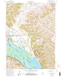
USGS Historical Quadrangle in GeoPDF.

USGS Historical Quadrangle in GeoPDF.
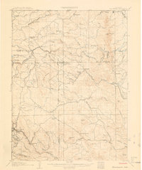
USGS Historical Quadrangle in GeoPDF.
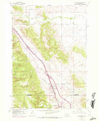
USGS Historical Quadrangle in GeoPDF.
Core Research Center, core U358, from well operated by UTAH POWER & LIGHTRaw Properties from download, web scrape, MapServer, and Macrostrat API{"Lib Num": "U358", "API Num": null, "Operator": "UTAH POWER & LIGHT", "Well Name": "A-744 DEER CREEK", "Field": "DEER CREEK MINE", "State": "UT", "County": "EMERY", "Type": "FULL", "Photos": "F", "Thin Sec": "F", "Analysis": "F", "Latitude": "39.34924", "Longitude": "-111.14528", "coordinates_geohash": "9wbzyg63zmbr", "Source": "CENTER OF QUARTER SECTION", "Security Flag": "NO SPECIAL RESTRICTIONS", "crc_collection_name": "core", "sb_parent_id": "4f4e49dae4b07f02db5e0486", "intervals": [{"Formation": "BLACKHAWK", "Age": "CRET", "Min Depth": "0", "Max Depth": "0"}], "crcwc_url":...
Categories: Physical Item;
Tags: BLACKHAWK,
CRET,
North Horn Formation,
North Horn Formation,
Paleocene and Upper Cretaceous,
Core Research Center, core U413, from well operated by UTAH POWER & LIGHTRaw Properties from download, web scrape, MapServer, and Macrostrat API{"Lib Num": "U413", "API Num": null, "Operator": "UTAH POWER & LIGHT", "Well Name": "A-622 DEER CREEK", "Field": "DEER CREEK MINE", "State": "UT", "County": "EMERY", "Type": "FULL", "Photos": "F", "Thin Sec": "F", "Analysis": "F", "Latitude": "39.342", "Longitude": "-111.13578", "coordinates_geohash": "9wbzz1cru8k5", "Source": "CENTER OF QUARTER SECTION", "Security Flag": "NO SPECIAL RESTRICTIONS", "crc_collection_name": "core", "sb_parent_id": "4f4e49dae4b07f02db5e0486", "intervals": [{"Formation": "BLACKHAWK", "Age": "CRET", "Min Depth": "0", "Max Depth": "0"}], "crcwc_url":...
Categories: Physical Item;
Tags: BLACKHAWK,
CRET,
North Horn Formation,
North Horn Formation,
Paleocene and Upper Cretaceous,
Core Research Center, core U412, from well operated by UTAH POWER & LIGHTRaw Properties from download, web scrape, MapServer, and Macrostrat API{"Lib Num": "U412", "API Num": null, "Operator": "UTAH POWER & LIGHT", "Well Name": "A-629 DEER CREEK", "Field": "DEER CREEK MINE", "State": "UT", "County": "EMERY", "Type": "FULL", "Photos": "F", "Thin Sec": "F", "Analysis": "F", "Latitude": "39.342", "Longitude": "-111.13578", "coordinates_geohash": "9wbzz1cru8k5", "Source": "CENTER OF QUARTER SECTION", "Security Flag": "NO SPECIAL RESTRICTIONS", "crc_collection_name": "core", "sb_parent_id": "4f4e49dae4b07f02db5e0486", "intervals": [{"Formation": "BLACKHAWK", "Age": "CRET", "Min Depth": "0", "Max Depth": "0"}], "crcwc_url":...
Categories: Physical Item;
Tags: BLACKHAWK,
CRET,
North Horn Formation,
North Horn Formation,
Paleocene and Upper Cretaceous,
Core Research Center, core U334, from well operated by UTAH POWER & LIGHTRaw Properties from download, web scrape, MapServer, and Macrostrat API{"Lib Num": "U334", "API Num": null, "Operator": "UTAH POWER & LIGHT", "Well Name": "B234 COTTONWOOD", "Field": "COTTONWOOD MINE", "State": "UT", "County": "EMERY", "Type": "FULL", "Photos": "F", "Thin Sec": "F", "Analysis": "F", "Latitude": "39.30938", "Longitude": "-111.14519", "coordinates_geohash": "9wbzwu499re9", "Source": "CENTER OF QUARTER SECTION", "Security Flag": "NO SPECIAL RESTRICTIONS", "crc_collection_name": "core", "sb_parent_id": "4f4e49dae4b07f02db5e0486", "intervals": [{"Formation": "BLACKHAWK", "Age": "CRET", "Min Depth": "0", "Max Depth": "0"}], "crcwc_url":...
Categories: Physical Item;
Tags: BLACKHAWK,
CRET,
Price River Formation,
Price River Formation,
Upper Cretaceous,

USGS Historical Quadrangle in GeoPDF.
|

|
