Filters
Date Range
Types
Contacts
Tag Types
Tag Schemes
|
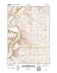
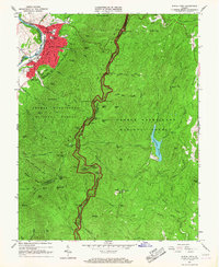
Layered GeoPDF 7.5 Minute Quadrangle Map. Layers of geospatial data include orthoimagery, roads, grids, geographic names, elevation contours, hydrography, and other selected map features.
Tags: 7.5 x 7.5 minute,
Buena Vista,
Clay,
Downloadable Data,
EarthCover, All tags...
GeoPDF,
Imagery and Base Maps,
Iowa,
Map,
Public Land Survey System,
U.S. National Grid,
US,
US Topo,
US Topo Historical,
United States,
Webb, IA,
boundary,
contour,
geographic names,
hydrography,
imageryBaseMapsEarthCover,
orthoimage,
structures,
topographic,
transportation,
woodland, Fewer tags
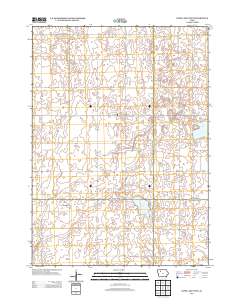
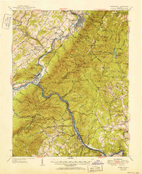
Layered GeoPDF 7.5 Minute Quadrangle Map. Layers of geospatial data include orthoimagery, roads, grids, geographic names, elevation contours, hydrography, and other selected map features.
Tags: 7.5 x 7.5 minute,
Buena Vista,
Clay,
Downloadable Data,
EarthCover, All tags...
GeoPDF,
Imagery and Base Maps,
Iowa,
Map,
Palo Alto,
Pocahontas,
Public Land Survey System,
Rush Lake West, IA,
U.S. National Grid,
US,
US Topo,
US Topo Historical,
United States,
boundary,
contour,
geographic names,
hydrography,
imageryBaseMapsEarthCover,
orthoimage,
structures,
topographic,
transportation,
woodland, Fewer tags
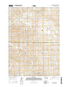
Layered GeoPDF 7.5 Minute Quadrangle Map. Layers of geospatial data include orthoimagery, roads, grids, geographic names, elevation contours, hydrography, and other selected map features.
Tags: 7.5 x 7.5 minute,
Buena Vista,
Downloadable Data,
EarthCover,
GeoPDF, All tags...
Imagery and Base Maps,
Iowa,
Map,
Public Land Survey System,
Sac,
Schaller North, IA,
U.S. National Grid,
US,
US Topo,
US Topo Historical,
United States,
boundary,
contour,
geographic names,
hydrography,
imageryBaseMapsEarthCover,
orthoimage,
structures,
topographic,
transportation,
woodland, Fewer tags
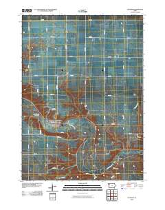
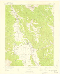
Layered GeoPDF 7.5 Minute Quadrangle Map. Layers of geospatial data include orthoimagery, roads, grids, geographic names, elevation contours, hydrography, and other selected map features.
Tags: 7.5 x 7.5 minute,
Buena Vista,
Clay,
Downloadable Data,
EarthCover, All tags...
GeoPDF,
Imagery and Base Maps,
Iowa,
Map,
Peterson, IA,
U.S. National Grid,
US,
US Topo,
US Topo Historical,
United States,
contour,
geographic names,
hydrography,
orthoimage,
topographic,
transportation, Fewer tags
USGS Historical Quadrangle in GeoPDF.
Tags: 7.5 x 7.5 minute,
AR,
Buena Vista,
Downloadable Data,
GeoPDF, All tags...
GeoTIFF,
Historical Topographic Maps,
Historical Topographic Maps 7.5 x 7.5 Minute Map Series,
Map,
imageryBaseMapsEarthCover, Fewer tags
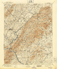
USGS Historical Quadrangle in GeoPDF.
Tags: 30 x 30 minute,
Buena Vista,
Downloadable Data,
GeoPDF,
GeoTIFF, All tags...
Historical Topographic Maps,
Historical Topographic Maps 30 x 30 Minute Map Series,
Map,
VA,
imageryBaseMapsEarthCover, Fewer tags
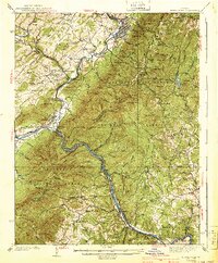
USGS Historical Quadrangle in GeoPDF.
Tags: 15 x 15 minute,
Buena Vista,
Downloadable Data,
GeoPDF,
GeoTIFF, All tags...
Historical Topographic Maps,
Historical Topographic Maps 15 x 15 Minute Map Series,
Map,
VA,
imageryBaseMapsEarthCover, Fewer tags
USGS Historical Quadrangle in GeoPDF.
Tags: 15 x 15 minute,
Buena Vista,
CO,
Downloadable Data,
GeoPDF, All tags...
GeoTIFF,
Historical Topographic Maps,
Historical Topographic Maps 15 x 15 Minute Map Series,
Map,
imageryBaseMapsEarthCover, Fewer tags

Geospatial data includes structures and other selected map features.
Tags: Adair,
Adams,
Allamakee,
Appanoose,
Audubon, All tags...
Benton,
Black Hawk,
Boone,
Bremer,
Buchanan,
Buena Vista,
Butler,
Calhoun,
Campground,
Carroll,
Cass,
Cedar,
Cerro Gordo,
Cherokee,
Chickasaw,
Clarke,
Clay,
Clayton,
Clinton,
College / University,
Courthouse,
Crawford,
Dallas,
Davis,
Decatur,
Delaware,
Des Moines,
Dickinson,
Downloadable Data,
Dubuque,
Emmet,
Esri Shapefile nan,
Fayette,
Fire Station/ EMS Station,
Floyd,
Franklin,
Fremont,
Greene,
Grundy,
Guthrie,
Hamilton,
Hancock,
Hardin,
Harrison,
Henry,
Hospital/Medical Center,
Howard,
Humboldt,
IA,
Ida,
Information Center,
Iowa,
Iowa,
Jackson,
Jasper,
Jefferson,
Johnson,
Jones,
Keokuk,
Kossuth,
Law Enforcement,
Lee,
Linn,
Louisa,
Lucas,
Lyon,
Madison,
Mahaska,
Marion,
Marshall,
Mills,
Mitchell,
Monona,
Monroe,
Montgomery,
Muscatine,
National Structures Dataset (NSD),
National Structures Dataset (NSD),
O'Brien,
Osceola,
Page,
Palo Alto,
Plymouth,
Pocahontas,
Polk,
Post Office,
Pottawattamie,
Poweshiek,
Prison/ Correctional Facility,
Ringgold,
Sac,
School,
School:Elementary,
School:High School,
School:Middle School,
Scott,
Shapefile,
Shelby,
Sioux,
State,
State,
State Capitol,
Story,
Structures,
Tama,
Taylor,
Technical School,
Town Hall,
Trade School,
Trailhead,
US,
Union,
United States,
Van Buren,
Visitor Center,
Wapello,
Warren,
Washington,
Wayne,
Webster,
Winnebago,
Winneshiek,
Woodbury,
Worth,
Wright,
structure, Fewer tags

The US Geological Survey, in cooperation with the National Park Service, mapped 35 7.5-minute quadrangles, within a 2-mile-wide+ corridor centered on the Parkway, from BLRI (Blue Ridge Parkway) Mile Post (MP) 0 near Afton, Virginia southward to MP 218 at Cumberland Knob, approximately 1.3 km south of the Virginia – North Carolina State Line. Detailed bedrock geologic mapping for this project was conducted at 1:24,000-scale by systematically traversing roads, trails, creeks, and ridges within and adjacent to the 2-mile-wide+ corridor along the 216.9-mile length of the BLRI in Virginia. Geologic data at more than 23,000 station points were collected during this project (September 2009 – February 2014), with approximately...
Types: Citation,
Map Service,
OGC WFS Layer,
OGC WMS Layer,
OGC WMS Service;
Tags: Adney Gap,
Air Bellows Gap,
Alligator Back Formation,
Antietam Formation,
Ashe Formation, All tags...
Ashville,
Bald Mountain,
Balsam Gap,
Beacon Heights,
Bear Den,
Bear Mountain Gap,
Bearwallow Gap,
Bedrock,
Beech Gap,
Beetree Gap,
Benge Gap,
Big Island,
Big Witch Gap,
Biltmore Estate,
Blackhorse Gap,
Blowing Rock,
Blue Ridge Music Center Visitor Center,
Blue Ridge Park Visitor Center and Park Headquarters,
Blue Ridge Parkway,
Bluff Mountain,
Bottom Creek Metagranitoid Suite,
Buck Creek Gap,
Buena Vista,
Bull Gap,
Carbonate,
Cherokee,
Cherokee Indian Reservation,
Chestoa View,
Chilhowee Group,
Cold Mountain,
Conococheague Formation,
Crabtree Falls,
Crabtree Faults,
Craggy Gardens Visitor Center,
Craven Gap,
Crossnore,
Crossnore Plutonic Suite,
Cumberland Knob,
Daniel Boone's Trace,
Deep Gap,
Devils Backbone Overlook,
Devils Courthouse,
Diabase,
Doughton Park,
E.B. Jeffress Park,
Elbrook Formation,
Elk Pasture Gap,
Ervin,
Ervin,
Fallingwater Cascades,
Fancy Gap,
Flat Rock,
Folds,
Formation,
Fox Hunters Paradise,
Geology,
George Washington National Forest,
Gillespie Gap,
Glendale Springs,
Gneiss,
Graggy Dome,
Grandfather Mountain,
Grandfather Mountain State Park,
Granite,
Graveyard Fields,
Great Valley Overlook,
Green Knob,
Greenstone Trail,
Groundhog Mountain,
Hampton Formation,
Harpers Formation,
Hawksbill Mountain,
Hominy Creek,
Humpback Mountain,
Humpback Rocks Visitor Center,
Indian Gap,
Irish Gap,
James River,
James River Visitor Center and Canal,
Jefferson National Forest,
Julian Price Memorial Park,
Jumpinoff Rock,
Lake Powhaten,
Laurel Springs,
Lineville River,
Linville,
Linville Falls,
Linville Falls Visitor Center,
Little Switzerland,
Looking Glass Rock Overlook,
Lynchburg Group,
Mabry Hill,
Martinsburg Formation,
McKinney Gap,
Meadows of Dan,
Mesoproterozoic gneisses of the Fries Thrust Sheet,
Metabasalt,
Metagranitoid,
Moses H. Cone Memorial Park and Visitor Center,
Mount Jefferson State Park,
Mount Mitchell,
Mount Mitchell State Park,
Mount Pisgah,
Museum of North Carolina Minerals Visitor Center,
N&W Railroad Overlook,
Nantahala National Forest,
Normal Fault,
North Carolina,
North Carolina Arboretum,
Northwest Trading Post,
Oconalufte Visitor Center,
Onion Mountain Overlook,
Orchard Gap,
Oteen,
Otter Creek,
Overmountain Victory Nation Historic Trail,
Peach Bottom Mountain,
Peaks of Otter Metagranitoid,
Peaks of Otter Visitor Center,
Petites Gap,
Pilot Gneiss,
Pineola,
Pipers Gap,
Pisgah National Forest,
Poor Mountain,
Powell Gap,
Price Lake,
Puckett Cabin,
Purgatory Overlook,
Rakes Millpond,
Ravens Roost,
Reverse Fault,
Richland Balsam,
Roanoke Mountain,
Roanoke River,
Roanoke River Gorge,
Roanoke Valley Overlook,
Rocky Knob,
Rocky Knob Visitor Center,
Sandy Creek Gneiss,
Shady Dolomite,
Sharp Top,
Sherando Lake,
Skyland,
Southern End,
Staunton River,
Stone Mountain State Park,
Structure,
Sugarloaf Mountain,
Swannanoa River,
Swift Run Formation,
Table Rock Mountain,
Terrapin Mountain,
The Lump,
The Saddle,
Thrust Fault,
Tunnel Gap,
Twenty Minute Cliff,
Tye River,
Tye River Gap,
USGS Science Data Catalog (SDC),
Unicoi Formation,
Virginia,
Virginia Explore Park and Visitor Center,
Volunteer Gap,
Wagon Road Gap,
Watauga River,
Waterrock Knob Visitor Center,
Wayneboro Formation,
Waynesboro,
Wayneville,
Weverton Formation,
Whites Gap Overlook,
Wigwarm Falls,
Woodlaw,
Wrights Creek,
Yankee Horse Ridge,
Z.B. Vance Birthplace, Fewer tags
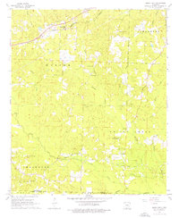
Layered GeoPDF 7.5 Minute Quadrangle Map. Layers of geospatial data include orthoimagery, roads, grids, geographic names, elevation contours, hydrography, and other selected map features.
Tags: 7.5 x 7.5 minute,
Buena Vista,
Cherokee,
Downloadable Data,
EarthCover, All tags...
Galva, IA,
GeoPDF,
Ida,
Imagery and Base Maps,
Iowa,
Map,
Public Land Survey System,
Sac,
U.S. National Grid,
US,
US Topo,
US Topo Historical,
United States,
boundary,
contour,
geographic names,
hydrography,
imageryBaseMapsEarthCover,
orthoimage,
structures,
topographic,
transportation,
woodland, Fewer tags
Layered GeoPDF 7.5 Minute Quadrangle Map. Layers of geospatial data include orthoimagery, roads, grids, geographic names, elevation contours, hydrography, and other selected map features.
Tags: 7.5 x 7.5 minute,
Buena Vista,
Cherokee,
Downloadable Data,
EarthCover, All tags...
GeoPDF,
Imagery and Base Maps,
Iowa,
Map,
Peterson SW, IA,
Public Land Survey System,
U.S. National Grid,
US,
US Topo,
US Topo Historical,
United States,
boundary,
contour,
geographic names,
hydrography,
imageryBaseMapsEarthCover,
orthoimage,
structures,
topographic,
transportation,
woodland, Fewer tags
Layered GeoPDF 7.5 Minute Quadrangle Map. Layers of geospatial data include orthoimagery, roads, grids, geographic names, elevation contours, hydrography, and other selected map features.
Tags: 7.5 x 7.5 minute,
Buena Vista,
Downloadable Data,
EarthCover,
GeoPDF, All tags...
Imagery and Base Maps,
Iowa,
Map,
Peterson SE, IA,
Public Land Survey System,
U.S. National Grid,
US,
US Topo,
US Topo Historical,
United States,
boundary,
contour,
geographic names,
hydrography,
imageryBaseMapsEarthCover,
orthoimage,
structures,
topographic,
transportation,
woodland, Fewer tags
USGS Historical Quadrangle in GeoPDF.
Tags: 7.5 x 7.5 minute,
Advance,
Buena Vista,
Downloadable Data,
GeoPDF, All tags...
GeoTIFF,
Historical Topographic Maps,
Historical Topographic Maps 7.5 x 7.5 Minute Map Series,
Map,
TN,
imageryBaseMapsEarthCover, Fewer tags
USGS Historical Quadrangle in GeoPDF.
Tags: 7.5 x 7.5 minute,
Buena Vista,
Downloadable Data,
GeoPDF,
GeoTIFF, All tags...
Historical Topographic Maps,
Historical Topographic Maps 7.5 x 7.5 Minute Map Series,
Map,
VA,
imageryBaseMapsEarthCover, Fewer tags
USGS Historical Quadrangle in GeoPDF.
Tags: 15 x 15 minute,
Buena Vista,
Downloadable Data,
GeoPDF,
GeoTIFF, All tags...
Historical Topographic Maps,
Historical Topographic Maps 15 x 15 Minute Map Series,
Map,
VA,
imageryBaseMapsEarthCover, Fewer tags
USGS Historical Quadrangle in GeoPDF.
Tags: 30 x 60 minute,
Buena Vista,
Downloadable Data,
GeoPDF,
GeoTIFF, All tags...
Historical Topographic Maps,
Historical Topographic Maps 30 x 60 Minute Map Series,
Map,
Planimetric,
VA,
imageryBaseMapsEarthCover, Fewer tags
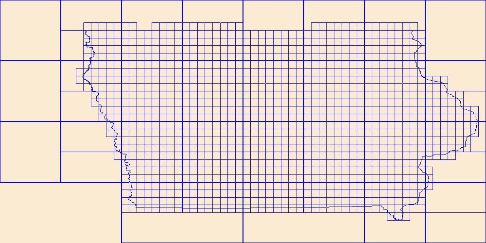
This data represents the map extent for current and historical USGS topographic maps for the United States and Territories, including 1 X 2 Degree, 1 X 1 Degree, 30 X 60 Minute, 15 X 15 Minute, 7.5 X 7.5 Minute, and 3.75 X 3.75 Minute. The grid was generated using ESRI ArcInfo GIS software.
Tags: Adair,
Adams,
Allamakee,
Appanoose,
Audubon, All tags...
Benton,
Black Hawk,
Boone,
Boundaries,
Bremer,
Buchanan,
Buena Vista,
Butler,
Calhoun,
Carroll,
Cass,
Cedar,
Cerro Gordo,
Cherokee,
Chickasaw,
Clarke,
Clay,
Clayton,
Clinton,
Crawford,
Dallas,
Davis,
Decatur,
Delaware,
Des Moines,
Dickinson,
Downloadable Data,
Dubuque,
Emmet,
Esri File GeoDatabase 10,
Fayette,
FileGDB,
Floyd,
Franklin,
Fremont,
Greene,
Grundy,
Guthrie,
Hamilton,
Hancock,
Hardin,
Harrison,
Henry,
Howard,
Humboldt,
IA,
Ida,
Iowa,
Iowa,
Jackson,
Jasper,
Jefferson,
Johnson,
Jones,
Keokuk,
Kossuth,
Lee,
Linn,
Louisa,
Lucas,
Lyon,
Madison,
Mahaska,
Map Indices,
Map Indices,
Map Indices,
Marion,
Marshall,
Mills,
Mitchell,
Monona,
Monroe,
Montgomery,
Muscatine,
O'Brien,
Osceola,
Page,
Palo Alto,
Plymouth,
Pocahontas,
Polk,
Pottawattamie,
Poweshiek,
Ringgold,
Sac,
Scott,
Shelby,
Sioux,
State,
State,
Story,
Tama,
Taylor,
US,
Union,
United States,
United States of America,
Van Buren,
Wapello,
Warren,
Washington,
Wayne,
Webster,
Winnebago,
Winneshiek,
Woodbury,
Worth,
Wright,
cells,
map indices,
polygon grid, Fewer tags
Geospatial data includes structures and other selected map features.
Tags: Adair,
Adams,
Allamakee,
Appanoose,
Audubon, All tags...
Benton,
Black Hawk,
Boone,
Bremer,
Buchanan,
Buena Vista,
Butler,
Calhoun,
Campground,
Carroll,
Cass,
Cedar,
Cerro Gordo,
Cherokee,
Chickasaw,
Clarke,
Clay,
Clayton,
Clinton,
College / University,
Courthouse,
Crawford,
Dallas,
Davis,
Decatur,
Delaware,
Des Moines,
Dickinson,
Downloadable Data,
Dubuque,
Emmet,
Esri File GeoDatabase 10,
Fayette,
FileGDB,
Fire Station/ EMS Station,
Floyd,
Franklin,
Fremont,
Greene,
Grundy,
Guthrie,
Hamilton,
Hancock,
Hardin,
Harrison,
Henry,
Hospital/Medical Center,
Howard,
Humboldt,
IA,
Ida,
Information Center,
Iowa,
Iowa,
Jackson,
Jasper,
Jefferson,
Johnson,
Jones,
Keokuk,
Kossuth,
Law Enforcement,
Lee,
Linn,
Louisa,
Lucas,
Lyon,
Madison,
Mahaska,
Marion,
Marshall,
Mills,
Mitchell,
Monona,
Monroe,
Montgomery,
Muscatine,
National Structures Dataset (NSD),
National Structures Dataset (NSD),
O'Brien,
Osceola,
Page,
Palo Alto,
Plymouth,
Pocahontas,
Polk,
Post Office,
Pottawattamie,
Poweshiek,
Prison/ Correctional Facility,
Ringgold,
Sac,
School,
School:Elementary,
School:High School,
School:Middle School,
Scott,
Shelby,
Sioux,
State,
State,
State Capitol,
Story,
Structures,
Tama,
Taylor,
Technical School,
Town Hall,
Trade School,
Trailhead,
US,
Union,
United States,
Van Buren,
Visitor Center,
Wapello,
Warren,
Washington,
Wayne,
Webster,
Winnebago,
Winneshiek,
Woodbury,
Worth,
Wright,
structure, Fewer tags
Geospatial data is comprised of government boundaries.
Tags: Accomack,
Albemarle,
Alexandria,
Alleghany,
Amelia, All tags...
Amherst,
Appomattox,
Arlington,
Augusta,
Bath,
Bedford,
Bland,
Botetourt,
Boundaries,
Bristol,
Brunswick,
Buchanan,
Buckingham,
Buena Vista,
Campbell,
Caroline,
Carroll,
Charles City,
Charlotte,
Charlottesville,
Chesapeake,
Chesterfield,
Clarke,
Colonial Heights,
County or Equivalent,
Covington,
Craig,
Culpeper,
Cumberland,
Danville,
Dickenson,
Dinwiddie,
Downloadable Data,
Emporia,
Essex,
Fairfax,
Falls Church,
Fauquier,
Floyd,
Fluvanna,
Franklin,
Frederick,
Fredericksburg,
Galax,
GeoPackage,
Giles,
Gloucester,
Goochland,
Grayson,
Greene,
Greensville,
Halifax,
Hampton,
Hanover,
Harrisonburg,
Henrico,
Henry,
Highland,
Hopewell,
Incorporated Place,
Isle of Wight,
James City,
Jurisdictional,
King George,
King William,
King and Queen,
Lancaster,
Lee,
Lexington,
Loudoun,
Louisa,
Lunenburg,
Lynchburg,
Madison,
Manassas,
Manassas Park,
Martinsville,
Mathews,
Mecklenburg,
Middlesex,
Minor Civil Division,
Montgomery,
National Boundary Dataset (NBD),
National Boundary Dataset (NBD),
Native American Area,
Nelson,
New Kent,
Newport News,
Norfolk,
Northampton,
Northumberland,
Norton,
Nottoway,
Open Geospatial Consortium GeoPackage 1.2,
Orange,
PLSS First Division,
PLSS Special Survey,
PLSS Township,
Page,
Patrick,
Petersburg,
Pittsylvania,
Poquoson,
Portsmouth,
Powhatan,
Prince Edward,
Prince George,
Prince William,
Public Land Survey System,
Pulaski,
Radford,
Rappahannock,
Reserve,
Richmond,
Roanoke,
Rockbridge,
Rockingham,
Russell,
Salem,
Scott,
Shenandoah,
Smyth,
Southampton,
Spotsylvania,
Stafford,
State,
State,
State or Territory,
Staunton,
Suffolk,
Surry,
Sussex,
Tazewell,
U.S. National Grid,
US,
Unincorporated Place,
United States,
VA,
Virginia,
Virginia Beach,
Warren,
Washington,
Waynesboro,
Westmoreland,
Williamsburg,
Winchester,
Wise,
Wythe,
York,
boundaries,
boundary,
cadastral surveys,
geographic names,
land ownership,
land use maps,
legal land descriptions,
political and administrative boundaries,
zoning maps, Fewer tags
|
|

