Filters: Tags: Cerro (X)
18 results (11ms)|
Filters
Date Range
Extensions Types Contacts
Categories Tag Types Tag Schemes |
This dataset includes the magnetotelluric (MT) sounding data collected in 2009 in and near the San Luis Basin, New Mexico. The U.S. Geological Survey conducted a series of multidisciplinary studies, including MT surveys, in the San Luis Basin to improve understanding of the hydrogeology of the Santa Fe Group and the nature of the sedimentary deposits comprising the principal groundwater aquifers of the Rio Grande rift. The shallow unconfined and the deeper confined Santa Fe Group aquifers in the San Luis Basin are the main sources of municipal water for the region. The population of the San Luis Basin region is growing rapidly and water shortfalls could have serious consequences. Future growth and land management...
This dataset includes the audio-magnetotelluric (AMT) sounding data collected in 2009 in and near the San Luis Basin, New Mexico. The U.S. Geological Survey conducted a series of multidisciplinary studies, including AMT surveys, in the San Luis Basin to improve understanding of the hydrogeology of the Santa Fe Group and the nature of the sedimentary deposits comprising the principal groundwater aquifers of the Rio Grande rift. The shallow unconfined and the deeper confined Santa Fe Group aquifers in the San Luis Basin are the main sources of municipal water for the region. The population of the San Luis Basin region is growing rapidly and water shortfalls could have serious consequences. Future growth and land management...
Categories: Data;
Types: Downloadable,
Map Service,
OGC WFS Layer,
OGC WMS Layer,
Shapefile;
Tags: AMT,
Cerro,
Cerro De La Olla,
GGGSC,
GPS measurement,
This dataset includes the audio-magnetotelluric (AMT) sounding data collected in 2009 in and near the San Luis Basin, New Mexico. The U.S. Geological Survey conducted a series of multidisciplinary studies, including AMT surveys, in the San Luis Basin to improve understanding of the hydrogeology of the Santa Fe Group and the nature of the sedimentary deposits comprising the principal groundwater aquifers of the Rio Grande rift. The shallow unconfined and the deeper confined Santa Fe Group aquifers in the San Luis Basin are the main sources of municipal water for the region. The population of the San Luis Basin region is growing rapidly and water shortfalls could have serious consequences. Future growth and land management...
This dataset includes the audio-magnetotelluric (AMT) sounding data collected in 2009 in and near the San Luis Basin, New Mexico. The U.S. Geological Survey conducted a series of multidisciplinary studies, including AMT surveys, in the San Luis Basin to improve understanding of the hydrogeology of the Santa Fe Group and the nature of the sedimentary deposits comprising the principal groundwater aquifers of the Rio Grande rift. The shallow unconfined and the deeper confined Santa Fe Group aquifers in the San Luis Basin are the main sources of municipal water for the region. The population of the San Luis Basin region is growing rapidly and water shortfalls could have serious consequences. Future growth and land management...
This dataset includes the magnetotelluric (MT) sounding data collected in 2009 in and near the San Luis Basin, New Mexico. The U.S. Geological Survey conducted a series of multidisciplinary studies, including MT surveys, in the San Luis Basin to improve understanding of the hydrogeology of the Santa Fe Group and the nature of the sedimentary deposits comprising the principal groundwater aquifers of the Rio Grande rift. The shallow unconfined and the deeper confined Santa Fe Group aquifers in the San Luis Basin are the main sources of municipal water for the region. The population of the San Luis Basin region is growing rapidly and water shortfalls could have serious consequences. Future growth and land management...
This dataset includes the magnetotelluric (MT) sounding data collected in 2009 in and near the San Luis Basin, New Mexico. The U.S. Geological Survey conducted a series of multidisciplinary studies, including MT surveys, in the San Luis Basin to improve understanding of the hydrogeology of the Santa Fe Group and the nature of the sedimentary deposits comprising the principal groundwater aquifers of the Rio Grande rift. The shallow unconfined and the deeper confined Santa Fe Group aquifers in the San Luis Basin are the main sources of municipal water for the region. The population of the San Luis Basin region is growing rapidly and water shortfalls could have serious consequences. Future growth and land management...
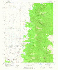
USGS Historical Quadrangle in GeoPDF.
This dataset includes the audio-magnetotelluric (AMT) sounding data collected in 2009 in and near the San Luis Basin, New Mexico. The U.S. Geological Survey conducted a series of multidisciplinary studies, including AMT surveys, in the San Luis Basin to improve understanding of the hydrogeology of the Santa Fe Group and the nature of the sedimentary deposits comprising the principal groundwater aquifers of the Rio Grande rift. The shallow unconfined and the deeper confined Santa Fe Group aquifers in the San Luis Basin are the main sources of municipal water for the region. The population of the San Luis Basin region is growing rapidly and water shortfalls could have serious consequences. Future growth and land management...
This dataset includes the audio-magnetotelluric (AMT) sounding data collected in 2009 in and near the San Luis Basin, New Mexico. The U.S. Geological Survey conducted a series of multidisciplinary studies, including AMT surveys, in the San Luis Basin to improve understanding of the hydrogeology of the Santa Fe Group and the nature of the sedimentary deposits comprising the principal groundwater aquifers of the Rio Grande rift. The shallow unconfined and the deeper confined Santa Fe Group aquifers in the San Luis Basin are the main sources of municipal water for the region. The population of the San Luis Basin region is growing rapidly and water shortfalls could have serious consequences. Future growth and land management...
This dataset includes the magnetotelluric (MT) sounding data collected in 2009 in and near the San Luis Basin, New Mexico. The U.S. Geological Survey conducted a series of multidisciplinary studies, including MT surveys, in the San Luis Basin to improve understanding of the hydrogeology of the Santa Fe Group and the nature of the sedimentary deposits comprising the principal groundwater aquifers of the Rio Grande rift. The shallow unconfined and the deeper confined Santa Fe Group aquifers in the San Luis Basin are the main sources of municipal water for the region. The population of the San Luis Basin region is growing rapidly and water shortfalls could have serious consequences. Future growth and land management...
Categories: Data;
Types: Citation,
Downloadable,
Map Service,
OGC WFS Layer,
OGC WMS Layer,
Shapefile;
Tags: CGGSC,
Cerro,
Crustal Geophysics and Geochemistry Science Center,
Electromagnetic surveying,
GPS measurement,
This dataset includes the magnetotelluric (MT) sounding data collected in 2009 in and near the San Luis Basin, New Mexico. The U.S. Geological Survey conducted a series of multidisciplinary studies, including MT surveys, in the San Luis Basin to improve understanding of the hydrogeology of the Santa Fe Group and the nature of the sedimentary deposits comprising the principal groundwater aquifers of the Rio Grande rift. The shallow unconfined and the deeper confined Santa Fe Group aquifers in the San Luis Basin are the main sources of municipal water for the region. The population of the San Luis Basin region is growing rapidly and water shortfalls could have serious consequences. Future growth and land management...
This dataset includes the magnetotelluric (MT) sounding data collected in 2009 in and near the San Luis Basin, New Mexico. The U.S. Geological Survey conducted a series of multidisciplinary studies, including MT surveys, in the San Luis Basin to improve understanding of the hydrogeology of the Santa Fe Group and the nature of the sedimentary deposits comprising the principal groundwater aquifers of the Rio Grande rift. The shallow unconfined and the deeper confined Santa Fe Group aquifers in the San Luis Basin are the main sources of municipal water for the region. The population of the San Luis Basin region is growing rapidly and water shortfalls could have serious consequences. Future growth and land management...
This dataset includes the audio-magnetotelluric (AMT) sounding data collected in 2009 in and near the San Luis Basin, New Mexico. The U.S. Geological Survey conducted a series of multidisciplinary studies, including AMT surveys, in the San Luis Basin to improve understanding of the hydrogeology of the Santa Fe Group and the nature of the sedimentary deposits comprising the principal groundwater aquifers of the Rio Grande rift. The shallow unconfined and the deeper confined Santa Fe Group aquifers in the San Luis Basin are the main sources of municipal water for the region. The population of the San Luis Basin region is growing rapidly and water shortfalls could have serious consequences. Future growth and land management...
This dataset includes the audio-magnetotelluric (AMT) sounding data collected in 2009 in and near the San Luis Basin, New Mexico. The U.S. Geological Survey conducted a series of multidisciplinary studies, including AMT surveys, in the San Luis Basin to improve understanding of the hydrogeology of the Santa Fe Group and the nature of the sedimentary deposits comprising the principal groundwater aquifers of the Rio Grande rift. The shallow unconfined and the deeper confined Santa Fe Group aquifers in the San Luis Basin are the main sources of municipal water for the region. The population of the San Luis Basin region is growing rapidly and water shortfalls could have serious consequences. Future growth and land management...
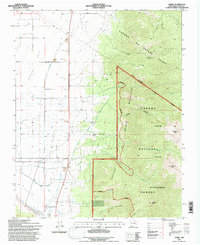
USGS Historical Quadrangle in GeoPDF.
This dataset includes the audio-magnetotelluric (AMT) sounding data collected in 2009 in and near the San Luis Basin, New Mexico. The U.S. Geological Survey conducted a series of multidisciplinary studies, including AMT surveys, in the San Luis Basin to improve understanding of the hydrogeology of the Santa Fe Group and the nature of the sedimentary deposits comprising the principal groundwater aquifers of the Rio Grande rift. The shallow unconfined and the deeper confined Santa Fe Group aquifers in the San Luis Basin are the main sources of municipal water for the region. The population of the San Luis Basin region is growing rapidly and water shortfalls could have serious consequences. Future growth and land management...
This dataset includes the magnetotelluric (MT) sounding data collected in 2009 in and near the San Luis Basin, New Mexico. The U.S. Geological Survey conducted a series of multidisciplinary studies, including MT surveys, in the San Luis Basin to improve understanding of the hydrogeology of the Santa Fe Group and the nature of the sedimentary deposits comprising the principal groundwater aquifers of the Rio Grande rift. The shallow unconfined and the deeper confined Santa Fe Group aquifers in the San Luis Basin are the main sources of municipal water for the region. The population of the San Luis Basin region is growing rapidly and water shortfalls could have serious consequences. Future growth and land management...
This dataset includes the magnetotelluric (MT) sounding data collected in 2009 in and near the San Luis Basin, New Mexico. The U.S. Geological Survey conducted a series of multidisciplinary studies, including MT surveys, in the San Luis Basin to improve understanding of the hydrogeology of the Santa Fe Group and the nature of the sedimentary deposits comprising the principal groundwater aquifers of the Rio Grande rift. The shallow unconfined and the deeper confined Santa Fe Group aquifers in the San Luis Basin are the main sources of municipal water for the region. The population of the San Luis Basin region is growing rapidly and water shortfalls could have serious consequences. Future growth and land management...
|

|
