Filters: Tags: Chance (X)
15 results (278ms)|
Filters
Date Range
Contacts Categories Tag Types Tag Schemes |
An overview of the Allison mine showing the mill, dumps, and other buildings.
Categories: Data;
Tags: 1940s,
Arizona,
Baboquivari Peak - 15 Min,
Baboquivari Valley physiographic area,
Baboquivari metallic mineral dist.,
ADMMR map collection: Allison Mine, Section Along A-A' Looking Northeast; 1 in. to 300 feet; 12 x 9 in.
Categories: Data;
Tags: 1960s,
Allison Mine,
Arizona,
Baboquivari Peak - 15 Min,
Baboquivari Valley physiographic area,
ADMMR map collection: Allison Mine; 1 in. to 300 feet; 18 x 24 in.
Categories: Data;
Tags: 1910s,
Allison Mine,
Arizona,
Baboquivari Peak - 15 Min,
Baboquivari Valley physiographic area,
ADMMR map collection: Allison Mine Composite Plan of Workings; 1 in. to 30 feet; 42 x 37 in.
Categories: Data;
Tags: 1940s,
Allison Mine,
Arizona,
Baboquivari Peak - 15 Min,
Baboquivari Valley physiographic area,
An overview of the mill showing a conveyor and other mine buildings, possibly dwellings.
Categories: Data;
Tags: 1940s,
Arizona,
Baboquivari Peak - 15 Min,
Baboquivari Valley physiographic area,
Baboquivari metallic mineral dist.,
The building over the well at the Allison mine.
Categories: Data;
Tags: 1940s,
Arizona,
Baboquivari Peak - 15 Min,
Baboquivari Valley physiographic area,
Baboquivari metallic mineral dist.,
The road into the Allison Mill showing the old mine buildings.
Categories: Data;
Tags: Arizona,
Baboquivari Peak - 15 Min,
Baboquivari Valley physiographic area,
Baboquivari metallic mineral dist.,
Chance,
An overview of the mining camp for the Allison mine showing various buildings.
Categories: Data;
Tags: 1940s,
Arizona,
Baboquivari Peak - 15 Min,
Baboquivari Valley physiographic area,
Baboquivari metallic mineral dist.,
This location is part of the Arizona Mineral Industry Location System (AzMILS), an inventory of mineral occurences, prospects and mine locations in Arizona. Pima55 is located in T18S R7E Sec 33 C in the Baboquivari Peak - 15 Min quad. This collection consists of various reports, maps, records and related materials acquired by the Arizona Department of Mines and Mineral Resources regarding mining properties in Arizona. Information was obtained by various means, including the property owners, exploration companies, consultants, verbal interviews, field visits, newspapers and publications. Some sections may be redacted for copyright. Please see the access statement.
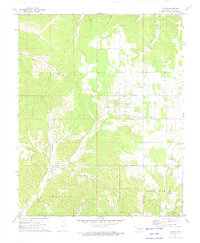
USGS Historical Quadrangle in GeoPDF.

USGS Historical Quadrangle in GeoPDF.
An overview of the Allison Mill showing the road, estensive old mine buildings, and the surrounding mountains.
Categories: Data;
Tags: 1950s,
Arizona,
Baboquivari Peak - 15 Min,
Baboquivari Valley physiographic area,
Baboquivari metallic mineral dist.,
A view of a dam and pond near the Allison mine with the mine in the background.
Categories: Data;
Tags: 1940s,
Arizona,
Baboquivari Peak - 15 Min,
Baboquivari Valley physiographic area,
Baboquivari metallic mineral dist.,
The dam and pond at the Allison mine.
Categories: Data;
Tags: 1940s,
Arizona,
Baboquivari Peak - 15 Min,
Baboquivari Valley physiographic area,
Baboquivari metallic mineral dist.,
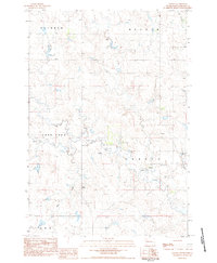
USGS Historical Quadrangle in GeoPDF.
|

|
