Filters: Tags: Coos Bay (X)
45 results (37ms)|
Filters
|
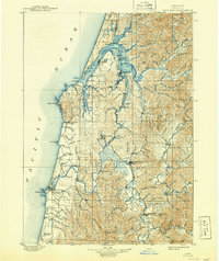
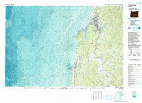
USGS Historical Quadrangle in GeoPDF.
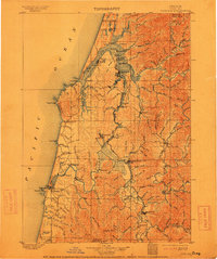
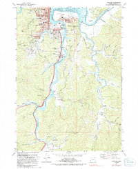
USGS Historical Quadrangle in GeoPDF.
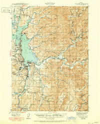
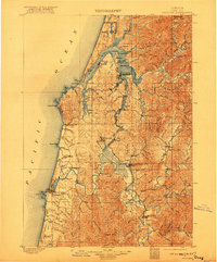
USGS Historical Quadrangle in GeoPDF.

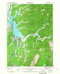
USGS Historical Quadrangle in GeoPDF.

USGS Historical Quadrangle in GeoPDF.
This data release contains data from the USGS survey of the Oregon OCS Floating Wind Farm Site in 2014.The bathymetry and shaded-relief rasters were generated from bathymetry data collected by USGS during the period from August 20 to September 1, 2014. using a Reson 7111 multibeam echosounder. The mapping mission collected bathymetry data from about 163 m to 566 m depths on the Oregon outer continental shelf. The acquisition was funded by the U.S. Bureau of Ocean Energy Management.
Categories: Data;
Types: Downloadable,
GeoTIFF,
Map Service,
Raster;
Tags: BOEM,
Bathymetry,
Bathymetry and Elevation,
Bureau of Ocean Energy Management,
Coos Bay,
This data release contains data from the USGS survey of the Oregon OCS Floating Wind Farm Site in 2014.The shaded-relief raster was generated from bathymetry data collected by USGS during the period from August 20 to September 1, 2014. using a Reson 7111 multibeam echosounder. The mapping mission collected bathymetry data from about 163 m to 566 m depths on the Oregon outer continental shelf. The acquisition was funded by the U.S. Bureau of Ocean Energy Management.
Categories: Data;
Types: Downloadable,
GeoTIFF,
Map Service,
Raster;
Tags: BOEM,
Bathymetry,
Bathymetry and Elevation,
Bureau of Ocean Energy Management,
Coos Bay,
This biotope raster is part of a data release of the Oregon outer continental shelf (OCS) proposed wind farm map site. The biotopes mapped in this area have been numbered to indicate combinations of seafloor hardness, ruggedness and depth associated with biotopes derived by analysis of video data as described in the accompanying Open-File Report (Cochrane and others, 2017). The map was created using video and multibeam echosounder bathymetry and backscatter data collected in 2014 and processed in 2015 (Cochrane and others, 2015). Cochrane, G.R., Dartnell, P., Hemery, L.G., and Hatcher, G., 2015, Data release for USGS field activity 2014-607-FA, Oregon OCS seafloor mapping; selected lease blocks relevant to renewable...
Categories: Data;
Types: Citation,
Downloadable,
GeoTIFF,
Map Service,
Raster;
Tags: BOEM,
Bureau of Ocean Energy Management,
CMECS,
CMGP,
Coastal and Marine Geology Program,
This part of the Oregon OCS Data Release presents geological observations from video collected on cruise 2014-607-FA in the Floating Wind Farm survey area. The survey was conducted using 12 hour day operations out of Charleston Harbor near Coos Bay, Oregon. The cruise plan consisted of 23 days on site split between sonar mapping and video ground truth surveying. Activities parsed out to nine days of sonar mapping, three days of video surveying, eight days of no operations due to weather, and three days mobilizing and demobilizing (table 1). Typically the Snavely would transit out to the survey area in an hour at a speed of 20 knots. Marine Mammal observations were made during the multibeam sonar mapping portion...
We used murrelet occupancy data collected by the Bureau of Land Management Coos Bay District and canopy metrics calculated from discrete return airborne LiDAR data to fit a logistic regression model predicting the probability of occupancy. Our final model for stand-level occupancy included distance to coast and 5 LiDAR-derived variables describing canopy structure. This dataset is a shapefile of forest stands in the Coos Bay district representing the model results.
Categories: Data;
Types: Downloadable,
Map Service,
OGC WFS Layer,
OGC WMS Layer,
Shapefile;
Tags: Coos Bay,
Ecology,
Forestry,
Oregon,
Oregon Coast Range,
USGS Historical Quadrangle in GeoPDF.
USGS Historical Quadrangle in GeoPDF.
To assess the current topography of tidal marsh at the study sites we conducted survey-grade global positioning system (GPS) surveys between 2009 and 2014 using a Leica RX1200 Real Time Kinematic (RTK) rover (±1 cm horizontal, ±2 cm vertical accuracy; Leica Geosystems Inc., Norcross, GA; Figure 4). At sites with RTK GPS network coverage (Padilla, Port Susan, Nisqually, Siletz, Bull Island, and Bandon), rover positions were received in real time from the Leica Smartnet system via a CDMA modem (www.lecia-geosystems.com). At sites without network coverage (Skokomish, Grays Harbor, and Willapa), rover positions were received in real time from a Leica GS10 antenna base station via radio link. At sites where we used the...
Categories: Data;
Types: ArcGIS REST Map Service,
ArcGIS Service Definition,
Downloadable,
Map Service,
Shapefile;
Tags: Bandon,
Bull Island,
Coos Bay,
Grays Harbor,
Nisqually,
We conducted vegetation surveys concurrently with elevation surveys at every fourth elevation point (~25% of the elevation points) (Figure 5). We visually assessed percent cover of all plant species within a 0.25 m2 quadrat, and recorded the average and maximum height (measured to the nearest centimeter) of each species. Total plant cover in a plot could exceed 100% due to vegetation layering. Vascular plant nomenclature generally follows Baldwin et al. (2012) and Cook et al. (2013). We located 69 tidal wetland species in 2,154 vegetation plots across the nine estuaries in the study. Common species included Carex lyngbyei, Sarcocornia perennis, Distichlis spicata, Deschampsia cespitosa, Juncus balticus and Potentilla...
To parameterize accretion for SLR models, we measured historic rates of mineral and organic matter accumulation at each site by collecting deep soil cores with a Russian peat borer. At each site, we obtained cores in each of three vegetation zones: low, medium, and high marsh. Two replicate cores were sampled from each station for a total of 6 cores per site (except Coos Bay where 7 cores were taken). Coring locations were determined by RTK GPS elevation and tidal inundation data. Transects for core sampling were determined in ArcGIS, using a digitial elevation model and site-specific tidal datums to choose station locations below MHW (low), between MHW and MHHW (mid), and above MHHW (high). Sediment cores were...
USGS Historical Quadrangle in GeoPDF.
USGS Historical Quadrangle in GeoPDF.
This data release contains data from the USGS field activity 2014-607-FA, a survey of the Oregon Outer Continental Shelf (OCS) Floating Wind Farm Site in 2014.The bathymetry raster was generated from bathymetry data collected by U.S. Geological Survey (USGS) during the period from August 20 to September 1, 2014 using a Reson 7111 multibeam echosounder. The mapping mission collected bathymetry data from about 163 m to 566 m depths on the Oregon outer continental shelf. The acquisition was funded by the U.S. Bureau of Ocean Energy Management. Contours were generated using the ESRI Contour tool in spatial analysit. The contour interval is 10 meters.
Categories: Data;
Types: Downloadable,
Map Service,
OGC WFS Layer,
OGC WMS Layer,
Shapefile;
Tags: Backscatter,
Bathymetry,
Bathymetry and Elevation,
CMGP,
Coos Bay,
This seafloor-character raster is part of a data release of the Oregon outer continental shelf (OCS) proposed wind farm map site. The substrate classes mapped in this area have been numbered to indicate combinations of seafloor hardness and ruggedness. The map was created from multibeam echosounder (MBES) bathymetry and backscattter data collected in 2014 and processed in 2015 (Cochrane and others, 2016) and a video supervised classification method described by Cochrane (2008). Cochrane, G.R., 2008, Video-supervised classification of sonar data for mapping seafloor habitat, in Reynolds, J.R., and Greene, H.G., eds., Marine habitat mapping technology for Alaska: Fairbanks, University of Alaska, Alaska Sea Grant...
Categories: Data;
Types: Citation,
Downloadable,
GeoTIFF,
Map Service,
Raster;
Tags: BOEM,
Bureau of Ocean Energy Management,
CMGP,
Coastal and Marine Geology Program,
Coos Bay,
|

|
