Filters: Tags: Coyote Creek (X)
6 results (66ms)|
Filters
Date Range
Extensions Types
Contacts
Categories Tag Types Tag Schemes |
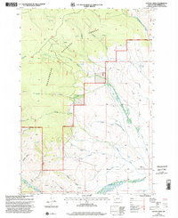
USGS Historical Quadrangle in GeoPDF.
Benthic invertebrate communities are monitored because the composition of those communities can affect and be affected by the water quality of an aquatic system. Benthic communities use and sometimes regulate the cycling of essential elements (for example, carbon). Benthic invertebrate taxa may also indicate acute and chronic stressors in an environment because they accumulate contaminants and can respond – sometimes dramatically - to oligotrophic and eutrophic conditions. Benthic communities affect water quality by grazing pelagic food resources and increasing the rate of nutrient regeneration through feeding and bioturbating sediments. South San Francisco Bay is a system dependent on phytoplankton as the base...
Categories: Data;
Types: Map Service,
OGC WFS Layer,
OGC WMS Layer,
OGC WMS Service;
Tags: Alviso Slough,
Annelids,
Aquatic Biology,
Benthic Ecosystems,
Benthos,
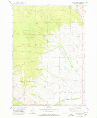
USGS Historical Quadrangle in GeoPDF.
A 1-m resolution, continuous surface, bathymetric digital elevation model (DEM) of the southern portion of San Francisco Bay, was constructed from bathymetric surveys collected from 2005 to 2020. In 2014 and 2015 the California Ocean Protection Council (OPC) contracted the collection of bathymetric surveys of large portions of San Francisco Bay. A total of 93 surveys were collected using a combination of multibeam and interferometric side-scan sonar systems. Of those 93 surveys, 75 consist of swaths of data ranging from 18- to just over 100-meters wide. These swaths were separated by data gaps ranging from 10- to just over 300-meters wide. The no-data areas required interpolation to create a continuous surface....
Polygon shapefile showing the footprint boundaries, source agency origins, and resolutions of compiled bathymetric digital elevation models (DEMs) used to construct a continuous, high-resolution DEM of the southern portion of San Francisco Bay.
Categories: Data;
Types: Downloadable,
Map Service,
OGC WFS Layer,
OGC WMS Layer,
Shapefile;
Tags: Alviso Slough,
Bathymetry and Elevation,
CMHRP,
Coastal and Marine Hazards and Resources Program,
Coyote Creek,
A 1-m resolution, continuous surface, bathymetric digital elevation model (DEM) of the southern portion of San Francisco Bay, was constructed from bathymetric surveys collected from 2005 to 2020. In 2014 and 2015 the California Ocean Protection Council (OPC) contracted the collection of bathymetric surveys of large portions of San Francisco Bay. A total of 93 surveys were collected using a combination of multibeam and interferometric side-scan sonar systems. Of those 93 surveys, 75 consist of swaths of data ranging from 18- to just over 100-meters wide. These swaths were separated by data gaps ranging from 10- to just over 300-meters wide. The no-data areas required interpolation to create a continuous surface....
|

|
