Filters: Tags: Cuba (X)
38 results (44ms)|
Filters
Date Range
Extensions (Less) Types (Less)
Contacts (Less)
Categories (Less) Tag Types
|
This composite shaded relief image dataset depicts generalized bathymetry and topography of the Caribbean region.
The Caribbean region is part of World Energy Assessment region 6 (Central and South America). A fundamental task in the assessment is to map the locations and type of production for existing oil and gas fields. The Petroconsultants database is the only available database that has coverage for the Caribbean region. Oil and gas field symbols represent field center-points and are published with permission from Petroconsultants International Data Corporation, 2002 database.
Categories: Data,
pre-SM502.8;
Types: Downloadable,
Map Service,
OGC WFS Layer,
OGC WMS Layer,
Shapefile;
Tags: AG,
AI,
AN,
AW,
Anguilla,
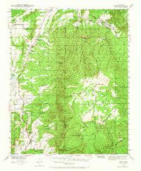
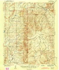
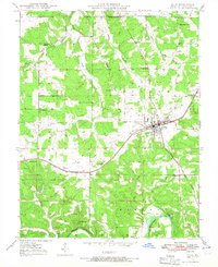
USGS Historical Quadrangle in GeoPDF.
The Critical Minerals in Archived Mine Samples Database (CMDB) contains chemistry and geologic information for historic ore and ore-related rock samples from mineral deposits in the United States. In addition, the database contains samples from archetypal deposits from 27 other countries in North America, South America, Asia, Africa and Europe. Samples were obtained from archived ore collections under the U.S. Geological Survey's project titled "Quick Assessment of Rare and Critical Metals in Ore Deposits: A National Assessment" (2008 to 2013) in an effort to begin an assessment of the Nations' previously mined ore deposits for critical minerals. Mineralized and altered rock samples were provided by the Colorado...
Categories: Data;
Types: ArcGIS REST Map Service,
ArcGIS Service Definition,
Downloadable,
Map Service,
OGC WFS Layer,
OGC WMS Layer,
Shapefile;
Tags: Alaska,
Argentina,
Arizona,
Arkansas,
Australia,
USGS Historical Quadrangle in GeoPDF.

USGS Historical Quadrangle in GeoPDF.
The publication "Invaders from Islands: Thermal Matching, Potential, or Plasticity?" is comprised of data derived from multiple datasets. These datasets include climatic and temperature variables used in ecological niche models for predicting suitable habitat for Leiocephalus carinatus in its invaded and native ranges. Also included are thermal tolerance measurements assessed in March 2020 for Leiocephalus carinatus from Key Largo and Cocoa Beach, Florida, USA. Additionally, we include weatherstation data for local minimum and maximum ambient temperatures for the experimentally assessed populations at short (months) and long (decades) timescales. The dataset "curly_thermal_limits" describes thermal tolerance data...
Outcrop of Camarones conglomerate member of San Luis formation, in bed of Rio Barrancas 4.8 km. southeast of La Maya. Geology of South-central Oriente, Cuba. Oct. 1940-Oct. 1945. Published as Fig. 37, U.S.G.S. Bulletin 975-D. 1955.
Categories: Image;
Types: Map Service,
OGC WFS Layer,
OGC WMS Layer,
OGC WMS Service;
Tags: Cuba,
Lewis, G.E. Collection,
Photographers,
photo print
USGS Historical Quadrangle in GeoPDF.
USGS Historical Quadrangle in GeoPDF.
USGS Historical Quadrangle in GeoPDF.

USGS Historical Quadrangle in GeoPDF.
This dataset includes a modified subset of polygon features that describe U.S. Geological Survey's defined geologic provinces of the World. Each province has a set of geologic characteristics that distinguish it from surrounding provinces. These characteristics may include dominant lithologies, the age of the strata, and/or structural type. Each province is assigned a unique numeric code and may fall within two or more countries or assessment regions.
Categories: Data,
pre-SM502.8;
Types: Downloadable,
Map Service,
OGC WFS Layer,
OGC WMS Layer,
Shapefile;
Tags: AG,
AI,
AN,
AW,
Anguilla,
USGS Historical Quadrangle in GeoPDF.
USGS Historical Quadrangle in GeoPDF.
Assessment Units of the Jurassic-Cretaceous Composite Total Petroleum System, North Cuba Basin, Cuba
The Assessment Unit is the fundamental unit used in the World Petroleum Resource Project. The Assessment Unit is defined within the context of the higher-level Total Petroleum System. The Assessment Unit is shown here as a geographic boundary interpreted, defined, and mapped by the geologist responsible for the province and incorporates a set of known or postulated oil and (or) gas accumulations sharing similar geologic, geographic, and temporal properties within the Total Petroleum System, such as source rock, timing, migration pathways, trapping mechanism, and hydrocarbon type. The Assessment Unit boundary is defined geologically as the limits of the geologic elements that define the Assessment Unit, such as limits...
Categories: Data,
pre-SM502.8;
Types: Downloadable,
Map Service,
OGC WFS Layer,
OGC WMS Layer,
Shapefile;
Tags: 2000plusassessment,
Assessment Unit,
Cuba,
Earth Science,
Economic geology,
USGS Historical Quadrangle in GeoPDF.
USGS Historical Quadrangle in GeoPDF.
USGS Historical Quadrangle in GeoPDF.
USGS Historical Quadrangle in GeoPDF.
|

|
