Filters: Tags: Drainage (X) > partyWithName: U.S. Geological Survey (X) > Types: Citation (X)
12 results (84ms)|
Filters
Date Range
Extensions Types Contacts
Categories Tag Types Tag Schemes
|

The USGS National Hydrography Dataset (NHD) service from The National Map (TNM) is a comprehensive set of digital spatial data that encodes information about naturally occurring and constructed bodies of surface water (lakes, ponds, and reservoirs), paths through which water flows (canals, ditches, streams, and rivers), and related entities such as point features (springs, wells, stream gages, and dams). The information encoded about these features includes classification and other characteristics, delineation, geographic name, position and related measures, a "reach code" through which other information can be related to the NHD, and the direction of water flow. The network of reach codes delineating water and...
This dataset is the output of a python script/ArcGIS model that identifes dikes as having a difference in elevation above a certain threshold. If the elevation difference was below a certain threshold the area was not considered a dike; however, if the difference in elevation between two points was significantly high then the area was marked as a dike. Areas continuous with eachother were considered part of the same dike. Post processing occured. Users examined the data output, comparing the proposed dike locations to aerial imagery, flowline data, and the DEM. Dikes that appeared to be false positives were deleted from the data set.
Categories: Data;
Types: Citation,
Downloadable,
Map Service,
OGC WFS Layer,
OGC WMS Layer,
Shapefile;
Tags: Great Lakes,
LIDAR,
Lake Erie,
biogeography,
coastal ecosystems,
This dataset is the output of a python script/ArcGIS model that identifes dikes as having a difference in elevation above a certain threshold. If the elevation difference was below a certain threshold the area was not considered a dike; however, if the difference in elevation between two points was significantly high then the area was marked as a dike. Areas continuous with eachother were considered part of the same dike. Post processing occured. Users examined the data output, comparing the proposed dike locations to aerial imagery, flowline data, and the DEM. Dikes that appeared to be false positives were deleted from the data set.
Categories: Data;
Types: Citation,
Downloadable,
Map Service,
OGC WFS Layer,
OGC WMS Layer,
Shapefile;
Tags: Detroit River,
Great Lakes,
LIDAR,
Lake St. Clair,
St. Clair River,
This represents the flowline network in Western Lale Erie Restoration Assessment (WLERA). It is attributed with the number of disconnections between the reach and the connecting river system. These data will help identify the condition of hydrologic separation between potential restoration areas and the connecting river system. Low numbers represent fewer disconnections such as culverts between the reach and the rivers requiring no flow network modification to restore the area.
Categories: Data;
Types: Citation,
Downloadable,
Map Service,
OGC WFS Layer,
OGC WMS Layer,
Shapefile;
Tags: Artificial Path,
Canal / Ditch,
FWHydrography,
Great Lakes,
Hydrography,

This geodatabase contains streams, waterbodies and wetlands, streamflow gaging stations, and coastlines for the United States, Puerto Rico, and the U.S. Virgin Islands. The streams are incorporated into a geometric network. All feature classes are vertically integrated with each other and with 1:1,000,000-scale transportation and boundary data sets.
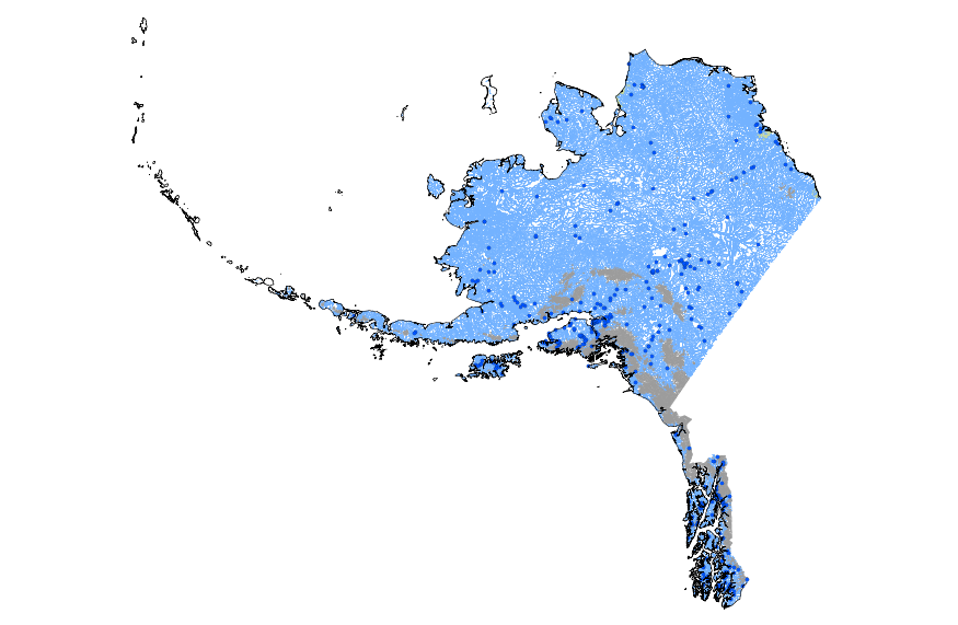
This geodatabase contains streams, waterbodies and wetlands, streamflow gaging stations, and coastlines for Alaska. The streams are incorporated into a geometric network. All feature classes are vertically integrated with each other and with 1:1,000,000-scale transportation and boundary data sets.
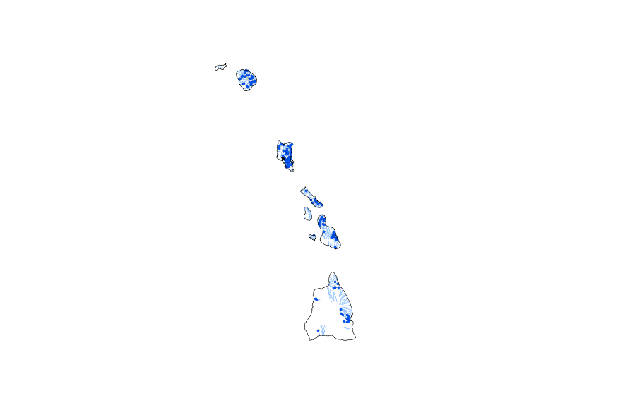
This geodatabase contains streams, waterbodies and wetlands, streamflow gaging stations, and coastlines for Hawaii. The streams are incorporated into a geometric network. All feature classes are vertically integrated with each other and with 1:1,000,000-scale transportation and boundary data sets.
This represents the flowline network in Connecting River Systems Restoration Assessment (CRSRA). It is attributed with the number of disconnections between the reach and the connecting river system. These data will help identify the condition of hydrologic separation between potential restoration areas and the connecting river system. Low numbers represent fewer disconnections such as culverts between the reach and the rivers requiring no flow network modification to restore the area.
Categories: Data;
Types: Citation,
Downloadable,
Map Service,
OGC WFS Layer,
OGC WMS Layer,
Shapefile;
Tags: Artificial Path,
Canal / Ditch,
Detroit River,
FWHydrography,
Great Lakes,
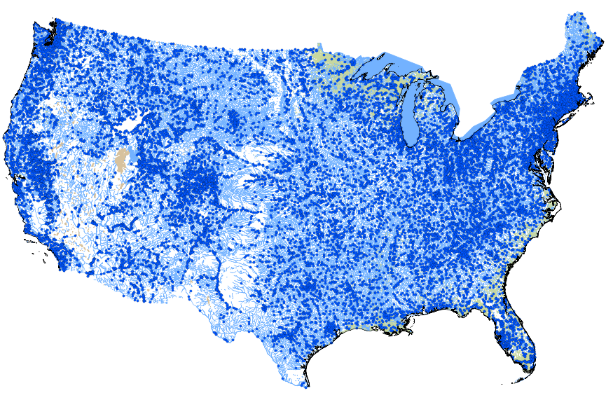
This geodatabase contains streams, waterbodies and wetlands, streamflow gaging stations, and coastlines for the conterminous United States. The streams are incorporated into a geometric network. All feature classes are vertically integrated with each other and with 1:1,000,000-scale transportation and boundary data sets.
This dataset is the output of a python script/ArcGIS model that identifes dikes as having a difference in elevation above a certain threshold. If the elevation difference was below a certain threshold the area was not considered a dike; however, if the difference in elevation between two points was significantly high then the area was marked as a dike. Areas continuous with eachother were considered part of the same dike. Post processing occured. Users examined the data output, comparing the proposed dike locations to aerial imagery, flowline data, and the DEM. Dikes that appeared to be false positives were deleted from the data set.
Categories: Data;
Types: Citation,
Downloadable,
Map Service,
OGC WFS Layer,
OGC WMS Layer,
Shapefile;
Tags: Great Lakes,
LIDAR,
Saginaw Bay,
biogeography,
coastal ecosystems,
This represents the flowline network in Sagina Bay Restoration Assessment (SBRA). It is attributed with the number of disconnections between the reach and the connecting river system. These data will help identify the condition of hydrologic separation between potential restoration areas and the connecting river system. Low numbers represent fewer disconnections such as culverts between the reach and the rivers requiring no flow network modification to restore the area.
Categories: Data;
Types: Citation,
Downloadable,
Map Service,
OGC WFS Layer,
OGC WMS Layer,
Shapefile;
Tags: Artificial Path,
Canal / Ditch,
FWHydrography,
Great Lakes,
Hydrography,
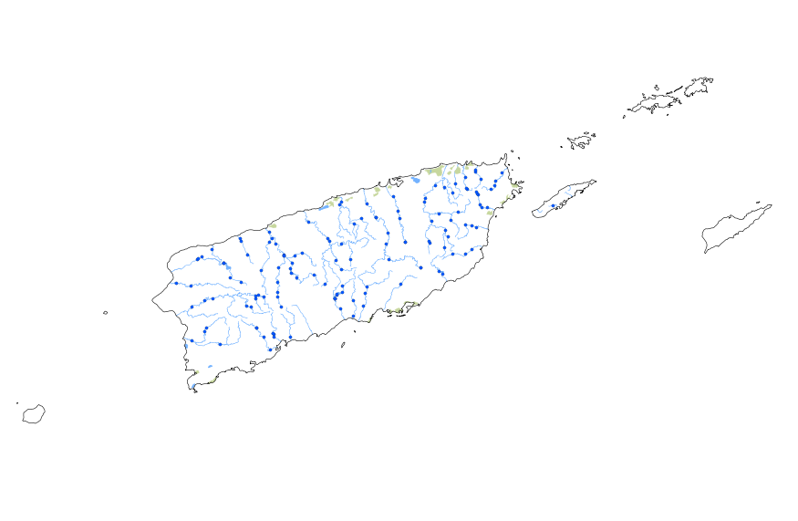
This geodatabase contains streams, waterbodies and wetlands, streamflow gaging stations, and coastlines for Puerto Rico and the U.S. Virgin Islands. The streams are incorporated into a geometric network. All feature classes are vertically integrated with each other and with 1:1,000,000-scale transportation and boundary data sets.
|

|
