Filters: Tags: GREEN RIVER (X) > Categories: Data (X)
10 results (31ms)|
Filters
Date Range
Types Contacts
Categories Tag Types
|
These data were compiled to study mercury and selenium concentrations in fish species and assemblages in lotic waterbodies across the Upper Colorado River Basin. Data were compiled from State and Federal agencies. This data table contains raw concentration data, as well as standardized concentrations corrected for differences based on sample type (i.e., tissue type), species-specific bioaccumulation rates (Table S1), and fish size (Table S2). The data were used in linear mixed effects models to estimate average mercury and selenium concentration in fish species and in fish assemblages, including fish total length (cm), sampling location (Sub basin name and GPS coordinates), and sampling year (Figures 2,3, and 4...
These data are bathymetry (river bottom elevation) in XYZ format (Easting, Northing, Elevation), generated from the July 24–25, 2023, and July 31, 2023, bathymetric survey of the Green River near Brownsville, Kentucky, from approximately 1.5 miles downstream from the Brownsville boat ramp to approximately 0.8 mile upstream from the former Green River Lock and Dam #6 site (3.8 miles total reach length). Hydrographic data were collected using an acoustic Doppler current profiler (ADCP) with an integrated global navigation satellite system (GNSS) smart antenna. The ADCP and GNSS antenna were mounted on a marine survey vessel, and data were collected as the survey vessel traversed the river along planned survey lines....
These data were compiled for/to National Park Service and Upper Colorado River Endangered Fish Recovery Program. Objective(s) of our study were to resurvey previously established cross sections on the Green River, Utah, in, and upstream, from Ouray National Wildlife Refuge to document changes in channel width, depth, and cross-sectional area. These data represent the 2020 resurvey coordinates and elevations of previously established cross sections (1994 - 1996) on the Green River. These data were collected in the Green River between Jensen and Ouray, Utah from October 11-16, 2020. These data were collected by Ronald Griffiths and Joel Unema from the U.S. Geological Survey using real-time kinematic (RTK) GPS positioning....
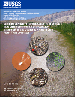
The Colorado River Basin provides habitat for 14 native fish, including four endangered species protected under the Federal Endangered Species Act of 1973 - Colorado pikeminnow (Ptychocheilus lucius), razorback sucker (Xyrauchen texanus), bonytail (Gila elegans), and humpback chub (Gila cypha). These endangered fish species once thrived in the Colorado River system, but water-resource development, including the building of numerous diversion dams and several large reservoirs, and the introduction of nonnative fish, resulted in large reductions in the numbers and range of the four species. Knowledge of sediment dynamics in river reaches important to specifc life-stages of the endangered fishes is critical to understanding...
Categories: Data,
Publication;
Tags: Green River,
Surface water,
aspinall unit,
blue mesa reservoir,
colorado pikeminnow,
The informal Uteland Butte member of the Eocene Green River Formation in the Uinta Basin, Utah is one of the few examples of a continuous petroleum resource play in the world situated in a lacustrine sedimentary basin (Johnson and others, 2015; Birdwell and others, 2016). The datasets compiled here were collected on outcrop samples of the Uteland Butte member with the purpose of better characterizing the geochemical and mineralogical properties and variability through this unit, which represents a period of freshwater conditions in Eocene Lake Uinta in the Uinta Basin. The data have been integrated with outcrop descriptions, geophysical (gamma ray) logs, and interpretations of depositional conditions across geographic...
Categories: Data;
Tags: Energy Resources,
Eocene Green River,
Green River,
Green River Formation,
Petroleum Geochemistry Research Laboratory,
Trout Unlimited will extend its existing Adopt-a-Trout program to the Henrys Fork River, a tributary to the Green River in the Colorado River basin. The project will include work with the Wyoming Game and Fish Department and local schools to tag and monitor Colorado River Cutthroat trout movements to learn more about fish passage issues, areas of high entrainment, habitat use, and native and wild trout migratory patterns. Colorado River Cutthroat trout are native to the Henrys Fork River and occupy portions of the drainage; however, no data exists for Colorado River Cutthroat trout in the Wyoming portion of the Henrys Fork drainage to understand population dynamics and habitat restraints.
Categories: Data;
Types: Report;
Tags: EARTH SCIENCE > LAND SURFACE > LANDSCAPE,
Green River,
Henry's Fork,
LCC,
LCC Network Science Catalog,
The Eocene Green River Formation in the Piceance Basin of Colorado contains some of the richest oil shale deposits in the world (Johnson and others, 2009; Birdwell and others, 2013). The datasets compiled here were collected with the purpose of refining our understanding of geochemical variability through the depositional history of Eocene Lake Uinta in Piceance Basin. The effects of salinity, water column stratification, and redox conditions were of particular interest. The inclusion of basin center (cores) and basin margin (outcrop) samples through the full stratigraphic interval of the Green River Formation facilitated temporal and spatial assessment of trends within the basin. Geochemical and sedimentologic...
Categories: Data;
Tags: Energy Resources,
Eocene Lake Uinta,
Green River,
Green River Formation,
Petroleum Geochemistry Research Laboratory,
A topographic and bathymetric survey was collected along a reach of the Green River downstream of Dinosaur National Monument. The surveyed reach extends approximately 16 kilometers upstream and 6 kilometers downstream of the U.S. Route 40 bridge near Jensen, Utah. The topographic and bathymetric data include survey point data for 382 cross sections over 22 kilometers and are provided as a text file of easting, northing and elevation, in meters. The cross-section location data were collected using real-time kinematic Global Navigation Satellite Systems (GNSS) by USGS personnel from March 26, 2018, through March 29, 2018 using a combination of Sound Navigation and Ranging (SONAR) and wading techniques.
Categories: Data;
Types: Map Service,
OGC WFS Layer,
OGC WMS Layer,
OGC WMS Service;
Tags: Dinosaur National Monument,
Green River,
Jensen,
USGS Science Data Catalog (SDC),
Utah,
This data is a compilation of fishery monitoring data collected by state agencies over several decades in tailwaters downriver of dams in Colorado, Utah, Montana, Wyoming, Idaho, New Mexico, Arizona, California, and Oregon. Specifically, the data contained herein is summary data used in four generalized linear mixed models that were developed to assess the biological and hydrologic factors that influence rainbow and brown trout recruitment and adult size in tailwaters across the western United States.
Categories: Data;
Types: Citation;
Tags: Anderson Ranch dam,
Beaverhead River,
Bighorn River,
Blue River,
Boysen dam,
This collection consists of core plugs and pulverized samples taken from three Green River oil shale cores. The cores are: Blacks Fork, Coyote Wash and Barcus Creek cores. These cores were each drilled in the depositional center of the three major Green River basins in Wyoming, Colorado, and Utah to support research into oil shale resources. The cores themselves are part of the UGSG Core Research Center Collection of Core. Samples were taken in the 1980s to support research focused on the geochemistry of the Green River oil shale by Michele Tuttle. The samples are maintained as a collection to support future research for Colorado, Wyoming, and Utah oil shale projects, specifically for the development of infrared...
|

|
