Filters: Tags: Grayling (X)
16 results (27ms)|
Filters
Date Range
Types Contacts Tag Types Tag Schemes |
This polygon feature class describes areas used for subsistence harvesting of ptarmigan and grouse in 2011 by surveyed households in Grayling, Alaska. This is a partial representation of areas used for resource harvesting in 2011.
This feature class describes areas used for subsistence harvesting of northern pike in 2011 by surveyed households in Grayling, Alaska. This is a partial representation of areas used for resource harvesting in 2011.
This polygon feature class describes areas used for subsistence harvesting of ducks and geese in 2011 by surveyed households in Grayling, Alaska. This is a partial representation of areas used for resource harvesting in 2011.
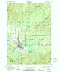
USGS Historical Quadrangle in GeoPDF.
This points feature class describes areas used for subsistence harvesting of sheefish in 2011 by surveyed households in Grayling, Alaska. This is a partial representation of areas used for resource harvesting in 2011.
USGS Historical Quadrangle in GeoPDF.
This polygon feature class describes areas used for subsistence harvesting of berries and plants in 2011 by surveyed households in Grayling, Alaska. This is a partial representation of areas used for resource harvesting in 2011.
USGS Historical Quadrangle in GeoPDF.
This polygon feature class describes areas used for subsistence harvesting of moose in 2011 by surveyed households in Grayling, Alaska. This is a partial representation of areas used for resource harvesting in 2011.
USGS Historical Quadrangle in GeoPDF.

USGS Historical Quadrangle in GeoPDF.

USGS Historical Quadrangle in GeoPDF.
USGS Historical Quadrangle in GeoPDF.
This points feature class describes areas used for subsistence harvesting of salmon in 2011 by surveyed households in Grayling, Alaska. This is a partial representation of areas used for resource harvesting in 2011.
This feature class describes areas used for subsistence harvesting of northern pike in 2011 by surveyed households in Grayling, Alaska. This is a partial representation of areas used for resource harvesting in 2011.
This feature class describes areas used for subsistence harvesting of beaver in 2011 by surveyed households in Grayling, Alaska. This is a partial representation of areas used for resource harvesting in 2011.
|

|
