Filters
Date Range
Extensions
Types
Contacts
Categories
Tag Types
Tag Schemes
|
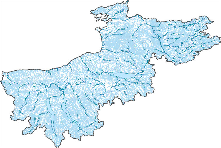
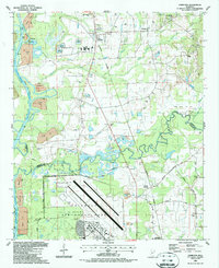
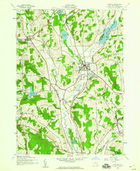
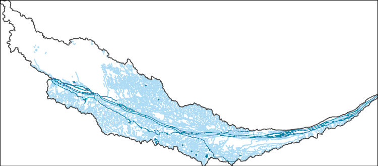
The National Hydrography Dataset (NHD) is a feature-based database that interconnects and uniquely identifies the stream segments or reaches that make up the nation's surface water drainage system. NHD data was originally developed at 1:100,000-scale and exists at that scale for the whole country. This high-resolution NHD, generally developed at 1:24,000/1:12,000 scale, adds detail to the original 1:100,000-scale NHD. (Data for Alaska, Puerto Rico and the Virgin Islands was developed at high-resolution, not 1:100,000 scale.) Local resolution NHD is being developed where partners and data exist. The NHD contains reach codes for networked features, flow direction, names, and centerline representations for areal water...
Tags: Administrative watershed units,
Administrative watershed units,
Area of Complex Channels,
Area to be submerged,
Basin, All tags...
Basin,
Bay/Inlet,
Boundaries,
Boundary,
Bridge,
Canal/Ditch,
Cayuga,
Chemung,
Coastline,
Connector,
Cortland,
Dam/Weir,
Downloadable Data,
Drainage areas for surface water,
Drainageway,
Estuary,
Flow direction network,
Flume,
ForeShore,
Gaging Station,
Gate,
GeoPackage,
HU-4,
HU-4 Subregion,
HU10,
HU12,
HU14,
HU16,
HU2,
HU4,
HU4_0414,
HU6,
HU8,
HUC,
Hamilton,
Hazard Zone,
Herkimer,
Hydrographic,
Hydrography,
Hydrography,
Hydrography,
Hydrologic Unit Code,
Hydrologic Units,
Ice mass,
Inundation Area,
Jefferson,
Levee,
Lewis,
Line,
Livingston,
Lock Chamber,
Madison,
Marsh,
Monroe,
NY,
National Hydrography Dataset (NHD),
National Hydrography Dataset (NHD) Best Resolution,
National Hydrography Dataset (NHD) Best Resolution,
New York,
Nonearthen Shore,
Oneida,
Onondaga,
Ontario,
Open Geospatial Consortium GeoPackage 1.2,
Orthoimage,
Oswego,
Playa,
Point,
PointEvent,
Pond,
Rapids,
Rapids,
Reach,
Reach code,
Reef,
Region,
Reservoir,
Rock,
Schuyler,
Sea/Ocean,
Seneca,
Sink/Rise,
Sounding Datum Line,
Special Use Zone,
Special Use Zone Limit,
Spillway,
Steuben,
Stream,
Stream/River,
Sub-basin,
Sub-region,
Subbasin,
Submerged Stream,
Subregion,
Subwatershed,
Surface water systems,
Swamp,
Tioga,
Tompkins,
Topographic,
Tunnel,
US,
Underground Conduit,
United States,
WBD,
WBD,
Wall,
Wash,
Water Intake Outflow,
Waterfall,
Watershed,
Watershed Boundaries,
Watershed Boundary Dataset,
Watershed Boundary Dataset,
Wayne,
Well,
Yates,
artificial path,
boundaries,
dams,
drainage systems and characteristics,
inlandWaters,
lakes,
ngda,
rivers, Fewer tags
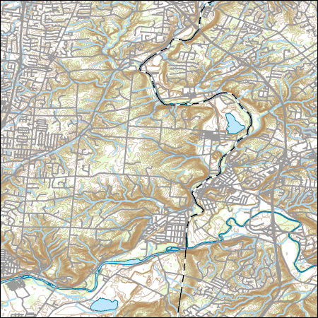
Layers of geospatial data include contours, boundaries, land cover, hydrography, roads, transportation, geographic names, structures, and other selected map features.
Types: Citation;
Tags: 7.5 x 7.5 minute,
7_5_Min,
Clermont,
Combined Vector,
Combined Vector, All tags...
Combined Vector,
Downloadable Data,
Esri Shapefile nan,
Hamilton,
OH,
Ohio,
Public Land Survey System,
Shapefile,
Topo Map Vector Data,
US,
United States,
boundary,
contours,
geographic names,
hydrography,
structures,
transportation,
woodland, Fewer tags
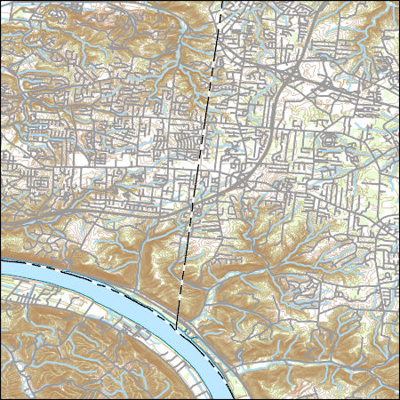
Layers of geospatial data include contours, boundaries, land cover, hydrography, roads, transportation, geographic names, structures, and other selected map features.
Types: Citation;
Tags: 7.5 x 7.5 minute,
7_5_Min,
Campbell,
Clermont,
Combined Vector, All tags...
Combined Vector,
Combined Vector,
Downloadable Data,
Esri File GeoDatabase 10,
FileGDB,
Hamilton,
KY,
Kentucky,
OH,
Ohio,
Public Land Survey System,
Topo Map Vector Data,
US,
United States,
boundary,
contours,
geographic names,
hydrography,
structures,
transportation,
woodland, Fewer tags
USGS Historical Quadrangle in GeoPDF.
Tags: 30 x 30 minute,
Downloadable Data,
GeoPDF,
GeoTIFF,
Hamilton, All tags...
Historical Topographic Maps,
Historical Topographic Maps 30 x 30 Minute Map Series,
Map,
TX,
imageryBaseMapsEarthCover, Fewer tags
USGS Historical Quadrangle in GeoPDF.
Tags: 7.5 x 7.5 minute,
Downloadable Data,
GeoPDF,
GeoTIFF,
Hamilton, All tags...
Historical Topographic Maps,
Historical Topographic Maps 7.5 x 7.5 Minute Map Series,
MS,
Map,
imageryBaseMapsEarthCover, Fewer tags
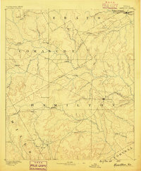
USGS Historical Quadrangle in GeoPDF.
Tags: 7.5 x 7.5 minute,
Downloadable Data,
GeoPDF,
GeoTIFF,
Hamilton, All tags...
Historical Topographic Maps,
Historical Topographic Maps 7.5 x 7.5 Minute Map Series,
Map,
NY,
imageryBaseMapsEarthCover, Fewer tags
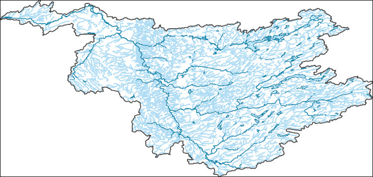
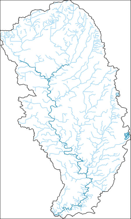
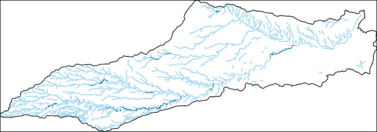
The National Hydrography Dataset (NHD) is a feature-based database that interconnects and uniquely identifies the stream segments or reaches that make up the nation's surface water drainage system. NHD data was originally developed at 1:100,000-scale and exists at that scale for the whole country. This high-resolution NHD, generally developed at 1:24,000/1:12,000 scale, adds detail to the original 1:100,000-scale NHD. (Data for Alaska, Puerto Rico and the Virgin Islands was developed at high-resolution, not 1:100,000 scale.) Local resolution NHD is being developed where partners and data exist. The NHD contains reach codes for networked features, flow direction, names, and centerline representations for areal water...
Tags: Administrative watershed units,
Administrative watershed units,
Area of Complex Channels,
Area to be submerged,
Basin, All tags...
Basin,
Bay/Inlet,
Boundaries,
Boundary,
Bridge,
Canal/Ditch,
Coastline,
Connector,
Dam/Weir,
Downloadable Data,
Drainage areas for surface water,
Drainageway,
Esri File GeoDatabase 10,
Estuary,
FileGDB,
Flow direction network,
Flume,
ForeShore,
Gaging Station,
Gate,
HU-8,
HU-8 Subbasin,
HU10,
HU12,
HU14,
HU16,
HU2,
HU4,
HU6,
HU8,
HU8_04140301,
HUC,
Hamilton,
Hazard Zone,
Herkimer,
Hydrographic,
Hydrography,
Hydrography,
Hydrography,
Hydrologic Unit Code,
Hydrologic Units,
Ice mass,
Inundation Area,
Jefferson,
Levee,
Lewis,
Line,
Lock Chamber,
Marsh,
NY,
National Hydrography Dataset (NHD),
National Hydrography Dataset (NHD) Best Resolution,
National Hydrography Dataset (NHD) Best Resolution,
New York,
Nonearthen Shore,
Oneida,
Orthoimage,
Playa,
Point,
PointEvent,
Pond,
Rapids,
Rapids,
Reach,
Reach code,
Reef,
Region,
Reservoir,
Rock,
Sea/Ocean,
Sink/Rise,
Sounding Datum Line,
Special Use Zone,
Special Use Zone Limit,
Spillway,
Stream,
Stream/River,
Sub-basin,
Sub-region,
Subbasin,
Submerged Stream,
Subregion,
Subwatershed,
Surface water systems,
Swamp,
Topographic,
Tunnel,
US,
Underground Conduit,
United States,
WBD,
WBD,
Wall,
Wash,
Water Intake Outflow,
Waterfall,
Watershed,
Watershed Boundaries,
Watershed Boundary Dataset,
Watershed Boundary Dataset,
Well,
artificial path,
boundaries,
dams,
drainage systems and characteristics,
inlandWaters,
lakes,
ngda,
rivers, Fewer tags
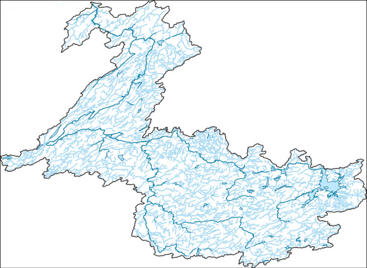
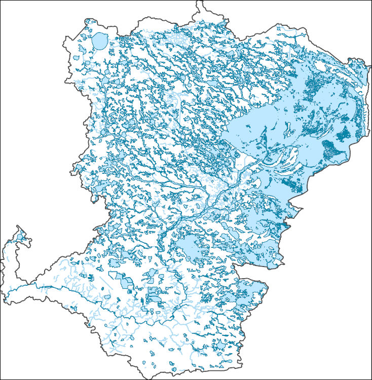
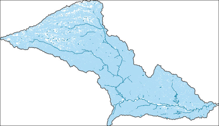
The National Hydrography Dataset (NHD) is a feature-based database that interconnects and uniquely identifies the stream segments or reaches that make up the nation's surface water drainage system. NHD data was originally developed at 1:100,000-scale and exists at that scale for the whole country. This high-resolution NHD, generally developed at 1:24,000/1:12,000 scale, adds detail to the original 1:100,000-scale NHD. (Data for Alaska, Puerto Rico and the Virgin Islands was developed at high-resolution, not 1:100,000 scale.) Local resolution NHD is being developed where partners and data exist. The NHD contains reach codes for networked features, flow direction, names, and centerline representations for areal water...
Tags: Administrative watershed units,
Administrative watershed units,
Area of Complex Channels,
Area to be submerged,
Basin, All tags...
Basin,
Bay/Inlet,
Boundaries,
Boundary,
Bridge,
Canal/Ditch,
Coastline,
Connector,
Dam/Weir,
Downloadable Data,
Drainage areas for surface water,
Drainageway,
Estuary,
Flow direction network,
Flume,
ForeShore,
Gaging Station,
Gate,
GeoPackage,
HU-8,
HU-8 Subbasin,
HU10,
HU12,
HU14,
HU16,
HU2,
HU4,
HU6,
HU8,
HU8_04290003,
HUC,
Hamilton,
Hazard Zone,
Herkimer,
Hydrographic,
Hydrography,
Hydrography,
Hydrography,
Hydrologic Unit Code,
Hydrologic Units,
Ice mass,
Inundation Area,
Jefferson,
Levee,
Lewis,
Line,
Lock Chamber,
Marsh,
NY,
National Hydrography Dataset (NHD),
National Hydrography Dataset (NHD) Best Resolution,
National Hydrography Dataset (NHD) Best Resolution,
New York,
Nonearthen Shore,
Open Geospatial Consortium GeoPackage 1.2,
Orthoimage,
Playa,
Point,
PointEvent,
Pond,
Rapids,
Rapids,
Reach,
Reach code,
Reef,
Region,
Reservoir,
Rock,
Sea/Ocean,
Sink/Rise,
Sounding Datum Line,
Special Use Zone,
Special Use Zone Limit,
Spillway,
St. Lawrence,
Stream,
Stream/River,
Sub-basin,
Sub-region,
Subbasin,
Submerged Stream,
Subregion,
Subwatershed,
Surface water systems,
Swamp,
Topographic,
Tunnel,
US,
Underground Conduit,
United States,
WBD,
WBD,
Wall,
Wash,
Water Intake Outflow,
Waterfall,
Watershed,
Watershed Boundaries,
Watershed Boundary Dataset,
Watershed Boundary Dataset,
Well,
artificial path,
boundaries,
dams,
drainage systems and characteristics,
inlandWaters,
lakes,
ngda,
rivers, Fewer tags
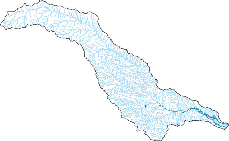
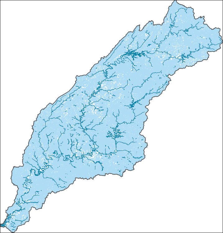
The National Hydrography Dataset (NHD) is a feature-based database that interconnects and uniquely identifies the stream segments or reaches that make up the nation's surface water drainage system. NHD data was originally developed at 1:100,000-scale and exists at that scale for the whole country. This high-resolution NHD, generally developed at 1:24,000/1:12,000 scale, adds detail to the original 1:100,000-scale NHD. (Data for Alaska, Puerto Rico and the Virgin Islands was developed at high-resolution, not 1:100,000 scale.) Local resolution NHD is being developed where partners and data exist. The NHD contains reach codes for networked features, flow direction, names, and centerline representations for areal water...
Tags: Administrative watershed units,
Administrative watershed units,
Area of Complex Channels,
Area to be submerged,
Basin, All tags...
Basin,
Bay/Inlet,
Boundaries,
Boundary,
Bridge,
Canal/Ditch,
Coastline,
Connector,
Dam/Weir,
Downloadable Data,
Drainage areas for surface water,
Drainageway,
Estuary,
Flow direction network,
Flume,
ForeShore,
Gaging Station,
Gate,
GeoPackage,
HU-8,
HU-8 Subbasin,
HU10,
HU12,
HU14,
HU16,
HU2,
HU4,
HU6,
HU8,
HU8_07100005,
HUC,
Hamilton,
Hancock,
Hazard Zone,
Humboldt,
Hydrographic,
Hydrography,
Hydrography,
Hydrography,
Hydrologic Unit Code,
Hydrologic Units,
IA,
Ice mass,
Inundation Area,
Iowa,
Kossuth,
Levee,
Line,
Lock Chamber,
Marsh,
National Hydrography Dataset (NHD),
National Hydrography Dataset (NHD) Best Resolution,
National Hydrography Dataset (NHD) Best Resolution,
Nonearthen Shore,
Open Geospatial Consortium GeoPackage 1.2,
Orthoimage,
Playa,
Point,
PointEvent,
Pond,
Rapids,
Rapids,
Reach,
Reach code,
Reef,
Region,
Reservoir,
Rock,
Sea/Ocean,
Sink/Rise,
Sounding Datum Line,
Special Use Zone,
Special Use Zone Limit,
Spillway,
Stream,
Stream/River,
Sub-basin,
Sub-region,
Subbasin,
Submerged Stream,
Subregion,
Subwatershed,
Surface water systems,
Swamp,
Topographic,
Tunnel,
US,
Underground Conduit,
United States,
WBD,
WBD,
Wall,
Wash,
Water Intake Outflow,
Waterfall,
Watershed,
Watershed Boundaries,
Watershed Boundary Dataset,
Watershed Boundary Dataset,
Webster,
Well,
Wright,
artificial path,
boundaries,
dams,
drainage systems and characteristics,
inlandWaters,
lakes,
ngda,
rivers, Fewer tags
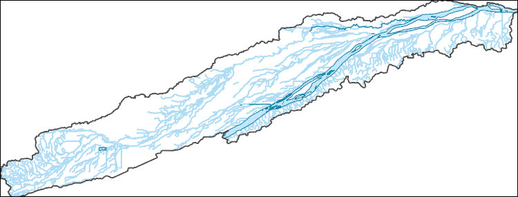
The National Hydrography Dataset (NHD) is a feature-based database that interconnects and uniquely identifies the stream segments or reaches that make up the nation's surface water drainage system. NHD data was originally developed at 1:100,000-scale and exists at that scale for the whole country. This high-resolution NHD, generally developed at 1:24,000/1:12,000 scale, adds detail to the original 1:100,000-scale NHD. (Data for Alaska, Puerto Rico and the Virgin Islands was developed at high-resolution, not 1:100,000 scale.) Local resolution NHD is being developed where partners and data exist. The NHD contains reach codes for networked features, flow direction, names, and centerline representations for areal water...
Tags: Administrative watershed units,
Administrative watershed units,
Area of Complex Channels,
Area to be submerged,
Atkinson, All tags...
Baker,
Basin,
Basin,
Bay/Inlet,
Boundaries,
Boundary,
Brantley,
Bridge,
Canal/Ditch,
Charlton,
Clinch,
Coastline,
Columbia,
Connector,
Dam/Weir,
Downloadable Data,
Drainage areas for surface water,
Drainageway,
Echols,
Esri File GeoDatabase 10,
Estuary,
FL,
FileGDB,
Florida,
Flow direction network,
Flume,
ForeShore,
GA,
Gaging Station,
Gate,
Georgia,
HU-8,
HU-8 Subbasin,
HU10,
HU12,
HU14,
HU16,
HU2,
HU4,
HU6,
HU8,
HU8_03110201,
HUC,
Hamilton,
Hazard Zone,
Hydrographic,
Hydrography,
Hydrography,
Hydrography,
Hydrologic Unit Code,
Hydrologic Units,
Ice mass,
Inundation Area,
Lanier,
Levee,
Line,
Lock Chamber,
Madison,
Marsh,
National Hydrography Dataset (NHD),
National Hydrography Dataset (NHD) Best Resolution,
National Hydrography Dataset (NHD) Best Resolution,
Nonearthen Shore,
Orthoimage,
Playa,
Point,
PointEvent,
Pond,
Rapids,
Rapids,
Reach,
Reach code,
Reef,
Region,
Reservoir,
Rock,
Sea/Ocean,
Sink/Rise,
Sounding Datum Line,
Special Use Zone,
Special Use Zone Limit,
Spillway,
Stream,
Stream/River,
Sub-basin,
Sub-region,
Subbasin,
Submerged Stream,
Subregion,
Subwatershed,
Surface water systems,
Suwannee,
Swamp,
Topographic,
Tunnel,
US,
Underground Conduit,
United States,
WBD,
WBD,
Wall,
Ware,
Wash,
Water Intake Outflow,
Waterfall,
Watershed,
Watershed Boundaries,
Watershed Boundary Dataset,
Watershed Boundary Dataset,
Well,
artificial path,
boundaries,
dams,
drainage systems and characteristics,
inlandWaters,
lakes,
ngda,
rivers, Fewer tags
The National Hydrography Dataset (NHD) is a feature-based database that interconnects and uniquely identifies the stream segments or reaches that make up the nation's surface water drainage system. NHD data was originally developed at 1:100,000-scale and exists at that scale for the whole country. This high-resolution NHD, generally developed at 1:24,000/1:12,000 scale, adds detail to the original 1:100,000-scale NHD. (Data for Alaska, Puerto Rico and the Virgin Islands was developed at high-resolution, not 1:100,000 scale.) Local resolution NHD is being developed where partners and data exist. The NHD contains reach codes for networked features, flow direction, names, and centerline representations for areal water...
Tags: Administrative watershed units,
Administrative watershed units,
Area of Complex Channels,
Area to be submerged,
Basin, All tags...
Basin,
Bay/Inlet,
Bell,
Boundaries,
Boundary,
Bridge,
Canal/Ditch,
Coastline,
Comanche,
Connector,
Coryell,
Dam/Weir,
Downloadable Data,
Drainage areas for surface water,
Drainageway,
Esri Shapefile nan,
Estuary,
Flow direction network,
Flume,
ForeShore,
Gaging Station,
Gate,
HU-8,
HU-8 Subbasin,
HU10,
HU12,
HU14,
HU16,
HU2,
HU4,
HU6,
HU8,
HU8_12070202,
HUC,
Hamilton,
Hazard Zone,
Hydrographic,
Hydrography,
Hydrography,
Hydrography,
Hydrologic Unit Code,
Hydrologic Units,
Ice mass,
Inundation Area,
Lampasas,
Levee,
Line,
Lock Chamber,
Marsh,
Mills,
National Hydrography Dataset (NHD),
National Hydrography Dataset (NHD) Best Resolution,
National Hydrography Dataset (NHD) Best Resolution,
Nonearthen Shore,
Orthoimage,
Playa,
Point,
PointEvent,
Pond,
Rapids,
Rapids,
Reach,
Reach code,
Reef,
Region,
Reservoir,
Rock,
Sea/Ocean,
Shapefile,
Sink/Rise,
Sounding Datum Line,
Special Use Zone,
Special Use Zone Limit,
Spillway,
Stream,
Stream/River,
Sub-basin,
Sub-region,
Subbasin,
Submerged Stream,
Subregion,
Subwatershed,
Surface water systems,
Swamp,
TX,
Texas,
Topographic,
Tunnel,
US,
Underground Conduit,
United States,
WBD,
WBD,
Wall,
Wash,
Water Intake Outflow,
Waterfall,
Watershed,
Watershed Boundaries,
Watershed Boundary Dataset,
Watershed Boundary Dataset,
Well,
artificial path,
boundaries,
dams,
drainage systems and characteristics,
inlandWaters,
lakes,
ngda,
rivers, Fewer tags
The National Hydrography Dataset (NHD) is a feature-based database that interconnects and uniquely identifies the stream segments or reaches that make up the nation's surface water drainage system. NHD data was originally developed at 1:100,000-scale and exists at that scale for the whole country. This high-resolution NHD, generally developed at 1:24,000/1:12,000 scale, adds detail to the original 1:100,000-scale NHD. (Data for Alaska, Puerto Rico and the Virgin Islands was developed at high-resolution, not 1:100,000 scale.) Local resolution NHD is being developed where partners and data exist. The NHD contains reach codes for networked features, flow direction, names, and centerline representations for areal water...
Tags: Administrative watershed units,
Administrative watershed units,
Area of Complex Channels,
Area to be submerged,
Basin, All tags...
Basin,
Bay/Inlet,
Boundaries,
Boundary,
Bridge,
Buffalo,
Butler,
Canal/Ditch,
Coastline,
Colfax,
Connector,
Dam/Weir,
Downloadable Data,
Drainage areas for surface water,
Drainageway,
Esri File GeoDatabase 10,
Estuary,
FileGDB,
Flow direction network,
Flume,
ForeShore,
Gaging Station,
Gate,
HU-8,
HU-8 Subbasin,
HU10,
HU12,
HU14,
HU16,
HU2,
HU4,
HU6,
HU8,
HU8_10200103,
HUC,
Hall,
Hamilton,
Hazard Zone,
Howard,
Hydrographic,
Hydrography,
Hydrography,
Hydrography,
Hydrologic Unit Code,
Hydrologic Units,
Ice mass,
Inundation Area,
Levee,
Line,
Lock Chamber,
Marsh,
Merrick,
NE,
Nance,
National Hydrography Dataset (NHD),
National Hydrography Dataset (NHD) Best Resolution,
National Hydrography Dataset (NHD) Best Resolution,
Nebraska,
Nonearthen Shore,
Orthoimage,
Platte,
Playa,
Point,
PointEvent,
Polk,
Pond,
Rapids,
Rapids,
Reach,
Reach code,
Reef,
Region,
Reservoir,
Rock,
Sea/Ocean,
Sink/Rise,
Sounding Datum Line,
Special Use Zone,
Special Use Zone Limit,
Spillway,
Stream,
Stream/River,
Sub-basin,
Sub-region,
Subbasin,
Submerged Stream,
Subregion,
Subwatershed,
Surface water systems,
Swamp,
Topographic,
Tunnel,
US,
Underground Conduit,
United States,
WBD,
WBD,
Wall,
Wash,
Water Intake Outflow,
Waterfall,
Watershed,
Watershed Boundaries,
Watershed Boundary Dataset,
Watershed Boundary Dataset,
Well,
artificial path,
boundaries,
dams,
drainage systems and characteristics,
inlandWaters,
lakes,
ngda,
rivers, Fewer tags
The National Hydrography Dataset (NHD) is a feature-based database that interconnects and uniquely identifies the stream segments or reaches that make up the nation's surface water drainage system. NHD data was originally developed at 1:100,000-scale and exists at that scale for the whole country. This high-resolution NHD, generally developed at 1:24,000/1:12,000 scale, adds detail to the original 1:100,000-scale NHD. (Data for Alaska, Puerto Rico and the Virgin Islands was developed at high-resolution, not 1:100,000 scale.) Local resolution NHD is being developed where partners and data exist. The NHD contains reach codes for networked features, flow direction, names, and centerline representations for areal water...
Tags: Adams,
Administrative watershed units,
Administrative watershed units,
Area of Complex Channels,
Area to be submerged, All tags...
Basin,
Basin,
Bay/Inlet,
Boundaries,
Boundary,
Bridge,
Buffalo,
Canal/Ditch,
Coastline,
Connector,
Custer,
Dam/Weir,
Dawson,
Downloadable Data,
Drainage areas for surface water,
Drainageway,
Esri File GeoDatabase 10,
Estuary,
FileGDB,
Flow direction network,
Flume,
ForeShore,
Frontier,
Gaging Station,
Gate,
Gosper,
HU-8,
HU-8 Subbasin,
HU10,
HU12,
HU14,
HU16,
HU2,
HU4,
HU6,
HU8,
HU8_10200101,
HUC,
Hall,
Hamilton,
Hazard Zone,
Hydrographic,
Hydrography,
Hydrography,
Hydrography,
Hydrologic Unit Code,
Hydrologic Units,
Ice mass,
Inundation Area,
Kearney,
Levee,
Lincoln,
Line,
Lock Chamber,
Logan,
Marsh,
McPherson,
Merrick,
NE,
National Hydrography Dataset (NHD),
National Hydrography Dataset (NHD) Best Resolution,
National Hydrography Dataset (NHD) Best Resolution,
Nebraska,
Nonearthen Shore,
Orthoimage,
Phelps,
Playa,
Point,
PointEvent,
Pond,
Rapids,
Rapids,
Reach,
Reach code,
Reef,
Region,
Reservoir,
Rock,
Sea/Ocean,
Sink/Rise,
Sounding Datum Line,
Special Use Zone,
Special Use Zone Limit,
Spillway,
Stream,
Stream/River,
Sub-basin,
Sub-region,
Subbasin,
Submerged Stream,
Subregion,
Subwatershed,
Surface water systems,
Swamp,
Topographic,
Tunnel,
US,
Underground Conduit,
United States,
WBD,
WBD,
Wall,
Wash,
Water Intake Outflow,
Waterfall,
Watershed,
Watershed Boundaries,
Watershed Boundary Dataset,
Watershed Boundary Dataset,
Well,
artificial path,
boundaries,
dams,
drainage systems and characteristics,
inlandWaters,
lakes,
ngda,
rivers, Fewer tags
The National Hydrography Dataset (NHD) is a feature-based database that interconnects and uniquely identifies the stream segments or reaches that make up the nation's surface water drainage system. NHD data was originally developed at 1:100,000-scale and exists at that scale for the whole country. This high-resolution NHD, generally developed at 1:24,000/1:12,000 scale, adds detail to the original 1:100,000-scale NHD. (Data for Alaska, Puerto Rico and the Virgin Islands was developed at high-resolution, not 1:100,000 scale.) Local resolution NHD is being developed where partners and data exist. The NHD contains reach codes for networked features, flow direction, names, and centerline representations for areal water...
Tags: Administrative watershed units,
Administrative watershed units,
Area of Complex Channels,
Area to be submerged,
Baca, All tags...
Basin,
Basin,
Bay/Inlet,
Boundaries,
Boundary,
Bridge,
CO,
Canal/Ditch,
Coastline,
Colorado,
Connector,
Dam/Weir,
Downloadable Data,
Drainage areas for surface water,
Drainageway,
Estuary,
Flow direction network,
Flume,
ForeShore,
Gaging Station,
Gate,
GeoPackage,
Grant,
HU-8,
HU-8 Subbasin,
HU10,
HU12,
HU14,
HU16,
HU2,
HU4,
HU6,
HU8,
HU8_11040005,
HUC,
Hamilton,
Hazard Zone,
Hydrographic,
Hydrography,
Hydrography,
Hydrography,
Hydrologic Unit Code,
Hydrologic Units,
Ice mass,
Inundation Area,
KS,
Kansas,
Kearny,
Levee,
Line,
Lock Chamber,
Marsh,
National Hydrography Dataset (NHD),
National Hydrography Dataset (NHD) Best Resolution,
National Hydrography Dataset (NHD) Best Resolution,
Nonearthen Shore,
Open Geospatial Consortium GeoPackage 1.2,
Orthoimage,
Playa,
Point,
PointEvent,
Pond,
Prowers,
Rapids,
Rapids,
Reach,
Reach code,
Reef,
Region,
Reservoir,
Rock,
Sea/Ocean,
Sink/Rise,
Sounding Datum Line,
Special Use Zone,
Special Use Zone Limit,
Spillway,
Stanton,
Stream,
Stream/River,
Sub-basin,
Sub-region,
Subbasin,
Submerged Stream,
Subregion,
Subwatershed,
Surface water systems,
Swamp,
Topographic,
Tunnel,
US,
Underground Conduit,
United States,
WBD,
WBD,
Wall,
Wash,
Water Intake Outflow,
Waterfall,
Watershed,
Watershed Boundaries,
Watershed Boundary Dataset,
Watershed Boundary Dataset,
Well,
artificial path,
boundaries,
dams,
drainage systems and characteristics,
inlandWaters,
lakes,
ngda,
rivers, Fewer tags
The National Hydrography Dataset (NHD) is a feature-based database that interconnects and uniquely identifies the stream segments or reaches that make up the nation's surface water drainage system. NHD data was originally developed at 1:100,000-scale and exists at that scale for the whole country. This high-resolution NHD, generally developed at 1:24,000/1:12,000 scale, adds detail to the original 1:100,000-scale NHD. (Data for Alaska, Puerto Rico and the Virgin Islands was developed at high-resolution, not 1:100,000 scale.) Local resolution NHD is being developed where partners and data exist. The NHD contains reach codes for networked features, flow direction, names, and centerline representations for areal water...
Tags: Adams,
Administrative watershed units,
Administrative watershed units,
Area of Complex Channels,
Area to be submerged, All tags...
Atchison,
Basin,
Basin,
Bay/Inlet,
Boundaries,
Boundary,
Bridge,
Brown,
Butler,
Canal/Ditch,
Clay,
Coastline,
Connector,
Dam/Weir,
Douglas,
Downloadable Data,
Drainage areas for surface water,
Drainageway,
Esri Shapefile nan,
Estuary,
Fillmore,
Flow direction network,
Flume,
ForeShore,
Franklin,
Gage,
Gaging Station,
Gate,
Geary,
HU-4,
HU-4 Subregion,
HU10,
HU12,
HU14,
HU16,
HU2,
HU4,
HU4_1027,
HU6,
HU8,
HUC,
Hall,
Hamilton,
Hazard Zone,
Hydrographic,
Hydrography,
Hydrography,
Hydrography,
Hydrologic Unit Code,
Hydrologic Units,
Ice mass,
Inundation Area,
Jackson,
Jefferson,
Johnson,
KS,
Kansas,
Kearney,
Lancaster,
Leavenworth,
Levee,
Line,
Lock Chamber,
MO,
Marsh,
Marshall,
Missouri,
Morris,
NE,
National Hydrography Dataset (NHD),
National Hydrography Dataset (NHD) Best Resolution,
National Hydrography Dataset (NHD) Best Resolution,
Nebraska,
Nemaha,
Nonearthen Shore,
Nuckolls,
Orthoimage,
Osage,
Pawnee,
Playa,
Point,
PointEvent,
Polk,
Pond,
Pottawatomie,
Rapids,
Rapids,
Reach,
Reach code,
Reef,
Region,
Republic,
Reservoir,
Riley,
Rock,
Saline,
Sea/Ocean,
Seward,
Shapefile,
Shawnee,
Sink/Rise,
Sounding Datum Line,
Special Use Zone,
Special Use Zone Limit,
Spillway,
Stream,
Stream/River,
Sub-basin,
Sub-region,
Subbasin,
Submerged Stream,
Subregion,
Subwatershed,
Surface water systems,
Swamp,
Thayer,
Topographic,
Tunnel,
US,
Underground Conduit,
United States,
WBD,
WBD,
Wabaunsee,
Wall,
Wash,
Washington,
Water Intake Outflow,
Waterfall,
Watershed,
Watershed Boundaries,
Watershed Boundary Dataset,
Watershed Boundary Dataset,
Webster,
Well,
Wyandotte,
York,
artificial path,
boundaries,
dams,
drainage systems and characteristics,
inlandWaters,
lakes,
ngda,
rivers, Fewer tags
The National Hydrography Dataset (NHD) is a feature-based database that interconnects and uniquely identifies the stream segments or reaches that make up the nation's surface water drainage system. NHD data was originally developed at 1:100,000-scale and exists at that scale for the whole country. This high-resolution NHD, generally developed at 1:24,000/1:12,000 scale, adds detail to the original 1:100,000-scale NHD. (Data for Alaska, Puerto Rico and the Virgin Islands was developed at high-resolution, not 1:100,000 scale.) Local resolution NHD is being developed where partners and data exist. The NHD contains reach codes for networked features, flow direction, names, and centerline representations for areal water...
Tags: AL,
Administrative watershed units,
Administrative watershed units,
Alabama,
Area of Complex Channels, All tags...
Area to be submerged,
Autauga,
Baldwin,
Bartow,
Basin,
Basin,
Bay/Inlet,
Bibb,
Blount,
Boundaries,
Boundary,
Bradley,
Bridge,
Bullock,
Butler,
Calhoun,
Canal/Ditch,
Carroll,
Chambers,
Chattooga,
Cherokee,
Chilton,
Clarke,
Clay,
Cleburne,
Coastline,
Cobb,
Conecuh,
Connector,
Coosa,
Crenshaw,
Dade,
Dallas,
Dam/Weir,
Dawson,
DeKalb,
Douglas,
Downloadable Data,
Drainage areas for surface water,
Drainageway,
Elmore,
Escambia,
Estuary,
Etowah,
Fannin,
Flow direction network,
Floyd,
Flume,
ForeShore,
Forsyth,
Fulton,
GA,
Gaging Station,
Gate,
GeoPackage,
Georgia,
Gilmer,
Gordon,
HU-4,
HU-4 Subregion,
HU10,
HU12,
HU14,
HU16,
HU2,
HU4,
HU4_0315,
HU6,
HU8,
HUC,
Hamilton,
Haralson,
Hazard Zone,
Heard,
Hydrographic,
Hydrography,
Hydrography,
Hydrography,
Hydrologic Unit Code,
Hydrologic Units,
Ice mass,
Inundation Area,
Jefferson,
Lee,
Levee,
Line,
Lock Chamber,
Lowndes,
Lumpkin,
Macon,
Marengo,
Marsh,
Monroe,
Montgomery,
Murray,
National Hydrography Dataset (NHD),
National Hydrography Dataset (NHD) Best Resolution,
National Hydrography Dataset (NHD) Best Resolution,
Nonearthen Shore,
Open Geospatial Consortium GeoPackage 1.2,
Orthoimage,
Paulding,
Perry,
Pickens,
Pike,
Playa,
Point,
PointEvent,
Polk,
Pond,
Randolph,
Rapids,
Rapids,
Reach,
Reach code,
Reef,
Region,
Reservoir,
Rock,
Russell,
Sea/Ocean,
Shelby,
Sink/Rise,
Sounding Datum Line,
Special Use Zone,
Special Use Zone Limit,
Spillway,
St. Clair,
Stream,
Stream/River,
Sub-basin,
Sub-region,
Subbasin,
Submerged Stream,
Subregion,
Subwatershed,
Surface water systems,
Swamp,
TN,
Talladega,
Tallapoosa,
Tennessee,
Topographic,
Tunnel,
Tuscaloosa,
US,
Underground Conduit,
Union,
United States,
WBD,
WBD,
Walker,
Wall,
Wash,
Water Intake Outflow,
Waterfall,
Watershed,
Watershed Boundaries,
Watershed Boundary Dataset,
Watershed Boundary Dataset,
Well,
Whitfield,
Wilcox,
artificial path,
boundaries,
dams,
drainage systems and characteristics,
inlandWaters,
lakes,
ngda,
rivers, Fewer tags

A mineral resource assessment was performed by the U.S. Geological Survey (USGS) to assess the potential of undiscovered skarn-hosted tungsten resources in the Northern Rocky Mountain region of eastern Idaho and western Montana. This region has seen moderate tungsten trioxide (WO3) production in the past from a variety of mineralization styles including skarn, vein and replacement, and wolframite-quartz veins. The geology of the area is dominated by large plutons of Cretaceous to Tertiary age, emplaced into a belt of sedimentary rock ranging from Mesoproterozoic to Permian age, and affected by tectonism related to the Sevier and later Laramide orogenies. Known tungsten (W) skarn mineral sites are associated with...
Categories: Data;
Types: ArcGIS REST Map Service,
ArcGIS Service Definition,
Downloadable,
Map Service;
Tags: Ashton,
Bald Mountain,
Beaverhead County,
Bitterroot Range,
Boise County, All tags...
Bozeman,
Broadwater County,
Butte,
Challis,
Choteau,
Cretaceous,
Custer County,
Deer Lodge County,
Dillon,
Dubois,
Elk City,
GGGSC,
Geology, Geophysics, and Geochemistry Science Center,
Granite County,
Great Falls,
Hamilton,
Helena,
Idaho,
Idaho County,
Jefferson County,
Lewis and Clark County,
Little Belt Mountains,
MRP,
Madison County,
Mesoproterozoic,
Mineral Resources Program,
Montana,
Northern Rocky Mountains,
Paleozoic,
Pioneer Mountains,
Powell County,
Ravali County,
Rocky Mountain,
Silver Bow County,
Tertiary,
Thompson Creek,
U.S. Geological Survey,
USGS,
USGS Science Data Catalog (SDC),
United States,
Valley County,
Wallace,
White Sulphur Spring,
Yellow Pine,
economic geology,
economy,
geochemistry,
geophysics,
geoscientificInformation,
idaho,
igneous rocks,
metallic mineral resources,
mineral assessment,
mineral assessment,
mineral deposits,
mineral resources,
montana,
plutonic rocks,
rocks and deposits,
sedimentary rocks,
tungsten,
tungsten, Fewer tags

ADMMR map collection: Vulture Town Site; 1 in. to 200 feet; 19 x 24 in.
Categories: Data;
Tags: Arizona,
Astor,
Black Hawk,
Conkling,
Cook, All tags...
Copper, Sulfide,
Custer,
Dataset,
East Vulture,
Elmore,
Gold,
Gold, Lode,
Hamilton,
Iron, Hema-Magne,
Iron, Sulfide,
Jane Elmore,
Lead, Sulfide,
Lithium,
Maricopa County,
Pit Gold,
Sheridan,
Sherman,
Silver, Oxide,
T6N R6W Sec 36 C,
Talmage,
Texhoma,
Tungsten,
United States,
Van Buren,
Vulture,
Vulture Extension,
Vulture Mountains - 15 Min,
Vulture Mts. physiographic area,
Vulture metallic mineral dist.,
Zinc, Sulfide,
geoscientificInformation,
maps and atlases,
mining and quarrying,
plats, Fewer tags

Heinrichs Geoexploration Co. Maps: Vulture Mine, Main Pit Area; 1 in. to 50 feet; 47 x 25 in.
Categories: Data;
Tags: 1980s,
Arizona,
Astor,
Black Hawk,
Conkling, All tags...
Cook,
Copper, Sulfide,
Custer,
Dataset,
East Vulture,
Elmore,
Gold,
Gold, Lode,
Hamilton,
Iron, Hema-Magne,
Iron, Sulfide,
Jane Elmore,
Lead, Sulfide,
Lithium,
Maricopa County,
Maricopa273,
Pit Gold,
Sheridan,
Sherman,
Silver, Oxide,
T6N R6W Sec 36 C,
Talmage,
Texhoma,
Tungsten,
United States,
Van Buren,
Vulture Extension,
Vulture Mountains - 15 Min,
Vulture Mts. physiographic area,
Vulture metallic mineral dist.,
Zinc, Sulfide,
chemical analysis,
drilling and coring,
geoscientificInformation,
maps and atlases,
mineral resources, Fewer tags

A.F. Budge Mining Ltd. Maps: Vulture Mine, Claim Locations, Map No. 1; 1 in. to 1000 feet; 24 x 18 in.
Categories: Data;
Tags: Arizona,
Astor,
Black Hawk,
Conkling,
Cook, All tags...
Copper, Sulfide,
Custer,
Dataset,
East Vulture,
Elmore,
Gold,
Gold, Lode,
Hamilton,
Iron, Hema-Magne,
Iron, Sulfide,
Jane Elmore,
Lead, Sulfide,
Lithium,
Maricopa County,
Maricopa273,
Pit Gold,
Sheridan,
Sherman,
Silver, Oxide,
T6N R6W Sec 36 C,
Talmage,
Texhoma,
Tungsten,
United States,
Van Buren,
Vulture Extension,
Vulture Mountains - 15 Min,
Vulture Mts. physiographic area,
Vulture metallic mineral dist.,
Zinc, Sulfide,
claim maps,
geoscientificInformation,
maps and atlases,
mineral resources, Fewer tags
|
|

