Filters: Tags: Harshaw (X)
15 results (41ms)|
Filters
Contacts
(Less)
|

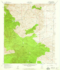
USGS Historical Quadrangle in GeoPDF.
The legacy of mining exploration and operations can remain for decades to centuries if not treated, posing risks to human and animal health due to fugitive dispersal of metal(loid) laden dust and water. The use of endemic plants is key to the success of phytostabilization because endemics are adapted to the conditions prevailing in local mine sites. To this end, we evaluated the phytostabilization potential of endemic plant populations growing at two unmined mineralized sites and on metallic wastes at two historic mine operations and two sites un-impacted by mining operations within the Harshaw Mining District in southern Arizona. Included in this dataset are the physical (pH, Electrical Conductivity, total carbon...
This dataset includes the magnetotelluric (MT) sounding data collected in 2008 in and near the Patagonia Mountains of Arizona. The U.S. Geological Survey (USGS) conducted a series of multidisciplinary studies as part of the Assessment Techniques for Concealed Mineral Resources project funded by the USGS Minerals Resources Program in cooperation with the U.S. Forest Service.
This dataset includes the magnetotelluric (MT) sounding data collected in 2008 in and near the Patagonia Mountains of Arizona. The U.S. Geological Survey (USGS) conducted a series of multidisciplinary studies as part of the Assessment Techniques for Concealed Mineral Resources project funded by the USGS Minerals Resources Program in cooperation with the U.S. Forest Service.
Categories: Data;
Types: Citation,
Downloadable,
Map Service,
OGC WFS Layer,
OGC WMS Layer,
Shapefile;
Tags: Arizona,
CGGSC,
Crustal Geophysics and Geochemistry Science Center,
Cumero Canyon,
Electromagnetic surveying,
This location is part of the Arizona Mineral Industry Location System (AzMILS), an inventory of mineral occurences, prospects and mine locations in Arizona. Pima141 is located in T19S R16E Sec 16 SE in the Empire Mountains - 15 Min quad. This collection consists of various reports, maps, records and related materials acquired by the Arizona Department of Mines and Mineral Resources regarding mining properties in Arizona. Information was obtained by various means, including the property owners, exploration companies, consultants, verbal interviews, field visits, newspapers and publications. Some sections may be redacted for copyright. Please see the access statement.
This dataset includes the magnetotelluric (MT) sounding data collected in 2008 in and near the Patagonia Mountains of Arizona. The U.S. Geological Survey (USGS) conducted a series of multidisciplinary studies as part of the Assessment Techniques for Concealed Mineral Resources project funded by the USGS Minerals Resources Program in cooperation with the U.S. Forest Service.
This dataset includes the magnetotelluric (MT) sounding data collected in 2008 in and near the Patagonia Mountains of Arizona. The U.S. Geological Survey (USGS) conducted a series of multidisciplinary studies as part of the Assessment Techniques for Concealed Mineral Resources project funded by the USGS Minerals Resources Program in cooperation with the U.S. Forest Service.

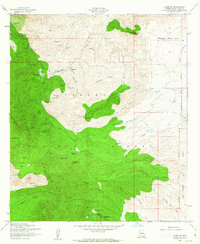
USGS Historical Quadrangle in GeoPDF.

USGS Historical Quadrangle in GeoPDF.

USGS Historical Quadrangle in GeoPDF.
This dataset includes the magnetotelluric (MT) sounding data collected in 2008 in and near the Patagonia Mountains of Arizona. The U.S. Geological Survey (USGS) conducted a series of multidisciplinary studies as part of the Assessment Techniques for Concealed Mineral Resources project funded by the USGS Minerals Resources Program in cooperation with the U.S. Forest Service.
This dataset includes the magnetotelluric (MT) sounding data collected in 2008 in and near the Patagonia Mountains of Arizona. The U.S. Geological Survey (USGS) conducted a series of multidisciplinary studies as part of the Assessment Techniques for Concealed Mineral Resources project funded by the USGS Minerals Resources Program in cooperation with the U.S. Forest Service.
USGS Historical Quadrangle in GeoPDF.
USGS Historical Quadrangle in GeoPDF.
This dataset includes the magnetotelluric (MT) sounding data collected in 2008 in and near the Patagonia Mountains of Arizona. The U.S. Geological Survey (USGS) conducted a series of multidisciplinary studies as part of the Assessment Techniques for Concealed Mineral Resources project funded by the USGS Minerals Resources Program in cooperation with the U.S. Forest Service.
|

|
