Filters: Tags: Hazards (X) > partyWithName: State of Alaska, Department of Natural Resources, Division of Geological & Geophysical Surveys (X)
3 results (11ms)|
Filters
Date Range
Contacts
Tag Types Tag Schemes |
As part of the Department of Natural Resources (DNR) effort to make final recommendations of federal land parcels to be considered for selection by the State of Alaska according to provisions of the Statehood Act, a decision was made to identify and evaluate potential access corridors. Corridor maps were compiled for a total of 78 quadrangles throughout Alaska. This map suite shows relevant geologic information at a scale of 1:250,000 for 10-mile-wide corridors straddling centerlines for proposed access routes throughout Alaska. The maps are based on geologic data compiled from existing, published mapping. Each compiled corridor geology map was used to derive maps of potential construction materials, data quality,...
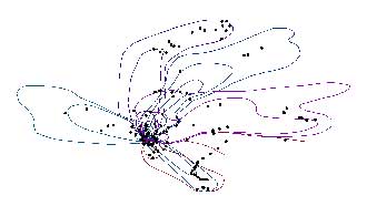
The 2009 eruption of Redoubt Volcano included 19 major tephra-producing explosions. Mass per unit area (MPUA) ash fall sampling of the resulting deposits allowed us to create isomass contours of the ash fall. This dataset contains the vector digital shapefiles of the ash fall contours for the explosive events. In addition, a point digital shapefile is included that describes more than 400 ash fall samples that were collected. For a detailed account of the 2009 eruption of Redoubt Volcano, see Schaefer, J.R., ed., 2012, The 2009 eruption of Redoubt Volcano, Alaska, with contributions by Bull, Katharine, Cameron, Cheryl, Coombs, Michelle, Diefenbach, Angie, Lopez, Taryn, McNutt, Steve, Neal, Christina, Payne, Allison,...
This report presents the findings of a geologic and geotechnical evaluation of a landslide at the Yukon River bridge (the E.L. Patton Bridge). The Yukon River bridge landslide occurred in fall 2012 between approximately 375 and 575 feet west of the bridge. Although there was no damage to the bridge foundation, the landslide's close proximity to the bridge and concerns over additional failures prompted multiple evaluations, including landslide documentation, drainage assessments, and geotechnical studies. This report was prepared to convey the general characteristics of the rock mass, characteristics of rock discontinuities, and the geomorphic expression of the 2012 landslide in the vicinity of the bridge. We determined...
|

|
