|
|
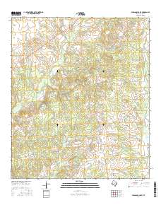
Layered GeoPDF 7.5 Minute Quadrangle Map. Layers of geospatial data include orthoimagery, roads, grids, geographic names, elevation contours, hydrography, and other selected map features.
Tags: 7.5 x 7.5 minute,
Downloadable Data,
EarthCover,
GeoPDF,
Houston, All tags...
Imagery and Base Maps,
Map,
Pearsons Chapel, TX,
Public Land Survey System,
Texas,
U.S. National Grid,
US,
US Topo,
US Topo Historical,
United States,
boundary,
contour,
geographic names,
hydrography,
imageryBaseMapsEarthCover,
orthoimage,
structures,
topographic,
transportation,
woodland, Fewer tags
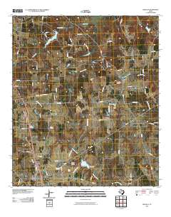
Layered GeoPDF 7.5 Minute Quadrangle Map. Layers of geospatial data include orthoimagery, roads, grids, geographic names, elevation contours, hydrography, and other selected map features.
Tags: 7.5 x 7.5 minute,
Anderson,
Downloadable Data,
EarthCover,
GeoPDF, All tags...
Houston,
Imagery and Base Maps,
Map,
Percilla, TX,
Texas,
U.S. National Grid,
US,
US Topo,
US Topo Historical,
United States,
contour,
geographic names,
hydrography,
orthoimage,
topographic,
transportation, Fewer tags
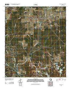
Layered GeoPDF 7.5 Minute Quadrangle Map. Layers of geospatial data include orthoimagery, roads, grids, geographic names, elevation contours, hydrography, and other selected map features.
Tags: 7.5 x 7.5 minute,
Downloadable Data,
EarthCover,
GeoPDF,
Glendale, TX, All tags...
Houston,
Imagery and Base Maps,
Map,
Texas,
Trinity,
U.S. National Grid,
US,
US Topo,
US Topo Historical,
United States,
contour,
geographic names,
hydrography,
orthoimage,
topographic,
transportation, Fewer tags
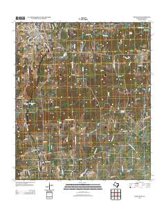
Layered GeoPDF 7.5 Minute Quadrangle Map. Layers of geospatial data include orthoimagery, roads, grids, geographic names, elevation contours, hydrography, and other selected map features.
Tags: 7.5 x 7.5 minute,
Downloadable Data,
EarthCover,
GeoPDF,
Grapeland, TX, All tags...
Houston,
Imagery and Base Maps,
Map,
Public Land Survey System,
Texas,
U.S. National Grid,
US,
US Topo,
US Topo Historical,
United States,
boundary,
contour,
geographic names,
hydrography,
imageryBaseMapsEarthCover,
orthoimage,
structures,
topographic,
transportation,
woodland, Fewer tags

This dataset documents the depth to groundwater measured in wells screened in the Chicot aquifer, Evangeline aquifer, Jasper aquifer, Burkeville confining unit, Catahoula confining system, or a combination of multiple hydrogeologic units in the greater Houston area, Texas for 2021. The U.S. Geological Survey prepared this dataset in cooperation with the Harris‐Galveston Subsidence District, City of Houston, Fort Bend Subsidence District, Lone Star Groundwater Conservation District, and Brazoria County Groundwater Conservation District. This dataset was created to provide resource managers, public officials, researchers, and the general public with ready access to information regarding depths to groundwater in the...
Tags: Brazoria County,
Burkeville confining unit,
Catahoula confining system,
Chambers County,
Chicot aquifer, All tags...
Evangeline aquifer,
Fort Bend County,
Galveston,
Galveston County,
Grimes County,
Harris County,
Houston,
Hydrology,
Jasper aquifer,
Liberty County,
Montgomery County,
San Jacinto County,
Texas,
USGS Science Data Catalog (SDC),
Walker County,
Waller County,
Water Resources,
aquifer,
elevation,
groundwater,
hydrology,
hypsometry,
subsidence,
water-level altitude, Fewer tags
The Watershed Boundary Dataset (WBD) is a comprehensive aggregated collection of hydrologic unit data consistent with the national criteria for delineation and resolution. It defines the areal extent of surface water drainage to a point except in coastal or lake front areas where there could be multiple outlets as stated by the "Federal Standards and Procedures for the National Watershed Boundary Dataset (WBD)" "Standard" (https://pubs.usgs.gov/tm/11/a3/). Watershed boundaries are determined solely upon science-based hydrologic principles, not favoring any administrative boundaries or special projects, nor particular program or agency. This dataset represents the hydrologic unit boundaries to the 12-digit (6th level)...
Tags: 10-digit,
12-digit,
14-digit,
16-digit,
2-digit, All tags...
4-digit,
6-digit,
8-digit,
Adair,
Adams,
Aitkin,
Alexander,
Allamakee,
Anoka,
Appanoose,
Ashland,
Audrain,
Audubon,
Ballard,
Barron,
Basin,
Bayfield,
Becker,
Beltrami,
Benton,
Berrien,
Big Stone,
Black Hawk,
Blue Earth,
Bollinger,
Bond,
Boone,
Bremer,
Brookings,
Brown,
Buchanan,
Buena Vista,
Buffalo,
Bureau,
Burnett,
Butler,
Calhoun,
Callaway,
Cape Girardeau,
Carlton,
Carroll,
Carver,
Cass,
Cedar,
Cerro Gordo,
Champaign,
Chickasaw,
Chippewa,
Chisago,
Christian,
Clark,
Clarke,
Clay,
Clayton,
Clearwater,
Clinton,
Codington,
Coles,
Columbia,
Cook,
Cottonwood,
Crawford,
Crow Wing,
Dakota,
Dallas,
Dane,
Davis,
Day,
De Witt,
DeKalb,
Delaware,
Dent,
Des Moines,
Deuel,
Dickinson,
Dodge,
Douglas,
Downloadable Data,
DuPage,
Dubuque,
Dunn,
Eau Claire,
Effingham,
Elkhart,
Emmet,
Faribault,
Fayette,
Fillmore,
Floyd,
Fond du Lac,
Ford,
Forest,
Franklin,
Freeborn,
Fulton,
Gasconade,
GeoPackage,
Gogebic,
Goodhue,
Grant,
Green,
Green Lake,
Greene,
Grundy,
Guthrie,
HU-2,
HU-2 Region,
HU2_07,
HUC,
Hamilton,
Hancock,
Hardin,
Henderson,
Hennepin,
Henry,
Houston,
Howard,
Hubbard,
Humboldt,
Hydrography,
Hydrologic Unit Code,
Hydrologic Units,
IA,
IL,
IN,
Illinois,
Indiana,
Iowa,
Iowa,
Iron,
Iroquois,
Isanti,
Itasca,
Jackson,
Jasper,
Jefferson,
Jersey,
Jo Daviess,
Johnson,
Jones,
Juneau,
KY,
Kanabec,
Kandiyohi,
Kane,
Kankakee,
Kendall,
Kenosha,
Kentucky,
Keokuk,
Knox,
Kosciusko,
Kossuth,
La Crosse,
LaPorte,
LaSalle,
Lac qui Parle,
Lafayette,
Lake,
Langlade,
Le Sueur,
Lee,
Lewis,
Lincoln,
Linn,
Livingston,
Logan,
Louisa,
Lucas,
Lyon,
MI,
MN,
MO,
Macon,
Macoupin,
Madison,
Mahaska,
Marathon,
Maries,
Marion,
Marquette,
Marshall,
Martin,
Mason,
McDonough,
McHenry,
McLean,
McLeod,
Meeker,
Menard,
Mercer,
Michigan,
Mille Lacs,
Milwaukee,
Minnesota,
Mississippi,
Missouri,
Mitchell,
Monroe,
Montgomery,
Morgan,
Morrison,
Moultrie,
Mower,
Murray,
Muscatine,
ND,
National Watershed Boundary Dataset (WBD),
National Watershed Boundary Dataset (WBD),
Newton,
Nicollet,
Nobles,
North Dakota,
Ogle,
Olmsted,
Oneida,
Open Geospatial Consortium GeoPackage 1.2,
Osage,
Otter Tail,
Palo Alto,
Peoria,
Pepin,
Perry,
Phelps,
Piatt,
Pierce,
Pike,
Pine,
Pipestone,
Pocahontas,
Polk,
Pope,
Portage,
Porter,
Poweshiek,
Price,
Pulaski,
Putnam,
Racine,
Ralls,
Ramsey,
Randolph,
Redwood,
Region,
Renville,
Reynolds,
Rice,
Richland,
Roberts,
Rock,
Rock Island,
Rusk,
SD,
Sac,
Sangamon,
Sauk,
Sawyer,
Schuyler,
Scotland,
Scott,
Shawano,
Shelby,
Sherburne,
Sibley,
South Dakota,
St. Charles,
St. Clair,
St. Croix,
St. Francois,
St. Joseph,
St. Louis,
Stark,
Starke,
Ste. Genevieve,
Stearns,
Steele,
Stephenson,
Stevens,
Story,
Sub-basin,
Sub-region,
Subwatershed,
Swift,
Tama,
Taylor,
Tazewell,
Texas,
Todd,
Traverse,
Trempealeau,
US,
Union,
United States,
Van Buren,
Vermilion,
Vernon,
Vilas,
WBD,
WI,
Wabasha,
Wadena,
Walworth,
Wapello,
Warren,
Waseca,
Washburn,
Washington,
Watershed,
Watershed Boundary Dataset,
Watonwan,
Waukesha,
Waushara,
Wayne,
Webster,
White,
Whiteside,
Will,
Williamson,
Winnebago,
Winneshiek,
Winona,
Wisconsin,
Wood,
Woodford,
Worth,
Wright,
Yellow Medicine,
inlandWaters, Fewer tags

The Watershed Boundary Dataset (WBD) is a comprehensive aggregated collection of hydrologic unit data consistent with the national criteria for delineation and resolution. It defines the areal extent of surface water drainage to a point except in coastal or lake front areas where there could be multiple outlets as stated by the "Federal Standards and Procedures for the National Watershed Boundary Dataset (WBD)" "Standard" (https://pubs.usgs.gov/tm/11/a3/). Watershed boundaries are determined solely upon science-based hydrologic principles, not favoring any administrative boundaries or special projects, nor particular program or agency. This dataset represents the hydrologic unit boundaries to the 12-digit (6th level)...
Tags: 10-digit,
12-digit,
14-digit,
16-digit,
2-digit, All tags...
4-digit,
6-digit,
8-digit,
AL,
Alabama,
Alcorn,
Anderson,
Ashe,
Avery,
Basin,
Bedford,
Bell,
Benton,
Bland,
Bledsoe,
Blount,
Bradley,
Bristol,
Buchanan,
Buncombe,
Caldwell,
Calloway,
Campbell,
Cannon,
Carroll,
Carter,
Catoosa,
Cherokee,
Chester,
Claiborne,
Clay,
Cocke,
Coffee,
Colbert,
Cullman,
Cumberland,
Dade,
DeKalb,
Decatur,
Dickenson,
Dickson,
Downloadable Data,
Etowah,
Fannin,
Fentress,
Franklin,
GA,
GeoPackage,
Georgia,
Giles,
Gilmer,
Graham,
Grainger,
Graves,
Grayson,
Greene,
Greenville,
Grundy,
HU-2,
HU-2 Region,
HU2_06,
HUC,
Habersham,
Hamblen,
Hamilton,
Hancock,
Hardin,
Harlan,
Hawkins,
Haywood,
Henderson,
Henry,
Hickman,
Houston,
Humphreys,
Hydrography,
Hydrologic Unit Code,
Hydrologic Units,
Itawamba,
Jackson,
Jefferson,
Johnson,
KY,
Kentucky,
Knox,
Lauderdale,
Lawrence,
Lee,
Letcher,
Lewis,
Limestone,
Lincoln,
Livingston,
Loudon,
Lumpkin,
Lyon,
MS,
Macon,
Madison,
Marion,
Marshall,
Maury,
McCracken,
McDowell,
McMinn,
McNairy,
Meigs,
Mississippi,
Mitchell,
Monroe,
Moore,
Morgan,
NC,
National Watershed Boundary Dataset (WBD),
National Watershed Boundary Dataset (WBD),
North Carolina,
Norton,
Open Geospatial Consortium GeoPackage 1.2,
Perry,
Pickens,
Polk,
Prentiss,
Putnam,
Rabun,
Region,
Rhea,
Roane,
Russell,
Rutherford,
SC,
Scott,
Sequatchie,
Sevier,
Smyth,
South Carolina,
Stewart,
Sub-basin,
Sub-region,
Subwatershed,
Sullivan,
Swain,
TN,
Tazewell,
Tennessee,
Tishomingo,
Towns,
Transylvania,
Trigg,
US,
Unicoi,
Union,
United States,
VA,
Van Buren,
Virginia,
WBD,
WV,
Walker,
Washington,
Watauga,
Watershed,
Watershed Boundary Dataset,
Wayne,
West Virginia,
White,
Whitfield,
Williamson,
Winston,
Wise,
Wythe,
Yancey,
inlandWaters, Fewer tags

The Watershed Boundary Dataset (WBD) is a comprehensive aggregated collection of hydrologic unit data consistent with the national criteria for delineation and resolution. It defines the areal extent of surface water drainage to a point except in coastal or lake front areas where there could be multiple outlets as stated by the "Federal Standards and Procedures for the National Watershed Boundary Dataset (WBD)" "Standard" (https://pubs.usgs.gov/tm/11/a3/). Watershed boundaries are determined solely upon science-based hydrologic principles, not favoring any administrative boundaries or special projects, nor particular program or agency. This dataset represents the hydrologic unit boundaries to the 12-digit (6th level)...
Tags: 10-digit,
12-digit,
14-digit,
16-digit,
2-digit, All tags...
4-digit,
6-digit,
8-digit,
AL,
Alabama,
Alcorn,
Anderson,
Ashe,
Avery,
Basin,
Bedford,
Bell,
Benton,
Bland,
Bledsoe,
Blount,
Bradley,
Bristol,
Buchanan,
Buncombe,
Caldwell,
Calloway,
Campbell,
Cannon,
Carroll,
Carter,
Catoosa,
Cherokee,
Chester,
Claiborne,
Clay,
Cocke,
Coffee,
Colbert,
Cullman,
Cumberland,
Dade,
DeKalb,
Decatur,
Dickenson,
Dickson,
Downloadable Data,
Esri Shapefile nan,
Etowah,
Fannin,
Fentress,
Franklin,
GA,
Georgia,
Giles,
Gilmer,
Graham,
Grainger,
Graves,
Grayson,
Greene,
Greenville,
Grundy,
HU-2,
HU-2 Region,
HU2_06,
HUC,
Habersham,
Hamblen,
Hamilton,
Hancock,
Hardin,
Harlan,
Hawkins,
Haywood,
Henderson,
Henry,
Hickman,
Houston,
Humphreys,
Hydrography,
Hydrologic Unit Code,
Hydrologic Units,
Itawamba,
Jackson,
Jefferson,
Johnson,
KY,
Kentucky,
Knox,
Lauderdale,
Lawrence,
Lee,
Letcher,
Lewis,
Limestone,
Lincoln,
Livingston,
Loudon,
Lumpkin,
Lyon,
MS,
Macon,
Madison,
Marion,
Marshall,
Maury,
McCracken,
McDowell,
McMinn,
McNairy,
Meigs,
Mississippi,
Mitchell,
Monroe,
Moore,
Morgan,
NC,
National Watershed Boundary Dataset (WBD),
National Watershed Boundary Dataset (WBD),
North Carolina,
Norton,
Perry,
Pickens,
Polk,
Prentiss,
Putnam,
Rabun,
Region,
Rhea,
Roane,
Russell,
Rutherford,
SC,
Scott,
Sequatchie,
Sevier,
Shapefile,
Smyth,
South Carolina,
Stewart,
Sub-basin,
Sub-region,
Subwatershed,
Sullivan,
Swain,
TN,
Tazewell,
Tennessee,
Tishomingo,
Towns,
Transylvania,
Trigg,
US,
Unicoi,
Union,
United States,
VA,
Van Buren,
Virginia,
WBD,
WV,
Walker,
Washington,
Watauga,
Watershed,
Watershed Boundary Dataset,
Wayne,
West Virginia,
White,
Whitfield,
Williamson,
Winston,
Wise,
Wythe,
Yancey,
inlandWaters, Fewer tags
The Watershed Boundary Dataset (WBD) is a comprehensive aggregated collection of hydrologic unit data consistent with the national criteria for delineation and resolution. It defines the areal extent of surface water drainage to a point except in coastal or lake front areas where there could be multiple outlets as stated by the "Federal Standards and Procedures for the National Watershed Boundary Dataset (WBD)" "Standard" (https://pubs.usgs.gov/tm/11/a3/). Watershed boundaries are determined solely upon science-based hydrologic principles, not favoring any administrative boundaries or special projects, nor particular program or agency. This dataset represents the hydrologic unit boundaries to the 12-digit (6th level)...
Tags: 10-digit,
12-digit,
14-digit,
16-digit,
2-digit, All tags...
4-digit,
6-digit,
8-digit,
AL,
Alabama,
Alcorn,
Anderson,
Ashe,
Avery,
Basin,
Bedford,
Bell,
Benton,
Bland,
Bledsoe,
Blount,
Bradley,
Bristol,
Buchanan,
Buncombe,
Caldwell,
Calloway,
Campbell,
Cannon,
Carroll,
Carter,
Catoosa,
Cherokee,
Chester,
Claiborne,
Clay,
Cocke,
Coffee,
Colbert,
Cullman,
Cumberland,
Dade,
DeKalb,
Decatur,
Dickenson,
Dickson,
Downloadable Data,
Esri File GeoDatabase 10,
Etowah,
Fannin,
Fentress,
FileGDB,
Franklin,
GA,
Georgia,
Giles,
Gilmer,
Graham,
Grainger,
Graves,
Grayson,
Greene,
Greenville,
Grundy,
HU-2,
HU-2 Region,
HU2_06,
HUC,
Habersham,
Hamblen,
Hamilton,
Hancock,
Hardin,
Harlan,
Hawkins,
Haywood,
Henderson,
Henry,
Hickman,
Houston,
Humphreys,
Hydrography,
Hydrologic Unit Code,
Hydrologic Units,
Itawamba,
Jackson,
Jefferson,
Johnson,
KY,
Kentucky,
Knox,
Lauderdale,
Lawrence,
Lee,
Letcher,
Lewis,
Limestone,
Lincoln,
Livingston,
Loudon,
Lumpkin,
Lyon,
MS,
Macon,
Madison,
Marion,
Marshall,
Maury,
McCracken,
McDowell,
McMinn,
McNairy,
Meigs,
Mississippi,
Mitchell,
Monroe,
Moore,
Morgan,
NC,
National Watershed Boundary Dataset (WBD),
National Watershed Boundary Dataset (WBD),
North Carolina,
Norton,
Perry,
Pickens,
Polk,
Prentiss,
Putnam,
Rabun,
Region,
Rhea,
Roane,
Russell,
Rutherford,
SC,
Scott,
Sequatchie,
Sevier,
Smyth,
South Carolina,
Stewart,
Sub-basin,
Sub-region,
Subwatershed,
Sullivan,
Swain,
TN,
Tazewell,
Tennessee,
Tishomingo,
Towns,
Transylvania,
Trigg,
US,
Unicoi,
Union,
United States,
VA,
Van Buren,
Virginia,
WBD,
WV,
Walker,
Washington,
Watauga,
Watershed,
Watershed Boundary Dataset,
Wayne,
West Virginia,
White,
Whitfield,
Williamson,
Winston,
Wise,
Wythe,
Yancey,
inlandWaters, Fewer tags

The U.S. Geological Survey (USGS), in cooperation with the Harris-Galveston Subsidence District and Fort Bend Subsidence District, constructed a finite-difference numerical groundwater-flow model of the northern Gulf Coast aquifer region for 1897 through 2018 using MODFLOW 6 with the Newton formulation solver to simulate groundwater flow and land-surface subsidence. Model parameter estimation and uncertainty analysis were conducted with PEST++ Iterative Ensemble Smoother software. The simulated results are described in the associated U.S. Geological Survey Professional Paper 1877. The model archive provided in this U.S. Geological Survey data release includes all the necessary files to run the MODFLOW 6 model and...
Types: Map Service,
OGC WFS Layer,
OGC WMS Layer,
OGC WMS Service;
Tags: Fort Bend County,
Galveston County,
Groundwater Model,
Harris County,
Houston, All tags...
InlandWaters,
MODFLOW6,
Montgomery County,
PEST++,
Python,
Soil Water Balance,
Texas,
USGS Science Data Catalog (SDC),
groundwater,
groundwater flow,
modeling,
subsidence,
usgsgroundwatermodel, Fewer tags
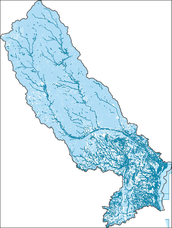
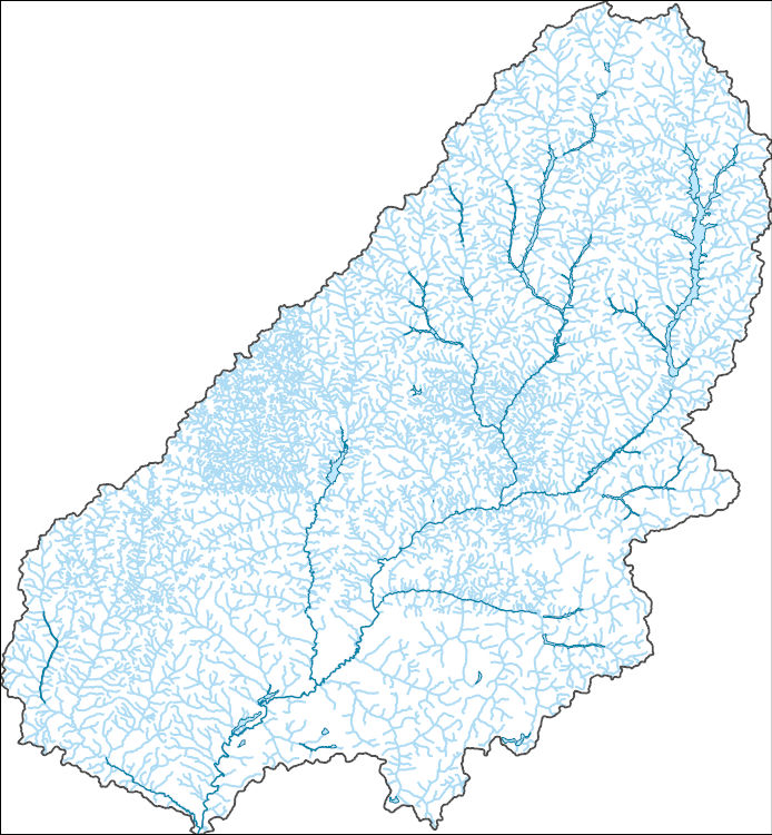
The National Hydrography Dataset (NHD) is a feature-based database that interconnects and uniquely identifies the stream segments or reaches that make up the nation's surface water drainage system. NHD data was originally developed at 1:100,000-scale and exists at that scale for the whole country. This high-resolution NHD, generally developed at 1:24,000/1:12,000 scale, adds detail to the original 1:100,000-scale NHD. (Data for Alaska, Puerto Rico and the Virgin Islands was developed at high-resolution, not 1:100,000 scale.) Local resolution NHD is being developed where partners and data exist. The NHD contains reach codes for networked features, flow direction, names, and centerline representations for areal water...
Tags: Administrative watershed units,
Administrative watershed units,
Area of Complex Channels,
Area to be submerged,
Basin, All tags...
Basin,
Bay/Inlet,
Boundaries,
Boundary,
Bridge,
Canal/Ditch,
Coastline,
Connector,
Dam/Weir,
Dodge,
Downloadable Data,
Drainage areas for surface water,
Drainageway,
Estuary,
Fillmore,
Flow direction network,
Flume,
ForeShore,
Gaging Station,
Gate,
GeoPackage,
HU-8,
HU-8 Subbasin,
HU10,
HU12,
HU14,
HU16,
HU2,
HU4,
HU6,
HU8,
HU8_07040008,
HUC,
Hazard Zone,
Houston,
Hydrographic,
Hydrography,
Hydrography,
Hydrography,
Hydrologic Unit Code,
Hydrologic Units,
IA,
Ice mass,
Inundation Area,
Iowa,
Levee,
Line,
Lock Chamber,
MN,
Marsh,
Minnesota,
Mower,
National Hydrography Dataset (NHD),
National Hydrography Dataset (NHD) Best Resolution,
National Hydrography Dataset (NHD) Best Resolution,
Nonearthen Shore,
Olmsted,
Open Geospatial Consortium GeoPackage 1.2,
Orthoimage,
Playa,
Point,
PointEvent,
Pond,
Rapids,
Rapids,
Reach,
Reach code,
Reef,
Region,
Reservoir,
Rock,
Sea/Ocean,
Sink/Rise,
Sounding Datum Line,
Special Use Zone,
Special Use Zone Limit,
Spillway,
Stream,
Stream/River,
Sub-basin,
Sub-region,
Subbasin,
Submerged Stream,
Subregion,
Subwatershed,
Surface water systems,
Swamp,
Topographic,
Tunnel,
US,
Underground Conduit,
United States,
WBD,
WBD,
Wall,
Wash,
Water Intake Outflow,
Waterfall,
Watershed,
Watershed Boundaries,
Watershed Boundary Dataset,
Watershed Boundary Dataset,
Well,
Winneshiek,
Winona,
artificial path,
boundaries,
dams,
drainage systems and characteristics,
inlandWaters,
lakes,
ngda,
rivers, Fewer tags
The National Hydrography Dataset (NHD) is a feature-based database that interconnects and uniquely identifies the stream segments or reaches that make up the nation's surface water drainage system. NHD data was originally developed at 1:100,000-scale and exists at that scale for the whole country. This high-resolution NHD, generally developed at 1:24,000/1:12,000 scale, adds detail to the original 1:100,000-scale NHD. (Data for Alaska, Puerto Rico and the Virgin Islands was developed at high-resolution, not 1:100,000 scale.) Local resolution NHD is being developed where partners and data exist. The NHD contains reach codes for networked features, flow direction, names, and centerline representations for areal water...
Tags: AL,
Administrative watershed units,
Administrative watershed units,
Alabama,
Area of Complex Channels, All tags...
Area to be submerged,
Basin,
Basin,
Bay,
Bay/Inlet,
Boundaries,
Boundary,
Bridge,
Calhoun,
Canal/Ditch,
Coastline,
Connector,
Dam/Weir,
Downloadable Data,
Drainage areas for surface water,
Drainageway,
Estuary,
FL,
Florida,
Flow direction network,
Flume,
ForeShore,
Gaging Station,
Gate,
Geneva,
GeoPackage,
Gulf,
HU-8,
HU-8 Subbasin,
HU10,
HU12,
HU14,
HU16,
HU2,
HU4,
HU6,
HU8,
HU8_03130012,
HUC,
Hazard Zone,
Houston,
Hydrographic,
Hydrography,
Hydrography,
Hydrography,
Hydrologic Unit Code,
Hydrologic Units,
Ice mass,
Inundation Area,
Jackson,
Levee,
Line,
Lock Chamber,
Marsh,
National Hydrography Dataset (NHD),
National Hydrography Dataset (NHD) Best Resolution,
National Hydrography Dataset (NHD) Best Resolution,
Nonearthen Shore,
Open Geospatial Consortium GeoPackage 1.2,
Orthoimage,
Playa,
Point,
PointEvent,
Pond,
Rapids,
Rapids,
Reach,
Reach code,
Reef,
Region,
Reservoir,
Rock,
Sea/Ocean,
Sink/Rise,
Sounding Datum Line,
Special Use Zone,
Special Use Zone Limit,
Spillway,
Stream,
Stream/River,
Sub-basin,
Sub-region,
Subbasin,
Submerged Stream,
Subregion,
Subwatershed,
Surface water systems,
Swamp,
Topographic,
Tunnel,
US,
Underground Conduit,
United States,
WBD,
WBD,
Wall,
Wash,
Washington,
Water Intake Outflow,
Waterfall,
Watershed,
Watershed Boundaries,
Watershed Boundary Dataset,
Watershed Boundary Dataset,
Well,
artificial path,
boundaries,
dams,
drainage systems and characteristics,
inlandWaters,
lakes,
ngda,
rivers, Fewer tags
The National Hydrography Dataset (NHD) is a feature-based database that interconnects and uniquely identifies the stream segments or reaches that make up the nation's surface water drainage system. NHD data was originally developed at 1:100,000-scale and exists at that scale for the whole country. This high-resolution NHD, generally developed at 1:24,000/1:12,000 scale, adds detail to the original 1:100,000-scale NHD. (Data for Alaska, Puerto Rico and the Virgin Islands was developed at high-resolution, not 1:100,000 scale.) Local resolution NHD is being developed where partners and data exist. The NHD contains reach codes for networked features, flow direction, names, and centerline representations for areal water...
Tags: Administrative watershed units,
Administrative watershed units,
Appling,
Area of Complex Channels,
Area to be submerged, All tags...
Atkinson,
Bacon,
Baker,
Baldwin,
Banks,
Barrow,
Bartow,
Basin,
Basin,
Bay/Inlet,
Ben Hill,
Berrien,
Bibb,
Bleckley,
Boundaries,
Boundary,
Brantley,
Bridge,
Brooks,
Bryan,
Bulloch,
Burke,
Butts,
Calhoun,
Camden,
Canal/Ditch,
Candler,
Carroll,
Catoosa,
Charlton,
Chatham,
Chattahoochee,
Chattooga,
Cherokee,
Clarke,
Clay,
Clayton,
Clinch,
Coastline,
Cobb,
Coffee,
Colquitt,
Columbia,
Connector,
Cook,
Coweta,
Crawford,
Crisp,
Dade,
Dam/Weir,
Dawson,
DeKalb,
Decatur,
Dodge,
Dooly,
Dougherty,
Douglas,
Downloadable Data,
Drainage areas for surface water,
Drainageway,
Early,
Echols,
Effingham,
Elbert,
Emanuel,
Esri File GeoDatabase 10,
Estuary,
Evans,
Fannin,
Fayette,
FileGDB,
Flow direction network,
Floyd,
Flume,
ForeShore,
Forsyth,
Franklin,
Fulton,
GA,
Gaging Station,
Gate,
Georgia,
Gilmer,
Glascock,
Glynn,
Gordon,
Grady,
Greene,
Gwinnett,
HU10,
HU12,
HU14,
HU16,
HU2,
HU4,
HU6,
HU8,
HUC,
Habersham,
Hall,
Hancock,
Haralson,
Harris,
Hart,
Hazard Zone,
Heard,
Henry,
Houston,
Hydrographic,
Hydrography,
Hydrography,
Hydrography,
Hydrologic Unit Code,
Hydrologic Units,
Ice mass,
Inundation Area,
Irwin,
Jackson,
Jasper,
Jeff Davis,
Jefferson,
Jenkins,
Johnson,
Jones,
Lamar,
Lanier,
Laurens,
Lee,
Levee,
Liberty,
Lincoln,
Line,
Lock Chamber,
Long,
Lowndes,
Lumpkin,
Macon,
Madison,
Marion,
Marsh,
McDuffie,
McIntosh,
Meriwether,
Miller,
Mitchell,
Monroe,
Montgomery,
Morgan,
Murray,
Muscogee,
National Hydrography Dataset (NHD),
National Hydrography Dataset (NHD) Best Resolution,
National Hydrography Dataset (NHD) Best Resolution,
Newton,
Nonearthen Shore,
Oconee,
Oglethorpe,
Orthoimage,
Paulding,
Peach,
Pickens,
Pierce,
Pike,
Playa,
Point,
PointEvent,
Polk,
Pond,
Pulaski,
Putnam,
Quitman,
Rabun,
Randolph,
Rapids,
Rapids,
Reach,
Reach code,
Reef,
Region,
Reservoir,
Richmond,
Rock,
Rockdale,
Schley,
Screven,
Sea/Ocean,
Seminole,
Sink/Rise,
Sounding Datum Line,
Spalding,
Special Use Zone,
Special Use Zone Limit,
Spillway,
State,
State,
State_Georgia,
Stephens,
Stewart,
Stream,
Stream/River,
Sub-basin,
Sub-region,
Subbasin,
Submerged Stream,
Subregion,
Subwatershed,
Sumter,
Surface water systems,
Swamp,
Talbot,
Taliaferro,
Tattnall,
Taylor,
Telfair,
Terrell,
Thomas,
Tift,
Toombs,
Topographic,
Towns,
Treutlen,
Troup,
Tunnel,
Turner,
Twiggs,
US,
Underground Conduit,
Union,
United States,
Upson,
WBD,
WBD,
Walker,
Wall,
Walton,
Ware,
Warren,
Wash,
Washington,
Water Intake Outflow,
Waterfall,
Watershed,
Watershed Boundaries,
Watershed Boundary Dataset,
Watershed Boundary Dataset,
Wayne,
Webster,
Well,
Wheeler,
White,
Whitfield,
Wilcox,
Wilkes,
Wilkinson,
Worth,
artificial path,
boundaries,
dams,
drainage systems and characteristics,
inlandWaters,
lakes,
ngda,
rivers, Fewer tags
The National Hydrography Dataset (NHD) is a feature-based database that interconnects and uniquely identifies the stream segments or reaches that make up the nation's surface water drainage system. NHD data was originally developed at 1:100,000-scale and exists at that scale for the whole country. This high-resolution NHD, generally developed at 1:24,000/1:12,000 scale, adds detail to the original 1:100,000-scale NHD. (Data for Alaska, Puerto Rico and the Virgin Islands was developed at high-resolution, not 1:100,000 scale.) Local resolution NHD is being developed where partners and data exist. The NHD contains reach codes for networked features, flow direction, names, and centerline representations for areal water...
Tags: AL,
Administrative watershed units,
Administrative watershed units,
Alabama,
Area of Complex Channels, All tags...
Area to be submerged,
Baldwin,
Barbour,
Basin,
Basin,
Bay,
Bay/Inlet,
Boundaries,
Boundary,
Bridge,
Bullock,
Butler,
Calhoun,
Canal/Ditch,
Coastline,
Coffee,
Conecuh,
Connector,
Covington,
Crenshaw,
Dale,
Dam/Weir,
Downloadable Data,
Drainage areas for surface water,
Drainageway,
Escambia,
Esri Shapefile nan,
Estuary,
FL,
Florida,
Flow direction network,
Flume,
ForeShore,
Gaging Station,
Gate,
Geneva,
Gulf,
HU-4,
HU-4 Subregion,
HU10,
HU12,
HU14,
HU16,
HU2,
HU4,
HU4_0314,
HU6,
HU8,
HUC,
Hazard Zone,
Henry,
Holmes,
Houston,
Hydrographic,
Hydrography,
Hydrography,
Hydrography,
Hydrologic Unit Code,
Hydrologic Units,
Ice mass,
Inundation Area,
Jackson,
Levee,
Line,
Lock Chamber,
Lowndes,
Marsh,
Mobile,
Monroe,
Montgomery,
National Hydrography Dataset (NHD),
National Hydrography Dataset (NHD) Best Resolution,
National Hydrography Dataset (NHD) Best Resolution,
Nonearthen Shore,
Okaloosa,
Orthoimage,
Pike,
Playa,
Point,
PointEvent,
Pond,
Rapids,
Rapids,
Reach,
Reach code,
Reef,
Region,
Reservoir,
Rock,
Santa Rosa,
Sea/Ocean,
Shapefile,
Sink/Rise,
Sounding Datum Line,
Special Use Zone,
Special Use Zone Limit,
Spillway,
Stream,
Stream/River,
Sub-basin,
Sub-region,
Subbasin,
Submerged Stream,
Subregion,
Subwatershed,
Surface water systems,
Swamp,
Topographic,
Tunnel,
US,
Underground Conduit,
United States,
WBD,
WBD,
Wall,
Walton,
Wash,
Washington,
Water Intake Outflow,
Waterfall,
Watershed,
Watershed Boundaries,
Watershed Boundary Dataset,
Watershed Boundary Dataset,
Well,
artificial path,
boundaries,
dams,
drainage systems and characteristics,
inlandWaters,
lakes,
ngda,
rivers, Fewer tags
The National Hydrography Dataset (NHD) is a feature-based database that interconnects and uniquely identifies the stream segments or reaches that make up the nation's surface water drainage system. NHD data was originally developed at 1:100,000-scale and exists at that scale for the whole country. This high-resolution NHD, generally developed at 1:24,000/1:12,000 scale, adds detail to the original 1:100,000-scale NHD. (Data for Alaska, Puerto Rico and the Virgin Islands was developed at high-resolution, not 1:100,000 scale.) Local resolution NHD is being developed where partners and data exist. The NHD contains reach codes for networked features, flow direction, names, and centerline representations for areal water...
Tags: Administrative watershed units,
Administrative watershed units,
Aitkin,
Anoka,
Area of Complex Channels, All tags...
Area to be submerged,
Basin,
Basin,
Bay/Inlet,
Becker,
Beltrami,
Benton,
Big Stone,
Blue Earth,
Boundaries,
Boundary,
Bridge,
Brown,
Canal/Ditch,
Carlton,
Carver,
Cass,
Chippewa,
Chisago,
Clay,
Clearwater,
Coastline,
Connector,
Cook,
Cottonwood,
Crow Wing,
Dakota,
Dam/Weir,
Dodge,
Douglas,
Downloadable Data,
Drainage areas for surface water,
Drainageway,
Esri Shapefile nan,
Estuary,
Faribault,
Fillmore,
Flow direction network,
Flume,
ForeShore,
Freeborn,
Gaging Station,
Gate,
Goodhue,
Grant,
HU10,
HU12,
HU14,
HU16,
HU2,
HU4,
HU6,
HU8,
HUC,
Hazard Zone,
Hennepin,
Houston,
Hubbard,
Hydrographic,
Hydrography,
Hydrography,
Hydrography,
Hydrologic Unit Code,
Hydrologic Units,
Ice mass,
Inundation Area,
Isanti,
Itasca,
Jackson,
Kanabec,
Kandiyohi,
Kittson,
Koochiching,
Lac qui Parle,
Lake,
Lake of the Woods,
Le Sueur,
Levee,
Lincoln,
Line,
Lock Chamber,
Lyon,
MN,
Mahnomen,
Marsh,
Marshall,
Martin,
McLeod,
Meeker,
Mille Lacs,
Minnesota,
Morrison,
Mower,
Murray,
National Hydrography Dataset (NHD),
National Hydrography Dataset (NHD) Best Resolution,
National Hydrography Dataset (NHD) Best Resolution,
Nicollet,
Nobles,
Nonearthen Shore,
Norman,
Olmsted,
Orthoimage,
Otter Tail,
Pennington,
Pine,
Pipestone,
Playa,
Point,
PointEvent,
Polk,
Pond,
Pope,
Ramsey,
Rapids,
Rapids,
Reach,
Reach code,
Red Lake,
Redwood,
Reef,
Region,
Renville,
Reservoir,
Rice,
Rock,
Rock,
Roseau,
Scott,
Sea/Ocean,
Shapefile,
Sherburne,
Sibley,
Sink/Rise,
Sounding Datum Line,
Special Use Zone,
Special Use Zone Limit,
Spillway,
St. Louis,
State,
State,
State_Minnesota,
Stearns,
Steele,
Stevens,
Stream,
Stream/River,
Sub-basin,
Sub-region,
Subbasin,
Submerged Stream,
Subregion,
Subwatershed,
Surface water systems,
Swamp,
Swift,
Todd,
Topographic,
Traverse,
Tunnel,
US,
Underground Conduit,
United States,
WBD,
WBD,
Wabasha,
Wadena,
Wall,
Waseca,
Wash,
Washington,
Water Intake Outflow,
Waterfall,
Watershed,
Watershed Boundaries,
Watershed Boundary Dataset,
Watershed Boundary Dataset,
Watonwan,
Well,
Wilkin,
Winona,
Wright,
Yellow Medicine,
artificial path,
boundaries,
dams,
drainage systems and characteristics,
inlandWaters,
lakes,
ngda,
rivers, Fewer tags
This data represents the map extent for current and historical USGS topographic maps for the United States and Territories, including 1 X 2 Degree, 1 X 1 Degree, 30 X 60 Minute, 15 X 15 Minute, 7.5 X 7.5 Minute, and 3.75 X 3.75 Minute. The grid was generated using ESRI ArcInfo GIS software.
Tags: Anderson,
Bedford,
Benton,
Bledsoe,
Blount, All tags...
Boundaries,
Bradley,
Campbell,
Cannon,
Carroll,
Carter,
Cheatham,
Chester,
Claiborne,
Clay,
Cocke,
Coffee,
Crockett,
Cumberland,
Davidson,
DeKalb,
Decatur,
Dickson,
Downloadable Data,
Dyer,
Esri File GeoDatabase 10,
Fayette,
Fentress,
FileGDB,
Franklin,
Gibson,
Giles,
Grainger,
Greene,
Grundy,
Hamblen,
Hamilton,
Hancock,
Hardeman,
Hardin,
Hawkins,
Haywood,
Henderson,
Henry,
Hickman,
Houston,
Humphreys,
Jackson,
Jefferson,
Johnson,
Knox,
Lake,
Lauderdale,
Lawrence,
Lewis,
Lincoln,
Loudon,
Macon,
Madison,
Map Indices,
Map Indices,
Map Indices,
Marion,
Marshall,
Maury,
McMinn,
McNairy,
Meigs,
Monroe,
Montgomery,
Moore,
Morgan,
Obion,
Overton,
Perry,
Pickett,
Polk,
Putnam,
Rhea,
Roane,
Robertson,
Rutherford,
Scott,
Sequatchie,
Sevier,
Shelby,
Smith,
State,
State,
Stewart,
Sullivan,
Sumner,
TN,
Tennessee,
Tipton,
Trousdale,
US,
Unicoi,
Union,
United States,
United States of America,
Van Buren,
Warren,
Washington,
Wayne,
Weakley,
White,
Williamson,
Wilson,
cells,
map indices,
polygon grid, Fewer tags
Geospatial data includes structures and other selected map features.
Tags: Anderson,
Bedford,
Benton,
Bledsoe,
Blount, All tags...
Bradley,
Campbell,
Campground,
Cannon,
Carroll,
Carter,
Cheatham,
Chester,
Claiborne,
Clay,
Cocke,
Coffee,
College / University,
Courthouse,
Crockett,
Cumberland,
Davidson,
DeKalb,
Decatur,
Dickson,
Downloadable Data,
Dyer,
Fayette,
Fentress,
Fire Station/ EMS Station,
Franklin,
GeoPackage,
Gibson,
Giles,
Grainger,
Greene,
Grundy,
Hamblen,
Hamilton,
Hancock,
Hardeman,
Hardin,
Hawkins,
Haywood,
Henderson,
Henry,
Hickman,
Hospital/Medical Center,
Houston,
Humphreys,
Information Center,
Jackson,
Jefferson,
Johnson,
Knox,
Lake,
Lauderdale,
Law Enforcement,
Lawrence,
Lewis,
Lincoln,
Loudon,
Macon,
Madison,
Marion,
Marshall,
Maury,
McMinn,
McNairy,
Meigs,
Monroe,
Montgomery,
Moore,
Morgan,
National Structures Dataset (NSD),
National Structures Dataset (NSD),
Obion,
Open Geospatial Consortium GeoPackage 1.2,
Overton,
Perry,
Pickett,
Polk,
Post Office,
Prison/ Correctional Facility,
Putnam,
Rhea,
Roane,
Robertson,
Rutherford,
School,
School:Elementary,
School:High School,
School:Middle School,
Scott,
Sequatchie,
Sevier,
Shelby,
Smith,
State,
State,
State Capitol,
Stewart,
Structures,
Sullivan,
Sumner,
TN,
Technical School,
Tennessee,
Tipton,
Town Hall,
Trade School,
Trailhead,
Trousdale,
US,
Unicoi,
Union,
United States,
Van Buren,
Visitor Center,
Warren,
Washington,
Wayne,
Weakley,
White,
Williamson,
Wilson,
structure, Fewer tags
The National Hydrography Dataset (NHD) is a feature-based database that interconnects and uniquely identifies the stream segments or reaches that make up the nation's surface water drainage system. NHD data was originally developed at 1:100,000-scale and exists at that scale for the whole country. This high-resolution NHD, generally developed at 1:24,000/1:12,000 scale, adds detail to the original 1:100,000-scale NHD. (Data for Alaska, Puerto Rico and the Virgin Islands was developed at high-resolution, not 1:100,000 scale.) Local resolution NHD is being developed where partners and data exist. The NHD contains reach codes for networked features, flow direction, names, and centerline representations for areal water...
Tags: Administrative watershed units,
Administrative watershed units,
Appling,
Area of Complex Channels,
Area to be submerged, All tags...
Atkinson,
Bacon,
Baker,
Baldwin,
Banks,
Barrow,
Basin,
Basin,
Bay/Inlet,
Ben Hill,
Bibb,
Bleckley,
Boundaries,
Boundary,
Brantley,
Bridge,
Butts,
Camden,
Canal/Ditch,
Candler,
Charlton,
Clarke,
Clayton,
Clinch,
Coastline,
Coffee,
Columbia,
Connector,
Crawford,
Dam/Weir,
DeKalb,
Dodge,
Dooly,
Downloadable Data,
Drainage areas for surface water,
Drainageway,
Duval,
Emanuel,
Esri Shapefile nan,
Estuary,
Evans,
FL,
Florida,
Flow direction network,
Flume,
ForeShore,
Fulton,
GA,
Gaging Station,
Gate,
Georgia,
Glynn,
Greene,
Gwinnett,
HU-4,
HU-4 Subregion,
HU10,
HU12,
HU14,
HU16,
HU2,
HU4,
HU4_0307,
HU6,
HU8,
HUC,
Hall,
Hancock,
Hazard Zone,
Henry,
Houston,
Hydrographic,
Hydrography,
Hydrography,
Hydrography,
Hydrologic Unit Code,
Hydrologic Units,
Ice mass,
Inundation Area,
Irwin,
Jackson,
Jasper,
Jeff Davis,
Jefferson,
Johnson,
Jones,
Lamar,
Laurens,
Levee,
Liberty,
Line,
Lock Chamber,
Long,
Macon,
Madison,
Marsh,
McIntosh,
Monroe,
Montgomery,
Morgan,
Nassau,
National Hydrography Dataset (NHD),
National Hydrography Dataset (NHD) Best Resolution,
National Hydrography Dataset (NHD) Best Resolution,
Newton,
Nonearthen Shore,
Oconee,
Oglethorpe,
Orthoimage,
Peach,
Pierce,
Playa,
Point,
PointEvent,
Pond,
Pulaski,
Putnam,
Rapids,
Rapids,
Reach,
Reach code,
Reef,
Region,
Reservoir,
Rock,
Rockdale,
Sea/Ocean,
Shapefile,
Sink/Rise,
Sounding Datum Line,
Spalding,
Special Use Zone,
Special Use Zone Limit,
Spillway,
Stream,
Stream/River,
Sub-basin,
Sub-region,
Subbasin,
Submerged Stream,
Subregion,
Subwatershed,
Surface water systems,
Swamp,
Taliaferro,
Tattnall,
Telfair,
Toombs,
Topographic,
Treutlen,
Tunnel,
Twiggs,
US,
Underground Conduit,
Union,
United States,
Upson,
WBD,
WBD,
Wall,
Walton,
Ware,
Wash,
Washington,
Water Intake Outflow,
Waterfall,
Watershed,
Watershed Boundaries,
Watershed Boundary Dataset,
Watershed Boundary Dataset,
Wayne,
Well,
Wheeler,
Wilcox,
Wilkinson,
artificial path,
boundaries,
dams,
drainage systems and characteristics,
inlandWaters,
lakes,
ngda,
rivers, Fewer tags
The National Hydrography Dataset (NHD) is a feature-based database that interconnects and uniquely identifies the stream segments or reaches that make up the nation's surface water drainage system. NHD data was originally developed at 1:100,000-scale and exists at that scale for the whole country. This high-resolution NHD, generally developed at 1:24,000/1:12,000 scale, adds detail to the original 1:100,000-scale NHD. (Data for Alaska, Puerto Rico and the Virgin Islands was developed at high-resolution, not 1:100,000 scale.) Local resolution NHD is being developed where partners and data exist. The NHD contains reach codes for networked features, flow direction, names, and centerline representations for areal water...
Tags: AL,
Administrative watershed units,
Administrative watershed units,
Alabama,
Area of Complex Channels, All tags...
Area to be submerged,
Barbour,
Basin,
Basin,
Bay/Inlet,
Boundaries,
Boundary,
Bridge,
Canal/Ditch,
Coastline,
Coffee,
Connector,
Dale,
Dam/Weir,
Downloadable Data,
Drainage areas for surface water,
Drainageway,
Esri Shapefile nan,
Estuary,
Flow direction network,
Flume,
ForeShore,
Gaging Station,
Gate,
Geneva,
HU-8,
HU-8 Subbasin,
HU10,
HU12,
HU14,
HU16,
HU2,
HU4,
HU6,
HU8,
HU8_03140201,
HUC,
Hazard Zone,
Henry,
Houston,
Hydrographic,
Hydrography,
Hydrography,
Hydrography,
Hydrologic Unit Code,
Hydrologic Units,
Ice mass,
Inundation Area,
Levee,
Line,
Lock Chamber,
Marsh,
National Hydrography Dataset (NHD),
National Hydrography Dataset (NHD) Best Resolution,
National Hydrography Dataset (NHD) Best Resolution,
Nonearthen Shore,
Orthoimage,
Playa,
Point,
PointEvent,
Pond,
Rapids,
Rapids,
Reach,
Reach code,
Reef,
Region,
Reservoir,
Rock,
Sea/Ocean,
Shapefile,
Sink/Rise,
Sounding Datum Line,
Special Use Zone,
Special Use Zone Limit,
Spillway,
Stream,
Stream/River,
Sub-basin,
Sub-region,
Subbasin,
Submerged Stream,
Subregion,
Subwatershed,
Surface water systems,
Swamp,
Topographic,
Tunnel,
US,
Underground Conduit,
United States,
WBD,
WBD,
Wall,
Wash,
Water Intake Outflow,
Waterfall,
Watershed,
Watershed Boundaries,
Watershed Boundary Dataset,
Watershed Boundary Dataset,
Well,
artificial path,
boundaries,
dams,
drainage systems and characteristics,
inlandWaters,
lakes,
ngda,
rivers, Fewer tags

The National Hydrography Dataset (NHD) is a feature-based database that interconnects and uniquely identifies the stream segments or reaches that make up the nation's surface water drainage system. NHD data was originally developed at 1:100,000-scale and exists at that scale for the whole country. This high-resolution NHD, generally developed at 1:24,000/1:12,000 scale, adds detail to the original 1:100,000-scale NHD. (Data for Alaska, Puerto Rico and the Virgin Islands was developed at high-resolution, not 1:100,000 scale.) Local resolution NHD is being developed where partners and data exist. The NHD contains reach codes for networked features, flow direction, names, and centerline representations for areal water...
Tags: AL,
Administrative watershed units,
Administrative watershed units,
Alabama,
Area of Complex Channels, All tags...
Area to be submerged,
Barbour,
Basin,
Basin,
Bay/Inlet,
Boundaries,
Boundary,
Bridge,
Canal/Ditch,
Coastline,
Coffee,
Connector,
Dale,
Dam/Weir,
Downloadable Data,
Drainage areas for surface water,
Drainageway,
Esri File GeoDatabase 10,
Estuary,
FileGDB,
Flow direction network,
Flume,
ForeShore,
Gaging Station,
Gate,
Geneva,
HU-8,
HU-8 Subbasin,
HU10,
HU12,
HU14,
HU16,
HU2,
HU4,
HU6,
HU8,
HU8_03140201,
HUC,
Hazard Zone,
Henry,
Houston,
Hydrographic,
Hydrography,
Hydrography,
Hydrography,
Hydrologic Unit Code,
Hydrologic Units,
Ice mass,
Inundation Area,
Levee,
Line,
Lock Chamber,
Marsh,
National Hydrography Dataset (NHD),
National Hydrography Dataset (NHD) Best Resolution,
National Hydrography Dataset (NHD) Best Resolution,
Nonearthen Shore,
Orthoimage,
Playa,
Point,
PointEvent,
Pond,
Rapids,
Rapids,
Reach,
Reach code,
Reef,
Region,
Reservoir,
Rock,
Sea/Ocean,
Sink/Rise,
Sounding Datum Line,
Special Use Zone,
Special Use Zone Limit,
Spillway,
Stream,
Stream/River,
Sub-basin,
Sub-region,
Subbasin,
Submerged Stream,
Subregion,
Subwatershed,
Surface water systems,
Swamp,
Topographic,
Tunnel,
US,
Underground Conduit,
United States,
WBD,
WBD,
Wall,
Wash,
Water Intake Outflow,
Waterfall,
Watershed,
Watershed Boundaries,
Watershed Boundary Dataset,
Watershed Boundary Dataset,
Well,
artificial path,
boundaries,
dams,
drainage systems and characteristics,
inlandWaters,
lakes,
ngda,
rivers, Fewer tags
|
|

