Filters
Date Range
Types
Contacts
Tag Types
Tag Schemes
|

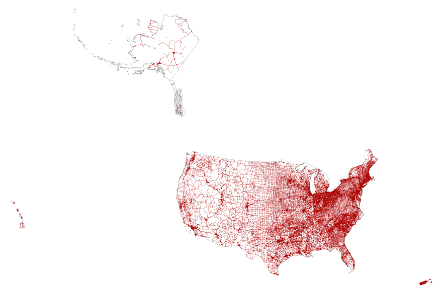
This map layer portrays the major roads in the United States, Puerto Rico, and the U.S. Virgin Islands. The file was produced by joining the individual State roads layers from the National Highway Planning Network (NHPN), Geographic Data Technology (GDT) Dynamap, and TIGER/Line files. This is a revised version of the July 2012 map layer.
Types: Citation;
Tags: Alabama,
Alaska,
Arizona,
Arkansas,
California, All tags...
Colorado,
Connecticut,
Delaware,
District of Columbia,
Downloadable Data,
Downloadable Data,
Florida,
Georgia,
Hawaii,
Highways,
Idaho,
Illinois,
Indiana,
Interstate highways,
Iowa,
Kansas,
Kentucky,
Louisiana,
Maine,
Maryland,
Massachusetts,
Michigan,
Minnesota,
Mississippi,
Missouri,
Montana,
National,
National,
National Atlas of the United States,
Nebraska,
Nevada,
New Hampshire,
New Jersey,
New Mexico,
New York,
North Carolina,
North Dakota,
Ohio,
Oklahoma,
Oregon,
Pennsylvania,
Puerto Rico,
Rhode Island,
Roads,
Shapefile,
Shapefile,
Small-scale Datasets,
Small-scale Datasets,
Small-scale Datasets,
Small-scale Datasets - Transportation,
South Carolina,
South Dakota,
State Route,
Tennessee,
Texas,
U.S. Virgin Islands,
US,
US Route,
USA,
United States,
Utah,
Vermont,
Virgin Islands,
Virginia,
Washington,
West Virginia,
Wisconsin,
Wyoming,
transportation, Fewer tags
This map layer portrays the major roads in the United States, Puerto Rico, and the U.S. Virgin Islands. The file was produced by joining the individual State roads layers from the National Highway Planning Network (NHPN), Geographic Data Technology (GDT) Dynamap, and TIGER/Line files. This is a revised version of the July 2012 map layer.
Types: Citation;
Tags: Alabama,
Alaska,
Arizona,
Arkansas,
California, All tags...
Colorado,
Connecticut,
Delaware,
District of Columbia,
Downloadable Data,
Downloadable Data,
FileGDB 10.1,
FileGDB 10.1,
Florida,
Georgia,
Hawaii,
Highways,
Idaho,
Illinois,
Indiana,
Interstate highways,
Iowa,
Kansas,
Kentucky,
Louisiana,
Maine,
Maryland,
Massachusetts,
Michigan,
Minnesota,
Mississippi,
Missouri,
Montana,
National,
National,
National Atlas of the United States,
Nebraska,
Nevada,
New Hampshire,
New Jersey,
New Mexico,
New York,
North Carolina,
North Dakota,
Ohio,
Oklahoma,
Oregon,
Pennsylvania,
Puerto Rico,
Rhode Island,
Roads,
Small-scale Datasets,
Small-scale Datasets,
Small-scale Datasets,
Small-scale Datasets - Transportation,
South Carolina,
South Dakota,
State Route,
Tennessee,
Texas,
U.S. Virgin Islands,
US,
US Route,
USA,
United States,
Utah,
Vermont,
Virgin Islands,
Virginia,
Washington,
West Virginia,
Wisconsin,
Wyoming,
transportation, Fewer tags
|
|

