Filters
Date Range
Contacts
Categories
Tag Types
Tag Schemes
|
The geology of an area of 660 square miles mostly in the northeastern corner of Tennessee and small adjacent areas in Virginia and North Carolina is the subject of this report. The region lies principally in the Unaka province, with extensions northwestward into the Appalachian Valley and southwestward into the Blue Ridge province. The report combines results of surveys made between 1941 and 1953 by the U. S. Geological Survey, the Tennessee Division of Geology, and the Tennessee Valley Authority, and is published in cooperation with the Tennessee Division of Geology. Northeasternmost Tennessee is a region of widespread mineralization and was formerly important for mineral production. Iron, manganese, and bauxite...
Tags: Abingdon,
Alluvium,
Andesite,
Argillite,
Arkose, All tags...
Austinville,
Baldwin Gap,
Blue Ridge,
Bluff City,
Bristol,
Cambrian,
Carbonate rock,
Carter,
Cenozoic,
Chert,
Conglomerate,
Conococheague Limestone,
Damascus,
Doe,
Dolostone,
Economic Geology,
Elbrook Dolomite,
Elizabethton,
Elk Mills,
Elk Park,
Erwin,
Erwin Formation,
Flaser gneiss,
Gneiss,
Granite,
Granodiorite,
Gravel,
Grayson,
Graywacke,
Greenstone,
Hampton,
Hampton Formation,
Holston Valley,
Honaker Dolomite,
Iron Mountain Gap,
Iron Mountains,
Jonesboro Limestone,
Keenburg,
Konnarock,
Latite,
Laurel Bloomery,
Lenoir Limestone,
Limestone,
Lucy Creek,
Lynn Mountain,
Migmatite,
Mill Creek,
Mount Rogers volcanic group,
Mountain City,
Mylonite,
Nolichucky Shale,
North Carolina,
Ordovician,
Paleozoic,
Phyllite,
Phyllonite,
Precambrian,
Quartz monzonite,
Quartzite,
Quaternary,
Rhyolite,
Rome Formation,
Sandstone,
Schist,
Shady Dolomite,
Shady Valley,
Shale,
Sherwood,
Siltstone,
Slate,
South Holston Lake,
Stone Mountain,
Stratigraphy,
Structural Geology,
Talus,
Tennessee,
Tertiary,
Tuff,
USGS Science Data Catalog (SDC),
Unicoi Formation,
Valley Forge,
Virginia,
Watauga,
White Rocks Mountain,
Zionville,
iron,
manganese,
metamorphic rocks,
metamorphism (geological),
plutonic rocks,
sedimentary rocks,
unconsolidated deposits,
volcanic rocks,
zinc, Fewer tags
USGS Historical Quadrangle in GeoPDF.
Tags: 7.5 x 7.5 minute,
CA,
Downloadable Data,
GeoPDF,
GeoTIFF, All tags...
Historical Topographic Maps,
Historical Topographic Maps 7.5 x 7.5 Minute Map Series,
Iron Mountains,
Map,
Provisional,
imageryBaseMapsEarthCover, Fewer tags
USGS Historical Quadrangle in GeoPDF.
Tags: 15 x 15 minute,
CA,
Downloadable Data,
GeoPDF,
GeoTIFF, All tags...
Historical Topographic Maps,
Historical Topographic Maps 15 x 15 Minute Map Series,
Iron Mountains,
Map,
imageryBaseMapsEarthCover, Fewer tags
USGS Historical Quadrangle in GeoPDF.
Tags: 15 x 15 minute,
CA,
Downloadable Data,
GeoPDF,
GeoTIFF, All tags...
Historical Topographic Maps,
Historical Topographic Maps 15 x 15 Minute Map Series,
Iron Mountains,
Map,
imageryBaseMapsEarthCover, Fewer tags
USGS Historical Quadrangle in GeoPDF.
Tags: 7.5 x 7.5 minute,
CA,
Downloadable Data,
GeoPDF,
GeoTIFF, All tags...
Historical Topographic Maps,
Historical Topographic Maps 7.5 x 7.5 Minute Map Series,
Iron Mountains,
Map,
Provisional,
imageryBaseMapsEarthCover, Fewer tags
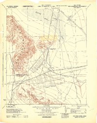
USGS Historical Quadrangle in GeoPDF.
Tags: 15 x 15 minute,
CA,
Downloadable Data,
GeoPDF,
GeoTIFF, All tags...
Historical Topographic Maps,
Historical Topographic Maps 15 x 15 Minute Map Series,
Iron Mountains,
Map,
imageryBaseMapsEarthCover, Fewer tags

This data release provides access to an aeromagnetic survey and magnetization boundaries over Blythe, California and surrounding areas in southern California and western Arizona. The survey extends east of Joshua Tree National Park across the Colorado River and west over the Dome Rock, Trigo, and Plomosa Mountains in Arizona. The survey was flown north of the Chocolate Mountains Gunnery Range over the McCoy, Palen, Granite, Iron, and Big and Little Maria Mountains. These data were acquired between January 22 and February 24, 2022, by Eon Geosciences Inc., working under contract to the U.S. Geological Survey. The nominal flying height was based on a best fit, pre-planned, three-dimensional draped surface targeted...
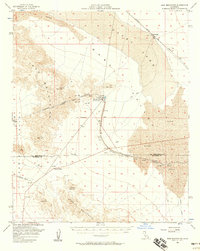
USGS Historical Quadrangle in GeoPDF.
Tags: 15 x 15 minute,
CA,
Downloadable Data,
GeoPDF,
GeoTIFF, All tags...
Historical Topographic Maps,
Historical Topographic Maps 15 x 15 Minute Map Series,
Iron Mountains,
Map,
imageryBaseMapsEarthCover, Fewer tags
|
|
