Filters
Date Types (for Date Range)
Extensions
Types
Contacts
Categories
Tag Types
Tag Schemes
|
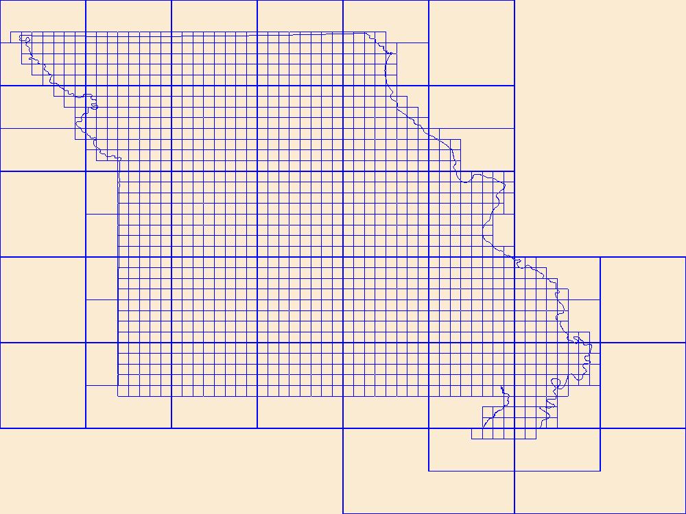
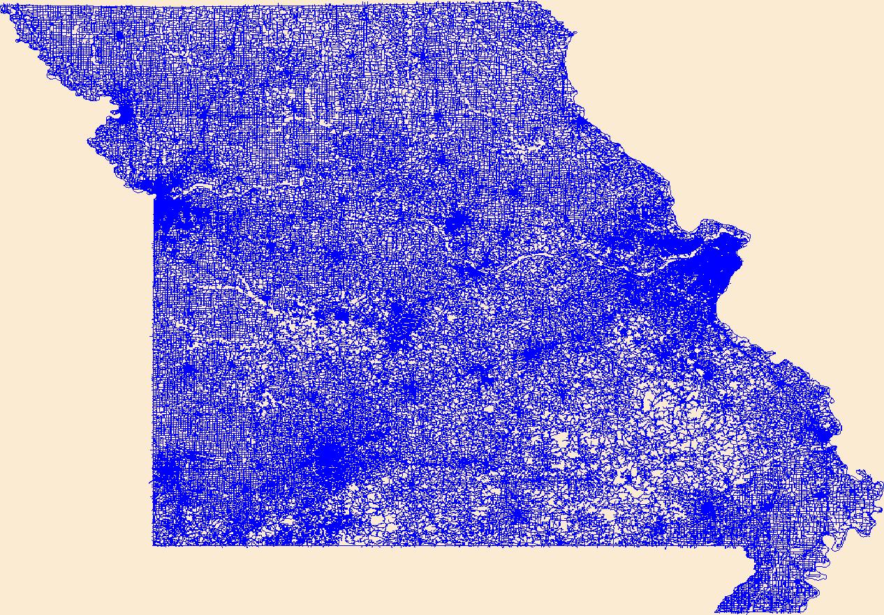
This data represents the map extent for current and historical USGS topographic maps for the United States and Territories, including 1 X 2 Degree, 1 X 1 Degree, 30 X 60 Minute, 15 X 15 Minute, 7.5 X 7.5 Minute, and 3.75 X 3.75 Minute. The grid was generated using ESRI ArcInfo GIS software.
Types: Citation;
Tags: Adair,
Andrew,
Atchison,
Audrain,
Barry, All tags...
Barton,
Bates,
Benton,
Bollinger,
Boone,
Boundaries,
Buchanan,
Butler,
Caldwell,
Callaway,
Camden,
Cape Girardeau,
Carroll,
Carter,
Cass,
Cedar,
Chariton,
Christian,
Clark,
Clay,
Clinton,
Cole,
Cooper,
Crawford,
Dade,
Dallas,
Daviess,
DeKalb,
Dent,
Douglas,
Downloadable Data,
Dunklin,
Esri Shapefile nan,
Franklin,
Gasconade,
Gentry,
Greene,
Grundy,
Harrison,
Henry,
Hickory,
Holt,
Howard,
Howell,
Iron,
Jackson,
Jasper,
Jefferson,
Johnson,
Knox,
Laclede,
Lafayette,
Lawrence,
Lewis,
Lincoln,
Linn,
Livingston,
MO,
Macon,
Madison,
Map Indices,
Map Indices,
Map Indices,
Maries,
Marion,
McDonald,
Mercer,
Miller,
Mississippi,
Missouri,
Moniteau,
Monroe,
Montgomery,
Morgan,
New Madrid,
Newton,
Nodaway,
Oregon,
Osage,
Ozark,
Pemiscot,
Perry,
Pettis,
Phelps,
Pike,
Platte,
Polk,
Pulaski,
Putnam,
Ralls,
Randolph,
Ray,
Reynolds,
Ripley,
Saline,
Schuyler,
Scotland,
Scott,
Shannon,
Shapefile,
Shelby,
St. Charles,
St. Clair,
St. Francois,
St. Louis,
State,
State,
Ste. Genevieve,
Stoddard,
Stone,
Sullivan,
Taney,
Texas,
US,
United States,
United States of America,
Vernon,
Warren,
Washington,
Wayne,
Webster,
Worth,
Wright,
cells,
map indices,
polygon grid, Fewer tags
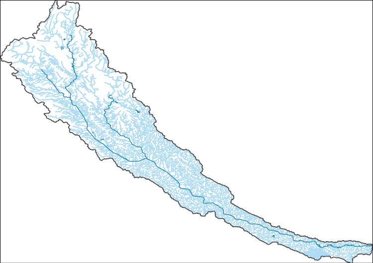
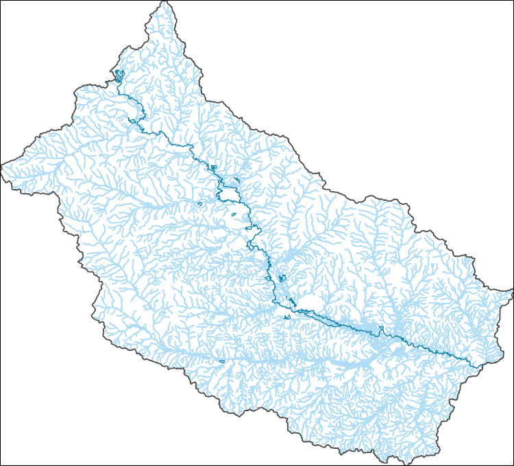
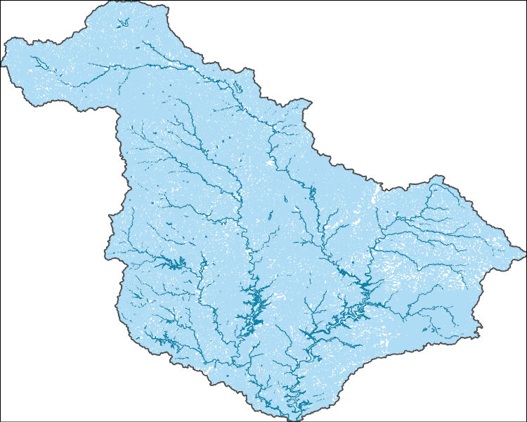
The National Hydrography Dataset (NHD) is a feature-based database that interconnects and uniquely identifies the stream segments or reaches that make up the nation's surface water drainage system. NHD data was originally developed at 1:100,000-scale and exists at that scale for the whole country. This high-resolution NHD, generally developed at 1:24,000/1:12,000 scale, adds detail to the original 1:100,000-scale NHD. (Data for Alaska, Puerto Rico and the Virgin Islands was developed at high-resolution, not 1:100,000 scale.) Local resolution NHD is being developed where partners and data exist. The NHD contains reach codes for networked features, flow direction, names, and centerline representations for areal water...
Tags: Administrative watershed units,
Administrative watershed units,
Area of Complex Channels,
Area to be submerged,
Basin, All tags...
Basin,
Bay/Inlet,
Boone,
Boundaries,
Boundary,
Bridge,
Canal/Ditch,
Coastline,
Connector,
Dam/Weir,
Downloadable Data,
Drainage areas for surface water,
Drainageway,
Esri Shapefile nan,
Estuary,
Flow direction network,
Flume,
ForeShore,
Gaging Station,
Gate,
HU-8,
HU-8 Subbasin,
HU10,
HU12,
HU14,
HU16,
HU2,
HU4,
HU6,
HU8,
HU8_07080105,
HUC,
Hamilton,
Hardin,
Hazard Zone,
Hydrographic,
Hydrography,
Hydrography,
Hydrography,
Hydrologic Unit Code,
Hydrologic Units,
IA,
Ice mass,
Inundation Area,
Iowa,
Jasper,
Jefferson,
Keokuk,
Levee,
Line,
Lock Chamber,
Mahaska,
Marion,
Marsh,
Marshall,
National Hydrography Dataset (NHD),
National Hydrography Dataset (NHD) Best Resolution,
National Hydrography Dataset (NHD) Best Resolution,
Nonearthen Shore,
Orthoimage,
Playa,
Point,
PointEvent,
Polk,
Pond,
Poweshiek,
Rapids,
Rapids,
Reach,
Reach code,
Reef,
Region,
Reservoir,
Rock,
Sea/Ocean,
Shapefile,
Sink/Rise,
Sounding Datum Line,
Special Use Zone,
Special Use Zone Limit,
Spillway,
Story,
Stream,
Stream/River,
Sub-basin,
Sub-region,
Subbasin,
Submerged Stream,
Subregion,
Subwatershed,
Surface water systems,
Swamp,
Topographic,
Tunnel,
US,
Underground Conduit,
United States,
WBD,
WBD,
Wall,
Wash,
Water Intake Outflow,
Waterfall,
Watershed,
Watershed Boundaries,
Watershed Boundary Dataset,
Watershed Boundary Dataset,
Webster,
Well,
artificial path,
boundaries,
dams,
drainage systems and characteristics,
inlandWaters,
lakes,
ngda,
rivers, Fewer tags
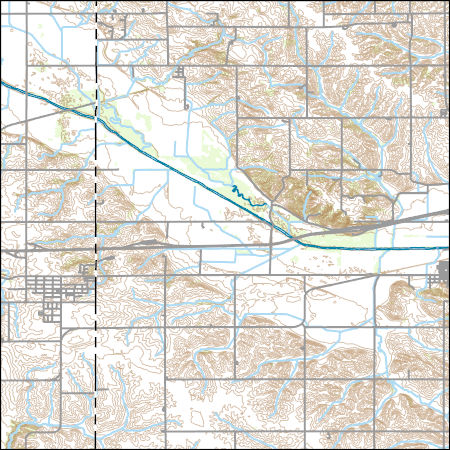
Layers of geospatial data include contours, boundaries, land cover, hydrography, roads, transportation, geographic names, structures, and other selected map features.
Types: Citation;
Tags: 7.5 x 7.5 minute,
7_5_Min,
Combined Vector,
Combined Vector,
Combined Vector, All tags...
Downloadable Data,
Esri File GeoDatabase 10,
FileGDB,
IA,
Iowa,
Jasper,
Polk,
Public Land Survey System,
Topo Map Vector Data,
US,
United States,
boundary,
contours,
geographic names,
hydrography,
structures,
transportation,
woodland, Fewer tags
The Geographic Names Information System (GNIS) is the Federal standard for geographic nomenclature. The U.S. Geological Survey developed the GNIS for the U.S. Board on Geographic Names, a Federal inter-agency body chartered by public law to maintain uniform feature name usage throughout the Government and to promulgate standard names to the public. The GNIS is the official repository of domestic geographic names data; the official vehicle for geographic names use by all departments of the Federal Government; and the source for applying geographic names to Federal electronic and printed products of all types.
Tags: Antarctica,
Antarctica,
Appling,
Atkinson,
BGN, All tags...
Bacon,
Baker,
Baldwin,
Banks,
Barrow,
Bartow,
Ben Hill,
Berrien,
Bibb,
Bleckley,
Board on Geographic Names,
Borough,
Brantley,
Brooks,
Bryan,
Bulloch,
Burke,
Butts,
Calhoun,
Camden,
Candler,
Carroll,
Catoosa,
Census Area,
Charlton,
Chatham,
Chattahoochee,
Chattooga,
Cherokee,
Clarke,
Clay,
Clayton,
Clinch,
Cobb,
Coffee,
Colquitt,
Columbia,
Commonwealth,
Cook,
County,
Coweta,
Crawford,
Crisp,
Dade,
Dawson,
DeKalb,
Decatur,
District,
Dodge,
Dooly,
Dougherty,
Douglas,
Downloadable Data,
Early,
Echols,
Effingham,
Elbert,
Emanuel,
Evans,
Fannin,
Fayette,
Feature class,
Feature coordinates,
Feature county,
Feature description,
Feature designation,
Feature history,
Feature indentification,
Feature name,
Feature state,
Floyd,
Forsyth,
Franklin,
Fulton,
GA,
GNIS,
Geographic Names,
Geographic Names Federal Codes,
Geographic Names Information System,
Geographic feature,
Geographic name,
Geographical feature,
Geographical name,
Georgia,
Gilmer,
Glascock,
Glynn,
Gordon,
Grady,
Greene,
Gwinnett,
Habersham,
Hall,
Hancock,
Haralson,
Harris,
Hart,
Heard,
Henry,
Houston,
Irwin,
Jackson,
Jasper,
Jeff Davis,
Jefferson,
Jenkins,
Johnson,
Jones,
Lamar,
Lanier,
Laurens,
Lee,
Liberty,
Lincoln,
Long,
Lowndes,
Lumpkin,
Macon,
Madison,
Marion,
McDuffie,
McIntosh,
Meriwether,
Miller,
Mitchell,
Monroe,
Montgomery,
Morgan,
Municipio,
Murray,
Muscogee,
National Geographic Names Information System (GNIS),
National Geographic Names Information System (GNIS),
Newton,
Oconee,
Official feature name,
Oglethorpe,
Outlying Area,
Parish,
Paulding,
Peach,
Pickens,
Pierce,
Pike,
Place name,
Polk,
Populated Place,
Pulaski,
Putnam,
Quitman,
Rabun,
Randolph,
Richmond,
Rockdale,
Schley,
Screven,
Seminole,
Spalding,
State,
Stephens,
Stewart,
Sumter,
TXT (pipes),
Talbot,
Taliaferro,
Tattnall,
Taylor,
Telfair,
Terrell,
Territories,
Territory,
Thomas,
Tift,
Toombs,
Topographic Map,
Towns,
Treutlen,
Troup,
Turner,
Twiggs,
U.S. Board on Geographic Names,
U.S. Geological Survey,
US,
USA,
USBGN,
USGS,
UTF-8 Pipe Delimited Text File nan,
Union,
United States,
United States,
United States,
Upson,
Variant name,
Walker,
Walton,
Ware,
Warren,
Washington,
Wayne,
Webster,
Wheeler,
White,
Whitfield,
Wilcox,
Wilkes,
Wilkinson,
Worth,
antarctic,
database,
economy,
environment,
feature,
gazetteer,
geographic,
geographic names,
geographical,
geography,
geospatial,
imageryBaseMapsEarthCover,
inlandWaters,
location,
map,
name,
place,
placename,
society,
structure,
topographic map,
toponymy, Fewer tags
The Geographic Names Information System (GNIS) is the Federal standard for geographic nomenclature. The U.S. Geological Survey developed the GNIS for the U.S. Board on Geographic Names, a Federal inter-agency body chartered by public law to maintain uniform feature name usage throughout the Government and to promulgate standard names to the public. The GNIS is the official repository of domestic geographic names data; the official vehicle for geographic names use by all departments of the Federal Government; and the source for applying geographic names to Federal electronic and printed products of all types.
Tags: Adair,
Adams,
Allamakee,
Antarctica,
Antarctica, All tags...
Appanoose,
Audubon,
BGN,
Benton,
Black Hawk,
Board on Geographic Names,
Boone,
Borough,
Bremer,
Buchanan,
Buena Vista,
Butler,
Calhoun,
Carroll,
Cass,
Cedar,
Census Area,
Cerro Gordo,
Cherokee,
Chickasaw,
Clarke,
Clay,
Clayton,
Clinton,
Commonwealth,
County,
Crawford,
Dallas,
Davis,
Decatur,
Delaware,
Des Moines,
Dickinson,
District,
Downloadable Data,
Dubuque,
Emmet,
Fayette,
Feature class,
Feature coordinates,
Feature county,
Feature description,
Feature designation,
Feature history,
Feature indentification,
Feature name,
Feature state,
Floyd,
Franklin,
Fremont,
GNIS,
Geographic Names,
Geographic Names Domestic Names,
Geographic Names Information System,
Geographic feature,
Geographic name,
Geographical feature,
Geographical name,
Greene,
Grundy,
Guthrie,
Hamilton,
Hancock,
Hardin,
Harrison,
Henry,
Howard,
Humboldt,
IA,
Ida,
Iowa,
Iowa,
Jackson,
Jasper,
Jefferson,
Johnson,
Jones,
Keokuk,
Kossuth,
Lee,
Linn,
Louisa,
Lucas,
Lyon,
Madison,
Mahaska,
Marion,
Marshall,
Mills,
Mitchell,
Monona,
Monroe,
Montgomery,
Municipio,
Muscatine,
National Geographic Names Information System (GNIS),
National Geographic Names Information System (GNIS),
O'Brien,
Official feature name,
Osceola,
Outlying Area,
Page,
Palo Alto,
Parish,
Place name,
Plymouth,
Pocahontas,
Polk,
Populated Place,
Pottawattamie,
Poweshiek,
Ringgold,
Sac,
Scott,
Shelby,
Sioux,
State,
Story,
TXT (pipes),
Tama,
Taylor,
Territories,
Territory,
Topographic Map,
U.S. Board on Geographic Names,
U.S. Geological Survey,
US,
USA,
USBGN,
USGS,
UTF-8 Pipe Delimited Text File nan,
Union,
United States,
United States,
United States,
Van Buren,
Variant name,
Wapello,
Warren,
Washington,
Wayne,
Webster,
Winnebago,
Winneshiek,
Woodbury,
Worth,
Wright,
antarctic,
database,
economy,
environment,
feature,
gazetteer,
geographic,
geographic names,
geographical,
geography,
geospatial,
imageryBaseMapsEarthCover,
inlandWaters,
location,
map,
name,
place,
placename,
society,
structure,
topographic map,
toponymy, Fewer tags
The Geographic Names Information System (GNIS) is the Federal standard for geographic nomenclature. The U.S. Geological Survey developed the GNIS for the U.S. Board on Geographic Names, a Federal inter-agency body chartered by public law to maintain uniform feature name usage throughout the Government and to promulgate standard names to the public. The GNIS is the official repository of domestic geographic names data; the official vehicle for geographic names use by all departments of the Federal Government; and the source for applying geographic names to Federal electronic and printed products of all types.
Tags: Anderson,
Andrews,
Angelina,
Antarctica,
Antarctica, All tags...
Aransas,
Archer,
Armstrong,
Atascosa,
Austin,
BGN,
Bailey,
Bandera,
Bastrop,
Baylor,
Bee,
Bell,
Bexar,
Blanco,
Board on Geographic Names,
Borden,
Borough,
Bosque,
Bowie,
Brazoria,
Brazos,
Brewster,
Briscoe,
Brooks,
Brown,
Burleson,
Burnet,
Caldwell,
Calhoun,
Callahan,
Cameron,
Camp,
Carson,
Cass,
Castro,
Census Area,
Chambers,
Cherokee,
Childress,
Clay,
Cochran,
Coke,
Coleman,
Collin,
Collingsworth,
Colorado,
Comal,
Comanche,
Commonwealth,
Concho,
Cooke,
Coryell,
Cottle,
County,
Crane,
Crockett,
Crosby,
Culberson,
Dallam,
Dallas,
Dawson,
DeWitt,
Deaf Smith,
Delta,
Denton,
Dickens,
Dimmit,
District,
Donley,
Downloadable Data,
Duval,
Eastland,
Ector,
Edwards,
El Paso,
Ellis,
Erath,
Falls,
Fannin,
Fayette,
Feature class,
Feature coordinates,
Feature county,
Feature description,
Feature designation,
Feature history,
Feature indentification,
Feature name,
Feature state,
Fisher,
Floyd,
Foard,
Fort Bend,
Franklin,
Freestone,
Frio,
GNIS,
Gaines,
Galveston,
Garza,
Geographic Names,
Geographic Names Federal Codes,
Geographic Names Information System,
Geographic feature,
Geographic name,
Geographical feature,
Geographical name,
Gillespie,
Glasscock,
Goliad,
Gonzales,
Gray,
Grayson,
Gregg,
Grimes,
Guadalupe,
Hale,
Hall,
Hamilton,
Hansford,
Hardeman,
Hardin,
Harris,
Harrison,
Hartley,
Haskell,
Hays,
Hemphill,
Henderson,
Hidalgo,
Hill,
Hockley,
Hood,
Hopkins,
Houston,
Howard,
Hudspeth,
Hunt,
Hutchinson,
Irion,
Jack,
Jackson,
Jasper,
Jeff Davis,
Jefferson,
Jim Hogg,
Jim Wells,
Johnson,
Jones,
Karnes,
Kaufman,
Kendall,
Kenedy,
Kent,
Kerr,
Kimble,
King,
Kinney,
Kleberg,
Knox,
La Salle,
Lamar,
Lamb,
Lampasas,
Lavaca,
Lee,
Leon,
Liberty,
Limestone,
Lipscomb,
Live Oak,
Llano,
Loving,
Lubbock,
Lynn,
Madison,
Marion,
Martin,
Mason,
Matagorda,
Maverick,
McCulloch,
McLennan,
McMullen,
Medina,
Menard,
Midland,
Milam,
Mills,
Mitchell,
Montague,
Montgomery,
Moore,
Morris,
Motley,
Municipio,
Nacogdoches,
National Geographic Names Information System (GNIS),
National Geographic Names Information System (GNIS),
Navarro,
Newton,
Nolan,
Nueces,
Ochiltree,
Official feature name,
Oldham,
Orange,
Outlying Area,
Palo Pinto,
Panola,
Parish,
Parker,
Parmer,
Pecos,
Place name,
Polk,
Populated Place,
Potter,
Presidio,
Rains,
Randall,
Reagan,
Real,
Red River,
Reeves,
Refugio,
Roberts,
Robertson,
Rockwall,
Runnels,
Rusk,
Sabine,
San Augustine,
San Jacinto,
San Patricio,
San Saba,
Schleicher,
Scurry,
Shackelford,
Shelby,
Sherman,
Smith,
Somervell,
Starr,
State,
Stephens,
Sterling,
Stonewall,
Sutton,
Swisher,
TX,
TXT (pipes),
Tarrant,
Taylor,
Terrell,
Territories,
Territory,
Terry,
Texas,
Throckmorton,
Titus,
Tom Green,
Topographic Map,
Travis,
Trinity,
Tyler,
U.S. Board on Geographic Names,
U.S. Geological Survey,
US,
USA,
USBGN,
USGS,
UTF-8 Pipe Delimited Text File nan,
United States,
United States,
United States,
Upshur,
Upton,
Uvalde,
Val Verde,
Van Zandt,
Variant name,
Victoria,
Walker,
Waller,
Ward,
Washington,
Webb,
Wharton,
Wheeler,
Wichita,
Wilbarger,
Willacy,
Williamson,
Wilson,
Winkler,
Wise,
Wood,
Yoakum,
Young,
Zapata,
Zavala,
antarctic,
database,
economy,
environment,
feature,
gazetteer,
geographic,
geographic names,
geographical,
geography,
geospatial,
imageryBaseMapsEarthCover,
inlandWaters,
location,
map,
name,
place,
placename,
society,
structure,
topographic map,
toponymy, Fewer tags
The Geographic Names Information System (GNIS) is the Federal standard for geographic nomenclature. The U.S. Geological Survey developed the GNIS for the U.S. Board on Geographic Names, a Federal inter-agency body chartered by public law to maintain uniform feature name usage throughout the Government and to promulgate standard names to the public. The GNIS is the official repository of domestic geographic names data; the official vehicle for geographic names use by all departments of the Federal Government; and the source for applying geographic names to Federal electronic and printed products of all types.
Tags: Abbeville,
Aiken,
Allendale,
Anderson,
Antarctica, All tags...
Antarctica,
BGN,
Bamberg,
Barnwell,
Beaufort,
Berkeley,
Board on Geographic Names,
Borough,
Calhoun,
Census Area,
Charleston,
Cherokee,
Chester,
Chesterfield,
Clarendon,
Colleton,
Commonwealth,
County,
Darlington,
Dillon,
District,
Dorchester,
Downloadable Data,
Edgefield,
Fairfield,
Feature class,
Feature coordinates,
Feature county,
Feature description,
Feature designation,
Feature history,
Feature indentification,
Feature name,
Feature state,
Florence,
GNIS,
Geographic Names,
Geographic Names Domestic Names,
Geographic Names Information System,
Geographic feature,
Geographic name,
Geographical feature,
Geographical name,
Georgetown,
Greenville,
Greenwood,
Hampton,
Horry,
Jasper,
Kershaw,
Lancaster,
Laurens,
Lee,
Lexington,
Marion,
Marlboro,
McCormick,
Municipio,
National Geographic Names Information System (GNIS),
National Geographic Names Information System (GNIS),
Newberry,
Oconee,
Official feature name,
Orangeburg,
Outlying Area,
Parish,
Pickens,
Place name,
Populated Place,
Richland,
SC,
Saluda,
South Carolina,
Spartanburg,
State,
Sumter,
TXT (pipes),
Territories,
Territory,
Topographic Map,
U.S. Board on Geographic Names,
U.S. Geological Survey,
US,
USA,
USBGN,
USGS,
UTF-8 Pipe Delimited Text File nan,
Union,
United States,
United States,
United States,
Variant name,
Williamsburg,
York,
antarctic,
database,
economy,
environment,
feature,
gazetteer,
geographic,
geographic names,
geographical,
geography,
geospatial,
imageryBaseMapsEarthCover,
inlandWaters,
location,
map,
name,
place,
placename,
society,
structure,
topographic map,
toponymy, Fewer tags
The Geographic Names Information System (GNIS) is the Federal standard for geographic nomenclature. The U.S. Geological Survey developed the GNIS for the U.S. Board on Geographic Names, a Federal inter-agency body chartered by public law to maintain uniform feature name usage throughout the Government and to promulgate standard names to the public. The GNIS is the official repository of domestic geographic names data; the official vehicle for geographic names use by all departments of the Federal Government; and the source for applying geographic names to Federal electronic and printed products of all types.
Tags: Adams,
Alexander,
Antarctica,
Antarctica,
BGN, All tags...
Board on Geographic Names,
Bond,
Boone,
Borough,
Brown,
Bureau,
Calhoun,
Carroll,
Cass,
Census Area,
Champaign,
Christian,
Clark,
Clay,
Clinton,
Coles,
Commonwealth,
Cook,
County,
Crawford,
Cumberland,
De Witt,
DeKalb,
District,
Douglas,
Downloadable Data,
DuPage,
Edgar,
Edwards,
Effingham,
Fayette,
Feature class,
Feature coordinates,
Feature county,
Feature description,
Feature designation,
Feature history,
Feature indentification,
Feature name,
Feature state,
Ford,
Franklin,
Fulton,
GNIS,
Gallatin,
GeoPackage,
Geographic Names,
Geographic Names Full Model,
Geographic Names Information System,
Geographic feature,
Geographic name,
Geographical feature,
Geographical name,
Greene,
Grundy,
Hamilton,
Hancock,
Hardin,
Henderson,
Henry,
IL,
Illinois,
Iroquois,
Jackson,
Jasper,
Jefferson,
Jersey,
Jo Daviess,
Johnson,
Kane,
Kankakee,
Kendall,
Knox,
LaSalle,
Lake,
Lawrence,
Lee,
Livingston,
Logan,
Macon,
Macoupin,
Madison,
Marion,
Marshall,
Mason,
Massac,
McDonough,
McHenry,
McLean,
Menard,
Mercer,
Monroe,
Montgomery,
Morgan,
Moultrie,
Municipio,
National Geographic Names Information System (GNIS),
National Geographic Names Information System (GNIS),
Official feature name,
Ogle,
Open Geospatial Consortium GeoPackage 1.2,
Outlying Area,
Parish,
Peoria,
Perry,
Piatt,
Pike,
Place name,
Pope,
Populated Place,
Pulaski,
Putnam,
Randolph,
Richland,
Rock Island,
Saline,
Sangamon,
Schuyler,
Scott,
Shelby,
St. Clair,
Stark,
State,
Stephenson,
Tazewell,
Territories,
Territory,
Topographic Map,
U.S. Board on Geographic Names,
U.S. Geological Survey,
US,
USA,
USBGN,
USGS,
Union,
United States,
United States,
United States,
Variant name,
Vermilion,
Wabash,
Warren,
Washington,
Wayne,
White,
Whiteside,
Will,
Williamson,
Winnebago,
Woodford,
antarctic,
database,
economy,
environment,
feature,
gazetteer,
geographic,
geographic names,
geographical,
geography,
geospatial,
imageryBaseMapsEarthCover,
inlandWaters,
location,
map,
name,
place,
placename,
society,
structure,
topographic map,
toponymy, Fewer tags
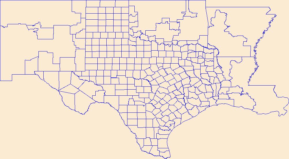
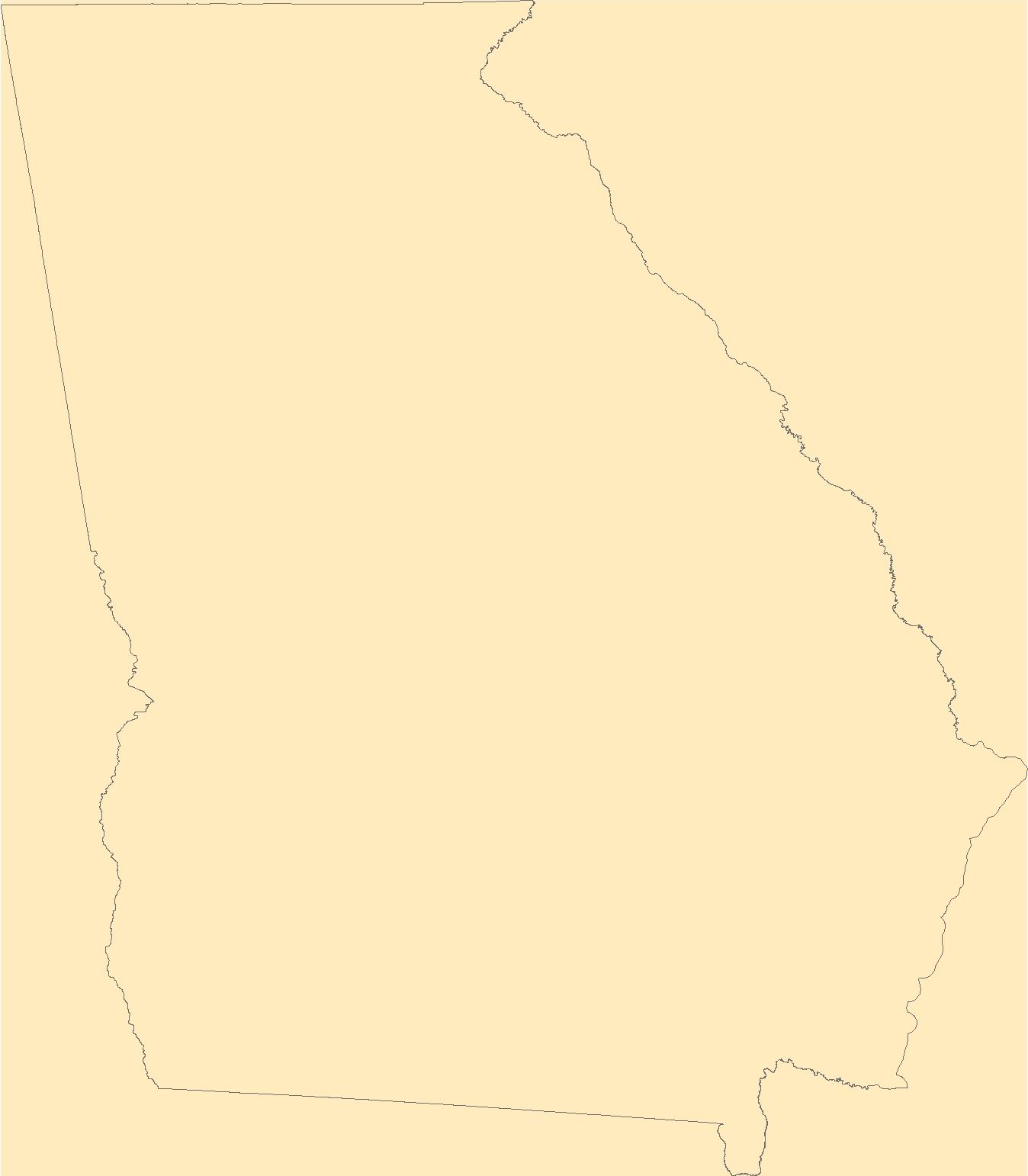
Geospatial data is comprised of government boundaries.
Types: Citation;
Tags: Anderson,
Andrews,
Angelina,
Aransas,
Archer, All tags...
Armstrong,
Atascosa,
Austin,
Bailey,
Bandera,
Bastrop,
Baylor,
Bee,
Bell,
Bexar,
Blanco,
Borden,
Bosque,
Boundaries,
Bowie,
Brazoria,
Brazos,
Brewster,
Briscoe,
Brooks,
Brown,
Burleson,
Burnet,
Caldwell,
Calhoun,
Callahan,
Cameron,
Camp,
Carson,
Cass,
Castro,
Chambers,
Cherokee,
Childress,
Clay,
Cochran,
Coke,
Coleman,
Collin,
Collingsworth,
Colorado,
Comal,
Comanche,
Concho,
Cooke,
Coryell,
Cottle,
County or Equivalent,
Crane,
Crockett,
Crosby,
Culberson,
Dallam,
Dallas,
Dawson,
DeWitt,
Deaf Smith,
Delta,
Denton,
Dickens,
Dimmit,
Donley,
Downloadable Data,
Duval,
Eastland,
Ector,
Edwards,
El Paso,
Ellis,
Erath,
Esri File GeoDatabase 10,
Falls,
Fannin,
Fayette,
FileGDB,
Fisher,
Floyd,
Foard,
Fort Bend,
Franklin,
Freestone,
Frio,
Gaines,
Galveston,
Garza,
Gillespie,
Glasscock,
Goliad,
Gonzales,
Gray,
Grayson,
Gregg,
Grimes,
Guadalupe,
Hale,
Hall,
Hamilton,
Hansford,
Hardeman,
Hardin,
Harris,
Harrison,
Hartley,
Haskell,
Hays,
Hemphill,
Henderson,
Hidalgo,
Hill,
Hockley,
Hood,
Hopkins,
Houston,
Howard,
Hudspeth,
Hunt,
Hutchinson,
Incorporated Place,
Irion,
Jack,
Jackson,
Jasper,
Jeff Davis,
Jefferson,
Jim Hogg,
Jim Wells,
Johnson,
Jones,
Jurisdictional,
Karnes,
Kaufman,
Kendall,
Kenedy,
Kent,
Kerr,
Kimble,
King,
Kinney,
Kleberg,
Knox,
La Salle,
Lamar,
Lamb,
Lampasas,
Lavaca,
Lee,
Leon,
Liberty,
Limestone,
Lipscomb,
Live Oak,
Llano,
Loving,
Lubbock,
Lynn,
Madison,
Marion,
Martin,
Mason,
Matagorda,
Maverick,
McCulloch,
McLennan,
McMullen,
Medina,
Menard,
Midland,
Milam,
Mills,
Minor Civil Division,
Mitchell,
Montague,
Montgomery,
Moore,
Morris,
Motley,
Nacogdoches,
National Boundary Dataset (NBD),
National Boundary Dataset (NBD),
Native American Area,
Navarro,
Newton,
Nolan,
Nueces,
Ochiltree,
Oldham,
Orange,
PLSS First Division,
PLSS Special Survey,
PLSS Township,
Palo Pinto,
Panola,
Parker,
Parmer,
Pecos,
Polk,
Potter,
Presidio,
Public Land Survey System,
Rains,
Randall,
Reagan,
Real,
Red River,
Reeves,
Refugio,
Reserve,
Roberts,
Robertson,
Rockwall,
Runnels,
Rusk,
Sabine,
San Augustine,
San Jacinto,
San Patricio,
San Saba,
Schleicher,
Scurry,
Shackelford,
Shelby,
Sherman,
Smith,
Somervell,
Starr,
State,
State,
State or Territory,
Stephens,
Sterling,
Stonewall,
Sutton,
Swisher,
TX,
Tarrant,
Taylor,
Terrell,
Terry,
Texas,
Throckmorton,
Titus,
Tom Green,
Travis,
Trinity,
Tyler,
U.S. National Grid,
US,
Unincorporated Place,
United States,
Upshur,
Upton,
Uvalde,
Val Verde,
Van Zandt,
Victoria,
Walker,
Waller,
Ward,
Washington,
Webb,
Wharton,
Wheeler,
Wichita,
Wilbarger,
Willacy,
Williamson,
Wilson,
Winkler,
Wise,
Wood,
Yoakum,
Young,
Zapata,
Zavala,
boundaries,
boundary,
cadastral surveys,
geographic names,
land ownership,
land use maps,
legal land descriptions,
political and administrative boundaries,
zoning maps, Fewer tags
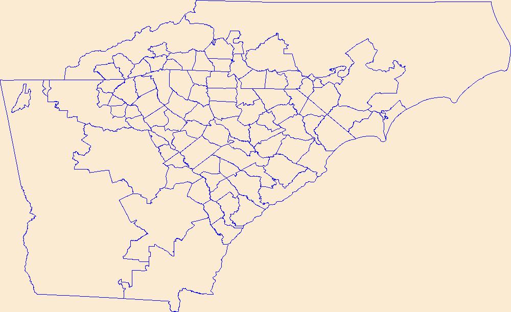
Geospatial data is comprised of government boundaries.
Types: Citation;
Tags: Abbeville,
Aiken,
Allendale,
Anderson,
Bamberg, All tags...
Barnwell,
Beaufort,
Berkeley,
Boundaries,
Calhoun,
Charleston,
Cherokee,
Chester,
Chesterfield,
Clarendon,
Colleton,
County or Equivalent,
Darlington,
Dillon,
Dorchester,
Downloadable Data,
Edgefield,
Esri File GeoDatabase 10,
Fairfield,
FileGDB,
Florence,
Georgetown,
Greenville,
Greenwood,
Hampton,
Horry,
Incorporated Place,
Jasper,
Jurisdictional,
Kershaw,
Lancaster,
Laurens,
Lee,
Lexington,
Marion,
Marlboro,
McCormick,
Minor Civil Division,
National Boundary Dataset (NBD),
National Boundary Dataset (NBD),
Native American Area,
Newberry,
Oconee,
Orangeburg,
PLSS First Division,
PLSS Special Survey,
PLSS Township,
Pickens,
Public Land Survey System,
Reserve,
Richland,
SC,
Saluda,
South Carolina,
Spartanburg,
State,
State,
State or Territory,
Sumter,
U.S. National Grid,
US,
Unincorporated Place,
Union,
United States,
Williamsburg,
York,
boundaries,
boundary,
cadastral surveys,
geographic names,
land ownership,
land use maps,
legal land descriptions,
political and administrative boundaries,
zoning maps, Fewer tags
Layers of geospatial data include roads, airports, trails, and railroads.
Tags: Adair,
Airport Complex,
Airport Point,
Airport Runway,
Airports, All tags...
Airstrips,
Andrew,
Atchison,
Audrain,
Barry,
Barton,
Bates,
Benton,
Bollinger,
Boone,
Buchanan,
Butler,
Caldwell,
Callaway,
Camden,
Cape Girardeau,
Carroll,
Carter,
Cass,
Cedar,
Chariton,
Christian,
Clark,
Clay,
Clinton,
Cole,
Cooper,
Crawford,
Dade,
Dallas,
Daviess,
DeKalb,
Dent,
Douglas,
Downloadable Data,
Dunklin,
Franklin,
Gasconade,
Gentry,
GeoPackage,
Geographic names,
Greene,
Grundy,
Harrison,
Henry,
Hickory,
Holt,
Howard,
Howell,
Iron,
Jackson,
Jasper,
Jefferson,
Johnson,
Knox,
Laclede,
Lafayette,
Lawrence,
Lewis,
Lincoln,
Linn,
Livingston,
MO,
Macon,
Madison,
Maries,
Marion,
McDonald,
Mercer,
Miller,
Mississippi,
Missouri,
Moniteau,
Monroe,
Montgomery,
Morgan,
National Transportation Dataset (NTD),
National Transportation Dataset (NTD),
New Madrid,
Newton,
Nodaway,
Open Geospatial Consortium GeoPackage 1.2,
Oregon,
Osage,
Ozark,
Pemiscot,
Perry,
Pettis,
Phelps,
Pike,
Platte,
Polk,
Pulaski,
Putnam,
Railways,
Ralls,
Randolph,
Ray,
Reynolds,
Ripley,
Roads,
Saline,
Schuyler,
Scotland,
Scott,
Shannon,
Shelby,
St. Charles,
St. Clair,
St. Francois,
St. Louis,
State,
State,
Ste. Genevieve,
Stoddard,
Stone,
Sullivan,
Taney,
Texas,
Trail,
Trails,
Transportation,
Transportation,
US,
United States,
Vernon,
Warren,
Washington,
Waterway,
Wayne,
Webster,
Worth,
Wright,
transportation, Fewer tags
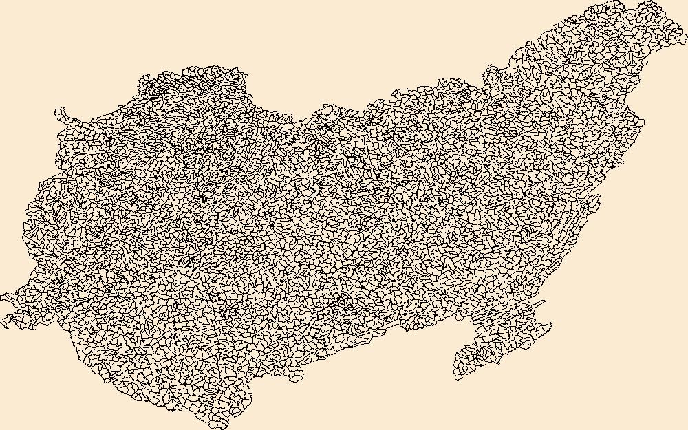
The Watershed Boundary Dataset (WBD) is a comprehensive aggregated collection of hydrologic unit data consistent with the national criteria for delineation and resolution. It defines the areal extent of surface water drainage to a point except in coastal or lake front areas where there could be multiple outlets as stated by the "Federal Standards and Procedures for the National Watershed Boundary Dataset (WBD)" "Standard" (https://pubs.usgs.gov/tm/11/a3/). Watershed boundaries are determined solely upon science-based hydrologic principles, not favoring any administrative boundaries or special projects, nor particular program or agency. This dataset represents the hydrologic unit boundaries to the 12-digit (6th level)...
Tags: 10-digit,
12-digit,
14-digit,
16-digit,
2-digit, All tags...
4-digit,
6-digit,
8-digit,
Adair,
Adams,
Alexander,
Allegany,
Alleghany,
Allegheny,
Allen,
Anderson,
Armstrong,
Ashe,
Ashland,
Ashtabula,
Athens,
Auglaize,
Ballard,
Barbour,
Barren,
Bartholomew,
Basin,
Bath,
Beaver,
Bedford,
Bell,
Belmont,
Benton,
Blackford,
Blair,
Bland,
Bledsoe,
Boone,
Bourbon,
Boyd,
Boyle,
Bracken,
Braxton,
Breathitt,
Breckinridge,
Brooke,
Brown,
Buchanan,
Bullitt,
Butler,
Cabell,
Caldwell,
Calhoun,
Cambria,
Cameron,
Campbell,
Cannon,
Carroll,
Carter,
Casey,
Cass,
Cattaraugus,
Champaign,
Chautauqua,
Cheatham,
Christian,
Claiborne,
Clarion,
Clark,
Clay,
Clearfield,
Clermont,
Clinton,
Coffee,
Coles,
Columbiana,
Coshocton,
Craig,
Crawford,
Crittenden,
Cumberland,
Darke,
Davidson,
Daviess,
DeKalb,
Dearborn,
Decatur,
Delaware,
Dickenson,
Dickson,
Doddridge,
Douglas,
Downloadable Data,
Dubois,
Edgar,
Edmonson,
Edwards,
Effingham,
Elk,
Elliott,
Erie,
Esri Shapefile nan,
Estill,
Fairfield,
Fayette,
Fentress,
Fleming,
Floyd,
Ford,
Forest,
Fountain,
Franklin,
Fulton,
Galax,
Gallatin,
Gallia,
Garrard,
Garrett,
Geauga,
Gibson,
Giles,
Gilmer,
Grant,
Grayson,
Green,
Greenbrier,
Greene,
Greenup,
Grundy,
Guernsey,
HU-2,
HU-2 Region,
HU2_05,
HUC,
Hamilton,
Hancock,
Hardin,
Harlan,
Harrison,
Hart,
Henderson,
Hendricks,
Henry,
Hickman,
Highland,
Hocking,
Holmes,
Hopkins,
Houston,
Howard,
Humphreys,
Huntington,
Hydrography,
Hydrologic Unit Code,
Hydrologic Units,
IL,
IN,
Illinois,
Indiana,
Indiana,
Iroquois,
Jackson,
Jasper,
Jay,
Jefferson,
Jennings,
Jessamine,
Johnson,
KY,
Kanawha,
Kenton,
Kentucky,
Knott,
Knox,
Kosciusko,
Larue,
Laurel,
Lawrence,
Lee,
Leslie,
Letcher,
Lewis,
Licking,
Lincoln,
Livingston,
Logan,
Lyon,
MD,
Macon,
Madison,
Magoffin,
Mahoning,
Marion,
Marshall,
Martin,
Maryland,
Mason,
Massac,
McCracken,
McCreary,
McDowell,
McKean,
McLean,
Meade,
Medina,
Meigs,
Menifee,
Mercer,
Metcalfe,
Miami,
Mingo,
Monongalia,
Monroe,
Montgomery,
Morgan,
Morrow,
Moultrie,
Muhlenberg,
Muskingum,
NC,
NY,
National Watershed Boundary Dataset (WBD),
National Watershed Boundary Dataset (WBD),
Nelson,
New York,
Nicholas,
Noble,
North Carolina,
OH,
Ohio,
Ohio,
Oldham,
Orange,
Overton,
Owen,
Owsley,
PA,
Parke,
Patrick,
Pendleton,
Pennsylvania,
Perry,
Pickaway,
Pickett,
Pike,
Pleasants,
Pocahontas,
Pope,
Portage,
Posey,
Potter,
Powell,
Preble,
Preston,
Pulaski,
Putnam,
Radford,
Raleigh,
Randolph,
Region,
Richland,
Ripley,
Ritchie,
Roane,
Robertson,
Rockcastle,
Ross,
Rowan,
Rush,
Russell,
Rutherford,
Saline,
Scioto,
Scott,
Sequatchie,
Shapefile,
Shelby,
Simpson,
Smith,
Smyth,
Somerset,
Spencer,
Stark,
Starke,
Stewart,
Sub-basin,
Sub-region,
Subwatershed,
Sullivan,
Summers,
Summit,
Sumner,
Surry,
Switzerland,
TN,
Taylor,
Tazewell,
Tennessee,
Tippecanoe,
Tipton,
Todd,
Trigg,
Trimble,
Trousdale,
Trumbull,
Tucker,
Tuscarawas,
Tyler,
US,
Union,
United States,
Upshur,
VA,
Van Buren,
Vanderburgh,
Venango,
Vermilion,
Vermillion,
Vigo,
Vinton,
Virginia,
WBD,
WV,
Wabash,
Warren,
Warrick,
Washington,
Watauga,
Watershed,
Watershed Boundary Dataset,
Wayne,
Webster,
Wells,
West Virginia,
Westmoreland,
Wetzel,
White,
Whitley,
Wilkes,
Williamson,
Wilson,
Wirt,
Wise,
Wolfe,
Wood,
Woodford,
Wyandot,
Wyoming,
Wythe,
inlandWaters, Fewer tags

The National Hydrography Dataset (NHD) is a feature-based database that interconnects and uniquely identifies the stream segments or reaches that make up the nation's surface water drainage system. NHD data was originally developed at 1:100,000-scale and exists at that scale for the whole country. This high-resolution NHD, generally developed at 1:24,000/1:12,000 scale, adds detail to the original 1:100,000-scale NHD. (Data for Alaska, Puerto Rico and the Virgin Islands was developed at high-resolution, not 1:100,000 scale.) Local resolution NHD is being developed where partners and data exist. The NHD contains reach codes for networked features, flow direction, names, and centerline representations for areal water...
Tags: Administrative watershed units,
Administrative watershed units,
Angelina,
Area of Complex Channels,
Area to be submerged, All tags...
Basin,
Basin,
Bay/Inlet,
Boundaries,
Boundary,
Bridge,
Canal/Ditch,
Cherokee,
Coastline,
Connector,
Dam/Weir,
Downloadable Data,
Drainage areas for surface water,
Drainageway,
Estuary,
Flow direction network,
Flume,
ForeShore,
Gaging Station,
Gate,
GeoPackage,
HU-8,
HU-8 Subbasin,
HU10,
HU12,
HU14,
HU16,
HU2,
HU4,
HU6,
HU8,
HU8_12020002,
HUC,
Hazard Zone,
Houston,
Hydrographic,
Hydrography,
Hydrography,
Hydrography,
Hydrologic Unit Code,
Hydrologic Units,
Ice mass,
Inundation Area,
Jasper,
Levee,
Line,
Lock Chamber,
Marsh,
National Hydrography Dataset (NHD),
National Hydrography Dataset (NHD) Best Resolution,
National Hydrography Dataset (NHD) Best Resolution,
Nonearthen Shore,
Open Geospatial Consortium GeoPackage 1.2,
Orthoimage,
Playa,
Point,
PointEvent,
Polk,
Pond,
Rapids,
Rapids,
Reach,
Reach code,
Reef,
Region,
Reservoir,
Rock,
Sea/Ocean,
Sink/Rise,
Sounding Datum Line,
Special Use Zone,
Special Use Zone Limit,
Spillway,
Stream,
Stream/River,
Sub-basin,
Sub-region,
Subbasin,
Submerged Stream,
Subregion,
Subwatershed,
Surface water systems,
Swamp,
TX,
Texas,
Topographic,
Trinity,
Tunnel,
Tyler,
US,
Underground Conduit,
United States,
WBD,
WBD,
Wall,
Wash,
Water Intake Outflow,
Waterfall,
Watershed,
Watershed Boundaries,
Watershed Boundary Dataset,
Watershed Boundary Dataset,
Well,
artificial path,
boundaries,
dams,
drainage systems and characteristics,
inlandWaters,
lakes,
ngda,
rivers, Fewer tags
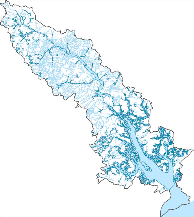
The National Hydrography Dataset (NHD) is a feature-based database that interconnects and uniquely identifies the stream segments or reaches that make up the nation's surface water drainage system. NHD data was originally developed at 1:100,000-scale and exists at that scale for the whole country. This high-resolution NHD, generally developed at 1:24,000/1:12,000 scale, adds detail to the original 1:100,000-scale NHD. (Data for Alaska, Puerto Rico and the Virgin Islands was developed at high-resolution, not 1:100,000 scale.) Local resolution NHD is being developed where partners and data exist. The NHD contains reach codes for networked features, flow direction, names, and centerline representations for areal water...
Tags: Administrative watershed units,
Administrative watershed units,
Angelina,
Area of Complex Channels,
Area to be submerged, All tags...
Basin,
Basin,
Bay/Inlet,
Boundaries,
Boundary,
Bridge,
Canal/Ditch,
Cherokee,
Coastline,
Connector,
Dam/Weir,
Downloadable Data,
Drainage areas for surface water,
Drainageway,
Esri File GeoDatabase 10,
Estuary,
FileGDB,
Flow direction network,
Flume,
ForeShore,
Gaging Station,
Gate,
HU-8,
HU-8 Subbasin,
HU10,
HU12,
HU14,
HU16,
HU2,
HU4,
HU6,
HU8,
HU8_12020002,
HUC,
Hazard Zone,
Houston,
Hydrographic,
Hydrography,
Hydrography,
Hydrography,
Hydrologic Unit Code,
Hydrologic Units,
Ice mass,
Inundation Area,
Jasper,
Levee,
Line,
Lock Chamber,
Marsh,
National Hydrography Dataset (NHD),
National Hydrography Dataset (NHD) Best Resolution,
National Hydrography Dataset (NHD) Best Resolution,
Nonearthen Shore,
Orthoimage,
Playa,
Point,
PointEvent,
Polk,
Pond,
Rapids,
Rapids,
Reach,
Reach code,
Reef,
Region,
Reservoir,
Rock,
Sea/Ocean,
Sink/Rise,
Sounding Datum Line,
Special Use Zone,
Special Use Zone Limit,
Spillway,
Stream,
Stream/River,
Sub-basin,
Sub-region,
Subbasin,
Submerged Stream,
Subregion,
Subwatershed,
Surface water systems,
Swamp,
TX,
Texas,
Topographic,
Trinity,
Tunnel,
Tyler,
US,
Underground Conduit,
United States,
WBD,
WBD,
Wall,
Wash,
Water Intake Outflow,
Waterfall,
Watershed,
Watershed Boundaries,
Watershed Boundary Dataset,
Watershed Boundary Dataset,
Well,
artificial path,
boundaries,
dams,
drainage systems and characteristics,
inlandWaters,
lakes,
ngda,
rivers, Fewer tags
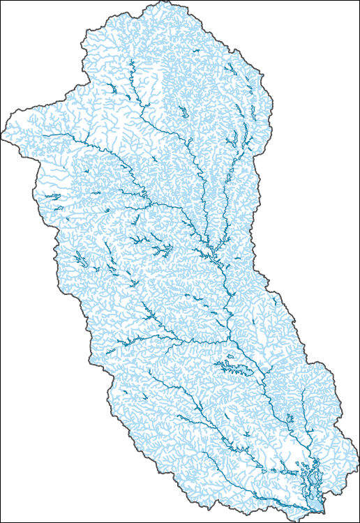
The National Hydrography Dataset (NHD) is a feature-based database that interconnects and uniquely identifies the stream segments or reaches that make up the nation's surface water drainage system. NHD data was originally developed at 1:100,000-scale and exists at that scale for the whole country. This high-resolution NHD, generally developed at 1:24,000/1:12,000 scale, adds detail to the original 1:100,000-scale NHD. (Data for Alaska, Puerto Rico and the Virgin Islands was developed at high-resolution, not 1:100,000 scale.) Local resolution NHD is being developed where partners and data exist. The NHD contains reach codes for networked features, flow direction, names, and centerline representations for areal water...
Tags: Administrative watershed units,
Administrative watershed units,
Allendale,
Area of Complex Channels,
Area to be submerged, All tags...
Basin,
Basin,
Bay/Inlet,
Beaufort,
Boundaries,
Boundary,
Bridge,
Canal/Ditch,
Coastline,
Connector,
Dam/Weir,
Downloadable Data,
Drainage areas for surface water,
Drainageway,
Estuary,
Flow direction network,
Flume,
ForeShore,
Gaging Station,
Gate,
GeoPackage,
HU-8,
HU-8 Subbasin,
HU10,
HU12,
HU14,
HU16,
HU2,
HU4,
HU6,
HU8,
HU8_03050208,
HUC,
Hampton,
Hazard Zone,
Hydrographic,
Hydrography,
Hydrography,
Hydrography,
Hydrologic Unit Code,
Hydrologic Units,
Ice mass,
Inundation Area,
Jasper,
Levee,
Line,
Lock Chamber,
Marsh,
National Hydrography Dataset (NHD),
National Hydrography Dataset (NHD) Best Resolution,
National Hydrography Dataset (NHD) Best Resolution,
Nonearthen Shore,
Open Geospatial Consortium GeoPackage 1.2,
Orthoimage,
Playa,
Point,
PointEvent,
Pond,
Rapids,
Rapids,
Reach,
Reach code,
Reef,
Region,
Reservoir,
Rock,
SC,
Sea/Ocean,
Sink/Rise,
Sounding Datum Line,
South Carolina,
Special Use Zone,
Special Use Zone Limit,
Spillway,
Stream,
Stream/River,
Sub-basin,
Sub-region,
Subbasin,
Submerged Stream,
Subregion,
Subwatershed,
Surface water systems,
Swamp,
Topographic,
Tunnel,
US,
Underground Conduit,
United States,
WBD,
WBD,
Wall,
Wash,
Water Intake Outflow,
Waterfall,
Watershed,
Watershed Boundaries,
Watershed Boundary Dataset,
Watershed Boundary Dataset,
Well,
artificial path,
boundaries,
dams,
drainage systems and characteristics,
inlandWaters,
lakes,
ngda,
rivers, Fewer tags
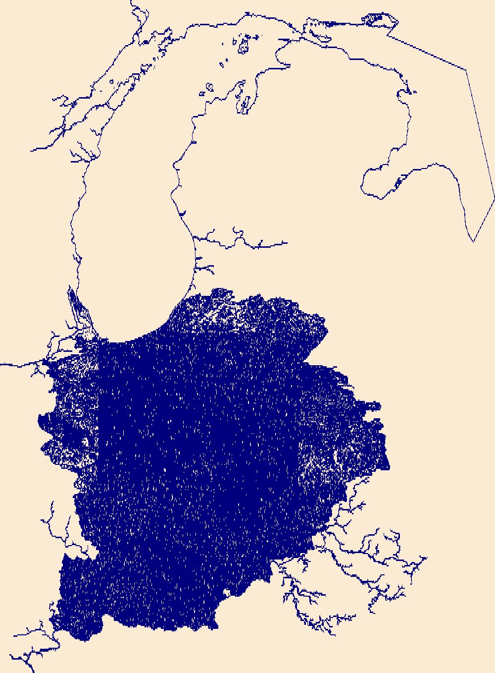
The National Hydrography Dataset (NHD) is a feature-based database that interconnects and uniquely identifies the stream segments or reaches that make up the nation's surface water drainage system. NHD data was originally developed at 1:100,000-scale and exists at that scale for the whole country. This high-resolution NHD, generally developed at 1:24,000/1:12,000 scale, adds detail to the original 1:100,000-scale NHD. (Data for Alaska, Puerto Rico and the Virgin Islands was developed at high-resolution, not 1:100,000 scale.) Local resolution NHD is being developed where partners and data exist. The NHD contains reach codes for networked features, flow direction, names, and centerline representations for areal water...
Tags: Administrative watershed units,
Administrative watershed units,
Area of Complex Channels,
Area to be submerged,
Basin, All tags...
Basin,
Bay/Inlet,
Bibb,
Boundaries,
Boundary,
Bridge,
Butts,
Canal/Ditch,
Clayton,
Coastline,
Connector,
Crawford,
Dam/Weir,
DeKalb,
Downloadable Data,
Drainage areas for surface water,
Drainageway,
Estuary,
Flow direction network,
Flume,
ForeShore,
Fulton,
GA,
Gaging Station,
Gate,
GeoPackage,
Georgia,
Gwinnett,
HU-8,
HU-8 Subbasin,
HU10,
HU12,
HU14,
HU16,
HU2,
HU4,
HU6,
HU8,
HU8_03070103,
HUC,
Hazard Zone,
Henry,
Houston,
Hydrographic,
Hydrography,
Hydrography,
Hydrography,
Hydrologic Unit Code,
Hydrologic Units,
Ice mass,
Inundation Area,
Jasper,
Jones,
Lamar,
Levee,
Line,
Lock Chamber,
Marsh,
Monroe,
National Hydrography Dataset (NHD),
National Hydrography Dataset (NHD) Best Resolution,
National Hydrography Dataset (NHD) Best Resolution,
Newton,
Nonearthen Shore,
Open Geospatial Consortium GeoPackage 1.2,
Orthoimage,
Peach,
Playa,
Point,
PointEvent,
Pond,
Rapids,
Rapids,
Reach,
Reach code,
Reef,
Region,
Reservoir,
Rock,
Rockdale,
Sea/Ocean,
Sink/Rise,
Sounding Datum Line,
Spalding,
Special Use Zone,
Special Use Zone Limit,
Spillway,
Stream,
Stream/River,
Sub-basin,
Sub-region,
Subbasin,
Submerged Stream,
Subregion,
Subwatershed,
Surface water systems,
Swamp,
Topographic,
Tunnel,
Twiggs,
US,
Underground Conduit,
United States,
Upson,
WBD,
WBD,
Wall,
Walton,
Wash,
Water Intake Outflow,
Waterfall,
Watershed,
Watershed Boundaries,
Watershed Boundary Dataset,
Watershed Boundary Dataset,
Well,
artificial path,
boundaries,
dams,
drainage systems and characteristics,
inlandWaters,
lakes,
ngda,
rivers, Fewer tags
The National Hydrography Dataset (NHD) is a feature-based database that interconnects and uniquely identifies the stream segments or reaches that make up the nation's surface water drainage system. NHD data was originally developed at 1:100,000-scale and exists at that scale for the whole country. This high-resolution NHD, generally developed at 1:24,000/1:12,000 scale, adds detail to the original 1:100,000-scale NHD. (Data for Alaska, Puerto Rico and the Virgin Islands was developed at high-resolution, not 1:100,000 scale.) Local resolution NHD is being developed where partners and data exist. The NHD contains reach codes for networked features, flow direction, names, and centerline representations for areal water...
Tags: Adams,
Administrative watershed units,
Administrative watershed units,
Allen,
Area of Complex Channels, All tags...
Area to be submerged,
Bartholomew,
Basin,
Basin,
Bay/Inlet,
Benton,
Blackford,
Boone,
Boundaries,
Boundary,
Bridge,
Brown,
Canal/Ditch,
Carroll,
Cass,
Clark,
Clay,
Clinton,
Coastline,
Connector,
Crawford,
Dam/Weir,
Daviess,
DeKalb,
Dearborn,
Decatur,
Delaware,
Downloadable Data,
Drainage areas for surface water,
Drainageway,
Dubois,
Elkhart,
Esri File GeoDatabase 10,
Estuary,
Fayette,
FileGDB,
Flow direction network,
Floyd,
Flume,
ForeShore,
Fountain,
Franklin,
Fulton,
Gaging Station,
Gate,
Gibson,
Grant,
Greene,
HU10,
HU12,
HU14,
HU16,
HU2,
HU4,
HU6,
HU8,
HUC,
Hamilton,
Hancock,
Harrison,
Hazard Zone,
Hendricks,
Henry,
Howard,
Huntington,
Hydrographic,
Hydrography,
Hydrography,
Hydrography,
Hydrologic Unit Code,
Hydrologic Units,
IN,
Ice mass,
Indiana,
Inundation Area,
Jackson,
Jasper,
Jay,
Jefferson,
Jennings,
Johnson,
Knox,
Kosciusko,
LaGrange,
LaPorte,
Lake,
Lawrence,
Levee,
Line,
Lock Chamber,
Madison,
Marion,
Marsh,
Marshall,
Martin,
Miami,
Monroe,
Montgomery,
Morgan,
National Hydrography Dataset (NHD),
National Hydrography Dataset (NHD) Best Resolution,
National Hydrography Dataset (NHD) Best Resolution,
Newton,
Noble,
Nonearthen Shore,
Ohio,
Orange,
Orthoimage,
Owen,
Parke,
Perry,
Pike,
Playa,
Point,
PointEvent,
Pond,
Porter,
Posey,
Pulaski,
Putnam,
Randolph,
Rapids,
Rapids,
Reach,
Reach code,
Reef,
Region,
Reservoir,
Ripley,
Rock,
Rush,
Scott,
Sea/Ocean,
Shelby,
Sink/Rise,
Sounding Datum Line,
Special Use Zone,
Special Use Zone Limit,
Spencer,
Spillway,
St. Joseph,
Starke,
State,
State,
State_Indiana,
Steuben,
Stream,
Stream/River,
Sub-basin,
Sub-region,
Subbasin,
Submerged Stream,
Subregion,
Subwatershed,
Sullivan,
Surface water systems,
Swamp,
Switzerland,
Tippecanoe,
Tipton,
Topographic,
Tunnel,
US,
Underground Conduit,
Union,
United States,
Vanderburgh,
Vermillion,
Vigo,
WBD,
WBD,
Wabash,
Wall,
Warren,
Warrick,
Wash,
Washington,
Water Intake Outflow,
Waterfall,
Watershed,
Watershed Boundaries,
Watershed Boundary Dataset,
Watershed Boundary Dataset,
Wayne,
Well,
Wells,
White,
Whitley,
artificial path,
boundaries,
dams,
drainage systems and characteristics,
inlandWaters,
lakes,
ngda,
rivers, Fewer tags
The National Hydrography Dataset (NHD) is a feature-based database that interconnects and uniquely identifies the stream segments or reaches that make up the nation's surface water drainage system. NHD data was originally developed at 1:100,000-scale and exists at that scale for the whole country. This high-resolution NHD, generally developed at 1:24,000/1:12,000 scale, adds detail to the original 1:100,000-scale NHD. (Data for Alaska, Puerto Rico and the Virgin Islands was developed at high-resolution, not 1:100,000 scale.) Local resolution NHD is being developed where partners and data exist. The NHD contains reach codes for networked features, flow direction, names, and centerline representations for areal water...
Tags: AR,
Administrative watershed units,
Administrative watershed units,
Allen,
Anderson, All tags...
Area of Complex Channels,
Area to be submerged,
Arkansas,
Barry,
Barton,
Basin,
Basin,
Bay/Inlet,
Benton,
Boundaries,
Boundary,
Bourbon,
Bridge,
Butler,
Canal/Ditch,
Chase,
Chautauqua,
Cherokee,
Christian,
Coastline,
Coffey,
Connector,
Cowley,
Craig,
Crawford,
Dade,
Dam/Weir,
Delaware,
Downloadable Data,
Drainage areas for surface water,
Drainageway,
Elk,
Estuary,
Flow direction network,
Flume,
ForeShore,
Gaging Station,
Gate,
GeoPackage,
Greenwood,
HU-4,
HU-4 Subregion,
HU10,
HU12,
HU14,
HU16,
HU2,
HU4,
HU4_1107,
HU6,
HU8,
HUC,
Harvey,
Hazard Zone,
Hydrographic,
Hydrography,
Hydrography,
Hydrography,
Hydrologic Unit Code,
Hydrologic Units,
Ice mass,
Inundation Area,
Jasper,
KS,
Kansas,
Labette,
Lawrence,
Levee,
Line,
Lock Chamber,
Lyon,
MO,
Marion,
Marsh,
Mayes,
McDonald,
McPherson,
Missouri,
Montgomery,
Morris,
Muskogee,
National Hydrography Dataset (NHD),
National Hydrography Dataset (NHD) Best Resolution,
National Hydrography Dataset (NHD) Best Resolution,
Neosho,
Newton,
Nonearthen Shore,
Nowata,
OK,
Oklahoma,
Open Geospatial Consortium GeoPackage 1.2,
Orthoimage,
Osage,
Ottawa,
Playa,
Point,
PointEvent,
Pond,
Rapids,
Rapids,
Reach,
Reach code,
Reef,
Region,
Reservoir,
Rock,
Rogers,
Sea/Ocean,
Sink/Rise,
Sounding Datum Line,
Special Use Zone,
Special Use Zone Limit,
Spillway,
Stone,
Stream,
Stream/River,
Sub-basin,
Sub-region,
Subbasin,
Submerged Stream,
Subregion,
Subwatershed,
Surface water systems,
Swamp,
Topographic,
Tulsa,
Tunnel,
US,
Underground Conduit,
United States,
WBD,
WBD,
Wabaunsee,
Wagoner,
Wall,
Wash,
Washington,
Water Intake Outflow,
Waterfall,
Watershed,
Watershed Boundaries,
Watershed Boundary Dataset,
Watershed Boundary Dataset,
Well,
Wilson,
Woodson,
artificial path,
boundaries,
dams,
drainage systems and characteristics,
inlandWaters,
lakes,
ngda,
rivers, Fewer tags
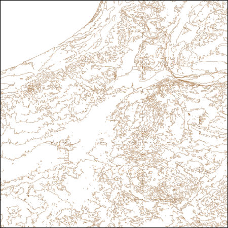
These vector contour lines are derived from the 3D Elevation Program using automated and semi-automated processes. They were created to support 1:24,000-scale CONUS and Hawaii, 1:25,000-scale Alaska, and 1:20,000-scale Puerto Rico / US Virgin Island topographic map products, but are also published in this GIS vector format. Contour intervals are assigned by 7.5-minute quadrangle, so this vector dataset is not visually seamless across quadrangle boundaries. The vector lines have elevation attributes (in feet above mean sea level on NAVD88), but this dataset does not carry line symbols or annotation.
Tags: 1 x 1 degree,
1X1,
Berrien,
Cass,
Downloadable Data, All tags...
Elevation,
Elevation Terrestrial,
Elkhart,
Esri File GeoDatabase 10,
FileGDB,
Fulton,
IN,
Indiana,
Jasper,
Kosciusko,
LaPorte,
MI,
Marshall,
Michigan,
National Elevation Dataset (NED),
National Elevation Dataset (NED) 1/3 arc-second - Contours,
National Elevation Dataset (NED) 1/3 arc-second - Contours,
Porter,
Pulaski,
St. Joseph,
Starke,
US,
United States,
elevation,
ngda, Fewer tags
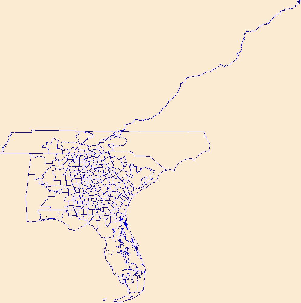
Geospatial data is comprised of government boundaries.
Tags: Appling,
Atkinson,
Bacon,
Baker,
Baldwin, All tags...
Banks,
Barrow,
Bartow,
Ben Hill,
Berrien,
Bibb,
Bleckley,
Boundaries,
Brantley,
Brooks,
Bryan,
Bulloch,
Burke,
Butts,
Calhoun,
Camden,
Candler,
Carroll,
Catoosa,
Charlton,
Chatham,
Chattahoochee,
Chattooga,
Cherokee,
Clarke,
Clay,
Clayton,
Clinch,
Cobb,
Coffee,
Colquitt,
Columbia,
Cook,
County or Equivalent,
Coweta,
Crawford,
Crisp,
Dade,
Dawson,
DeKalb,
Decatur,
Dodge,
Dooly,
Dougherty,
Douglas,
Downloadable Data,
Early,
Echols,
Effingham,
Elbert,
Emanuel,
Esri Shapefile nan,
Evans,
Fannin,
Fayette,
Floyd,
Forsyth,
Franklin,
Fulton,
GA,
Georgia,
Gilmer,
Glascock,
Glynn,
Gordon,
Grady,
Greene,
Gwinnett,
Habersham,
Hall,
Hancock,
Haralson,
Harris,
Hart,
Heard,
Henry,
Houston,
Incorporated Place,
Irwin,
Jackson,
Jasper,
Jeff Davis,
Jefferson,
Jenkins,
Johnson,
Jones,
Jurisdictional,
Lamar,
Lanier,
Laurens,
Lee,
Liberty,
Lincoln,
Long,
Lowndes,
Lumpkin,
Macon,
Madison,
Marion,
McDuffie,
McIntosh,
Meriwether,
Miller,
Minor Civil Division,
Mitchell,
Monroe,
Montgomery,
Morgan,
Murray,
Muscogee,
National Boundary Dataset (NBD),
National Boundary Dataset (NBD),
Native American Area,
Newton,
Oconee,
Oglethorpe,
PLSS First Division,
PLSS Special Survey,
PLSS Township,
Paulding,
Peach,
Pickens,
Pierce,
Pike,
Polk,
Public Land Survey System,
Pulaski,
Putnam,
Quitman,
Rabun,
Randolph,
Reserve,
Richmond,
Rockdale,
Schley,
Screven,
Seminole,
Shapefile,
Spalding,
State,
State,
State or Territory,
Stephens,
Stewart,
Sumter,
Talbot,
Taliaferro,
Tattnall,
Taylor,
Telfair,
Terrell,
Thomas,
Tift,
Toombs,
Towns,
Treutlen,
Troup,
Turner,
Twiggs,
U.S. National Grid,
US,
Unincorporated Place,
Union,
United States,
Upson,
Walker,
Walton,
Ware,
Warren,
Washington,
Wayne,
Webster,
Wheeler,
White,
Whitfield,
Wilcox,
Wilkes,
Wilkinson,
Worth,
boundaries,
boundary,
cadastral surveys,
geographic names,
land ownership,
land use maps,
legal land descriptions,
political and administrative boundaries,
zoning maps, Fewer tags
|
|

