Filters
Date Range
Types
Contacts
Categories
Tag Types
Tag Schemes
|

Geospatial data is comprised of government boundaries.
Types: Citation;
Tags: Adams,
Allen,
Bartholomew,
Benton,
Blackford, All tags...
Boone,
Boundaries,
Brown,
Carroll,
Cass,
Clark,
Clay,
Clinton,
County or Equivalent,
Crawford,
Daviess,
DeKalb,
Dearborn,
Decatur,
Delaware,
Downloadable Data,
Dubois,
Elkhart,
Esri File GeoDatabase 10,
Fayette,
FileGDB,
Floyd,
Fountain,
Franklin,
Fulton,
Gibson,
Grant,
Greene,
Hamilton,
Hancock,
Harrison,
Hendricks,
Henry,
Howard,
Huntington,
IN,
Incorporated Place,
Indiana,
Jackson,
Jasper,
Jay,
Jefferson,
Jennings,
Johnson,
Jurisdictional,
Knox,
Kosciusko,
LaGrange,
LaPorte,
Lake,
Lawrence,
Madison,
Marion,
Marshall,
Martin,
Miami,
Minor Civil Division,
Monroe,
Montgomery,
Morgan,
National Boundary Dataset (NBD),
National Boundary Dataset (NBD),
Native American Area,
Newton,
Noble,
Ohio,
Orange,
Owen,
PLSS First Division,
PLSS Special Survey,
PLSS Township,
Parke,
Perry,
Pike,
Porter,
Posey,
Public Land Survey System,
Pulaski,
Putnam,
Randolph,
Reserve,
Ripley,
Rush,
Scott,
Shelby,
Spencer,
St. Joseph,
Starke,
State,
State,
State or Territory,
Steuben,
Sullivan,
Switzerland,
Tippecanoe,
Tipton,
U.S. National Grid,
US,
Unincorporated Place,
Union,
United States,
Vanderburgh,
Vermillion,
Vigo,
Wabash,
Warren,
Warrick,
Washington,
Wayne,
Wells,
White,
Whitley,
boundaries,
boundary,
cadastral surveys,
geographic names,
land ownership,
land use maps,
legal land descriptions,
political and administrative boundaries,
zoning maps, Fewer tags

Layers of geospatial data include contours, boundaries, land cover, hydrography, roads, transportation, geographic names, structures, and other selected map features.
Tags: 7.5 x 7.5 minute,
7_5_Min,
Combined Vector,
Combined Vector,
Combined Vector, All tags...
Downloadable Data,
Elkhart,
GeoPackage,
IN,
Indiana,
LaGrange,
MI,
Michigan,
Open Geospatial Consortium GeoPackage 1.2,
Public Land Survey System,
St. Joseph,
Topo Map Vector Data,
US,
United States,
boundary,
contours,
geographic names,
hydrography,
structures,
transportation,
woodland, Fewer tags
Layers of geospatial data include contours, boundaries, land cover, hydrography, roads, transportation, geographic names, structures, and other selected map features.
Types: Citation;
Tags: 7.5 x 7.5 minute,
7_5_Min,
Branch,
Combined Vector,
Combined Vector, All tags...
Combined Vector,
Downloadable Data,
Esri File GeoDatabase 10,
FileGDB,
IN,
Indiana,
LaGrange,
MI,
Michigan,
Public Land Survey System,
St. Joseph,
Topo Map Vector Data,
US,
United States,
boundary,
contours,
geographic names,
hydrography,
structures,
transportation,
woodland, Fewer tags
The National Hydrography Dataset (NHD) is a feature-based database that interconnects and uniquely identifies the stream segments or reaches that make up the nation's surface water drainage system. NHD data was originally developed at 1:100,000-scale and exists at that scale for the whole country. This high-resolution NHD, generally developed at 1:24,000/1:12,000 scale, adds detail to the original 1:100,000-scale NHD. (Data for Alaska, Puerto Rico and the Virgin Islands was developed at high-resolution, not 1:100,000 scale.) Local resolution NHD is being developed where partners and data exist. The NHD contains reach codes for networked features, flow direction, names, and centerline representations for areal water...
Tags: Adams,
Administrative watershed units,
Administrative watershed units,
Allen,
Area of Complex Channels, All tags...
Area to be submerged,
Bartholomew,
Basin,
Basin,
Bay/Inlet,
Benton,
Blackford,
Boone,
Boundaries,
Boundary,
Bridge,
Brown,
Canal/Ditch,
Carroll,
Cass,
Clark,
Clay,
Clinton,
Coastline,
Connector,
Crawford,
Dam/Weir,
Daviess,
DeKalb,
Dearborn,
Decatur,
Delaware,
Downloadable Data,
Drainage areas for surface water,
Drainageway,
Dubois,
Elkhart,
Estuary,
Fayette,
Flow direction network,
Floyd,
Flume,
ForeShore,
Fountain,
Franklin,
Fulton,
Gaging Station,
Gate,
GeoPackage,
Gibson,
Grant,
Greene,
HU10,
HU12,
HU14,
HU16,
HU2,
HU4,
HU6,
HU8,
HUC,
Hamilton,
Hancock,
Harrison,
Hazard Zone,
Hendricks,
Henry,
Howard,
Huntington,
Hydrographic,
Hydrography,
Hydrography,
Hydrography,
Hydrologic Unit Code,
Hydrologic Units,
IN,
Ice mass,
Indiana,
Inundation Area,
Jackson,
Jasper,
Jay,
Jefferson,
Jennings,
Johnson,
Knox,
Kosciusko,
LaGrange,
LaPorte,
Lake,
Lawrence,
Levee,
Line,
Lock Chamber,
Madison,
Marion,
Marsh,
Marshall,
Martin,
Miami,
Monroe,
Montgomery,
Morgan,
National Hydrography Dataset (NHD),
National Hydrography Dataset (NHD) Best Resolution,
National Hydrography Dataset (NHD) Best Resolution,
Newton,
Noble,
Nonearthen Shore,
Ohio,
Open Geospatial Consortium GeoPackage 1.2,
Orange,
Orthoimage,
Owen,
Parke,
Perry,
Pike,
Playa,
Point,
PointEvent,
Pond,
Porter,
Posey,
Pulaski,
Putnam,
Randolph,
Rapids,
Rapids,
Reach,
Reach code,
Reef,
Region,
Reservoir,
Ripley,
Rock,
Rush,
Scott,
Sea/Ocean,
Shelby,
Sink/Rise,
Sounding Datum Line,
Special Use Zone,
Special Use Zone Limit,
Spencer,
Spillway,
St. Joseph,
Starke,
State,
State,
State_Indiana,
Steuben,
Stream,
Stream/River,
Sub-basin,
Sub-region,
Subbasin,
Submerged Stream,
Subregion,
Subwatershed,
Sullivan,
Surface water systems,
Swamp,
Switzerland,
Tippecanoe,
Tipton,
Topographic,
Tunnel,
US,
Underground Conduit,
Union,
United States,
Vanderburgh,
Vermillion,
Vigo,
WBD,
WBD,
Wabash,
Wall,
Warren,
Warrick,
Wash,
Washington,
Water Intake Outflow,
Waterfall,
Watershed,
Watershed Boundaries,
Watershed Boundary Dataset,
Watershed Boundary Dataset,
Wayne,
Well,
Wells,
White,
Whitley,
artificial path,
boundaries,
dams,
drainage systems and characteristics,
inlandWaters,
lakes,
ngda,
rivers, Fewer tags
The National Hydrography Dataset (NHD) is a feature-based database that interconnects and uniquely identifies the stream segments or reaches that make up the nation's surface water drainage system. NHD data was originally developed at 1:100,000-scale and exists at that scale for the whole country. This high-resolution NHD, generally developed at 1:24,000/1:12,000 scale, adds detail to the original 1:100,000-scale NHD. (Data for Alaska, Puerto Rico and the Virgin Islands was developed at high-resolution, not 1:100,000 scale.) Local resolution NHD is being developed where partners and data exist. The NHD contains reach codes for networked features, flow direction, names, and centerline representations for areal water...
Tags: Administrative watershed units,
Administrative watershed units,
Allegan,
Area of Complex Channels,
Area to be submerged, All tags...
Barry,
Basin,
Basin,
Bay/Inlet,
Berrien,
Boundaries,
Boundary,
Branch,
Bridge,
Calhoun,
Canal/Ditch,
Cass,
Clinton,
Coastline,
Connector,
Dam/Weir,
DeKalb,
Downloadable Data,
Drainage areas for surface water,
Drainageway,
Eaton,
Elkhart,
Esri File GeoDatabase 10,
Estuary,
FileGDB,
Flow direction network,
Flume,
ForeShore,
Gaging Station,
Gate,
Gratiot,
HU-4,
HU-4 Subregion,
HU10,
HU12,
HU14,
HU16,
HU2,
HU4,
HU4_0405,
HU6,
HU8,
HUC,
Hazard Zone,
Hillsdale,
Hydrographic,
Hydrography,
Hydrography,
Hydrography,
Hydrologic Unit Code,
Hydrologic Units,
IN,
Ice mass,
Indiana,
Ingham,
Inundation Area,
Ionia,
Isabella,
Jackson,
Kalamazoo,
Kent,
Kosciusko,
LaGrange,
Levee,
Line,
Livingston,
Lock Chamber,
MI,
Marsh,
Mecosta,
Michigan,
Montcalm,
Muskegon,
National Hydrography Dataset (NHD),
National Hydrography Dataset (NHD) Best Resolution,
National Hydrography Dataset (NHD) Best Resolution,
Newaygo,
Noble,
Nonearthen Shore,
Orthoimage,
Ottawa,
Playa,
Point,
PointEvent,
Pond,
Rapids,
Rapids,
Reach,
Reach code,
Reef,
Region,
Reservoir,
Rock,
Sea/Ocean,
Shiawassee,
Sink/Rise,
Sounding Datum Line,
Special Use Zone,
Special Use Zone Limit,
Spillway,
St. Joseph,
Steuben,
Stream,
Stream/River,
Sub-basin,
Sub-region,
Subbasin,
Submerged Stream,
Subregion,
Subwatershed,
Surface water systems,
Swamp,
Topographic,
Tunnel,
US,
Underground Conduit,
United States,
Van Buren,
WBD,
WBD,
Wall,
Wash,
Washtenaw,
Water Intake Outflow,
Waterfall,
Watershed,
Watershed Boundaries,
Watershed Boundary Dataset,
Watershed Boundary Dataset,
Well,
Whitley,
artificial path,
boundaries,
dams,
drainage systems and characteristics,
inlandWaters,
lakes,
ngda,
rivers, Fewer tags
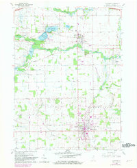
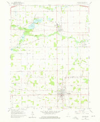
USGS Historical Quadrangle in GeoPDF.
Tags: 7.5 x 7.5 minute,
Downloadable Data,
GeoPDF,
GeoTIFF,
Historical Topographic Maps, All tags...
Historical Topographic Maps 7.5 x 7.5 Minute Map Series,
IN,
Lagrange,
Map,
imageryBaseMapsEarthCover, Fewer tags
USGS Historical Quadrangle in GeoPDF.
Tags: 7.5 x 7.5 minute,
Downloadable Data,
GeoPDF,
GeoTIFF,
Historical Topographic Maps, All tags...
Historical Topographic Maps 7.5 x 7.5 Minute Map Series,
IN,
Lagrange,
Map,
imageryBaseMapsEarthCover, Fewer tags
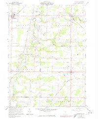
USGS Historical Quadrangle in GeoPDF.
Tags: 7.5 x 7.5 minute,
Downloadable Data,
GeoPDF,
GeoTIFF,
Historical Topographic Maps, All tags...
Historical Topographic Maps 7.5 x 7.5 Minute Map Series,
Lagrange,
Map,
OH,
imageryBaseMapsEarthCover, Fewer tags

The Fluvial Egg Drift Simulator (FluEgg) estimates bighead, silver, and grass carp egg and larval drift in rivers using species-specific egg developmental data combined with user-supplied hydraulic inputs (Garcia and others, 2013; Domanski, 2020). This data release contains results from 240 FluEgg 4.1.0 simulations of bighead carp eggs in the Illinois River under steady flow conditions. The data release also contains the hydraulic inputs used in the FluEgg simulations and a KML file of the centerline that represents the model domain. FluEgg simulations were run for all combinations of four spawning locations, six water temperatures, and ten steady flow conditions. Each simulation included 5,000 bighead carp eggs,...
Tags: Aquatic Biology,
Environmental Health,
Hydrology,
Illinois,
LaGrange, All tags...
Marseilles,
Peoria,
Starved Rock,
USGS Science Data Catalog (SDC),
USGS-CC Asian Carp,
invasive species,
mathematical modeling,
streamflow,
surface water (non-marine), Fewer tags
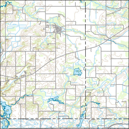
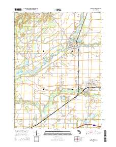
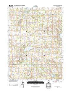
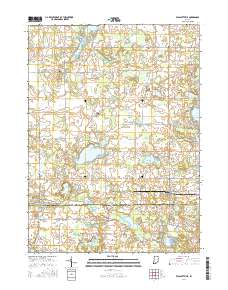
Layered GeoPDF 7.5 Minute Quadrangle Map. Layers of geospatial data include orthoimagery, roads, grids, geographic names, elevation contours, hydrography, and other selected map features.
Tags: 7.5 x 7.5 minute,
Branch,
Burr Oak, MI-IN,
Downloadable Data,
EarthCover, All tags...
GeoPDF,
Imagery and Base Maps,
Indiana,
LaGrange,
Map,
Michigan,
St. Joseph,
U.S. National Grid,
US,
US Topo,
US Topo Historical,
United States,
contour,
geographic names,
hydrography,
imageryBaseMapsEarthCover,
orthoimage,
structures,
topographic,
transportation, Fewer tags
Layered GeoPDF 7.5 Minute Quadrangle Map. Layers of geospatial data include orthoimagery, roads, grids, geographic names, elevation contours, hydrography, and other selected map features.
Tags: 7.5 x 7.5 minute,
Constantine, MI-IN,
Downloadable Data,
EarthCover,
Elkhart, All tags...
GeoPDF,
Imagery and Base Maps,
Indiana,
LaGrange,
Map,
Michigan,
St. Joseph,
U.S. National Grid,
US,
US Topo,
US Topo Historical,
United States,
contour,
geographic names,
hydrography,
imageryBaseMapsEarthCover,
orthoimage,
structures,
topographic,
transportation, Fewer tags
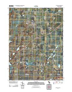
Layered GeoPDF 7.5 Minute Quadrangle Map. Layers of geospatial data include orthoimagery, roads, grids, geographic names, elevation contours, hydrography, and other selected map features.
Tags: 7.5 x 7.5 minute,
Constantine, MI-IN,
Downloadable Data,
EarthCover,
Elkhart, All tags...
GeoPDF,
Imagery and Base Maps,
Indiana,
LaGrange,
Map,
Michigan,
Public Land Survey System,
St. Joseph,
U.S. National Grid,
US,
US Topo,
US Topo Historical,
United States,
boundary,
contour,
geographic names,
hydrography,
imageryBaseMapsEarthCover,
orthoimage,
structures,
topographic,
transportation,
woodland, Fewer tags
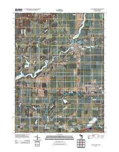
Layered GeoPDF 7.5 Minute Quadrangle Map. Layers of geospatial data include orthoimagery, roads, grids, geographic names, elevation contours, hydrography, and other selected map features.
Tags: 7.5 x 7.5 minute,
Downloadable Data,
EarthCover,
GeoPDF,
Imagery and Base Maps, All tags...
Indiana,
LaGrange,
Map,
Noble,
Public Land Survey System,
U.S. National Grid,
US,
US Topo,
US Topo Historical,
United States,
Wolcottville, IN,
boundary,
contour,
geographic names,
hydrography,
imageryBaseMapsEarthCover,
orthoimage,
structures,
topographic,
transportation,
woodland, Fewer tags
Layered geospatial PDF Map. Layers of geospatial data include orthoimagery, roads, grids, geographic names, elevation contours, hydrography, and other selected map features.
Tags: 7.5 x 7.5 minute,
Downloadable Data,
EarthCover,
GeoPDF,
Imagery and Base Maps, All tags...
Indiana,
LaGrange,
Map,
Noble,
Public Land Survey System,
U.S. National Grid,
US,
US Topo,
US Topo Historical,
United States,
Wolcottville, IN,
boundary,
contour,
geographic names,
hydrography,
imageryBaseMapsEarthCover,
orthoimage,
structures,
topographic,
transportation,
woodland, Fewer tags
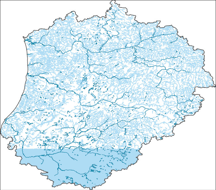
The Watershed Boundary Dataset (WBD) is a comprehensive aggregated collection of hydrologic unit data consistent with the national criteria for delineation and resolution. It defines the areal extent of surface water drainage to a point except in coastal or lake front areas where there could be multiple outlets as stated by the "Federal Standards and Procedures for the National Watershed Boundary Dataset (WBD)" "Standard" (https://pubs.usgs.gov/tm/11/a3/). Watershed boundaries are determined solely upon science-based hydrologic principles, not favoring any administrative boundaries or special projects, nor particular program or agency. This dataset represents the hydrologic unit boundaries to the 12-digit (6th level)...
Tags: 10-digit,
12-digit,
14-digit,
16-digit,
2-digit, All tags...
4-digit,
6-digit,
8-digit,
Adams,
Addison,
Aitkin,
Alcona,
Alger,
Allegan,
Allegany,
Allen,
Alpena,
Antrim,
Arenac,
Ashland,
Ashtabula,
Auglaize,
Baraga,
Barry,
Basin,
Bay,
Bayfield,
Bennington,
Benzie,
Berrien,
Branch,
Brown,
Caledonia,
Calhoun,
Calumet,
Carlton,
Cass,
Cattaraugus,
Cayuga,
Charlevoix,
Chautauqua,
Cheboygan,
Chemung,
Chippewa,
Chittenden,
Clare,
Clinton,
Columbia,
Cook,
Coos,
Cortland,
Crawford,
Cuyahoga,
DeKalb,
Defiance,
Delta,
Dickinson,
Dodge,
Door,
Douglas,
Downloadable Data,
Eaton,
Elkhart,
Emmet,
Erie,
Essex,
Florence,
Fond du Lac,
Forest,
Franklin,
Fulton,
Geauga,
Genesee,
GeoPackage,
Gladwin,
Gogebic,
Grand Isle,
Grand Traverse,
Gratiot,
Green Lake,
HU-2,
HU-2 Region,
HU2_04,
HUC,
Hamilton,
Hancock,
Hardin,
Henry,
Herkimer,
Hillsdale,
Houghton,
Huron,
Hydrography,
Hydrologic Unit Code,
Hydrologic Units,
IL,
IN,
Illinois,
Indiana,
Ingham,
Ionia,
Iosco,
Iron,
Isabella,
Itasca,
Jackson,
Jefferson,
Kalamazoo,
Kalkaska,
Kenosha,
Kent,
Kewaunee,
Keweenaw,
Kosciusko,
LaGrange,
LaPorte,
Lake,
Lamoille,
Langlade,
Lapeer,
Leelanau,
Lenawee,
Lewis,
Livingston,
Lorain,
Lucas,
Luce,
ME,
MI,
MN,
Mackinac,
Macomb,
Madison,
Maine,
Manistee,
Manitowoc,
Marathon,
Marinette,
Marion,
Marquette,
Mason,
Mecosta,
Medina,
Menominee,
Mercer,
Michigan,
Midland,
Milwaukee,
Minnesota,
Missaukee,
Monroe,
Montcalm,
Montmorency,
Muskegon,
NH,
NY,
National Watershed Boundary Dataset (WBD),
National Watershed Boundary Dataset (WBD),
New Hampshire,
New York,
Newaygo,
Niagara,
Noble,
OH,
Oakland,
Oceana,
Oconto,
Ogemaw,
Ohio,
Oneida,
Onondaga,
Ontario,
Ontonagon,
Open Geospatial Consortium GeoPackage 1.2,
Orange,
Orleans,
Osceola,
Oscoda,
Oswego,
Otsego,
Ottawa,
Outagamie,
Oxford,
Ozaukee,
PA,
Paulding,
Pennsylvania,
Pine,
Portage,
Porter,
Potter,
Presque Isle,
Putnam,
Racine,
Region,
Richland,
Roscommon,
Rutland,
Saginaw,
Sandusky,
Sanilac,
Schoolcraft,
Schuyler,
Seneca,
Shawano,
Sheboygan,
Shelby,
Shiawassee,
Somerset,
St. Clair,
St. Joseph,
St. Lawrence,
St. Louis,
Stark,
Steuben,
Sub-basin,
Sub-region,
Subwatershed,
Summit,
Tioga,
Tompkins,
Trumbull,
Tuscola,
US,
United States,
VT,
Van Buren,
Van Wert,
Vermont,
Vilas,
WBD,
WI,
Warren,
Washington,
Washtenaw,
Watershed,
Watershed Boundary Dataset,
Waukesha,
Waupaca,
Waushara,
Wayne,
Wells,
Wexford,
Whitley,
Williams,
Windsor,
Winnebago,
Wisconsin,
Wood,
Wyandot,
Wyoming,
Yates,
inlandWaters, Fewer tags

The Watershed Boundary Dataset (WBD) is a comprehensive aggregated collection of hydrologic unit data consistent with the national criteria for delineation and resolution. It defines the areal extent of surface water drainage to a point except in coastal or lake front areas where there could be multiple outlets as stated by the "Federal Standards and Procedures for the National Watershed Boundary Dataset (WBD)" "Standard" (https://pubs.usgs.gov/tm/11/a3/). Watershed boundaries are determined solely upon science-based hydrologic principles, not favoring any administrative boundaries or special projects, nor particular program or agency. This dataset represents the hydrologic unit boundaries to the 12-digit (6th level)...
Tags: 10-digit,
12-digit,
14-digit,
16-digit,
2-digit, All tags...
4-digit,
6-digit,
8-digit,
Adams,
Addison,
Aitkin,
Alcona,
Alger,
Allegan,
Allegany,
Allen,
Alpena,
Antrim,
Arenac,
Ashland,
Ashtabula,
Auglaize,
Baraga,
Barry,
Basin,
Bay,
Bayfield,
Bennington,
Benzie,
Berrien,
Branch,
Brown,
Caledonia,
Calhoun,
Calumet,
Carlton,
Cass,
Cattaraugus,
Cayuga,
Charlevoix,
Chautauqua,
Cheboygan,
Chemung,
Chippewa,
Chittenden,
Clare,
Clinton,
Columbia,
Cook,
Coos,
Cortland,
Crawford,
Cuyahoga,
DeKalb,
Defiance,
Delta,
Dickinson,
Dodge,
Door,
Douglas,
Downloadable Data,
Eaton,
Elkhart,
Emmet,
Erie,
Esri Shapefile nan,
Essex,
Florence,
Fond du Lac,
Forest,
Franklin,
Fulton,
Geauga,
Genesee,
Gladwin,
Gogebic,
Grand Isle,
Grand Traverse,
Gratiot,
Green Lake,
HU-2,
HU-2 Region,
HU2_04,
HUC,
Hamilton,
Hancock,
Hardin,
Henry,
Herkimer,
Hillsdale,
Houghton,
Huron,
Hydrography,
Hydrologic Unit Code,
Hydrologic Units,
IL,
IN,
Illinois,
Indiana,
Ingham,
Ionia,
Iosco,
Iron,
Isabella,
Itasca,
Jackson,
Jefferson,
Kalamazoo,
Kalkaska,
Kenosha,
Kent,
Kewaunee,
Keweenaw,
Kosciusko,
LaGrange,
LaPorte,
Lake,
Lamoille,
Langlade,
Lapeer,
Leelanau,
Lenawee,
Lewis,
Livingston,
Lorain,
Lucas,
Luce,
ME,
MI,
MN,
Mackinac,
Macomb,
Madison,
Maine,
Manistee,
Manitowoc,
Marathon,
Marinette,
Marion,
Marquette,
Mason,
Mecosta,
Medina,
Menominee,
Mercer,
Michigan,
Midland,
Milwaukee,
Minnesota,
Missaukee,
Monroe,
Montcalm,
Montmorency,
Muskegon,
NH,
NY,
National Watershed Boundary Dataset (WBD),
National Watershed Boundary Dataset (WBD),
New Hampshire,
New York,
Newaygo,
Niagara,
Noble,
OH,
Oakland,
Oceana,
Oconto,
Ogemaw,
Ohio,
Oneida,
Onondaga,
Ontario,
Ontonagon,
Orange,
Orleans,
Osceola,
Oscoda,
Oswego,
Otsego,
Ottawa,
Outagamie,
Oxford,
Ozaukee,
PA,
Paulding,
Pennsylvania,
Pine,
Portage,
Porter,
Potter,
Presque Isle,
Putnam,
Racine,
Region,
Richland,
Roscommon,
Rutland,
Saginaw,
Sandusky,
Sanilac,
Schoolcraft,
Schuyler,
Seneca,
Shapefile,
Shawano,
Sheboygan,
Shelby,
Shiawassee,
Somerset,
St. Clair,
St. Joseph,
St. Lawrence,
St. Louis,
Stark,
Steuben,
Sub-basin,
Sub-region,
Subwatershed,
Summit,
Tioga,
Tompkins,
Trumbull,
Tuscola,
US,
United States,
VT,
Van Buren,
Van Wert,
Vermont,
Vilas,
WBD,
WI,
Warren,
Washington,
Washtenaw,
Watershed,
Watershed Boundary Dataset,
Waukesha,
Waupaca,
Waushara,
Wayne,
Wells,
Wexford,
Whitley,
Williams,
Windsor,
Winnebago,
Wisconsin,
Wood,
Wyandot,
Wyoming,
Yates,
inlandWaters, Fewer tags
The National Hydrography Dataset (NHD) is a feature-based database that interconnects and uniquely identifies the stream segments or reaches that make up the nation's surface water drainage system. NHD data was originally developed at 1:100,000-scale and exists at that scale for the whole country. This high-resolution NHD, generally developed at 1:24,000/1:12,000 scale, adds detail to the original 1:100,000-scale NHD. (Data for Alaska, Puerto Rico and the Virgin Islands was developed at high-resolution, not 1:100,000 scale.) Local resolution NHD is being developed where partners and data exist. The NHD contains reach codes for networked features, flow direction, names, and centerline representations for areal water...
Tags: Administrative watershed units,
Administrative watershed units,
Area of Complex Channels,
Area to be submerged,
Basin, All tags...
Basin,
Bay/Inlet,
Berrien,
Boundaries,
Boundary,
Branch,
Bridge,
Calhoun,
Canal/Ditch,
Cass,
Coastline,
Connector,
Dam/Weir,
DeKalb,
Downloadable Data,
Drainage areas for surface water,
Drainageway,
Elkhart,
Esri File GeoDatabase 10,
Estuary,
FileGDB,
Flow direction network,
Flume,
ForeShore,
Gaging Station,
Gate,
HU-8,
HU-8 Subbasin,
HU10,
HU12,
HU14,
HU16,
HU2,
HU4,
HU6,
HU8,
HU8_04050001,
HUC,
Hazard Zone,
Hillsdale,
Hydrographic,
Hydrography,
Hydrography,
Hydrography,
Hydrologic Unit Code,
Hydrologic Units,
IN,
Ice mass,
Indiana,
Inundation Area,
Kalamazoo,
Kosciusko,
LaGrange,
Levee,
Line,
Lock Chamber,
MI,
Marsh,
Michigan,
National Hydrography Dataset (NHD),
National Hydrography Dataset (NHD) Best Resolution,
National Hydrography Dataset (NHD) Best Resolution,
Noble,
Nonearthen Shore,
Orthoimage,
Playa,
Point,
PointEvent,
Pond,
Rapids,
Rapids,
Reach,
Reach code,
Reef,
Region,
Reservoir,
Rock,
Sea/Ocean,
Sink/Rise,
Sounding Datum Line,
Special Use Zone,
Special Use Zone Limit,
Spillway,
St. Joseph,
Steuben,
Stream,
Stream/River,
Sub-basin,
Sub-region,
Subbasin,
Submerged Stream,
Subregion,
Subwatershed,
Surface water systems,
Swamp,
Topographic,
Tunnel,
US,
Underground Conduit,
United States,
Van Buren,
WBD,
WBD,
Wall,
Wash,
Water Intake Outflow,
Waterfall,
Watershed,
Watershed Boundaries,
Watershed Boundary Dataset,
Watershed Boundary Dataset,
Well,
Whitley,
artificial path,
boundaries,
dams,
drainage systems and characteristics,
inlandWaters,
lakes,
ngda,
rivers, Fewer tags

The National Hydrography Dataset (NHD) is a feature-based database that interconnects and uniquely identifies the stream segments or reaches that make up the nation's surface water drainage system. NHD data was originally developed at 1:100,000-scale and exists at that scale for the whole country. This high-resolution NHD, generally developed at 1:24,000/1:12,000 scale, adds detail to the original 1:100,000-scale NHD. (Data for Alaska, Puerto Rico and the Virgin Islands was developed at high-resolution, not 1:100,000 scale.) Local resolution NHD is being developed where partners and data exist. The NHD contains reach codes for networked features, flow direction, names, and centerline representations for areal water...
Tags: Adams,
Administrative watershed units,
Administrative watershed units,
Allen,
Area of Complex Channels, All tags...
Area to be submerged,
Bartholomew,
Basin,
Basin,
Bay/Inlet,
Benton,
Blackford,
Boone,
Boundaries,
Boundary,
Bridge,
Brown,
Canal/Ditch,
Carroll,
Cass,
Clark,
Clay,
Clinton,
Coastline,
Connector,
Crawford,
Dam/Weir,
Daviess,
DeKalb,
Dearborn,
Decatur,
Delaware,
Downloadable Data,
Drainage areas for surface water,
Drainageway,
Dubois,
Elkhart,
Esri Shapefile nan,
Estuary,
Fayette,
Flow direction network,
Floyd,
Flume,
ForeShore,
Fountain,
Franklin,
Fulton,
Gaging Station,
Gate,
Gibson,
Grant,
Greene,
HU10,
HU12,
HU14,
HU16,
HU2,
HU4,
HU6,
HU8,
HUC,
Hamilton,
Hancock,
Harrison,
Hazard Zone,
Hendricks,
Henry,
Howard,
Huntington,
Hydrographic,
Hydrography,
Hydrography,
Hydrography,
Hydrologic Unit Code,
Hydrologic Units,
IN,
Ice mass,
Indiana,
Inundation Area,
Jackson,
Jasper,
Jay,
Jefferson,
Jennings,
Johnson,
Knox,
Kosciusko,
LaGrange,
LaPorte,
Lake,
Lawrence,
Levee,
Line,
Lock Chamber,
Madison,
Marion,
Marsh,
Marshall,
Martin,
Miami,
Monroe,
Montgomery,
Morgan,
National Hydrography Dataset (NHD),
National Hydrography Dataset (NHD) Best Resolution,
National Hydrography Dataset (NHD) Best Resolution,
Newton,
Noble,
Nonearthen Shore,
Ohio,
Orange,
Orthoimage,
Owen,
Parke,
Perry,
Pike,
Playa,
Point,
PointEvent,
Pond,
Porter,
Posey,
Pulaski,
Putnam,
Randolph,
Rapids,
Rapids,
Reach,
Reach code,
Reef,
Region,
Reservoir,
Ripley,
Rock,
Rush,
Scott,
Sea/Ocean,
Shapefile,
Shelby,
Sink/Rise,
Sounding Datum Line,
Special Use Zone,
Special Use Zone Limit,
Spencer,
Spillway,
St. Joseph,
Starke,
State,
State,
State_Indiana,
Steuben,
Stream,
Stream/River,
Sub-basin,
Sub-region,
Subbasin,
Submerged Stream,
Subregion,
Subwatershed,
Sullivan,
Surface water systems,
Swamp,
Switzerland,
Tippecanoe,
Tipton,
Topographic,
Tunnel,
US,
Underground Conduit,
Union,
United States,
Vanderburgh,
Vermillion,
Vigo,
WBD,
WBD,
Wabash,
Wall,
Warren,
Warrick,
Wash,
Washington,
Water Intake Outflow,
Waterfall,
Watershed,
Watershed Boundaries,
Watershed Boundary Dataset,
Watershed Boundary Dataset,
Wayne,
Well,
Wells,
White,
Whitley,
artificial path,
boundaries,
dams,
drainage systems and characteristics,
inlandWaters,
lakes,
ngda,
rivers, Fewer tags

Geospatial data includes structures and other selected map features.
Tags: Adams,
Allen,
Bartholomew,
Benton,
Blackford, All tags...
Boone,
Brown,
Campground,
Carroll,
Cass,
Clark,
Clay,
Clinton,
College / University,
Courthouse,
Crawford,
Daviess,
DeKalb,
Dearborn,
Decatur,
Delaware,
Downloadable Data,
Dubois,
Elkhart,
Fayette,
Fire Station/ EMS Station,
Floyd,
Fountain,
Franklin,
Fulton,
GeoPackage,
Gibson,
Grant,
Greene,
Hamilton,
Hancock,
Harrison,
Hendricks,
Henry,
Hospital/Medical Center,
Howard,
Huntington,
IN,
Indiana,
Information Center,
Jackson,
Jasper,
Jay,
Jefferson,
Jennings,
Johnson,
Knox,
Kosciusko,
LaGrange,
LaPorte,
Lake,
Law Enforcement,
Lawrence,
Madison,
Marion,
Marshall,
Martin,
Miami,
Monroe,
Montgomery,
Morgan,
National Structures Dataset (NSD),
National Structures Dataset (NSD),
Newton,
Noble,
Ohio,
Open Geospatial Consortium GeoPackage 1.2,
Orange,
Owen,
Parke,
Perry,
Pike,
Porter,
Posey,
Post Office,
Prison/ Correctional Facility,
Pulaski,
Putnam,
Randolph,
Ripley,
Rush,
School,
School:Elementary,
School:High School,
School:Middle School,
Scott,
Shelby,
Spencer,
St. Joseph,
Starke,
State,
State,
State Capitol,
Steuben,
Structures,
Sullivan,
Switzerland,
Technical School,
Tippecanoe,
Tipton,
Town Hall,
Trade School,
Trailhead,
US,
Union,
United States,
Vanderburgh,
Vermillion,
Vigo,
Visitor Center,
Wabash,
Warren,
Warrick,
Washington,
Wayne,
Wells,
White,
Whitley,
structure, Fewer tags
Geospatial data includes structures and other selected map features.
Tags: Adams,
Allen,
Bartholomew,
Benton,
Blackford, All tags...
Boone,
Brown,
Campground,
Carroll,
Cass,
Clark,
Clay,
Clinton,
College / University,
Courthouse,
Crawford,
Daviess,
DeKalb,
Dearborn,
Decatur,
Delaware,
Downloadable Data,
Dubois,
Elkhart,
Esri Shapefile nan,
Fayette,
Fire Station/ EMS Station,
Floyd,
Fountain,
Franklin,
Fulton,
Gibson,
Grant,
Greene,
Hamilton,
Hancock,
Harrison,
Hendricks,
Henry,
Hospital/Medical Center,
Howard,
Huntington,
IN,
Indiana,
Information Center,
Jackson,
Jasper,
Jay,
Jefferson,
Jennings,
Johnson,
Knox,
Kosciusko,
LaGrange,
LaPorte,
Lake,
Law Enforcement,
Lawrence,
Madison,
Marion,
Marshall,
Martin,
Miami,
Monroe,
Montgomery,
Morgan,
National Structures Dataset (NSD),
National Structures Dataset (NSD),
Newton,
Noble,
Ohio,
Orange,
Owen,
Parke,
Perry,
Pike,
Porter,
Posey,
Post Office,
Prison/ Correctional Facility,
Pulaski,
Putnam,
Randolph,
Ripley,
Rush,
School,
School:Elementary,
School:High School,
School:Middle School,
Scott,
Shapefile,
Shelby,
Spencer,
St. Joseph,
Starke,
State,
State,
State Capitol,
Steuben,
Structures,
Sullivan,
Switzerland,
Technical School,
Tippecanoe,
Tipton,
Town Hall,
Trade School,
Trailhead,
US,
Union,
United States,
Vanderburgh,
Vermillion,
Vigo,
Visitor Center,
Wabash,
Warren,
Warrick,
Washington,
Wayne,
Wells,
White,
Whitley,
structure, Fewer tags
|
|

