Filters: Tags: LYONS (X)
93 results (3.8s)|
Filters
Date Range
Extensions Types Contacts Categories Tag Types
|
Core Research Center, core S693, from well operated by CHEVRON OILRaw Properties from download, web scrape, MapServer, and Macrostrat API{"Lib Num": "S693", "API Num": "0512307006", "Operator": "CHEVRON OIL", "Well Name": "1-A UPRR", "Field": "BLACK HOLLOW", "State": "CO", "County": "WELD", "Type": "FULL", "Photos": "F", "Thin Sec": "T", "Analysis": "F", "Latitude": "40.613322", "Longitude": "-104.828555", "coordinates_geohash": "9xjrn96jtxgy", "Source": "FROM STATE RECORDS", "Security Flag": "NO SPECIAL RESTRICTIONS", "crc_collection_name": "core", "sb_parent_id": "4f4e49dae4b07f02db5e0486", "intervals": [{"Formation": "LYONS", "Age": "PERM", "Min Depth": "8888", "Max Depth": "8964"}], "crcwc_url": "https://my.usgs.gov/crcwc/core/report/13741",...
Categories: Physical Item;
Tags: LYONS,
PERM,
Piney Creek Alluvium,
Piney Creek Alluvium,
Upper Holocene
Core Research Center, core S402, from well operated by NATOMAS NORTH AM INCRaw Properties from download, web scrape, MapServer, and Macrostrat API{"Lib Num": "S402", "API Num": "0512310195", "Operator": "NATOMAS NORTH AM INC", "Well Name": "1 SANDERS", "Field": "WILDCAT", "State": "CO", "County": "WELD", "Type": "SLABBED", "Photos": "F", "Thin Sec": "F", "Analysis": "F", "Latitude": "40.611601", "Longitude": "-104.942069", "coordinates_geohash": "9xjr5cpe8x1u", "Source": "FROM STATE RECORDS", "Security Flag": "NO SPECIAL RESTRICTIONS", "crc_collection_name": "core", "sb_parent_id": "4f4e49dae4b07f02db5e0486", "intervals": [{"Formation": "LYONS", "Age": "PER", "Min Depth": "8768", "Max Depth": "8823"}], "crcwc_url":...
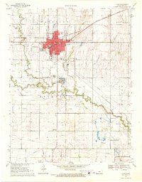
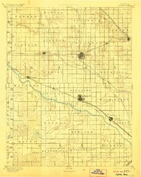
USGS Historical Quadrangle in GeoPDF.

USGS Historical Quadrangle in GeoPDF.
USGS Historical Quadrangle in GeoPDF.
Core Research Center, core B526, from well operated by APACHE CORPORATIONRaw Properties from download, web scrape, MapServer, and Macrostrat API{"Lib Num": "B526", "API Num": "0512309510", "Operator": "APACHE CORPORATION", "Well Name": "1-17 ANTELOPE", "Field": "ANTELOPE", "State": "CO", "County": "WELD", "Type": "SLABBED", "Photos": "T", "Thin Sec": "T", "Analysis": "T", "Latitude": "40.489753", "Longitude": "-104.804433", "coordinates_geohash": "9xjqr4gtztn8", "Source": "FROM STATE RECORDS", "Security Flag": "NO SPECIAL RESTRICTIONS", "crc_collection_name": "core", "sb_parent_id": "4f4e49dae4b07f02db5e0486", "intervals": [{"Formation": "LYONS", "Age": "PERM", "Min Depth": "9007", "Max Depth": "9076"}], "crcwc_url":...
Core Research Center, core C968, from well operated by GENERAL AM OIL TEXASRaw Properties from download, web scrape, MapServer, and Macrostrat API{"Lib Num": "C968", "API Num": "0512309953", "Operator": "GENERAL AM OIL TEXAS", "Well Name": "129 DEVERRES", "Field": "WILDCAT", "State": "CO", "County": "WELD", "Type": "SLABBED", "Photos": "T", "Thin Sec": "F", "Analysis": "T", "Latitude": "40.72206", "Longitude": "-104.808166", "coordinates_geohash": "9xjrxj1p0wpj", "Source": "FROM STATE RECORDS", "Security Flag": "NO SPECIAL RESTRICTIONS", "crc_collection_name": "core", "sb_parent_id": "4f4e49dae4b07f02db5e0486", "intervals": [{"Formation": "LYONS", "Age": "PERM", "Min Depth": "9285", "Max Depth": "9377"}], "crcwc_url":...
Categories: Physical Item;
Tags: Calabrian - Middle Pleistocene,
LYONS,
Older gravels and alluviums,
PERM,
gravel
Core Research Center, core D966, from well operated by CHEVRON OILRaw Properties from download, web scrape, MapServer, and Macrostrat API{"Lib Num": "D966", "API Num": "0512305471", "Operator": "CHEVRON OIL", "Well Name": "6 UPRR", "Field": "BLACK HOLLOW", "State": "CO", "County": "WELD", "Type": "SLABBED", "Photos": "F", "Thin Sec": "T", "Analysis": "F", "Latitude": "40.61981", "Longitude": "-104.8291", "coordinates_geohash": "9xjrnd9g8cms", "Source": "FROM STATE RECORDS", "Security Flag": "NO SPECIAL RESTRICTIONS", "crc_collection_name": "core", "sb_parent_id": "4f4e49dae4b07f02db5e0486", "intervals": [{"Formation": "LYONS", "Age": "PERM", "Min Depth": "8979", "Max Depth": "9033"}], "crcwc_url": "https://my.usgs.gov/crcwc/core/report/11963",...
Categories: Physical Item;
Tags: LYONS,
PERM,
Piney Creek Alluvium,
Piney Creek Alluvium,
Upper Holocene
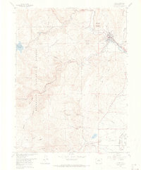
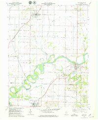
USGS Historical Quadrangle in GeoPDF.
USGS Historical Quadrangle in GeoPDF.
Core Research Center, core S675, from well operated by CHEVRON OILRaw Properties from download, web scrape, MapServer, and Macrostrat API{"Lib Num": "S675", "API Num": "0512307053", "Operator": "CHEVRON OIL", "Well Name": "4 STATE", "Field": "BLACK HOLLOW", "State": "CO", "County": "WELD", "Type": "FULL", "Photos": "F", "Thin Sec": "F", "Analysis": "F", "Latitude": "40.623601", "Longitude": "-104.834396", "coordinates_geohash": "9xjrn7mcts0e", "Source": "FROM STATE RECORDS", "Security Flag": "NO SPECIAL RESTRICTIONS", "crc_collection_name": "core", "sb_parent_id": "4f4e49dae4b07f02db5e0486", "intervals": [{"Formation": "LYONS", "Age": "PERM", "Min Depth": "9002", "Max Depth": "9049"}, {"Formation": "SATANKA", "Age":...
Categories: Physical Item;
Tags: Eolium (Windblown Clay, Silt (Loess), Sand And Granules),
LYONS,
PERM,
PERM,
SATANKA,
Core Research Center, core F118, from well operated by CALIFORNIA OILRaw Properties from download, web scrape, MapServer, and Macrostrat API{"Lib Num": "F118", "API Num": "0512305178", "Operator": "CALIFORNIA OIL", "Well Name": "1 HAYES", "Field": "WILDCAT", "State": "CO", "County": "WELD", "Type": "SLABBED", "Photos": "T", "Thin Sec": "F", "Analysis": "F", "Latitude": "40.386781", "Longitude": "-104.796419", "coordinates_geohash": "9xjmz21w43wk", "Source": "PROVIDED BY DONOR", "Security Flag": null, "crc_collection_name": "core", "sb_parent_id": "4f4e49dae4b07f02db5e0486", "intervals": [{"Formation": "LYONS", "Age": "CRETACEOUS", "Min Depth": "9082", "Max Depth": "9089"}], "crcwc_url": "https://my.usgs.gov/crcwc/core/report/70015",...
Core Research Center, core E739, from well operated by HILLIARD O & G INCRaw Properties from download, web scrape, MapServer, and Macrostrat API{"Lib Num": "E739", "API Num": "0512307614", "Operator": "HILLIARD O & G INC", "Well Name": "1 AMOCO UPRR", "Field": "QWILDCAT", "State": "CO", "County": "WELD", "Type": "SLABBED", "Photos": "T", "Thin Sec": "T", "Analysis": "T", "Latitude": "40.77037", "Longitude": "-104.798546", "coordinates_geohash": "9xjrzq008gu6", "Source": "FROM STATE RECORDS", "Security Flag": "NO SPECIAL RESTRICTIONS", "crc_collection_name": "core", "sb_parent_id": "4f4e49dae4b07f02db5e0486", "intervals": [{"Formation": "DAKOTA", "Age": "CRET", "Min Depth": "8364", "Max Depth": "8406"}, {"Formation":...
Categories: Physical Item;
Tags: CRET,
CRETACEOUS,
Calabrian - Middle Pleistocene,
DAKOTA,
FORELLE /LM/,
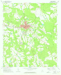
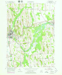
USGS Historical Quadrangle in GeoPDF.
USGS Historical Quadrangle in GeoPDF.
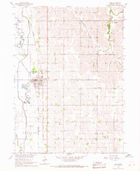
USGS Historical Quadrangle in GeoPDF.
Core Research Center, core E053, from well operated by CALIFORNIA OILRaw Properties from download, web scrape, MapServer, and Macrostrat API{"Lib Num": "E053", "API Num": "0512305513", "Operator": "CALIFORNIA OIL", "Well Name": "1 UPRR-FERCH", "Field": "PIERCE", "State": "CO", "County": "WELD", "Type": "SLABBED", "Photos": "T", "Thin Sec": "T", "Analysis": "T", "Latitude": "40.634652", "Longitude": "-104.755913", "coordinates_geohash": "9xjx0jr4421u", "Source": "FROM STATE RECORDS", "Security Flag": "NO SPECIAL RESTRICTIONS", "crc_collection_name": "core", "sb_parent_id": "4f4e49dae4b07f02db5e0486", "intervals": [{"Formation": "LYTLE SD", "Age": "CRET", "Min Depth": "8097", "Max Depth": "8236"}, {"Formation": "LYONS",...
Core Research Center, core E786, from well operated by CALIFORNIA OILRaw Properties from download, web scrape, MapServer, and Macrostrat API{"Lib Num": "E786", "API Num": "0512305422", "Operator": "CALIFORNIA OIL", "Well Name": "3 UNION PACIFIC RR", "Field": "BLACK HOLLOW", "State": "CO", "County": "WELD", "Type": "SLABBED", "Photos": "F", "Thin Sec": "F", "Analysis": "T", "Latitude": "40.601502", "Longitude": "-104.834195", "coordinates_geohash": "9xjqyrq0fhw9", "Source": "FROM STATE RECORDS", "Security Flag": "NO SPECIAL RESTRICTIONS", "crc_collection_name": "core", "sb_parent_id": "4f4e49dae4b07f02db5e0486", "intervals": [{"Formation": "LYONS", "Age": "PERM", "Min Depth": "9015", "Max Depth": "9026"}], "crcwc_url":...

These data were released prior to the October 1, 2016 effective date for the USGS’s policy dictating the review, approval, and release of scientific data as referenced in USGS Survey Manual Chapter 502.8 Fundamental Science Practices: Review and Approval of Scientific Data for Release. LiDAR-derived (hydrography) stream network.
This dataset contains the areas of surficial sand and gravel with water-resource potential within the study area. The delineated areas are the largest areas of glaciofluvial sand and gravel with known or inferred thicknesses of saturated sand and gravel that might be sufficient for water supply. This digital dataset is the result of a study to investigate the hydrogeology of the Fairport-Lyons channel and inter-drumlin aquifer system and to map the extent of the glacial aquifers in southern Wayne County, New York; it supports USGS SIR 2021-5086, "Hydrogeology of aquifers within the Fairport-Lyons channel system and adjacent areas in Wayne, Ontario, and Seneca Counties, New York."
Categories: Data;
Types: Downloadable,
Map Service,
OGC WFS Layer,
OGC WMS Layer,
Shapefile;
Tags: Aquifer Mapping,
Fairport,
Groundwater and Streamflow Information,
Hydrogeologic Characterization,
Lyons,
|

|
