Advanced Search

Filters: Tags: Lafourche (X)

185 results (279ms)   

Filters
Date Range
Extensions
Types
Contacts
Categories
Tag Types
Tag Schemes
View Results as: JSON ATOM CSV
This data set contains imagery from the National Agriculture Imagery Program (NAIP). The NAIP program is administered by USDA FSA and has been established to support two main FSA strategic goals centered on agricultural production. These are, increase stewardship of America's natural resources while enhancing the environment, and to ensure commodities are procured and distributed effectively and efficiently to increase food security. The NAIP program supports these goals by acquiring and providing ortho imagery that has been collected during the agricultural growing season in the U.S. The NAIP ortho imagery is tailored to meet FSA requirements and is a fundamental tool used to support FSA farm and conservation programs....
thumbnail
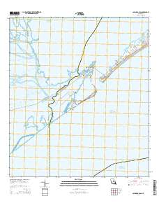
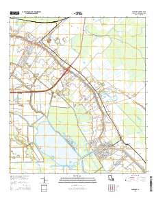
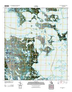
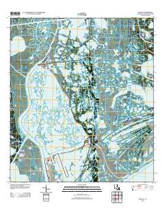
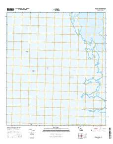
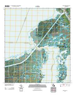
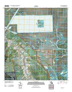
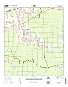
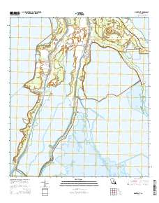
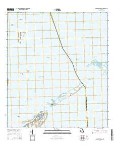
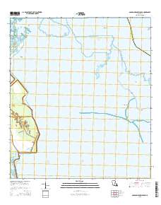
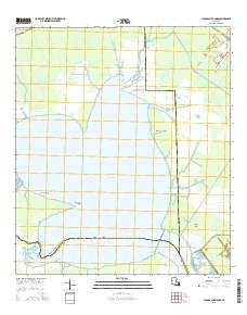
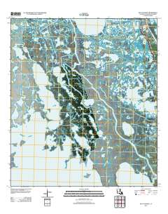
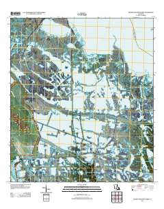
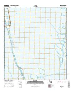
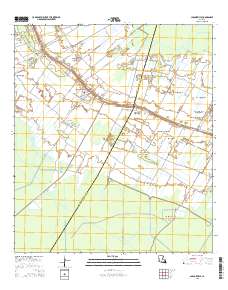
Layered GeoPDF 7.5 Minute Quadrangle Map. Layers of geospatial data include orthoimagery, roads, grids, geographic names, elevation contours, hydrography, and other selected map features.
This data set contains imagery from the National Agriculture Imagery Program (NAIP). The NAIP program is administered by USDA FSA and has been established to support two main FSA strategic goals centered on agricultural production. These are, increase stewardship of America's natural resources while enhancing the environment, and to ensure commodities are procured and distributed effectively and efficiently to increase food security. The NAIP program supports these goals by acquiring and providing ortho imagery that has been collected during the agricultural growing season in the U.S. The NAIP ortho imagery is tailored to meet FSA requirements and is a fundamental tool used to support FSA farm and conservation programs....
thumbnail
This package includes a detailed habitat map, general habitat map, and georeferenced imagery from 2015 for the National Fish and Wildlife Foundation (NFWF) Caminada Headland Beach and Dune Restoration Incr2 project area (BA-0143). The project restored 489 acres of beach and dune habitat along more than seven miles of Caminada Headland in Jefferson and Lafourche Parishes through the direct placement of about 5.4 million cubic yards of sandy substrate from Ship Shoal. The habitat maps are part of a suite of Caminada Headland habitat maps for the years 2012, 2015, and 2017–19, which span the time period before, during, and after the restoration project was conducted. For more information on this restoration project,...
thumbnail
The Geographic Names Information System (GNIS) is the Federal standard for geographic nomenclature. The U.S. Geological Survey developed the GNIS for the U.S. Board on Geographic Names, a Federal inter-agency body chartered by public law to maintain uniform feature name usage throughout the Government and to promulgate standard names to the public. The GNIS is the official repository of domestic geographic names data; the official vehicle for geographic names use by all departments of the Federal Government; and the source for applying geographic names to Federal electronic and printed products of all types.
Tags: Acadia, Allen, Antarctica, Antarctica, Ascension, All tags...
This data set contains imagery from the National Agriculture Imagery Program (NAIP). The NAIP program is administered by USDA FSA and has been established to support two main FSA strategic goals centered on agricultural production. These are, increase stewardship of America's natural resources while enhancing the environment, and to ensure commodities are procured and distributed effectively and efficiently to increase food security. The NAIP program supports these goals by acquiring and providing ortho imagery that has been collected during the agricultural growing season in the U.S. The NAIP ortho imagery is tailored to meet FSA requirements and is a fundamental tool used to support FSA farm and conservation programs....


map background search result map search result map FSA 10:1 NAIP Imagery m_2909009_sw_15_1_20150430_20151019 3.75 x 3.75 minute JPEG2000 from The National Map FSA 10:1 NAIP Imagery m_2909012_sw_15_1_20150826_20151019 3.75 x 3.75 minute JPEG2000 from The National Map FSA 10:1 NAIP Imagery m_2909021_ne_15_1_20150430_20151019 3.75 x 3.75 minute JPEG2000 from The National Map FSA 10:1 NAIP Imagery m_2909023_sw_15_1_20150430_20151019 3.75 x 3.75 minute JPEG2000 from The National Map FSA 10:1 NAIP Imagery m_2909037_ne_15_1_20150430_20151019 3.75 x 3.75 minute JPEG2000 from The National Map FSA 10:1 NAIP Imagery m_2909047_nw_15_1_20150430_20151019 3.75 x 3.75 minute JPEG2000 from The National Map FSA 10:1 NAIP Imagery m_2909047_sw_15_1_20150430_20151019 3.75 x 3.75 minute JPEG2000 from The National Map FSA 10:1 NAIP Imagery m_2909048_nw_15_1_20150430_20151019 3.75 x 3.75 minute JPEG2000 from The National Map FSA 10:1 NAIP Imagery m_2909054_se_15_1_20150430_20151019 3.75 x 3.75 minute JPEG2000 from The National Map FSA 10:1 NAIP Imagery m_2909055_se_15_1_20150430_20151019 3.75 x 3.75 minute JPEG2000 from The National Map FSA 10:1 NAIP Imagery m_2909062_nw_15_1_20150430_20151019 3.75 x 3.75 minute JPEG2000 from The National Map FSA 10:1 NAIP Imagery m_2909063_nw_15_1_20150430_20151019 3.75 x 3.75 minute JPEG2000 from The National Map USGS US Topo 7.5-minute map for Barataria, LA 2012 USGS US Topo 7.5-minute map for Caminada Pass, LA 2015 USGS US Topo 7.5-minute map for Golden Meadow Farms, LA 2015 USGS US Topo 7.5-minute map for Lockport, LA 2015 USGS US Topo 7.5-minute map for Lower Vacherie, LA 2015 USGS US Topo 7.5-minute map for Montegut, LA 2015 Caminada Headland restoration area – 2015 habitat map, Louisiana Barrier Island Comprehensive Monitoring Program Geographic Names Information System (GNIS) Full Model for LA (published 20230601) GeoPackage FSA 10:1 NAIP Imagery m_2909009_sw_15_1_20150430_20151019 3.75 x 3.75 minute JPEG2000 from The National Map FSA 10:1 NAIP Imagery m_2909012_sw_15_1_20150826_20151019 3.75 x 3.75 minute JPEG2000 from The National Map FSA 10:1 NAIP Imagery m_2909021_ne_15_1_20150430_20151019 3.75 x 3.75 minute JPEG2000 from The National Map FSA 10:1 NAIP Imagery m_2909023_sw_15_1_20150430_20151019 3.75 x 3.75 minute JPEG2000 from The National Map FSA 10:1 NAIP Imagery m_2909037_ne_15_1_20150430_20151019 3.75 x 3.75 minute JPEG2000 from The National Map FSA 10:1 NAIP Imagery m_2909047_nw_15_1_20150430_20151019 3.75 x 3.75 minute JPEG2000 from The National Map FSA 10:1 NAIP Imagery m_2909047_sw_15_1_20150430_20151019 3.75 x 3.75 minute JPEG2000 from The National Map FSA 10:1 NAIP Imagery m_2909048_nw_15_1_20150430_20151019 3.75 x 3.75 minute JPEG2000 from The National Map FSA 10:1 NAIP Imagery m_2909054_se_15_1_20150430_20151019 3.75 x 3.75 minute JPEG2000 from The National Map FSA 10:1 NAIP Imagery m_2909055_se_15_1_20150430_20151019 3.75 x 3.75 minute JPEG2000 from The National Map FSA 10:1 NAIP Imagery m_2909062_nw_15_1_20150430_20151019 3.75 x 3.75 minute JPEG2000 from The National Map FSA 10:1 NAIP Imagery m_2909063_nw_15_1_20150430_20151019 3.75 x 3.75 minute JPEG2000 from The National Map USGS US Topo 7.5-minute map for Barataria, LA 2012 USGS US Topo 7.5-minute map for Caminada Pass, LA 2015 USGS US Topo 7.5-minute map for Golden Meadow Farms, LA 2015 USGS US Topo 7.5-minute map for Lockport, LA 2015 USGS US Topo 7.5-minute map for Lower Vacherie, LA 2015 USGS US Topo 7.5-minute map for Montegut, LA 2015 Caminada Headland restoration area – 2015 habitat map, Louisiana Barrier Island Comprehensive Monitoring Program Geographic Names Information System (GNIS) Full Model for LA (published 20230601) GeoPackage