Filters
Date Range
Extensions
Types
Contacts
Categories
Tag Types
Tag Schemes
|

This coverage includes arcs, polygons and polygon labels that describe U.S. Geological Survey defined geologic provinces of Europe including Turkey. (Albania, Andorra, Austria, Belgium, Bosnia and Herzegovina, Bulgaria, Croatia, Cyprus, Czech Republic, Denmark, Finland, France, Germany, Greece, Hungary, Iceland, Ireland, Italy, Liechtenstein, Luxembourg, The Former Yugoslav Republic of Macedonia, Malta, Monaco, Netherlands, Norway, Poland, Portugal, Romania, San Marino, Serbia and Montenegro, Slovakia, Slovenia, Spain, Sweden, Switzerland, Turkey, United Kingdom and Vatican City.) Each province has a set of geologic characteristics distinguishing it from surrounding provinces. These characteristics may include the...
Categories: Data,
pre-SM502.8;
Types: Downloadable,
Map Service,
OGC WFS Layer,
OGC WMS Layer,
Shapefile;
Tags: AL,
AN,
AU,
Adana/Sivas, Province 2079,
Adriatic Basin, Province 4058, All tags...
Aegean, Province 4075,
Albania,
Alentejo-Guadalquivir Basin, Province 4077,
Alps, Province 4051,
Andalucia, Province 4088,
Andorra,
Anglo-Dutch Basin, Province 4036,
Anglo-Paris Basin, Province 4040,
Apulia Platform, Province 4059,
Aquitaine Basin, Province 4045,
Araks, Province 2080,
Armoricia, Province 4041,
Austria,
BE,
BK,
BU,
Baltic Depression, Province 4021,
Baltic Shield-Norwegian Caledonides, Province 4016,
Barents Continental Slope, Province 4013,
Belgium,
Belorussian-Voronezh High, Province 1004,
Betic Zone, Province 4078,
Black Sea Continental Slope, Province 1107,
Bohemia, Province 4046,
Bosnia and Herzegovina,
Bresse Depression, Province 4054,
Bulgaria,
CY,
Carpathian-Balkanian Basin, Province 4061,
Corsican-Sardinian Basins, Province 4067,
Crete, Province 4076,
Croatia,
Cyprus,
Czech Republic,
DA,
Denmark,
Dinaric Alps, Province 4071,
Dobrogea Foreland, Province 1103,
Dobrogean Orogen, Province 4063,
EI,
EZ,
Earth Science,
Economic geology,
Euphrates/Mardin, Province 2075,
Europe,
FI,
FO,
FR,
Faeroes-Shetland-Orkney Basin, Province 4019,
Faroe Islands,
Fennoscandian Border-Danish-Polish Margin, Province 4022,
Finland,
France,
GI,
GK,
GM,
GR,
Galician Basin, Province 4073,
Gas,
Geologic province,
Geology,
German-Polish Basin, Province 4033,
Germany,
Gibraltar,
Greece,
Guernsey,
HR,
HU,
Haleb, Province 2076,
Hammerfest-Varanger Basin, Province 4015,
Hatton-Rockall Basin, Province 4020,
Horda-Norwegian-Danish Basin, Province 4023,
Hungary,
IC,
IM,
IT,
Iberian Massif, Province 4072,
Iberic Cordillera, Province 4083,
Iceland,
Ireland,
Ireland-Scotland Platform, Province 4026,
Irish Sea, Province 4030,
Isle of Man,
Italy,
JE,
Jersey,
Jura, Province 4052,
Kardiff/Menders Massif, Province 2084,
Kola Monocline-Finnmark Platform, Province 1051,
LO,
LS,
LU,
Lesser Caucasus, Province 2081,
Liechtenstein,
Lion-Camargue, Province 4056,
London-Brabant Platform, Province 4037,
Lusitanian Basin, Province 4074,
Luxembourg,
MK,
MN,
MW,
Malta,
Massif Central, Province 4043,
Mediterranean Basin, Province 2070,
Mid-North Sea High, Province 4028,
Midland Valley-Forth Approaches Basin, Province 4027,
Molasse Basin, Province 4049,
Monaco,
Munsterland Basin, Province 4038,
NL,
NO,
Natural Gas,
Natural Resources,
Natural gas resources,
Netherlands,
North Carpathian Basin, Province 4047,
North Sea Graben, Province 4025,
Northwest German Basin, Province 4035,
Norway,
Oil,
Oil,
Oil sand resources,
Oil shale resources,
PL,
PO,
Pannonian Basin, Province 4048,
Pelagian Basin, Province 2048,
Petroleum,
Po Basin, Province 4060,
Poland,
Portugal,
Provence Basin, Province 4068,
Pyrenean Foothills-Ebro Basin, Province 4044,
RO,
Resource Assessment,
Rhine Graben, Province 4055,
Rif Basin, Province 2072,
Romania,
Russian Craton Margin, Province 1011,
SI,
SM,
SP,
SR,
SV,
SW,
SZ,
San Marino,
Serbia and Montenegro,
Sicily, Province 4066,
Slovakia,
Slovenia,
Southwest German Basin, Province 4039,
Spain,
Spanish Trough-Cantabrian Zone, Province 4070,
Svalbard,
Sweden,
Switzerland,
TU,
Tajo-Duero Basin, Province 4082,
The Former Yugoslav Republic of Macedonia,
Thrace/Samsun, Province 2085,
Trans-Graben, Province 4053,
Transylvanian Basin, Province 4057,
Troms-Bjornoya, Province 4014,
Turkey,
Tuscany-Latium-Paola, Province 4062,
Tuz/Corum, Province 2083,
Tyrrhenian Basin, Province 4069,
U.S. Geological Survey,
UK,
USGS,
USGS Science Data Catalog (SDC),
Ukrainian Shield, Province 1013,
United Kingdom,
VT,
Vatican City,
Vestford-Helgeland, Province 4017,
West Black Sea Basin, Province 4064,
Zagros Fold Belt, Province 2030,
Zagros Thrust Zone, Province 2031,
environment,
europe,
geoscientificInformation,
oilgas,
wep,
worldgeologicmaps, Fewer tags
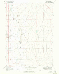
USGS Historical Quadrangle in GeoPDF.
Tags: 7.5 x 7.5 minute,
Downloadable Data,
GeoPDF,
GeoTIFF,
Historical Topographic Maps, All tags...
Historical Topographic Maps 7.5 x 7.5 Minute Map Series,
ID,
Malta,
Map,
imageryBaseMapsEarthCover, Fewer tags

This coverage includes arcs that describe faults found in the surface outcrops of bedrock of Europe including Turkey (Albania, Andorra, Austria, Belgium, Bosnia and Herzegovina, Bulgaria, Croatia, Cyprus, Czech Republic, Denmark, Finland, France, Germany, Greece, Hungary, Iceland, Ireland, Italy, Liechtenstein, Luxembourg, The Former Yugoslav Republic of Macedonia, Malta, Monaco, Netherlands, Norway, Poland, Portugal, Romania, San Marino, Serbia and Montenegro, Slovakia, Slovenia, Spain, Sweden, Switzerland, Turkey, United Kingdom and Vatican City.)
Categories: Data;
Types: Downloadable,
Map Service,
OGC WFS Layer,
OGC WMS Layer,
Shapefile;
Tags: AL,
AN,
AU,
Adana/Sivas, Province 2079,
Adriatic Basin, Province 4058, All tags...
Aegean, Province 4075,
Age,
Albania,
Alentejo-Guadalquivir Basin, Province 4077,
Alps, Province 4051,
Andalucia, Province 4088,
Andorra,
Anglo-Dutch Basin, Province 4036,
Anglo-Paris Basin, Province 4040,
Apulia Platform, Province 4059,
Aquitaine Basin, Province 4045,
Araks, Province 2080,
Armoricia, Province 4041,
Austria,
BE,
BK,
BU,
Baltic Depression, Province 4021,
Baltic Shield-Norwegian Caledonides, Province 4016,
Barents Continental Slope, Province 4013,
Belgium,
Belorussian-Voronezh High, Province 1004,
Betic Zone, Province 4078,
Black Sea Continental Slope, Province 1107,
Bohemia, Province 4046,
Bosnia and Herzegovina,
Bresse Depression, Province 4054,
Bulgaria,
CY,
Carpathian-Balkanian Basin, Province 4061,
Corsican-Sardinian Basins, Province 4067,
Crete, Province 4076,
Croatia,
Cyprus,
Czech Republic,
DA,
Denmark,
Dinaric Alps, Province 4071,
Dobrogea Foreland, Province 1103,
Dobrogean Orogen, Province 4063,
EI,
EZ,
Earth Science,
Economic geology,
Euphrates/Mardin, Province 2075,
Europe,
FI,
FO,
FR,
Faeroes-Shetland-Orkney Basin, Province 4019,
Faroe Islands,
Fault,
Fennoscandian Border-Danish-Polish Margin, Province 4022,
Finland,
France,
GI,
GK,
GM,
GR,
Galician Basin, Province 4073,
Gas,
Generalized geology,
Geologic Province,
Geologic age,
Geologic map,
Geology,
Geology,
German-Polish Basin, Province 4033,
Germany,
Gibraltar,
Greece,
Guernsey,
HR,
HU,
Haleb, Province 2076,
Hammerfest-Varanger Basin, Province 4015,
Hatton-Rockall Basin, Province 4020,
Horda-Norwegian-Danish Basin, Province 4023,
Hungary,
IC,
IM,
IT,
Iberian Massif, Province 4072,
Iberic Cordillera, Province 4083,
Iceland,
Ireland,
Ireland-Scotland Platform, Province 4026,
Irish Sea, Province 4030,
Isle of Man,
Italy,
JE,
Jersey,
Jura, Province 4052,
Kardiff/Menders Massif, Province 2084,
Kola Monocline-Finnmark Platform, Province 1051,
LO,
LS,
LU,
Lesser Caucasus, Province 2081,
Liechtenstein,
Lion-Camargue, Province 4056,
London-Brabant Platform, Province 4037,
Lusitanian Basin, Province 4074,
Luxembourg,
MK,
MN,
MW,
Malta,
Massif Central, Province 4043,
Mediterranean Basin, Province 2070,
Mid-North Sea High, Province 4028,
Midland Valley-Forth Approaches Basin, Province 4027,
Molasse Basin, Province 4049,
Monaco,
Munsterland Basin, Province 4038,
NL,
NO,
Natural Gas,
Natural Resources,
Natural gas resources,
Netherlands,
North Carpathian Basin, Province 4047,
North Sea Graben, Province 4025,
Northwest German Basin, Province 4035,
Norway,
Oil,
Oil,
Oil sand resources,
Oil shale resources,
PL,
PO,
Pannonian Basin, Province 4048,
Pelagian Basin, Province 2048,
Petroleum,
Po Basin, Province 4060,
Poland,
Portugal,
Provence Basin, Province 4068,
Pyrenean Foothills-Ebro Basin, Province 4044,
RO,
Resource Assessment,
Rhine Graben, Province 4055,
Rif Basin, Province 2072,
Romania,
Russian Craton Margin, Province 1011,
SI,
SM,
SP,
SR,
SV,
SW,
SZ,
San Marino,
Serbia and Montenegro,
Sicily, Province 4066,
Slovakia,
Slovenia,
Southwest German Basin, Province 4039,
Spain,
Spanish Trough-Cantabrian Zone, Province 4070,
Svalbard,
Sweden,
Switzerland,
TU,
Tajo-Duero Basin, Province 4082,
The Former Yugoslav Republic of Macedonia,
Thrace/Samsun, Province 2085,
Thrust fault,
Trans-Graben, Province 4053,
Transylvanian Basin, Province 4057,
Troms-Bjornoya, Province 4014,
Turkey,
Tuscany-Latium-Paola, Province 4062,
Tuz/Corum, Province 2083,
Tyrrhenian Basin, Province 4069,
U.S. Geological Survey,
UK,
USGS,
USGS Science Data Catalog (SDC),
Ukrainian Shield, Province 1013,
United Kingdom,
VT,
Vatican City,
Vestford-Helgeland, Province 4017,
West Black Sea Basin, Province 4064,
Zagros Fold Belt, Province 2030,
Zagros Thrust Zone, Province 2031,
environment,
europe,
geoscientificInformation,
oilgas,
wep,
worldgeologicmaps, Fewer tags
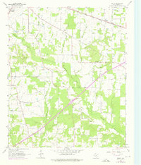
USGS Historical Quadrangle in GeoPDF.
Tags: 7.5 x 7.5 minute,
Downloadable Data,
GeoPDF,
GeoTIFF,
Historical Topographic Maps, All tags...
Historical Topographic Maps 7.5 x 7.5 Minute Map Series,
Malta,
Map,
TX,
imageryBaseMapsEarthCover, Fewer tags

This coverage includes arcs, polygons, and polygon labels that describe the generalized geologic age of surface outcrops of bedrock of Europe including Turkey (Albania, Andorra, Austria, Belgium, Bosnia and Herzegovina, Bulgaria, Croatia, Cyprus, Czech Republic, Denmark, Finland, France, Germany, Greece, Hungary, Iceland, Ireland, Italy, Liechtenstein, Luxembourg, The Former Yugoslav Republic of Macedonia, Malta, Monaco, Netherlands, Norway, Poland, Portugal, Romania, San Marino, Serbia and Montenegro, Slovakia, Slovenia, Spain, Sweden, Switzerland, Turkey, United Kingdom and Vatican City.) It also includes shorelines and inland water bodies.
Categories: Data,
pre-SM502.8;
Types: Downloadable,
Map Service,
OGC WFS Layer,
OGC WMS Layer,
Shapefile;
Tags: AL,
AN,
AU,
Adana/Sivas, Province 2079,
Adriatic Basin, Province 4058, All tags...
Aegean, Province 4075,
Age,
Albania,
Alentejo-Guadalquivir Basin, Province 4077,
Alps, Province 4051,
Andalucia, Province 4088,
Andorra,
Anglo-Dutch Basin, Province 4036,
Anglo-Paris Basin, Province 4040,
Apulia Platform, Province 4059,
Aquitaine Basin, Province 4045,
Araks, Province 2080,
Armoricia, Province 4041,
Austria,
BE,
BK,
BU,
Baltic Depression, Province 4021,
Baltic Shield-Norwegian Caledonides, Province 4016,
Barents Continental Slope, Province 4013,
Belgium,
Belorussian-Voronezh High, Province 1004,
Betic Zone, Province 4078,
Black Sea Continental Slope, Province 1107,
Bohemia, Province 4046,
Bosnia and Herzegovina,
Bresse Depression, Province 4054,
Bulgaria,
CY,
Carpathian-Balkanian Basin, Province 4061,
Corsican-Sardinian Basins, Province 4067,
Crete, Province 4076,
Croatia,
Cyprus,
Czech Republic,
DA,
Denmark,
Dinaric Alps, Province 4071,
Dobrogea Foreland, Province 1103,
Dobrogean Orogen, Province 4063,
EI,
EZ,
Earth Science,
Economic geology,
Euphrates/Mardin, Province 2075,
Europe,
FI,
FO,
FR,
Faeroes-Shetland-Orkney Basin, Province 4019,
Faroe Islands,
Fennoscandian Border-Danish-Polish Margin, Province 4022,
Finland,
France,
GI,
GK,
GM,
GR,
Galician Basin, Province 4073,
Gas,
Generalized geology,
Geologic Province,
Geologic age,
Geologic map,
Geology,
Geology,
German-Polish Basin, Province 4033,
Germany,
Gibraltar,
Greece,
Guernsey,
HR,
HU,
Haleb, Province 2076,
Hammerfest-Varanger Basin, Province 4015,
Hatton-Rockall Basin, Province 4020,
Horda-Norwegian-Danish Basin, Province 4023,
Hungary,
IC,
IM,
IT,
Iberian Massif, Province 4072,
Iberic Cordillera, Province 4083,
Iceland,
Ireland,
Ireland-Scotland Platform, Province 4026,
Irish Sea, Province 4030,
Isle of Man,
Italy,
JE,
Jersey,
Jura, Province 4052,
Kardiff/Menders Massif, Province 2084,
Kola Monocline-Finnmark Platform, Province 1051,
LO,
LS,
LU,
Lesser Caucasus, Province 2081,
Liechtenstein,
Lion-Camargue, Province 4056,
London-Brabant Platform, Province 4037,
Lusitanian Basin, Province 4074,
Luxembourg,
MK,
MN,
MW,
Malta,
Massif Central, Province 4043,
Mediterranean Basin, Province 2070,
Mid-North Sea High, Province 4028,
Midland Valley-Forth Approaches Basin, Province 4027,
Molasse Basin, Province 4049,
Monaco,
Munsterland Basin, Province 4038,
NL,
NO,
Natural Gas,
Natural Resources,
Natural gas resources,
Netherlands,
North Carpathian Basin, Province 4047,
North Sea Graben, Province 4025,
Northwest German Basin, Province 4035,
Norway,
Oil,
Oil,
Oil sand resources,
Oil shale resources,
PL,
PO,
Pannonian Basin, Province 4048,
Pelagian Basin, Province 2048,
Petroleum,
Po Basin, Province 4060,
Poland,
Portugal,
Provence Basin, Province 4068,
Pyrenean Foothills-Ebro Basin, Province 4044,
RO,
Resource Assessment,
Rhine Graben, Province 4055,
Rif Basin, Province 2072,
Romania,
Russian Craton Margin, Province 1011,
SI,
SM,
SP,
SR,
SV,
SW,
SZ,
San Marino,
Serbia and Montenegro,
Sicily, Province 4066,
Slovakia,
Slovenia,
Southwest German Basin, Province 4039,
Spain,
Spanish Trough-Cantabrian Zone, Province 4070,
Svalbard,
Sweden,
Switzerland,
TU,
Tajo-Duero Basin, Province 4082,
The Former Yugoslav Republic of Macedonia,
Thrace/Samsun, Province 2085,
Trans-Graben, Province 4053,
Transylvanian Basin, Province 4057,
Troms-Bjornoya, Province 4014,
Turkey,
Tuscany-Latium-Paola, Province 4062,
Tuz/Corum, Province 2083,
Tyrrhenian Basin, Province 4069,
U.S. Geological Survey,
UK,
USGS,
USGS Science Data Catalog (SDC),
Ukrainian Shield, Province 1013,
United Kingdom,
VT,
Vatican City,
Vestford-Helgeland, Province 4017,
West Black Sea Basin, Province 4064,
Zagros Fold Belt, Province 2030,
Zagros Thrust Zone, Province 2031,
europe,
oilgas,
wep,
worldgeologicmaps, Fewer tags
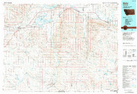
USGS Historical Quadrangle in GeoPDF.
Tags: 30 x 60 minute,
Downloadable Data,
GeoPDF,
GeoTIFF,
Historical Topographic Maps, All tags...
Historical Topographic Maps 30 x 60 Minute Map Series,
MT,
Malta,
Map,
imageryBaseMapsEarthCover, Fewer tags

This 1:50,000-scale geologic map represents a compilation of the most recent geologic studies of the upper Arkansas River valley, between Leadville and Salida, Colorado. The valley is structurally controlled by an extensional fault system that forms part of the prominent northern Rio Grande rift, an intra-continental region of crustal extension. This work also incorporates new detailed geologic mapping of poorly understood areas within the map area and reinterprets previously studied areas, aided by lidar data that covers 59 percent of the map area. The mapped region extends into the Proterozoic metamorphic and intrusive rocks in the Sawatch Range west of the valley and the Mosquito Range to the east. Paleozoic...
Categories: Data;
Tags: 207Pb/206Pb zircon age,
40Ar/39Ar age,
Arkansas River,
Balltown,
Balltown placer gold mining areas, All tags...
Belle of Granite Mine,
Big Union Creek,
Bishop ash,
Black Cloud Mine,
Black Mountain,
Browns Canyon,
Browns Canyon fluorspar mining district,
Browns Creek,
Buckskin Gulch,
Buena Vista,
Buffalo Creek,
Buffalo Peaks,
Bull Lake glaciation,
Cache Creek,
California Gulch,
California Mine,
Centerville,
Chaffee County,
Chalk Creek,
Clear Creek,
Clear Creek Reservoir,
Colorado,
Cottonwood Creek,
Dry Union Gulch,
Eagle County,
Eagle River,
East Fork Arkansas River,
Eddy Creek,
Elephant Rock,
Fremont County,
Front Range,
Garfield,
Garfield Mine,
Garfield mining district,
Gordon Mine,
Granite,
Granite mining district,
Granite placer gold mining areas,
Hayden Gulch,
Homestake Reservoir,
Iowa Gulch,
Johnson Village,
Lake County,
Lake Creek,
Langhoff Gulch,
Lava Creek B ash,
Leadville,
Leadville mining district,
Lilly Mine,
London Mine,
Malta,
Maysville,
Mesozoic rocks,
Morrison Creek,
Mosquito Range,
Mount Aetna,
Mount Antero,
Mount Antero mining district,
Mount Princeton,
Mount Shavano,
Mount Yale,
Paleozoic rocks,
Park County,
Pine Creek,
Pinedale glaciation,
Pitkin County,
Poncha Springs,
Proterozoic rocks,
Quaternary deposits,
Rio Grande rift,
Riverside,
Rock Creek,
Ruby Mine,
Ruby Mountain,
San Juan Mountains,
Sangre de Cristo Range,
Sawatch Range,
Sedalia Mine,
Sedalia copper-zinc mining district,
South Arkansas River,
South Park,
South Platte River,
Squaw Creek,
St. Kevin mining district,
Structural Geology,
Sugar Loaf mining district,
Sugarloaf Mountain,
Tennessee Creek,
Tertiary rocks,
Triad Ridge,
Trout Creek,
Trout Creek Pass,
Trout Creek paleovalley,
Tumble Creek,
Turquoise Lake,
Twin Lakes Reservoir,
Twin Lakes mining district,
Two Bits mining district,
USA,
USGS Science Data Catalog (SDC),
United States,
Western Alma mining district,
Weston Pass,
Weston Pass mining district,
Yankee Blade Mine,
alluvial deposits,
alluvium,
andesite,
artificial-fill deposits,
augen gneiss,
basalt,
basin-fill deposits,
breccia,
colluvium,
copper,
cosmogenic surface-exposure age,
dacite,
debris flow,
debris-flow deposits,
diamicton,
diorite,
eolian deposits,
fan deposits,
fault,
faulting,
fluorspar,
fluvial deposits,
gabbro,
glacial deposits,
glacial flood deposits,
glacial flood gravel,
glaciofluvial deposits,
gneiss,
gold,
graben,
granite,
granitic gneiss,
granodiorite,
gravel,
hydrologic hazards,
hypabyssal rhyolite,
intrusive rock,
lahar deposit,
lamprophyre,
landslide deposits,
latite,
lava,
lead,
leucogranite,
leucogranite gneiss,
lidar imagery,
man-made deposits,
mass-movement deposits,
mass-movement hazards,
metabasalt,
metagabbro,
metaigneous rocks,
metasedimentary rocks,
metavolcanic rocks,
microtonalite,
mine,
mine-waste deposits,
mineral deposits,
mining district,
monzodiorite,
monzogranite,
monzonite,
mud-flow deposits,
neotectonics,
ore,
outwash,
outwash gravel,
peat deposits,
pegmatite,
periglacial,
placer gold,
placer-tailings deposits,
porphyry,
pre-Bull Lake glaciation,
quartz diorite,
quartz latite,
quartzite,
rhyodacite,
rhyolite,
rift,
rock-glacier deposits,
sackungen,
sand and gravel resources,
scarp,
schist,
sedimentary rocks,
seismic hazards,
silver,
smelter-slag deposits,
soil,
surficial deposits,
talus deposits,
till,
tuff,
volcanic ash,
volcanic breccia,
volcanic rock,
weathering,
wetland deposits,
zinc, Fewer tags
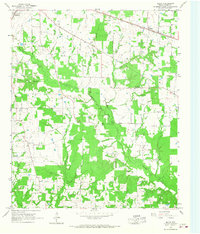
USGS Historical Quadrangle in GeoPDF.
Tags: 7.5 x 7.5 minute,
Downloadable Data,
GeoPDF,
GeoTIFF,
Historical Topographic Maps, All tags...
Historical Topographic Maps 7.5 x 7.5 Minute Map Series,
Malta,
Map,
TX,
imageryBaseMapsEarthCover, Fewer tags
|
|

