Filters: Tags: MINERAL (X)
795 results (76ms)|
Filters
Date Range
Extensions Types
Contacts
Categories Tag Types
|
We examined bird and bat mortality at a new 89-turbine windfarm constructed in an environmentally sensitive area in north-central Iowa. The windfarm became operational in November 2001. It is located in cropland between three Wildlife Management Areas (WMA's) with historically high bird use. In the past, migrant and resident waterfowl, shorebirds, raptors, and songbirds moved between the WMA's through the area now occupied by the windfarm. Studies of bird collision mortality in California and elsewhere raised concerns about the possibility of mortalities in this area. From April 15, 2003 and December 15, 2003 we searched for dead animals under 26 randomly selected turbines. Six 76.2 m by 3.0 m transects were maintained...
Categories: Publication;
Types: Citation;
Tags: Aqueous,
Carbon dioxide,
carbonation,
mineral,
sequestration,
Exergoenvironmental analysis for evaluation of the environmental impact of energy conversion systems
Societal dependence on oil leads to increasingly negative social consequences throughout the world, including climate change, air pollution, political and economic instability, and habitat degradation. Reliance on the automobile for transportation also contributes to a sedentary lifestyle, an obesity epidemic and poor health. These problems are particularly pronounced in the USA, which currently consumes c. 27% of global oil production and produces c. 25% of global carbon emissions, and where c. 65% of adults are overweight or obese. Other countries throughout the world that replicate or hope to replicate the automobile-based lifestyle of the USA face similar problems now or in the near future. This paper develops...
Categories: Publication;
Types: Citation;
Tags: Earth,
Exergoecology,
accounting,
approach,
capital,
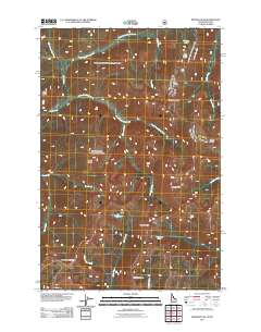
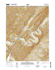
Layered GeoPDF 7.5 Minute Quadrangle Map. Layers of geospatial data include orthoimagery, roads, grids, geographic names, elevation contours, hydrography, and other selected map features.
Layered GeoPDF 7.5 Minute Quadrangle Map. Layers of geospatial data include orthoimagery, roads, grids, geographic names, elevation contours, hydrography, and other selected map features.
Layered GeoPDF 7.5 Minute Quadrangle Map. Layers of geospatial data include orthoimagery, roads, grids, geographic names, elevation contours, hydrography, and other selected map features.
Layered GeoPDF 7.5 Minute Quadrangle Map. Layers of geospatial data include orthoimagery, roads, grids, geographic names, elevation contours, hydrography, and other selected map features.
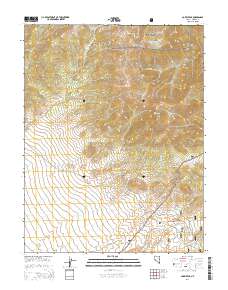
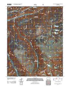
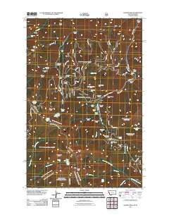
Layered GeoPDF 7.5 Minute Quadrangle Map. Layers of geospatial data include orthoimagery, roads, grids, geographic names, elevation contours, hydrography, and other selected map features.
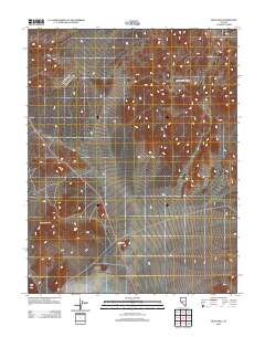
Layered GeoPDF 7.5 Minute Quadrangle Map. Layers of geospatial data include orthoimagery, roads, grids, geographic names, elevation contours, hydrography, and other selected map features.
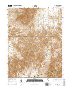
Layered GeoPDF 7.5 Minute Quadrangle Map. Layers of geospatial data include orthoimagery, roads, grids, geographic names, elevation contours, hydrography, and other selected map features.
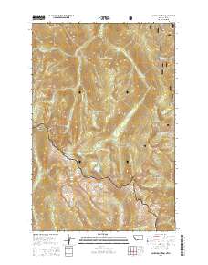
Layered GeoPDF 7.5 Minute Quadrangle Map. Layers of geospatial data include orthoimagery, roads, grids, geographic names, elevation contours, hydrography, and other selected map features.
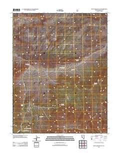
Layered geospatial PDF Map. Layers of geospatial data include orthoimagery, roads, grids, geographic names, elevation contours, hydrography, and other selected map features.
Layered GeoPDF 7.5 Minute Quadrangle Map. Layers of geospatial data include orthoimagery, roads, grids, geographic names, elevation contours, hydrography, and other selected map features.
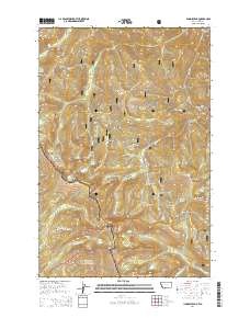
Layered GeoPDF 7.5 Minute Quadrangle Map. Layers of geospatial data include orthoimagery, roads, grids, geographic names, elevation contours, hydrography, and other selected map features.
Layered GeoPDF 7.5 Minute Quadrangle Map. Layers of geospatial data include orthoimagery, roads, grids, geographic names, elevation contours, hydrography, and other selected map features.
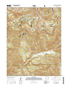
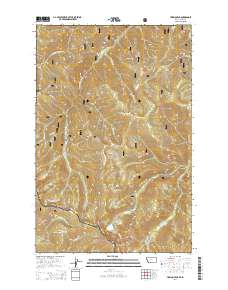
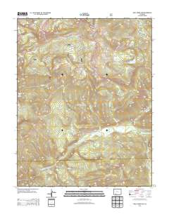
Layered geospatial PDF Map. Layers of geospatial data include orthoimagery, roads, grids, geographic names, elevation contours, hydrography, and other selected map features.
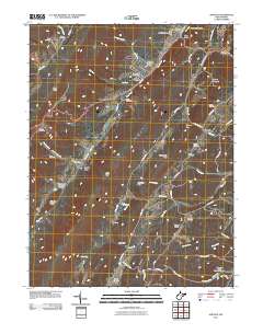
Layered GeoPDF 7.5 Minute Quadrangle Map. Layers of geospatial data include orthoimagery, roads, grids, geographic names, elevation contours, hydrography, and other selected map features.
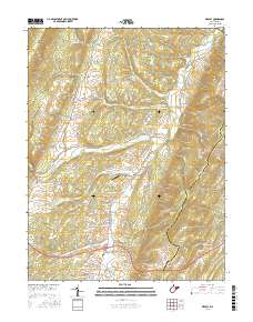
Layered geospatial PDF Map. Layers of geospatial data include orthoimagery, roads, grids, geographic names, elevation contours, hydrography, and other selected map features.

Layered geospatial PDF Map. Layers of geospatial data include orthoimagery, roads, grids, geographic names, elevation contours, hydrography, and other selected map features.
|

|
