Filters: Tags: Maryland (X) > Date Range: {"choice":"month"} (X)
40 results (104ms)|
Filters
Contacts
(Less)
|
Nest number, description of nest structure and location, longitude, latitude, dates of observations, presence of adults, eggs, nestlings, outcome of reproductive effort, number of young fledged, and osprey nest platforms occupied by Canada geese.
Categories: Data;
Tags: Chesapeake Bay,
Maryland,
USGS Science Data Catalog (SDC),
biota,
bird conservation,

The High Resolution National Hydrography Dataset Plus (NHDPlus HR) is an integrated set of geospatial data layers, including the National Hydrography Dataset (NHD), National Watershed Boundary Dataset (WBD), and 3D Elevation Program Digital Elevation Model (3DEP DEM). The NHDPlus HR combines the NHD, 3DEP DEMs, and WBD to a data suite that includes the NHD stream network with linear referencing functionality, the WBD hydrologic units, elevation-derived catchment areas for each stream segment, "value added attributes" (VAAs), and other features that enhance hydrologic data analysis and routing.
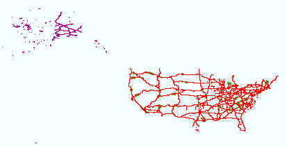
Layers of geospatial data include roads, airports, trails, and railroads.
This dataset was developed to estimate point-source total nitrogen and phosphorous loads to streams in the conterminous United States (U.S.) from December 1999 to November 2020. This dataset uses discharge and concentration information from point sources to streams in the conterminous United States from the U.S. Environmental Protection Agency (EPA) Integrated Compliance Information System - Permit Compliance System (ICIS-PCS) database. Nutrient concentrations were used to calculate point source loads. However, measured concentration data was often not available so “typical pollutant concentrations” (TPCs) were developed using concentration data from the same facility but a different time or from similar facilities....

The High Resolution National Hydrography Dataset Plus (NHDPlus HR) is an integrated set of geospatial data layers, including the National Hydrography Dataset (NHD), National Watershed Boundary Dataset (WBD), and 3D Elevation Program Digital Elevation Model (3DEP DEM). The NHDPlus HR combines the NHD, 3DEP DEMs, and WBD to a data suite that includes the NHD stream network with linear referencing functionality, the WBD hydrologic units, elevation-derived catchment areas for each stream segment, "value added attributes" (VAAs), and other features that enhance hydrologic data analysis and routing.
This imagery dataset consists of 3-meter resolution, lidar-derived imagery of the Kingwood 30 x 60 minute quadrangle in West Virginia and Maryland. The source data used to construct this imagery consists of 1-meter lidar-derived digital elevation models (DEMs). The lidar source data were compiled from different acquisitions published between 2020 and 2023. The data were processed using geographic information systems (GIS) software. The data is projected in WGS 1984. This representation illustrates the terrain as a hillshade with contrast adjusted to highlight local relief according to a topographic position index (TPI) calculation.
Categories: Data,
Data Release - In Progress;
Types: Downloadable,
GeoTIFF,
Map Service,
OGC WFS Layer,
OGC WMS Layer,
OGC WMS Service,
Raster;
Tags: Economic Geology,
Environmental Health,
Geography,
Geomorphology,
Land Use Change,
Note: this data release has been deprecated. Please see new data release here: https://doi.org/10.5066/P9Y2HOUJ. These data were originally released on the Water Mission Area National Spatial Data Infrastructure (NSDI) Node and were migrated to ScienceBase in 2023. This data release has since been identified as a duplicate record stemming from the migration of two distinct offerings of identical data on the NSDI node. These data were released prior to the October 1, 2016 effective date for the USGS’s policy dictating the review, approval, and release of scientific data as referenced in USGS Survey Manual Chapter 502.8 Fundamental Science Practices: Review and Approval of Scientific Data for Release. This map...
U. S. Geological Survey (USGS) scientists completed a data collection campaign from the 25th of April to the 10th of June in 2022, using various methods to record geomorphic and habitat indicators throughout 30 streams on the Delmarva Peninsula. Field methods included GNSS surveys, gravelometer-based pebble count readings, visual assessments, and riparian analyses. This metadata record contains all raw observations from the campaign as well as numerous summary metrics to be used in model development. Those "model-ready" data can be found in Delmarva_Model_Deliverable.csv in the parent item, while the two child items containing raw in-channel observations and raw survey data. Attached to this release is a data dictionary...
Categories: Data;
Tags: Chesapeake Bay,
Chesapeake Bay,
Delaware,
Delmarva Peninsula,
GPS measurement,

Layers of geospatial data include roads, airports, trails, and railroads.
National watershed boundary (HUC12) dataset for the conterminous United States, retrieved 10/26/2020
This child item provides a snapshot of the watershed boundary dataset which consists of a shapefile with 87,020 12-digit hydrologic unit codes (HUC12) for the conterminous United States retrieved 10/26/2020. The National Watershed Boundary Dataset (WBD) is a comprehensive set of digital spatial data that represents the surface drainages areas of the United States. Although versions of the WBD are published as part of U.S. Geological Survey National Hydrography Products, the version used to produce the water-use reanalysis was not archived and is provided here. This dataset is part of a larger data release using machine learning to predict public supply water use for 12-digit hydrologic units from 2000-2020. Public-supply...
This child item describes Python code used to retrieve gridMET climate data for a specific area and time period. Climate data were retrieved for public-supply water service areas, but the climate data collector could be used to retrieve data for other areas of interest. This dataset is part of a larger data release using machine learning to predict public supply water use for 12-digit hydrologic units from 2000-2020. Data retrieved by the climate data collector code were used as input feature variables in the public supply delivery and water use machine learning models. This page includes the following file: climate_data_collector.zip - a zip file containing the climate data collector Python code used to retrieve...
This child item describes R code used to determine public supply consumptive use estimates. Consumptive use was estimated by scaling an assumed fraction of deliveries used for outdoor irrigation by spatially explicit estimates of evaporative demand using estimated domestic and commercial, industrial, and institutional deliveries from the public supply delivery machine learning model child item. This method scales public supply water service area outdoor water use by the relationship between service area gross reference evapotranspiration provided by GridMET and annual continental U.S. (CONUS) growing season maximum evapotranspiration. This relationship to climate at the CONUS scale could result in over- or under-estimation...
This data release presents chemical results from investigations of surface-water quality in the Potomac River watershed (encompassing Washington, D.C. and parts of West Virginia, Virginia, Pennsylvania, and Maryland) conducted during low-flow conditions in July through September of 2022 and modeling results that support interpretative products. Water-quality sampling: A sampling campaign was conducted at 32 stream sites throughout the watershed (Table 1). A suite of field parameters and inorganic and organic chemical characteristics at each site were characterized using seven separate analytical methods at five laboratories (Table 2). The water-quality results are presented in Table 3. Analytical methods and laboratories...
U. S. Geological Survey (USGS) scientists completed a data collection campaign from the 25th of April to the 10th of June in 2022, using various methods to record geomorphic and habitat indicators throughout 30 streams on the Delmarva Peninsula. Field methods included GNSS surveys, gravelometer-based pebble count readings, visual assessments, and riparian analyses. These data contain all raw field metrics from the in-channel habitat assessment as well as the rapid riparian assessment. Any use of trade, firm, or product names is for descriptive purposes only and does not imply endorsement by the U.S. Government.
This data set describes accession numbers for nucleotide sequence data derived from whole mitochondrial genome and double digest restriction-site associated DNA (ddRAD).
This child item describes a machine learning model that was developed to estimate public-supply water use by water service area (WSA) boundary and 12-digit hydrologic unit code (HUC12) for the conterminous United States. This model was used to develop an annual and monthly reanalysis of public supply water use for the period 2000-2020. This data release contains model input feature datasets, python codes used to develop and train the water use machine learning model, and output water use predictions by HUC12 and WSA. Public supply water use estimates and statistics files for HUC12s are available on this child item landing page. Public supply water use estimates and statistics for WSAs are available in public_water_use_model.zip....
This child item describes R code used to determine water source fractions (groundwater (GW), surface water (SW), or spring (SP)) for public-supply water service areas, counties, and 12-digit hydrologic unit codes (HUC12) using information from a proprietary dataset from the U.S. Environmental Protection Agency. Water-use volumes per source were not available from public-supply systems so water source fractions were calculated by the number of withdrawal source types (GW/SW). For example, for a public supply system with three SW intakes and one GW well, the fractions would be 0.75 SW and 0.25 GW. This dataset is part of a larger data release using machine learning to predict public supply water use for 12-digit hydrologic...
Freshwater salinization is an emerging water quality issue for non-tidal streams and rivers in the Chesapeake Bay watershed (CBW), USA region. A model was developed to predict specific conductance (SC; a proxy for salinity) conditions across the CBW and departures from background SC. Discrete observations of SC from 1999-2016 were acquired from a published SC data inventory and explanatory variables describing sources of SC were compiled from several sources. Random forests modeling was conducted to predict SC at four time periods (1999-2001, 2004-2006, 2009-2011, and 2014-2016) at all non-tidal National Hydrography Dataset Plus Version 2.1 (NHDPlusV2.1; 1:100K scale) stream reaches. These predictions were then...
Categories: Data;
Tags: Chesapeake Bay watershed,
Delaware,
District of Columbia,
Ecology,
Geochemistry,
Geoheritage is a term which lies at the intersection of science, society, and sustainability and is applied to significant geologic features and landforms that have scientific, educational, cultural, economic, and aesthetic value. Many geologic sites have enriched society through the geoheritage values: scientific research and education, cultural significance, economic opportunities, and aesthetic appeal. The Geoheritage Sites of the Nation geodatabase (GDB) provides an initial inventory of geoheritage sites to showcase the geodiversity and natural heritage throughout the United States (U.S.) and its territories. Sites included in this inventory were selected from compiled geosite references of in situ geologic...

The High Resolution National Hydrography Dataset Plus (NHDPlus HR) is an integrated set of geospatial data layers, including the best available National Hydrography Dataset (NHD), the 10-meter 3D Elevation Program Digital Elevation Model (3DEP DEM), and the National Watershed Boundary Dataset (WBD). The NHDPlus HR combines the NHD, 3DEP DEMs, and WBD to create a stream network with linear referencing, feature naming, "value added attributes" (VAAs), elevation-derived catchments, and other features for hydrologic data analysis. The stream network with linear referencing is a system of data relationships applied to hydrographic systems so that one stream reach "flows" into another and "events" can be tied to and traced...
|

|
