Filters
Date Range
Types
Contacts
Categories
Tag Types
Tag Schemes
|
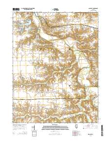
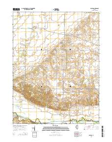
Layered GeoPDF 7.5 Minute Quadrangle Map. Layers of geospatial data include orthoimagery, roads, grids, geographic names, elevation contours, hydrography, and other selected map features.
Tags: 7.5 x 7.5 minute,
Downloadable Data,
EarthCover,
East Elm Creek, TX,
GeoPDF, All tags...
Imagery and Base Maps,
Map,
Menard,
Texas,
U.S. National Grid,
US,
US Topo,
US Topo Historical,
United States,
contour,
geographic names,
hydrography,
orthoimage,
topographic,
transportation, Fewer tags
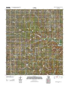
Layered GeoPDF 7.5 Minute Quadrangle Map. Layers of geospatial data include orthoimagery, roads, grids, geographic names, elevation contours, hydrography, and other selected map features.
Tags: 7.5 x 7.5 minute,
Downloadable Data,
EarthCover,
East Elm Creek, TX,
GeoPDF, All tags...
Imagery and Base Maps,
Map,
Menard,
Public Land Survey System,
Texas,
U.S. National Grid,
US,
US Topo,
US Topo Historical,
United States,
boundary,
contour,
geographic names,
hydrography,
imageryBaseMapsEarthCover,
orthoimage,
structures,
topographic,
transportation,
woodland, Fewer tags
Layered GeoPDF 7.5 Minute Quadrangle Map. Layers of geospatial data include orthoimagery, roads, grids, geographic names, elevation contours, hydrography, and other selected map features.
Tags: 7.5 x 7.5 minute,
Concho,
Downloadable Data,
EarthCover,
Eden SW, TX, All tags...
GeoPDF,
Imagery and Base Maps,
Map,
Menard,
Public Land Survey System,
Texas,
U.S. National Grid,
US,
US Topo,
US Topo Historical,
United States,
boundary,
contour,
geographic names,
hydrography,
imageryBaseMapsEarthCover,
orthoimage,
structures,
topographic,
transportation,
woodland, Fewer tags
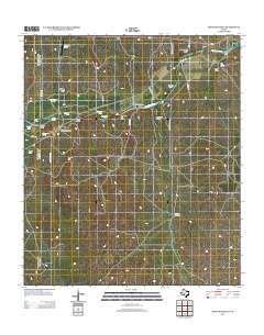
Layered GeoPDF 7.5 Minute Quadrangle Map. Layers of geospatial data include orthoimagery, roads, grids, geographic names, elevation contours, hydrography, and other selected map features.
Tags: 7.5 x 7.5 minute,
Downloadable Data,
EarthCover,
Fort McKavett, TX,
GeoPDF, All tags...
Imagery and Base Maps,
Map,
Menard,
Public Land Survey System,
Schleicher,
Texas,
U.S. National Grid,
US,
US Topo,
US Topo Historical,
United States,
boundary,
contour,
geographic names,
hydrography,
imageryBaseMapsEarthCover,
orthoimage,
structures,
topographic,
transportation,
woodland, Fewer tags
Layered GeoPDF 7.5 Minute Quadrangle Map. Layers of geospatial data include orthoimagery, roads, grids, geographic names, elevation contours, hydrography, and other selected map features.
Tags: 7.5 x 7.5 minute,
Downloadable Data,
EarthCover,
GeoPDF,
Illinois, All tags...
Imagery and Base Maps,
Map,
Menard,
Public Land Survey System,
Salisbury, IL,
Sangamon,
U.S. National Grid,
US,
US Topo,
US Topo Historical,
United States,
boundary,
contour,
geographic names,
hydrography,
imageryBaseMapsEarthCover,
orthoimage,
structures,
topographic,
transportation,
woodland, Fewer tags
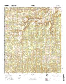
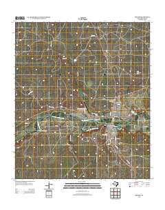
Layered GeoPDF 7.5 Minute Quadrangle Map. Layers of geospatial data include orthoimagery, roads, grids, geographic names, elevation contours, hydrography, and other selected map features.
Tags: 7.5 x 7.5 minute,
Brewer Hollow, TX,
Downloadable Data,
EarthCover,
GeoPDF, All tags...
Imagery and Base Maps,
Kimble,
Map,
Menard,
Public Land Survey System,
Texas,
U.S. National Grid,
US,
US Topo,
US Topo Historical,
United States,
boundary,
contour,
geographic names,
hydrography,
imageryBaseMapsEarthCover,
orthoimage,
structures,
topographic,
transportation,
woodland, Fewer tags
Layered GeoPDF 7.5 Minute Quadrangle Map. Layers of geospatial data include orthoimagery, roads, grids, geographic names, elevation contours, hydrography, and other selected map features.
Tags: 7.5 x 7.5 minute,
Biggs, IL,
Downloadable Data,
EarthCover,
GeoPDF, All tags...
Illinois,
Imagery and Base Maps,
Map,
Mason,
Menard,
U.S. National Grid,
US,
US Topo,
US Topo Historical,
United States,
contour,
geographic names,
hydrography,
imageryBaseMapsEarthCover,
orthoimage,
structures,
topographic,
transportation, Fewer tags
Layered GeoPDF 7.5 Minute Quadrangle Map. Layers of geospatial data include orthoimagery, roads, grids, geographic names, elevation contours, hydrography, and other selected map features.
Tags: 7.5 x 7.5 minute,
Downloadable Data,
EarthCover,
GeoPDF,
Imagery and Base Maps, All tags...
Map,
Menard,
Spoon Draw, TX,
Texas,
U.S. National Grid,
US,
US Topo,
US Topo Historical,
United States,
contour,
geographic names,
hydrography,
orthoimage,
topographic,
transportation, Fewer tags
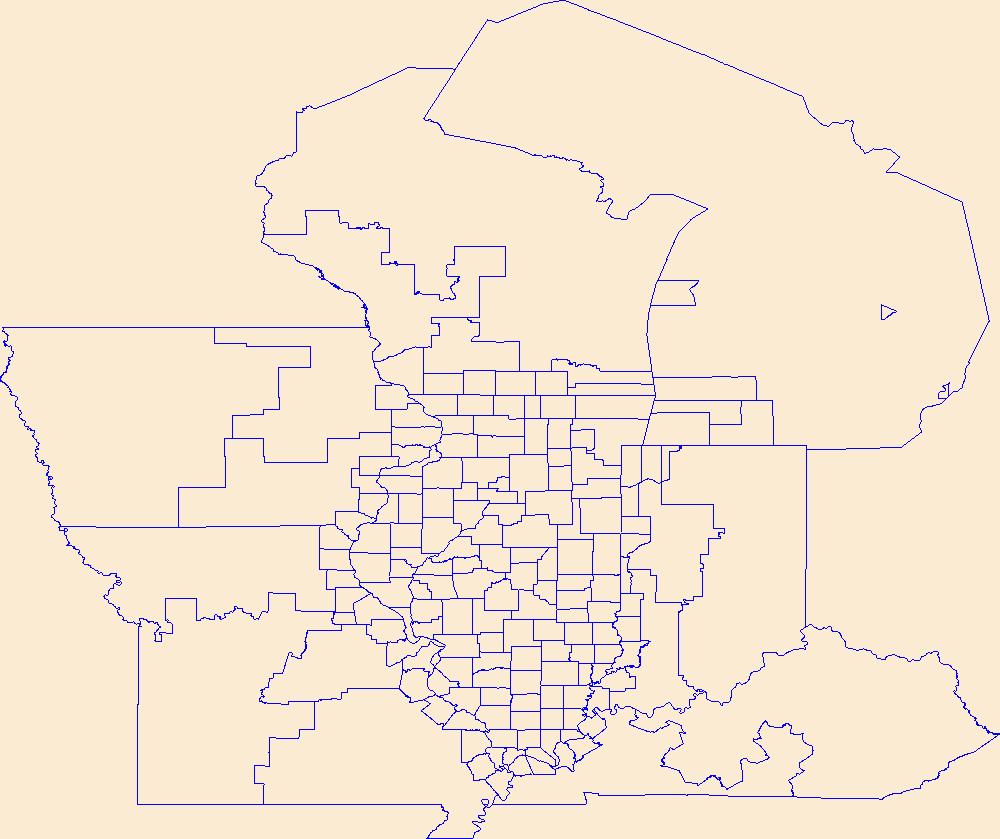
Geospatial data is comprised of government boundaries.
Tags: Adams,
Alexander,
Bond,
Boone,
Boundaries, All tags...
Brown,
Bureau,
Calhoun,
Carroll,
Cass,
Champaign,
Christian,
Clark,
Clay,
Clinton,
Coles,
Cook,
County or Equivalent,
Crawford,
Cumberland,
De Witt,
DeKalb,
Douglas,
Downloadable Data,
DuPage,
Edgar,
Edwards,
Effingham,
Esri Shapefile nan,
Fayette,
Ford,
Franklin,
Fulton,
Gallatin,
Greene,
Grundy,
Hamilton,
Hancock,
Hardin,
Henderson,
Henry,
IL,
Illinois,
Incorporated Place,
Iroquois,
Jackson,
Jasper,
Jefferson,
Jersey,
Jo Daviess,
Johnson,
Jurisdictional,
Kane,
Kankakee,
Kendall,
Knox,
LaSalle,
Lake,
Lawrence,
Lee,
Livingston,
Logan,
Macon,
Macoupin,
Madison,
Marion,
Marshall,
Mason,
Massac,
McDonough,
McHenry,
McLean,
Menard,
Mercer,
Minor Civil Division,
Monroe,
Montgomery,
Morgan,
Moultrie,
National Boundary Dataset (NBD),
National Boundary Dataset (NBD),
Native American Area,
Ogle,
PLSS First Division,
PLSS Special Survey,
PLSS Township,
Peoria,
Perry,
Piatt,
Pike,
Pope,
Public Land Survey System,
Pulaski,
Putnam,
Randolph,
Reserve,
Richland,
Rock Island,
Saline,
Sangamon,
Schuyler,
Scott,
Shapefile,
Shelby,
St. Clair,
Stark,
State,
State,
State or Territory,
Stephenson,
Tazewell,
U.S. National Grid,
US,
Unincorporated Place,
Union,
United States,
Vermilion,
Wabash,
Warren,
Washington,
Wayne,
White,
Whiteside,
Will,
Williamson,
Winnebago,
Woodford,
boundaries,
boundary,
cadastral surveys,
geographic names,
land ownership,
land use maps,
legal land descriptions,
political and administrative boundaries,
zoning maps, Fewer tags
Geospatial data includes structures and other selected map features.
Tags: Adams,
Alexander,
Bond,
Boone,
Brown, All tags...
Bureau,
Calhoun,
Campground,
Carroll,
Cass,
Champaign,
Christian,
Clark,
Clay,
Clinton,
Coles,
College / University,
Cook,
Courthouse,
Crawford,
Cumberland,
De Witt,
DeKalb,
Douglas,
Downloadable Data,
DuPage,
Edgar,
Edwards,
Effingham,
Fayette,
Fire Station/ EMS Station,
Ford,
Franklin,
Fulton,
Gallatin,
GeoPackage,
Greene,
Grundy,
Hamilton,
Hancock,
Hardin,
Henderson,
Henry,
Hospital/Medical Center,
IL,
Illinois,
Information Center,
Iroquois,
Jackson,
Jasper,
Jefferson,
Jersey,
Jo Daviess,
Johnson,
Kane,
Kankakee,
Kendall,
Knox,
LaSalle,
Lake,
Law Enforcement,
Lawrence,
Lee,
Livingston,
Logan,
Macon,
Macoupin,
Madison,
Marion,
Marshall,
Mason,
Massac,
McDonough,
McHenry,
McLean,
Menard,
Mercer,
Monroe,
Montgomery,
Morgan,
Moultrie,
National Structures Dataset (NSD),
National Structures Dataset (NSD),
Ogle,
Open Geospatial Consortium GeoPackage 1.2,
Peoria,
Perry,
Piatt,
Pike,
Pope,
Post Office,
Prison/ Correctional Facility,
Pulaski,
Putnam,
Randolph,
Richland,
Rock Island,
Saline,
Sangamon,
School,
School:Elementary,
School:High School,
School:Middle School,
Schuyler,
Scott,
Shelby,
St. Clair,
Stark,
State,
State,
State Capitol,
Stephenson,
Structures,
Tazewell,
Technical School,
Town Hall,
Trade School,
Trailhead,
US,
Union,
United States,
Vermilion,
Visitor Center,
Wabash,
Warren,
Washington,
Wayne,
White,
Whiteside,
Will,
Williamson,
Winnebago,
Woodford,
structure, Fewer tags

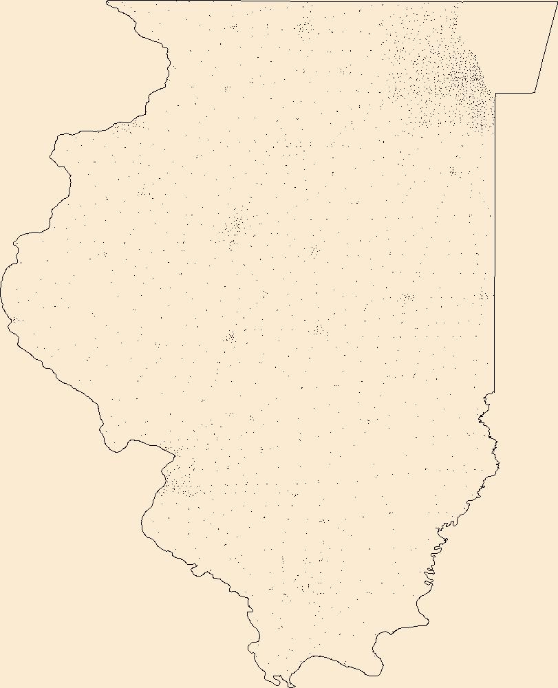
The Geographic Names Information System (GNIS) is the Federal standard for geographic nomenclature. The U.S. Geological Survey developed the GNIS for the U.S. Board on Geographic Names, a Federal inter-agency body chartered by public law to maintain uniform feature name usage throughout the Government and to promulgate standard names to the public. The GNIS is the official repository of domestic geographic names data; the official vehicle for geographic names use by all departments of the Federal Government; and the source for applying geographic names to Federal electronic and printed products of all types.
Tags: Adams,
Alexander,
Antarctica,
Antarctica,
BGN, All tags...
Board on Geographic Names,
Bond,
Boone,
Borough,
Brown,
Bureau,
Calhoun,
Carroll,
Cass,
Census Area,
Champaign,
Christian,
Clark,
Clay,
Clinton,
Coles,
Commonwealth,
Cook,
County,
Crawford,
Cumberland,
De Witt,
DeKalb,
District,
Douglas,
Downloadable Data,
DuPage,
Edgar,
Edwards,
Effingham,
Fayette,
Feature class,
Feature coordinates,
Feature county,
Feature description,
Feature designation,
Feature history,
Feature indentification,
Feature name,
Feature state,
Ford,
Franklin,
Fulton,
GNIS,
Gallatin,
Geographic Names,
Geographic Names Federal Codes,
Geographic Names Information System,
Geographic feature,
Geographic name,
Geographical feature,
Geographical name,
Greene,
Grundy,
Hamilton,
Hancock,
Hardin,
Henderson,
Henry,
IL,
Illinois,
Iroquois,
Jackson,
Jasper,
Jefferson,
Jersey,
Jo Daviess,
Johnson,
Kane,
Kankakee,
Kendall,
Knox,
LaSalle,
Lake,
Lawrence,
Lee,
Livingston,
Logan,
Macon,
Macoupin,
Madison,
Marion,
Marshall,
Mason,
Massac,
McDonough,
McHenry,
McLean,
Menard,
Mercer,
Monroe,
Montgomery,
Morgan,
Moultrie,
Municipio,
National Geographic Names Information System (GNIS),
National Geographic Names Information System (GNIS),
Official feature name,
Ogle,
Outlying Area,
Parish,
Peoria,
Perry,
Piatt,
Pike,
Place name,
Pope,
Populated Place,
Pulaski,
Putnam,
Randolph,
Richland,
Rock Island,
Saline,
Sangamon,
Schuyler,
Scott,
Shelby,
St. Clair,
Stark,
State,
Stephenson,
TXT (pipes),
Tazewell,
Territories,
Territory,
Topographic Map,
U.S. Board on Geographic Names,
U.S. Geological Survey,
US,
USA,
USBGN,
USGS,
UTF-8 Pipe Delimited Text File nan,
Union,
United States,
United States,
United States,
Variant name,
Vermilion,
Wabash,
Warren,
Washington,
Wayne,
White,
Whiteside,
Will,
Williamson,
Winnebago,
Woodford,
antarctic,
database,
economy,
environment,
feature,
gazetteer,
geographic,
geographic names,
geographical,
geography,
geospatial,
imageryBaseMapsEarthCover,
inlandWaters,
location,
map,
name,
place,
placename,
society,
structure,
topographic map,
toponymy, Fewer tags
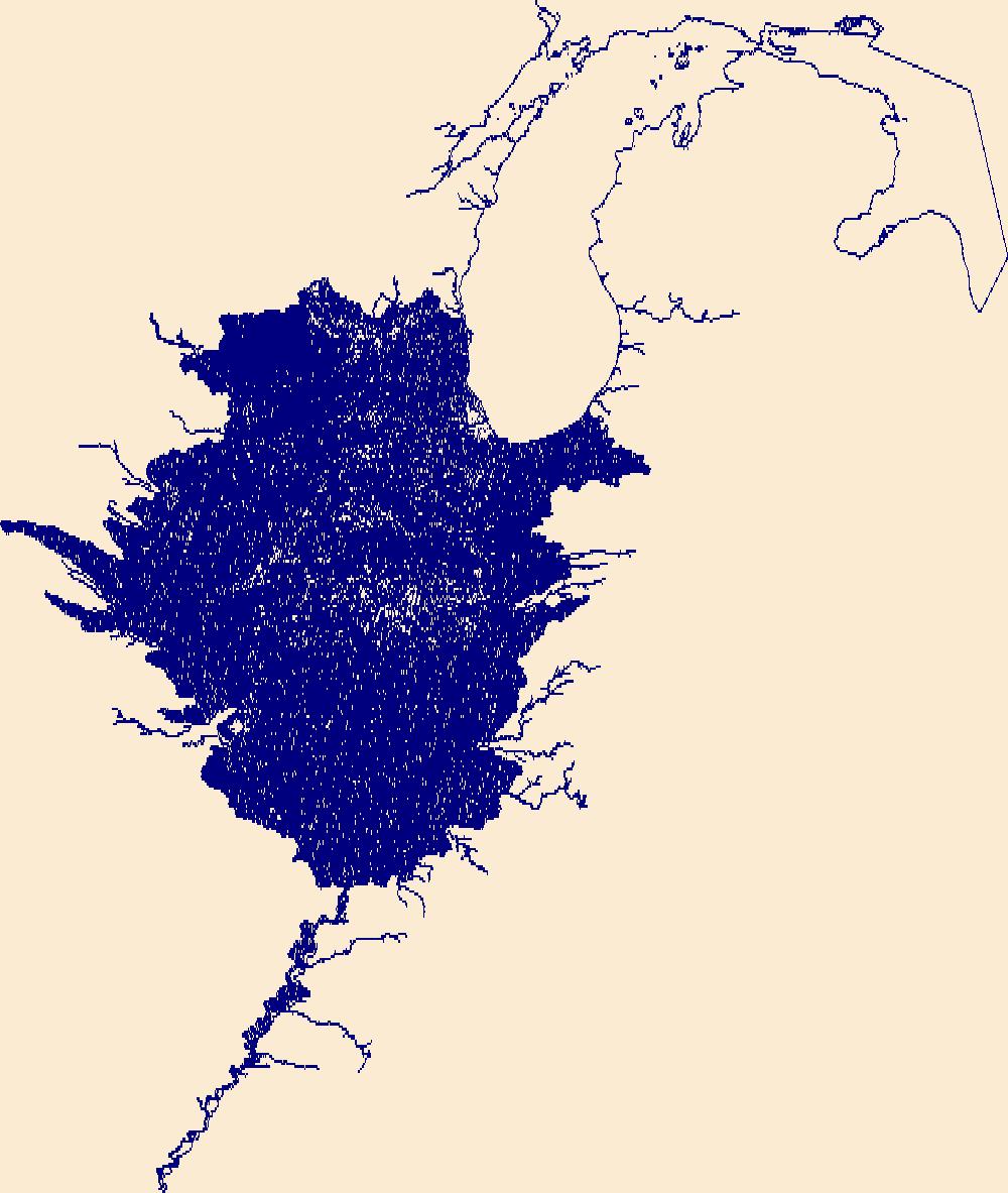
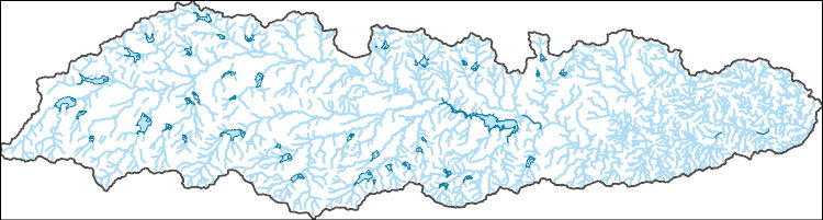
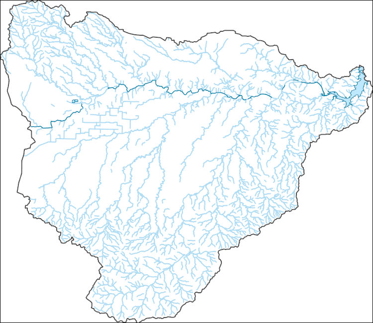
The National Hydrography Dataset (NHD) is a feature-based database that interconnects and uniquely identifies the stream segments or reaches that make up the nation's surface water drainage system. NHD data was originally developed at 1:100,000-scale and exists at that scale for the whole country. This high-resolution NHD, generally developed at 1:24,000/1:12,000 scale, adds detail to the original 1:100,000-scale NHD. (Data for Alaska, Puerto Rico and the Virgin Islands was developed at high-resolution, not 1:100,000 scale.) Local resolution NHD is being developed where partners and data exist. The NHD contains reach codes for networked features, flow direction, names, and centerline representations for areal water...
Tags: Adams,
Administrative watershed units,
Administrative watershed units,
Alexander,
Area of Complex Channels, All tags...
Area to be submerged,
Basin,
Basin,
Bay/Inlet,
Bond,
Boone,
Boundaries,
Boundary,
Bridge,
Brown,
Bureau,
Calhoun,
Canal/Ditch,
Carroll,
Cass,
Champaign,
Christian,
Clark,
Clay,
Clinton,
Coastline,
Coles,
Connector,
Cook,
Crawford,
Cumberland,
Dam/Weir,
De Witt,
DeKalb,
Douglas,
Downloadable Data,
Drainage areas for surface water,
Drainageway,
DuPage,
Edgar,
Edwards,
Effingham,
Estuary,
Fayette,
Flow direction network,
Flume,
Ford,
ForeShore,
Franklin,
Fulton,
Gaging Station,
Gallatin,
Gate,
GeoPackage,
Greene,
Grundy,
HU10,
HU12,
HU14,
HU16,
HU2,
HU4,
HU6,
HU8,
HUC,
Hamilton,
Hancock,
Hardin,
Hazard Zone,
Henderson,
Henry,
Hydrographic,
Hydrography,
Hydrography,
Hydrography,
Hydrologic Unit Code,
Hydrologic Units,
IL,
Ice mass,
Illinois,
Inundation Area,
Iroquois,
Jackson,
Jasper,
Jefferson,
Jersey,
Jo Daviess,
Johnson,
Kane,
Kankakee,
Kendall,
Knox,
LaSalle,
Lake,
Lawrence,
Lee,
Levee,
Line,
Livingston,
Lock Chamber,
Logan,
Macon,
Macoupin,
Madison,
Marion,
Marsh,
Marshall,
Mason,
Massac,
McDonough,
McHenry,
McLean,
Menard,
Mercer,
Monroe,
Montgomery,
Morgan,
Moultrie,
National Hydrography Dataset (NHD),
National Hydrography Dataset (NHD) Best Resolution,
National Hydrography Dataset (NHD) Best Resolution,
Nonearthen Shore,
Ogle,
Open Geospatial Consortium GeoPackage 1.2,
Orthoimage,
Peoria,
Perry,
Piatt,
Pike,
Playa,
Point,
PointEvent,
Pond,
Pope,
Pulaski,
Putnam,
Randolph,
Rapids,
Rapids,
Reach,
Reach code,
Reef,
Region,
Reservoir,
Richland,
Rock,
Rock Island,
Saline,
Sangamon,
Schuyler,
Scott,
Sea/Ocean,
Shelby,
Sink/Rise,
Sounding Datum Line,
Special Use Zone,
Special Use Zone Limit,
Spillway,
St. Clair,
Stark,
State,
State,
State_Illinois,
Stephenson,
Stream,
Stream/River,
Sub-basin,
Sub-region,
Subbasin,
Submerged Stream,
Subregion,
Subwatershed,
Surface water systems,
Swamp,
Tazewell,
Topographic,
Tunnel,
US,
Underground Conduit,
Union,
United States,
Vermilion,
WBD,
WBD,
Wabash,
Wall,
Warren,
Wash,
Washington,
Water Intake Outflow,
Waterfall,
Watershed,
Watershed Boundaries,
Watershed Boundary Dataset,
Watershed Boundary Dataset,
Wayne,
Well,
White,
Whiteside,
Will,
Williamson,
Winnebago,
Woodford,
artificial path,
boundaries,
dams,
drainage systems and characteristics,
inlandWaters,
lakes,
ngda,
rivers, Fewer tags
The National Hydrography Dataset (NHD) is a feature-based database that interconnects and uniquely identifies the stream segments or reaches that make up the nation's surface water drainage system. NHD data was originally developed at 1:100,000-scale and exists at that scale for the whole country. This high-resolution NHD, generally developed at 1:24,000/1:12,000 scale, adds detail to the original 1:100,000-scale NHD. (Data for Alaska, Puerto Rico and the Virgin Islands was developed at high-resolution, not 1:100,000 scale.) Local resolution NHD is being developed where partners and data exist. The NHD contains reach codes for networked features, flow direction, names, and centerline representations for areal water...
Tags: Administrative watershed units,
Administrative watershed units,
Area of Complex Channels,
Area to be submerged,
Basin, All tags...
Basin,
Bay/Inlet,
Boundaries,
Boundary,
Bridge,
Canal/Ditch,
Coastline,
Concho,
Connector,
Dam/Weir,
Downloadable Data,
Drainage areas for surface water,
Drainageway,
Esri File GeoDatabase 10,
Estuary,
FileGDB,
Flow direction network,
Flume,
ForeShore,
Gaging Station,
Gate,
HU-8,
HU-8 Subbasin,
HU10,
HU12,
HU14,
HU16,
HU2,
HU4,
HU6,
HU8,
HU8_12090110,
HUC,
Hazard Zone,
Hydrographic,
Hydrography,
Hydrography,
Hydrography,
Hydrologic Unit Code,
Hydrologic Units,
Ice mass,
Inundation Area,
Levee,
Line,
Lock Chamber,
Marsh,
McCulloch,
Menard,
National Hydrography Dataset (NHD),
National Hydrography Dataset (NHD) Best Resolution,
National Hydrography Dataset (NHD) Best Resolution,
Nonearthen Shore,
Orthoimage,
Playa,
Point,
PointEvent,
Pond,
Rapids,
Rapids,
Reach,
Reach code,
Reef,
Region,
Reservoir,
Rock,
San Saba,
Sea/Ocean,
Sink/Rise,
Sounding Datum Line,
Special Use Zone,
Special Use Zone Limit,
Spillway,
Stream,
Stream/River,
Sub-basin,
Sub-region,
Subbasin,
Submerged Stream,
Subregion,
Subwatershed,
Surface water systems,
Swamp,
TX,
Texas,
Topographic,
Tunnel,
US,
Underground Conduit,
United States,
WBD,
WBD,
Wall,
Wash,
Water Intake Outflow,
Waterfall,
Watershed,
Watershed Boundaries,
Watershed Boundary Dataset,
Watershed Boundary Dataset,
Well,
artificial path,
boundaries,
dams,
drainage systems and characteristics,
inlandWaters,
lakes,
ngda,
rivers, Fewer tags
The National Hydrography Dataset (NHD) is a feature-based database that interconnects and uniquely identifies the stream segments or reaches that make up the nation's surface water drainage system. NHD data was originally developed at 1:100,000-scale and exists at that scale for the whole country. This high-resolution NHD, generally developed at 1:24,000/1:12,000 scale, adds detail to the original 1:100,000-scale NHD. (Data for Alaska, Puerto Rico and the Virgin Islands was developed at high-resolution, not 1:100,000 scale.) Local resolution NHD is being developed where partners and data exist. The NHD contains reach codes for networked features, flow direction, names, and centerline representations for areal water...
Tags: Administrative watershed units,
Administrative watershed units,
Area of Complex Channels,
Area to be submerged,
Basin, All tags...
Basin,
Bay/Inlet,
Boundaries,
Boundary,
Bridge,
Canal/Ditch,
Coastline,
Coke,
Concho,
Connector,
Dam/Weir,
Downloadable Data,
Drainage areas for surface water,
Drainageway,
Esri Shapefile nan,
Estuary,
Flow direction network,
Flume,
ForeShore,
Gaging Station,
Gate,
HU-8,
HU-8 Subbasin,
HU10,
HU12,
HU14,
HU16,
HU2,
HU4,
HU6,
HU8,
HU8_12090105,
HUC,
Hazard Zone,
Hydrographic,
Hydrography,
Hydrography,
Hydrography,
Hydrologic Unit Code,
Hydrologic Units,
Ice mass,
Inundation Area,
Levee,
Line,
Lock Chamber,
Marsh,
Menard,
National Hydrography Dataset (NHD),
National Hydrography Dataset (NHD) Best Resolution,
National Hydrography Dataset (NHD) Best Resolution,
Nonearthen Shore,
Orthoimage,
Playa,
Point,
PointEvent,
Pond,
Rapids,
Rapids,
Reach,
Reach code,
Reef,
Region,
Reservoir,
Rock,
Runnels,
Schleicher,
Sea/Ocean,
Shapefile,
Sink/Rise,
Sounding Datum Line,
Special Use Zone,
Special Use Zone Limit,
Spillway,
Stream,
Stream/River,
Sub-basin,
Sub-region,
Subbasin,
Submerged Stream,
Subregion,
Subwatershed,
Surface water systems,
Swamp,
TX,
Texas,
Tom Green,
Topographic,
Tunnel,
US,
Underground Conduit,
United States,
WBD,
WBD,
Wall,
Wash,
Water Intake Outflow,
Waterfall,
Watershed,
Watershed Boundaries,
Watershed Boundary Dataset,
Watershed Boundary Dataset,
Well,
artificial path,
boundaries,
dams,
drainage systems and characteristics,
inlandWaters,
lakes,
ngda,
rivers, Fewer tags
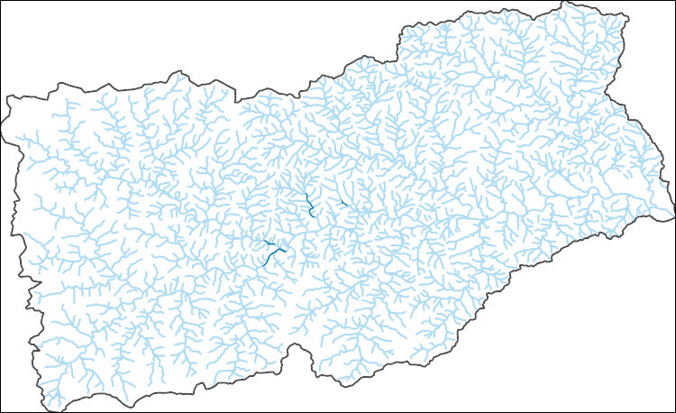
The National Hydrography Dataset (NHD) is a feature-based database that interconnects and uniquely identifies the stream segments or reaches that make up the nation's surface water drainage system. NHD data was originally developed at 1:100,000-scale and exists at that scale for the whole country. This high-resolution NHD, generally developed at 1:24,000/1:12,000 scale, adds detail to the original 1:100,000-scale NHD. (Data for Alaska, Puerto Rico and the Virgin Islands was developed at high-resolution, not 1:100,000 scale.) Local resolution NHD is being developed where partners and data exist. The NHD contains reach codes for networked features, flow direction, names, and centerline representations for areal water...
Tags: Administrative watershed units,
Administrative watershed units,
Area of Complex Channels,
Area to be submerged,
Basin, All tags...
Basin,
Bay/Inlet,
Boundaries,
Boundary,
Bridge,
Canal/Ditch,
Coastline,
Connector,
Dam/Weir,
Downloadable Data,
Drainage areas for surface water,
Drainageway,
Edwards,
Esri Shapefile nan,
Estuary,
Flow direction network,
Flume,
ForeShore,
Gaging Station,
Gate,
HU-8,
HU-8 Subbasin,
HU10,
HU12,
HU14,
HU16,
HU2,
HU4,
HU6,
HU8,
HU8_12090202,
HUC,
Hazard Zone,
Hydrographic,
Hydrography,
Hydrography,
Hydrography,
Hydrologic Unit Code,
Hydrologic Units,
Ice mass,
Inundation Area,
Kimble,
Levee,
Line,
Lock Chamber,
Marsh,
Menard,
National Hydrography Dataset (NHD),
National Hydrography Dataset (NHD) Best Resolution,
National Hydrography Dataset (NHD) Best Resolution,
Nonearthen Shore,
Orthoimage,
Playa,
Point,
PointEvent,
Pond,
Rapids,
Rapids,
Reach,
Reach code,
Reef,
Region,
Reservoir,
Rock,
Sea/Ocean,
Shapefile,
Sink/Rise,
Sounding Datum Line,
Special Use Zone,
Special Use Zone Limit,
Spillway,
Stream,
Stream/River,
Sub-basin,
Sub-region,
Subbasin,
Submerged Stream,
Subregion,
Subwatershed,
Surface water systems,
Sutton,
Swamp,
TX,
Texas,
Topographic,
Tunnel,
US,
Underground Conduit,
United States,
WBD,
WBD,
Wall,
Wash,
Water Intake Outflow,
Waterfall,
Watershed,
Watershed Boundaries,
Watershed Boundary Dataset,
Watershed Boundary Dataset,
Well,
artificial path,
boundaries,
dams,
drainage systems and characteristics,
inlandWaters,
lakes,
ngda,
rivers, Fewer tags
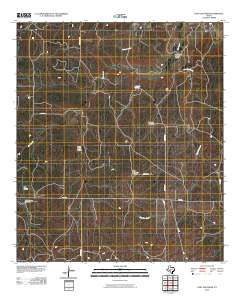
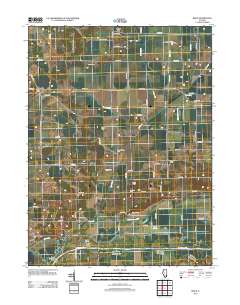
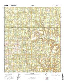
Layered GeoPDF 7.5 Minute Quadrangle Map. Layers of geospatial data include orthoimagery, roads, grids, geographic names, elevation contours, hydrography, and other selected map features.
Tags: 7.5 x 7.5 minute,
Downloadable Data,
EarthCover,
Easton, IL,
GeoPDF, All tags...
Illinois,
Imagery and Base Maps,
Map,
Mason,
Menard,
Public Land Survey System,
U.S. National Grid,
US,
US Topo,
US Topo Historical,
United States,
boundary,
contour,
geographic names,
hydrography,
imageryBaseMapsEarthCover,
orthoimage,
structures,
topographic,
transportation,
woodland, Fewer tags
Layered GeoPDF 7.5 Minute Quadrangle Map. Layers of geospatial data include orthoimagery, roads, grids, geographic names, elevation contours, hydrography, and other selected map features.
Tags: 7.5 x 7.5 minute,
Brewer Hollow, TX,
Downloadable Data,
EarthCover,
GeoPDF, All tags...
Imagery and Base Maps,
Kimble,
Map,
Menard,
Public Land Survey System,
Texas,
U.S. National Grid,
US,
US Topo,
US Topo Historical,
United States,
boundary,
contour,
geographic names,
hydrography,
imageryBaseMapsEarthCover,
orthoimage,
structures,
topographic,
transportation,
woodland, Fewer tags
Layered GeoPDF 7.5 Minute Quadrangle Map. Layers of geospatial data include orthoimagery, roads, grids, geographic names, elevation contours, hydrography, and other selected map features.
Tags: 7.5 x 7.5 minute,
Downloadable Data,
EarthCover,
GeoPDF,
Imagery and Base Maps, All tags...
Map,
McCulloch,
Menard,
Public Land Survey System,
Robbers Roost, TX,
Texas,
U.S. National Grid,
US,
US Topo,
US Topo Historical,
United States,
boundary,
contour,
geographic names,
hydrography,
imageryBaseMapsEarthCover,
orthoimage,
structures,
topographic,
transportation,
woodland, Fewer tags
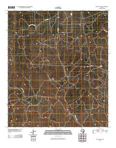
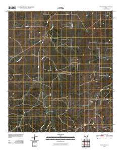
Layered GeoPDF 7.5 Minute Quadrangle Map. Layers of geospatial data include orthoimagery, roads, grids, geographic names, elevation contours, hydrography, and other selected map features.
Tags: 7.5 x 7.5 minute,
Downloadable Data,
EarthCover,
GeoPDF,
Imagery and Base Maps, All tags...
Kimble,
Map,
Menard,
Rust Ranch, TX,
Texas,
U.S. National Grid,
US,
US Topo,
US Topo Historical,
United States,
contour,
geographic names,
hydrography,
orthoimage,
topographic,
transportation, Fewer tags
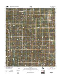
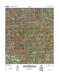
Layered GeoPDF 7.5 Minute Quadrangle Map. Layers of geospatial data include orthoimagery, roads, grids, geographic names, elevation contours, hydrography, and other selected map features.
Tags: 7.5 x 7.5 minute,
Downloadable Data,
EarthCover,
GeoPDF,
Imagery and Base Maps, All tags...
Map,
Menard,
Menard, TX,
Public Land Survey System,
Texas,
U.S. National Grid,
US,
US Topo,
US Topo Historical,
United States,
boundary,
contour,
geographic names,
hydrography,
imageryBaseMapsEarthCover,
orthoimage,
structures,
topographic,
transportation,
woodland, Fewer tags
|
|

