|
|
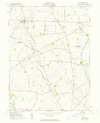
USGS Historical Quadrangle in GeoPDF.
Tags: 7.5 x 7.5 minute,
Downloadable Data,
GeoPDF,
GeoTIFF,
Historical Topographic Maps, All tags...
Historical Topographic Maps 7.5 x 7.5 Minute Map Series,
KY,
Map,
Midway,
imageryBaseMapsEarthCover, Fewer tags
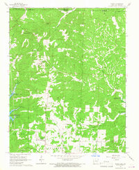
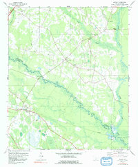
USGS Historical Quadrangle in GeoPDF.
Tags: 7.5 x 7.5 minute,
AR,
Downloadable Data,
GeoPDF,
GeoTIFF, All tags...
Historical Topographic Maps,
Historical Topographic Maps 7.5 x 7.5 Minute Map Series,
Map,
Midway,
imageryBaseMapsEarthCover, Fewer tags
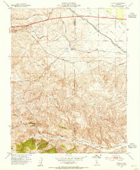
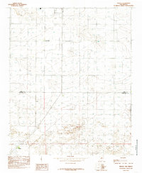
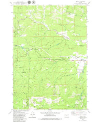
USGS Historical Quadrangle in GeoPDF.
Tags: 7.5 x 7.5 minute,
CA,
Downloadable Data,
GeoPDF,
GeoTIFF, All tags...
Historical Topographic Maps,
Historical Topographic Maps 7.5 x 7.5 Minute Map Series,
Map,
Midway,
imageryBaseMapsEarthCover, Fewer tags
Core Research Center, cutting HH01886, from well operated by PIONEER NATURAL RESOURCESRaw Properties from download, web scrape, MapServer, and Macrostrat API{"Lib Num": "HH01886", "API Num": "4228333475", "Operator": "PIONEER NATURAL RESOURCES", "Well Name": "WASHBURN RANCH 01 03H", "Field": "EAGLEVILLE", "State": "TX", "County": "LA SALLE", "Thin Sec": "F", "Analysis": "F", "Latitude": "28.35864", "Longitude": "-98.88636", "coordinates_geohash": "9v19mf91hc9s", "Source": "PROVIDED BY DONOR", "Min": "560", "Max": "17525", "Security Flag": "NO SPECIAL RESTRICTIONS", "crc_collection_name": "cutting", "sb_parent_id": "4f4e49d8e4b07f02db5df2d2", "intervals": [{"Formation": "EAGLE FORD", "Age": "CRETACEOUS", "Min Depth":...
Categories: Physical Item;
Tags: AUSTIN,
CRETACEOUS,
CRETACEOUS,
EAGLE FORD,
Holocene, All tags...
MIDWAY,
Modern alluvium,
TERTIARY,
TERTIARY,
TERTIARY,
WILCOX,
clay,
gravel,
sand,
silt, Fewer tags
Core Research Center, cutting HH01897, from well operated by PIONEER NATURAL RESOURCESRaw Properties from download, web scrape, MapServer, and Macrostrat API{"Lib Num": "HH01897", "API Num": "4228333911", "Operator": "PIONEER NATURAL RESOURCES", "Well Name": "WASHBURN RANCH 04 03H", "Field": "EAGLEVILLE", "State": "TX", "County": "LA SALLE", "Thin Sec": "F", "Analysis": "F", "Latitude": "28.378772", "Longitude": "-98.918317", "coordinates_geohash": "9v19mn1yk4sb", "Source": "PROVIDED BY DONOR", "Min": "200", "Max": "16710", "Security Flag": "NO SPECIAL RESTRICTIONS", "crc_collection_name": "cutting", "sb_parent_id": "4f4e49d8e4b07f02db5df2d2", "intervals": [{"Formation": "EAGLE FORD", "Age": "CRETACEOUS", "Min Depth":...
Categories: Physical Item;
Tags: ANACACHO,
AUSTIN,
CARRIZO,
CRETACEOUS,
CRETACEOUS, All tags...
CRETACEOUS,
EAGLE FORD,
Eocene,
MIDWAY,
TERTIARY,
TERTIARY,
TERTIARY,
WILCOX,
Yegua Formation,
Yegua Formation,
clay,
sandstone, Fewer tags
Core Research Center, cutting HH01905, from well operated by PIONEER NATURAL RESOURCESRaw Properties from download, web scrape, MapServer, and Macrostrat API{"Lib Num": "HH01905", "API Num": "4229735358", "Operator": "PIONEER NATURAL RESOURCES", "Well Name": "GEORGIA BUCK 01 05H", "Field": "EAGLEVILLE", "State": "TX", "County": "LIVE OAK", "Thin Sec": "F", "Analysis": "F", "Latitude": "28.67482", "Longitude": "-98.24856", "coordinates_geohash": "9v45hk1dftgu", "Source": "PROVIDED BY DONOR", "Min": "2100", "Max": "15370", "Security Flag": "NO SPECIAL RESTRICTIONS", "crc_collection_name": "cutting", "sb_parent_id": "4f4e49d8e4b07f02db5df2d2", "intervals": [{"Formation": "EAGLE FORD", "Age": "CRETACEOUS", "Min Depth":...
Categories: Physical Item;
Tags: ANACACHO,
AUSTIN,
CARRIZO,
CRETACEOUS,
CRETACEOUS, All tags...
CRETACEOUS,
EAGLE FORD,
Eocene,
Jackson Group,
Jackson Group, undivided,
MIDWAY,
TERTIARY,
TERTIARY,
TERTIARY,
WILCOX,
clay,
sandstone,
shale,
siltstone,
tuff, Fewer tags
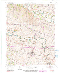
USGS Historical Quadrangle in GeoPDF.
Tags: 7.5 x 7.5 minute,
Downloadable Data,
GeoPDF,
GeoTIFF,
Historical Topographic Maps, All tags...
Historical Topographic Maps 7.5 x 7.5 Minute Map Series,
Map,
Midway,
NC,
imageryBaseMapsEarthCover, Fewer tags
USGS Historical Quadrangle in GeoPDF.
Tags: 7.5 x 7.5 minute,
Downloadable Data,
GeoPDF,
GeoTIFF,
Historical Topographic Maps, All tags...
Historical Topographic Maps 7.5 x 7.5 Minute Map Series,
Map,
Midway,
NM,
Provisional,
imageryBaseMapsEarthCover, Fewer tags
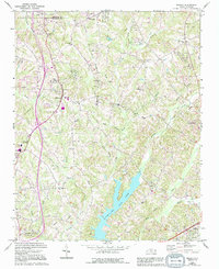
USGS Historical Quadrangle in GeoPDF.
Tags: 7.5 x 7.5 minute,
Downloadable Data,
GeoPDF,
GeoTIFF,
Historical Topographic Maps, All tags...
Historical Topographic Maps 7.5 x 7.5 Minute Map Series,
Map,
Midway,
PA,
imageryBaseMapsEarthCover, Fewer tags
USGS Historical Quadrangle in GeoPDF.
Tags: 7.5 x 7.5 minute,
Downloadable Data,
GeoPDF,
GeoTIFF,
Historical Topographic Maps, All tags...
Historical Topographic Maps 7.5 x 7.5 Minute Map Series,
Map,
Midway,
SC,
imageryBaseMapsEarthCover, Fewer tags
Core Research Center, cutting HH01881, from well operated by PIONEER NATURAL RESOURCESRaw Properties from download, web scrape, MapServer, and Macrostrat API{"Lib Num": "HH01881", "API Num": "4201334323", "Operator": "PIONEER NATURAL RESOURCES", "Well Name": "EDMUND TOM 02 01 PILOT", "Field": "EAGLEVILLE", "State": "TX", "County": "ATASCOSA", "Thin Sec": "F", "Analysis": "F", "Latitude": "28.72015", "Longitude": "-98.2812", "coordinates_geohash": "9v457s3g4018", "Source": "PROVIDED BY DONOR", "Min": "900", "Max": "10690", "Security Flag": "NO SPECIAL RESTRICTIONS", "crc_collection_name": "cutting", "sb_parent_id": "4f4e49d8e4b07f02db5df2d2", "intervals": [{"Formation": "NAVARRO", "Age": "CRETACEOUS", "Min Depth":...
Categories: Physical Item;
Tags: ANACACHO,
AUSTIN,
BUDA,
CRETACEOUS,
CRETACEOUS, All tags...
CRETACEOUS,
CRETACEOUS,
CRETACEOUS,
CRETACEOUS,
CRETACEOUS,
CRETACEOUS,
DEL RIO,
EAGLE FORD,
Eocene,
GEORGETOWN,
Jackson Group,
Jackson Group, undivided,
MIDWAY,
NAVARRO,
OLMOS,
TERTIARY,
TERTIARY,
WILCOX,
clay,
sandstone,
shale,
siltstone,
tuff, Fewer tags
Core Research Center, cutting HH01883, from well operated by PIONEER NATURAL RESOURCESRaw Properties from download, web scrape, MapServer, and Macrostrat API{"Lib Num": "HH01883", "API Num": "4201334322", "Operator": "PIONEER NATURAL RESOURCES", "Well Name": "EDMUND TOM 01 01 P/H", "Field": "EAGLEVILLE", "State": "TX", "County": "ATASCOSA", "Thin Sec": "F", "Analysis": "F", "Latitude": "28.696978", "Longitude": "-98.295219", "coordinates_geohash": "9v4570ps52km", "Source": "PROVIDED BY DONOR", "Min": "10000", "Max": "15620", "Security Flag": "NO SPECIAL RESTRICTIONS", "crc_collection_name": "cutting", "sb_parent_id": "4f4e49d8e4b07f02db5df2d2", "intervals": [{"Formation": "GEORGETOWN", "Age": "CRETACEOUS", "Min...
Categories: Physical Item;
Tags: ANACACHO,
AUSTIN,
BUDA,
CARRIZO,
CRETACEOUS, All tags...
CRETACEOUS,
CRETACEOUS,
CRETACEOUS,
CRETACEOUS,
CRETACEOUS,
CRETACEOUS,
CRETACEOUS,
DEL RIO,
EAGLE FORD,
Eocene,
GEORGETOWN,
Jackson Group,
Jackson Group, undivided,
MIDWAY,
NAVARRO,
OLMOS,
TERTIARY,
TERTIARY,
TERTIARY,
WILCOX,
clay,
sandstone,
shale,
siltstone,
tuff, Fewer tags
Core Research Center, cutting HH01913, from well operated by PIONEER NATURAL RESOURCESRaw Properties from download, web scrape, MapServer, and Macrostrat API{"Lib Num": "HH01913", "API Num": "4229735039", "Operator": "PIONEER NATURAL RESOURCES", "Well Name": "H HARLAN BETHUNE 01 02H", "Field": "EAGLEVILLE", "State": "TX", "County": "LIVE OAK", "Thin Sec": "F", "Analysis": "F", "Latitude": "28.59905", "Longitude": "-98.26693", "coordinates_geohash": "9v44eyk1w964", "Source": "PROVIDED BY DONOR", "Min": "2732", "Max": "16670", "Security Flag": "NO SPECIAL RESTRICTIONS", "crc_collection_name": "cutting", "sb_parent_id": "4f4e49d8e4b07f02db5df2d2", "intervals": [{"Formation": "EAGLE FORD", "Age": "CRETACEOUS", "Min...
Categories: Physical Item;
Tags: AUSTIN,
Alluvium, undivided,
CARRIZO,
CRETACEOUS,
CRETACEOUS, All tags...
EAGLE FORD,
Holocene and Pleistocene,
MIDWAY,
TERTIARY,
TERTIARY,
TERTIARY,
WILCOX,
clay,
gravel,
sand,
silt, Fewer tags
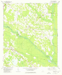
USGS Historical Quadrangle in GeoPDF.
Tags: 7.5 x 7.5 minute,
Downloadable Data,
FL,
GeoPDF,
GeoTIFF, All tags...
Historical Topographic Maps,
Historical Topographic Maps 7.5 x 7.5 Minute Map Series,
Map,
Midway,
imageryBaseMapsEarthCover, Fewer tags
Core Research Center, cutting HH01933, from well operated by PIONEER NATURAL RESOURCESRaw Properties from download, web scrape, MapServer, and Macrostrat API{"Lib Num": "HH01933", "API Num": "4229735079", "Operator": "PIONEER NATURAL RESOURCES", "Well Name": "JAMES KEITH ESSE 01 02H", "Field": "EAGLEVILLE", "State": "TX", "County": "LIVE OAK", "Thin Sec": "F", "Analysis": "F", "Latitude": "28.654181", "Longitude": "-98.231322", "coordinates_geohash": "9v45h8q4sq3r", "Source": "PROVIDED BY DONOR", "Min": "1000", "Max": "17369", "Security Flag": "NO SPECIAL RESTRICTIONS", "crc_collection_name": "cutting", "sb_parent_id": "4f4e49d8e4b07f02db5df2d2", "intervals": [{"Formation": "EAGLE FORD", "Age": "CRETACEOUS", "Min...
Categories: Physical Item;
Tags: ANACACHO,
AUSTIN,
CARRIZO,
CRETACEOUS,
CRETACEOUS, All tags...
CRETACEOUS,
CRETACEOUS,
Catahoula Formation; Frio Formation; Vicksburg Formation,
Catahoula and Frio and Vicksburg Formations, undivided,
EAGLE FORD,
MIDWAY,
Miocene-Oligocene,
OLMOS,
TERTIARY,
TERTIARY,
TERTIARY,
WILCOX,
claystone,
conglomerate,
gypsum,
mudstone,
sandstone,
tuff,
volcaniclastic, Fewer tags
USGS Historical Quadrangle in GeoPDF.
Tags: 7.5 x 7.5 minute,
Downloadable Data,
GeoPDF,
GeoTIFF,
Historical Topographic Maps, All tags...
Historical Topographic Maps 7.5 x 7.5 Minute Map Series,
Map,
Midway,
OH,
imageryBaseMapsEarthCover, Fewer tags
USGS Historical Quadrangle in GeoPDF.
Tags: 7.5 x 7.5 minute,
Downloadable Data,
GeoPDF,
GeoTIFF,
Historical Topographic Maps, All tags...
Historical Topographic Maps 7.5 x 7.5 Minute Map Series,
Map,
Midway,
SC,
imageryBaseMapsEarthCover, Fewer tags

USGS Historical Quadrangle in GeoPDF.
Tags: 7.5 x 7.5 minute,
CA,
Downloadable Data,
GeoPDF,
GeoTIFF, All tags...
Historical Topographic Maps,
Historical Topographic Maps 7.5 x 7.5 Minute Map Series,
Map,
Midway,
imageryBaseMapsEarthCover, Fewer tags
Core Research Center, cutting HH01901, from well operated by PIONEER NATURAL RESOURCESRaw Properties from download, web scrape, MapServer, and Macrostrat API{"Lib Num": "HH01901", "API Num": "4228334550", "Operator": "PIONEER NATURAL RESOURCES", "Well Name": "WASHBURN RANCH 02 10H", "Field": "HAWKVILLE", "State": "TX", "County": "LA SALLE", "Thin Sec": "F", "Analysis": "F", "Latitude": "28.346611", "Longitude": "-98.92439", "coordinates_geohash": "9v19kbm6yxk9", "Source": "PROVIDED BY DONOR", "Min": "200", "Max": "20185", "Security Flag": "NO SPECIAL RESTRICTIONS", "crc_collection_name": "cutting", "sb_parent_id": "4f4e49d8e4b07f02db5df2d2", "intervals": [{"Formation": "EAGLE FORD", "Age": "CRETACEOUS", "Min Depth":...
Categories: Physical Item;
Tags: AUSTIN,
CRETACEOUS,
CRETACEOUS,
EAGLE FORD,
Eocene, All tags...
MIDWAY,
QUEEN CITY,
SPARTA /SD/,
TERTIARY,
TERTIARY,
TERTIARY,
TERTIARY,
TERTIARY,
WILCOX,
Yegua Formation,
Yegua Formation,
clay,
sandstone, Fewer tags
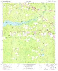
USGS Historical Quadrangle in GeoPDF.
Tags: 7.5 x 7.5 minute,
Downloadable Data,
GeoPDF,
GeoTIFF,
Historical Topographic Maps, All tags...
Historical Topographic Maps 7.5 x 7.5 Minute Map Series,
Map,
Midway,
OR,
imageryBaseMapsEarthCover, Fewer tags
|
|

