Filters
Date Range
Contacts
Tag Types
Tag Schemes
|
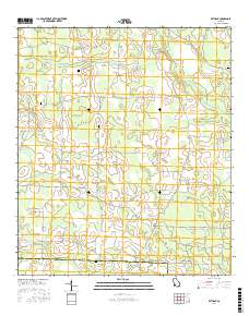
Layered geospatial PDF Map. Layers of geospatial data include orthoimagery, roads, grids, geographic names, elevation contours, hydrography, and other selected map features.
Tags: 7.5 x 7.5 minute,
Baker,
Bethany, GA,
Downloadable Data,
EarthCover, All tags...
GeoPDF,
Georgia,
Imagery and Base Maps,
Map,
Miller,
Public Land Survey System,
U.S. National Grid,
US,
US Topo,
US Topo Historical,
United States,
boundary,
contour,
geographic names,
hydrography,
imageryBaseMapsEarthCover,
orthoimage,
structures,
topographic,
transportation,
woodland, Fewer tags
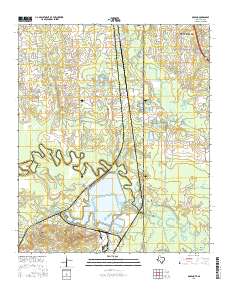
Layered GeoPDF 7.5 Minute Quadrangle Map. Layers of geospatial data include orthoimagery, roads, grids, geographic names, elevation contours, hydrography, and other selected map features.
Tags: 7.5 x 7.5 minute,
Arkansas,
Bowie,
Cass,
Domino, TX-AR, All tags...
Downloadable Data,
EarthCover,
GeoPDF,
Imagery and Base Maps,
Map,
Miller,
Public Land Survey System,
Texas,
U.S. National Grid,
US,
US Topo,
US Topo Historical,
United States,
boundary,
contour,
geographic names,
hydrography,
imageryBaseMapsEarthCover,
orthoimage,
structures,
topographic,
transportation,
woodland, Fewer tags
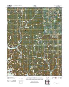
Layered GeoPDF 7.5 Minute Quadrangle Map. Layers of geospatial data include orthoimagery, roads, grids, geographic names, elevation contours, hydrography, and other selected map features.
Tags: 7.5 x 7.5 minute,
Downloadable Data,
EarthCover,
GeoPDF,
Imagery and Base Maps, All tags...
Map,
Miller,
Missouri,
Morgan,
Rocky Mount, MO,
U.S. National Grid,
US,
US Topo,
US Topo Historical,
United States,
contour,
geographic names,
hydrography,
imageryBaseMapsEarthCover,
orthoimage,
structures,
topographic,
transportation, Fewer tags
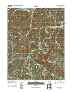
Layered GeoPDF 7.5 Minute Quadrangle Map. Layers of geospatial data include orthoimagery, roads, grids, geographic names, elevation contours, hydrography, and other selected map features.
Tags: 7.5 x 7.5 minute,
Downloadable Data,
EarthCover,
GeoPDF,
Imagery and Base Maps, All tags...
Map,
Miller,
Missouri,
Saint Anthony, MO,
U.S. National Grid,
US,
US Topo,
US Topo Historical,
United States,
contour,
geographic names,
hydrography,
imageryBaseMapsEarthCover,
orthoimage,
structures,
topographic,
transportation, Fewer tags
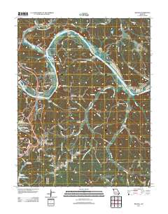
Layered GeoPDF 7.5 Minute Quadrangle Map. Layers of geospatial data include orthoimagery, roads, grids, geographic names, elevation contours, hydrography, and other selected map features.
Tags: 7.5 x 7.5 minute,
Bagnell, MO,
Camden,
Downloadable Data,
EarthCover, All tags...
GeoPDF,
Imagery and Base Maps,
Map,
Miller,
Missouri,
U.S. National Grid,
US,
US Topo,
US Topo Historical,
United States,
contour,
geographic names,
hydrography,
imageryBaseMapsEarthCover,
orthoimage,
structures,
topographic,
transportation, Fewer tags
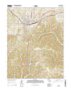
Layered GeoPDF 7.5 Minute Quadrangle Map. Layers of geospatial data include orthoimagery, roads, grids, geographic names, elevation contours, hydrography, and other selected map features.
Tags: 7.5 x 7.5 minute,
Downloadable Data,
EarthCover,
Eldon, MO,
GeoPDF, All tags...
Imagery and Base Maps,
Map,
Miller,
Missouri,
Public Land Survey System,
U.S. National Grid,
US,
US Topo,
US Topo Historical,
United States,
boundary,
contour,
geographic names,
hydrography,
imageryBaseMapsEarthCover,
orthoimage,
structures,
topographic,
transportation,
woodland, Fewer tags
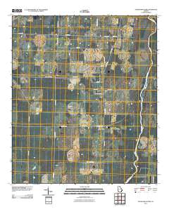
Layered GeoPDF 7.5 Minute Quadrangle Map. Layers of geospatial data include orthoimagery, roads, grids, geographic names, elevation contours, hydrography, and other selected map features.
Tags: 7.5 x 7.5 minute,
Decatur,
Downloadable Data,
EarthCover,
GeoPDF, All tags...
Georgia,
Imagery and Base Maps,
Map,
Miller,
Steadhams Store, GA,
U.S. National Grid,
US,
US Topo,
US Topo Historical,
United States,
contour,
geographic names,
hydrography,
imageryBaseMapsEarthCover,
orthoimage,
topographic,
transportation, Fewer tags
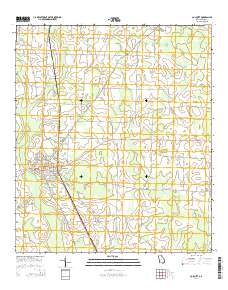
Layered GeoPDF 7.5 Minute Quadrangle Map. Layers of geospatial data include orthoimagery, roads, grids, geographic names, elevation contours, hydrography, and other selected map features.
Tags: 7.5 x 7.5 minute,
Colquitt, GA,
Downloadable Data,
EarthCover,
GeoPDF, All tags...
Georgia,
Imagery and Base Maps,
Map,
Miller,
Public Land Survey System,
U.S. National Grid,
US,
US Topo,
US Topo Historical,
United States,
boundary,
contour,
geographic names,
hydrography,
imageryBaseMapsEarthCover,
orthoimage,
structures,
topographic,
transportation,
woodland, Fewer tags
Layered geospatial PDF Map. Layers of geospatial data include orthoimagery, roads, grids, geographic names, elevation contours, hydrography, and other selected map features.
Tags: 7.5 x 7.5 minute,
Arkansas,
Downloadable Data,
EarthCover,
GeoPDF, All tags...
Homan, AR,
Imagery and Base Maps,
Little River,
Map,
Miller,
Public Land Survey System,
U.S. National Grid,
US,
US Topo,
US Topo Historical,
United States,
boundary,
contour,
geographic names,
hydrography,
imageryBaseMapsEarthCover,
orthoimage,
structures,
topographic,
transportation,
woodland, Fewer tags
Layered geospatial PDF Map. Layers of geospatial data include orthoimagery, roads, grids, geographic names, elevation contours, hydrography, and other selected map features.
Tags: 7.5 x 7.5 minute,
Blakely South, GA,
Downloadable Data,
Early,
EarthCover, All tags...
GeoPDF,
Georgia,
Imagery and Base Maps,
Map,
Miller,
Public Land Survey System,
U.S. National Grid,
US,
US Topo,
US Topo Historical,
United States,
boundary,
contour,
geographic names,
hydrography,
imageryBaseMapsEarthCover,
orthoimage,
structures,
topographic,
transportation,
woodland, Fewer tags
Layered GeoPDF 7.5 Minute Quadrangle Map. Layers of geospatial data include orthoimagery, roads, grids, geographic names, elevation contours, hydrography, and other selected map features.
Tags: 7.5 x 7.5 minute,
Boykin, GA,
Decatur,
Downloadable Data,
EarthCover, All tags...
GeoPDF,
Georgia,
Imagery and Base Maps,
Map,
Miller,
U.S. National Grid,
US,
US Topo,
US Topo Historical,
United States,
contour,
geographic names,
hydrography,
imageryBaseMapsEarthCover,
orthoimage,
topographic,
transportation, Fewer tags
Layered geospatial PDF Map. Layers of geospatial data include orthoimagery, roads, grids, geographic names, elevation contours, hydrography, and other selected map features.
Tags: 7.5 x 7.5 minute,
Baker,
Damascus, GA,
Downloadable Data,
Early, All tags...
EarthCover,
GeoPDF,
Georgia,
Imagery and Base Maps,
Map,
Miller,
Public Land Survey System,
U.S. National Grid,
US,
US Topo,
US Topo Historical,
United States,
boundary,
contour,
geographic names,
hydrography,
imageryBaseMapsEarthCover,
orthoimage,
structures,
topographic,
transportation,
woodland, Fewer tags
Layered GeoPDF 7.5 Minute Quadrangle Map. Layers of geospatial data include orthoimagery, roads, grids, geographic names, elevation contours, hydrography, and other selected map features.
Tags: 7.5 x 7.5 minute,
Downloadable Data,
Early,
EarthCover,
GeoPDF, All tags...
Georgia,
Hentown, GA,
Imagery and Base Maps,
Map,
Miller,
U.S. National Grid,
US,
US Topo,
US Topo Historical,
United States,
contour,
geographic names,
hydrography,
imageryBaseMapsEarthCover,
orthoimage,
topographic,
transportation, Fewer tags
Layered GeoPDF 7.5 Minute Quadrangle Map. Layers of geospatial data include orthoimagery, roads, grids, geographic names, elevation contours, hydrography, and other selected map features.
Tags: 7.5 x 7.5 minute,
Bagnell, MO,
Camden,
Downloadable Data,
EarthCover, All tags...
GeoPDF,
Imagery and Base Maps,
Map,
Miller,
Missouri,
Public Land Survey System,
U.S. National Grid,
US,
US Topo,
US Topo Historical,
United States,
boundary,
contour,
geographic names,
hydrography,
imageryBaseMapsEarthCover,
orthoimage,
structures,
topographic,
transportation,
woodland, Fewer tags
Layered GeoPDF 7.5 Minute Quadrangle Map. Layers of geospatial data include orthoimagery, roads, grids, geographic names, elevation contours, hydrography, and other selected map features.
Tags: 7.5 x 7.5 minute,
Downloadable Data,
EarthCover,
GeoPDF,
Imagery and Base Maps, All tags...
Map,
Miller,
Missouri,
Public Land Survey System,
Saint Anthony, MO,
U.S. National Grid,
US,
US Topo,
US Topo Historical,
United States,
boundary,
contour,
geographic names,
hydrography,
imageryBaseMapsEarthCover,
orthoimage,
structures,
topographic,
transportation,
woodland, Fewer tags
Layered GeoPDF 7.5 Minute Quadrangle Map. Layers of geospatial data include orthoimagery, roads, grids, geographic names, elevation contours, hydrography, and other selected map features.
Tags: 7.5 x 7.5 minute,
Camden,
Downloadable Data,
EarthCover,
GeoPDF, All tags...
Imagery and Base Maps,
Map,
Miller,
Missouri,
Public Land Survey System,
Toronto, MO,
U.S. National Grid,
US,
US Topo,
US Topo Historical,
United States,
boundary,
contour,
geographic names,
hydrography,
imageryBaseMapsEarthCover,
orthoimage,
structures,
topographic,
transportation,
woodland, Fewer tags
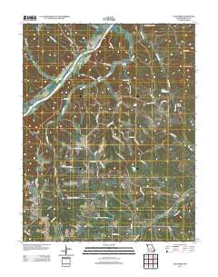
Layered GeoPDF 7.5 Minute Quadrangle Map. Layers of geospatial data include orthoimagery, roads, grids, geographic names, elevation contours, hydrography, and other selected map features.
Tags: 7.5 x 7.5 minute,
Downloadable Data,
EarthCover,
GeoPDF,
Imagery and Base Maps, All tags...
Map,
Miller,
Missouri,
Tuscumbia, MO,
U.S. National Grid,
US,
US Topo,
US Topo Historical,
United States,
contour,
geographic names,
hydrography,
imageryBaseMapsEarthCover,
orthoimage,
structures,
topographic,
transportation, Fewer tags
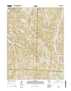
Layered GeoPDF 7.5 Minute Quadrangle Map. Layers of geospatial data include orthoimagery, roads, grids, geographic names, elevation contours, hydrography, and other selected map features.
Tags: 7.5 x 7.5 minute,
Brays, MO,
Downloadable Data,
EarthCover,
GeoPDF, All tags...
Imagery and Base Maps,
Map,
Maries,
Miller,
Missouri,
Public Land Survey System,
Pulaski,
U.S. National Grid,
US,
US Topo,
US Topo Historical,
United States,
boundary,
contour,
geographic names,
hydrography,
imageryBaseMapsEarthCover,
orthoimage,
structures,
topographic,
transportation,
woodland, Fewer tags
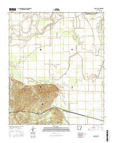
Layered geospatial PDF Map. Layers of geospatial data include orthoimagery, roads, grids, geographic names, elevation contours, hydrography, and other selected map features.
Tags: 7.5 x 7.5 minute,
Arkansas,
Downloadable Data,
EarthCover,
Fouke NE, AR, All tags...
GeoPDF,
Hempstead,
Imagery and Base Maps,
Map,
Miller,
Public Land Survey System,
U.S. National Grid,
US,
US Topo,
US Topo Historical,
United States,
boundary,
contour,
geographic names,
hydrography,
imageryBaseMapsEarthCover,
orthoimage,
structures,
topographic,
transportation,
woodland, Fewer tags
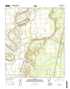
Layered geospatial PDF Map. Layers of geospatial data include orthoimagery, roads, grids, geographic names, elevation contours, hydrography, and other selected map features.
Tags: 7.5 x 7.5 minute,
Arkansas,
Canfield, AR,
Downloadable Data,
EarthCover, All tags...
GeoPDF,
Imagery and Base Maps,
Lafayette,
Map,
Miller,
Public Land Survey System,
U.S. National Grid,
US,
US Topo,
US Topo Historical,
United States,
boundary,
contour,
geographic names,
hydrography,
imageryBaseMapsEarthCover,
orthoimage,
structures,
topographic,
transportation,
woodland, Fewer tags
|
|