Filters
Date Range
Extensions
Types
Contacts
Categories
Tag Types
Tag Schemes
|
A Phelps Dodge locamotive at the Morenci mine.
Categories: Data;
Tags: 1990s,
Arizona,
Arizona Central,
Bon Ton,
Caynga, All tags...
Clifton - 15 Min,
Copper King,Alice Winifred,
Copper Mountain,
Copper Mountain metallic mineral dist.,
Copper, Sulfide,
Dataset,
Delaware,
Detr,
East And West Yankie,
Garfield,
Greenlee,
Hormeyer,
Humboldt,
Ida,
Jameson, Joy, Raton,
King,
Las Terrazas,
Manganese Blue,
Metcalf,
Montezuma,
Morenci physiographic area,
Northwest Extension,
Ryerson,
Shannon,
T4S R29E Sec 16 N2,
Thompson,
United States,
geoscientificInformation,
image collections,
mining,
photographic prints,
railroads, Fewer tags
A water truck spraying water on a haul road at the Morenci mine on the right with a haul truck on the left.
Categories: Data;
Tags: 1990s,
Arizona,
Arizona Central,
Bon Ton,
Caynga, All tags...
Clifton - 15 Min,
Copper King,Alice Winifred,
Copper Mountain,
Copper Mountain metallic mineral dist.,
Copper, Sulfide,
Dataset,
Delaware,
Detr,
East And West Yankie,
Garfield,
Greenlee,
Hormeyer,
Humboldt,
Ida,
Jameson, Joy, Raton,
King,
Las Terrazas,
Manganese Blue,
Metcalf,
Montezuma,
Morenci physiographic area,
Northwest Extension,
Ryerson,
Shannon,
T4S R29E Sec 16 N2,
Thompson,
United States,
geoscientificInformation,
image collections,
mining,
photographic prints,
surface mining,
trucks,
water use, Fewer tags
A drill rig and a power shovel on benches in the Morenci mine.
Categories: Data;
Tags: 1990s,
Arizona,
Arizona Central,
Bon Ton,
Caynga, All tags...
Clifton - 15 Min,
Copper King,Alice Winifred,
Copper Mountain,
Copper Mountain metallic mineral dist.,
Copper, Sulfide,
Dataset,
Delaware,
Detr,
East And West Yankie,
Garfield,
Greenlee,
Hormeyer,
Humboldt,
Ida,
Jameson, Joy, Raton,
King,
Las Terrazas,
Manganese Blue,
Metcalf,
Montezuma,
Morenci physiographic area,
Northwest Extension,
Ryerson,
Shannon,
T4S R29E Sec 16 N2,
Thompson,
United States,
drilling and coring,
geoscientificInformation,
image collections,
mining,
photographic prints,
power shovels,
surface mining,
trucks, Fewer tags
A view of the open pit at the Morenci mine.
Categories: Data;
Tags: 1990s,
Arizona,
Arizona Central,
Bon Ton,
Caynga, All tags...
Clifton - 15 Min,
Copper King,Alice Winifred,
Copper Mountain,
Copper Mountain metallic mineral dist.,
Copper, Sulfide,
Dataset,
Delaware,
Detr,
East And West Yankie,
Garfield,
Greenlee,
Hormeyer,
Humboldt,
Ida,
Jameson, Joy, Raton,
King,
Las Terrazas,
Manganese Blue,
Metcalf,
Montezuma,
Morenci physiographic area,
Northwest Extension,
Ryerson,
Shannon,
T4S R29E Sec 16 N2,
Thompson,
United States,
geoscientificInformation,
image collections,
mining,
photographic prints,
surface mining, Fewer tags
ADMMR map collection: Morenci Mine Bit Shop; 1 in. to 10 feet; 23 x 20 in.
Categories: Data;
Tags: Abrasive, Garnet Andra,
Arizona,
Arizona Central,
Bon Ton,
Calcium, Limestone, All tags...
Caynga,
Clay,
Clifton - 15 Min,
Copper King,Alice Winifred,
Copper Mountain,
Copper, Native,
Copper, Oxide,
Copper, Sulfide,
Dataset,
Delaware,
Detr,
East And West Yankie,
Garfield,
Gemstone, Turquoise,
Gold,
Greenlee County,
Hormeyer,
Humboldt,
Ida,
Jameson, Joy, Raton,
King,
Las Terrazas,
Manganese Blue,
Metcalf,
Montezuma,
Morenci Mine,
Northwest Extension,
Ryerson,
Shannon,
Silicon,
Silver,
T4S R29E Sec 16 N2,
Thompson,
United States,
Vanadium,
diagrams,
geoscientificInformation,
maps and atlases,
mining and quarrying,
mining equipment,
plans, Fewer tags
ADMMR map collection: Morenci Inclined Top-Slice System; 24 x 14 in.
Categories: Data;
Tags: Abrasive, Garnet Andra,
Arizona,
Arizona Central,
Bon Ton,
Calcium, Limestone, All tags...
Caynga,
Clay,
Clifton - 15 Min,
Copper King,Alice Winifred,
Copper Mountain,
Copper, Native,
Copper, Oxide,
Copper, Sulfide,
Dataset,
Delaware,
Detr,
East And West Yankie,
Garfield,
Gemstone, Turquoise,
Gold,
Greenlee County,
Hormeyer,
Humboldt,
Ida,
Jameson, Joy, Raton,
King,
Las Terrazas,
Manganese Blue,
Metcalf,
Montezuma,
Morenci Mine,
Northwest Extension,
Ryerson,
Shannon,
Silicon,
Silver,
T4S R29E Sec 16 N2,
Thompson,
United States,
Vanadium,
geoscientificInformation,
maps and atlases,
mining and quarrying,
sections,
subsurface maps, Fewer tags
Heinrichs Geoexploration Co. Maps: Area 4, Aerial-Magnetic Location Plan and Geology; 1:24000; 38 x 52 in.
Categories: Data;
Tags: 1960s,
Arizona,
Castle Dome Mts. physiographic area,
Copper, Sulfide,
Dataset, All tags...
Eva Ann 1 & 2,
Gold, Lode,
Lead,
Montezuma,
Red Bluff Mountain - 15 Min,
Silver,
T5S R18W Sec 20 SW,
Thumb Butte,
United States,
Yuma County,
Yuma24,
Zinc,
aeromagnetic surveying,
geology,
geophysics,
geoscientificInformation,
maps and atlases,
mineral resources,
natural resource exploration,
plans, Fewer tags
Layered GeoPDF 7.5 Minute Quadrangle Map. Layers of geospatial data include orthoimagery, roads, grids, geographic names, elevation contours, hydrography, and other selected map features.
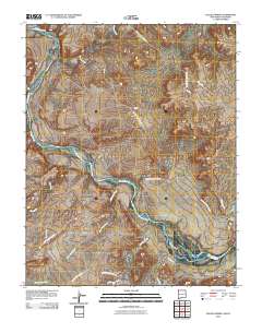
Tags: 7.5 x 7.5 minute,
Colorado,
Downloadable Data,
EarthCover,
Elk Creek, CO, All tags...
GeoPDF,
Imagery and Base Maps,
La Plata,
Map,
Montezuma,
U.S. National Grid,
US,
US Topo,
US Topo Historical,
United States,
contour,
geographic names,
hydrography,
imageryBaseMapsEarthCover,
orthoimage,
topographic,
transportation, Fewer tags
Layered geospatial PDF Map. Layers of geospatial data include orthoimagery, roads, grids, geographic names, elevation contours, hydrography, and other selected map features.
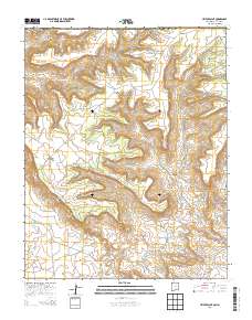
Tags: 7.5 x 7.5 minute,
Colorado,
Downloadable Data,
EarthCover,
GeoPDF, All tags...
Imagery and Base Maps,
Map,
Montezuma,
Public Land Survey System,
U.S. National Grid,
US,
US Topo,
US Topo Historical,
United States,
Wallace Ranch, CO,
boundary,
contour,
geographic names,
hydrography,
imageryBaseMapsEarthCover,
orthoimage,
structures,
topographic,
transportation,
woodland, Fewer tags
Layered geospatial PDF Map. Layers of geospatial data include orthoimagery, roads, grids, geographic names, elevation contours, hydrography, and other selected map features.
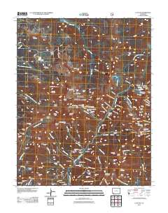
Tags: 7.5 x 7.5 minute,
Colorado,
Downloadable Data,
EarthCover,
GeoPDF, All tags...
Imagery and Base Maps,
Map,
Montezuma,
Public Land Survey System,
U.S. National Grid,
US,
US Topo,
US Topo Historical,
United States,
Wetherill Mesa, CO,
boundary,
contour,
geographic names,
hydrography,
imageryBaseMapsEarthCover,
orthoimage,
structures,
topographic,
transportation,
woodland, Fewer tags
Layered GeoPDF 7.5 Minute Quadrangle Map. Layers of geospatial data include orthoimagery, roads, grids, geographic names, elevation contours, hydrography, and other selected map features.
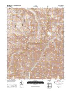
Tags: 7.5 x 7.5 minute,
Colorado,
Downloadable Data,
EarthCover,
GeoPDF, All tags...
Imagery and Base Maps,
Map,
Montezuma,
Public Land Survey System,
U.S. National Grid,
US,
US Topo,
US Topo Historical,
United States,
Yellow Jacket, CO,
boundary,
contour,
geographic names,
hydrography,
imageryBaseMapsEarthCover,
orthoimage,
structures,
topographic,
transportation,
woodland, Fewer tags
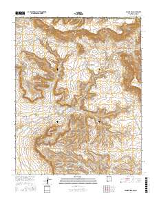
Layered geospatial PDF Map. Layers of geospatial data include orthoimagery, roads, grids, geographic names, elevation contours, hydrography, and other selected map features.
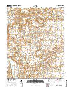
Tags: 7.5 x 7.5 minute,
Colorado,
Downloadable Data,
EarthCover,
GeoPDF, All tags...
Imagery and Base Maps,
Map,
Moccasin Mesa, CO,
Montezuma,
Public Land Survey System,
U.S. National Grid,
US,
US Topo,
US Topo Historical,
United States,
boundary,
contour,
geographic names,
hydrography,
imageryBaseMapsEarthCover,
orthoimage,
structures,
topographic,
transportation,
woodland, Fewer tags
Layered GeoPDF 7.5 Minute Quadrangle Map. Layers of geospatial data include orthoimagery, roads, grids, geographic names, elevation contours, hydrography, and other selected map features.
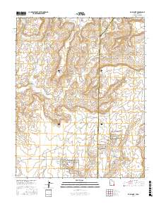
Tags: 7.5 x 7.5 minute,
Champagne Spring, CO,
Colorado,
Dolores,
Downloadable Data, All tags...
EarthCover,
GeoPDF,
Imagery and Base Maps,
Map,
Montezuma,
U.S. National Grid,
US,
US Topo,
US Topo Historical,
United States,
contour,
geographic names,
hydrography,
imageryBaseMapsEarthCover,
orthoimage,
topographic,
transportation, Fewer tags
Layered geospatial PDF Map. Layers of geospatial data include orthoimagery, roads, grids, geographic names, elevation contours, hydrography, and other selected map features.
Tags: 7.5 x 7.5 minute,
Colorado,
Downloadable Data,
EarthCover,
GeoPDF, All tags...
Imagery and Base Maps,
Map,
Montezuma,
Mud Creek, CO,
Public Land Survey System,
U.S. National Grid,
US,
US Topo,
US Topo Historical,
United States,
boundary,
contour,
geographic names,
hydrography,
imageryBaseMapsEarthCover,
orthoimage,
structures,
topographic,
transportation,
woodland, Fewer tags
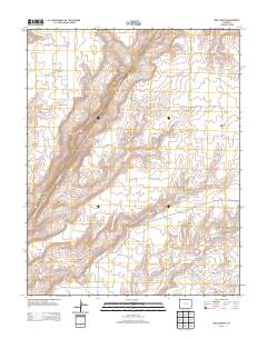
USGS Historical Quadrangle in GeoPDF.
Tags: 7.5 x 7.5 minute,
Downloadable Data,
GeoPDF,
GeoTIFF,
Historical Topographic Maps, All tags...
Historical Topographic Maps 7.5 x 7.5 Minute Map Series,
Map,
Montezuma,
NY,
imageryBaseMapsEarthCover, Fewer tags
USGS Historical Quadrangle in GeoPDF.
Tags: 15 x 15 minute,
CO,
Downloadable Data,
GeoPDF,
GeoTIFF, All tags...
Historical Topographic Maps,
Historical Topographic Maps 15 x 15 Minute Map Series,
Map,
Montezuma,
imageryBaseMapsEarthCover, Fewer tags
Layers of geospatial data include contours, boundaries, land cover, hydrography, roads, transportation, geographic names, structures, and other selected map features.
Types: Citation;
Tags: 7.5 x 7.5 minute,
7_5_Min,
CO,
Colorado,
Combined Vector, All tags...
Combined Vector,
Combined Vector,
Dolores,
Downloadable Data,
Esri File GeoDatabase 10,
FileGDB,
Montezuma,
Public Land Survey System,
Topo Map Vector Data,
US,
United States,
boundary,
contours,
geographic names,
hydrography,
structures,
transportation,
woodland, Fewer tags
Layers of geospatial data include contours, boundaries, land cover, hydrography, roads, transportation, geographic names, structures, and other selected map features.
Tags: 7.5 x 7.5 minute,
7_5_Min,
CO,
Colorado,
Combined Vector, All tags...
Combined Vector,
Combined Vector,
Dolores,
Downloadable Data,
GeoPackage,
Montezuma,
Open Geospatial Consortium GeoPackage 1.2,
Public Land Survey System,
San Juan,
Topo Map Vector Data,
US,
UT,
United States,
Utah,
boundary,
contours,
geographic names,
hydrography,
structures,
transportation,
woodland, Fewer tags
The National Hydrography Dataset (NHD) is a feature-based database that interconnects and uniquely identifies the stream segments or reaches that make up the nation's surface water drainage system. NHD data was originally developed at 1:100,000-scale and exists at that scale for the whole country. This high-resolution NHD, generally developed at 1:24,000/1:12,000 scale, adds detail to the original 1:100,000-scale NHD. (Data for Alaska, Puerto Rico and the Virgin Islands was developed at high-resolution, not 1:100,000 scale.) Local resolution NHD is being developed where partners and data exist. The NHD contains reach codes for networked features, flow direction, names, and centerline representations for areal water...
Tags: Administrative watershed units,
Administrative watershed units,
Area of Complex Channels,
Area to be submerged,
Basin, All tags...
Basin,
Bay/Inlet,
Boundaries,
Boundary,
Bridge,
CO,
Canal/Ditch,
Coastline,
Colorado,
Connector,
Dam/Weir,
Downloadable Data,
Drainage areas for surface water,
Drainageway,
Esri File GeoDatabase 10,
Estuary,
FileGDB,
Flow direction network,
Flume,
ForeShore,
Gaging Station,
Gate,
HU-8,
HU-8 Subbasin,
HU10,
HU12,
HU14,
HU16,
HU2,
HU4,
HU6,
HU8,
HU8_14080107,
HUC,
Hazard Zone,
Hydrographic,
Hydrography,
Hydrography,
Hydrography,
Hydrologic Unit Code,
Hydrologic Units,
Ice mass,
Inundation Area,
La Plata,
Levee,
Line,
Lock Chamber,
Marsh,
Montezuma,
NM,
National Hydrography Dataset (NHD),
National Hydrography Dataset (NHD) Best Resolution,
New Mexico,
Nonearthen Shore,
Orthoimage,
Playa,
Point,
PointEvent,
Pond,
Rapids,
Rapids,
Reach,
Reach code,
Reef,
Region,
Reservoir,
Rock,
San Juan,
Sea/Ocean,
Sink/Rise,
Sounding Datum Line,
Special Use Zone,
Special Use Zone Limit,
Spillway,
Stream,
Stream/River,
Sub-basin,
Sub-region,
Subbasin,
Submerged Stream,
Subregion,
Subwatershed,
Surface water systems,
Swamp,
Topographic,
Tunnel,
US,
Underground Conduit,
United States,
WBD,
WBD,
Wall,
Wash,
Water Intake Outflow,
Waterfall,
Watershed,
Watershed Boundaries,
Watershed Boundary Dataset,
Well,
artificial path,
boundaries,
dams,
drainage systems and characteristics,
inlandWaters,
lakes,
ngda,
rivers, Fewer tags
The National Hydrography Dataset (NHD) is a feature-based database that interconnects and uniquely identifies the stream segments or reaches that make up the nation's surface water drainage system. NHD data was originally developed at 1:100,000-scale and exists at that scale for the whole country. This high-resolution NHD, generally developed at 1:24,000/1:12,000 scale, adds detail to the original 1:100,000-scale NHD. (Data for Alaska, Puerto Rico and the Virgin Islands was developed at high-resolution, not 1:100,000 scale.) Local resolution NHD is being developed where partners and data exist. The NHD contains reach codes for networked features, flow direction, names, and centerline representations for areal water...
Tags: Administrative watershed units,
Administrative watershed units,
Area of Complex Channels,
Area to be submerged,
Basin, All tags...
Basin,
Bay/Inlet,
Boundaries,
Boundary,
Bridge,
CO,
Canal/Ditch,
Coastline,
Colorado,
Connector,
Dam/Weir,
Dolores,
Downloadable Data,
Drainage areas for surface water,
Drainageway,
Esri File GeoDatabase 10,
Estuary,
FileGDB,
Flow direction network,
Flume,
ForeShore,
Gaging Station,
Gate,
HU-8,
HU-8 Subbasin,
HU10,
HU12,
HU14,
HU16,
HU2,
HU4,
HU6,
HU8,
HU8_14030002,
HUC,
Hazard Zone,
Hydrographic,
Hydrography,
Hydrography,
Hydrography,
Hydrologic Unit Code,
Hydrologic Units,
Ice mass,
Inundation Area,
La Plata,
Levee,
Line,
Lock Chamber,
Marsh,
Montezuma,
Montrose,
National Hydrography Dataset (NHD),
National Hydrography Dataset (NHD) Best Resolution,
Nonearthen Shore,
Orthoimage,
Playa,
Point,
PointEvent,
Pond,
Rapids,
Rapids,
Reach,
Reach code,
Reef,
Region,
Reservoir,
Rock,
San Juan,
San Miguel,
Sea/Ocean,
Sink/Rise,
Sounding Datum Line,
Special Use Zone,
Special Use Zone Limit,
Spillway,
Stream,
Stream/River,
Sub-basin,
Sub-region,
Subbasin,
Submerged Stream,
Subregion,
Subwatershed,
Surface water systems,
Swamp,
Topographic,
Tunnel,
US,
UT,
Underground Conduit,
United States,
Utah,
WBD,
WBD,
Wall,
Wash,
Water Intake Outflow,
Waterfall,
Watershed,
Watershed Boundaries,
Watershed Boundary Dataset,
Well,
artificial path,
boundaries,
dams,
drainage systems and characteristics,
inlandWaters,
lakes,
ngda,
rivers, Fewer tags
|
|