Filters
Date Range
Contacts
Tag Types
Tag Schemes
|

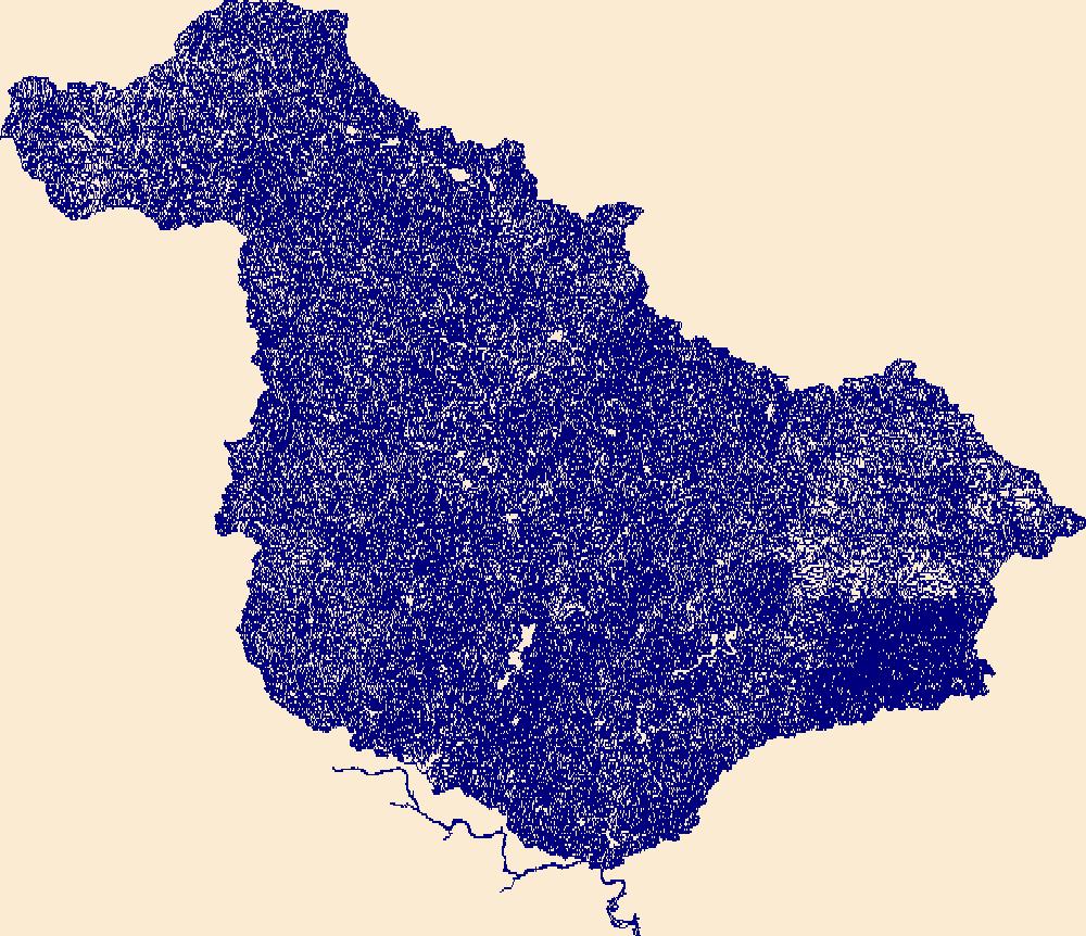
The High Resolution National Hydrography Dataset Plus (NHDPlus HR) is an integrated set of geospatial data layers, including the best available National Hydrography Dataset (NHD), the 10-meter 3D Elevation Program Digital Elevation Model (3DEP DEM), and the National Watershed Boundary Dataset (WBD). The NHDPlus HR combines the NHD, 3DEP DEMs, and WBD to create a stream network with linear referencing, feature naming, "value added attributes" (VAAs), elevation-derived catchments, and other features for hydrologic data analysis. The stream network with linear referencing is a system of data relationships applied to hydrographic systems so that one stream reach "flows" into another and "events" can be tied to and traced...
Tags: Atoka County,
Blaine County,
Caddo County,
Canadian County,
Carson County, All tags...
Cimarron County,
Cleveland County,
Colfax County,
Curry County,
Custer County,
Dallam County,
Deaf Smith County,
Dewey County,
Downloadable Data,
Ellis County,
FileGDB,
FileGDB 10.1,
Garvin County,
Grady County,
Gray County,
HU-4 Subregion,
HU-4 Subregion,
HU4_1109,
Hansford County,
Harding County,
Hartley County,
Haskell County,
Hemphill County,
Hughes County,
Hutchinson County,
Hydrography,
Latimer County,
Lipscomb County,
McClain County,
McIntosh County,
Moore County,
Muskogee County,
NHDPlus HR Rasters,
NHDPlus High Resolution (NHDPlus HR),
NM,
National Hydrography Dataset (NHD),
National Hydrography Dataset Plus High Resolution (NHDPlus HR),
National Hydrography Dataset Plus High Resolution (NHDPlus HR) Current,
New Mexico,
OK,
Ochiltree County,
Oklahoma,
Oklahoma County,
Oldham County,
Pittsburg County,
Pontotoc County,
Pottawatomie County,
Potter County,
Quay County,
Randall County,
Roberts County,
Roger Mills County,
Seminole County,
TX,
Texas,
US,
Union County,
United States,
Woodward County,
base maps,
cartography,
catchments,
channels,
digital elevation models,
drainage basins,
earth sciences,
elevation,
environment,
geographic information systems,
geoscientific,
geospatial analysis,
hydrographic datasets,
hydrographic features,
hydrology,
imagery,
inland waters,
lakes,
land surface characteristics,
reservoirs,
river reaches,
rivers,
streamflow,
streamflow data,
streams,
topography,
water bodies,
water quality,
water resources,
watersheds, Fewer tags
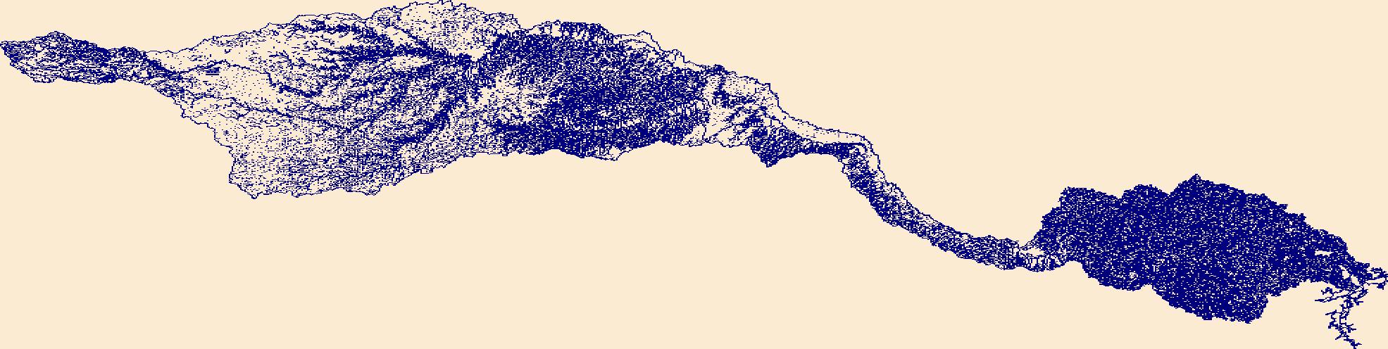
The High Resolution National Hydrography Dataset Plus (NHDPlus HR) is an integrated set of geospatial data layers, including the best available National Hydrography Dataset (NHD), the 10-meter 3D Elevation Program Digital Elevation Model (3DEP DEM), and the National Watershed Boundary Dataset (WBD). The NHDPlus HR combines the NHD, 3DEP DEMs, and WBD to create a stream network with linear referencing, feature naming, "value added attributes" (VAAs), elevation-derived catchments, and other features for hydrologic data analysis. The stream network with linear referencing is a system of data relationships applied to hydrographic systems so that one stream reach "flows" into another and "events" can be tied to and traced...
Tags: AR,
Allen County,
Anderson County,
Arkansas,
Barry County, All tags...
Barton County,
Benton County,
Bourbon County,
Butler County,
Chase County,
Chautauqua County,
Cherokee County,
Cherokee County,
Christian County,
Coffey County,
Cowley County,
Craig County,
Crawford County,
Dade County,
Delaware County,
Downloadable Data,
Elk County,
FileGDB,
FileGDB 10.1,
Greenwood County,
HU-4 Subregion,
HU-4 Subregion,
HU4_1107,
Harvey County,
Hydrography,
Jasper County,
KS,
Kansas,
Labette County,
Lawrence County,
Lyon County,
MO,
Marion County,
Mayes County,
McDonald County,
McPherson County,
Missouri,
Montgomery County,
Morris County,
Muskogee County,
NHDPlus HR Rasters,
NHDPlus High Resolution (NHDPlus HR),
National Hydrography Dataset (NHD),
National Hydrography Dataset Plus High Resolution (NHDPlus HR),
National Hydrography Dataset Plus High Resolution (NHDPlus HR) Current,
Neosho County,
Newton County,
Nowata County,
OK,
Oklahoma,
Osage County,
Osage County,
Ottawa County,
Rogers County,
Stone County,
Tulsa County,
US,
United States,
Wabaunsee County,
Wagoner County,
Washington County,
Wilson County,
Woodson County,
base maps,
cartography,
catchments,
channels,
digital elevation models,
drainage basins,
earth sciences,
elevation,
environment,
geographic information systems,
geoscientific,
geospatial analysis,
hydrographic datasets,
hydrographic features,
hydrology,
imagery,
inland waters,
lakes,
land surface characteristics,
reservoirs,
river reaches,
rivers,
streamflow,
streamflow data,
streams,
topography,
water bodies,
water quality,
water resources,
watersheds, Fewer tags

The High Resolution National Hydrography Dataset Plus (NHDPlus HR) is an integrated set of geospatial data layers, including the best available National Hydrography Dataset (NHD), the 10-meter 3D Elevation Program Digital Elevation Model (3DEP DEM), and the National Watershed Boundary Dataset (WBD). The NHDPlus HR combines the NHD, 3DEP DEMs, and WBD to create a stream network with linear referencing, feature naming, "value added attributes" (VAAs), elevation-derived catchments, and other features for hydrologic data analysis. The stream network with linear referencing is a system of data relationships applied to hydrographic systems so that one stream reach "flows" into another and "events" can be tied to and traced...
Tags: AR,
Adair County,
Arkansas,
Benton County,
Cherokee County, All tags...
Cleburne County,
Conway County,
Crawford County,
Creek County,
Delaware County,
Downloadable Data,
Faulkner County,
FileGDB,
FileGDB 10.1,
Franklin County,
Garland County,
Grant County,
HU-4 Subregion,
HU-4 Subregion,
HU4_1111,
Haskell County,
Hydrography,
Jefferson County,
Johnson County,
Latimer County,
Le Flore County,
Logan County,
Lonoke County,
Madison County,
McIntosh County,
Montgomery County,
Muskogee County,
NHDPlus HR Rasters,
NHDPlus High Resolution (NHDPlus HR),
National Hydrography Dataset (NHD),
National Hydrography Dataset Plus High Resolution (NHDPlus HR),
National Hydrography Dataset Plus High Resolution (NHDPlus HR) Current,
Newton County,
OK,
Oklahoma,
Okmulgee County,
Osage County,
Perry County,
Pittsburg County,
Polk County,
Pope County,
Pulaski County,
Saline County,
Scott County,
Searcy County,
Sebastian County,
Sequoyah County,
Tulsa County,
US,
United States,
Van Buren County,
Wagoner County,
Washington County,
White County,
Yell County,
base maps,
cartography,
catchments,
channels,
digital elevation models,
drainage basins,
earth sciences,
elevation,
environment,
geographic information systems,
geoscientific,
geospatial analysis,
hydrographic datasets,
hydrographic features,
hydrology,
imagery,
inland waters,
lakes,
land surface characteristics,
reservoirs,
river reaches,
rivers,
streamflow,
streamflow data,
streams,
topography,
water bodies,
water quality,
water resources,
watersheds, Fewer tags
The High Resolution National Hydrography Dataset Plus (NHDPlus HR) is an integrated set of geospatial data layers, including the best available National Hydrography Dataset (NHD), the 10-meter 3D Elevation Program Digital Elevation Model (3DEP DEM), and the National Watershed Boundary Dataset (WBD). The NHDPlus HR combines the NHD, 3DEP DEMs, and WBD to create a stream network with linear referencing, feature naming, "value added attributes" (VAAs), elevation-derived catchments, and other features for hydrologic data analysis. The stream network with linear referencing is a system of data relationships applied to hydrographic systems so that one stream reach "flows" into another and "events" can be tied to and traced...
Tags: Beaver County,
Blaine County,
Canadian County,
Cimarron County,
Cleveland County, All tags...
Creek County,
Dallam County,
Dewey County,
Downloadable Data,
Ellis County,
FileGDB,
FileGDB 10.1,
HU-4 Subregion,
HU-4 Subregion,
HU4_1110,
Hansford County,
Harper County,
Hartley County,
Hemphill County,
Hughes County,
Hutchinson County,
Hydrography,
KS,
Kansas,
Lincoln County,
Lipscomb County,
Logan County,
Major County,
McIntosh County,
Moore County,
Muskogee County,
NHDPlus HR Rasters,
NHDPlus High Resolution (NHDPlus HR),
NM,
National Hydrography Dataset (NHD),
National Hydrography Dataset Plus High Resolution (NHDPlus HR),
National Hydrography Dataset Plus High Resolution (NHDPlus HR) Current,
New Mexico,
OK,
Ochiltree County,
Okfuskee County,
Oklahoma,
Oklahoma County,
Okmulgee County,
Pottawatomie County,
Seminole County,
Seward County,
Sherman County,
Stevens County,
TX,
Texas,
Texas County,
US,
Union County,
United States,
Woodward County,
base maps,
cartography,
catchments,
channels,
digital elevation models,
drainage basins,
earth sciences,
elevation,
environment,
geographic information systems,
geoscientific,
geospatial analysis,
hydrographic datasets,
hydrographic features,
hydrology,
imagery,
inland waters,
lakes,
land surface characteristics,
reservoirs,
river reaches,
rivers,
streamflow,
streamflow data,
streams,
topography,
water bodies,
water quality,
water resources,
watersheds, Fewer tags
|
|

