Filters
Date Types (for Date Range)
Contacts
Tag Types
Tag Schemes
|

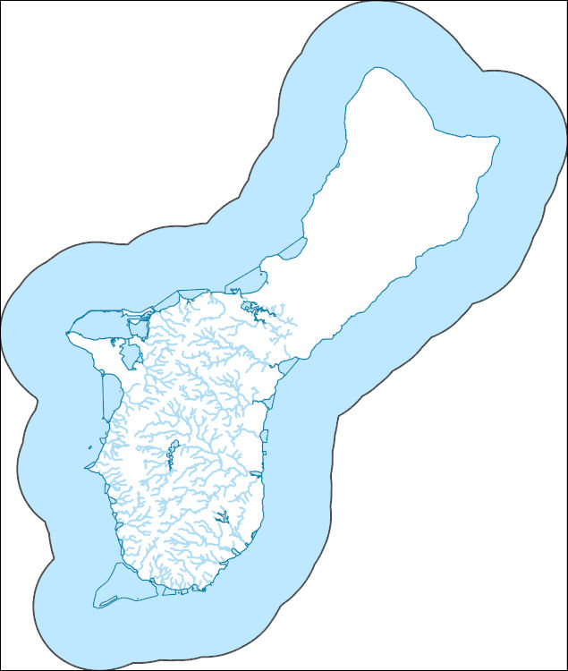
The High Resolution National Hydrography Dataset Plus (NHDPlus HR) is an integrated set of geospatial data layers, including the National Hydrography Dataset (NHD), National Watershed Boundary Dataset (WBD), and 3D Elevation Program Digital Elevation Model (3DEP DEM). The NHDPlus HR combines the NHD, 3DEP DEMs, and WBD to a data suite that includes the NHD stream network with linear referencing functionality, the WBD hydrologic units, elevation-derived catchment areas for each stream segment, "value added attributes" (VAAs), and other features that enhance hydrologic data analysis and routing.
Tags: Beaver County,
Box Elder County,
Cache County,
Carbon County,
Cassia County, All tags...
Davis County,
Downloadable Data,
Duchesne County,
Elko County,
GeoPackage,
HU-4,
HU-4 Subregion,
HU4_1602,
Hydrography,
ID,
Idaho,
Iron County,
Juab County,
Lincoln County,
Millard County,
Morgan County,
NHDPlus HR Rasters,
NHDPlus High Resolution (NHDPlus HR),
NV,
National Hydrography Dataset (NHD),
National Hydrography Dataset Plus High Resolution (NHDPlus HR),
National Hydrography Dataset Plus High Resolution (NHDPlus HR) Current,
Nevada,
Oneida County,
Open Geospatial Consortium GeoPackage 1.2,
Power County,
Rich County,
Salt Lake County,
Sanpete County,
Summit County,
Tooele County,
US,
UT,
Uinta County,
United States,
Utah,
Utah County,
WY,
Wasatch County,
Weber County,
White Pine County,
Wyoming,
base maps,
cartography,
catchments,
channels,
digital elevation models,
drainage basins,
earthsciences,
environment,
geographic information systems,
geoscientificInformation,
geospatial analysis,
hydrographic datasets,
hydrographic features,
hydrology,
inlandWaters,
lakes,
land surface characteristics,
reservoirs,
river reaches,
rivers,
streamflow,
streamflow data,
streams,
surface water quality,
topography,
water resources,
waterbodies,
watersheds, Fewer tags

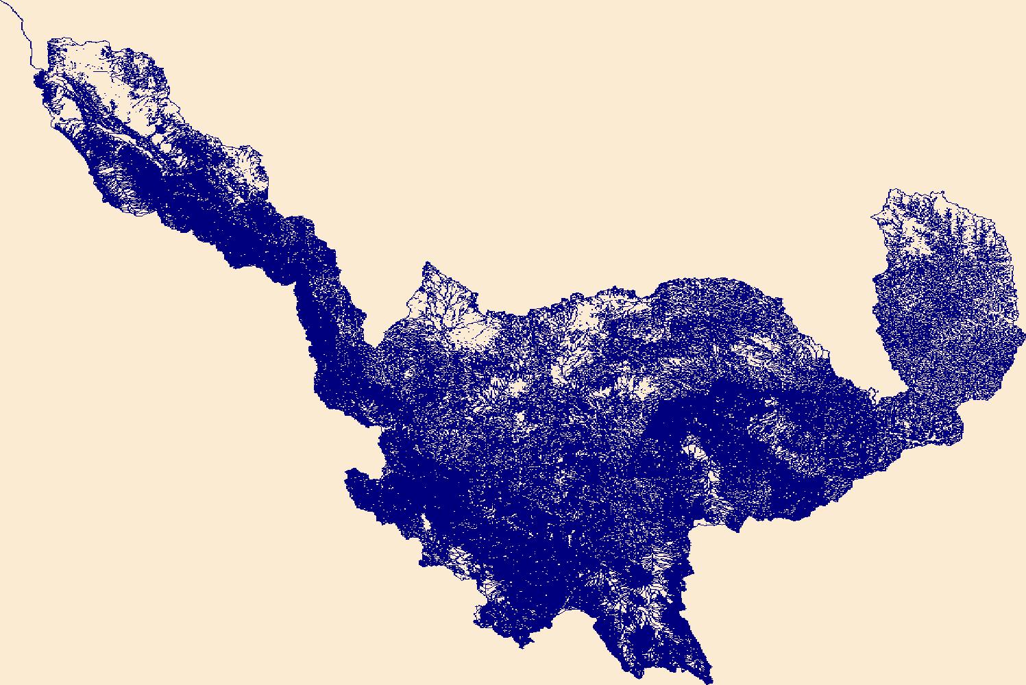
The High Resolution National Hydrography Dataset Plus (NHDPlus HR) is an integrated set of geospatial data layers, including the best available National Hydrography Dataset (NHD), the 10-meter 3D Elevation Program Digital Elevation Model (3DEP DEM), and the National Watershed Boundary Dataset (WBD). The NHDPlus HR combines the NHD, 3DEP DEMs, and WBD to create a stream network with linear referencing, feature naming, "value added attributes" (VAAs), elevation-derived catchments, and other features for hydrologic data analysis. The stream network with linear referencing is a system of data relationships applied to hydrographic systems so that one stream reach "flows" into another and "events" can be tied to and traced...
Tags: CA,
California,
Downloadable Data,
Esmeralda County,
Fresno County, All tags...
GeoPackage,
HU-4 Subregion,
HU-4 Subregion,
HU4_1809,
Hydrography,
Inyo County,
Kern County,
Los Angeles County,
Madera County,
Mineral County,
Mono County,
NHDPlus HR Rasters,
NHDPlus High Resolution (NHDPlus HR),
NV,
National Hydrography Dataset (NHD),
National Hydrography Dataset Plus High Resolution (NHDPlus HR),
National Hydrography Dataset Plus High Resolution (NHDPlus HR) Current,
Nevada,
Nye County,
Open Geospatial Consortium GeoPackage 1.2,
San Bernardino County,
Tulare County,
Tuolumne County,
US,
United States,
base maps,
cartography,
catchments,
channels,
digital elevation models,
drainage basins,
earth sciences,
elevation,
environment,
geographic information systems,
geoscientific,
geospatial analysis,
hydrographic datasets,
hydrographic features,
hydrology,
imagery,
inland waters,
lakes,
land surface characteristics,
reservoirs,
river reaches,
rivers,
streamflow,
streamflow data,
streams,
topography,
water bodies,
water quality,
water resources,
watersheds, Fewer tags
The High Resolution National Hydrography Dataset Plus (NHDPlus HR) is an integrated set of geospatial data layers, including the best available National Hydrography Dataset (NHD), the 10-meter 3D Elevation Program Digital Elevation Model (3DEP DEM), and the National Watershed Boundary Dataset (WBD). The NHDPlus HR combines the NHD, 3DEP DEMs, and WBD to create a stream network with linear referencing, feature naming, "value added attributes" (VAAs), elevation-derived catchments, and other features for hydrologic data analysis. The stream network with linear referencing is a system of data relationships applied to hydrographic systems so that one stream reach "flows" into another and "events" can be tied to and traced...
Tags: Downloadable Data,
GU,
GeoPackage,
Guam,
Guam County, All tags...
HU-4 Subregion,
HU-4 Subregion,
HU4_2201,
Hydrography,
NHDPlus HR Rasters,
NHDPlus High Resolution (NHDPlus HR),
National Hydrography Dataset (NHD),
National Hydrography Dataset Plus High Resolution (NHDPlus HR),
National Hydrography Dataset Plus High Resolution (NHDPlus HR) Current,
Open Geospatial Consortium GeoPackage 1.2,
US,
United States,
base maps,
cartography,
catchments,
channels,
digital elevation models,
drainage basins,
earth sciences,
elevation,
environment,
geographic information systems,
geoscientific,
geospatial analysis,
hydrographic datasets,
hydrographic features,
hydrology,
imagery,
inland waters,
lakes,
land surface characteristics,
reservoirs,
river reaches,
rivers,
streamflow,
streamflow data,
streams,
topography,
water bodies,
water quality,
water resources,
watersheds, Fewer tags
The High Resolution National Hydrography Dataset Plus (NHDPlus HR) is an integrated set of geospatial data layers, including the best available National Hydrography Dataset (NHD), the 10-meter 3D Elevation Program Digital Elevation Model (3DEP DEM), and the National Watershed Boundary Dataset (WBD). The NHDPlus HR combines the NHD, 3DEP DEMs, and WBD to create a stream network with linear referencing, feature naming, "value added attributes" (VAAs), elevation-derived catchments, and other features for hydrologic data analysis. The stream network with linear referencing is a system of data relationships applied to hydrographic systems so that one stream reach "flows" into another and "events" can be tied to and traced...
Tags: Brewster County,
Crockett County,
Culberson County,
Downloadable Data,
Doña Ana County, All tags...
Edwards County,
El Paso County,
GeoPackage,
HU-4 Subregion,
HU-4 Subregion,
HU4_1304,
Hudspeth County,
Hydrography,
Jeff Davis County,
NHDPlus HR Rasters,
NHDPlus High Resolution (NHDPlus HR),
NM,
National Hydrography Dataset (NHD),
National Hydrography Dataset Plus High Resolution (NHDPlus HR),
National Hydrography Dataset Plus High Resolution (NHDPlus HR) Current,
New Mexico,
Open Geospatial Consortium GeoPackage 1.2,
Pecos County,
Presidio County,
Schleicher County,
Sutton County,
TX,
Terrell County,
Texas,
US,
United States,
Val Verde County,
base maps,
cartography,
catchments,
channels,
digital elevation models,
drainage basins,
earth sciences,
elevation,
environment,
geographic information systems,
geoscientific,
geospatial analysis,
hydrographic datasets,
hydrographic features,
hydrology,
imagery,
inland waters,
lakes,
land surface characteristics,
reservoirs,
river reaches,
rivers,
streamflow,
streamflow data,
streams,
topography,
water bodies,
water quality,
water resources,
watersheds, Fewer tags

The High Resolution National Hydrography Dataset Plus (NHDPlus HR) is an integrated set of geospatial data layers, including the National Hydrography Dataset (NHD), National Watershed Boundary Dataset (WBD), and 3D Elevation Program Digital Elevation Model (3DEP DEM). The NHDPlus HR combines the NHD, 3DEP DEMs, and WBD to a data suite that includes the NHD stream network with linear referencing functionality, the WBD hydrologic units, elevation-derived catchment areas for each stream segment, "value added attributes" (VAAs), and other features that enhance hydrologic data analysis and routing.
Tags: 4-digit hydrologic unit,
CA,
California,
Churchill County,
Downloadable Data, All tags...
Elko County,
Eureka County,
GeoPackage,
HU-4 Subregion,
HU4,
HU4_1604,
Harney County,
Humboldt County,
Hydrography,
Lander County,
Lassen County,
Malheur County,
NHDPlus HR Rasters,
NHDPlus High Resolution (NHDPlus HR),
NV,
National Hydrography Dataset (NHD),
National Hydrography Dataset Plus High Resolution (NHDPlus HR),
National Hydrography Dataset Plus High Resolution (NHDPlus HR) Current,
Nevada,
Nye County,
OR,
Oregon,
Pershing County,
US,
United States,
Washoe County,
White Pine County,
base maps,
cartography,
catchments,
channels,
digital elevation models,
drainage basins,
earthsciences,
environment,
geographic information systems,
geoscientificInformation,
geospatial analysis,
hydrographic datasets,
hydrographic features,
hydrology,
inlandWaters,
lakes,
land surface characteristics,
reservoirs,
river reaches,
rivers,
streamflow,
streamflow data,
streams,
surface water quality,
topography,
water resources,
waterbodies,
watersheds, Fewer tags

The High Resolution National Hydrography Dataset Plus (NHDPlus HR) is an integrated set of geospatial data layers, including the best available National Hydrography Dataset (NHD), the 10-meter 3D Elevation Program Digital Elevation Model (3DEP DEM), and the National Watershed Boundary Dataset (WBD). The NHDPlus HR combines the NHD, 3DEP DEMs, and WBD to create a stream network with linear referencing, feature naming, "value added attributes" (VAAs), elevation-derived catchments, and other features for hydrologic data analysis. The stream network with linear referencing is a system of data relationships applied to hydrographic systems so that one stream reach "flows" into another and "events" can be tied to and traced...
Tags: Chaves County,
Culberson County,
Curry County,
De Baca County,
Downloadable Data, All tags...
Eddy County,
GeoPackage,
Guadalupe County,
HU-4 Subregion,
HU-4 Subregion,
HU4_1306,
Hydrography,
Lea County,
Lincoln County,
Mora County,
NHDPlus HR Rasters,
NHDPlus High Resolution (NHDPlus HR),
NM,
National Hydrography Dataset (NHD),
National Hydrography Dataset Plus High Resolution (NHDPlus HR),
National Hydrography Dataset Plus High Resolution (NHDPlus HR) Current,
New Mexico,
Open Geospatial Consortium GeoPackage 1.2,
Otero County,
Quay County,
Rio Arriba County,
Roosevelt County,
San Miguel County,
Santa Fe County,
TX,
Texas,
Torrance County,
US,
United States,
base maps,
cartography,
catchments,
channels,
digital elevation models,
drainage basins,
earth sciences,
elevation,
environment,
geographic information systems,
geoscientific,
geospatial analysis,
hydrographic datasets,
hydrographic features,
hydrology,
imagery,
inland waters,
lakes,
land surface characteristics,
reservoirs,
river reaches,
rivers,
streamflow,
streamflow data,
streams,
topography,
water bodies,
water quality,
water resources,
watersheds, Fewer tags

The High Resolution National Hydrography Dataset Plus (NHDPlus HR) is an integrated set of geospatial data layers, including the best available National Hydrography Dataset (NHD), the 10-meter 3D Elevation Program Digital Elevation Model (3DEP DEM), and the National Watershed Boundary Dataset (WBD). The NHDPlus HR combines the NHD, 3DEP DEMs, and WBD to create a stream network with linear referencing, feature naming, "value added attributes" (VAAs), elevation-derived catchments, and other features for hydrologic data analysis. The stream network with linear referencing is a system of data relationships applied to hydrographic systems so that one stream reach "flows" into another and "events" can be tied to and traced...
Tags: CA,
California,
Downloadable Data,
GeoPackage,
HU-4 Subregion, All tags...
HU-4 Subregion,
HU4_1807,
Hydrography,
Kern County,
Los Angeles County,
NHDPlus HR Rasters,
NHDPlus High Resolution (NHDPlus HR),
National Hydrography Dataset (NHD),
National Hydrography Dataset Plus High Resolution (NHDPlus HR),
National Hydrography Dataset Plus High Resolution (NHDPlus HR) Current,
Open Geospatial Consortium GeoPackage 1.2,
Orange County,
Riverside County,
San Bernardino County,
San Diego County,
Santa Barbara County,
US,
United States,
Ventura County,
base maps,
cartography,
catchments,
channels,
digital elevation models,
drainage basins,
earth sciences,
elevation,
environment,
geographic information systems,
geoscientific,
geospatial analysis,
hydrographic datasets,
hydrographic features,
hydrology,
imagery,
inland waters,
lakes,
land surface characteristics,
reservoirs,
river reaches,
rivers,
streamflow,
streamflow data,
streams,
topography,
water bodies,
water quality,
water resources,
watersheds, Fewer tags

The High Resolution National Hydrography Dataset Plus (NHDPlus HR) is an integrated set of geospatial data layers, including the National Hydrography Dataset (NHD), National Watershed Boundary Dataset (WBD), and 3D Elevation Program Digital Elevation Model (3DEP DEM). The NHDPlus HR combines the NHD, 3DEP DEMs, and WBD to a data suite that includes the NHD stream network with linear referencing functionality, the WBD hydrologic units, elevation-derived catchment areas for each stream segment, "value added attributes" (VAAs), and other features that enhance hydrologic data analysis and routing.
Tags: AK,
Alaska,
Downloadable Data,
GeoPackage,
HU-8, All tags...
HU-8 Subbasin,
HU8_19060504,
Hydrography,
NHDPlus HR Rasters,
NHDPlus High Resolution (NHDPlus HR),
National Hydrography Dataset (NHD),
National Hydrography Dataset Plus High Resolution (NHDPlus HR),
National Hydrography Dataset Plus High Resolution (NHDPlus HR) Current,
North Slope County,
Open Geospatial Consortium GeoPackage 1.2,
US,
United States,
base maps,
cartography,
catchments,
channels,
digital elevation models,
drainage basins,
earthsciences,
environment,
geographic information systems,
geoscientificInformation,
geospatial analysis,
hydrographic datasets,
hydrographic features,
hydrology,
inlandWaters,
lakes,
land surface characteristics,
reservoirs,
river reaches,
rivers,
streamflow,
streamflow data,
streams,
surface water quality,
topography,
water resources,
waterbodies,
watersheds, Fewer tags

The High Resolution National Hydrography Dataset Plus (NHDPlus HR) is an integrated set of geospatial data layers, including the National Hydrography Dataset (NHD), National Watershed Boundary Dataset (WBD), and 3D Elevation Program Digital Elevation Model (3DEP DEM). The NHDPlus HR combines the NHD, 3DEP DEMs, and WBD to a data suite that includes the NHD stream network with linear referencing functionality, the WBD hydrologic units, elevation-derived catchment areas for each stream segment, "value added attributes" (VAAs), and other features that enhance hydrologic data analysis and routing.
Tags: AK,
Alaska,
Downloadable Data,
GeoPackage,
HU-8, All tags...
HU-8 Subbasin,
HU8_19060502,
Hydrography,
NHDPlus HR Rasters,
NHDPlus High Resolution (NHDPlus HR),
National Hydrography Dataset (NHD),
National Hydrography Dataset Plus High Resolution (NHDPlus HR),
National Hydrography Dataset Plus High Resolution (NHDPlus HR) Current,
North Slope County,
Open Geospatial Consortium GeoPackage 1.2,
US,
United States,
base maps,
cartography,
catchments,
channels,
digital elevation models,
drainage basins,
earthsciences,
environment,
geographic information systems,
geoscientificInformation,
geospatial analysis,
hydrographic datasets,
hydrographic features,
hydrology,
inlandWaters,
lakes,
land surface characteristics,
reservoirs,
river reaches,
rivers,
streamflow,
streamflow data,
streams,
surface water quality,
topography,
water resources,
waterbodies,
watersheds, Fewer tags

The High Resolution National Hydrography Dataset Plus (NHDPlus HR) is an integrated set of geospatial data layers, including the best available National Hydrography Dataset (NHD), the 10-meter 3D Elevation Program Digital Elevation Model (3DEP DEM), and the National Watershed Boundary Dataset (WBD). The NHDPlus HR combines the NHD, 3DEP DEMs, and WBD to create a stream network with linear referencing, feature naming, "value added attributes" (VAAs), elevation-derived catchments, and other features for hydrologic data analysis. The stream network with linear referencing is a system of data relationships applied to hydrographic systems so that one stream reach "flows" into another and "events" can be tied to and traced...
Tags: Archer County,
Baylor County,
Beckham County,
Briscoe County,
Bryan County, All tags...
Caddo County,
Canadian County,
Carter County,
Childress County,
Clay County,
Collingsworth County,
Comanche County,
Cooke County,
Cottle County,
Cotton County,
Crosby County,
Custer County,
Dewey County,
Dickens County,
Downloadable Data,
Floyd County,
Foard County,
Garvin County,
GeoPackage,
Grady County,
Gray County,
Grayson County,
HU-4 Subregion,
HU-4 Subregion,
HU4_1113,
Hale County,
Hall County,
Hardeman County,
Harmon County,
Hemphill County,
Hydrography,
Jackson County,
Jefferson County,
Johnston County,
King County,
Kiowa County,
Knox County,
Love County,
Marshall County,
McClain County,
Montague County,
Motley County,
Murray County,
NHDPlus HR Rasters,
NHDPlus High Resolution (NHDPlus HR),
National Hydrography Dataset (NHD),
National Hydrography Dataset Plus High Resolution (NHDPlus HR),
National Hydrography Dataset Plus High Resolution (NHDPlus HR) Current,
OK,
Oklahoma,
Open Geospatial Consortium GeoPackage 1.2,
Pontotoc County,
Roberts County,
Roger Mills County,
Stephens County,
Swisher County,
TX,
Texas,
Tillman County,
US,
United States,
Washita County,
Wheeler County,
Wichita County,
Wilbarger County,
Young County,
base maps,
cartography,
catchments,
channels,
digital elevation models,
drainage basins,
earth sciences,
elevation,
environment,
geographic information systems,
geoscientific,
geospatial analysis,
hydrographic datasets,
hydrographic features,
hydrology,
imagery,
inland waters,
lakes,
land surface characteristics,
reservoirs,
river reaches,
rivers,
streamflow,
streamflow data,
streams,
topography,
water bodies,
water quality,
water resources,
watersheds, Fewer tags

The High Resolution National Hydrography Dataset Plus (NHDPlus HR) is an integrated set of geospatial data layers, including the best available National Hydrography Dataset (NHD), the 10-meter 3D Elevation Program Digital Elevation Model (3DEP DEM), and the National Watershed Boundary Dataset (WBD). The NHDPlus HR combines the NHD, 3DEP DEMs, and WBD to create a stream network with linear referencing, feature naming, "value added attributes" (VAAs), elevation-derived catchments, and other features for hydrologic data analysis. The stream network with linear referencing is a system of data relationships applied to hydrographic systems so that one stream reach "flows" into another and "events" can be tied to and traced...
Tags: AdamsCounty,
AtchisonCounty,
BrownCounty,
ButlerCounty,
ClayCounty, All tags...
ClayCounty,
DouglasCounty,
Downloadable Data,
FillmoreCounty,
FranklinCounty,
GageCounty,
GearyCounty,
GeoPackage,
HU-4 Subregion,
HU-4 Subregion,
HallCounty,
HamiltonCounty,
Hydrography,
JacksonCounty,
JacksonCounty,
JeffersonCounty,
JeffersonCounty,
JohnsonCounty,
KearneyCounty,
LancasterCounty,
LeavenworthCounty,
MarshallCounty,
MorrisCounty,
NE,
NHDPlus HR Rasters,
NHDPlus High Resolution (NHDPlus HR),
National Hydrography Dataset (NHD),
National Hydrography Dataset Plus High Resolution (NHDPlus HR),
National Hydrography Dataset Plus High Resolution (NHDPlus HR) Current,
Nebraska,
NemahaCounty,
NuckollsCounty,
Open Geospatial Consortium GeoPackage 1.2,
OsageCounty,
PawneeCounty,
PolkCounty,
PottawatomieCounty,
RepublicCounty,
RileyCounty,
SalineCounty,
SewardCounty,
ShawneeCounty,
ThayerCounty,
US,
United States,
WabaunseeCounty,
WashingtonCounty,
WebsterCounty,
WyandotteCounty,
YorkCounty,
base maps,
cartography,
catchments,
channels,
digital elevation models,
drainage basins,
earth sciences,
elevation,
environment,
geographic information systems,
geoscientific,
geospatial analysis,
hydrographic datasets,
hydrographic features,
hydrology,
imagery,
inland waters,
lakes,
land surface characteristics,
reservoirs,
river reaches,
rivers,
streamflow,
streamflow data,
streams,
topography,
water bodies,
water quality,
water resources,
watersheds, Fewer tags

The High Resolution National Hydrography Dataset Plus (NHDPlus HR) is an integrated set of geospatial data layers, including the best available National Hydrography Dataset (NHD), the 10-meter 3D Elevation Program Digital Elevation Model (3DEP DEM), and the National Watershed Boundary Dataset (WBD). The NHDPlus HR combines the NHD, 3DEP DEMs, and WBD to create a stream network with linear referencing, feature naming, "value added attributes" (VAAs), elevation-derived catchments, and other features for hydrologic data analysis. The stream network with linear referencing is a system of data relationships applied to hydrographic systems so that one stream reach "flows" into another and "events" can be tied to and traced...
Tags: Beaver County,
Blaine County,
Canadian County,
Cimarron County,
Cleveland County, All tags...
Creek County,
Dallam County,
Dewey County,
Downloadable Data,
Ellis County,
GeoPackage,
HU-4 Subregion,
HU-4 Subregion,
HU4_1110,
Hansford County,
Harper County,
Hartley County,
Hemphill County,
Hughes County,
Hutchinson County,
Hydrography,
KS,
Kansas,
Lincoln County,
Lipscomb County,
Logan County,
Major County,
McIntosh County,
Moore County,
Muskogee County,
NHDPlus HR Rasters,
NHDPlus High Resolution (NHDPlus HR),
NM,
National Hydrography Dataset (NHD),
National Hydrography Dataset Plus High Resolution (NHDPlus HR),
National Hydrography Dataset Plus High Resolution (NHDPlus HR) Current,
New Mexico,
OK,
Ochiltree County,
Okfuskee County,
Oklahoma,
Oklahoma County,
Okmulgee County,
Open Geospatial Consortium GeoPackage 1.2,
Pottawatomie County,
Seminole County,
Seward County,
Sherman County,
Stevens County,
TX,
Texas,
Texas County,
US,
Union County,
United States,
Woodward County,
base maps,
cartography,
catchments,
channels,
digital elevation models,
drainage basins,
earth sciences,
elevation,
environment,
geographic information systems,
geoscientific,
geospatial analysis,
hydrographic datasets,
hydrographic features,
hydrology,
imagery,
inland waters,
lakes,
land surface characteristics,
reservoirs,
river reaches,
rivers,
streamflow,
streamflow data,
streams,
topography,
water bodies,
water quality,
water resources,
watersheds, Fewer tags

The High Resolution National Hydrography Dataset Plus (NHDPlus HR) is an integrated set of geospatial data layers, including the best available National Hydrography Dataset (NHD), the 10-meter 3D Elevation Program Digital Elevation Model (3DEP DEM), and the National Watershed Boundary Dataset (WBD). The NHDPlus HR combines the NHD, 3DEP DEMs, and WBD to create a stream network with linear referencing, feature naming, "value added attributes" (VAAs), elevation-derived catchments, and other features for hydrologic data analysis. The stream network with linear referencing is a system of data relationships applied to hydrographic systems so that one stream reach "flows" into another and "events" can be tied to and traced...
Tags: ButteCounty,
CampbellCounty,
CarterCounty,
ConverseCounty,
CrookCounty, All tags...
CusterCounty,
DawesCounty,
Downloadable Data,
Fall RiverCounty,
GeoPackage,
HU-4 Subregion,
HU-4 Subregion,
HaakonCounty,
Hydrography,
LawrenceCounty,
MeadeCounty,
NHDPlus HR Rasters,
NHDPlus High Resolution (NHDPlus HR),
National Hydrography Dataset (NHD),
National Hydrography Dataset Plus High Resolution (NHDPlus HR),
National Hydrography Dataset Plus High Resolution (NHDPlus HR) Current,
NatronaCounty,
NiobraraCounty,
Oglala LakotaCounty,
Open Geospatial Consortium GeoPackage 1.2,
PenningtonCounty,
SiouxCounty,
US,
United States,
WY,
WestonCounty,
Wyoming,
ZiebachCounty,
base maps,
cartography,
catchments,
channels,
digital elevation models,
drainage basins,
earth sciences,
elevation,
environment,
geographic information systems,
geoscientific,
geospatial analysis,
hydrographic datasets,
hydrographic features,
hydrology,
imagery,
inland waters,
lakes,
land surface characteristics,
reservoirs,
river reaches,
rivers,
streamflow,
streamflow data,
streams,
topography,
water bodies,
water quality,
water resources,
watersheds, Fewer tags

The High Resolution National Hydrography Dataset Plus (NHDPlus HR) is an integrated set of geospatial data layers, including the best available National Hydrography Dataset (NHD), the 10-meter 3D Elevation Program Digital Elevation Model (3DEP DEM), and the National Watershed Boundary Dataset (WBD). The NHDPlus HR combines the NHD, 3DEP DEMs, and WBD to create a stream network with linear referencing, feature naming, "value added attributes" (VAAs), elevation-derived catchments, and other features for hydrologic data analysis. The stream network with linear referencing is a system of data relationships applied to hydrographic systems so that one stream reach "flows" into another and "events" can be tied to and traced...
Tags: AntelopeCounty,
ArthurCounty,
BlaineCounty,
BooneCounty,
BrownCounty, All tags...
BuffaloCounty,
CherryCounty,
CusterCounty,
DawsonCounty,
Downloadable Data,
GardenCounty,
GarfieldCounty,
GeoPackage,
GrantCounty,
GreeleyCounty,
HU-4 Subregion,
HU-4 Subregion,
HallCounty,
HoltCounty,
HookerCounty,
HowardCounty,
Hydrography,
LincolnCounty,
LoganCounty,
LoupCounty,
McPhersonCounty,
MerrickCounty,
NE,
NHDPlus HR Rasters,
NHDPlus High Resolution (NHDPlus HR),
NanceCounty,
National Hydrography Dataset (NHD),
National Hydrography Dataset Plus High Resolution (NHDPlus HR),
National Hydrography Dataset Plus High Resolution (NHDPlus HR) Current,
Nebraska,
Open Geospatial Consortium GeoPackage 1.2,
PlatteCounty,
RockCounty,
SheridanCounty,
ShermanCounty,
ThomasCounty,
US,
United States,
ValleyCounty,
WheelerCounty,
base maps,
cartography,
catchments,
channels,
digital elevation models,
drainage basins,
earth sciences,
elevation,
environment,
geographic information systems,
geoscientific,
geospatial analysis,
hydrographic datasets,
hydrographic features,
hydrology,
imagery,
inland waters,
lakes,
land surface characteristics,
reservoirs,
river reaches,
rivers,
streamflow,
streamflow data,
streams,
topography,
water bodies,
water quality,
water resources,
watersheds, Fewer tags

The High Resolution National Hydrography Dataset Plus (NHDPlus HR) is an integrated set of geospatial data layers, including the best available National Hydrography Dataset (NHD), the 10-meter 3D Elevation Program Digital Elevation Model (3DEP DEM), and the National Watershed Boundary Dataset (WBD). The NHDPlus HR combines the NHD, 3DEP DEMs, and WBD to create a stream network with linear referencing, feature naming, "value added attributes" (VAAs), elevation-derived catchments, and other features for hydrologic data analysis. The stream network with linear referencing is a system of data relationships applied to hydrographic systems so that one stream reach "flows" into another and "events" can be tied to and traced...
Tags: AdamsCounty,
AntelopeCounty,
BooneCounty,
BuffaloCounty,
ButlerCounty, All tags...
CassCounty,
ColfaxCounty,
CusterCounty,
DawsonCounty,
DodgeCounty,
DouglasCounty,
Downloadable Data,
FrontierCounty,
GageCounty,
GeoPackage,
GosperCounty,
HU-4 Subregion,
HU-4 Subregion,
HallCounty,
HamiltonCounty,
HowardCounty,
Hydrography,
KearneyCounty,
LancasterCounty,
LincolnCounty,
LoganCounty,
MadisonCounty,
McPhersonCounty,
MerrickCounty,
NE,
NHDPlus HR Rasters,
NHDPlus High Resolution (NHDPlus HR),
NanceCounty,
National Hydrography Dataset (NHD),
National Hydrography Dataset Plus High Resolution (NHDPlus HR),
National Hydrography Dataset Plus High Resolution (NHDPlus HR) Current,
Nebraska,
Open Geospatial Consortium GeoPackage 1.2,
PhelpsCounty,
PlatteCounty,
PolkCounty,
SalineCounty,
SarpyCounty,
SaundersCounty,
SewardCounty,
US,
United States,
base maps,
cartography,
catchments,
channels,
digital elevation models,
drainage basins,
earth sciences,
elevation,
environment,
geographic information systems,
geoscientific,
geospatial analysis,
hydrographic datasets,
hydrographic features,
hydrology,
imagery,
inland waters,
lakes,
land surface characteristics,
reservoirs,
river reaches,
rivers,
streamflow,
streamflow data,
streams,
topography,
water bodies,
water quality,
water resources,
watersheds, Fewer tags

The High Resolution National Hydrography Dataset Plus (NHDPlus HR) is an integrated set of geospatial data layers, including the best available National Hydrography Dataset (NHD), the 10-meter 3D Elevation Program Digital Elevation Model (3DEP DEM), and the National Watershed Boundary Dataset (WBD). The NHDPlus HR combines the NHD, 3DEP DEMs, and WBD to create a stream network with linear referencing, feature naming, "value added attributes" (VAAs), elevation-derived catchments, and other features for hydrologic data analysis. The stream network with linear referencing is a system of data relationships applied to hydrographic systems so that one stream reach "flows" into another and "events" can be tied to and traced...
Tags: AL,
Alabama,
BaldwinCounty,
BarbourCounty,
BayCounty, All tags...
BullockCounty,
ButlerCounty,
CalhounCounty,
CoffeeCounty,
ConecuhCounty,
CovingtonCounty,
CrenshawCounty,
DaleCounty,
Downloadable Data,
EscambiaCounty,
EscambiaCounty,
GenevaCounty,
GeoPackage,
GulfCounty,
HU-4 Subregion,
HU-4 Subregion,
HenryCounty,
HolmesCounty,
HoustonCounty,
Hydrography,
JacksonCounty,
LowndesCounty,
MobileCounty,
MonroeCounty,
MontgomeryCounty,
NHDPlus HR Rasters,
NHDPlus High Resolution (NHDPlus HR),
National Hydrography Dataset (NHD),
National Hydrography Dataset Plus High Resolution (NHDPlus HR),
National Hydrography Dataset Plus High Resolution (NHDPlus HR) Current,
OkaloosaCounty,
Open Geospatial Consortium GeoPackage 1.2,
PikeCounty,
Santa RosaCounty,
US,
United States,
WaltonCounty,
WashingtonCounty,
base maps,
cartography,
catchments,
channels,
digital elevation models,
drainage basins,
earth sciences,
elevation,
environment,
geographic information systems,
geoscientific,
geospatial analysis,
hydrographic datasets,
hydrographic features,
hydrology,
imagery,
inland waters,
lakes,
land surface characteristics,
reservoirs,
river reaches,
rivers,
streamflow,
streamflow data,
streams,
topography,
water bodies,
water quality,
water resources,
watersheds, Fewer tags

The High Resolution National Hydrography Dataset Plus (NHDPlus HR) is an integrated set of geospatial data layers, including the best available National Hydrography Dataset (NHD), the 10-meter 3D Elevation Program Digital Elevation Model (3DEP DEM), and the National Watershed Boundary Dataset (WBD). The NHDPlus HR combines the NHD, 3DEP DEMs, and WBD to create a stream network with linear referencing, feature naming, "value added attributes" (VAAs), elevation-derived catchments, and other features for hydrologic data analysis. The stream network with linear referencing is a system of data relationships applied to hydrographic systems so that one stream reach "flows" into another and "events" can be tied to and traced...
Tags: Alachua County,
Baker County,
Bradford County,
Brevard County,
Clay County, All tags...
Downloadable Data,
Duval County,
FL,
Flagler County,
Florida,
GeoPackage,
HU-4 Subregion,
HU-4 Subregion,
HU4_0308,
Hydrography,
Indian River County,
Lake County,
Levy County,
Marion County,
NHDPlus HR Rasters,
NHDPlus High Resolution (NHDPlus HR),
National Hydrography Dataset (NHD),
National Hydrography Dataset Plus High Resolution (NHDPlus HR),
National Hydrography Dataset Plus High Resolution (NHDPlus HR) Current,
Okeechobee County,
Open Geospatial Consortium GeoPackage 1.2,
Orange County,
Osceola County,
Polk County,
Putnam County,
Seminole County,
St. Johns County,
St. Lucie County,
Sumter County,
US,
United States,
Volusia County,
base maps,
cartography,
catchments,
channels,
digital elevation models,
drainage basins,
earth sciences,
elevation,
environment,
geographic information systems,
geoscientific,
geospatial analysis,
hydrographic datasets,
hydrographic features,
hydrology,
imagery,
inland waters,
lakes,
land surface characteristics,
reservoirs,
river reaches,
rivers,
streamflow,
streamflow data,
streams,
topography,
water bodies,
water quality,
water resources,
watersheds, Fewer tags

The High Resolution National Hydrography Dataset Plus (NHDPlus HR) is an integrated set of geospatial data layers, including the National Hydrography Dataset (NHD), National Watershed Boundary Dataset (WBD), and 3D Elevation Program Digital Elevation Model (3DEP DEM). The NHDPlus HR combines the NHD, 3DEP DEMs, and WBD to a data suite that includes the NHD stream network with linear referencing functionality, the WBD hydrologic units, elevation-derived catchment areas for each stream segment, "value added attributes" (VAAs), and other features that enhance hydrologic data analysis and routing.
Tags: 4-digit hydrologic unit,
Anderson County,
Ashe County,
Avery County,
Bell County, All tags...
Bland County,
Bledsoe County,
Blount County,
Bristol County,
Buchanan County,
Buncombe County,
Caldwell County,
Campbell County,
Carter County,
Cherokee County,
Claiborne County,
Clay County,
Cocke County,
Cumberland County,
Dickenson County,
Downloadable Data,
Fentress County,
GA,
GeoPackage,
Georgia,
Graham County,
Grainger County,
Grayson County,
Greene County,
Greenville County,
HU-4 Subregion,
HU4,
HU4_0601,
Hamblen County,
Hancock County,
Harlan County,
Hawkins County,
Haywood County,
Henderson County,
Hydrography,
Jackson County,
Jefferson County,
Johnson County,
KY,
Kentucky,
Knox County,
Lee County,
Letcher County,
Loudon County,
Macon County,
Madison County,
McDowell County,
McMinn County,
Meigs County,
Mitchell County,
Monroe County,
Morgan County,
NC,
NHDPlus HR Rasters,
NHDPlus High Resolution (NHDPlus HR),
National Hydrography Dataset (NHD),
National Hydrography Dataset Plus High Resolution (NHDPlus HR),
National Hydrography Dataset Plus High Resolution (NHDPlus HR) Current,
North Carolina,
Norton County,
Pickens County,
Putnam County,
Rabun County,
Rhea County,
Roane County,
Russell County,
SC,
Scott County,
Sevier County,
Smyth County,
South Carolina,
Sullivan County,
Swain County,
TN,
Tazewell County,
Tennessee,
Transylvania County,
US,
Unicoi County,
Union County,
United States,
VA,
Virginia,
WV,
Washington County,
Watauga County,
West Virginia,
Wise County,
Wythe County,
Yancey County,
base maps,
cartography,
catchments,
channels,
digital elevation models,
drainage basins,
earthsciences,
environment,
geographic information systems,
geoscientificInformation,
geospatial analysis,
hydrographic datasets,
hydrographic features,
hydrology,
inlandWaters,
lakes,
land surface characteristics,
reservoirs,
river reaches,
rivers,
streamflow,
streamflow data,
streams,
surface water quality,
topography,
water resources,
waterbodies,
watersheds, Fewer tags

The High Resolution National Hydrography Dataset Plus (NHDPlus HR) is an integrated set of geospatial data layers, including the best available National Hydrography Dataset (NHD), the 10-meter 3D Elevation Program Digital Elevation Model (3DEP DEM), and the National Watershed Boundary Dataset (WBD). The NHDPlus HR combines the NHD, 3DEP DEMs, and WBD to create a stream network with linear referencing, feature naming, "value added attributes" (VAAs), elevation-derived catchments, and other features for hydrologic data analysis. The stream network with linear referencing is a system of data relationships applied to hydrographic systems so that one stream reach "flows" into another and "events" can be tied to and traced...
Tags: Adams County,
Allen County,
Allen County,
Ashland County,
Auglaize County, All tags...
Branch County,
Crawford County,
DeKalb County,
Defiance County,
Downloadable Data,
Erie County,
Fulton County,
GeoPackage,
HU-4 Subregion,
HU-4 Subregion,
HU4_0410,
Hancock County,
Hardin County,
Henry County,
Hillsdale County,
Huron County,
Hydrography,
IN,
Indiana,
Ingham County,
Jackson County,
Lenawee County,
Livingston County,
Lorain County,
Lucas County,
MI,
Marion County,
Mercer County,
Michigan,
Monroe County,
NHDPlus HR Rasters,
NHDPlus High Resolution (NHDPlus HR),
National Hydrography Dataset (NHD),
National Hydrography Dataset Plus High Resolution (NHDPlus HR),
National Hydrography Dataset Plus High Resolution (NHDPlus HR) Current,
Noble County,
OH,
Oakland County,
Ohio,
Open Geospatial Consortium GeoPackage 1.2,
Ottawa County,
Paulding County,
Putnam County,
Richland County,
Sandusky County,
Seneca County,
Shelby County,
Steuben County,
US,
United States,
Van Wert County,
Washtenaw County,
Wayne County,
Wells County,
Williams County,
Wood County,
Wyandot County,
base maps,
cartography,
catchments,
channels,
digital elevation models,
drainage basins,
earth sciences,
elevation,
environment,
geographic information systems,
geoscientific,
geospatial analysis,
hydrographic datasets,
hydrographic features,
hydrology,
imagery,
inland waters,
lakes,
land surface characteristics,
reservoirs,
river reaches,
rivers,
streamflow,
streamflow data,
streams,
topography,
water bodies,
water quality,
water resources,
watersheds, Fewer tags

The High Resolution National Hydrography Dataset Plus (NHDPlus HR) is an integrated set of geospatial data layers, including the best available National Hydrography Dataset (NHD), the 10-meter 3D Elevation Program Digital Elevation Model (3DEP DEM), and the National Watershed Boundary Dataset (WBD). The NHDPlus HR combines the NHD, 3DEP DEMs, and WBD to create a stream network with linear referencing, feature naming, "value added attributes" (VAAs), elevation-derived catchments, and other features for hydrologic data analysis. The stream network with linear referencing is a system of data relationships applied to hydrographic systems so that one stream reach "flows" into another and "events" can be tied to and traced...
Tags: AshlandCounty,
BarronCounty,
BayfieldCounty,
BuffaloCounty,
BurnettCounty, All tags...
ChippewaCounty,
ClarkCounty,
Downloadable Data,
DunnCounty,
Eau ClaireCounty,
GeoPackage,
GogebicCounty,
HU-4 Subregion,
HU-4 Subregion,
Hydrography,
IronCounty,
JacksonCounty,
NHDPlus HR Rasters,
NHDPlus High Resolution (NHDPlus HR),
National Hydrography Dataset (NHD),
National Hydrography Dataset Plus High Resolution (NHDPlus HR),
National Hydrography Dataset Plus High Resolution (NHDPlus HR) Current,
OneidaCounty,
Open Geospatial Consortium GeoPackage 1.2,
PepinCounty,
PierceCounty,
PolkCounty,
PriceCounty,
RuskCounty,
SawyerCounty,
St. CroixCounty,
TaylorCounty,
US,
United States,
VilasCounty,
WI,
WashburnCounty,
Wisconsin,
base maps,
cartography,
catchments,
channels,
digital elevation models,
drainage basins,
earth sciences,
elevation,
environment,
geographic information systems,
geoscientific,
geospatial analysis,
hydrographic datasets,
hydrographic features,
hydrology,
imagery,
inland waters,
lakes,
land surface characteristics,
reservoirs,
river reaches,
rivers,
streamflow,
streamflow data,
streams,
topography,
water bodies,
water quality,
water resources,
watersheds, Fewer tags
|
|

