Filters: Tags: PARKER (X) > Types: Citation (X)
7 results (35ms)|
Filters
Date Range
Contacts
Tag Types Tag Schemes |
This zip folder contains ASCII text files of vectors at the specified volcano at 12-hour intervals, from January 1, 1990 through December 28, 2009. The wind vectors are divided into five files, names by their elevation range above sea level in the atmosphere: 00-05km.txt; 05-11km.txt; 11-16km.txt; 16-24km.txt; and 24-30km.txt. The zip folder also contains a subfolder "figures", with Wind rose plots of wind direction and speed over this time period. The plots are by season, and by elevation, given a total of 20 plots (4 seasons, 5 elevation ranges). A summary plot is also included which gives the year-round wind pattern at the volcano, at 0-5 km elevation. Plots are in both jpg and pdf format.
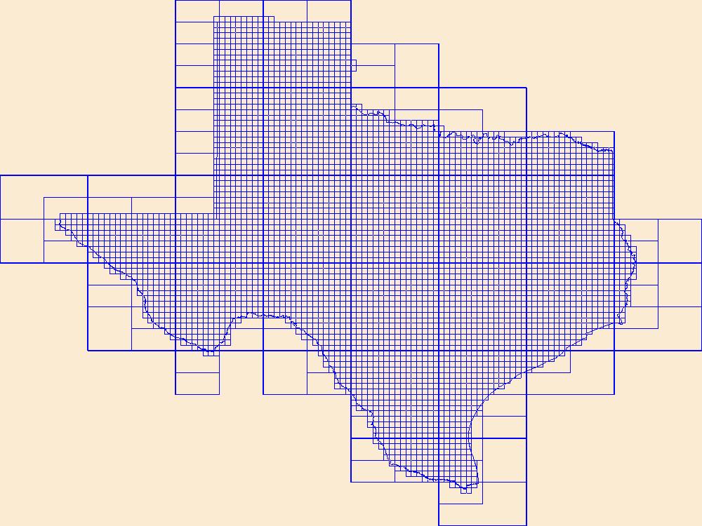
This data represents the map extent for current and historical USGS topographic maps for the United States and Territories, including 1 X 2 Degree, 1 X 1 Degree, 30 X 60 Minute, 15 X 15 Minute, 7.5 X 7.5 Minute, and 3.75 X 3.75 Minute. The grid was generated using ESRI ArcInfo GIS software.

Layers of geospatial data include contours, boundaries, land cover, hydrography, roads, transportation, geographic names, structures, and other selected map features.
Types: Citation;
Tags: 7.5 x 7.5 minute,
7_5_Min,
Combined Vector,
Combined Vector,
Combined Vector,
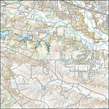
Layers of geospatial data include contours, boundaries, land cover, hydrography, roads, transportation, geographic names, structures, and other selected map features.
Types: Citation;
Tags: 7.5 x 7.5 minute,
7_5_Min,
Combined Vector,
Combined Vector,
Combined Vector,

Layers of geospatial data include contours, boundaries, land cover, hydrography, roads, transportation, geographic names, structures, and other selected map features.
Types: Citation;
Tags: 7.5 x 7.5 minute,
7_5_Min,
Combined Vector,
Combined Vector,
Combined Vector,
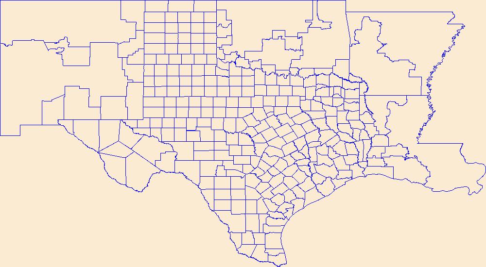
Geospatial data is comprised of government boundaries.
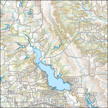
Layers of geospatial data include contours, boundaries, land cover, hydrography, roads, transportation, geographic names, structures, and other selected map features.
Types: Citation;
Tags: 7.5 x 7.5 minute,
7_5_Min,
Combined Vector,
Combined Vector,
Combined Vector,
|

|
