Filters
Date Types (for Date Range)
Contacts
(Less)
Tag Types
Tag Schemes
|
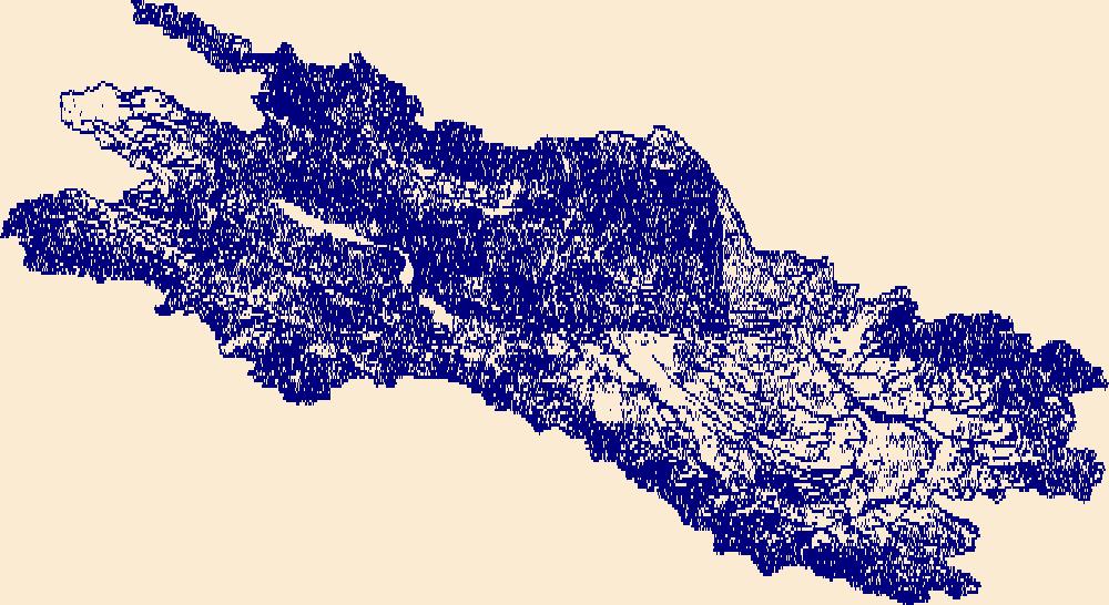
The High Resolution National Hydrography Dataset Plus (NHDPlus HR) is an integrated set of geospatial data layers, including the best available National Hydrography Dataset (NHD), the 10-meter 3D Elevation Program Digital Elevation Model (3DEP DEM), and the National Watershed Boundary Dataset (WBD). The NHDPlus HR combines the NHD, 3DEP DEMs, and WBD to create a stream network with linear referencing, feature naming, "value added attributes" (VAAs), elevation-derived catchments, and other features for hydrologic data analysis. The stream network with linear referencing is a system of data relationships applied to hydrographic systems so that one stream reach "flows" into another and "events" can be tied to and traced...
Tags: Benson County,
Bottineau County,
Burke County,
Divide County,
Downloadable Data, All tags...
GeoPackage,
HU-4 Subregion,
HU-4 Subregion,
HU4_0901,
Hydrography,
McHenry County,
McLean County,
Mountrail County,
ND,
NHDPlus HR Rasters,
NHDPlus High Resolution (NHDPlus HR),
National Hydrography Dataset (NHD),
National Hydrography Dataset Plus High Resolution (NHDPlus HR),
National Hydrography Dataset Plus High Resolution (NHDPlus HR) Current,
North Dakota,
Open Geospatial Consortium GeoPackage 1.2,
Pierce County,
Renville County,
Rolette County,
Sheridan County,
US,
United States,
Ward County,
base maps,
cartography,
catchments,
channels,
digital elevation models,
drainage basins,
earth sciences,
elevation,
environment,
geographic information systems,
geoscientific,
geospatial analysis,
hydrographic datasets,
hydrographic features,
hydrology,
imagery,
inland waters,
lakes,
land surface characteristics,
reservoirs,
river reaches,
rivers,
streamflow,
streamflow data,
streams,
topography,
water bodies,
water quality,
water resources,
watersheds, Fewer tags

The High Resolution National Hydrography Dataset Plus (NHDPlus HR) is an integrated set of geospatial data layers, including the best available National Hydrography Dataset (NHD), the 10-meter 3D Elevation Program Digital Elevation Model (3DEP DEM), and the National Watershed Boundary Dataset (WBD). The NHDPlus HR combines the NHD, 3DEP DEMs, and WBD to create a stream network with linear referencing, feature naming, "value added attributes" (VAAs), elevation-derived catchments, and other features for hydrologic data analysis. The stream network with linear referencing is a system of data relationships applied to hydrographic systems so that one stream reach "flows" into another and "events" can be tied to and traced...
Tags: Clackamas County,
Clark County,
Clatsop County,
Columbia County,
Cowlitz County, All tags...
Downloadable Data,
GeoPackage,
HU-4 Subregion,
HU-4 Subregion,
HU4_1708,
Hood River County,
Hydrography,
Lewis County,
Multnomah County,
NHDPlus HR Rasters,
NHDPlus High Resolution (NHDPlus HR),
National Hydrography Dataset (NHD),
National Hydrography Dataset Plus High Resolution (NHDPlus HR),
National Hydrography Dataset Plus High Resolution (NHDPlus HR) Current,
OR,
Open Geospatial Consortium GeoPackage 1.2,
Oregon,
Pacific County,
Pierce County,
Skamania County,
US,
United States,
WA,
Wahkiakum County,
Wasco County,
Washington,
Yakima County,
base maps,
cartography,
catchments,
channels,
digital elevation models,
drainage basins,
earth sciences,
elevation,
environment,
geographic information systems,
geoscientific,
geospatial analysis,
hydrographic datasets,
hydrographic features,
hydrology,
imagery,
inland waters,
lakes,
land surface characteristics,
reservoirs,
river reaches,
rivers,
streamflow,
streamflow data,
streams,
topography,
water bodies,
water quality,
water resources,
watersheds, Fewer tags

The High Resolution National Hydrography Dataset Plus (NHDPlus HR) is an integrated set of geospatial data layers, including the best available National Hydrography Dataset (NHD), the 10-meter 3D Elevation Program Digital Elevation Model (3DEP DEM), and the National Watershed Boundary Dataset (WBD). The NHDPlus HR combines the NHD, 3DEP DEMs, and WBD to create a stream network with linear referencing, feature naming, "value added attributes" (VAAs), elevation-derived catchments, and other features for hydrologic data analysis. The stream network with linear referencing is a system of data relationships applied to hydrographic systems so that one stream reach "flows" into another and "events" can be tied to and traced...
Tags: Benton County,
Chelan County,
Downloadable Data,
GeoPackage,
HU-4 Subregion, All tags...
HU-4 Subregion,
HU4_1703,
Hydrography,
King County,
Kittitas County,
Klickitat County,
Lewis County,
NHDPlus HR Rasters,
NHDPlus High Resolution (NHDPlus HR),
National Hydrography Dataset (NHD),
National Hydrography Dataset Plus High Resolution (NHDPlus HR),
National Hydrography Dataset Plus High Resolution (NHDPlus HR) Current,
Open Geospatial Consortium GeoPackage 1.2,
Pierce County,
US,
United States,
WA,
Washington,
Yakima County,
base maps,
cartography,
catchments,
channels,
digital elevation models,
drainage basins,
earth sciences,
elevation,
environment,
geographic information systems,
geoscientific,
geospatial analysis,
hydrographic datasets,
hydrographic features,
hydrology,
imagery,
inland waters,
lakes,
land surface characteristics,
reservoirs,
river reaches,
rivers,
streamflow,
streamflow data,
streams,
topography,
water bodies,
water quality,
water resources,
watersheds, Fewer tags

The High Resolution National Hydrography Dataset Plus (NHDPlus HR) is an integrated set of geospatial data layers, including the best available National Hydrography Dataset (NHD), the 10-meter 3D Elevation Program Digital Elevation Model (3DEP DEM), and the National Watershed Boundary Dataset (WBD). The NHDPlus HR combines the NHD, 3DEP DEMs, and WBD to create a stream network with linear referencing, feature naming, "value added attributes" (VAAs), elevation-derived catchments, and other features for hydrologic data analysis. The stream network with linear referencing is a system of data relationships applied to hydrographic systems so that one stream reach "flows" into another and "events" can be tied to and traced...
Tags: Chelan County,
Clallam County,
Downloadable Data,
GeoPackage,
Grays Harbor County, All tags...
HU-4 Subregion,
HU-4 Subregion,
HU4_1711,
Hydrography,
Island County,
Jefferson County,
King County,
Kitsap County,
Kittitas County,
Lewis County,
Mason County,
NHDPlus HR Rasters,
NHDPlus High Resolution (NHDPlus HR),
National Hydrography Dataset (NHD),
National Hydrography Dataset Plus High Resolution (NHDPlus HR),
National Hydrography Dataset Plus High Resolution (NHDPlus HR) Current,
Okanogan County,
Open Geospatial Consortium GeoPackage 1.2,
Pierce County,
San Juan County,
Skagit County,
Snohomish County,
Thurston County,
US,
United States,
WA,
Washington,
Whatcom County,
Yakima County,
base maps,
cartography,
catchments,
channels,
digital elevation models,
drainage basins,
earth sciences,
elevation,
environment,
geographic information systems,
geoscientific,
geospatial analysis,
hydrographic datasets,
hydrographic features,
hydrology,
imagery,
inland waters,
lakes,
land surface characteristics,
reservoirs,
river reaches,
rivers,
streamflow,
streamflow data,
streams,
topography,
water bodies,
water quality,
water resources,
watersheds, Fewer tags

The High Resolution National Hydrography Dataset Plus (NHDPlus HR) is an integrated set of geospatial data layers, including the best available National Hydrography Dataset (NHD), the 10-meter 3D Elevation Program Digital Elevation Model (3DEP DEM), and the National Watershed Boundary Dataset (WBD). The NHDPlus HR combines the NHD, 3DEP DEMs, and WBD to create a stream network with linear referencing, feature naming, "value added attributes" (VAAs), elevation-derived catchments, and other features for hydrologic data analysis. The stream network with linear referencing is a system of data relationships applied to hydrographic systems so that one stream reach "flows" into another and "events" can be tied to and traced...
Tags: Barnes County,
Becker County,
Beltrami County,
Benson County,
Big Stone County, All tags...
Cass County,
Cavalier County,
Clay County,
Clearwater County,
Dickey County,
Downloadable Data,
Eddy County,
Foster County,
GeoPackage,
Grand Forks County,
Grant County,
Griggs County,
HU-4 Subregion,
HU-4 Subregion,
HU4_0902,
Hydrography,
Itasca County,
Kittson County,
Koochiching County,
Lake of the Woods County,
MN,
Mahnomen County,
Marshall County,
Marshall County,
McHenry County,
McLean County,
Minnesota,
ND,
NHDPlus HR Rasters,
NHDPlus High Resolution (NHDPlus HR),
National Hydrography Dataset (NHD),
National Hydrography Dataset Plus High Resolution (NHDPlus HR),
National Hydrography Dataset Plus High Resolution (NHDPlus HR) Current,
Nelson County,
Norman County,
North Dakota,
Open Geospatial Consortium GeoPackage 1.2,
Otter Tail County,
Pembina County,
Pennington County,
Pierce County,
Polk County,
Ramsey County,
Ransom County,
Red Lake County,
Richland County,
Roberts County,
Rolette County,
Roseau County,
SD,
Sargent County,
Sheridan County,
South Dakota,
Steele County,
Stevens County,
Stutsman County,
Towner County,
Traill County,
Traverse County,
US,
United States,
Walsh County,
Wells County,
Wilkin County,
base maps,
cartography,
catchments,
channels,
digital elevation models,
drainage basins,
earth sciences,
elevation,
environment,
geographic information systems,
geoscientific,
geospatial analysis,
hydrographic datasets,
hydrographic features,
hydrology,
imagery,
inland waters,
lakes,
land surface characteristics,
reservoirs,
river reaches,
rivers,
streamflow,
streamflow data,
streams,
topography,
water bodies,
water quality,
water resources,
watersheds, Fewer tags

The High Resolution National Hydrography Dataset Plus (NHDPlus HR) is an integrated set of geospatial data layers, including the best available National Hydrography Dataset (NHD), the 10-meter 3D Elevation Program Digital Elevation Model (3DEP DEM), and the National Watershed Boundary Dataset (WBD). The NHDPlus HR combines the NHD, 3DEP DEMs, and WBD to create a stream network with linear referencing, feature naming, "value added attributes" (VAAs), elevation-derived catchments, and other features for hydrologic data analysis. The stream network with linear referencing is a system of data relationships applied to hydrographic systems so that one stream reach "flows" into another and "events" can be tied to and traced...
Tags: Appling County,
Atkinson County,
Bacon County,
Baker County,
Baldwin County, All tags...
Banks County,
Barrow County,
Ben Hill County,
Bibb County,
Bleckley County,
Brantley County,
Butts County,
Camden County,
Candler County,
Charlton County,
Clarke County,
Clayton County,
Clinch County,
Coffee County,
Columbia County,
Crawford County,
DeKalb County,
Dodge County,
Dooly County,
Downloadable Data,
Duval County,
Emanuel County,
Evans County,
FL,
Florida,
Fulton County,
GA,
GeoPackage,
Georgia,
Glynn County,
Greene County,
Gwinnett County,
HU-4 Subregion,
HU-4 Subregion,
HU4_0307,
Hall County,
Hancock County,
Henry County,
Houston County,
Hydrography,
Irwin County,
Jackson County,
Jasper County,
Jeff Davis County,
Jefferson County,
Johnson County,
Jones County,
Lamar County,
Laurens County,
Liberty County,
Long County,
Macon County,
Madison County,
McIntosh County,
Monroe County,
Montgomery County,
Morgan County,
NHDPlus HR Rasters,
NHDPlus High Resolution (NHDPlus HR),
Nassau County,
National Hydrography Dataset (NHD),
National Hydrography Dataset Plus High Resolution (NHDPlus HR),
National Hydrography Dataset Plus High Resolution (NHDPlus HR) Current,
Newton County,
Oconee County,
Oglethorpe County,
Open Geospatial Consortium GeoPackage 1.2,
Peach County,
Pierce County,
Pulaski County,
Putnam County,
Rockdale County,
Spalding County,
Taliaferro County,
Tattnall County,
Telfair County,
Toombs County,
Treutlen County,
Twiggs County,
US,
Union County,
United States,
Upson County,
Walton County,
Ware County,
Washington County,
Wayne County,
Wheeler County,
Wilcox County,
Wilkinson County,
base maps,
cartography,
catchments,
channels,
digital elevation models,
drainage basins,
earth sciences,
elevation,
environment,
geographic information systems,
geoscientific,
geospatial analysis,
hydrographic datasets,
hydrographic features,
hydrology,
imagery,
inland waters,
lakes,
land surface characteristics,
reservoirs,
river reaches,
rivers,
streamflow,
streamflow data,
streams,
topography,
water bodies,
water quality,
water resources,
watersheds, Fewer tags
|
|

