Filters: Tags: Rattlesnake Hills (X)
2 results (27ms)|
Filters
Date Range
Types Contacts Categories Tag Types Tag Schemes |
This data contains fences within the southwest portion of Wyoming at a 1:100,000 scale. A two and one-half year inventory of fences on federal lands was conducted by the Bureau of Land Management (BLM) from 1990 to 1992. The attribute fields describe the type of fences, the 30 x 60- minute quadrangle map which they are found, the ownership of the land, the year the fence was built, and their location according to township, range and section.
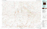
USGS Historical Quadrangle in GeoPDF.
|

|
