Filters: Tags: Red River (X)
212 results (45ms)|
Filters
Date Range
Extensions Types Contacts
Categories Tag Types
|
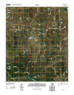
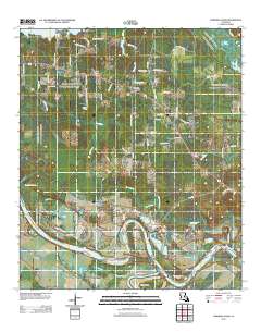
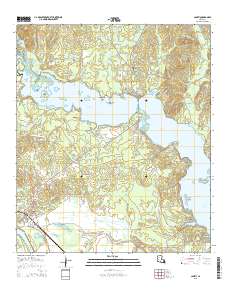
Layered GeoPDF 7.5 Minute Quadrangle Map. Layers of geospatial data include orthoimagery, roads, grids, geographic names, elevation contours, hydrography, and other selected map features.
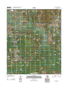
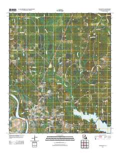
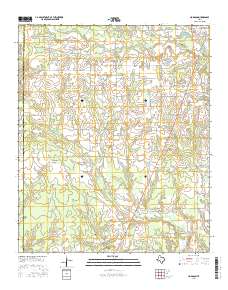
Layered GeoPDF 7.5 Minute Quadrangle Map. Layers of geospatial data include orthoimagery, roads, grids, geographic names, elevation contours, hydrography, and other selected map features.
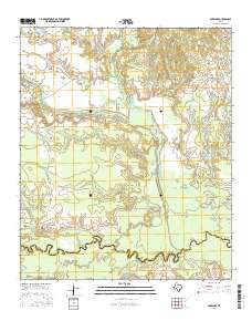
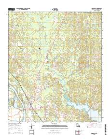
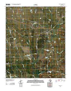
Layered GeoPDF 7.5 Minute Quadrangle Map. Layers of geospatial data include orthoimagery, roads, grids, geographic names, elevation contours, hydrography, and other selected map features.
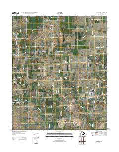
Layered GeoPDF 7.5 Minute Quadrangle Map. Layers of geospatial data include orthoimagery, roads, grids, geographic names, elevation contours, hydrography, and other selected map features.
Layered GeoPDF 7.5 Minute Quadrangle Map. Layers of geospatial data include orthoimagery, roads, grids, geographic names, elevation contours, hydrography, and other selected map features.
Layered GeoPDF 7.5 Minute Quadrangle Map. Layers of geospatial data include orthoimagery, roads, grids, geographic names, elevation contours, hydrography, and other selected map features.
Layered GeoPDF 7.5 Minute Quadrangle Map. Layers of geospatial data include orthoimagery, roads, grids, geographic names, elevation contours, hydrography, and other selected map features.
The U.S. Great Plains is known for frequent hazardous convective weather and climate extremes. Across this region, climate change is expected to cause more severe droughts, more intense heavy rainfall events, and subsequently more flooding episodes. These potential changes in climate will adversely affect habitats, ecosystems, and landscapes as well as the fish and wildlife they support. Better understanding and simulation of regional precipitation can help natural resource managers mitigate and adapt to these adverse impacts. In this project, we aim to achieve a better precipitation downscaling in the Great Plains with the Weather Research and Forecast (WRF) model and use the high quality dynamic downscaling results...
Categories: Data;
Types: NetCDF OPeNDAP Service;
Tags: Red River,
climatologyMeteorologyAtmosphere,
dataset,
downscaling,
service
This part of the Data Release contains the raster representation of the water-level altitude and water-level change maps developed every 5 years from 1980-2015 for the upper Rio Grande Focus Area Study. The input point data used to generate the water-level altitude maps can be found in the "Groundwater level measurement data used to develop water-level altitude maps in the upper Rio Grande Alluvial Basins" child item of this data release. These digital data accompany Houston, N.A., Thomas, J.V., Foster, L.K., Pedraza, D.E., and Welborn, T.L., 2020, Hydrogeologic framework, groundwater-level altitudes, groundwater-level changes, and groundwater-storage changes in selected alluvial basins of the upper Rio Grande...
Types: Map Service,
OGC WFS Layer,
OGC WMS Layer,
OGC WMS Service;
Tags: Abiquiu Reservoir,
Ahumada,
Alamosa,
Alamosa County,
Alamosa Creek,
Sandbars of large sand-bedded rivers of the Central U.S. serve important ecological functions to many species, including the endangered Interior Least Tern (Sternula antillarum) (ILT). ILT are colonial birds which feed on fish and nest primarily on riverine sandbars during their annual breeding season of approximately May through July, depending on region. During this time, ILT require bare sand of sufficient elevation so as not to be inundated during the period between nest initiation and fledging of hatchlings. ILT were originally listed as endangered due in part to decreases in available sandbar habitat from river channelization and impoundment. Sandbars in Central U.S. rivers used by ILT are highly dynamic,...
Types: Citation;
Tags: Arkansas River,
Canadian River,
Cimarron River,
Interior Least Tern,
Mississippi River,
Core Research Center, core B819, from well operated by CARTER OILRaw Properties from download, web scrape, MapServer, and Macrostrat API{"Lib Num": "B819", "API Num": "2501105091", "Operator": "CARTER OIL", "Well Name": "1 TRAWEEK", "Field": "WILDCAT CARTER", "State": "MT", "County": "CARTER", "Type": "CHIPS", "Photos": "T", "Thin Sec": "T", "Analysis": "T", "Latitude": "45.966857", "Longitude": "-104.178706", "coordinates_geohash": "c8jvt252k5nw", "Source": "FROM STATE RECORDS", "Security Flag": "NO SPECIAL RESTRICTIONS", "crc_collection_name": "core", "sb_parent_id": "4f4e49dae4b07f02db5e0486", "intervals": [{"Formation": "RED RIVER", "Age": null, "Min Depth": "9385", "Max Depth": "9394"}, {"Formation": "UNKNOWN",...
Categories: Physical Item;
Tags: Danian,
Ludlow Member,
Ludlow Member of Fort Union Formation,
MISSION CANYON,
RED RIVER,
Core Research Center, core T275, from well operated by PETRO HUNT LLCRaw Properties from download, web scrape, MapServer, and Macrostrat API{"Lib Num": "T275", "API Num": "2502121185", "Operator": "PETRO HUNT LLC", "Well Name": "OLSON 19-54-21B-2-1", "Field": "SOUTH BLOOMFIELD", "State": "MT", "County": "DAWSON", "Type": "SLABBED", "Photos": "T", "Thin Sec": "F", "Analysis": "F", "Latitude": "47.396531", "Longitude": "-104.851664", "coordinates_geohash": "c8mmwh32g1u8", "Source": "FROM STATE RECORDS", "Security Flag": "NO SPECIAL RESTRICTIONS", "crc_collection_name": "core", "sb_parent_id": "4f4e49dae4b07f02db5e0486", "intervals": [{"Formation": "RED RIVER", "Age": "ORDOVICIAN", "Min Depth": "10989", "Max Depth":...
Categories: Physical Item;
Tags: Danian - Selandian,
ORDOVICIAN,
RED RIVER,
Tongue River Member,
Tongue River Member of Fort Union Formation,
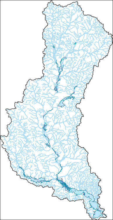
The National Hydrography Dataset (NHD) is a feature-based database that interconnects and uniquely identifies the stream segments or reaches that make up the nation's surface water drainage system. NHD data was originally developed at 1:100,000-scale and exists at that scale for the whole country. This high-resolution NHD, generally developed at 1:24,000/1:12,000 scale, adds detail to the original 1:100,000-scale NHD. (Data for Alaska, Puerto Rico and the Virgin Islands was developed at high-resolution, not 1:100,000 scale.) Local resolution NHD is being developed where partners and data exist. The NHD contains reach codes for networked features, flow direction, names, and centerline representations for areal water...
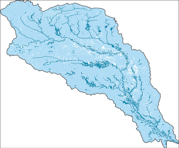
The National Hydrography Dataset (NHD) is a feature-based database that interconnects and uniquely identifies the stream segments or reaches that make up the nation's surface water drainage system. NHD data was originally developed at 1:100,000-scale and exists at that scale for the whole country. This high-resolution NHD, generally developed at 1:24,000/1:12,000 scale, adds detail to the original 1:100,000-scale NHD. (Data for Alaska, Puerto Rico and the Virgin Islands was developed at high-resolution, not 1:100,000 scale.) Local resolution NHD is being developed where partners and data exist. The NHD contains reach codes for networked features, flow direction, names, and centerline representations for areal water...
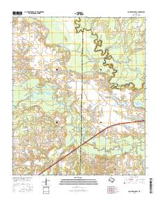
Layered GeoPDF 7.5 Minute Quadrangle Map. Layers of geospatial data include orthoimagery, roads, grids, geographic names, elevation contours, hydrography, and other selected map features.
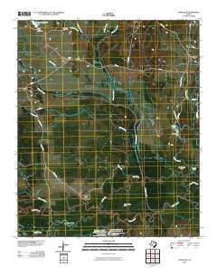
Layered GeoPDF 7.5 Minute Quadrangle Map. Layers of geospatial data include orthoimagery, roads, grids, geographic names, elevation contours, hydrography, and other selected map features.
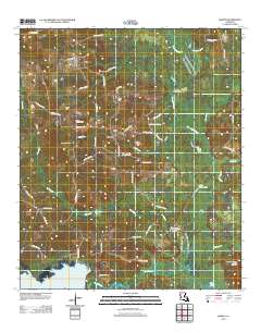
Layered GeoPDF 7.5 Minute Quadrangle Map. Layers of geospatial data include orthoimagery, roads, grids, geographic names, elevation contours, hydrography, and other selected map features.
Layered GeoPDF 7.5 Minute Quadrangle Map. Layers of geospatial data include orthoimagery, roads, grids, geographic names, elevation contours, hydrography, and other selected map features.
Layered GeoPDF 7.5 Minute Quadrangle Map. Layers of geospatial data include orthoimagery, roads, grids, geographic names, elevation contours, hydrography, and other selected map features.
Layered GeoPDF 7.5 Minute Quadrangle Map. Layers of geospatial data include orthoimagery, roads, grids, geographic names, elevation contours, hydrography, and other selected map features.
|

|
